
Maps
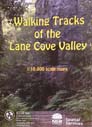
View details Walking Tracks of the Lane Cove Valley
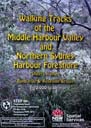
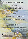
View details Walking Tracks of Middle Harbour (North)
View details Walking Tracks of Middle Harbour (South)
We also sell Walking Map for Berowra Valley (published by Friends of Berowra Valley)
Note 1: We're currently offering free membership which entitles you to a 30% discount – just follow the instructions on the checkout page
Note 2: To avoid paying postage, contact This email address is being protected from spambots. You need JavaScript enabled to view it. to arrange cash payment and pickup from Turramurra
Note 3: If you pay using PayPal you don't need a PayPal account
Under the expert cartographic skills of John Martyn, STEP has published three full-colour, double-sided maps of Sydney's northern suburbs. The maps show bush tracks, cycleways and fire trails with connecting streets and access points. They are excellent references for all ages and suitable for all users, from the occasional suburban stroller to the dedicated bushwalker. At a scale of 1 cm to 100 m (1:10 000) the level of detail is ideal for anyone wanting to explore the bush with beautiful colour photographs illustrating places of interest.