Early this month the Department of Planning, Industry and the Environment announced that Macquarie Park has been chosen as one of the sites for major new development. A draft strategy has been released that is open for comment until 10 August.
This new development is in addition to the huge amount of new construction of commercial and residential projects currently in progress. This web site lists the major proposals, including:
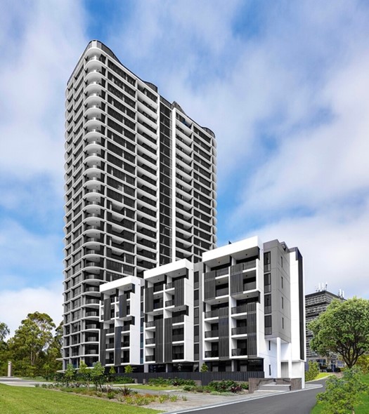
- Meriton has built a 27-storey building between Talavera Road and the M2 that that interrupts views across Lane Cove National Park from West Pymble. This is only the first stage of the Orana development with three more buildings of 60, 45 and 30 storeys providing another 1000 units. The image is of the First Meriton tower, the smallest of the four planned for the site
- Natura on Waterloo Road will have two, 20-storey towers with 357 units.
- NBH on Epping Road has eight buildings ranging from 3 to 17-storeys with a total of 885 units.
- The Ivanhoe Estate on Epping Road will have 3500 dwellings including 950 social housing and 128 affordable housing units.
The plan for up to 7600 additional apartments will be in addition to these 6000 apartments already approved!
The framework for the new development is explained in a long-awaited draft Macquarie Park Place Strategy. The Minister for Planning and Public Spaces Rob Stokes, in announcing the strategy, said:
This future development would help Macquarie Park transition from a successful suburban business park to a vibrant commercial and residential centre.
The plan is intended to be implemented over the next 20 years up to 2041.
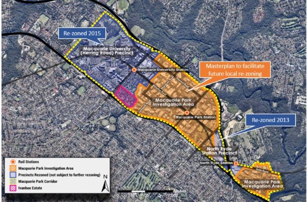
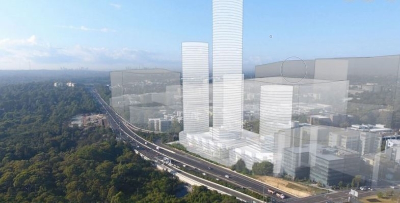
The entire 350 ha being considered for development includes land between the Macquarie Centre and Ivanhoe Estate to Lachlan’s Line and Riverside Corporate Park, bounded by Epping Road, Delhi Road, M2 Motorway and Vimiera Road adjacent to Lane Cove National Park.
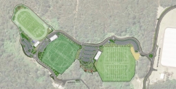
Under this strategy, seven new residential neighbourhoods as well as 14 ha of new parks, squares, plazas, cycleways and linear parks plus 2.7 ha of enhanced open space are proposed. The forecast additional floor space will create upwards of 20 000 new jobs in the region. It is acknowledged that major expenditure will be required on infrastructure with the need for about $6.5 billion in spending on transport and other public facilities within the next 15 years. The state budget has allocated $20 million for initial planning.
One innovation that fits in with the Greener Places strategy is the integration with indigenous history and the Dharug languages. Each of the neighbourhoods is to be given an indigenous name. For example, the area east of Lane Cove Road south of the M2 has been named Burbigal, meaning ‘morning’.
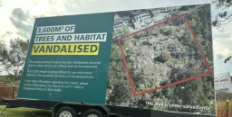
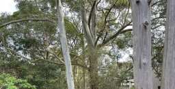
The area of particular concern for potential impact on Lane Cove National Park is the Riverside Park area (Narrami Badu-Gumada or connecting water spirit) where 1500 to 2000 new homes are proposed as well as expansion in commercial and retail space. The area abuts directly alongside Lane Cove National Park between Epping Road and Fairyland. There are some statements that are overwhelmed by jargon, for example:
Walking trails, cycle ways and possible micro mobility corridors will weave through and across the water corridors.
What are micro mobility corridors and water corridors? The area is at the top of a hill!
One Big Issue – Transport
Rob Stokes said the three Sydney Metro stations delivered in 2019 at Macquarie University, Macquarie Park and North Ryde have laid the foundations for this growth plan. The documents also reveal that currently about 70% of trips to Macquarie Park are made by road despite the opening of the new Metro stations. We all know about the North Ryde congestion any time of day.
Transport is an important contributor to greenhouse gas emissions. NSW has an objective to be net zero by 2050 so reduction in car use is essential. Conversion to 100% use of electric vehicles will not be a solution.
There is plenty of public transport going east and west using the Metro and bus services along the M2 and Epping Road. There is only one road taking cars from north to south, from the North Shore to Macquarie Park and on to the Olympic Park. The only other options are a long way further east (Gladesville Bridge) or further west (Pennant Hills Road). Public transport involves buses that add to the congestion or catching a train to Chatswood and then the Metro back west.
What the strategy has to say about dealing with road congestion is optimistic. Car transport will be discouraged with new buildings having fewer car parking spaces than in existing buildings. Walking and cycling will be encouraged with more pathways and made more pleasant by widening footpaths and greater tree planting. This statement is made:
The proximity to Lane Cove National Park provides an opportunity to increase cycling once the lack of facilities, safety issues and limited crossing opportunities can be addressed.
A lot more information is required.