STEP Matters 211
- Default
- Title
- Date
- Random
- The land that comprises the St Ives Showground, Wildflower Garden and Community Nursery are important areas for conservation as well…Read More
- We haven’t heard much lately about Mirvac’s planned development on the IBM site in West Pennant Hills next to the…Read More
- In our previous newsletter there was a last-minute story about a proposal to build an 18-storey tower at Eden Gardens…Read More
- Early this month the Department of Planning, Industry and the Environment announced that Macquarie Park has been chosen as one…Read More
- In STEP Matters 210 we described the strong community opposition to plans by several councils for the installation of synthetic…Read More
- The Byles Creek Valley Union has been fighting for several years for the valley to be protected from further development.…Read More
- In Issue 191 we wrote about our concerns about the effectiveness of the Biodiversity Offsets Scheme (BOS) to be established…Read More
- The key recommendation of Prof Samuel’s review of the EPBC Act was that the national environmental standards need to be…Read More
- Since 2017 STEP has supported the Threatened Species Children’s Art Competition. The competition was instigated by Forestmedia Network, a non-profit…Read More
- This information has been provided by the Willoughby Environment Protection Association, a member of the Powerful Owl Coalition. WEPA was…Read More
- In the Issue 209 we reported on the community concern about Ku-ring-gai Council’s determination to remove an illegal mountain bike…Read More
- Birdlife Australia’s regular newsletters have a regular series of snippets about well-known birds. Here are some about the Grey Fantail,…Read More
- Staghorn ferns belong to a group of tree-dwelling plants known as epiphytes. Tree canopies are a challenging environment for plants…Read More

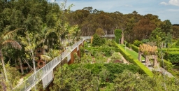


St Ives Showground and Precinct Lands Draft Plan of Management is Open for Submissions
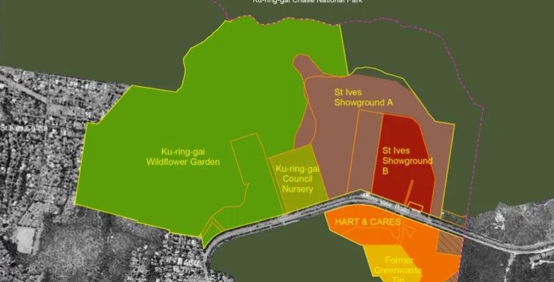
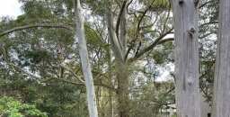
The land that comprises the St Ives Showground, Wildflower Garden and Community Nursery are important areas for conservation as well as recreation. A draft plan of management (PoM) has been released and is open for submissions until 6 August.
A PoM provides a framework and guides the management of public land owned or managed by a council. It identifies issues affecting public land and sets out how that land is to be used, managed, maintained and enhanced in the future.
The draft PoM also covers areas south of Mona Vale Road; the Green Waste Tip site and HART road safety centre. The management of these two areas is different because they are bound by user agreements and developments that are subject to the Minster of Planning’s consent. Nevertheless, because of their bushland location, they are considered important for development of an integrated management plan for the overall precinct.
St Ives Showground and Precinct Lands contains several ecologically important areas including:
- threatened vegetation communities including Duffys Forest Endangered Ecological Community and Coastal Upland Swamp;
- riparian habitats protecting creek systems; and
- habitats for a number of threatened plants and animal species (listed under NSW Biodiversity Conservation Act).
The area is an important wildlife corridor that can facilitate movement and gene flow between Garigal and Ku-ring-gai Chase National Parks. However busy Mona Vale Road is a barrier. Measures to facilitate crossings should be developed and improvements should be made to the ecological function of the roadside edges that are weed and litter infested.
Changes that are canvassed that may be worthy of comment include:
- Traffic signals at the entrance to the Showground to improve safety.
- Improved public transport.
- Improved internal road circulation, walking tracks and signage.
- Closure of trails that fragment bushland and impact wildlife and Aboriginal heritage sites.
- Additional bushwalking tracks and fire trails to key points of interest be built in accordance with council’s Recreation in Natural Areas Strategy.
- Development of a multi-purpose cultural and environmental education centre. The centre would provide a range of education programs, activities and exhibitions focused on environmental and cultural topics.
- Possibility of commercial camping subject to market analysis of viability. Currently camping is only allowed during special events.
- Development of a commercially operated outdoor adventure recreation area including issuing a licence or lease for a high ropes course or similar activity.
- Rehabilitation and repurposing of the former mini-wheels site based on suitability of the site yet to be determined. This may include activities such as sustainable nature-based community education and camping or other recreation activity.
- Upgrade of the Wildflower Garden facilities and car parking. There is a plan to designate the site as a Wildlife Protection area (under the NSW Companion Animals Act 1998).
Community Nursery
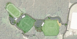
The community nursery site has been neglected for many years. The draft PoM proposes some upgrades and additions of community facilities such as a retail outlet, bushfoods garden or green waste collection. It is suggested that other uses be investigated such as camping facilities, adventure-based recreation such as obstacle courses and potential for sporting facilities. It is difficult to see how these can be compatible in this area of swampy land on the edge of Ku-ring-gai Chase National Park.
Green Waste Tip Site
This area is a conundrum as this stage. The draft PoM states:
The main objective for the site is to continue the current site rehabilitation and water recycling/harvesting processes. Additional improvements and proposed uses to be considered are:
- A feasibility study could be undertaken to determine the potential for a dedicated mountain bike facility.
- Explore the potential for environmental initiatives with associated infrastructure. For example, solar farming, community green waste and compost, alternate location for community nursery, sustainable light industry for community benefit.
Should recreation use or additional environmental infrastructure not be viable, then full rehabilitation and inclusion into Garigal National Park could be pursued.
Delays in Mirvac's Development Plans for the IBM Site

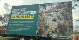
We haven’t heard much lately about Mirvac’s planned development on the IBM site in West Pennant Hills next to the Cumberland State Forest. You may recall that last June the NSW government ‘fast tracked’ the rezoning of the land that would enable the development of 600 apartments to proceed and, in theory, provide jobs to stimulate the post COVID-19 recovery. This decision ignored the strong community and local council objections that include overdevelopment, destruction of critically endangered vegetation communities and loss of forest habitat for the Powerful Owl and other endangered species.
Mirvac has initiated the next stage of the development process by submitting an application for the demolition of the existing buildings on the site and clearing of vegetation in the development area. This would involve the removal of 1253 trees. The application will go before a Planning Panel on 21 July.
Local community groups have objected strongly to the removal of so many trees including about 450 that are essential components of two critically endangered ecological communities. These communities, Blue Gum High Forest and Sydney Turpentine Ironbark Forest, have the same classification under the Commonwealth Environment Protection and Biodiversity Conservation (EPBC) Act as the NSW threatened species legislation.
Under the EPBC Act clearing of this extent of critically endangered vegetation could be deemed to be a matter of national environmental significance. The planned clearing should therefore be referred to the Federal Environment Minister to decide whether the proposal should be subject to assessment. Assessment can lead to approval, refusal or conditions of approval.
It is understood that the Mirvac has not done this referral, arguing that the trees were planted as part of the landscaped gardens when the IBM corporate park was established and cannot be classed as natural forest relevant to the EPBC Act. However, the community groups Forest in Danger and West Pennant Hills Valley Progress Association (WPHVPA) have been successful in obtaining further documentation dating back to the original development plans that indicate that the trees are regrowth from remnant bushland and therefore come under the Act.
A threatened species assessment of significance by an independent ecologist has confirmed that the vegetation within the demolition meets the definition of a critically endangered ecological community.
The Nature Conservation Council, the peak body for conservation groups in NSW, supports this action and has written to the Federal Environment Minister, the Hon Sussan Ley, asking that she intervenes so the proposal is assessed under the EPBC Act.
This issue appears to be holding up Mirvac’s planning process. A concept masterplan for the apartment development was planned for earlier this year.
Eden Gardens Tower: What Happens Next

In our previous newsletter there was a last-minute story about a proposal to build an 18-storey tower at Eden Gardens on Lane Cove Road in Macquarie Park. Many submissions in opposition were made to the City of Ryde Council. The development application will be assessed by the Sydney North Planning Panel.
Eden Gardens is surrounded by Lane Cove National Park on three sides and Lane Cove Road to the west. The M2 is further away to the south. The only development nearby is on the western side of Lane Cove Road where the buildings are 6 to 8 stories and further south in Macquarie Park.
There seems to be an oversight in the zoning because there is actually no zoning for the site. The applicant has taken advantage of this and decided to have a go at getting approval for building a commercial tower significantly higher than any other building nearby. Did the City of Ryde Council provide any guidance about the chances of such a tall building being approved?
Some of the problems with the development if it goes ahead are:
- Additional traffic along the already congested Lane Cove Road as workers on site will be reluctant to tackle the long walk from Macquarie Park Station involving crossing several major roads.
- Developments adjacent to national parks are required to meet guidelines defined by the NPWS (2020) covering matters like the impact on public amenity or enjoyment of the park, whether it is sympathetic with the natural and cultural heritage of the park, and appropriate controls on lighting.
- Lane Cove National Park has important heritage values drawing from its long history of aboriginal use and European development plus the presence of many threatened species and endangered ecological communities.
- The location has high bushfire risk with exposure to the north and northwest. Up to 2000 workers would need rapid evacuation via Lane Cove Road.
- The building would form a high risk to bird and bats traversing the park that would be attracted to reflections from the glass facade and foraging for insects.
- The building will tower over the surroundings with lighting that spills into the park disturbing the natural foraging and nesting patterns of nocturnal and diurnal aerial fauna, particularly owls and bats. Threatened nocturnal species recorded in the park include four species of bat plus the powerful owl and barking owl.
Reference
NPWS (2020) Developments adjacent to NPWS lands: Guidelines for consent and planning authorities. National Parks and Wildlife Service, NSW Department of Planning Industry and Environment.
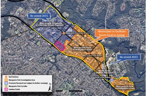
Up to 7600 New Homes for Macquarie Park
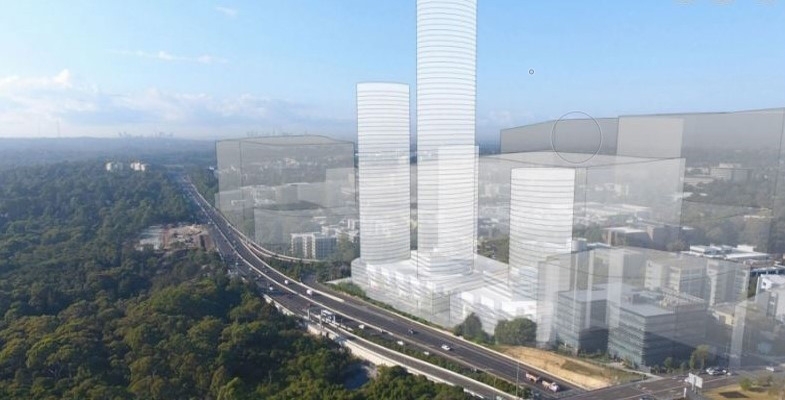
Early this month the Department of Planning, Industry and the Environment announced that Macquarie Park has been chosen as one of the sites for major new development. A draft strategy has been released that is open for comment until 10 August.
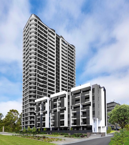
This new development is in addition to the huge amount of new construction of commercial and residential projects currently in progress. This web site lists the major proposals, including:
- Meriton has built a 27-storey building between Talavera Road and the M2 that that interrupts views across Lane Cove National Park from West Pymble. This is only the first stage of the Orana development with three more buildings of 60, 45 and 30 storeys providing another 1000 units. The image is of the First Meriton tower, the smallest of the four planned for the site
- Natura on Waterloo Road will have two, 20-storey towers with 357 units.
- NBH on Epping Road has eight buildings ranging from 3 to 17-storeys with a total of 885 units.
- The Ivanhoe Estate on Epping Road will have 3500 dwellings including 950 social housing and 128 affordable housing units.
The plan for up to 7600 additional apartments will be in addition to these 6000 apartments already approved!
The framework for the new development is explained in a long-awaited draft Macquarie Park Place Strategy. The Minister for Planning and Public Spaces Rob Stokes, in announcing the strategy, said:
This future development would help Macquarie Park transition from a successful suburban business park to a vibrant commercial and residential centre.
The plan is intended to be implemented over the next 20 years up to 2041.
The entire 350 ha being considered for development includes land between the Macquarie Centre and Ivanhoe Estate to Lachlan’s Line and Riverside Corporate Park, bounded by Epping Road, Delhi Road, M2 Motorway and Vimiera Road adjacent to Lane Cove National Park.
Under this strategy, seven new residential neighbourhoods as well as 14 ha of new parks, squares, plazas, cycleways and linear parks plus 2.7 ha of enhanced open space are proposed. The forecast additional floor space will create upwards of 20 000 new jobs in the region. It is acknowledged that major expenditure will be required on infrastructure with the need for about $6.5 billion in spending on transport and other public facilities within the next 15 years. The state budget has allocated $20 million for initial planning.
One innovation that fits in with the Greener Places strategy is the integration with indigenous history and the Dharug languages. Each of the neighbourhoods is to be given an indigenous name. For example, the area east of Lane Cove Road south of the M2 has been named Burbigal, meaning ‘morning’.
The area of particular concern for potential impact on Lane Cove National Park is the Riverside Park area (Narrami Badu-Gumada or connecting water spirit) where 1500 to 2000 new homes are proposed as well as expansion in commercial and retail space. The area abuts directly alongside Lane Cove National Park between Epping Road and Fairyland. There are some statements that are overwhelmed by jargon, for example:
Walking trails, cycle ways and possible micro mobility corridors will weave through and across the water corridors.
What are micro mobility corridors and water corridors? The area is at the top of a hill!
One Big Issue – Transport
Rob Stokes said the three Sydney Metro stations delivered in 2019 at Macquarie University, Macquarie Park and North Ryde have laid the foundations for this growth plan. The documents also reveal that currently about 70% of trips to Macquarie Park are made by road despite the opening of the new Metro stations. We all know about the North Ryde congestion any time of day.
Transport is an important contributor to greenhouse gas emissions. NSW has an objective to be net zero by 2050 so reduction in car use is essential. Conversion to 100% use of electric vehicles will not be a solution.
There is plenty of public transport going east and west using the Metro and bus services along the M2 and Epping Road. There is only one road taking cars from north to south, from the North Shore to Macquarie Park and on to the Olympic Park. The only other options are a long way further east (Gladesville Bridge) or further west (Pennant Hills Road). Public transport involves buses that add to the congestion or catching a train to Chatswood and then the Metro back west.
What the strategy has to say about dealing with road congestion is optimistic. Car transport will be discouraged with new buildings having fewer car parking spaces than in existing buildings. Walking and cycling will be encouraged with more pathways and made more pleasant by widening footpaths and greater tree planting. This statement is made:
The proximity to Lane Cove National Park provides an opportunity to increase cycling once the lack of facilities, safety issues and limited crossing opportunities can be addressed.
A lot more information is required.
Councils are Pushing Ahead With Synthetic Turf Installations
In STEP Matters 210 we described the strong community opposition to plans by several councils for the installation of synthetic turf on local ovals. There are concerns about the environmental impacts of using plastic grass and the social impacts of creating fields that are primarily designed for playing football and therefore restrict community use. There are examples of the use of natural grass that overcome the problems of fields becoming degraded by overuse so the number of playing hours do not need to be restricted.
Ku-ring-gai and Lane Cove Councils are proceeding regardless with deadlines to meet to sign contracts related to funding, particularly promised grants. A report from the inquiry instigated by the Minister for Planning and Public Spaces, Rob Stokes is due any day now. This inquiry is investigating sustainable alternatives to reduce environmental impacts.
Ku-ring-gai Council – Norman Griffiths Oval
Following the decision to proceed in November 2020, Ku-ring-gai Council has been developing a design for installing synthetic turf at Norman Griffiths Oval so that quotations could be commissioned from contractors. The infill to be used is cork not the most common fill, tyre crumb. The use of cork is a fairly recent innovation for keeping the plastic grass blades upright. We don’t know much about the management of cork nor the construction and management methods for keeping it clean and in place during general use and heavy rain.
The design covers stormwater mitigation works as well as the synthetic turf installation because the field currently acts as a stormwater detention basin. Extensive stormwater mitigation works are required because Quarry Creek flows under the field and it is also the catchment area for rainwater collected over the large area of Sydney Turpentine Ironbark Forest (STIF) above the field. With synthetic turf the oval will no longer absorb the water flows from this catchment.
STEP and several other interested people, representing the local community and volunteer bushcarers as well as the sporting clubs, were advised they could participate in a stakeholder reference group that would review progress and provide comment on the design at key milestones. We were told that these reviews would be:
… a check measure to ensure we remain transparent and accountable to the community.
However, we were not given any opportunity to consider the design before it went out to tender. We had been advised early this year that the level of the field needed to be raised by about half a metre to accommodate the stormwater mitigation and the base fill. This would impact on the hydrology of the bank above the field, which contains some rare orchids as well as the STIF around the oval. No reference group meeting has occurred.
The outcome of the tenders was considered at the council meeting on 15 June. According to the meeting agenda documents, only two tenders were received and neither met the tender requirements. With a deadline to be met to select a contractor and sign documents, the critical part of the process is being rushed.
There was no discussion at the council meeting and the decision was in line with staff recommendation. The meeting resolution was as follows:
- Fresh tenders as referred to in clause 178(3)(b)–(d) of the Regulation not be invited due to the current deadlines for the grant funding.
- Pursuant to clause 178(3)(e) of the Regulation, the General Manager enter into negotiations with any person (whether or not the person was a tenderer) with a view to entering into a contract in relation to the subject matter of the tender in terms acceptable to Council’s requirements.
- The Mayor and the General Manager be delegated authority to execute all documents on Council’s behalf in relation to any contract formed as a result of the above.
We are very concerned that there will be no broader review of the design and construction contract. No information has been provided about potential environmental impacts of the decision.
In October 2020, when the decision was made to proceed with the project, it was stated in the meeting agenda papers that the likely environmental impacts were ‘reasonable’ on the basis of only a concept plan. Now we are told that a Review of Environmental Factors (REF) will be completed by the winning contractor when the design and construction of the project is refined. This is putting the cart before the horse! What happens if the review finds that impacts will exceed guidelines?
We hope to find out more soon.
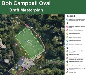
Lane Cove Council – Bob Campbell Oval
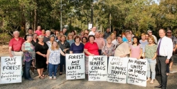
For several months the community of Greenwich has been fighting the proposed installation of synthetic turf on Bob Campbell Oval, on the edge of Sydney Harbour foreshore at the end of Gore Creek. This park, which is the only piece of flat land in the area and is used by all the community, would be predominantly available only for organised sport if synthetic turf were installed. It would be fenced off from general community use and the popular off leash dog area would be reduced to small areas beside the field.
Lane Cove Council claims that the issue of potential environmental impacts has been addressed by their decision to use ‘4G’ technology, a fully woven product made of one polymer family (polyolefin). The woven construction results in the grass fibres and backing structure being produced as one combined product and eliminates the need for infill such as tyre or cork crumb. It is claimed that this product will significantly reduce the likelihood of lost fibres migrating into the environment. It would be the first use of this product in Australia.
A new group has been formed to fight this decision, Natural Grass at Bob Campbell Inc (NGABC). On 21 June, the same day that contracts were due to be signed, solicitors for NGABC delivered a letter of demand to council’s general manager stating that they have serious concerns about the validity of the mandatory environmental assessment that had been conducted. The letter calls on council to undertake to cancel its environmental assessment, to conduct a new assessment in accordance with environmental legislation and not to sign construction contracts for the synthetic surface.
Some Promising Signs for Protection of Byles Creek Valley
The Byles Creek Valley Union has been fighting for several years for the valley to be protected from further development. The valley has high quality biodiversity including threatened plant species and a habitat for Powerful Owls and Gang-gang cockatoos. In addition, it contains beautiful tall forest and is an important wildlife corridor from the Lane Cove Valley through to Pennant Hills Park.
Land immediately along the creek is zoned open space but there are several residential lots that have not yet been developed. Many of these residential lots are large and recent approvals have allowed subdivision leading to the removal of many trees for bushfire protection. The valley is steep so the creation of driveways and construction access will require clearing and excavation with a risk of erosion.
Thanks to pressure from the local groups Hornsby Council has resolved to progress a review of the suitability of the planning controls for residential properties adjoining open space zoned land within the Byles Creek corridor with regard to protection and maintenance of the environmental values of the land. Consultation has now been completed.
Representatives from the Byles Creek Valley Union have been trying for over two years to meet their local member, Minister Perrottet. This finally happened recently with a promising outcome. Minister Perrottet clearly stating there is money set aside for the purchase of private land to support the Byles Creek corridor. He told them he was ‘going to take care of it’. They will hold him to his word!
Inquiry Into Shonky NSW Offsets Scheme
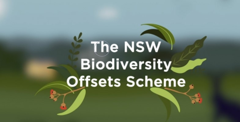
In Issue 191 we wrote about our concerns about the effectiveness of the Biodiversity Offsets Scheme (BOS) to be established under the NSW Biodiversity Conservation Act. We wrote:
Implementing the BOS will in fact add extinction pressures to the very species and ecological communities it is supposed to protect by facilitating the more rapid and widespread destruction of threatened species habitat across NSW.
NSW has had several offset schemes since 2005. The principle behind the schemes is that, if a development requires the destruction of native vegetation and habitat then other land must be protected and/or restored to offset this loss on a ‘no net loss’ basis. The fundamental problem with this idea is that vegetation on the development site will still be lost. In theory offset land will be improved to make up for the loss but it is impossible to restore another piece of land to match habitat effectively. To make matters worse the BOS has several compromises that go against the like for like principle.
Not only are there concerns about the principles of the scheme but now there are some recent examples of promised offsets that are not delivered. Guardian Australia reported in February that:
- Fifteen years after the M7 opened to traffic, the state government has not yet established a public reserve that was proposed as the major environmental offset for loss on Cumberland Plain Woodland from the motorway’s construction.
- A second reserve on the site of Airservices Australia’s former radio transmitting station at Shanes Park in the Blacktown City Council area is also undelivered more than 10 years after it was first identified as priority conservation land to compensate for the construction of 181 000 houses in new suburb developments. Bureaucratic obfuscation of the transfer of ownership from the Commonwealth to the NPWS is the problem here. This high-quality land has become weed infested and degraded by 4WD access.
More recently there are questionable transactions whereby landowners have made windfall gains over a short space of time. A Guardian investigation (published 25 June 2021) uncovered tens of millions of dollars in offset credits purchased by the state and federal governments from properties linked to consultants whose company advised the government on development in western Sydney.
Some of these transactions have been referred by the Transport Department to ICAC for investigation. The NSW auditor general has also fast-tracked a planned review of the scheme.
Now experience in the use of environmental offsets to compensate for habitat destruction caused by major developments will be examined by a NSW Upper House inquiry.
The inquiry was self-referred by the environment and planning committee with backing from the Greens, Labor and the Animal Justice party.
The terms of reference are to examine:
- the effectiveness of the scheme to halt or reverse the loss of biodiversity values, including threatened species and threatened habitat in NSW, the role of the Biodiversity Conservation Trust in administering the scheme and whether the Trust is subject to adequate transparency and oversight;
- the use of offsets by the NSW Government for major projects and strategic approvals; and
- the impact of non-additional offsetting practices on biodiversity outcomes, offset prices and the opportunities for private landowners to engage in the scheme.
The inquiry is due to report in March 2022.
Federal Government is Refusing to Upgrade Environmental Standards
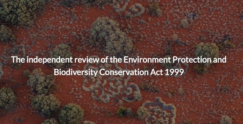
The key recommendation of Prof Samuel’s review of the EPBC Act was that the national environmental standards need to be strengthened but the federal government is refusing to adopt Samuel’s interim standards. It seems National Cabinet is the stumbling block.
On 16 June the environment minister, Sussan Ley spoke at the National Press Club about the release of ‘a pathway for reforming national environment law’. She said the government agreed with ‘the central pillars’ of Samuel’s 38 recommendations but did not respond to them individually.
The report states that:
The immediate priority is to implement single touch environmental approvals, underpinned by national environmental standards.
She stated that the interim standards will be used that reflect current requirements of the EPBC Act because this is consistent with the agreement of National Cabinet. These standards will provide greater clarity for proponents and the community, as thousands of pages of rules will be distilled into clear and concise requirements.
There are two issues here:
- The approval powers are being handed over to the states and territories whose resources for undertaking the requisite analysis are not proven.
- The current national environmental standards were heavily criticised by the Samuel Review. The interim standards will be not be reviewed for two years. Given political pressures that are inevitable any attempt to tighten the standards will be vigorously opposed by vested interests,
One plus is that the government has committed to establish of the Environment Assurance Commissioner later this year.
Critics of the government’s stance include three of the crossbenchers Rex Patrick, Jacqui Lambie and Stirling Griff, who wrote a joint letter to Ley in February calling for greater action. With Labor and the Greens opposed, the government needs the support of at least one of the three to pass its legislation. Speaking at the national press club, Ley said she was hopeful of reaching agreement, but the standards would not be strengthened before the legislation was passed.
The Morrison government is attempting to stare down the Senate over changes to conservation laws. Who will blink first?
Hope for More Action on Kosciuszko Feral Horses?
As a side note from the Press Club talk, Ley was asked about damage to the alpine environment in Kosciuszko National Park caused by feral horses. She suggested she may attempt to force the NSW government to change its management of the area. She was looking for ways to use the EPBC Act to prevent it.
The feral horse population in alpine parks has increased to about 14 000 over the past two decades. Three years ago the NSW government introduced legislation, at the behest of the deputy premier, John Barilaro, to prevent culling.
Wild At Art: Threatened Species Art Competition for Kids
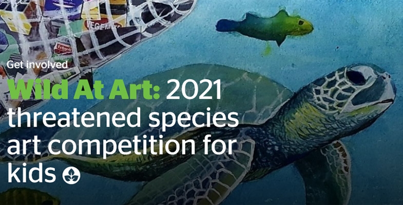
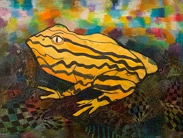 Since 2017 STEP has supported the Threatened Species Children’s Art Competition. The competition was instigated by Forestmedia Network, a non-profit organisation that raises public awareness of the importance of Australian native forests, woodlands and other ecosystems. It originally only applied to NSW.
In 2021, the Australian Conservation Foundation is partnering with Forestmedia to make this year's art competition for kids bigger than ever! It will be open for entries from Saturday 5 June, World Environment Day, to Friday 30 July. Children aged 5 to 12 from all states and territories are invited to unleash their creativity through art while learning about our incredible plants and animals, and the threats facing them.
Each child may choose one of Australia’s many threatened animals or plants to research, create, and write a short explanation of their work. The judges are not simply looking for works that display outstanding technical skills. The judges will be looking for surprising or interesting interpretation of compositions, and work that demonstrates an emotional connection with the species.
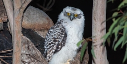
Powerful Owl at Chatswood High School – Threat Averted

This information has been provided by the Willoughby Environment Protection Association, a member of the Powerful Owl Coalition. WEPA was alarmed to hear recently that the expansion works at Chatswood High School were an immediate threat to an active nest tree of a threatened species, the Powerful Owl. The nesting site has been in use from at least 2011 (except for 2019–20) and it is currently in use for the 2021 breeding season – chicks have been heard trilling. At least 11 chicks have successfully fledged from this nest over the last decade or more.
Fortunately, discussions on 1 July between Willoughby City Council staff, a Powerful Owl Project representative, project management and the Department of Education infrastructure personnel have led to an agreement that the nest tree will be retained.
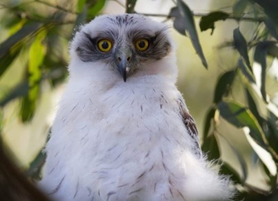
The problem seems to have emerged because the Biodiversity Development Assessment Report did not identify that Powerful Owls were nesting on-site and the Tree Retention / Removal Report prepared for the Chatswood High School environmental impact statement unfortunately did not capture the nesting tree on its plan.
Powerful Owls are very particular about the nests they choose. They need large tree hollows (at least 0.5 m deep), in large eucalypts (diameter at breast height of 80–240 cm) that are at least 150 years old. Once the female chooses a nesting hollow the pair tend to return to it year after year.
We are extremely grateful to Dr Beth Mott, leader of the Powerful Owl Project in Sydney run by Birdlife Australia and the Wildlife and Bushland Officers at Willoughby City Council, who went into bat on a number of occasions to protect the owls and were prominent in this week’s negotiations. A shout-out as well to local Powerful Owl watchers who have collected data on the owls for the last decade or more.
It is an excellent result that this should happen on the grounds of a high school as the youth of today will have much to do to help retain our unique wildlife in an uncertain future.
WEPA has also written to the Premier and Minister for Planning suggesting that the protection of our native flora and fauna during state significant developments of this sort might be improved if there was a legislated obligation for those tasked with preparing environmental impact statements to make direct contact with local community and environmental groups and with the bushland / biodiversity staff in local councils. This would allow those with expertise in the area to share this local knowledge in order to protect our urban bushland and wildlife when development is considered. Frequently wildlife can be seen only during certain times of the year.
The Powerful Owl is a potent symbol in northern Sydney of the way in which urban Sydney can continue to coexist with our local flora and fauna – they are much admired and much loved. They are also apex predators essential to the maintenance of ecological balance. We appreciate that action has been taken to ensure that they continue to help our bush thrive and delight our community for years to come. It is hoped that new building will not disturb the viability of the tree and that the environment near the tree is maintained so the owls will continue to choose this nest.
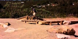
Biking Community in Partnership in New Design of Jubes Bike Park

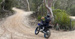
In the Issue 209 we reported on the community concern about Ku-ring-gai Council’s determination to remove an illegal mountain bike tracks in North Wahroonga. Council staff met with the locals to discuss the issue. It turns out the young people involved are mainly interested in building rather than using the tracks.
Council decided to invite the local riders to give their ideas for a redesign of the Jubes Mountain Bike track that is in the same area. The aim is to rebuild the track to make it a more exciting experience for riders.
The mountain bike track is located at the back of Golden Jubilee Field in Wahroonga that has become badly degraded. There is also a Pump Track and Skills Track nearby.
The Single Track trail has been excavated in preparation for new jumps to be built. Large piles of clay and sandstone crush have been provided by council for track and jump building. Mountain bikers are being invited to help construct the new tracks once excavation is completed by joining council’s Trailcare program. It is expected to open in August 2021.
In return for the creation of this partnership, the mountain bike community have pledged to be responsible for caring for the local environment and agreeing not to construct illegal jumps in the area. Time will tell!
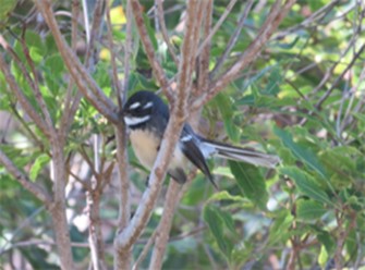
Some Facts About Grey Fantails
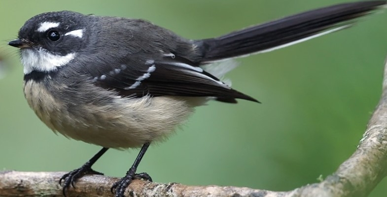
Birdlife Australia’s regular newsletters have a regular series of snippets about well-known birds.
Here are some about the Grey Fantail, a bird that is common in Sydney bushland. Their call sounds like a squeaky violin.
- Grey Fantails occur in pretty much every corner of the continent, inhabiting just about any terrestrial habitat you can name.
- While some populations of Grey Fantails are resident, others are highly migratory, undertaking regular long-distance, seasonal movements. Tasmanian birds even migrate across the waters of Bass Strait, defying their apparently weak powers of flight.
- The spectacular aerobatics performed by Grey Fantails while they are foraging involve such complex manoeuvres and flight sequences that they are impossible for any aircraft to replicate, even in theory.
- The Grey Fantail’s nest is one of Australia’s neatest, with a long, pendulous tail that makes it look like a wine glass with the base of the stem broken off.
- Although they are usually seen singly or in small numbers, Grey Fantails sometimes congregate into quite large flocks at the end of their migration, with dozens or maybe hundreds of birds gathering together. They also readily join mixed-species feeding flocks with other birds.
Life in the Tree Tops
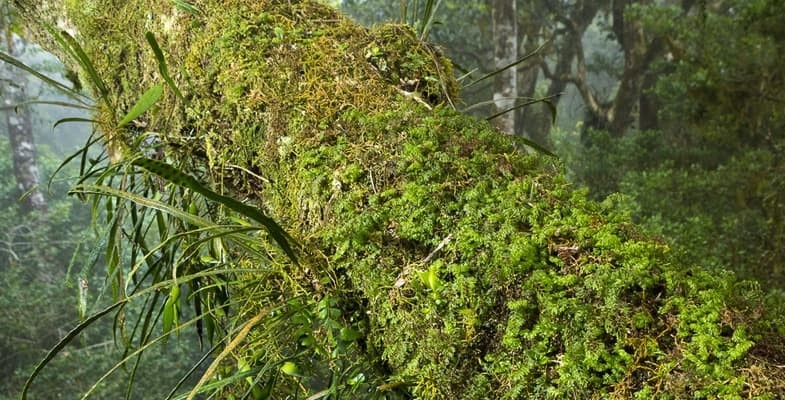
Staghorn ferns belong to a group of tree-dwelling plants known as epiphytes. Tree canopies are a challenging environment for plants to grow. Without access to soil, epiphytes are regularly exposed to severe water and nutrient stress.
Epiphytes have evolved several ways to mediate the lack of access to water and nutrients. Bromeliads grow cup-shaped leaves, while orchids have specialised root tissues. But staghorn ferns have developed a colony lifestyle to overcome the problem.
Staghorn ferns can be bought at many garden stores and will grow like any other pot plant. But in the wild on Lord Howe Island, we discovered individual plants collaborate, specialising in different tasks in the construction of the communal water and nutrient store, often at the cost of their own reproduction — just like social insects.
This radically changes our understanding of biological complexity. It suggests major evolutionary transitions towards eusociality can occur in both plants and animals. Plants and beehives aren’t as different as they might seem.
For decades, scientists interested in eusociality argued for a strict definition — many felt the term should be reserved for only a select group of highly co-operative insects.
This perspective led to widespread scepticism about its occurrence in the natural world. Perhaps this is why it was overlooked for so long in one of horticulture’s most popular pot plants.
Evolution of biological complexity
Four billion years ago, life began as simple, self-replicating molecules. Today’s diversity arose from these simple origins towards increasingly complex organisms.
Evolutionary biologists think that biological complexity developed in abrupt, major evolutionary transitions, rather than slow and continuous changes. Such transitions occur when independent entities begin to collaborate, forming new, more complex life forms — such as, for example, when single-celled organisms evolved into multi-cellular organisms.
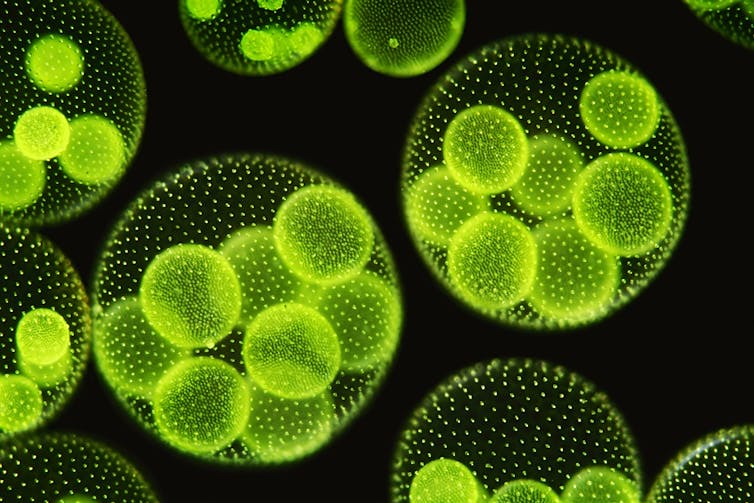
Another example is the transition from unspecialised bacterial (prokaryotic) cells to cells with an enclosed nucleus and specialised organelles that perform particular functions, known as eukaryotic cells.
Co-operation underpins the evolutionary origins of organelles — they likely evolved from free-living ancestors that gave up their independence to live safely within the walls of another cell.
There are eight commonly recognised major evolutionary transitions — and eusociality is the most recent. Eusocial animals differ from others in three fundamental ways:
- they live in colonies comprised of different generations of adults
- they subdivide labour into reproductive and non-reproductive groups
- they care for offspring co-operatively.
Our observations over the past two years on Lord Howe Island found staghorn ferns meet these criteria.
In highly eusocial species, caste membership is permanent and unchanging. But in primitively eusocial species, individuals can alter their behaviour to suit many roles required by the colony. Staghorn ferns probably fit under the latter category.
Our ongoing research will determine the staghorn’s position along this continuum of eusociality. But, for now, we know plants and animals share a similar evolutionary pathway towards greater biological complexity.![]()
Kevin Burns, Professor, Te Herenga Waka — Victoria University of Wellington
This article is republished from The Conversation under a Creative Commons license. Read the original article.