Displaying items by tag: Lane Cove Valley
Dharug women's-led cultural burn at Browns Waterhole
One initiative that relates to the Durumbura project was the cultural burn near Browns Waterhole that took place in April 2024. Dharug women and allies worked together to undertake the first (since earliest colonisation days) Dharug women’s-led cultural burn. The information in this story comes from Regenavitis, the newsletter of the Friends of Lane Cove National Park.
The cultural burn originated from an invitation and funding from the Department of Planning and Environment’s Cultural Fire Management Team to the Dharug Yanama Budyari Gumada Collective. Macquarie University was also involved with the management of the burn. It is the first time Dharug women have been invited by a government department to restore Dharug cultural knowledges, language, and practices through fire, as a Caring for Country initiative so close to the inner city.
It was actively supported by a variety of Dharug community members as well as the NPWS, Friends of Lane Cove National Park, the three relevant local councils (Hornsby, Ku-ring-gai and Ryde) and the Rural Fire Service. It took about four years to plan the project including preparing a review of environmental factors and developing the burn plan.
The journey involved Dharug women holding a women’s camp in May, 2023, thanks to Ryde Council permitting Dharug women to camp at Waterloo Park – another first! Over the three days of the camp, Dharug women renewed cultural connection to Ngurra/country, engaged in ceremonial practices, storytelling, yarning, weaving, made place-based art, did some tools-based training with NPWS, and engaged in digital data collection thanks to Macquarie University scientists. In the process, they were able to establish the presence of swamp wallabies, bandicoots, goannas, turtles, gudgeons, diamond pythons, echidnas, a large variety of culturally important plants, and, of course, ever-present multitudes of sulphur-crested cockatoos, bell minors, kookaburras, various finches, parakeets, and other important bird species. Soil testing, before and after the burn has also been undertaken to determine changes in soil quality.
Originally it was supposed to be completed by 2023, but due to COVID and poor weather conditions, the burn was delayed until 2024. As such the undergrowth grew in height from around 1 m in 2021 to nearly 2 m in 2024. Nevertheless, the delay allowed for greater time to plan and budget. In March, 2024, Dharug women and allies came together to prepare the site for the burn and it was completed in April. It will be interesting to observe the impact of the burn on the forest ecology in coming years.
Group’s summary of the experience was:
While Dharug women have undertaken the cultural burn according to our cultural priorities of nurturing Ngurra (her soils, plants, animals and other presences), we recognise that based on the contemporary context, working collaboratively together with our allies enables us to continue our cultural ways of knowing, being and doing, as well as bringing others along the journey to establish sustainable futures in the city. Undertaking our cool-fire burn approaches mitigates the threat of mega-fires in the Durrumburra Dhurabang (Lane Cove River) valley, and simultaneously restores and strengthens an appreciation of the values that caring for Ngurra/country enacts.
Lane Cove River restoration – the Durumbura Dhurabang stakeholder project
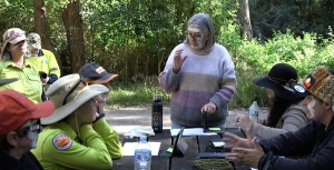
STEP representatives and many others with an interest in the well-being of the Lane Cove Valley attended a workshop on 16 August organised by Macquarie University. It was led by Dr Jo Rey from the Department of Indigenous Studies.
The restoration project is a recent Dhurag initiative aiming to return traditional custodial ontologies, knowledges, languages, practices to the Lane Cove River catchment in respectful alliance with existing stakeholders.
The goal is to bring best practices together for the well-being of Ngurra/country knowing that if we have healthy country we can have healthy people for a sustainable future.
The participants were representatives from local councils, academics, Macquarie Business Park companies, environment groups, indigenous communities, government organisations such as Sydney Water and NPWS.
The workshop was an initial idea sharing exercise to identify knowledge gaps, issues, barriers to improvement and initial priorities for action.
Urban planning impacts on the catchment
The workshop identified one of the major issues for the catchment is the lack of coordinated monitoring of water quality and modelling of stormwater management requirements. This is vital with the increasing incidence of extreme rainfall events and the rapid increase in residential development and associated infrastructure.
A matter of concern is that there are currently no flood-related development control provisions applying under the Ku-ring-gai local environmental plan. A number of catchment flood studies are being undertaken subject to funding from the NSW government but these are progressing very slowly.
Our planning system needs a major upgrade to improve stormwater controls and reduce pollution from run-off and erosion. All governments and organisations like Sydney Water have to be involved.
The Early Days in what is now Lane Cove National Park
The early European history of the area that became Lane Cove National Park could be said to stem from an exploratory visit to the Lane Cove River by George Caley in 1805. Caley was employed as a plant collector by Joseph Banks and was the first person to make a systematic study of eucalypts. He reported on the quality of the trees in the Lane Cove River valley and it is thought that as a result a convict timber camp was set up at what later became Fiddens Wharf.
One of the convicts employed at the camp was William Henry. He arrived in 1801 on the Earl Cornwallis, and no doubt obtained a good knowledge of the valley while working as a timber getter. After Henry was emancipated Governor William Bligh promised him a grant of 1,000 acres in an area which now includes much of the lower park and West Lindfield. Henry took up the grant and started a vineyard on a portion of the area. Unfortunately for him Bligh became somewhat distracted with the Rum Rebellion, the grant was never confirmed and eventually around 1850 Henry was thrown off the land as the government of the day prepared to sell it.
Some say that another famous Australian identity, John MacArthur had schemed to ensure that William Henry suffered because he had supported Bligh during the rebellion.
However, that was not the end of his family’s connection, his granddaughter Maria married Thomas Jenkins and in 1852 they purchased a portion of the land originally held by her grandfather. It was this family who held the property right up until 1937 when it was purchased by the government to form the basis of the national park.
The farm or orchard was known as Millwood, the house Waterview and the small stone building we now know as Jenkin’s Kitchen was built around 1855, separately from the house, as was often the case at that time when there was a fear of fire burning down the main building. Ironically the main building burnt down in 1943 after the incorporation of the area into the park, and although the kitchen has been affected by fire it is still with us.
After the recent renovations, which include a new roof and extensive work to the sandstone, there is every hope that it will remain as a focal point at the park headquarters for many years.
Invitation
Congratulations to STEP on reaching the milestone of the 200th issue of your magazine.
We at Friends of Lane Cove National Park also have a milestone coming up: the 25th anniversary of our founding. Many of you will know that this came about after the devastating fires in early 1994. However, that was not the start of bushcare in the park, a dedicated group had already been working in Carters Creek since 1991.
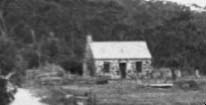 On 25 May we are gathering at the park to celebrate our 25 years and also to officially open Jenkins Kitchen which Friends have renovated with the aid of a Heritage Near Me grant. The grant is particularly designed to return heritage buildings to a form that can be accessed by the public. In this case the building, which is thought to be the oldest building in Ku-ring-gai, will be used at an interpretation centre illustrating its past use as a kitchen while acting as a source of information about the flora and fauna of the park.
We would like to extend an invitation to anyone who has been a volunteer in the park or member of Friends of Lane Cove National Park in the past (and who we may have lost contact with) to come along and help us celebrate.
We will meet near the park headquarters at noon. Refreshments and a barbeque lunch will be provided, and it will be a good chance to catch up with old friends.
If you intend to come, please let us know at This email address is being protected from spambots. You need JavaScript enabled to view it. to help us with the catering.
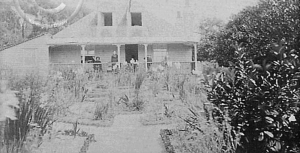
Photo at the top of the page is Jenkin’s homestead 1895 (photo Ku-ring-gai Library)
Tony Butteriss
Ahimsa: A Story of Bushland Protection
Walking along hand built stone paths into the bushland property Ahimsa is a step back in time and an inspiration for the future. It is also a remarkable testament to the former owner Marie Byles.
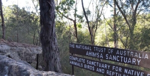
Gifted to the National Trust of Australia (NSW) over 40 years ago by Marie Byles, this 3.5 acre bushland property at Cheltenham in the Upper Lane Cove Valley is now listed as a state heritage item. Ahimsa adjoins Lane Cove National Park and is part of a large area of bushland surrounded by urban development.
Marie Byles was a visionary woman well ahead of her time. She was the first female to practice law in NSW, a mountaineer, explorer and avid bushwalker, a committed conservationist, a feminist, author, and original member of the Buddhist Society in NSW.
Marie was a passionate protector of bushland, whether from development, roads, weeds, or uncaring government officials. In 1938 she built a simple fibro and sandstone cottage on the property for her home on a rock ledge overlooking the beautiful surrounding bushland. The name of her home Ahimsa means harmlessness, a Buddhist and Hindu spiritual doctrine and Sanskrit word. This name reflects her belief that we are not separate from the world around us, and the natural environment should be respected and protected from harm.
Later in 1947, Marie designed the nearby Hut of Happy Omen which was built by friends and volunteers to accommodate a range of people and activities, including visiting Buddhists, bushwalking groups, conservationists and social gatherings.
Ahimsa is little changed in over half a century, and represents the physical expression of the life and values of Marie Byles. She left the land to the National Trust to protect its bushland in perpetuity, and in the public interest. The significance of the property is its realisation of Marie’s lifestyle and beliefs, and strong connection with current ideas about sustainable living, mindfulness, meditation and protection of the natural environment.
Ahimsa is a place that is important in the story of the conservation of Sydney’s bushland. An easy walk from the railway station, it is a place of peace away from Sydney’s hustle and bustle. The Hut of Happy Omen is available for use by people and groups compatible with the values of the property, by arrangement with the National Trust.
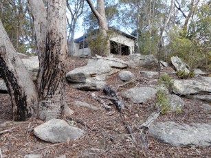
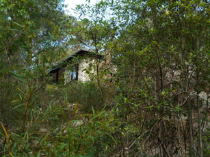
Friends of Ahimsa is working with the National Trust of Australia (NSW) to support future management of the property and to make Ahimsa accessible as a place that tells the story of its former owner and contributes to the realisation of Marie Byles’ dreams and values.
Children’s Art at Ahimsa on Sunday 28 April 2019 provides an opportunity for children between 7 and 11 years of age and their carers to appreciate the Ahimsa bush.
Although Ahimsa faces challenges for the future, including how to effectively maintain its bushland, heritage values and buildings, Marie Byles’ vision of simple living and protection of nature remains an inspiration. It is hoped that future generations will continue to use Ahimsa to learn about and reflect on Sydney’s bushland heritage, and the people who were instrumental in protecting it.
To find out more about Friends of Ahimsa, the conservation and management of the property, or to be placed on the Friends of Ahimsa contact list for future events and activities, please email This email address is being protected from spambots. You need JavaScript enabled to view it..
Martin Fallding has a lifelong association with Ahimsa as a neighbour and family friend of Marie Byles. He has had a long involvement in bushland conservation and is currently the president of Friends of Ahimsa.
Timbergetting in the Lane Cove Catchment
In February 1805 botanist George Caley (sent out by Sir Joseph Banks) made an exploratory trip from Pennant Hills across the upper catchment of the Lane Cove River and reported on the fine timber. Nine months later Governor King issued directions for a gang of convicts to be employed at the North Shore to procure ship timber.
A timber carriage with eight draught bullocks was conveyed to the work site in the government punt, attended by a competent number of hands. Thomas Hyndes, one of the original grantees of land at Wahroonga, and clerk and overseer to the superintendent of camp and gaol gangs, probably accompanied them to the site on the flat at Fiddens Wharf, on the northern side of the Lane Cove River at Killara.
From an administrative point of view the Lane Cove camp was a problem. It was located distant from Sydney and run by overseers who had not been tried and tested in Sydney under the watchful eye of the principal superintendent.
There were three overseers appointed and dismissed from Lane Cove between 1808 and 1814. It was during 1809 to 1814 that the camp was most productive. The main timbers logged were Blackbutt, Blue Gum and Iron Bark for building purposes and Casuarina for roof shingles.
Governor Bligh prepared material to erect some necessary buildings including a large barrack for soldiers and timber from the North Shore Camp was used to build the Parramatta Store, completed by the end of 1809, and the Commissariat Building in Sydney, begun in 1809. These no longer exist.
Macquarie visited the camp in May 1810 and found that the timber in the Lane Cove Valley between Hornsby and Roseville was getting scarce and observed that the camp would need to be moved elsewhere.
Macquarie’s first major project using Lane Cove timber was the building of a Light Horse Barracks and a new hospital, now Parliament House and The Mint. The numbers of draught cattle at Lane Cove were trebled in preparation for this major project.
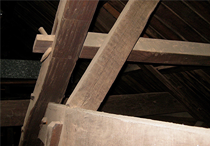
Rafters at the southern end of The Mint showing a purlin (top horizontal timber) attached to the rafter using a tusk tenon joint (photo Ralph Hawkins)
In 1814 there were two overseers at Lane Cove; one for the men and one for the stock. There were four timber fellers who supplied eleven sawyers, seven shingle splitters, eight timber carriage drivers, four stockmen, two boatmen, two blacksmiths and a wheelwright. There were also two watchmen and five other labourers, making a total of 48 men.
The hospital, completed in 1816, has some of the last timber cut at Lane Cove. Soon afterwards the camp was re-located to Pennant Hills and the North Shore was described as follows by Alexander Harris:
I could not but take notice of the immense number of tree stumps. Each one of these had supplied its barrel to the splitter or sawyer or squarer: and altogether the number seemed countless. Several times I was induced to wander off the road down a grassy slope overshadowed by oak or gum or ironbark, to where I saw the form of a hut, in the hope of getting a light for my pipe; but found only some deserted pit or falling hut, with docks and other such plants growing all around, as is usually the case when the grass has been destroyed to the very roots.
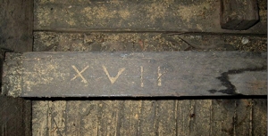
Photo at the top of the page shows timbers in The Mint that were probably sawn from timber cut in Lane Cove during 1812 and 1813; the ceiling joists are all numbered in Roman numerals (photo Ralph Hawkins)
Ralph Hawkins
Lane Cove National Park to Gain some Land near M2
Lane Cove National Park will be expanded, albeit marginally, with the addition of 0.6 ha near the river at North Ryde near the Epping Road bridge below the business park.
The announcement from NSW Environment Minister Gabrielle Upton states that it will help foster habitat and threatened species along the river. The threatened species include Darwinia biflora, a shrub only found in Sydney’s northern suburbs. Weeds are a problem in this area because of the steep terrain.
STEP History – A Mapping Retrospective
The preparation of STEP’s history by Graeme Aplin and the committee is progressing well and will be completed by our 40th anniversary celebration on 22 July. This has given us an opportunity to reflect on the work that went into the development of our walking maps and the tremendous contribution of our volunteers. Below is an outline of the history and process of production of our maps.
There is still a regular demand for the STEP maps. Their broad coverage and detail make it possible to plan connections with public transport and interesting variations on the standard routes.
First Lane Cove Valley Map
It all started in the 1980s when a group of South Turramurra locals decided that a map was needed of the STEP Track and other local tracks. They went out checking the tracks that had been created over the years by various authorities and locals who found their own way to explore the bush. There was no national park in those days. They often met people who welcomed the idea of formal printed map. So this was the beginnings of the first Lane Cove Valley map that was printed in 1990 but it had a long gestation period of about 8 years.
The first draft was developed by geographer, Graeme Aplin and then Margaret Booth and the team of South Turramurra locals marked out the tracks which were then verified by a team of volunteers. This map covered the area upstream from De Burghs Bridge.
The final cartography and printing was done by the Central Mapping Authority in Bathurst and the Paddy Pallin Foundation provided a loan to cover printing costs.
The map was launched by Tim Moore, the State Minister for the Environment as a prelude to a bushwalk on 19 August 1990.
2000 and 2016 Lane Cove Valley Maps
In late 1997 the committee decided that a revision was needed because most copies had been sold, and changes had been caused by the 1994 bushfires and the M2 motorway. This time the map was extended to cover the whole Lane Cove River valley down to Greenwich Point. The map was launched in November 2000 by Peter Duncan, Director of the Centennial Park and Moore Park Trust.
John Martyn’s experience as a geologist was vital for the creation of the base map. Many hours or work were involved in building a full-colour base map stitched together from digital files provided by the NSW Lands and Property Information, air photos, satellite images and field observations. Roads, national park boundaries, local parks, hazards, natural features and many other details were meticulously inserted. Then the tracks were added and checked by John and a team of volunteers. Some volunteers did this with GPS and for wider tracks by Google Earth and air photos, others by simple navigation.
By 2015 it was realised that the map was getting out of date again. We had a good base to work on with the previous map. However John decided to extend the map detail to the west and south-west to cover more of the Lane Cove River catchment and more opportunities for walking connections with railway stations on the northern line. It is amazing how much has changed over 15 years so this again was a major exercise. Often it is harder to check for changes than to start from scratch!
It would not be possible to produce both maps without the help of our volunteers. Their work is much appreciated. Their names are listed below but please excuse us if any names are left out as it was hard to keep track of them all:
- 2000 map – Phil Helmore, Ralph Pridmore, Jenny Schwarz, Peter and Robin Tuft, Natalie Wood, Helen Wortham.
- 2016 map – John Booth, Debbie Byers, Robert Carruthers, Jill Green, John Hungerford, Adrienne Kinna, Andrew Lumsden, Ruaridh MacDonald, Natalie Maguire, Alan McPhail, Ralph Pridmore, Jim Wells, Natalie Wood, Ted Woodley.
Middle Harbour Maps
It became evident in the early 2000s that the Middle Harbour catchment offered numerous walks over a much larger area, and also that many STEP members who are keen walkers also lived in or near that catchment. Given the experience with Lane Cove mapping it seemed an easy choice to create bushwalking maps of that area. It also followed creation of Garigal National Park which merged large council bushland areas into one entity. The map coverage included a considerable area of suburbs carrying small reserves and linking larger bushland reserves, and included popular harbourside walks too, many in Sydney Harbour National Park. The end result was two double-sided sheets extending from Mona Vale Road to Greenwich and North Head.
The base for the Middle Harbour catchment was purchased from Lands and Surveys digital database and they also carried out the printing.
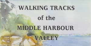
Volunteers were John Balint, Therese Carew, Bill Filson, Tim Gastineau-Hills, Gerald Holder, Simon and Joy Jackson, Bill Jones, Jan Kaufman, Kate Read, Jennifer Schwarz, Peter Tuft and Natalie Wood. STEP was also supported by the late Bill Orme, Graham Spindler and Leigh Shearer-Herriot (North Sydney Volunteer Walkers Group), NPWS and the relevant councils. Map cover pictures were watercolours by artist Janet Carter of East Roseville.

