
Robin Buchanan reminds us that maps on smart phones have limitations.
‘Just another lost bushwalker’ said the weary voice of the policeman at Hornsby Police Station when I rang to ask why there was a helicopter searching the bush below our house. For those who know the areas of Lane Cove, Berowra and Ku-ring-gai National Parks well it is hard to imagine becoming lost but it happens very regularly and even more so in larger national parks.
Too many people rely on smart phones. These are really useful but they have three disadvantages. They run out of batteries quickly if they are used for navigation for too long, they don’t show landform and they can’t give both a detailed view of where you are at the same time as giving a broad view of the area. Hand held GPS (global positioning system) units are better as they are more rugged; the batteries are only used for the GPS and are easily replaced. They also have designated maps installed but they still suffer the same problem as phones when you zoom in and out.
Paper maps never run out of batteries and you can simultaneously see where you are and where you are going – even if it is several kilometres away. These days I tend to take a phone, GPS and paper map with me at all times as experience has taught me that they all may come in useful. The following examples illustrate how useful maps can be.
We were on a track a friend had walked many years ago but as the sun slid down in the west the track became more and more overgrown and our speed became slower and slower. The GPS told us exactly where we were but the paper map was spread out so we could accurately gauge the distance if we went back, continued on or crossed the valley to a well-established tack. It quickly became clear that forward and backwards would see us out after dark but we should make it if we crossed the valley.
On another occasion a friend decided to walk ahead but missed the turnoff to the cars. No friend when we got there! The map was spread out and his most likely positions determined. The hunt was begun. He was quickly located at one of the points and all ended happily.
I have even given away a map when it was obvious that walkers had no idea of the size of the area in which they were walking: some simple calculations were done; if it has taken x amount of time to walk as far as you have, then to reach Berowra Creek and back is going to take four times as long. That will be after dark. Why not go to a nice lookout instead? Here, have a map.
Groups can gather around a map, make collective decisions, name far mountain ranges and reminisce about walks they have done before or plan the next walk. Good group dynamics.
1:25 000 Maps
The maps that give the largest view of an area are the 1:25 000 series (every distance on the ground is divided by 25 000). These are published by the NSW Government.
Bobbin Head Information Centre in Ku-ring-gai Chase usually have stock of the maps covering local national parks.
Don’t be put off by the name of the maps; they are titled by a main feature on the map. The Hornsby map is not a map of Hornsby, Hornsby is located in the centre of the map and lots of bushland is shown on the map as well. The local national parks are covered by several maps:
- Ku-ring-gai Chase: Hornsby, Cowan, Mona Vale and Broken Bay
- Berowra Valley: Hornsby and Cowan
- Lane Cove: Hornsby and Parramatta River
- Garigal: Hornsby,Parramatta River and Mona Vale
STEP and Friends of Berowra Valley
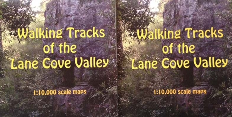
STEP’s three maps cover the Lane Cove Valley and Middle Harbour (North and South) and are printed at 1:10 000 (ground distances divided by only 10 000). They give a more detailed view of the area but are still broad enough to give you a good view of your surroundings.
The Walking Guide to Berowra Valley National Park published by the Friends of Berowra Valley is printed at a scale of approximately 1:18 000.
WildWalks
WildWalks produces detailed maps and descriptions of particular walks. You can download pdfs but printing them is safest. They are best used in conjunction with maps of the area such as the ones described above.
Great North Walk
The Great North Walk, through Lane Cove Valley and Berowra Valley is covered by The Great North Walk Companion.
Having Trouble Reading Maps?
If you have trouble reading paper maps and would like an introductory course, please let us know! Don’t be ‘just another lost bushwalker’.