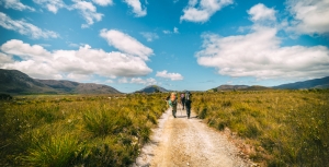
Displaying items by tag: bushwalking
Introductory Bush Walks are Popular
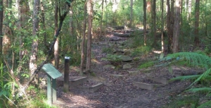
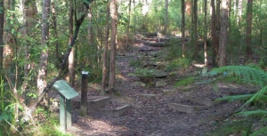
We have conducted two introduction to bushland walks this year, one in Sheldon Forest/Rofe Park and the other along the STEP Track. They have been well received. Peter Clarke has given interesting explanations of the ecological features of our local bushland and the importance of preserving this biodiversity. We plan on running these walks every couple of months and extend them, not far away, into the Hornsby area.
New Walk Series – Introduction to our Local Bushland
STEP member, Beverley Gwatkin, came up with the great idea of conducting walks for people unfamiliar with the amazing features of our local bushland so she approached Peter Clarke who agreed to lead the walks.
Until his recent retirement, Peter was Ku-ring-gai Council’s community volunteer program coordinator, so he has a wealth of knowledge about the local flora and fauna.
STEP will be organising a walk every couple of months on a Sunday morning. Click here for more information and to register.
New Steps on STEP Track
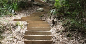
STEP applied for an Environmental Small Grant from Ku-ring-gai Council last year for further repairs to the STEP Track near the Lane Cove River. Previous repairs were carried out near Kingsford Avenue. The repairs have now been completed so the walk up or down the steep section is now much safer.
Paper Maps are Good Friends
Robin Buchanan reminds us that maps on smart phones have limitations.
‘Just another lost bushwalker’ said the weary voice of the policeman at Hornsby Police Station when I rang to ask why there was a helicopter searching the bush below our house. For those who know the areas of Lane Cove, Berowra and Ku-ring-gai National Parks well it is hard to imagine becoming lost but it happens very regularly and even more so in larger national parks.
Too many people rely on smart phones. These are really useful but they have three disadvantages. They run out of batteries quickly if they are used for navigation for too long, they don’t show landform and they can’t give both a detailed view of where you are at the same time as giving a broad view of the area. Hand held GPS (global positioning system) units are better as they are more rugged; the batteries are only used for the GPS and are easily replaced. They also have designated maps installed but they still suffer the same problem as phones when you zoom in and out.
Paper maps never run out of batteries and you can simultaneously see where you are and where you are going – even if it is several kilometres away. These days I tend to take a phone, GPS and paper map with me at all times as experience has taught me that they all may come in useful. The following examples illustrate how useful maps can be.
We were on a track a friend had walked many years ago but as the sun slid down in the west the track became more and more overgrown and our speed became slower and slower. The GPS told us exactly where we were but the paper map was spread out so we could accurately gauge the distance if we went back, continued on or crossed the valley to a well-established tack. It quickly became clear that forward and backwards would see us out after dark but we should make it if we crossed the valley.
On another occasion a friend decided to walk ahead but missed the turnoff to the cars. No friend when we got there! The map was spread out and his most likely positions determined. The hunt was begun. He was quickly located at one of the points and all ended happily.
I have even given away a map when it was obvious that walkers had no idea of the size of the area in which they were walking: some simple calculations were done; if it has taken x amount of time to walk as far as you have, then to reach Berowra Creek and back is going to take four times as long. That will be after dark. Why not go to a nice lookout instead? Here, have a map.
Groups can gather around a map, make collective decisions, name far mountain ranges and reminisce about walks they have done before or plan the next walk. Good group dynamics.
1:25 000 Maps
The maps that give the largest view of an area are the 1:25 000 series (every distance on the ground is divided by 25 000). These are published by the NSW Government.
Bobbin Head Information Centre in Ku-ring-gai Chase usually have stock of the maps covering local national parks.
Don’t be put off by the name of the maps; they are titled by a main feature on the map. The Hornsby map is not a map of Hornsby, Hornsby is located in the centre of the map and lots of bushland is shown on the map as well. The local national parks are covered by several maps:
- Ku-ring-gai Chase: Hornsby, Cowan, Mona Vale and Broken Bay
- Berowra Valley: Hornsby and Cowan
- Lane Cove: Hornsby and Parramatta River
- Garigal: Hornsby,Parramatta River and Mona Vale
STEP and Friends of Berowra Valley
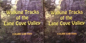
STEP’s three maps cover the Lane Cove Valley and Middle Harbour (North and South) and are printed at 1:10 000 (ground distances divided by only 10 000). They give a more detailed view of the area but are still broad enough to give you a good view of your surroundings.
The Walking Guide to Berowra Valley National Park published by the Friends of Berowra Valley is printed at a scale of approximately 1:18 000.
WildWalks
WildWalks produces detailed maps and descriptions of particular walks. You can download pdfs but printing them is safest. They are best used in conjunction with maps of the area such as the ones described above.
Great North Walk
The Great North Walk, through Lane Cove Valley and Berowra Valley is covered by The Great North Walk Companion.
Having Trouble Reading Maps?
If you have trouble reading paper maps and would like an introductory course, please let us know! Don’t be ‘just another lost bushwalker’.
Bushwalking Booms as Participation Nearly Doubles
Interesting consumer research has found the number of Australians going bushwalking has risen significantly in the past five years.
Findings from Roy Morgan research shows that between October 2010 and September 2015, the proportion of the population over the age of 14 who reported going bushwalking at least occasionally has almost doubled from 15.6% to 27.3% – a total of 5.3 million Australians. That is a lot of people.
The information was gleaned by a survey conducted by the reputable consumer research organisation, which asked respondents about how often they go bushwalking, and what they did on their last holiday.
Self-reported regular or occasional bushwalkers were shown to be more likely to visit wilderness locations, as well as undertake other outdoor adventures. I got in touch with researchers at Roy Morgan and they kindly provided state specific information that shows South Australia saw the greatest increase in bushwalkers over the period, while Tasmania has the highest rates of participation overall.
Most importantly, it seems the trend towards an increasing interest in bushwalking holds true across the country.
From personal experience, I’ve seen walks near my home in NSW increase in popularity in recent years, with one route in particular jumping from up to 15 walkers on a good Saturday to now closer to 80. There have also been some incredible increases in the number of people on a few specific walks in Royal National Park, but these are big outliers and unsustainable increases rather than the slow and steady growth we might hope for.
This growth is also visible online and in community groups that are closely affiliated with bushwalking. I’ve seen a clear increase in participation in recent years on bushwalk.com and wildwalks.com.
But this seems to be leading to more people presenting as under-prepared for the adventures they’re undertaking. I’ve come across more walkers without an adequate map or relevant details for the route they’re on. This is a worrying trend and I hope that as more experienced members of the bushwalking community we can assist beginners whenever and wherever they need the help. Equipping people new to walking should be a priority, not only for the health and safety of new bushwalkers, but also to try and minimise their impacts on the parks, tracks, flora and fauna they interact with.

What hikers/bushwalkers did on their last trip compared to the average Australian
(from Roy Morgan’s latest findings on the holiday habits of Australians)
Related Industries to Benefit
The overall result of this increase in bushwalking participation will have knock-on effects for the businesses that are closely related to the activity, especially for information services such as Wild.
Cafés and other businesses near walking tracks should also enjoy an increase in walkers, which would be a great win for the edge of suburbs. Hopefully the number of people enjoying a day walk will also graduate into multi-day hikes, and they’ll do so with the help of guides and tour operators. This is the good news Roy Morgan Research wants to communicate, with group account director, Angela Smith saying the apparent boom in bushwalking represents ‘a wonderful opportunity for savvy tourism operators and destination marketers’
‘Not surprisingly, destinations offering scenic wilderness hold greater appeal for hikers and bushwalkers than for the average Australian considering a holiday. When asked where they’d like to visit, this group showed an above-average preference for unspoiled regions such as Freycinet National Park, the Flinders Ranges, Cradle Mountain and Lord Howe Island,’ she said.
If this graduation process occurs then the adventure-specific retailers and clubs should also start to see a marked increase, but it may be too early to see these effects taking place. Also, given the popularity of online retail and community groups, the benefit to traditional organisations will no doubt be a little muted.
We need to be careful that we don’t love these special places to death. Hopefully the most significant change will be for parks and reserve management, otherwise the increase in participation will have adverse impacts on the environment. In NSW, we have seen some walks become over-the-top popular, going from just a few walkers per day to sometimes as many as 1000. Many of these bushwalkers are inexperienced and not aware of potential risks to themselves and the bush. This is not the norm, but show the impact social media can have in encouraging people to adventure, a lesson and warning.
Keeping Bushwalking on Track
Since we are now talking about nearly 30% of the population participating in bushwalking (more than golf, competitive sports, and cycling) it is time to start doing some solid research.
We need to better understand where people are walking, how they use the track networks, how often they return, walking speed, direction of travel, group sizes and so on. Much of this is easy data to collect and will help in better planning, equipping and promotion.
We can better understand how people are using walking tracks now, I am confident that we can plan for a future where even more people are walking, where we maintain a sense of wilderness and look after these precious areas. To do this we need to stop making assumptions and get some real data that can inform planning.
Unlike golf and cycling, the cost of entry to bushwalking is much lower for most popular short walking tracks. Gear suppliers have done a wonderful job at producing lightweight gear for experienced walkers. A challenge for the industry will be to find ways to provide products and services of interest to all these new bushwalkers, again the challenge would be made easier if we can better understand how, when and where these people are walking.
In the meantime, at least we know our national pastime is more popular than ever.
Our thanks to Matt McClelland for permission to republish this article. It was published in Wild on 17 February 2016.

