
Newsletter blog
Children categories
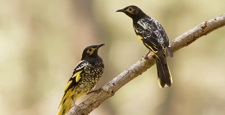
Cockatoo bin opening survey
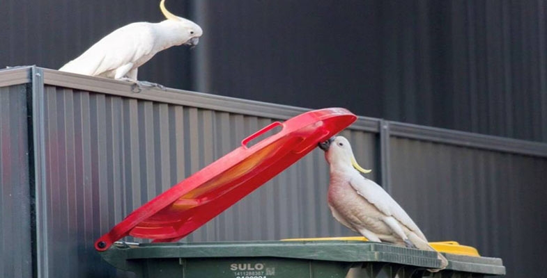
Our highly intelligent and loud sulphur-crested cockatoos have developed a new skill, opening wheelie bins in order to raid their contents. This behaviour has been surveyed by the Max Planck Institute of Animal Behaviour, the Australian Museum and Taronga Zoo over the past four years and the ‘word’ is spreading.
Help the researchers learn about cockatoo bin-opening: whether you ‘have’ or ‘have not’ observed this behaviour is valuable to the study, so please participate.
Reported in three suburbs in 2018, the ‘knowledge’ has spread to 44 suburbs by late 2019. The research published in the journal Science reported differing techniques between suburbs resulting from different sub-cultures that have developed in areas that are well separated from each other.
A milestone for the Friends of Lane Cove National Park – 30 years of volunteering
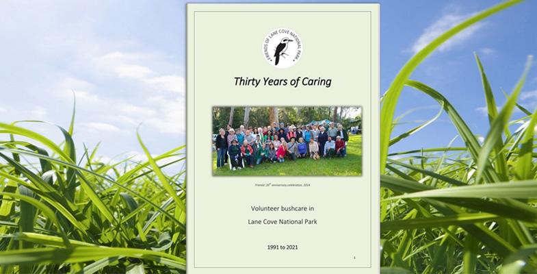
The Friends of Lane Cove National Park were planning to hold a celebration this year commemorating 30 years of volunteering in the Park but COVID-19 stymied that plan. However Mike Pickles and David Meggitt have compiled a booklet documenting the achievements of the volunteers Thirty Years of Caring: Volunteer Bushcare in Lane Cove National Park.
It includes a history of the northern Sydney Bushcare movement from its beginnings in the 1960s. The techniques were formalised by publications such as Joan Bradley’s Bringing Back the Bush and Robin Buchanan’s TAFE sponsored textbook that became the reference (and still is) for all trainees.
In Lane Cove National Park, a series of working bees were held in the early 1990s and these evolved into the creation of the Friends thanks to the initiative of Nancy Pallin and Nan Goodsell. The creation of this organisation facilitated the ability to apply for government grants.
The first meeting was held in January 1994 and a week later one of Sydney’s worst bushfires occurred and 85% of the park was badly burnt. This led to a large influx of volunteers eager to help restore the park and the Volunteer Bush Regeneration Program was created. This program is still going strong.
The booklet chronicles the activities and personnel involved with the Friends, including the great support from the NWPS staff. It also provides a profile of each of the 27 Bushcare sites that are still functioning.
Young Scientist Award 2021

It is good to see the Young Scientist Awards being run again this year. The winner of the STEP award was Chloe LeMap from PLC Sydney for her project Cool the Sand, Save the Sea Turtles. Her project has demonstrated excellent background research, scientific process and initiative. We thank Gaye Braiding and Margery Street for judging.
National parks cycling strategy – submissions needed

NPWS has released a set of documents for consultation on an updated cycling strategy in national parks and reserves.
The National Parks Association will be putting out a submission guide early in 2022. Submissions may be made until 30 January.
There are three documents:
- policy statement
- outline of the strategy
- guidelines for implementation of the strategy
We are concerned with a number of aspects of these documents:
- The three documents give a very conflicted picture of priorities for mountain bike management in national parks. While the conservation purpose of national parks is emphasised the development of new tracks is being actively encouraged.
- ‘Stakeholder’ groups will be able to propose new mountain bike trail routes for which a standardised assessment method has been outlined. This is a job that should be initiated by the NPWS and many areas should be off limits.
- There is no strength in the proposals to deal with the issue of what they call unauthorised tracks. The number of tracks has increased significantly over the COVID lockdown period and this has been an intractable issue for a long time.
- There is insufficient emphasis on education of mountain bike riders about the conservation objectives of national parks and the damage caused to habitat by illegally constructed tracks and their use.
We recognise that the demand for riding on tracks, as against management trails, has increased significantly but the use of tracks and their construction has to be controlled in the same way as other activities in national parks.
A quick Google search shows that this has been a problem for many years. Attempts by the NPWS to close down illegal tracks and fine bikers found riding on walking tracks have met strong resistance.
Significance of numbers of mountain bike riders
We need to put this issue into perspective. Statistics based on surveys undertaken by AusPlay, a federal government agency, show that in 2020 in NSW, 1.8% of adults participated in mountain biking compared with 8.6% who bushwalked. The majority of mountain bikers would be riding on management trails or signposted tracks. A minority engage in challenging downhill rides such as the Gahnia and Serrata tracks in Garigal NP near Bantry Bay. In our experience of the northern Sydney region this minority are the people demanding new trails.
Is it reasonable for the NPWS to be expending so much time and their limited budget on developing and managing more facilities that will benefit such a minority? There will be limited opportunity to get a financial return from these facilities.
Conflicted picture
The first statement in the policy seems well measured:
A range of cycling experiences, including mountain biking, may be provided in some national parks and reserves managed by NPWS, where cycling can be undertaken sustainably and consistent with the conservation of natural and cultural values.
However, the strategy documents are all about increasing cycling opportunities in national parks through the creation of new dedicated tracks and formalising unauthorised tracks.
NPWS recognise that many unauthorised tracks have been created due to the demand for single track and more technical cycling experiences. As NPWS looks to invest in enhancing existing tracks, and creating new tracks on park, we will be engaging early with stakeholders to explore sustainable experiences that protect the natural and cultural values of our parks and ensure NPWS legislative requirements are being met.
The mountain biking community will relish the opportunities presented. The question is whether the NPWS can stand firm against the pressure that will be applied by the vocal biking advocacy groups and ensure that the objectives defined in the National Parks Act for the management of national parks are enforced.
Planning and assessment processes for new track proposals
The strategy guidelines set out processes for deciding whether a proposed new track or formalisation of an unauthorised track is suitable for the national park. It seems that proposals can be put forward by interested parties. This totally overturns the general principle that NPWS should be deciding where any new track could potentially be placed and areas that are totally off limits.
Under the current process NPWS does the background research into the protection requirements of the location and suitability of the route and drafts an amendment to the plan of management that will be open for public consultation. This was the process for the development of the new tracks in Garigal National Park. This will still be the case, but having the plan initiated by outside stakeholders, could make it difficult to justify refusal against strong lobbying.
The document does acknowledge that:
Not all parks will be suitable for cycling activities, and in some parks cycling experiences will be limited.
The proposal is to be assessed in stages:
- Site suitability – even pristine, unmodified bushland is not completely eliminated from the development possibility. Generally land that has been modified to some extent is a possible candidate for further consideration – see stage 2.
- Then an analysis is applied according to a list of criteria that are given a point score under three equally weighted categories:
- protection of park values and whether use will be ecologically sustainable
- an enjoyable and safe visitor experience
- construction and maintenance cost
The actual application of these criteria is highly questionable and basically incomprehensible. For example, it is possible for a proposed track to go through an area with threatened flora or ecological community. A low score is given but that is just one item that could be swamped by the other criteria. Protection of park values should outweigh the other categories.
The guidelines claim that:
A standard process to assess and enable proposed new cycling experiences in a park will provide certainty for proponents of cycling experiences on the process to be undertaken and the issues that need to be considered. A consistent approach for assessment ensures that all appropriate environmental and cultural values, as well as visitor needs, are considered.
If a proposal is acceptable under the assessment outlined above then it is assessed at a regional level taking into account higher level factors such as demand, connectivity with nearby tracks and compatibility with other users such as walkers.
The method seems to be mainly aimed at creating longer tracks that can be regarded as a ‘destination’, a visitor drawcard. Our conclusion is that the assessment method will be a waste of time. Mountain biking groups can present proposals and then why can’t the assessment be left in the hands of the NPWS?
The assessment process is not suitable for the Sydney region because the topography is most areas is too steep and incised by waterways. Only relatively short tracks could be built and the potential areas are already covered by management trails.
Tracks in Sydney cannot contribute to the local economy as they are primarily used by local residents. The two tracks built in Garigal NP cost over $1 million are only 6.5km long and can be completed in 1.5 hours according to the NPWS website.
STEP’s Position Paper on Bushland Tracks and Trails takes a much simpler approach. Basically tracks, whether new or existing unauthorised bike tracks, should not be built in high quality bushland. This applies particularly in Sydney where the national parks are compromised by their proximity to urban areas, often deeply incised by waterways, have erodible soils. These parks are already being degraded by their location and need to be carefully managed to mitigate the effects of climate change.
Response to issue of unauthorised tracks
This statement is made in the policy document:
NPWS will progressively close and rehabilitate unauthorised tracks unless identified through appropriate planning processes (e.g. plans of management) to be formalised as part of a park cycling track network. Subject to available resources and identified priorities, NPWS will also undertake community engagement and compliance activities to address ongoing illegal track building and the risks associated with the use of unauthorised tracks.
The strategy goes into a lot of detail about these ‘appropriate planning processes’ with a potential outcome that illegal tracks could be formalised, vindicating illegal activity as an outcome of strong advocacy from mountain biking groups.
Unauthorised tracks can be managed and reduced by proactively establishing cycling networks that meet both environmental and user requirements, and through establishing processes by which NPWS can prioritise and rehabilitate unauthorised tracks.
Positive experiences for cyclists and NPWS can be forged through the creation of partnerships to ensure all perspectives are considered. There are currently numerous great examples in our parks of community groups working with parks to maintain and monitor tracks and reduce unauthorised tracks.
In our experience in Sydney’s national parks, these statements are very optimistic!
Rehabilitation of unauthorised tracks
Even before the COVID lockdowns the construction of unauthorised tracks has proliferated. This was recognised as an issue back in 2011 when the previous strategy was written. NPWS just hasn’t had the resources to close down these tracks. Will this new strategy make any difference?
Walkers in Sydney’s national parks come across these unauthorised tracks all the time. Many are quite short and provide an alternative more exciting route than the official management trail or a short cut from streets to a management trail. Some seem to be built just for the fun of trying out skills at building jumps and tight curves. Often it seems the people building these get bored with the track they have built and move on to another area. We don’t often see them actually being used.
Solutions
The NPWS claims they can:
Develop a consistent and firm approach to non-compliant activities and work with user groups to develop a self-regulating culture of stewardship for the parks they enjoy.
But how many of the young illegal track builders are members of user groups? Education is inadequate and should be increased through signage and social media. Publicity about imposition of fines would help.
The culture and attitude of some mountain bike riders has to be changed so they accept that national park land is not available for their exclusive enjoyment. It is a rare asset that needs to be cared for and appreciated.
The attitude of bike riders on shared tracks also has to be changed. Too often they ride too fast to the extent that some walkers are scared to use some management trails.
Points for submissions
As STEPs primary concern is damage to bushland in our region, the main points we would like made in submissions are:
- Our local national parks are not suitable locations for the development of cycling experiences envisaged by the draft cycling strategy.
- NPWS has to make it clear in the documents that they are in control in determining where new mountain biking tracks may be built.
- More resources should be allocated to the closure and rehabilitation of unauthorised tracks.
- NPWS should encourage user groups to get their members to engage with all riders to instil a culture that regards the destruction of natural bushland as unacceptable.
- The strategy provides for NPWS to work with user groups and other land managers, such as councils. These groups should work together to develop stronger education programs about the appropriate places for developing mountain bike tracks and their use.
Gardens of Stone protected at long last
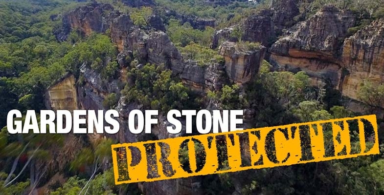
After 90 hard years of campaigning the NSW government has finally decided to declare some protection for the Gardens of Stone. The ideal would have been the creation of a national park but a state recreation area is a start. Here is some history:
- 1932, Colong Foundation for Wilderness founder, Myles Dunphy, included the Gardens of Stone in his ‘Greater Blue Mountains National Park Proposal’.
- 1985, former Colong Foundation Director, Dr Haydn Washington, published the Gardens of Stone Reserve Proposal.
- 1994 the liberal environment minister, Chris Hartcher, reserved the Gardens of Stone National Park (stage 1) after a strategic park proposal from the Colong Foundation for Wilderness while independents held balance of power in the NSW Legislative Assembly.
- 2005, the Gardens of Stone Alliance formed, consisting of the Blue Mountains Conservation Society, Colong Foundation for Wilderness and the Lithgow Environment Group to coordinate a community campaign to protect the Gardens of Stone based on a state conservation area proposal by the Colong Foundation. The campaign highlighted the damage being done to upland swamps and the pagoda formations by underground mining.
- 2019, a comprehensive visitor management plan, Destination Pagoda, was released by the Gardens of Stone Alliance to showcase the economic benefits of developing the tourism potential of the region.
- 2021, Centennial Coal withdrew their proposal for expansion of the Angus Place Colliery after persistent campaigning from the Gardens of Stone Alliance.
The total 30,000 ha of land to be protected has been drawn from several state forests and crown land. It includes threatened ecological communities such as upland swamps and box woodland and several rare and threatened species.
The campaigners have worked with the local Lithgow community, council and politicians to demonstrate the benefits of making the Gardens of Stone a tourist destination. Mining jobs will be replaced by new employment in the Lithgow area. The NSW government has come up with some financial support with $50 million for management and upgrades.
The drawcard is the amazing rock formations called pagodas that dot the landscape, with gorges, canyons and waterways winding between them. There are valleys with lush rainforest and high-country woodlands, including patches of snow gum. There are amazing wetlands that support unique wildlife like the giant dragonfly.
A state conservation area does not prohibit mining in the way that a national park declaration does. While Centennial Coal has withdrawn its proposal to expand the Angus Place coal mine, it still wants to extract coal and has submitted a new proposal to mine underground at Angus Place West. The prospect of more coal mining will be opposed strongly by conservation groups but at least the Gardens of Stone will not be affected.
The tourism developments include:
- An iconic great walk (six days) from the Wollemi wilderness through the Capertee Valley to the Gardens of Stone that will feature incredible views across the Wollemi wilderness and the ancient pagoda formations. Accommodation and purpose-built eco-cabins will be built along the way.
- Existing four wheel drive circuits will be retained.
- A 35 km mountain bike circuit.
- The Lost City Adventure project that will include Australia’s longest zip line and a spectacular elevated canyon walk.
- Upgraded roads and lookouts for the more sedate visitors
The challenge will be the potential damage from the expected influx to areas such as the Lost City and other rock formations, as well as indigenous rock shelters and other heritage. The design of these projects and management must give priority to protection of this unique area.
Haydn Washington has written about the history of the campaign, which you can download and read at your leisure History of the Campaign for Gardens of Stone from 1980 to 2021.
Feeling adrift in a sea of false hope

A couple of months ago, I sat in on an Australian Conservation Foundation (ACF) event via Zoom for its donors and supporters that promoted its latest climate change campaign. As a long-serving councillor and former vice president of ACF, I was interested to hear about their campaign plans, which they explained are based on a poll of 15,000 people who indicated a desire for firm action on climate change. However, at the end of it, I felt isolated and alone. I felt I had moved on in my thinking, while ACF has not.
The presentations by senior ACF staff were earnest and uplifting and the comments posted in response were enthusiastic and supportive. But I felt myself estranged from the event. I found myself recalling how often, over my 30 years of enthusiastic involvement with ACF, I had felt uplifted and inspired by the same style of presentations by ACF’s key personnel. Now, not so and it felt a bit like having lost a faith.
So, what has changed for me as ACF barrels along in its customary manner? It comes down to a realisation that ACF, and environmentalism more generally, is stuck with talking about the symptoms of the environmental crisis, while ignoring the underlying causes. It is also locked into a largely fruitless campaign mode that is focused on targeting marginal seats in each Federal election. This has been its style since I joined its council in the 1980s and it remains a deeply entrenched, culturally embedded modus operandi.
The ACF people are intelligent, well-meant and deeply committed environmentalists, and for that they have my great respect. But they, and seemingly their supporters and donors who joined in this event, now appear to me to be tunnel-visioned and misguided in their fervour. First, and foremost, there is the assumption that climate change is the major existential threat that ACF and the wider environmental movement must address. It is their highest priority. And second, there is the additional assumption that this threat can be averted through a political campaign focussed on key marginal seats that will somehow bring about a radically different response. I hear myself thinking, ‘same old, same old’, looking back over forty years of ACF campaigning strategy. When will the penny drop that this is a fruitless strategy?
I could have submitted a comment to the event along the following lines:
When will ACF connect its climate change and biodiversity work to a deeper sustainability agenda that encompasses population growth, consumption, economic growth and technology – the underlying drivers of imminent collapse?
That would have been a real ‘party pooper’ contribution that I am sure would not have been welcomed by the ACF organisers on the night. It probably also would have been dismissed as inappropriate or irrelevant by most of the supporters and donors participating in the event.
The reality is that these deeper and more complex issues have been either ignored or dismissed by most ACF staff for much of its existence. This is despite the efforts of a number of its elected councillors and former Presidents over many years (ranging from Sir Garfield Barwick in the early 1970s to Emeritus Professor Ian Lowe more recently), to draw attention to them. The focus within ACF staff remains on an agenda dominated by the twin environmental pillars of climate change and biodiversity. But it would be unfair to level this criticism only at ACF. The environmental movement more generally, both here in Australia and in most other Western countries overseas, has largely displayed the same myopia in framing their campaigning and advocacy efforts.
As to the reasons for this behaviour, a fellow ex-ACF councillor, Jonathan Miller, offered me recently the following salient observations:
- The internal perception that it is easier to attract public support for issues such as climate change and biodiversity than for complex and less tangible issues such as population growth, consumption and economic growth.
- The additional perception that tackling the drivers of unsustainability is more difficult conceptually, much harder to win in the long-term and that it is more difficult to identify ‘wins’ to supporters and members.
- A shift in the profile of ACF (and other ENGO organisation) activists and their collective culture from those who deeply understand and love the bush (e.g. bushwalkers and those with natural science degrees) to those with broader social issue concerns (and whom, in turn, are particularly reluctant to tackle issues such as immigration-driven population growth in Australia).
Reinforcing the first of these points, the US founder of the Post Carbon Institute, Richard Heinberg, has offered the following observation about environmentalists more generally in a recent blog (The Only Long-Range Solution to Climate Change, Museletter #343 September 2021):
It’s understandable why most environmentalists frame global warming the way they do (by targeting the fossil fuel industry). It makes solutions seem easier to achieve. But if we’re just soothing ourselves while failing to actually stave off disaster, or even to understand our problems, what’s the point?
This succinctly echoes exactly where my own thoughts have arrived at after over 40 years of involvement with environmental law and environmentalism. I have come to believe that:
- climate change is essentially a symptom (admittedly a very powerful one) of an underlying ‘growth’ disease; and
- that the current political system, which is the hand maiden of capitalism and completely in its capture, is incapable of producing an effective response to climate change, much less the deeper challenge of avoiding ecological collapse and transitioning to sustainability.
On the latter score, the efforts by ACF and other ENGO’s to scramble for the crumbs falling from the table at each, successive federal election, seem both flawed and largely fruitless. Over the years, even though ACF does not directly support any political party, it has often engaged in targeting marginal seats where the ALP may have a chance of defeating the Coalition. The relationship with the Australian Greens has remained strained. And, after watching on ABC TV this week the first episode of the series, Big Deal, which laid bare the lack of any safeguards with respect to corporate political donations, it is clear where the most powerful influences on federal politics come from.
So, this is why I am left feeling alone and isolated. Where are the voices to raise the larger sustainability agenda? What is the point of environmentalism, however well-intentioned, if it proceeds in almost deliberate disregard of this larger agenda? How can this agenda be pursued when those most likely to support it do not, or are not willing to, recognise it? And what is the point of trying to engage with the current, corrupt political system in which a large proportion of Australian citizens have lost all confidence?
My response to these questions, perhaps surprisingly, remains hopeful. There are many voices emerging globally in support of a deeper sustainability agenda, including some luminaries in Australia. Environmentalism has been a meritorious movement over the past fifty years but it now must be seen as one that is limited in its vision and incapable of promoting a deeper sustainability agenda. This agenda must and will emerge from other sources and directions. And the goal must be to promote this agenda through radical social, economic and political reforms – these will be the pathways of the transition to a sustainable future that embodies ecological resilience and a human civilisation that is living within its means.
To develop these ideas further, I am engaged currently in writing a book entitled The Great Transition: From the Anthropocene to the Ecolocene which I hope to get published in about eighteen months from now.
This article is reproduced with permission. It was published in the Sustainable Population Australia newsletter, issue #145, November 2021. It was written by Rob Fowler, Adjunct Professor at the School of Law, University of Adelaide. He was a vice-president of the ACF from 2008 to 2015.
Firestorm by Greg Mullins
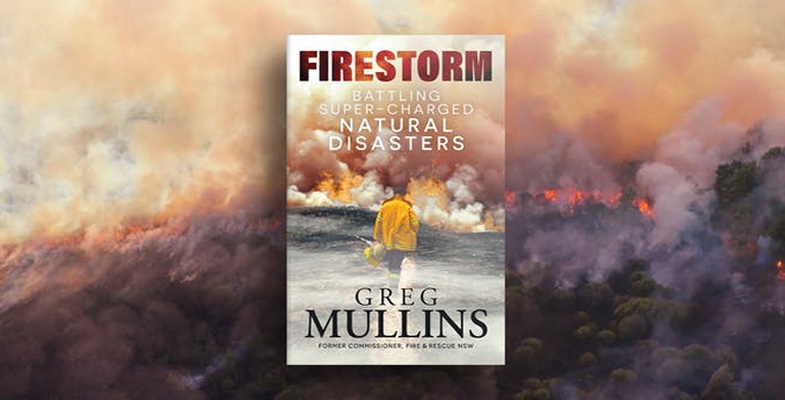
Between July 2003 and January 2017 Greg was Commissioner, Fire and Rescue, NSW. Being a former employee is an advantage when he speaks out publicly because public servants are not so encouraged. He is the person who organised Emergency Leaders for Climate Action (ELCA), a group of 34 past fire chiefs and experts who implored our Prime Minister to meet with them and understand the predictions for the 2019-20 fire season. Self-funded, they eventually managed a meeting with Ministers Taylor and Littleproud after some adverse media coverage.
This is an exciting adventure story of a local young man fighting fires all around Sydney’s North Shore, until chapter four. He applied for and received a Winston Churchill Memorial Trust Fellowship, as government agencies have no funds for R&D overseas travel, and observed bushfire control in England, France, Spain, Canada and the USA.
Californians do it in style! Within hours a small town would be set up: command units, catering units, shower and toilet bocks, busloads of experienced firefighting prisoners, T-shirts naming the fire for sale; and of course water-bombing aircraft and experts form Alaska, Colorado and Florida. The Oakland Fire Department had a novel prevention strategy, namely, that homeowners with a heavy fuel load could hire a ‘goat man’ to lose his herd of goats to effectively eat the fuel.
Throughout the book Mullins notes changing weather conditions in Australia and around the world. People have to accept that what worked in the past will not suffice in the hotter, drier future. Following the 1994 fires, a fire brigade station officer brought us the community fire units so familiar to us around the suburbs.
Enabling homeowners to wet down the bush, prepare their homes and emerge after the fire to put out small fires and embers, community fire units were decisive in the 2002 fires in Lane Cove in saving houses.
It is not the ‘much-derided so-called greenies who are the real canaries in the coal mine…it’s our farmers and primary producers’ [p145]. They suffer first from climate change. The account of ELCA’s attempts to meet with the Prime Minister from April 2019 made my hair stand on end. The Murdoch press personally attacked Greg Mullins and the former Queensland Fire and Emergency Services Commissioner; the federal government held back two tranches of funding until December and January when it was, of course, too late to source additional aircraft from overseas. Even then-current Commissioner of the NSW Rural Fire Service, Shane Fitzsimmons, was vocal, and noted that the PM had not warned him of unilaterally calling out army reservists to help fight the fires.
Mullins debunks the five biggest myths promulgated on social and other media destined to deflect attention from worsening climate change: in fact, Greenies never had control of decision-making on hazard reduction burning; we have not had weather conditions like this before; arsonists did not cause those fires; grazing in national parks does not reduce fuel loads - cows don’t eat many branches, twigs, bark, eucalyptus leaves and bark; we have not had worse fires before. Mullins then tells what the experts really said, basically that climate change is exacerbating fire danger.
He gives short, medium and long term directions to save ourselves. Some are as obvious as mandatory smoke alarms; cigarettes that self-extinguish in dry grass; and sprinkler systems in aged care facilities.
Unfortunately the book has no index. However, dates and names are precise; there are 109 references as well as appendices on factors affecting fires, fire dynamics, and finally, a word on how the ANZACs might view our disregard for facts.
Reviewed by Margery Street
A Kean eye for extinction: minister’s ‘fortress’ for endangered species crumbles on closer inspection
Earlier this week, NSW Environment Minister Matt Kean claimed he was ‘fortressing’ threatened species from extinction within our national parks reserve system. His announcement was to declare 221 areas of threatened species habitat as Assets of Intergenerational Significance (AIS).
Great! Environment groups joined in congratulating Kean on his ‘intergenerational’ vision before looking at it in any detail.
I wanted to know what exactly the announcement was meant to achieve. The minister’s media headline sounded purposeful: ‘Zero extinctions targets set for NSW National Parks’. But how exactly did the announcement go that further step needed to protect our threatened species in National Parks? After all, aren’t National Parks established to be a ‘fortress’ against threatened species extinction in the first place?
On the day of the announcement, I could find little reference to the exact species or habitats that had been protected. I then asked around my contacts for the ministerial press release. Bingo – a small link in the PDF press release sent me to an online map. It is fair to say, what I stumbled across in that map shocked me.
The most threatened bird species in NSW is the critically endangered Regent Honeyeater. Its habitat in the Burragorang, Capertee and Hunter valleys were not listed as an ‘intergenerational asset’. A curious omission given the $1 million in funding the NSW government has thrown at the species over the past six years.
‘Threatened species fortress’: zero extinction goal for national parks
I then turned my attention to the Blue Mountains, an area where my family has spent decades bushwalking. One of the rarest eucalypt species in the Greater Blue Mountains World Heritage Area, the vulnerable Camden white gum, was also left off the list. There are only two known populations of the species left on the planet. Again, a very strange omission.
Then, in one corner of the Blue Mountains intergenerational asset map, I finally spotted two lesser-known endangered species that had been listed – the Kowmung hakea and Solanum armourense, tenacious little shrubs that grow in the depths of the southern Blue Mountains wilderness. Curiously, only one half of the population for each of these species had been declared an AIS.
I was starting to ask the question. How could such a well-instructed minister simply overlook these species and their known habitats?
It then dawned upon me that these species shared a common fate. Matt Kean’s government plans to flood their World Heritage National Park habitat by raising the Warragamba Dam wall. Indeed, it has been estimated that half the remaining global populations of both the Regent Honeyeater and the Camden White Gum will be drowned by the dam project. And the populations of those little endangered shrubs conveniently left off the intergenerational asset list are also set to go under.
The fact is, Kean has consigned these species to extinction by conveniently forgetting they exist in the very national park he is responsible for. It seems he has handed the control of the Blue Mountains National Park to Stuart Ayres, the Minister for Western Sydney – a man who has claimed the people advocating for the area’s protection in the face of his plans to raise Warragamba Dam wall, such as myself, are engaging in ‘environmental terrorism’.
The environmental movement should be calling out this announcement for the blatant political spin that it is. The devil is always in the detail – and the detail shows Matt Kean is sending some of Australia’s most iconic species towards extinction through what could be called his government’s own form of ‘environmental terrorism’.
This article was published in the Sydney Morning Herald on 10 September and is republished with permission from the author, Rob Pallin. Rob is the chairman of the Paddy Pallin Foundation, a board director of the Colong Foundation for Wilderness and a STEP member.
Postscript
Click here for a map of AIS. There are some noteworthy species on the list that are to be protected by these AIS declarations.
- There are several sites covering the critically endangered Southern Corroboree frog in Kosciuszko National Park. One questions how effective the conservation action can be when there is no effective plan to reduce feral horse numbers. One would have to be an insider in the NPWS to know if there are habitat sites outside the AIS sites that are badly affected by the horses so that these frogs will continue to lose suitable wetland habitats. The horses trample the sphagnum moss resulting in water draining away so that the streams dry out.
- There are several sites of koala habitat around the Port Macquarie area and further north in the AIS list. A more comprehensive method of meeting Kean’s objective of doubling the koala population by 2050 would be to adopt the proposal by the National Parks Association of creating the Great Koala National Park inland from Coffs Harbour. This land is currently state forest subject to intensive logging and has been badly affected by the 2019 bushfires. Private land clearing, particularly on the north coast, is a major factor in the decline of koala populations.
Will the improvement in numbers in the AIS sites make up for the continuing losses elsewhere?
Assets of intergenerational significance – what are they?

The NSW Bushfire Inquiry recognised the need to identify the most important natural and cultural assets in the national park estate, so that special provision can be made for their conservation.
In 2020 the National Parks and Wildlife Act 1974 was amended to allow the Minister for the Environment to declare an area to be an Asset of Intergenerational Significance (AIS). An AIS can be any area of exceptional value – natural or cultural – that warrants special protection including dedicated management measures.
The first tranche of AIS is intended to protect the most important habitat for threatened species. Subsequent themes for AIS declarations may include nationally significant wetlands or important cultural heritage.
Potential declarations of environmental AIS will be informed by a range of considerations that include:
- sites for critically endangered, endangered, or vulnerable species
- important areas for breeding, feeding or shelter
- locations where locally extinct mammal species are being reintroduced
- where the national park otherwise provides important habitat
Opportunities to declare land in national parks as a cultural AIS will also be examined. Aboriginal communities will lead the process to determine areas with Aboriginal cultural heritage significance in national parks for declaration as cultural assets.
These cultural assets may include lands with tangible cultural heritage of importance to Aboriginal people, such as rock art, scar trees and middens. Protection may also be provided to intangible values, such as places of spiritual importance where storylines live on in the landscape and where significant cultural activities occurred and continue to take place.
What about those areas that will be flooded if Warragamba Dam is raised?
Conservation action plans
For each threatened species AIS, NPWS is under a statutory obligation to prepare and implement a concise conservation action plan (CAP) which sets out:
- key risks to the declared area of habitat for the threatened species
- priority actions to reduce risks to this important habitat – such as dedicated feral animal control or fire management, or the establishment of insurance populations
- actions to measure and report on the health/population of the threatened species (metrics)
In most cases, draft CAPs will be exhibited for public comment and advice sought from the National Parks and Wildlife Advisory Council.
The first declaration of an AIS was made in January 2021 for the Wollemi pine. In September the Environment Minister, Matt Kean announced a further 221 AIS sites that are habitat for 92 threatened species. They comprise 66 types of plants, 13 mammals, seven frogs, four birds and three reptiles. The 221 sites cover just over 300,000 hectares, or almost 4% of the national park estate. But national parks cover only about 9% of the state so the new protection is going to a very small proportion of the state.
Also he announced that the government has set a target of zero extinctions of native wildlife in the state’s national parks estate and an aim to improve and stabilise the status of threatened species. This will involve measures such as additions of land to the national park estate, creating a network of predator-free areas to support the return of locally extinct species (e.g. platypus in Royal National Park), consideration of threatened species in fire plans, feral animal control.
There is no mention of increased funding for all this activity.
This information comes from the Environment, Energy and Science Group which is part of the Department of Planning, Industry and Environment.
Some local AIS sites and the story of Hal
It is interesting to note that there are some local asset of intergenerational significance (AIS) sites protecting an unusual plant, Haloragodendron lucasii. There are four sites, one in Garigal National Park below Barra Brui Oval and three totalling about 300 ha in Ku-ring-gai Chase National Park in North Turramurra and St Ives. It is classified as endangered under both NSW and federal conservation legislation.
The Australian Plant Society reveals that H. lucasii was:
First recorded near ‘Gordon in a wild gully’ in 1908, five specimens of H. lucasii were held in the National Herbarium of NSW. The last specimen was collected in 1926, and following subsequent unsuccessful searches, the species was presumed extinct. That is until 1986 when the species was rediscovered at St Ives.
The rediscovered population was spread over a distance of at least 150 m along a terrace below the cliff line, and appeared to comprise several hundred plants growing among and out of a tangle of Gleichenia and Bauera. However, it was determined that the rediscovered population comprised only two plants. The first plant covered an area of 20 m2, with its underground stems giving the appearance of many separate plants. The second plant was even larger, spreading some 120 m along the terrace, but was discontinuous probably due to the effect of bushfires and the surrounding vegetation. It was, however, found to be a single individual or clone. More remarkable was that the plants were estimated to be 400 to 500 years old.
It was also established that the plants were sterile (i.e. produced no pollen). It was speculated that here was a remnant plant from an earlier era bound for extinction in the short term.
A further discovery effort was undertaken in 1997 by the NPWS, an ANU PhD student and Ku-ring-gai Council plus community volunteers. The story is told in this paper.
Over two flowering seasons three new populations of ‘Hal’ were found containing up to seven individuals. This doubled the number of known populations and genetic individuals. Still no fruit or seedlings were found so the verdict of sterility remains.
John Martyn has recently been on the hunt to spot these plants in North Turramurra. He described the ones he found as a maze of underground stems or runners that put up a small forest of suckers to around waist height. Its normal setting is below sandstone benches or drop-offs where it seems to like the runoff moisture.
But interestingly, at the site off the Bobbin Head trail there are three distinct sucker clusters that seem to me too far apart for an underground link. One is slightly downstream on a tiny creek line as if seeds (do they exist?) had washed down.
It seems there is more information to be discovered.
Further changes to threatened species management under the EPBC Act

The Morrison government has proposed scrapping recovery plans for almost 200 endangered species and habitats. Recovery plans are documents that set out actions needed to stop the extinction of threatened species. Ministers are legally bound not to make decisions that are inconsistent with them. However there is a huge backlog in the finalisation of recovery plans.
In 2020 the Environment Department revealed to a Senate estimates hearing that not one recovery plan had been finalised for 18 months and more than 170 were overdue, e.g. the Blue Gum High Forest recovery plan that has not been completed over the 14 years since it was declared critically endangered.
Instead of a recovery plan a ‘conservation advice’ is written that does not have the same legal force under national law. This has been possible under changes made to the EPBC Act in 2007.
The species and ecological communities to be given priority for a recovery plan are those that are most frequently affected by development and have often been referred for assessment by the minister as to whether the development should not proceed or conditions should be imposed. A prime example is the Cumberland Plain Woodland because of all the development in western Sydney but it is on the list of ecological communities to be downgraded to a conservation advice.
Another example is Blue Gum High Forest. The data provided only covers sites of BGHF on public land. It is important that the conservation advice also applies to private land such as the Mirvac site that includes about 3 ha outside the demolition area. If the conservation advice does not have the same legal status as recovery plans then we are left with council management policies to ensure that endangered species and ecological communities are protected.
The government is asking for feedback on proposed decisions to abandon recovery plans for 185 species and ecological communities. Consultation closes on 2 November 2021.
Full steam ahead for the Mirvac development at West Pennant Hills
In the previous issue of STEP Matters we provided information on what wasn’t happening with the Mirvac development on the IBM site next to Cumberland State Forest.
A local planning panel meeting was finally held on 15 September to determine whether to approve Mirvac’s development application to demolish the IBM buildings and the surrounding vegetation. There was a large number of passionate speakers opposing the DA.
The chief concern was the clearing of 1,253 trees. There is a basic disagreement as to whether most of this area can be classified as Blue Gum High Forest. Mirvac argued that they were planted as part of the creation of the IBM corporate park. Council documents show that most of the trees had naturally regenerated. But then council determined that it is okay to clear them because of other conditions that will be imposed such as biodiversity offsets, dedication of forest on other parts of the site to management by Forestry Corp (that is, to become part of Cumberland State Forest), some weed clearing and planting a measly 60 trees elsewhere.
Unfortunately, the planning panel approved the DA so, no doubt, the demolition will be starting soon. There were some minor amendments to the conditions of consent. There were no definite assurances that the trees would be checked for nesting birds or nocturnal animals before the clearing takes place.
An attempt was also made to get the clearing of Blue Gum High Forest assessed by the federal minister for the environment as a controlled action under the EPBC Act but that was unsuccessful.
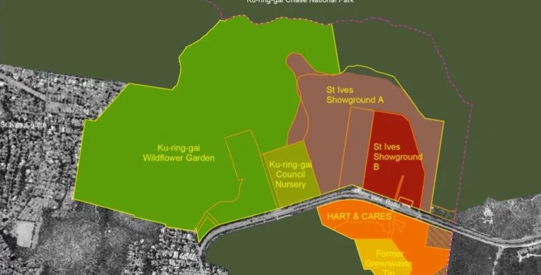
Ku-ring-gai Council consultation process for St Ives Showground and Precinct Lands – should do better
The St Ives Showground and Precinct Lands are a complex mix of developed areas with a long history within a bushland setting including a large area of Duffys Forest endangered ecological community. The Showground itself has been used for agricultural shows since 1927 and as an equestrian showground for almost as long.
During the Second World War it was occupied by the Defence Forces. It contains several heritage buildings and footings for former facilities such as a mess hut and headquarters. Of particular interest is the unique relief map of Ku-ring-gai Chase constructed by army engineers. It would have taken considerable skill to accurately represent the landforms of this rugged bushland area.
The Precinct Lands include the Wildflower Garden and Community Nursery that retain some of the legacy from original uses of market gardening and poultry and pig farming such as dams. The old Green Waste site and the HART Road Safety Centre are part of the precinct but council is not currently Crown Land Manager.
Development and management of various parts of the Showground and precincts have been subject to consultation on options for use and development several times dating back to 1999. Back in 2014 there was a proposal to build a large sports complex on the Council Nursery site with two synthetic fields and an indoor sports centre. This was finally abandoned for cost and environmental reasons.
The management of the area has been complicated because of multiple ownership. Since the Crown Lands Management Act was passed in 2016 many of these issues have been clarified. Ku-ring-gai Council has now been given authority to manage all of the Showground, Nursery and Wildflower Garden sites.
Councils were required to finalise a Plan of Management (PoM) for the Crown Land they manage by 1 July 2021. Ku-ring-gai had received approval earlier in 2021 for the basic aspects of the plan relating to land categorisation. It seems there is some leeway being given to submission of final PoMs as there are a large number of councils with PoMs needing approval. The finalisation process has to comply with the Crown Land Management Act and the Local Government Act 1993.
Rushed consultation
The draft PoM was placed on exhibition with submissions invited to be made with a closing date of 6 August. The last issue of STEP Matters gave a brief outline of the multiple aspects of the plan that the community could comment on, e.g. whether they support or oppose a proposal, have different ideas for an activity, some of the wording of management actions is unclear or the priority is inappropriate.
Many community groups ranging from users of the precinct to environment groups concerned about some proposals and their impact on the area’s bushland put in submissions prior to the deadline. Some groups put in a lot of time working on ideas for improving the facilities and the functioning of the precinct.
But what happened next shocked us and many other groups. Our submissions were made before the deadline of 5 pm, 6 August but the papers for the council meeting that was to consider the draft PoM were published before the closing date. The report had obviously been written by council staff some days before. All the submissions from the community groups, 15 in total, were not considered in the report.
STEP and other groups protested about this treatment. There were no apologies and a curt response that the actions were taken for ‘operational reasons’ that the finalisation of the PoM was urgent. Council needed to get moving with designing the Cultural Environmental and Education Centre before the local government election. The September meeting was not a possibility because the mayoral election was to occur at the meeting. The council PoM had to be submitted to the Minister for Crown Lands for approval as soon as possible for some reason that was not explained apart from the excuse that the minister had lots of plans to approve and the minister had been told to expect this plan in August.
Subsequently council staff did put together a supplementary report with a summary and response to all these submissions. It was added to the meeting papers on the Friday before the meeting on the following Tuesday, 17 August. Of course councillors had less that the normal 14 days to consider all these submissions.
The staff recommendation at the council meeting was for the PoM to be approved subject to the Director, Strategy and Sustainability making a few amendments to the draft clarifying some wording inconsistencies and correcting some names. So that was that!
Neglect of heritage responsibilities
Some submissions pointed out that council had still not implemented resolutions passed back in 2009 accepting recommendations in Philips Marler heritage report that applications be made for state heritage listing of items associated with the agricultural show history and wartime buildings at the Showground and Caleys Pavilion at the Wildflower Garden. This building is a rare example of a small building in the style of the Sydney School of Architecture from the 1950s to 1970s.
At the last minute the councillors agreed to amendments to the PoM to give priority to pursuing heritage listing and preparation of a Conservation Management Plan.
Subsequent information
In further investigation of actions of council staff STEP and Friends of Ku-ring-gai Environment looked into the history of planning actions in relation to the Showground. It seems we were meant to be following the council meetings and know all about some earlier decisions.
The Cultural Environmental and Education Centre had already been designed and costed to go ahead. The location was decided back in May 2019. In June 2021 council resolved to progress to a detailed design. Only internal consultations and a presentation to councillors had been undertaken prior to this June meeting. The only information in the draft PoM was an indication of where the building was to be placed on the site. We were totally in the dark about the design concepts and purposes of the centre.
And yet at the same August meeting council resolved to give the general manager authority to negotiate the finalisation of a quotation for a detailed design for the Cultural Environmental and Education Centre (photo above). At that stage of the meeting the approved PoM that was supposed to be a prerequisite for proceeding with the Cultural Environmental and Education Centre had not been considered by the meeting.
Another development was announced early in September, the Tree Tops High Ropes Course. The site was indicated in the draft PoM but that is about all we know. Has there been an environmental assessment for the site that is mapped as Duffys Forest endangered ecological community?
Public consultation has been a sham.
The hurried process of consultation has left interested community groups feeling as if senior council staff have their own agenda that will be pushed through and community views can be ignored. However once we knew more of the background story it seems the main issue is poor communication. Staff were being asked to prepare a complex document in a shortened timeframe and details were left out of previous decisions.
Earlier consultation and information sessions for the community should have been undertaken. The draft PoM document stated that consultation had taken place but it seems this involved just a few paying users of the facilities. There will be several plans to be written in the future such as the Conservation and Biodiversity Management Plans and detailed masterplans. The draft PoM listed several possibilities of future facilities and developments that will be covered by specific plans. We would like to see plans for the community nursery site announced soon as some buildings are deteriorating fast.
We hope the consultation on these plans is carried out in a constructive manner. We are still not sure about the legitimacy of the approval of the Cultural Environmental and Education Centre and high ropes course under the Crown Lands Management Act 2016.
Weeds in national parks along sewer lines, energy transmission lines
My concern is that weeds occur along all land that has been disturbed in otherwise pristine bushland areas. These are unsightly and continually invasive.
For example, the sewer lines constructed through Sydney in the 1950s and 60s have much unfinished business in bushland areas where the mains have been constructed.
Sydney Water, and before it, the Sydney Water Board never finished the environmental work of restoring the iconic bushland of the Sydney Basin; all part of the world-renown Sydney Bioregion. Custodial responsibility means carrying out work to ensure that environmental repairs are undertaken in a timely manner to sustain ecological integrity.
More than 20 years ago Sydney Water played an important and effective role in the active catchment management committees (CMCs) which were set up by the NSW Government. I know this because I was deputy chair of the Lane Cove River CMC. CMCs and CMAs were set up as a consequence of concerns from my then local MP, who was The Hon Tim Moore.
It is even more important in present times that these matters of concern then be reactivated. CMCs need to be reactivated and incorporate members of all government entities implicated. Untreated weed outbreaks do not disappear over time; they tend to exacerbate. This also means energy authorities, such as Ausgrid and the Roads and Maritime Services.
My recent walks in the Lane Cove National Park attest to this. Roads and Maritime Services are apparently doing nothing in the area around de Burghs Bridge and the former bridge.
All public authorities who do construction work through bushland must be held environmentally responsible for ensuring regeneration work in the areas disturbed; or previously disturbed, until they again become ecologically stable.
As a former teacher of bush regeneration at TAFE, it is clear to me that there are on-going responsibilities that have not been addressed. All these major service providers have the capacity to pay. There is no excuse for walking away from land management obligations. Especially in pristine natural bush. This applies to all areas that have had physical disturbance and on-going access by vehicles that carry weeds in their tyre treads, etc.
Such environmental work should not be left to the National Parks and Wildlife Service to do the ‘cleaning-up’.
Please inform me of the present status of environmental responsibility within Sydney Water, energy authorities and Roads and Maritime Services, especially with regard to assessment, action and monitoring, until an ecologically functional and stable state is reached and maintained over time.
I realise this will require a whole new approach and will require service providers to environmentally Care for Country. It must be done together with local government.
However, it MUST be done.
This is a letter sent to the Minister for the Environment, Matt Kean, by Janet Fairlie-Cuninghame. Janet is highlighting a problem that is very evident when walking along creek lines. We hope she receives a constructive response. National Parks staff have a huge job to do currently with so many people using national parks for recreation. This is also an expensive issue for local councils.
What does net zero greenhouse gas emissions actually mean?

Under the Paris climate change agreement the majority of countries have made pledges to get their greenhouse gas emissions down to ‘net zero’ by 2050 with the hope of keeping the global average temperature increase below 2°C and, preferably, no more than 1.5°C.
Australia is still an appalling laggard with no commitment by the Morrison government or any plan to achieve a goal of any sort. The commitment for 2030 of a reduction of 26 to 28% below 2005 levels is also being eclipsed by stronger commitments being made by many developed countries.
The world still has a long way to go to get to net zero. Many scientists are calling for a much faster reduction. The average global temperature has already increased by 1.1°C since pre-industrial levels and Australia’s increase is 1.44°C since 1910 when reliable data is available. It seems that reaching 1.5°C is inevitable so the Glasgow meeting is crucial to put in place actual policies, not just pledges, that will have provide a high probability that we won’t get beyond 2°C. Every fraction of a degree counts.
Definition of net zero
Net zero emissions describes the point in time when humans stop adding to the burden of climate-heating gases in the atmosphere. It refers to achieving an overall balance between greenhouse gas emissions produced and greenhouse gas emissions taken out of the atmosphere. The level of balance was approximately at the time before the world started burning coal during the 18th century. The level of CO2 then was about 280 ppm. It is now about 417 ppm. Actual worldwide CO2 emissions are currently about 35 billion tonnes pa. The net effect of the natural land and ocean absorption processes leaves the situation where the CO2 concentration in the atmosphere is still increasing, by 2.4 ppm pa over the past decade.
This data does not include emissions of the greenhouse gases methane and nitrous dioxides that have strong effects of atmospheric warming but are dissipated by chemical reaction relatively quickly. The following information focusses on CO2 emissions because they remain in the atmosphere for hundreds of years.
Getting to net zero means we can still produce some emissions, as long as they are offset by processes that reduce greenhouse gases already in the atmosphere. For example, these could be things like planting new forests, or drawdown technologies like direct air capture.
However, to meet the goal of net zero, new emissions of greenhouse gas must be as low as possible. This means that we need to rapidly phase out fossil fuels – coal, oil and gas – and transition to renewable energy.
Climate change isn’t a tap we can turn off once we stop using fossil fuels. Carbon dioxide, the main contributor to climate change, will stay in the atmosphere and keep heating the planet for years and years. As the data above shows there is already an excess quantity of greenhouse gases in the atmosphere that are having an impact on our climate so that we actually need to remove the excess in order to stop further increases in temperature and other effects of climate change.
Carbon offsetting options
Currently the main method of reducing emissions, called carbon offsetting, is planting trees. A massive area of land would be needed to make a big difference to total emissions. As a forest ages, it reaches what ecologists call a ‘steady state’ – this is when the amount of carbon absorbed by the trees each year is perfectly balanced by the CO₂ released through the breathing of the plants themselves and the trillions of decomposer microbes underground. So new areas will need to be planted out every year as emissions remain positive.
The calculation of the carbon content of a tree cannot be accurate unless the tree is pulled out of the ground so approximations are needed. Also the growth of each tree is non-linear, starting slowly and then the greatest sequestration rate is in the younger stages of tree growth, depending on rates and peaks of individual species, with the sequestration of CO2 per year dropping thereafter. The usual method is to choose the appropriate time scale and average the amount of carbon stored over that period.
Multiple factors such as growth conditions are at play so there is still much research needed into more accurate calculations. Of course the basic assumption is that the trees will remain standing. They won’t be burned down or degrade through drought of insect attack.
Once trees reach maturity they need to be locked away and then new areas need to be planted if more emissions need to be offset.
There are lots of other schemes for reducing emissions. The federal government is supporting ideas like carbon farming, avoided reforestation and land restoration.
A large market has developed for carbon credits that are calculated under schemes developed by under the UNFCCC. Some of these are available to governments and are popular with companies and individuals wanting to offset their emissions. The credits are sold by organisations that are running projects that reduce emissions, for example by supporting renewable energy in developing countries.
Have any countries or Australian states reached net zero emissions already?
Five countries have a net-zero target in place by law: Sweden, the United Kingdom, France, Denmark and New Zealand.
Closer to home, some of the states and territories are doing well. Australia’s states and territories all have net zero targets, but most governments have not outlined how these targets will be met. Tasmania has been net zero in some individual years. In 2014 and 2018, Tasmania’s emissions dropped below net zero thanks to Tasmania’s massive hydroelectric dams, and massive carbon-dense forests. With the state’s electricity supply already nearing 100% renewable, the remaining emissions from the state – across transport, manufacturing, agriculture and forestry – were offset by the greenhouse gases sucked out of the atmosphere by the state’s forests.
A target is only as good as the policies underpinning it. Several governments with a net zero goal, such as Western Australia, Northern Territory and Queensland, are still increasing their emissions each year. Even governments that are leading the pack when it comes to climate action – like South Australia and the ACT – still have more work to do to outline how they will meet their net zero goals.
The big concern is there are still new coal mining and gas projects being developed. It all seems very hypocritical for NSW to be supporting the Santos Pilliga gas project and mine expansion.
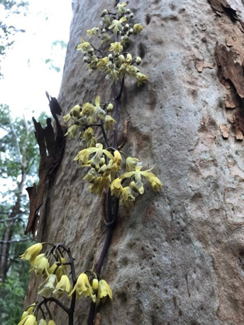
Springtime orchid discoveries

We have all been out and about this spring and have made some new discoveries of orchids, some quite rare and usual.
The photos above (Calochilus paludosis and Caladenia catenata) were taken by Fran Rein
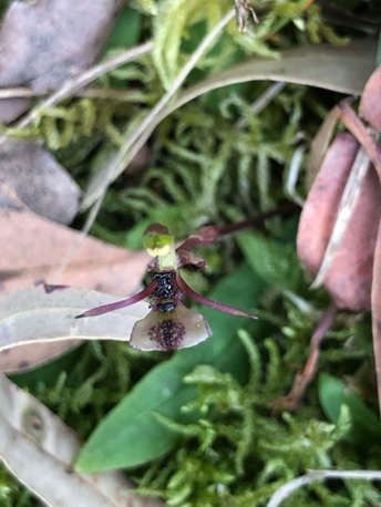
Ant orchid, Chiloglottis formicifera, a tiny orchid in West Pymble
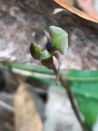
Broad-lip Bird Orchid, Chiloglottis trapeziformis, rare in the Lane Cove Valley (photo – Sandra Shergill)
The spectacular Bootlace orchid, Erythrorchis cassythoides in Sheldon Forest. This is one of only two species in the world. It climbs trees by means of short stiff hooked roots. Pollination is by native bees attracted to the flowers’ perfume. This one has climbed about 5 m.
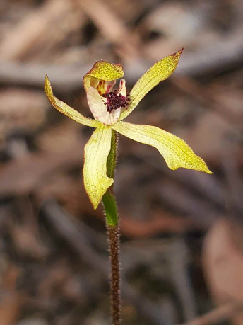
Green caps, Caladenia transitoria, a tiny orchid with flowers about 2 cm wide. It has a short flowering period, hence its name. A rare find in West Pymble (photo: Michael Gillings)
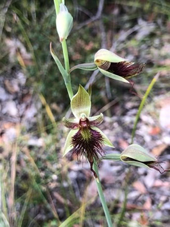
Red bearded orchid, Calochilus paludosis, on the Murrua track
Our activities in 2021

Although most of our walks and talks have had to be cancelled there has been lots of activity behind the scenes.
Walks
Walks were scheduled for every month but either the weather or COVID intervened so the only walks held were on 21 March (Pennant Hills Park), 21 April (Lawson), 24 April (Sheldon Forest Heritage Walk), 23 May (St Ives Showground), 20 June (Devlins Creek, rain affected but still went ahead) then the COVID lockdown hit. Somehow these activities feel to have been in the dim distant past.
Talks
We finally managed to hear Prof Culum Brown’s talk on shark behaviour after it had been postponed by the South Turramurra bushfire in 2019 and then COVID in 2020. A summary of Culum’s talk is in STEP Matters, May 2021 issue.
Talks on Julian’s Hibbertia and Gondwanan Plants of the Sydney Region have had to be cancelled.
Submissions
There has been plenty of work to do preparing submissions of local issues and plans.
- March – Barra Brui synthetic turf proposal
- May – Eden Gardens high rise development
- May – Hornsby Park and Westleigh Park masterplans
- June – Gordon Flying Fox Reserve Plan of Management
- June – Northern Beaches Tunnel and links
- June – Mirvac demolition DA
- July – proposed sale of Bales Park, Roseville
- August – St Ives Showground draft Plan of Management
- September – Mirvac EPBC referral
- September – Ku-ring-gai fauna management policy
- September – Hassall Park redevelopment
Survey of candidates in Hornsby and Ku-ring-gai

To help STEP members learn more about the environmental credentials of candidates in Hornsby and Ku-ring-gai we sent them a survey.
We contacted 49 candidates (all those who gave their email to the Electoral Commission) and we received ten responses (one from Hornsby and nine from Ku-ring-gai).
Responses
Click on the links below to see what the prospective councillors have to say, and click here to compare answers.
- Hornsby (Ward A) — Mick Marr (Group B)
- Ku-ring-gai (Comenarra) — Jayamala Gupte (Group D),
- Ku-ring-gai (Comenarra) — Trish Lynch (Group A),
- Ku-ring-gai (Comenarra) — Greg Taylor (Group F)
- Ku-ring-gai (Gordon) — Simon Lennon (Group B)
- Ku-ring-gai (Roseville) — Carmel Heffernan (Group D)
- Ku-ring-gai (Roseville) — Sam Ngai (Group B)
- Ku-ring-gai (Roseville) — Alec Taylor (Group A)
- Ku-ring-gai (St Ives) — Amanda Brien (Group D)
- Ku-ring-gai (Wahroonga) — Sheri Evans (Group F)
Questions we asked
- There are community concerns about urban heat, and the environmental and social impacts of the installation of synthetic turf on local ovals. What are your views on this?
- What’s your view on mountain bikers constructing their own new tracks through bushland?
- The NSW government wants to increase tree canopy cover in Greater Sydney from 16% to 40% by 2030. However, development as a result of population growth, subdivision, larger house footprints etc means that we continue to lose tree cover. Will you work to increase tree canopy?
- Do you support council’s environmental management policies, e.g. the biodiversity and water sensitive cities policies?
- Council does not have the financial resources to maintain effective firebreaks around all of the bushland boundaries of properties. Are you in favour of council developing a set of protocols so that qualified residents or their contractors are able to maintain their own boundaries?
- Some councils have resolved to dispose of surplus parcels of land behind closed doors. Will you undertake to make all such proposals transparent and invite community involvement?
- Some councils have not followed due process when asking for stakeholder feedback on a project. Would you take steps to ensure that all public consultation processes are carried out in an orderly and transparent manner?
- Do you think council should do more to encourage residents to reduce waste going into landfill?
- Council has resolved to reduce greenhouse gas emissions from its own operations and by the community to net zero by 2040 with an interim objective of a reduction of about 50% by 2030. Do you consider that enough action is being taken to achieve these goals?
- Is there anything you’d like to add?
St Ives Showground and Precinct Lands Draft Plan of Management is Open for Submissions
The land that comprises the St Ives Showground, Wildflower Garden and Community Nursery are important areas for conservation as well as recreation. A draft plan of management (PoM) has been released and is open for submissions until 6 August.
A PoM provides a framework and guides the management of public land owned or managed by a council. It identifies issues affecting public land and sets out how that land is to be used, managed, maintained and enhanced in the future.
The draft PoM also covers areas south of Mona Vale Road; the Green Waste Tip site and HART road safety centre. The management of these two areas is different because they are bound by user agreements and developments that are subject to the Minster of Planning’s consent. Nevertheless, because of their bushland location, they are considered important for development of an integrated management plan for the overall precinct.
St Ives Showground and Precinct Lands contains several ecologically important areas including:
- threatened vegetation communities including Duffys Forest Endangered Ecological Community and Coastal Upland Swamp;
- riparian habitats protecting creek systems; and
- habitats for a number of threatened plants and animal species (listed under NSW Biodiversity Conservation Act).
The area is an important wildlife corridor that can facilitate movement and gene flow between Garigal and Ku-ring-gai Chase National Parks. However busy Mona Vale Road is a barrier. Measures to facilitate crossings should be developed and improvements should be made to the ecological function of the roadside edges that are weed and litter infested.
Changes that are canvassed that may be worthy of comment include:
- Traffic signals at the entrance to the Showground to improve safety.
- Improved public transport.
- Improved internal road circulation, walking tracks and signage.
- Closure of trails that fragment bushland and impact wildlife and Aboriginal heritage sites.
- Additional bushwalking tracks and fire trails to key points of interest be built in accordance with council’s Recreation in Natural Areas Strategy.
- Development of a multi-purpose cultural and environmental education centre. The centre would provide a range of education programs, activities and exhibitions focused on environmental and cultural topics.
- Possibility of commercial camping subject to market analysis of viability. Currently camping is only allowed during special events.
- Development of a commercially operated outdoor adventure recreation area including issuing a licence or lease for a high ropes course or similar activity.
- Rehabilitation and repurposing of the former mini-wheels site based on suitability of the site yet to be determined. This may include activities such as sustainable nature-based community education and camping or other recreation activity.
- Upgrade of the Wildflower Garden facilities and car parking. There is a plan to designate the site as a Wildlife Protection area (under the NSW Companion Animals Act 1998).
Community Nursery
The community nursery site has been neglected for many years. The draft PoM proposes some upgrades and additions of community facilities such as a retail outlet, bushfoods garden or green waste collection. It is suggested that other uses be investigated such as camping facilities, adventure-based recreation such as obstacle courses and potential for sporting facilities. It is difficult to see how these can be compatible in this area of swampy land on the edge of Ku-ring-gai Chase National Park.
Green Waste Tip Site
This area is a conundrum as this stage. The draft PoM states:
The main objective for the site is to continue the current site rehabilitation and water recycling/harvesting processes. Additional improvements and proposed uses to be considered are:
- A feasibility study could be undertaken to determine the potential for a dedicated mountain bike facility.
- Explore the potential for environmental initiatives with associated infrastructure. For example, solar farming, community green waste and compost, alternate location for community nursery, sustainable light industry for community benefit.
Should recreation use or additional environmental infrastructure not be viable, then full rehabilitation and inclusion into Garigal National Park could be pursued.
Delays in Mirvac's Development Plans for the IBM Site

We haven’t heard much lately about Mirvac’s planned development on the IBM site in West Pennant Hills next to the Cumberland State Forest. You may recall that last June the NSW government ‘fast tracked’ the rezoning of the land that would enable the development of 600 apartments to proceed and, in theory, provide jobs to stimulate the post COVID-19 recovery. This decision ignored the strong community and local council objections that include overdevelopment, destruction of critically endangered vegetation communities and loss of forest habitat for the Powerful Owl and other endangered species.
Mirvac has initiated the next stage of the development process by submitting an application for the demolition of the existing buildings on the site and clearing of vegetation in the development area. This would involve the removal of 1253 trees. The application will go before a Planning Panel on 21 July.
Local community groups have objected strongly to the removal of so many trees including about 450 that are essential components of two critically endangered ecological communities. These communities, Blue Gum High Forest and Sydney Turpentine Ironbark Forest, have the same classification under the Commonwealth Environment Protection and Biodiversity Conservation (EPBC) Act as the NSW threatened species legislation.
Under the EPBC Act clearing of this extent of critically endangered vegetation could be deemed to be a matter of national environmental significance. The planned clearing should therefore be referred to the Federal Environment Minister to decide whether the proposal should be subject to assessment. Assessment can lead to approval, refusal or conditions of approval.
It is understood that the Mirvac has not done this referral, arguing that the trees were planted as part of the landscaped gardens when the IBM corporate park was established and cannot be classed as natural forest relevant to the EPBC Act. However, the community groups Forest in Danger and West Pennant Hills Valley Progress Association (WPHVPA) have been successful in obtaining further documentation dating back to the original development plans that indicate that the trees are regrowth from remnant bushland and therefore come under the Act.
A threatened species assessment of significance by an independent ecologist has confirmed that the vegetation within the demolition meets the definition of a critically endangered ecological community.
The Nature Conservation Council, the peak body for conservation groups in NSW, supports this action and has written to the Federal Environment Minister, the Hon Sussan Ley, asking that she intervenes so the proposal is assessed under the EPBC Act.
This issue appears to be holding up Mirvac’s planning process. A concept masterplan for the apartment development was planned for earlier this year.
Eden Gardens Tower: What Happens Next

In our previous newsletter there was a last-minute story about a proposal to build an 18-storey tower at Eden Gardens on Lane Cove Road in Macquarie Park. Many submissions in opposition were made to the City of Ryde Council. The development application will be assessed by the Sydney North Planning Panel.
Eden Gardens is surrounded by Lane Cove National Park on three sides and Lane Cove Road to the west. The M2 is further away to the south. The only development nearby is on the western side of Lane Cove Road where the buildings are 6 to 8 stories and further south in Macquarie Park.
There seems to be an oversight in the zoning because there is actually no zoning for the site. The applicant has taken advantage of this and decided to have a go at getting approval for building a commercial tower significantly higher than any other building nearby. Did the City of Ryde Council provide any guidance about the chances of such a tall building being approved?
Some of the problems with the development if it goes ahead are:
- Additional traffic along the already congested Lane Cove Road as workers on site will be reluctant to tackle the long walk from Macquarie Park Station involving crossing several major roads.
- Developments adjacent to national parks are required to meet guidelines defined by the NPWS (2020) covering matters like the impact on public amenity or enjoyment of the park, whether it is sympathetic with the natural and cultural heritage of the park, and appropriate controls on lighting.
- Lane Cove National Park has important heritage values drawing from its long history of aboriginal use and European development plus the presence of many threatened species and endangered ecological communities.
- The location has high bushfire risk with exposure to the north and northwest. Up to 2000 workers would need rapid evacuation via Lane Cove Road.
- The building would form a high risk to bird and bats traversing the park that would be attracted to reflections from the glass facade and foraging for insects.
- The building will tower over the surroundings with lighting that spills into the park disturbing the natural foraging and nesting patterns of nocturnal and diurnal aerial fauna, particularly owls and bats. Threatened nocturnal species recorded in the park include four species of bat plus the powerful owl and barking owl.
Reference
NPWS (2020) Developments adjacent to NPWS lands: Guidelines for consent and planning authorities. National Parks and Wildlife Service, NSW Department of Planning Industry and Environment.
Up to 7600 New Homes for Macquarie Park

Early this month the Department of Planning, Industry and the Environment announced that Macquarie Park has been chosen as one of the sites for major new development. A draft strategy has been released that is open for comment until 10 August.

This new development is in addition to the huge amount of new construction of commercial and residential projects currently in progress. This web site lists the major proposals, including:
- Meriton has built a 27-storey building between Talavera Road and the M2 that that interrupts views across Lane Cove National Park from West Pymble. This is only the first stage of the Orana development with three more buildings of 60, 45 and 30 storeys providing another 1000 units. The image is of the First Meriton tower, the smallest of the four planned for the site
- Natura on Waterloo Road will have two, 20-storey towers with 357 units.
- NBH on Epping Road has eight buildings ranging from 3 to 17-storeys with a total of 885 units.
- The Ivanhoe Estate on Epping Road will have 3500 dwellings including 950 social housing and 128 affordable housing units.
The plan for up to 7600 additional apartments will be in addition to these 6000 apartments already approved!
The framework for the new development is explained in a long-awaited draft Macquarie Park Place Strategy. The Minister for Planning and Public Spaces Rob Stokes, in announcing the strategy, said:
This future development would help Macquarie Park transition from a successful suburban business park to a vibrant commercial and residential centre.
The plan is intended to be implemented over the next 20 years up to 2041.
The entire 350 ha being considered for development includes land between the Macquarie Centre and Ivanhoe Estate to Lachlan’s Line and Riverside Corporate Park, bounded by Epping Road, Delhi Road, M2 Motorway and Vimiera Road adjacent to Lane Cove National Park.
Under this strategy, seven new residential neighbourhoods as well as 14 ha of new parks, squares, plazas, cycleways and linear parks plus 2.7 ha of enhanced open space are proposed. The forecast additional floor space will create upwards of 20 000 new jobs in the region. It is acknowledged that major expenditure will be required on infrastructure with the need for about $6.5 billion in spending on transport and other public facilities within the next 15 years. The state budget has allocated $20 million for initial planning.
One innovation that fits in with the Greener Places strategy is the integration with indigenous history and the Dharug languages. Each of the neighbourhoods is to be given an indigenous name. For example, the area east of Lane Cove Road south of the M2 has been named Burbigal, meaning ‘morning’.
The area of particular concern for potential impact on Lane Cove National Park is the Riverside Park area (Narrami Badu-Gumada or connecting water spirit) where 1500 to 2000 new homes are proposed as well as expansion in commercial and retail space. The area abuts directly alongside Lane Cove National Park between Epping Road and Fairyland. There are some statements that are overwhelmed by jargon, for example:
Walking trails, cycle ways and possible micro mobility corridors will weave through and across the water corridors.
What are micro mobility corridors and water corridors? The area is at the top of a hill!
One Big Issue – Transport
Rob Stokes said the three Sydney Metro stations delivered in 2019 at Macquarie University, Macquarie Park and North Ryde have laid the foundations for this growth plan. The documents also reveal that currently about 70% of trips to Macquarie Park are made by road despite the opening of the new Metro stations. We all know about the North Ryde congestion any time of day.
Transport is an important contributor to greenhouse gas emissions. NSW has an objective to be net zero by 2050 so reduction in car use is essential. Conversion to 100% use of electric vehicles will not be a solution.
There is plenty of public transport going east and west using the Metro and bus services along the M2 and Epping Road. There is only one road taking cars from north to south, from the North Shore to Macquarie Park and on to the Olympic Park. The only other options are a long way further east (Gladesville Bridge) or further west (Pennant Hills Road). Public transport involves buses that add to the congestion or catching a train to Chatswood and then the Metro back west.
What the strategy has to say about dealing with road congestion is optimistic. Car transport will be discouraged with new buildings having fewer car parking spaces than in existing buildings. Walking and cycling will be encouraged with more pathways and made more pleasant by widening footpaths and greater tree planting. This statement is made:
The proximity to Lane Cove National Park provides an opportunity to increase cycling once the lack of facilities, safety issues and limited crossing opportunities can be addressed.
A lot more information is required.
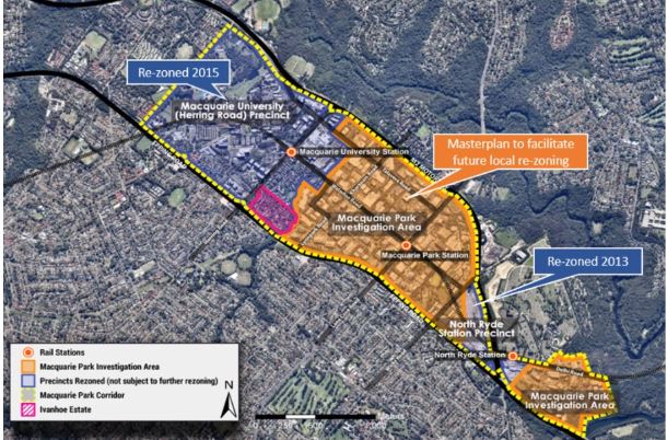
Councils are Pushing Ahead With Synthetic Turf Installations

In STEP Matters 210 we described the strong community opposition to plans by several councils for the installation of synthetic turf on local ovals. There are concerns about the environmental impacts of using plastic grass and the social impacts of creating fields that are primarily designed for playing football and therefore restrict community use. There are examples of the use of natural grass that overcome the problems of fields becoming degraded by overuse so the number of playing hours do not need to be restricted.
Ku-ring-gai and Lane Cove Councils are proceeding regardless with deadlines to meet to sign contracts related to funding, particularly promised grants. A report from the inquiry instigated by the Minister for Planning and Public Spaces, Rob Stokes is due any day now. This inquiry is investigating sustainable alternatives to reduce environmental impacts.
Ku-ring-gai Council – Norman Griffiths Oval
Following the decision to proceed in November 2020, Ku-ring-gai Council has been developing a design for installing synthetic turf at Norman Griffiths Oval so that quotations could be commissioned from contractors. The infill to be used is cork not the most common fill, tyre crumb. The use of cork is a fairly recent innovation for keeping the plastic grass blades upright. We don’t know much about the management of cork nor the construction and management methods for keeping it clean and in place during general use and heavy rain.
The design covers stormwater mitigation works as well as the synthetic turf installation because the field currently acts as a stormwater detention basin. Extensive stormwater mitigation works are required because Quarry Creek flows under the field and it is also the catchment area for rainwater collected over the large area of Sydney Turpentine Ironbark Forest (STIF) above the field. With synthetic turf the oval will no longer absorb the water flows from this catchment.
STEP and several other interested people, representing the local community and volunteer bushcarers as well as the sporting clubs, were advised they could participate in a stakeholder reference group that would review progress and provide comment on the design at key milestones. We were told that these reviews would be:
… a check measure to ensure we remain transparent and accountable to the community.
However, we were not given any opportunity to consider the design before it went out to tender. We had been advised early this year that the level of the field needed to be raised by about half a metre to accommodate the stormwater mitigation and the base fill. This would impact on the hydrology of the bank above the field, which contains some rare orchids as well as the STIF around the oval. No reference group meeting has occurred.
The outcome of the tenders was considered at the council meeting on 15 June. According to the meeting agenda documents, only two tenders were received and neither met the tender requirements. With a deadline to be met to select a contractor and sign documents, the critical part of the process is being rushed.
There was no discussion at the council meeting and the decision was in line with staff recommendation. The meeting resolution was as follows:
- Fresh tenders as referred to in clause 178(3)(b)–(d) of the Regulation not be invited due to the current deadlines for the grant funding.
- Pursuant to clause 178(3)(e) of the Regulation, the General Manager enter into negotiations with any person (whether or not the person was a tenderer) with a view to entering into a contract in relation to the subject matter of the tender in terms acceptable to Council’s requirements.
- The Mayor and the General Manager be delegated authority to execute all documents on Council’s behalf in relation to any contract formed as a result of the above.
We are very concerned that there will be no broader review of the design and construction contract. No information has been provided about potential environmental impacts of the decision.
In October 2020, when the decision was made to proceed with the project, it was stated in the meeting agenda papers that the likely environmental impacts were ‘reasonable’ on the basis of only a concept plan. Now we are told that a Review of Environmental Factors (REF) will be completed by the winning contractor when the design and construction of the project is refined. This is putting the cart before the horse! What happens if the review finds that impacts will exceed guidelines?
We hope to find out more soon.
Lane Cove Council – Bob Campbell Oval
For several months the community of Greenwich has been fighting the proposed installation of synthetic turf on Bob Campbell Oval, on the edge of Sydney Harbour foreshore at the end of Gore Creek. This park, which is the only piece of flat land in the area and is used by all the community, would be predominantly available only for organised sport if synthetic turf were installed. It would be fenced off from general community use and the popular off leash dog area would be reduced to small areas beside the field.
Lane Cove Council claims that the issue of potential environmental impacts has been addressed by their decision to use ‘4G’ technology, a fully woven product made of one polymer family (polyolefin). The woven construction results in the grass fibres and backing structure being produced as one combined product and eliminates the need for infill such as tyre or cork crumb. It is claimed that this product will significantly reduce the likelihood of lost fibres migrating into the environment. It would be the first use of this product in Australia.
A new group has been formed to fight this decision, Natural Grass at Bob Campbell Inc (NGABC). On 21 June, the same day that contracts were due to be signed, solicitors for NGABC delivered a letter of demand to council’s general manager stating that they have serious concerns about the validity of the mandatory environmental assessment that had been conducted. The letter calls on council to undertake to cancel its environmental assessment, to conduct a new assessment in accordance with environmental legislation and not to sign construction contracts for the synthetic surface.
Some Promising Signs for Protection of Byles Creek Valley
The Byles Creek Valley Union has been fighting for several years for the valley to be protected from further development. The valley has high quality biodiversity including threatened plant species and a habitat for Powerful Owls and Gang-gang cockatoos. In addition, it contains beautiful tall forest and is an important wildlife corridor from the Lane Cove Valley through to Pennant Hills Park.
Land immediately along the creek is zoned open space but there are several residential lots that have not yet been developed. Many of these residential lots are large and recent approvals have allowed subdivision leading to the removal of many trees for bushfire protection. The valley is steep so the creation of driveways and construction access will require clearing and excavation with a risk of erosion.
Thanks to pressure from the local groups Hornsby Council has resolved to progress a review of the suitability of the planning controls for residential properties adjoining open space zoned land within the Byles Creek corridor with regard to protection and maintenance of the environmental values of the land. Consultation has now been completed.
Representatives from the Byles Creek Valley Union have been trying for over two years to meet their local member, Minister Perrottet. This finally happened recently with a promising outcome. Minister Perrottet clearly stating there is money set aside for the purchase of private land to support the Byles Creek corridor. He told them he was ‘going to take care of it’. They will hold him to his word!
Inquiry Into Shonky NSW Offsets Scheme

In Issue 191 we wrote about our concerns about the effectiveness of the Biodiversity Offsets Scheme (BOS) to be established under the NSW Biodiversity Conservation Act. We wrote:
Implementing the BOS will in fact add extinction pressures to the very species and ecological communities it is supposed to protect by facilitating the more rapid and widespread destruction of threatened species habitat across NSW.
NSW has had several offset schemes since 2005. The principle behind the schemes is that, if a development requires the destruction of native vegetation and habitat then other land must be protected and/or restored to offset this loss on a ‘no net loss’ basis. The fundamental problem with this idea is that vegetation on the development site will still be lost. In theory offset land will be improved to make up for the loss but it is impossible to restore another piece of land to match habitat effectively. To make matters worse the BOS has several compromises that go against the like for like principle.
Not only are there concerns about the principles of the scheme but now there are some recent examples of promised offsets that are not delivered. Guardian Australia reported in February that:
- Fifteen years after the M7 opened to traffic, the state government has not yet established a public reserve that was proposed as the major environmental offset for loss on Cumberland Plain Woodland from the motorway’s construction.
- A second reserve on the site of Airservices Australia’s former radio transmitting station at Shanes Park in the Blacktown City Council area is also undelivered more than 10 years after it was first identified as priority conservation land to compensate for the construction of 181 000 houses in new suburb developments. Bureaucratic obfuscation of the transfer of ownership from the Commonwealth to the NPWS is the problem here. This high-quality land has become weed infested and degraded by 4WD access.
More recently there are questionable transactions whereby landowners have made windfall gains over a short space of time. A Guardian investigation (published 25 June 2021) uncovered tens of millions of dollars in offset credits purchased by the state and federal governments from properties linked to consultants whose company advised the government on development in western Sydney.
Some of these transactions have been referred by the Transport Department to ICAC for investigation. The NSW auditor general has also fast-tracked a planned review of the scheme.
Now experience in the use of environmental offsets to compensate for habitat destruction caused by major developments will be examined by a NSW Upper House inquiry.
The inquiry was self-referred by the environment and planning committee with backing from the Greens, Labor and the Animal Justice party.
The terms of reference are to examine:
- the effectiveness of the scheme to halt or reverse the loss of biodiversity values, including threatened species and threatened habitat in NSW, the role of the Biodiversity Conservation Trust in administering the scheme and whether the Trust is subject to adequate transparency and oversight;
- the use of offsets by the NSW Government for major projects and strategic approvals; and
- the impact of non-additional offsetting practices on biodiversity outcomes, offset prices and the opportunities for private landowners to engage in the scheme.
The inquiry is due to report in March 2022.
Federal Government is Refusing to Upgrade Environmental Standards

The key recommendation of Prof Samuel’s review of the EPBC Act was that the national environmental standards need to be strengthened but the federal government is refusing to adopt Samuel’s interim standards. It seems National Cabinet is the stumbling block.
On 16 June the environment minister, Sussan Ley spoke at the National Press Club about the release of ‘a pathway for reforming national environment law’. She said the government agreed with ‘the central pillars’ of Samuel’s 38 recommendations but did not respond to them individually.
The report states that:
The immediate priority is to implement single touch environmental approvals, underpinned by national environmental standards.
She stated that the interim standards will be used that reflect current requirements of the EPBC Act because this is consistent with the agreement of National Cabinet. These standards will provide greater clarity for proponents and the community, as thousands of pages of rules will be distilled into clear and concise requirements.
There are two issues here:
- The approval powers are being handed over to the states and territories whose resources for undertaking the requisite analysis are not proven.
- The current national environmental standards were heavily criticised by the Samuel Review. The interim standards will be not be reviewed for two years. Given political pressures that are inevitable any attempt to tighten the standards will be vigorously opposed by vested interests,
One plus is that the government has committed to establish of the Environment Assurance Commissioner later this year.
Critics of the government’s stance include three of the crossbenchers Rex Patrick, Jacqui Lambie and Stirling Griff, who wrote a joint letter to Ley in February calling for greater action. With Labor and the Greens opposed, the government needs the support of at least one of the three to pass its legislation. Speaking at the national press club, Ley said she was hopeful of reaching agreement, but the standards would not be strengthened before the legislation was passed.
The Morrison government is attempting to stare down the Senate over changes to conservation laws. Who will blink first?
Hope for More Action on Kosciuszko Feral Horses?
As a side note from the Press Club talk, Ley was asked about damage to the alpine environment in Kosciuszko National Park caused by feral horses. She suggested she may attempt to force the NSW government to change its management of the area. She was looking for ways to use the EPBC Act to prevent it.
The feral horse population in alpine parks has increased to about 14 000 over the past two decades. Three years ago the NSW government introduced legislation, at the behest of the deputy premier, John Barilaro, to prevent culling.
Wild At Art: Threatened Species Art Competition for Kids

 Since 2017 STEP has supported the Threatened Species Children’s Art Competition. The competition was instigated by Forestmedia Network, a non-profit organisation that raises public awareness of the importance of Australian native forests, woodlands and other ecosystems. It originally only applied to NSW.
In 2021, the Australian Conservation Foundation is partnering with Forestmedia to make this year's art competition for kids bigger than ever! It will be open for entries from Saturday 5 June, World Environment Day, to Friday 30 July. Children aged 5 to 12 from all states and territories are invited to unleash their creativity through art while learning about our incredible plants and animals, and the threats facing them.
Each child may choose one of Australia’s many threatened animals or plants to research, create, and write a short explanation of their work. The judges are not simply looking for works that display outstanding technical skills. The judges will be looking for surprising or interesting interpretation of compositions, and work that demonstrates an emotional connection with the species.
Powerful Owl at Chatswood High School – Threat Averted

This information has been provided by the Willoughby Environment Protection Association, a member of the Powerful Owl Coalition. WEPA was alarmed to hear recently that the expansion works at Chatswood High School were an immediate threat to an active nest tree of a threatened species, the Powerful Owl. The nesting site has been in use from at least 2011 (except for 2019–20) and it is currently in use for the 2021 breeding season – chicks have been heard trilling. At least 11 chicks have successfully fledged from this nest over the last decade or more.
Fortunately, discussions on 1 July between Willoughby City Council staff, a Powerful Owl Project representative, project management and the Department of Education infrastructure personnel have led to an agreement that the nest tree will be retained.

The problem seems to have emerged because the Biodiversity Development Assessment Report did not identify that Powerful Owls were nesting on-site and the Tree Retention / Removal Report prepared for the Chatswood High School environmental impact statement unfortunately did not capture the nesting tree on its plan.
Powerful Owls are very particular about the nests they choose. They need large tree hollows (at least 0.5 m deep), in large eucalypts (diameter at breast height of 80–240 cm) that are at least 150 years old. Once the female chooses a nesting hollow the pair tend to return to it year after year.
We are extremely grateful to Dr Beth Mott, leader of the Powerful Owl Project in Sydney run by Birdlife Australia and the Wildlife and Bushland Officers at Willoughby City Council, who went into bat on a number of occasions to protect the owls and were prominent in this week’s negotiations. A shout-out as well to local Powerful Owl watchers who have collected data on the owls for the last decade or more.
It is an excellent result that this should happen on the grounds of a high school as the youth of today will have much to do to help retain our unique wildlife in an uncertain future.
WEPA has also written to the Premier and Minister for Planning suggesting that the protection of our native flora and fauna during state significant developments of this sort might be improved if there was a legislated obligation for those tasked with preparing environmental impact statements to make direct contact with local community and environmental groups and with the bushland / biodiversity staff in local councils. This would allow those with expertise in the area to share this local knowledge in order to protect our urban bushland and wildlife when development is considered. Frequently wildlife can be seen only during certain times of the year.
The Powerful Owl is a potent symbol in northern Sydney of the way in which urban Sydney can continue to coexist with our local flora and fauna – they are much admired and much loved. They are also apex predators essential to the maintenance of ecological balance. We appreciate that action has been taken to ensure that they continue to help our bush thrive and delight our community for years to come. It is hoped that new building will not disturb the viability of the tree and that the environment near the tree is maintained so the owls will continue to choose this nest.
Biking Community in Partnership in New Design of Jubes Bike Park

In the Issue 209 we reported on the community concern about Ku-ring-gai Council’s determination to remove an illegal mountain bike tracks in North Wahroonga. Council staff met with the locals to discuss the issue. It turns out the young people involved are mainly interested in building rather than using the tracks.
Council decided to invite the local riders to give their ideas for a redesign of the Jubes Mountain Bike track that is in the same area. The aim is to rebuild the track to make it a more exciting experience for riders.
The mountain bike track is located at the back of Golden Jubilee Field in Wahroonga that has become badly degraded. There is also a Pump Track and Skills Track nearby.
The Single Track trail has been excavated in preparation for new jumps to be built. Large piles of clay and sandstone crush have been provided by council for track and jump building. Mountain bikers are being invited to help construct the new tracks once excavation is completed by joining council’s Trailcare program. It is expected to open in August 2021.
In return for the creation of this partnership, the mountain bike community have pledged to be responsible for caring for the local environment and agreeing not to construct illegal jumps in the area. Time will tell!
Some Facts About Grey Fantails

Birdlife Australia’s regular newsletters have a regular series of snippets about well-known birds.
Here are some about the Grey Fantail, a bird that is common in Sydney bushland. Their call sounds like a squeaky violin.
- Grey Fantails occur in pretty much every corner of the continent, inhabiting just about any terrestrial habitat you can name.
- While some populations of Grey Fantails are resident, others are highly migratory, undertaking regular long-distance, seasonal movements. Tasmanian birds even migrate across the waters of Bass Strait, defying their apparently weak powers of flight.
- The spectacular aerobatics performed by Grey Fantails while they are foraging involve such complex manoeuvres and flight sequences that they are impossible for any aircraft to replicate, even in theory.
- The Grey Fantail’s nest is one of Australia’s neatest, with a long, pendulous tail that makes it look like a wine glass with the base of the stem broken off.
- Although they are usually seen singly or in small numbers, Grey Fantails sometimes congregate into quite large flocks at the end of their migration, with dozens or maybe hundreds of birds gathering together. They also readily join mixed-species feeding flocks with other birds.
Life in the Tree Tops

Staghorn ferns belong to a group of tree-dwelling plants known as epiphytes. Tree canopies are a challenging environment for plants to grow. Without access to soil, epiphytes are regularly exposed to severe water and nutrient stress.
Epiphytes have evolved several ways to mediate the lack of access to water and nutrients. Bromeliads grow cup-shaped leaves, while orchids have specialised root tissues. But staghorn ferns have developed a colony lifestyle to overcome the problem.
Staghorn ferns can be bought at many garden stores and will grow like any other pot plant. But in the wild on Lord Howe Island, we discovered individual plants collaborate, specialising in different tasks in the construction of the communal water and nutrient store, often at the cost of their own reproduction — just like social insects.
This radically changes our understanding of biological complexity. It suggests major evolutionary transitions towards eusociality can occur in both plants and animals. Plants and beehives aren’t as different as they might seem.
For decades, scientists interested in eusociality argued for a strict definition — many felt the term should be reserved for only a select group of highly co-operative insects.
This perspective led to widespread scepticism about its occurrence in the natural world. Perhaps this is why it was overlooked for so long in one of horticulture’s most popular pot plants.
Evolution of biological complexity
Four billion years ago, life began as simple, self-replicating molecules. Today’s diversity arose from these simple origins towards increasingly complex organisms.
Evolutionary biologists think that biological complexity developed in abrupt, major evolutionary transitions, rather than slow and continuous changes. Such transitions occur when independent entities begin to collaborate, forming new, more complex life forms — such as, for example, when single-celled organisms evolved into multi-cellular organisms.

Another example is the transition from unspecialised bacterial (prokaryotic) cells to cells with an enclosed nucleus and specialised organelles that perform particular functions, known as eukaryotic cells.
Co-operation underpins the evolutionary origins of organelles — they likely evolved from free-living ancestors that gave up their independence to live safely within the walls of another cell.
There are eight commonly recognised major evolutionary transitions — and eusociality is the most recent. Eusocial animals differ from others in three fundamental ways:
- they live in colonies comprised of different generations of adults
- they subdivide labour into reproductive and non-reproductive groups
- they care for offspring co-operatively.
Our observations over the past two years on Lord Howe Island found staghorn ferns meet these criteria.
In highly eusocial species, caste membership is permanent and unchanging. But in primitively eusocial species, individuals can alter their behaviour to suit many roles required by the colony. Staghorn ferns probably fit under the latter category.
Our ongoing research will determine the staghorn’s position along this continuum of eusociality. But, for now, we know plants and animals share a similar evolutionary pathway towards greater biological complexity.![]()
Kevin Burns, Professor, Te Herenga Waka — Victoria University of Wellington
This article is republished from The Conversation under a Creative Commons license. Read the original article.
Vale Bob Salt

The Friends of Berowra Valley are sad to report the death of founding chair, Robert ‘Bob’ Salt OAM on Easter Monday at Bowden Brae Nursing Home.
Bob was largely instrumental in having the Berowra Valley Regional Park declared the Berowra Valley National Park in 2012. He contributed important sections to the Guide to Berowra Valley Regional Park published in 2004 and was involved in the production of the Walking Guide to Berowra Valley National
Park in 2014.
In a speech supporting the National Parks and Wildlife Amendment (Adjustment of Areas) Bill 2012 that led to the creation of the Berowra Valley National Park, Matt Kean said:
Sixty years ago, Bob Salt found this beautiful part of the world and set about fighting to protect it for future generations to enjoy. Bob has lobbied, fought, harassed and made this possible. He has been a wonderful advocate for this remarkable and special part of Sydney. Future generations will owe Bob a great debt. I know our community certainly does.
In 2011 Bob was awarded an OAM for service to conservation and the environment through a range of organisations in the North Sydney region (see photo). He has worked for the conservation and effective management of Berowra Valley bushland since 1962 to the present day.
John Martyn Research Grant Award for 2021
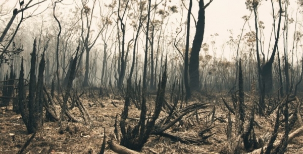

We are pleased to announce that the recipient of the John Martyn Research Grant for 2021 is Erin Rogers. She has provided the following description of her work.
I have a keen interest in plant science and ecology and am particularly passionate about how plants respond physiologically to changes in environmental conditions. I have a foundational background in Environmental Biology, having completed my undergraduate degree at UTS at the end of 2020. I have also worked in bush regeneration within the greater Sydney region for over three years. This sparked my love of plants and my curiosity into understanding the many wonderful ways in which they survive.
Having started my master of research with the Hawkesbury Institute for the Environment at Western Sydney University at the beginning of this year (2021), I was keen to explore how nutrients in the soil limit plant growth and function. Given that low phosphorus soils predominate across Australia and Sydney’s east coast, I aim to investigate phosphorus limitation on photosynthesis on a range of native plants with my thesis titled: The Rich and Poor: Plant Phosphorus and Photosynthesis Follow Soil Fertility.
Under the John Martyn Grant for the Conservation of Bushland I will investigate the effects of increasing fire severity and subsequent phosphorus liberation on the re-growth capacity of native plants. This grant will allow me to explore an area of phosphorus limitation that would otherwise not be examined under my master of research thesis. This research aims to provide a unique insight into species recovery and will give a snapshot of how quickly our native plants can respond to different levels of fire disturbance.
I would like to thank STEP and its members for this opportunity, and I am keen to get out in the field and start this research.
Hornsby and Westleigh Parks: Masterplans out for Consultation

The long-awaited plans for the redevelopment of Hornsby Park and Westleigh Park are now open for submissions until 2 June. There is a planned link trail between the two parks.
Westleigh Park
We have written about Hornsby Park and the Quarry several times in STEP Matters. Westleigh Park is another important bushland site in the Hornsby Shire. The land was owned by Sydney Water until 2016 when it was purchased by Hornsby Council with the main objectives of providing future recreational opportunities and for conservation purposes.
The site covers 34 ha and contains a mix of open space and bushland. The land has not been managed so mountain bikers have taken the liberty to construct 9 km of tracks over the site.
Hornsby Council has undertaken various studies of the site. Vegetation mapping has identified critically endangered ecological communities, Sydney Turpentine Forest and endangered Duffys Forest that council is obliged to conserve and protect. There are also other large areas of quality bushland and threatened plant and animal species.
Studies undertaken of the current unauthorised trails identified soil degradation, contamination and asbestos. The exposed asbestos is managed by monitoring and removal when required but there is buried asbestos that needs to be dealt with.
TrailScapes Pty Ltd, an international trail building company, undertook a study in 2018 of options for restructuring the mountain bike trails network. Their report summed up the current state of the trails as:
In its current form the trail network is unsustainable and not ‘maintainable’. The appropriate management of water is key to a sustainable trail network. A network that continues to erode and pool water not only contributes to erosion but also edge effects such as trail creep (widening) as riders trample vegetation by riding around erosion gullies, pooling water and deteriorating trail features.
In the draft masterplan the bike trails have been reduced considerably. They have been moved to the margins of the endangered ecological communities (EECs) rather than cutting through them. Some bushwalking tracks are proposed that will to go directly through the EECs. The management plan must prevent bikers using these walking tracks.
Clearly existing trails have to be shut down and rehabilitated. The mountain biking fraternity is up in arms fighting the proposal with many people signing petitions and commenting on Facebook. We need submissions to express the importance of fixing the damage and ensuring the bushland is preserved.
The masterplan includes three sporting fields with one proposed to have synthetic turf for soccer and AFL. This is another bone of contention – see Opposition to Synthetic Turf is Growing.
The two projects will be staged over several years with the Westleigh project being given lower priority. The rehabilitation of the mountain bike trails should be given a high priority.
Link Track
A link track will be built between the two sites using existing walking tracks and fire trails but some new tracks will be required plus a bridge over Waitara Creek. Details are not clear at this stage.
Hornsby Park
The masterplan is full of glossy diagrams with huge file sizes. There are several precincts including the Old Mans Valley sporting field area, the crusher plant, the Higgins cemetery as well as the Quarry void area.
The environmental status of the precinct is crucial given the rare bushland vegetation that includes Powerful Owl nesting sites and its proximity to Berowra Valley National Park.
The park is close to the Hornsby residential area and many more apartment buildings are proposed. It is important that the park provides facilities for families as well as sporting groups.
STEP has several concerns about the plan in its current form. Some details are still to be worked out so there is currently plenty of opportunity to express our views and counteract the influence of the mountain bikers.
In brief our main concerns are:
- The existing mountain bike tracks in the Blue Gum Diatreme Forest and high-quality Blackbutt Forest should be closed down.
- There are few walking tracks and these conflict with the mountain bike trails.
- The only space for general informal community use is in the Quarry void where there appears there will be large open space with no trees. This would be very hot in summer.
- The sporting field in Old Mans Valley, close to the suburban area, will have synthetic turf surface. This makes it unsuitable for general public use and will be a bushfire hazard.
- It appears that extensive lighting is proposed that will impact on nearby nocturnal wildlife, particularly the Powerful Owls.
Opposition to Synthetic Turf is Growing

In the November 2020 issue of STEP Matters we outlined the current issues with proposals to install synthetic turf on Barra Brui Oval and Norman Griffiths Oval in West Pymble. There are some local issues relating to these fields but the use of synthetic turf has grown into a major concern all over Sydney.
Ultimately Ku-ring-gai Council decided not to proceed at Barra Brui. At their meeting on 30 June 2020, it was resolved to carry out preliminary design studies but they have not yet been seen. At the March 2021 meeting it was decided that there was insufficient parking space for this field to become the planned major hockey centre for northern Sydney; alternative venues are being assessed but may be hard to find.
Ku-ring-gai Council is proceeding with the detailed planning for the installation of synthetic turf at Norman Griffiths Oval. A community reference group was established, including representatives from the soccer club, local bushcarers, local residents and STEP. We hope to get details of the construction process and drainage measures.
We are concerned about the design of the field. The level of the field will be 0.5 m higher than its current level. At this stage, cork is to be used as the infill product rather than tyre crumb. Fencing will be required to maintain the higher surface. Will fencing limit the use of the field for the local community for informal sports and dog walking?
Major reworking of the drainage system is required as the field is a stormwater detention basin and Quarry Creek flows under the existing field then flows into the Lane Cove River.
The impact of these works on the Sydney Turpentine Ironbark Forest and other native vegetation surrounding the field and Quarry Creek, is unknown.
Issue throughout Sydney
Many other councils are at various stages of planning to install synthetic turf and there is strong opposition from local communities. Some contentious projects are:
- In the Bayside LGA, the Friends of Gardiner Park in Banksia went to the Land and Environment Court to try to stop work on the installation as no consultation with residents had been carried out.
- Lane Cove Council received a $3.6 million grant from the NSW government to provide facilities for the anticipated large growth in population. They want to go ahead with installing synthetic turf at Bob Campbell Oval in Greenwich despite strong opposition being expressed by local residents in a petition and at the council meeting.
- In Hunters Hill, a decision in relation to Gladesville Park was deferred but several councillors are keen to spend a $2 million grant from the government.
- In Hornsby, the draft master plan for Westleigh and Hornsby Parks, which includes provision for synthetic turf fields, will be strongly opposed by environment groups.
Opposition to installation of synthetic turf is becoming stronger as evidence is shared by groups all over Sydney about environmental and health impacts.
The NSW government is also aware of the issue. In March Planning Minister Rob Stokes asked his department to investigate sustainable alternatives to synthetic turf amid growing concerns about its impacts, saying:
I am sufficiently concerned about the environmental impacts ... and will ask the Department to examine what alternative technologies or techniques exist to maximise the use of community sporting facilities without hurting our environment.
Reasons for the demand for use of synthetic turf
A study prepared for the Northern Sydney Regional Organisation of Councils predicted that councils will need to increase the capacity of sportsgrounds by over 40% up to 2036 (through a range of initiatives and new facilities) to cope with existing and future population growth.
Local councils in northern Sydney have strategies to install synthetic turf in a number of existing playing fields. The argued benefits include that these fields are not affected by weather, both wet and dry, and can be used for many more hours than natural grass fields, particularly in winter.
With population growth there is increasing demand for playing fields, particularly for organised sports like soccer. If organised sport were concentrated on fields with synthetic turf, then other fields would be available for other sports and informal recreation. It is also argued that synthetic turf, once installed is cheaper to maintain than grass.
The planning legislation (Part V of the Planning Act) facilitates the installation of synthetic turf as councils can proceed without public consultation provided the council satisfies themselves that the environmental impacts are not significant or can be mitigated. Government has been offering grants in association with soccer clubs, who, naturally, are all in favour of the prospects of much improved facilities.
Many of the council strategies were developed several years ago before experience in the use of synthetic turf fields identified several issues.
Arguments against synthetic turf
David Shoebridge, the Green Upper House MP organised a webinar on 22 April that provided insights into the latest research and experience in the use of synthetic turf.
When the air temperature is over about 30ºC, the surfaces become excessively hot (over 60ºC) making the field unusable. In winter this may not be an issue but fields should be usable for other sports such as cricket and general recreation.
Tyre crumbs are widely used as infill to stop the grass blades flattening and these leach heavy metals that are harmful, particularly for children.
The plastic grass fragments and tyre crumb can end up in waterways unless carefully filtered. The crumb infill, which washes out from the field, has to be regularly replaced. New research by the Australian Microplastic Assessment Project with Northern Beaches Council, funded by NSW’s Environment Protection Authority, has found in areas with synthetic turf fields, 80% of the waste entering stormwater drains was black crumb and microplastics from synthetic turf. In areas without these playing fields this is only 5%.
In addition to particles coming off the field, chemicals which are required to clean the field, require treatment.
The proponents of synthetic turf argue that the product is a good way of reducing waste from old tyres going to landfill. But after about ten years the turf needs to be replaced and so the tyre waste it ends up in landfill anyway and is more difficult to recycle as it is mixed up with plastic.
Many fields have been built on flood-prone land that was unsuitable for housing development. With synthetic turf additional drainage measures are required to control extra water that flows from the hard surface that cannot soak into natural ground.
The use of synthetic turf will lead to loss of natural areas that provide foraging area for birds and space for soil organisms.
Is there a better alternative?
The webinar organised by David Shoebridge included case studies where playing fields with natural grass have been upgraded using composted soil and appropriate grass species. These fields have proven to be more cost effective over a 20-year life cycle than a synthetic surface.
For example, the fields on Middle Head withstood a high level of usage over winter and remained in good condition. Also, the soccer players gave very positive feedback when comparing the playing experience with the synthetic surface.
Large amounts of green waste are composted and it is argued that using anerobic processes reduces the emissions of methane from land fill. Currently compost producers are having trouble finding buyers of this product.
If you have concerns about synthetic turf, please let your local MP and councillors know.
Stop Press — Eden Gardens Monstrosity
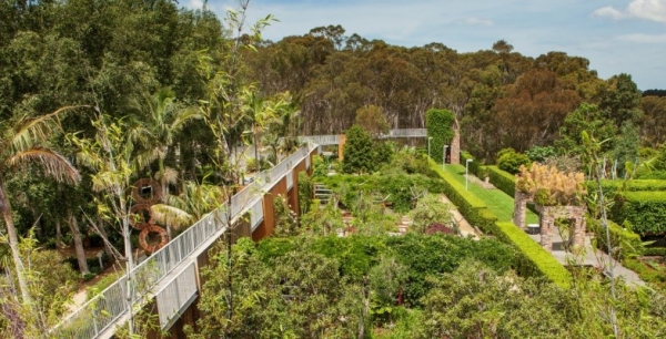
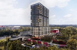
We have just found out about a proposal for an 18-storey office tower to be built on the Eden Gardens nursery site on Lane Cove Road, on the edge of Lane Cove National Park.
This would be the only high-rise building between Lane Cove National Park and the M2. It would also be the only tall building on the eastern side of Lane Cove Road. All other commercial buildings on this side of Lane Cove Road are further south on the other side of the M2.
Naturally, as it is bushfire prone land there will need to be a wide Asset Protection Zone. How much bush will be cleared to accommodate that? This building will stick out like a sore thumb over the treed skyline of Lane Cove National Park with light spill into the park that will impact on the nocturnal animals living in the park. More details will be on our website as they come to light.
Submissions are open until 21 May. Objections can be emailed quoting the number LDA2021/0095 to the This email address is being protected from spambots. You need JavaScript enabled to view it..
Look Up! A Powerful Owl Could be Sleeping in Your Backyard After a Night Surveying Kilometres of Territory
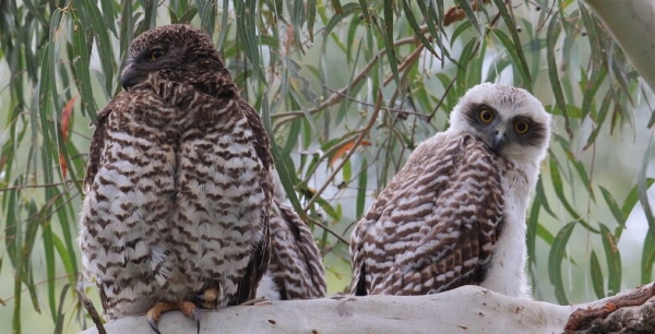
Picture this: you’re in your backyard gardening when you get that strange, ominous feeling of being watched. You find a grey oval-shaped ball about the size of a thumb, filled with bones and fur — a pellet, or ‘owl vomit’.
You look up and see the bright ‘surprised’ eyes of a powerful owl staring back at you, with half a possum in its talons.
This may be becoming a familiar story for many Australians. We strapped tracking devices to 20 powerful owls in Melbourne for our new research, and learned these apex predators are increasingly choosing to sleep in urban areas, from backyard trees to city parks.
These respite areas are critical for species to survive in challenging urban environments because, just like for humans, rest is an essential behaviour to conserve energy for the day (or night) ahead.
Our research highlights the importance of trees on both public and private land for wild animals. Without an understanding of where urban wildlife rests, we risk damaging these urban habitats with encroaching development.
One owl, one year, 300 possums
Powerful owls are Australia’s largest, measuring 65 centimetres from head to tail and weighing a hefty 1.6 kilograms. They’re found in Australia’s eastern states, except for Tasmania.
These owls have traditionally been thought to live only in large old-growth forested areas. However, Victoria has lost over 65% of forest cover since European settlement, and because of this habitat loss, the owls are listed as threatened in Victoria.
Their remaining habitat is extremely fragmented. This means we’re finding owls in interesting places — from dry, open woodland to our major east coast cities. This is likely due to the high numbers of prey, such as possums, that thrive alongside exotic garden trees and house roofs.
Powerful owls usually eat one possum per night, or 250 to 300 possums per year — mostly common ringtail and brushtail possums in Melbourne. They’re often seen holding prey at their roosting spots, where they’ll finish eating in the evening for breakfast.
This has ecosystem-wide benefits, as powerful owls can help keep overabundant possums in check. Too many possums can strip away vegetation, causing it to die back, which stops other wildlife from nesting or finding shelter.
Tracking their nocturnal haunt
But powerful owls are extremely elusive. With low populations, locating owls and researching their requirements is very difficult.
So, to help narrow down the general areas where powerful owls live in Melbourne, we used species distribution models and sought help from land management agencies and citizen scientists.
Over five years, we deployed GPS devices on 20 Melburnian owls to find how they use urban environments. These devices automatically record where the owls move at night and rest during the day.
We learned they fly, on average, 4.4 km per night through golf courses, farms, reserves and backyards looking for dinner and defending their territory. One owl along the Mornington Peninsula travelled 47 km over two nights (possibly in search of a mate). Another urban owl called several golf courses in the Melbourne suburb of Alphington home.
Choosing where to sleep
After their nightly adventures, the owls usually return to a number of regular roosting (resting) spots, sometimes on the exact same branch. The powerful owl chooses roosts that protect them against being mobbed by aggressive daytime birds, such as the noisy miner and pied currawong.
We found the owls used 32 different tree species to roost in: 23 were native, and nine were exotic, including pine and willow trees. This shows powerful owls can adapt to use a range of species to fit their roosting requirements, such as thick foliage to hide in during the day.
Owls will generally roost in damp, dark areas during summer, and in open roosts in full or dappled sunlight during winter to help regulate their body temperature.
Our research also shows rivers in urban environments are just as important as trees for roosting habitat.
Rivers are naturally home to a diverse range of wildlife. Using trees near rivers to rest in may be a strategic decision to reduce time and energy when travelling at night to find other resources, such as prey, mates and nests.
Rivers that constantly flow, such as the Yarra River, are a particular favourite for the owls.
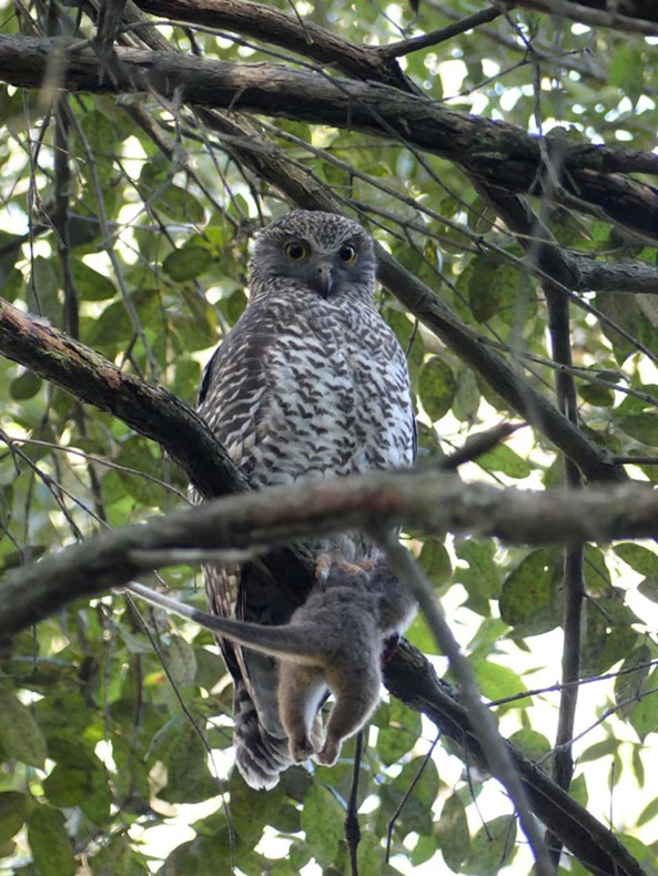
The urban roost risk
These resting habitats, however, are under constant pressure by urban expansion and agriculture. Suitable roosting habitat is either removed, or degraded in quality and converted to housing, roads, grass cover or bare soil.
We found potentially suitable roosting habitat in Melbourne is extremely fragmented, covering just 10% of the landscape because owls are very selective about where they sleep.
Although there might be the odd suitable patch (or tree) to roost in urban environments, what’s often lacking is natural connectivity between patches. While owls are nocturnal, they still need places to rest in the night before they settle down in another spot to sleep for the day.
Supplementing habitat with more trees on private property and enhancing the quality of habitat along river systems may encourage owls to roost in other areas of Melbourne.
Powerful owls don’t discriminate between private land and reserves for roosting. So, conserving and enhancing resting habitats on public and private land will enable urban wildlife to persist alongside expanding and intensifying urbanisation.
So, what can you do to help?
If you want powerful owls to roost in your backyard, visit your local indigenous nursery and ask about trees local to your area.
Several favourite roost trees in Melbourne include many Eucalyptus species and wattles. If you don’t have the space for a large tree, they will also roost in the shorter, dense Kunzea and swamp paperbark (Melaleuca ericifolia).
Planting them will provide additional habitat and, if you are lucky, your neighbourhood owls may even decide to settle in for the day and have a snooze.
This article was published in The Conversation on 1 March 2021. It was written by Nick Bradsworth, John White and Raylene Cook from Deakin University
Wonderful Displays of Pink Flannel Flowers
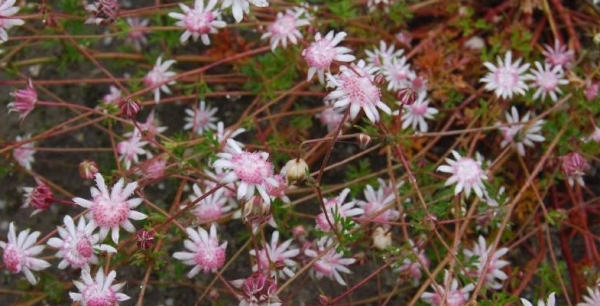
The devastating fires over the Black Summer in the Blue Mountains have produced one remarkable display, the pink flannel flower (Actinotus forsythii). These flowers have been seen in burnt out areas from Katoomba to Lithgow and north to Newnes. The huge number of sightseers has caused the national parks rangers to institute traffic and parking control measures at easy access places like Narrow Neck.
The Pink Flannel Flower is special because of its ephemeral nature. It only germinates after conditions of fire and then good rainfall. It is believed that they germinate in response to bushfire smoke rather than heat.
Researchers at the University of NSW Centre for Ecosystem Science are aiming to find out more about the species, including how long their seeds can remain between fire events in a ‘deep dormancy’ before germination.
The smoke-derived chemical karrikinolide is the active ingredient to trigger the plants’ emergence. Lab tests involved creating so-called smoke-water infused with the chemical to prompt germination.
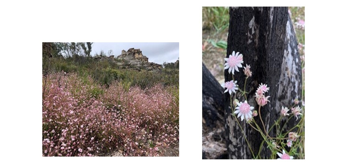
Left: View near State Mine Gully Road (Jill Green). Right: Narrow Neck close up (John Martyn)
Much Maligned Sharks


Arguably there are fewer animals in the world that are feared more than sharks. But the reality is that they pose little threat to humans. Our innate fear of them is heightened by a potent mix of Hollywood portrayal and media hype. The vast majority of the 1,050+ shark and rays in the world pose no risk what-so-ever, many of them are benthic, don’t have pointy teeth and will never interact with humans. But they are all tarred by the same brush.
Shark attack data
The top three ‘killers’ (white sharks, bull sharks and tiger sharks) collectively kill around one person per annum in Australia according to the Shark Attack File maintained by Taronga Zoo. More people are killed by bees or horses than are killed by sharks. Far more people are killed by falling branches. So, we really need to take a reality check on the risk sharks pose to humans. More importantly, we need to be sure our shark management policies are driven by scientific reality rather than irrational fear. Shark management policy need not be a hyper-political issue, the numbers simply don’t warrant the attention they get let alone the budget expenditure.
Shark behaviour
Sharks are grossly misunderstood. Unlike crocodiles, sharks do not eat people. They are naturally inquisitive and tend to explore the world with their mouths. Unfortunately, if a white shark takes an interest in a person in the water, the exploratory bite can be fatal.
Of the 28 or so encounters each year, on average one is fatal (ca 5%). The injured person will likely die from blood loss if they do not get immediate medical assistance. The key to saving lives is to stem the bleeding as quickly as possible. This means that while the number of encounters each year remains much the same, the number of fatalities can vary, largely due to luck; Where on the body was the person bitten, how far from shore are they, how quickly does help arrive, can the blood flow be stopped? Most years we have no fatalities, but some years there are several. 2020 was particularly bad with eight fatalities; the highest recorded for 90 years.
Sadly, our misplaced fear of sharks means that our ability to conserve and appropriately manage them is hindered by our prejudice against them.
Many sharks are at risk of extinction
The IUCN suggests that a quarter of all sharks and ray species in the world are at risk of extinction. They are among the most threatened group of animals in the world.
The main reason sharks and rays are so vulnerable to anthropogenic impacts is that they have slow life history traits: They live for a long time, take a long time to reach maturity, have few young each year, often skip breeding season and have long gestation times (many are longer than humans). Collectively this means that their reproduction capacity is very low and they simply can’t rebound from impacts quickly enough.
Netting does not only kill sharks
Apart from overfishing (ca 50 million sharks are killed by the fin trade each year alone), the next greatest threat to many shark species is ‘shark control’. Many state governments have bather protection programs that involve a mix of management strategies. Sadly, many of them are lethal to sharks and other collateral species. Perhaps the most widely used and grossly inappropriate management action is shark netting. Contrary to popular belief, shark nets are simply a fish net suspended in the ocean off popular beaches. They do not act as a barrier, rather they catch animals indiscriminately.
Data from the 2017 shark netting program in NSW showed that not a single target shark (white, tiger or bull) was captured but 65 other animals were, including endangered species such as turtles, hammerhead sharks, grey nurse sharks and devil rays. 77% of the animals where dead by the time the nets were checked. Data from the 2019–20 season were much the same but on a larger scale. 480 animals ensnared, 90% of them non-target species, 284 of them dead, including dolphins.
These shocking statistics has led to wide-spread criticism of this program and many local councils are announcing bans on shark nets on their beaches. Of course, it’s likely that all these dead animals stuck in the nets actually attract sharks, many of whom are happy to take a free lunch.
Drum lines are another management approach. These are effectively hooks with bait on the end and of course they are equally indiscriminate. Some have argued that the baits actually attract sharks rather than deter them. The trouble with this system is that someone has to physically check the hooks. Often by the time they are checked, whatever has been caught has long since died. This may further attract sharks to the area.
There has been a shift towards ‘smart drum lines’ which are basically the same thing as a regular drum line, but they are fitted with an alarm. When an animal is hooked, the alarm goes off and prompts someone to check the line. This does improve the likelihood that the animal will survive the encounter.
What happens to the shark that is caught by drum lines is also controversial. In some instances, if the animal is a target species, it is simply shot. In other cases, it is moved offshore and released (with or without a tag). The trouble with both approaches is that many of these target species, particularly tigers and white sharks, move incredible distances and are mostly unpredictable. So, moving a shark offshore is only a short-term benefit from a swimmer safety perspective, till that shark or another one swims back again. Because these animals literally roam the ocean, shooting or removing sharks has no locally discernible impact either on shark numbers or shark bite statistics. In other words, it’s largely a political stunt that has no basis in science. The only benefit is that if the shark is tagged, that data makes a contribution to our understanding of shark movements and behaviour.
There are smarter alternatives
We already have the capacity for more common-sense approaches to managing human-shark relationships. Part of the solution is education. People need to realise the risk is small, but exists none-the-less. We need to take responsibility for our behaviour and the decisions we make. A shark is just being a shark when it bites a person, they are not being malicious. We humans are entering their environment and we need to be respectful.
A useful comparison is our laws regarding jay-walking. It’s illegal to randomly walk across a busy road or highway within 20 m of a pedestrian crossing because it’s dangerous; You could be killed by a car. If an incident does happen, its largely the pedestrian’s fault not the driver’s. The same common sense applies with entering the ocean; there are risks and if you get bitten by a shark, it’s not the shark’s fault.
Our understanding of shark behaviour also means that we can be a little smarter about when and where we go swimming. Dawn and dusk are periods of high shark activity, thus the risk at these times is slightly elevated. Obviously, one should not swim close to seal colonies, or near big schools of fish. River mouths after rainfall event should also be avoided. Swim with a buddy and tell people when and where you are going.
Drones are a better idea
New technology is also coming to our aid. Busy beaches can be monitored by drones. Drones connected to blimp-like balloons can stay afloat for long periods of time. They can stream images direct to a ground station and artificial intelligence can identify and track sharks in real time. Bathers can be warned that a shark is in the area and they should leave the water. We would be far better investing in this kind of approach than continually wasting time (and lives) on shark nets and drum lines that just don’t work.
Using our smarts and taking responsibility for our actions will go a long way towards harmonious human shark relations.
Prof Culum Brown gave us a fascinating talk about his research into shark behaviour. He has kindly sent us a summary of his talk
Glyphosate Confirmed as Safe to Use but not Everyone Agrees
Glyphosate, most commonly marketed as Roundup, is extensively used as a herbicide in agricultural areas and bushcarers know how effective it is in controlling weed invasions in native vegetation woody weeds such as privet and ground covers such as Ehrharta. In recent years its safety has been called into question.
Glyphosate was developed by Monsanto and came onto the market in the 1970s. In 2015 the International Agency for Research on Cancer (IARC) determined that glyphosate may be capable of causing cancer, but did not specify the circumstances, since that was beyond the IARC remit.
This decision led to three court cases in the US where huge damages were awarded to people who developed non-Hodgkins lymphoma. In each case they found that Monsanto had not provided adequate information about the risks of using glyphosate-based products. The people involved had repeatedly come into direct contact with the chemical and were not aware of the need to take the precautions.
The response to these events has been a ban of its use in some countries and in some council areas in Australia. This is despite the announcement by the European Food Safety Authority that glyphosate ‘is unlikely to pose a carcinogenic hazard to humans’. Similar conclusions have been reached by regulatory authorities in Australia, the US, Canada, Japan and New Zealand.
How does it work?
Glyphosate is absorbed through foliage and transported to growing leaves. It interferes with the shikimate pathway used to produce some amino acids. Animals and people lack this pathway so they are not harmed by the presence of the chemical in the food they eat.
Earlier this year at the AGM of the Australian Association of Bush Regenerators, Tim Low gave a talk on glyphosate. Tim is author of the best-selling book Feral Future, he helped found the Invasive Species Council and recently wrote an assessment for them called Glyphosate: A Chemical to Understand. The following information gives a brief summary of this very detailed paper.
Tim explained that the danger posed by a chemical can be assessed in two ways:
- a hazard assessment simply asks if a substance is capable of causing harm
- a risk assessment asks if it can cause harm under conditions of exposure
The IARC determined that glyphosate may cause cancer but so does exposure to the sun, eating salami or drinking wine. The risk is determined by the circumstances and level of exposure.
The Australian Pesticides and Veterinary Medicines Authority is an independent statutory authority that is responsible for testing the safety of pesticides. They commissioned a report from the Office of Chemical Safety. This review led the Australian Pesticides and Veterinary Medicines Authority to restate a previous finding that glyphosate is safe to use if the safety instructions are followed. The safety instructions include advice to wear the likes of ‘safety shoes, overalls, gloves, safety glasses’ when using concentrates and ‘wear gloves and wash hands after use’ for home garden mixes.
The opinions expressed by other experts quoted in the paper vary and are often qualified by the context of frequency of use and observation of exposure precautions. Some still say it should be avoided.
Are there any effective alternatives?
A pesticide expert at the University of Sydney, Professor Ivan Kennedy, says that ‘any’ replacement is likely to be more damaging to human health, and a herbicide expert at the University of Adelaide, Dr Chris Preston, says that glyphosate is safer than the alternatives, and better for the environment because there is no residual toxicity. This long persistence in the environment can impact on waterways, seagrass and algae.
In some cases, new chemicals appear to be better because there is less research on their impacts. Glyphosate has been studied far more intensively than the current alternatives. For example, Atrazine has caused tumours in female rats but the significance for humans is unknown because, the IARC decided, too little is known about atrazine to assess its carcinogenicity.
Most of those who argue against glyphosate do not acknowledge the chemical world we live in. One Guardian article noted that glyphosate ‘traces are commonly found in our food and even our bodily fluids’ but this is the case with many other chemicals.
Experience with non-chemical methods
Byron Shire Council moved to ban glyphosate in 2013 when councillors passed a resolution aspiring to end pesticide use in highly frequented public places. Council officers tried slashing and brush cutting instead but roadside weeds increased in diversity and spread, and potholes formed where weeds undermined the road. Current policy is to use herbicides to control priority weeds on roadsides, and strive to replace weedy roadside grasses with low-growing desirable plants.
Byron Council has largely eliminated herbicide use in urban areas. The council purchased a steam weeder but it will only kill annual weeds, so is unsuitable for most environmental weeds. Steam has to be used carefully because of the risk of burns, and only suits areas with vehicle access.
Hobart City Council trialled steam with disappointing results. Many weeds needed repeated treatments. It was estimated that the city-wide use of steam would cost more than ten times more than the use of glyphosate.
In Perth one council trialled alternative methods on clovers and other small weeds growing beside a gravel trail, achieving some success with mulch, steam, pelargonic acid, pine oil, and salt and vinegar. There was no suggestion that these methods will work against larger weeds. Trials are ongoing.
Weed control becomes as much more labour-intensive process if herbicides are not used. Non-chemical methods of control, especially steam spraying, can be used against some very small weeds in city parks and ovals. They do not kill larger weeds in parks, nature reserves and on farms.
Current opinions of the use of glyphosate
Farmers
The National Farmers’ Federation has said farming cannot survive without glyphosate, presumably because of poorer weed control from other herbicides (and lower yields under organic farming). The president, Fiona Simson, also pointed out the environmental benefits of glyphosate. Farmers can spray the weeds that emerge in bare fields rather than killing them by tilling, which disturbs soil structure and soil biota, increases soil erosion and loses moisture. Defending glyphosate, Simson said:
New practices like low- and no-till cropping have radically reduced our greenhouse gas emissions, improved the quality of our soils, and taken water use efficiency to new heights.
Bush regenerators
Glyphosate is the main herbicide used against bushland weeds, and a ban would undermine environmental goals. After the American court cases the president of the Australian Association of Bush Regenerators, Dr Tein McDonald, said that bush regenerators:
… do not want to discard a highly important tool from our conservation toolbox without sound justification.
Adam Muyt in his book Bush Invaders of South-eastern Australia (2001), states that, of the many methods to control weeds in bushland reserves (which include fire, mulching, slashing, grazing and scalping), herbicides:
… offer the only really effective treatment for removing many of the more tenacious and aggressive invasive species.
Unlike on farms, glyphosate is usually applied in a discrete and targeted way, with stem injection or a cut-and-paint application to individual plants. Admittedly, on large scale weed invasions, it is sprayed on foliage and some spray drift can then occur. Methods like cut and paint avoid the need to disturb the ground to dig up weeds, creating bare ground that invites further weed germination and can cause erosion.
On a larger scale glyphosate is often the most effective means of controlling weeds of national significance such as gamba grass in the Northern Territory. This grass was imported as cattle feed but areas that are not eaten create hotter fires. Around Darwin fire-fighting costs have increased significantly.
References
Tim Low (2020) Glyphosate: A Chemical to Understand (Invasive Species Council, Fairfield, Victoria)
Adam Muyt (2001) Bush Invaders of South-East Australia: A Guide to the Identification and Control of Environmental Weeds Found in South-East Australia (RG and FJ Richardson, Meredith, Victoria)
At Last, a Recovery Plan for the Grey-headed Flying-fox

It is 20 years since the Grey-headed Flying-fox was listed as a threatened species under NSW and Commonwealth legislation. This legislation requires that a recovery plan is prepared and implemented. Getting the Australian government and the states (Victoria, NSW and Queensland) to agree on the plan has been frustrated by political pressure many times.
In 2017 there was a serious attempt to delist the flying-foxes. Fortunately, the Australasian Bat Society prepared a strong submission to the Parliamentary Inquiry set up to address the issue of flying-foxes.
Finally, the national recovery plan is no longer a draft and it came into effect under the Environment Protection and Biodiversity Conservation Act on 19 March 2021.
The plan is written clearly and contains useful summaries of the biology and ecology of the species. The actions will need pressure from the community to ensure they are implemented.
Flying foxes are critical to the pollination of eucalypts, in particular, throughout Australia. It is probably not accidental that most eucalypts on the East Coast are white flowered so their blossoms can be seen at night. Even Turpentines, which have a much higher flow of nectar at night, provide a ‘high octane fuel’ needed for these blossom-feeding mammals.

Attempt to Legitimise Illegal Bike Tracks in Ku-ring-gai
In many areas of Ku-ring-gai people living near bushland have been busy constructing bike tracks for their family and neighbours to use. We are aware of these tracks in North Turramurra, East Lindfield and North Wahroonga and there are many more.
This is illegal! You cannot go onto public land and do what you like. That is just like setting up a coffee shop at the front of your neighbour’s house and then dumping the rubbish in their garden.
These tracks can do tremendous damage to bushland, for example:
- erosion and compaction of the soil that damages root systems and destroys micro-organisms that plants depend on, particularly orchids
- destruction of plants and animal habitat including threatened species
- introduction of weeds and fungal pathogens
- changing stormwater flow causing erosion
- disturbance to wildlife that are nesting or foraging nearby
The authorised Warrimoo track was constructed after detailed research into the appropriate route and suitable materials.
Ku-ring-gai Council is actively implementing its Recreation in Natural Areas Strategy which includes the closure of these unauthorised tracks. Council has the power:
- to issue a notice to stop work
- to issue fines
- to recover the cost of remediation works
- to take legal proceedings to restrain the unlawful activities
But it seems that some people think they are entitled to do what they like in the bush.
There is an online petition circulating at the moment trying to gather community support to persuade Ku-ring-gai Council to stop closing and taking down illegal bike tracks and rehabilitating the bush.
[Please also see update at end of story]
The introduction to the petition demonstrates the gall of the proponents:
Waterball Enduro Mountain bike trail has been in construction for over a year, has not damaged the beautiful surrounding bushland in any way and has brought together so many kids in the local community in its construction and use. It has had many hundreds of hours spent in its building, design and maintenance.
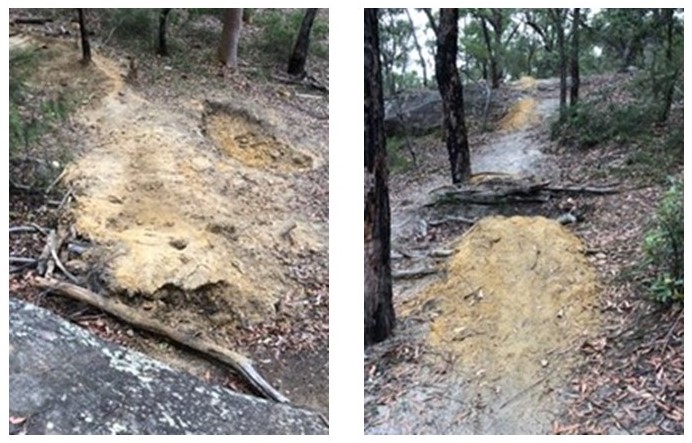
These photos clearly demonstrates the damage they are doing to the ‘beautiful bushland’. Actually it is blatant vandalism.
If you would like to express your views, please address them to Councillor Donna Greenfield who will be receiving the petition to save the illegal bike track. Her email address is This email address is being protected from spambots. You need JavaScript enabled to view it.. Also send your letter to Mayor Jennifer Anderson This email address is being protected from spambots. You need JavaScript enabled to view it.,au.
UpdateThe damage two bushland caused by the track builders in North Wahroonga has now been remediated by Ku-ring-gai Council. There is still a lot of work to be done in other sites.
Coalition Against the Lane Cove Valley Freeway 1988 to 1995: An Amazing Community Achievement
 The North Connex Tunnel that is a direct link between the Sydney Newcastle Expressway (now called the M1) and the M2 was finally opened in December 2020. The occasion has caused several STEP members to reflect on the prolonged and passionate campaign that was undertaken to prevent the horrifying alternative proposals of freeway/s through the Lane Cove Valley bushland. The stories sent to us by Elaine Malicki, Pat Stewart and Caron Morrison are copied below, but firstly some background.
Background
A corridor had been marked on maps by the DMR since the 1940s for roads through the Lane Cove Valley between Pearces Corner and Fig Tree Bridge. Government attitudes at the time were that urban bushland was just vacant space available for utilitarian purposes. In the 1980s the word was out that plans were under active consideration for a freeway. The STEP committee was immediately on the case.
The August 1984 meeting minutes record a plan to alert residents, prepare a position paper and write to the Premier Nick Greiner. A sub-committee was formed that joined with other local groups. Walks were undertaken with photographers to illustrate what could be lost.
In early 1987 the NSW government’s intentions became clearer with the publication of a report called Roads 2000. A freeway along the valley seemed to have been abandoned but a link from Pearces Corner to North Ryde was still a possibility. This road may have been at least 10 years away but serious action began to try to nip this in the bud.
John Burke wrote a position paper that refuted the arguments for more freeways as well as highlighting the damage to bushland and neighbourhoods. On receipt of the paper Nick Greiner wrote a statement that that there was no intention of building a freeway.
But a change of government can change previous undertakings! Late in 1988 the prospects of a freeway became more serious when possible routes for a link were published by the RTA in a North West Sector Road Needs Study. The map shows the possible routes, dubbed the B2 and B3, that would have destroyed the tranquillity and environment of Wahroonga and South Turramurra.
Community groups were established such as the Coalition against Lane Cove Freeway (CALCVF) chaired by Elaine Malicki. The 1989 president’s report lists the massive amount of work carried out: public meetings, meetings with politicians, information papers, letters sent to media and politicians, members asked to write
Finally, in July 1995, the freeway corridor was abandoned.
That was not the end of the story as a further study by Sinclair Knight Merz on linking the F3 and M2 was made in the early 2000s. STEP employed a project officer, Kate Read, who wrote a paper that was submitted to SKM by STEP. It demonstrated that a link road would be a short-term fix unlikely to solve the transport problems in the longer term. This was followed up with lots of lobbying. The outcome was the recommendation for the tunnel that was built.
Postscript
The South Turramurra land that was in the B2/B3 corridor (Chisholm St) is now a residential area and other parts remain as bushland. The land between Eastbourne Ave and Fox Valley Road parallel to Lucinda Ave is still in government hands. Most is zoned as E2 and can’t become residential. Some near Fox Valley Road is zoned as E4 but has Blue Gum High Forest vegetation so we hope it can be maintained as green space.
 Elaine Malicki
My documentation has been passed on to historical groups but would like to share what I see as the reasons for the strength and success of this campaign.
The initial meeting was called by the oldest community group in the area, the Kissing Point Progress Association. The meeting was held at the Kissing Point Sports Club and was very well attended, with representatives of the Kissing Point Progress Association, Ku-ring-gai Ratepayers Association, STEP (as it was then), a range of sporting groups, scouts and guides, local P&Cs, churches, kindergartens and environmental and bushcare groups. The Fox Valley area was involved as well as parts of Wahroonga, South Turramurra and West Pymble.
As locals we were very committed to opposing the plans for every freeway option.
At CALCVF’s initial meeting I was elected president and Tony Morrison was to be secretary, with a bevy of committee members from many different groups and this network became an essential part of our communication strategy and provided an army of helpers. My role as secretary of the Ku-ring-gai Ratepayers’ Association meant I had strong links with Ku-ring-gai Council (which opposed the freeway options) and the media.
Meetings were frequent and well attended. We resolved to provide regular newsletters to inform the community, and to seek and encourage media attention at all levels to both inform and pressure politicians. Community appeals for donations kept us in stationery and paid postage. We kept strong records and researched as much as possible. Every available document was scrutinised and contacts cultivated within the various departments involved with the decision-making as well as National Parks and Ku-ring-gai Council who were the custodians of most of the land involved.
Politicians were approached both en masse using Greg Bloomfield’s Votergrams, and through frequent letters to every MP. Every response was followed up and as many politicians and media as possible were asked to join us for a bushwalk to view the valley or to receive a briefing.
Public meetings were held at critical times to muster support and were open to all. It became our practice to invite any other freeway action groups who quickly became part of our network, e.g. LEN (Less Expressway Noise) from the vicinity of the newly opened F3 Freeway commencing at Wahroonga.
We shared information, supported and demonstrated for other groups and ultimately were similarly supported. I think it is fair to say
that CALCVF initiated this intense networking concept and it was highly successful.
Committee members worked to their strengths and the energy was extraordinary. Availability varied and people stepped up to fill gaps or to provide expertise or information or help. I resigned in 1991 to become a council alderman and my role was taken over wonderfully by Pat Stewart with Tony Morrison’s wife, Caron, becoming a linchpin of the group. The research and networking were second to none and persistence, knowledge and accuracy were central.
Bob Carr announced in 1995 that the B1, B2 and B3 freeway corridors were to be abandoned. It had been a long, intense and successful community campaign with a core of inexperienced mums and dads whose dedication saved the Lane Cove Valley for the future.
We worked together so well, with such a strong common objective, and we had fun too! This was the greatest achievement of my life (family excluded!) and I am sure many of the others felt the same. To have been part of saving our special valley for future generations was a marvel to me. It mattered ...

Elaine Malicki and Pat Stewart
Pat Stewart
I was president of CALCVF from 1991 until 1995 when the plans for the freeway were abandoned. Many people had worked hard and played an important part in the establishment of CALCVF before I joined the group and it was, indeed, a vital energetic group.
My most vivid memory of the long journey was the amazing committee that I worked with. The dedication of the people involved and the knowledge and skills that they possessed as well as their willingness to be called upon (often at short notice) to walk with, and talk to, politicians and other officials about what would be lost if the freeway went ahead. It was a privilege to know them.
I lived in Leuna Ave at the end of The Broadway Wahroonga, a historic roadway. This fascinated me. I began to clear sections using hand tools and I researched the style of road building and realised it was a Telford road. There are very few Telford roads remaining in Sydney. Further research revealed that it was part of a roadway planned by John Bradfield to join the northern roadway area to the Sydney Harbour Bridge. I also found that John Bradfield had been president of the Lane Cove River Trust and he wanted to retain the natural beauty of the area so I felt that should he be alive – he would find an alternative solution to the freeway.
When I became president I decided to focus on making all members of the NSW parliament aware of what would be lost if the freeway went ahead. I was lucky that Caron Morrison agreed with me and was prepared to work with me. Caron was familiar with the ins and outs of politics – she knew who we should focus on and she was prepared to keep them up-to-date with matters pertaining to our cause. Caron would regularly go into Parliament House to talk to parliamentarians personally.
I wrote letters to all parliamentarians addressing each individual letter and signing them personally. I invited them to come and see the area for themselves and members of our committee would meet them and talk to them and take them for a walk along part of the proposed route of the freeway. Quite a few parliamentarians and bureaucrats accepted the invitation.
Neroli and Harry Lock who lived in Leuna Ave would take us on a short walk to a large rock that gave a view over the valley and from there it was possible to see how much bushland would be lost.
We also kept the local people informed about the situation with letterbox drops and information tables at the local shopping centres.
We needed money from time to time to cover expenses. Our fundraising activities were kept to a minimum but one that still brings a smile to my face was one initiated by Neroli Lock. Neroli used her creative ability to print ‘money’. The ‘money’ was a larger size than the legal tender but it was an ‘investment in protecting the bushland of the Lane Cove Valley’. There were $2, $5 and $10 notes. These notes were different colours. When the idea was suggested to me, I went to her house to see what she was actually meaning and there – hanging on the clothesline were all these ‘notes’. ‘Laundering money’ certainly took on a new meaning.
All ‘investments’ (donations) were given with a chuckle. (I kept mine for many years.)
When it was announced that the freeway was not going to be built, we were elated. All the efforts of all the people involved had been worthwhile!
Although the announcement had been made, we knew that we had to continue our efforts to ensure that subsequent governments could not reverse the decision. It was not until the official
notice was published in the Government Gazette that we relaxed and felt that the group had really achieved an amazing result.
In summary, it looks like it was a simple easy thing to do – in reality it took a lot of effort by many people. It consumed years of my life.
Personally, I only fully relaxed when the tunnel was officially opened. It had been a long journey for many. John Burke, Elaine Malicki, Bruno Krockenburger, John Martyn, Neroli and Harry Lock all played a major role in this quest.
Stopping the building of the Lane Cove Valley Freeway was absolutely a magnificent accomplishment. Congratulations to everyone involved.
Caron Morrison
Psychologists say that the promises you make to yourself, especially when you are a child, are the most important commitments of all.
In 1964 my family moved from the centre of Sydney to the wilds of South Turramurra. After a life of traffic and bustle it was a strange and exotic land, full of the promise of adventure and mystery. Almost simultaneous with my arrival I witnessed the earth scarring destruction of the valley for the construction of the Comenarra Parkway. Whilst watching the intruders going about their business I made a silent vow that if I was ever in a position to prevent another road being built, I would do whatever I could.
Making this decision settled my mind but I can honestly say that I never really thought I would be in the position of having to act upon it. By several twists of fate however, I found myself as a young parent of four boisterous sons living once again on the edge of the valley and in 1989 the unthinkable happened. The NSW government decided, after decades of inertia, to build another massive road to connect Ryde Road with Pennant Hills Road and I was driven to almost manic levels of activity.
Since then, I have often wondered whether that level of activity was necessary, or whether I was just acting out following my childhood experiences but I genuinely believe that nothing short of a super human effort is required when you are up against the full might of government.
It would be easy to say that the period between the government announcement to build in 1989 and the decision not to build in 1996 was completely awful, but I value the opportunities to meet and work with some fascinating people in ways that I think led to great outcomes, even if I was ridiculously tired and stressed most of the time. I am incredibly proud to have been able to contribute in some way to the preservation of this unique treasure.
Bushfire-prone Land Clearing Rules
In the November 2020 newsletter we explained concerns about the proposed change to land clearing regulations that would allow landowners to clear within 25 metres of boundary fences without obtaining consent. This could lead to large areas of peri-urban rural land on smaller blocks being cleared. This was not a recommendation of the bushfire enquiry.
After lobbying by concerned residents Hornsby Council passed a resolution to write to the government requesting an exemption for rural-zoned land in the council area. Mayor Philip Ruddock said that the rural boundary clearing code could potentially result in the clearing of 1035 hectares, or half the vegetation on rural-zoned lands within the local government area.
In response, the NSW government agreed to exclude Sydney's councils from new land-clearing rules that would have given residents much greater freedom to cut down trees on their properties.
The final details of the code are being discussed. It is understood that Matt Kean and Planning Minister Stokes are pushing for curbs to avoid the destruction of endangered ecosystems, including koala habitat. We don’t want to see the indiscriminate clearing that is still occurring under the 10/50 code.
Concern about Sale of Glengarry Land
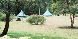
In November 2020 we were alerted by residents of North Turramurra that the Glengarry Girl Guides site was up for sale. The site covers 8.1 hectares and is zoned RE2, private recreation.
From the Miowera Road access the site is fairly level with a large hall, commercial kitchen, accommodation, multi-purpose cottages and rooms as well as outdoor recreation spaces. The rest of the site is high quality bushland on a steep slope that is bordered by the popular Glengarry fire trail and Darri walking track.
The bushland portion contains significant habitat elements such as hollow bearing trees, rocky outcrops, major creek lines and riparian zone that would cater for a diversity of native fauna species including threatened species such as the Powerful Owl. Walkers in the area have observed Lyrebirds, numerous small birds and seasonal visits by Goshawks. As the land has been privately owned there has not been any detailed ecological survey.
This land was donated to the Girl Guides in the 1930s for community use. They own two adjoining blocks to the north that were also donated to the Guides and are held under a Reserve Trust. They are zoned E2 and link to Ku-ring-gai Chase National Park. The whole sequence of blocks is part of the Cowan Creek Reserve of high biodiversity value.
In December the Girl Guides announced that:
The Board has approved the purchase of Glengarry by the preferred party and contracts have been exchanged. The purchase exhibits benefit to our Association, residents, and the community at large and includes a licence agreement of six years’ access for Guiding.
The purchaser is a community organisation. Their identity has not been disclosed. There's a big risk the purchaser may try to rezone the land for housing. (This happened to other Girl Guide owned land in Miowera Road in 2010.)
In STEP’s view any increase in population should not occur in this bushfire prone and high risk bushfire evacuation area. It could also be used for recreational purposes that would be detrimental to the ecology of the bushland.
We will be watching developments closely. Please alert us if you hear anything.
Update on the Mirvac Development in West Pennant Hills
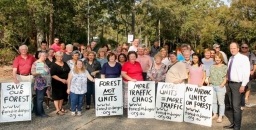
The Mirvac development of the old IBM site next to Cumberland State Forest in West Pennant Hills was fast-tracked by the NSW government in June. The project is now proceeding at full speed. STEP is a member of the Community Reference Committee that has been set up by Mirvac. We are able to receive the details on the evolution of the project.
The DA for demolition was submitted to the Hills Council in December. This confirms that over 1,200 trees will be removed to make way for the residential development site including Blue Gum and STIF vegetation. This is the tree destruction that led to the huge level of opposition from the local community.
The next stage is the submission of the Concept Masterplan DA for the apartment and house developments. The original plan was for 600 dwellings, 400 apartments and 200 houses. This has been reduced to 450, 280 apartments and 170 houses in response to the Department of Planning requirements for Asset Protection Zones and protection of sensitive vegetation. This may change when the DA is submitted.
The number of apartment blocks has been reduced from nine in the original plan to alternative options with seven or four larger blocks. There is the possibility of some sections being up to nine stories. This exceeds the usual height limits. The argument is that the sight lines to the forest will be improved. We await the detailed DA for more information.
The forest area to be dedicated to the management of NSW Forestry as part of Cumberland State Forest has been increased to 10 ha. Mirvac will contribute some of the management costs. This will not occur until the DA has been approved and the subdivision process completed. It is still not known what will happen to other E2 (conservation) zoned areas.
Government Response to Samuel Review of the EPBC Act is Pathetic
The final report on the review of the federal Environment Protection and Biodiversity Conservation (EPBC) Act headed by Prof Graeme Samuel was released by the Environment Minister, Sussan Ley, in January, 3 months late. The report gives a scathing assessment of the implementation of the current Act. It ‘is not fit for current and future environmental challenges’. Sadly, but not unexpectedly, the government’s response does not provide promise that decisive reform will happen.
The main recommendations are for:
- strong, outcome focussed national environmental standards to guide decision making
- independent oversight by an Environment Assurance Commissioner and audit by an Office of Compliance and Enforcement to build confidence that the Act and the national environmental standards are working
- a mandated, rigorous compliance and enforcement regime to ensure compliance and enforcement of environmental approval conditions
- outcomes-focused law, which will require the capacity to effectively monitor and report on environmental outcomes
- adequate funding for species recovery and an environmental database such as mapping of habitat for threatened species to underpin decision making
- harnessing the knowledge of Indigenous Australians to better inform how the environment is managed
- recognition that environmental protection under Regional Forestry Agreements is insufficient and the need for immediate reform and Commonwealth oversight – a critical element to the ending of logging in the habitat of endangered species like the Swift Parrot
One controversial recommendation is to hand over approval powers to the states but subject to observance of agreed environmental standards. This proposal was included in the interim report released in August.
In response, the government rammed through legislation to implement this proposal. Attempts by independents, such as Zali Steggall, to make amendments for the crucial new standards were ignored. It is now up to the Senate to improve the situation.
Setting standards
The centrepiece of Samuel’s report is the proposed new national environmental standards. These would provide clear grounds for drawing a line in the sand on environmental damage. Any new developments would need to be in places where environmental damage is avoided from the outset, with offsets only available if they’re ecologically feasible and effective. One of the many failings of Australia’s environmental laws is there has never been a point beyond which no further impacts are acceptable. This requires consideration of cumulative impacts in a regional context.
The proposed standards say there should be ‘no net loss’ of vulnerable or endangered species habitat, and ‘no detrimental change’ to listed critical habitat of a species or ecological community. But the data has not been updated for 15 years so who knows what the correct baseline should be.
The proposed standards were leaked on 12 February. According to the Sydney Morning Herald they are no different to the existing clauses in the EPBC Act and obviously don’t meet the recommendations of an independent review. For example:
- demands for ‘best available’ information becomes a requirement only for ‘adequate’ assessments
- the need to address detrimental cumulative impact is missing
- plans that ‘must be prepared and implemented to monitor and evaluate outcomes of actions’ is also absent
We hope that the states refuse to accept these standards. Matt Kean has already stated he wants the strongest environmental standards enforced with a strong environmental watchdog.
Accountability
The federal environment minister can make decisions with little requirement to publicly justify them. They must be open to public and robust scrutiny and explain how their decisions might affect environments and species.
Species recovery actions
The review report explained the initiatives that are needed and why. Basically, the evidence shows our biodiversity is in dire straits and lip service is being paid to calls for action. Australia has more than 1,900 listed threatened species and ecological communities, and most don’t even have active recovery plans. Ecologists will need to collect, analyse and interpret new, up-to-date data to make biodiversity conservation laws operational for most threatened species.
A report in the journal Conservation Letters in November 2019 found that annual spending on targeted threatened species recovery is around $122 million which is around 15% of what is needed to avoid extinctions and recover threatened species.
Regional forestry agreements
Many reports have been written about the shortcomings of the Regional Forest Agreements. Currently they do not ensure protection of threatened species and their habitats. Any reforms will be hard fought by the forestry industries and locally affected communities.
Prof Samuel noted that:
… governments should avoid the temptation to cherry pick from a highly interconnected suite of recommendations.
But this is exactly what the Morrison government is doing.
Dendrobium Mine Expansion Refused by the IPC
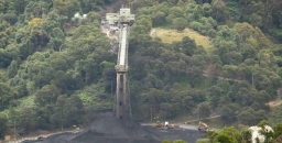
There has been much relief that the Independent Planning Commission (IPC) has ruled against the expansion of the Dendrobium Mine near Wollongong. The mine is under the Sydney water supply catchment metropolitan Special Areas where longwall mining has already caused subsidence in the surface above with significant environmental damage.
The extension would have allowed the proponent, South32, to extract an additional 78 million tonnes of coking coal from two new areas near the Avon and Cordeaux Dams during the period 2024 to 2048. The mining would have comprised 21 ‘long wall’ panels, 18 of which would have been more than 300 m wide. Most of that coal would be used in steelmaking here and overseas.
In summary the IPC’s ruling is that the proposed longwall mine design introduces uncertainty regarding the extent of environmental impacts in the Metropolitan Special Area and the Applicant’s ability to adequately manage those impacts and ensure their statutory purpose is achieved; that is providing a supply of clean drinking water.
Some more detailed reasons for the decision were:
- the risk of significant subsidence that would degrade 25 watercourses and swamps and lead to the potential instability and fracturing of up to 40 cliffs located above the proposed longwalls
- the cracking of the surface could lead to significant surface water losses into the groundwater system with detrimental impacts to threatened ecological communities such as upland swamps, and Aboriginal cultural artefacts and values
- the fracturing of rocks could contribute to increased concentrations of metals in water flowing into the dams that are part of Sydney’ water supply
- the impact of past and existing longwall mining in the catchment is estimated at 3billion litres per annum – the extension is likely to increase this loss
- uncertainty around managing mine water inflow (surface waters permanently diverted underground) after mine closure
The level of risk posed by the project has not been properly quantified and, based on the potential for long-term and irreversible impacts particularly on the integrity of a vital drinking water source for the Macarthur and Illawarra regions, the Wollondilly Shire and Metropolitan Sydney – it is not in the public interest.
The IPC noted the applicant has offered mitigation measures for remediation of selected key stream features, financial offsets for water losses and water quality impacts and an upland swamp offset site; however, a number of these measures have not been considered acceptable by the responsible statutory agencies. How can it be possible to quantify the cost of irreversible and continuing loss of water or the value of a threatened upland swamp that cannot be replaced? How much more desalinisation capability would be required?
The Planning Department had recommended approval but as usual, they did not take into account cumulative impacts when added to the impact of the existing mines.
The Deputy Premier John Barilaro condemned the decision claiming a massive loss of jobs and investment uncertainty. One of the IPC’s considerations was that the bulk of this coal is primarily destined for other markets beyond the Illawarra Region, so we can’t take Barilaro’s scaremongering seriously.
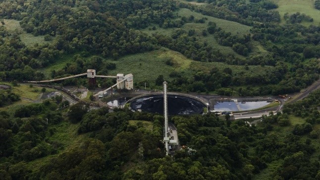
Northern Beaches Tunnel: Is there a better way?

The NSW government is ploughing ahead with plans to build the Northern Beaches tunnel link at great expense estimated at $14 billion. The massive EIS was released in December, just in time for Christmas. Submissions close 1 March. Click below:
The Beaches Link and Gore Hill Freeway Connection project, its full title, comprises a new motorway tunnel connection across Middle Harbour from the Warringah Freeway and Gore Hill Freeway to the Burnt Bridge Creek Deviation at Balgowlah and Wakehurst Parkway at Killarney Heights. The total tunnel length will be 5.6 km.
The crossing of Middle Harbour between Northbridge and Seaforth would involve three lane, twin immersed tube tunnels. The project also includes a surface upgrade of Wakehurst Parkway from Seaforth to Frenchs Forest and upgrade and integration works to connect to the Gore Hill Freeway and Reserve Road at Artarmon (see map at the bottom of the page).
The project will have major impacts on reserves and golf courses that will be used as construction and tunnel dive sites. Filtration vents will be close to schools. Then there will be all the traffic disruption over more than 5 years as the links are constructed and the tunnel waste is removed.
We have changed our ways of living and working in response to the COVID pandemic. As is happening all over Sydney, population increases are planned for the Northern Beaches but how many of these new residents want to commute to the city? Will they work within the northern beaches peninsula or want to travel west via Mona Vale Road?
The increased traffic along the proposed road will spill out near the Northern Beaches Hospital. Then what? Increases in congestion along Warringah and Pittwater Roads no doubt. The project will only encourage more road use as well as many longer term consequences.
There will be increased traffic along Wakehurst Parkway because it will lead directly into the new tunnel. But that road floods frequently. Will there be pressure to extend the widening of the Parkway? Yet this road goes through more high quality bushland.
So do we need to rethink this massive road project? Tolls will have to be increased to help pay for all this. Are there better alternatives? What about boosting public transport instead!
The Willoughby Environment Protection Association has discussed in detail whether public transport options have been given adequate consideration.
Another group, called Viable Transport Solutions has lots of information on their website.
Environmental impacts
Once again bushland is deemed to be expendable. The Wakehurst Parkway from Seaforth to the Northern Beaches Hospital would be widened to two lanes each way with most of the bushland clearing occurring on the Manly Dam catchment side. Garigal National Park on the west side will also be affected, especially during construction. Could there be a viable alternative of extending the tunnels to reduce the damage to the bushland?
The current proposal entails the clearing of 15.44 hectares of native vegetation, much of which is threatened species habitat, adjoining Manly Warringah War Memorial Park that protects the waters of Manly Dam. This includes about 2,000 mature trees.
1.38 hectares is consistent with the Duffys Forest Ecological Community in the Sydney Basin Bioregion (listed as endangered under the Biodiversity Conservation Act). A large area of Duffys Forest was also removed for the road widening around the Northern Beaches Hospital. More cumulative impact being ignored!
Overhead ladders and some tunnels will be built to provide wildlife corridors across the Wakehurst Parkway. Funding will be needed to observe their effectiveness.
The EIS says biodiversity offsets for native vegetation would be provided for the project. Of course they can never make up for what will be lost. Where can suitable offsets come from? They can’t be in national parks.
The list of other negative environmental impacts is long; for example, pollution entering water courses and groundwater that will affect water quality in Manly Dam, Aboriginal heritage along the Engraving Track, air pollution from traffic and tunnel emissions.
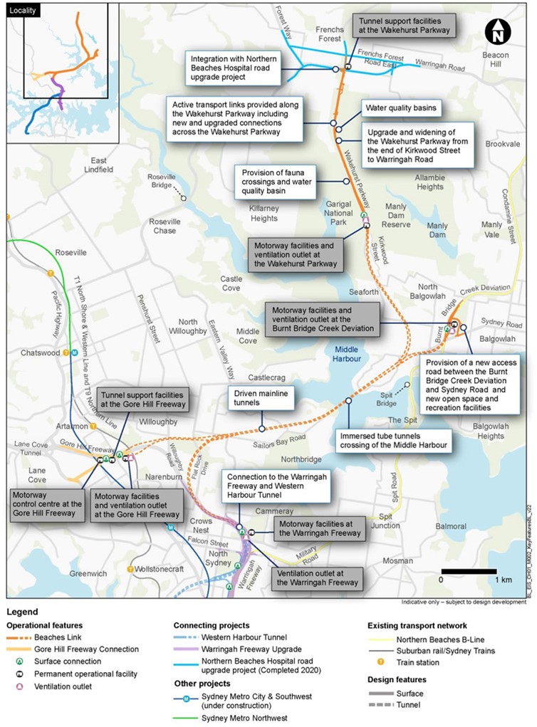
More Bad News About the Snowy Hydro Project
We previously wrote about the damage the Snowy Hydro 2.0 project will cause to the sensitive environment of the Snowy Mountains National Park. The EIS in relation to another aspect of the project has been released covering the transmission of power to the electricity grid.
Snowy Hydro has chosen the cheapest and most environmentally destructive option by proposing overhead transmission lines. The impacts of overhead transmission will include:
- permanent disturbance to wildlife habitat by clearing 100 ha (8 km of clearing up to 200 m wide) of national park under the path of the powerlines
- ongoing cost and disturbance when the land clearing has to be renewed
- loss of native fauna including threatened species such as the Yellow-bellied Glider, Eastern Pygmy-possum, Squirrel Glider, Gang-gang Cockatoo, Powerful Owl, Masked Owl and Booroolong Frog
- land disturbance including erosion and weed infestation
- the lines will be visible over a vast area, totally destroying the ambience and habitat integrity of this remote and largely pristine region
These are irreplaceable ecosystems in the middle of Kosciuszko National Park, they will not recover, and they cannot be offset, these are natural areas set aside for conservation and future generations, not for development.
These powerlines should be put underground.
Click here for more details from the National Parks Association about why Snowy 2.0 doesn’t stack up.
Please write to the Environment Minister Matt Kean and Planning Minister Rob Stokes to express your views.
Photomontage at top of page by Transgrid, Lobs Hole, Kosciuszko National Park
The Linnean Society's Symposium

 The Linnean Society of NSW was established in 1874 and is one of Australia’ oldest scientific societies. Their objective is to promote 'the cultivation and study of the science of natural history in all its branches'. Associate membership costs $15 per year.
The topic for their next symposium is Natural History of the North East Sydney Basin. This covers the area bordered by the coastline, Sydney Harbour, the Hunter Valley and the westerly national parks, Berowra and Marramarra. The focus will be on the geology, botany and zoology of the national parks and other reserves, inlets (e.g. Broken Bay), central coast lakes and sea cliff features.
Call for papers
Anyone conducting research into any aspects of the natural history of the North East Sydney Basin, be it formal studies or citizen science, is invited to present their results at the symposium. Aspects of planning and management related to environmental matters can also be covered.
Papers will be subject to the normal refereeing procedures of the Society and will be published in the Proceedings.
To indicate your interest contact Mike Augee (symposium secretary) This email address is being protected from spambots. You need JavaScript enabled to view it. or 89 Caves Road, Wellington NSW 2820.
Program
Wednesday 27 and Thursday 28 October
Symposium with scientific talks (both technical and popular) at Hornsby RSL.
Cost: $70/day ($100/day for non-members). After 31 August costs $10 more per day. Includes lunch and refreshments.
Friday 29 October
Full day field trip by bus, centred on Ku-ring-gai Chase National Park (visiting West Head, Elvina Track and Bobbin Head, Gibberagong boardwalk), finishing up with an inspection of the diatreme face exposed in the Hornsby Quarry redevelopment (subject to access being permitted). Experts in geology, botany and zoology will guide the excursion. Numbers are limited.
Cost: estimate is $50 ($60 for non-members). Includes lunch.
Saturday 30 October
Special additional optional excursion (at no cost) for registrants only, walking the Newcastle Coastal Geotrail and guided by staff from the Geological Survey of NSW who have created this widely acclaimed tour. Intending participants will provide their own transport and food for this excursion.
Michelle Leishman Awarded the Clarke Medal

The Clarke Medal is awarded each year for distinguished research in the natural sciences conducted in Australia and its territories. The fields of geology, botany and zoology are considered in rotation.
In 2020 it was the turn for botany and the award winner is Distinguished Professor Michelle Leishman. Michelle was STEP president during the periods 1997–99 and 2000–06.
Her studies at the Macquarie University’s School of Biological Sciences are currently directed towards greening urban spaces through the Which Plant Where program such as cooling school environments, studying plant responses and adaptation to climate change and understanding invasive plant pathogens. We congratulate her for the significant initiatives that respond to the need to adapt to the long-term outlook for the natural world

Annual Report for the Year to October 2020

Welcome to the annual report on the 42nd year of operation of STEP Inc. Believe it or not, 2020 has been a positive year for STEP. Our membership total has increased significantly and our publications have become very popular. I will explain the reasons for this later in this report.
Sadly, the past year, as we all know, has been very bad for the environment, especially bushland and wildlife. The long-term impacts of the catastrophic bushfires will only be revealed by detailed scientific research. The bleak situation with government policy at the federal level has not improved but at the local and state government level there has been mixed performance.
Activities
The restrictions on group activities imposed to control the spread of the COVID-19 virus have meant that we have not had any talks since March 2020.
AGM
It wasn’t COVID that curtailed participation at the 2019 Annual General Meeting on 12 November. Instead a small bushfire in South Turramurra on a catastrophic bushfire risk day ended up with a lockdown of the area in the late afternoon. Enough brave souls turned up to make a quorum so that the meeting could proceed.
Talks
Talks have been placed on hold since March. We managed to fit in one talk by Dr Ian Percival on Cliefden Caves, a spectacular fossil site in western NSW.
The speaker lined up for the AGM was to speak in April. Professor Culum Brown was to give us some insights into the behaviours of sharks. We hope that talks can be resumed in 2021.
Walks
We ran walks (Two Creeks and the STEP Track) before cancelling our walks program in April. Walks resumed in July with local walks led by Peter Clarke in the areas of Blackbutt Creek, the Wildflower Garden and the Darri Track. John Martyn led a walk in Strickland Forest on the Central Coast in September showing a great diversity of trees and flowers.
We have limited numbers to about 15 to comply with the COVID-19 requirements. Requests for walks in particular areas, provided they are not too far from our local area, are welcome
Publications
We are currently offering free membership for a year to compensate for the lack of activities. Also, anyone who buys a book or map is offered a year’s free membership. There has been a good response to this offer.
As a result of these initiatives our membership is now over 500.
With many people working from home and many types of outdoor activity restricted, taking a break by walking in the bush has become very popular. Sales of our maps have boomed. The South Turramurra Post Office that is close to Lane Cove National Park, has become a successful outlet for map sales.
Committee
The STEP committee has, as always, been a great group of people to work with. We owe a huge thank you for all their efforts. Other individuals have been a great help in specialist areas of our operations.
In particular Helen Wortham has come up with some great ideas that have increased her workload significantly but have led to great boost to our membership and publication sales. There has been a lot of work required by Robin Buchanan and Margery Street in keeping up-to-date and writing submissions on government policies and actions. John Martyn continues to lead walks and add his expertise to all aspects of our work including beautiful photos on Facebook. Peter Clarke continues to be an inspiring walk leader as well as taking on some of the work in putting the newsletter up on the website. Anita Andrew and Jim Wells have kept track of our finances. John Burke and Trish Lynch continue to keep Twitter and Facebook up to date and find lots of interesting items to add on a regular basis.
Accounts
Thanks to the increase in publication sales our net cash balance increased by $4,400 over the year. The Environment Protection Fund balance has reduced as the funds are being applied to the John Martyn Research grant.
Again we thank Allan Donald, Chartered Accountant for his completion of the audit on a pro bono basis.
Newsletter
We are continuing to publish five issues of the newsletter, STEP Matters, each year with most members receiving a pdf version via email. Links to individual topics are also included in the email and are on our website so anyone can pick out particular articles of interest. These articles also have links to previous articles on related topics.
While the newsletter concentrates on local issues and events we also cover broader national environmental issues that affect us all. We aim to be educational but not too technical. I hope they are of interest, but feedback is welcome. Also, contributions from members about local events and developments can be published in the newsletter or on Facebook.
Environment Protection Fund
We continue to maintain the Environment Protection Fund which has Deductible Gift Recipient status so that donations are tax deductible. The Fund’s purpose is to support our environmental objectives. We received a total of $440 in donations in the past financial year.
Due to the uncertainties about restrictions on research processes during the COVID-19 we received a smaller number of applications for the John Martyn Research Grant for 2020. This grant supports student research in an area relating to the conservation of bushland. The award this year went to a University of NSW student who is studying the effects of fire seasonality on seed ecology focussing on the Gymea lily.
Education
STEP is still donating a prize in the Young Scientist Awards run by the NSW Science Teachers Association. We have not done the judging for 2020 yet as the students have been given more time to complete their projects.
Advocacy
The major concern for 2020 has been the NSW government’s decision to fast track construction projects, overriding the normal review and consultation process. It is very disappointing that the Mirvac development of the IBM site that contains critically endangered forest and Powerful Owl habitat is proceeding despite huge community opposition and Council refusal. We will keeping a close eye on the details of the development.
Other local areas of focus have been the rehabilitation of Hornsby Quarry, synthetic turf on playing fields and the perennial problem of illegal mountain bike track construction.
There are several common issues that affect all areas of urban bushland. We are currently working with other groups to compile a database of research on these impacts such as bird strike on high rise glass walls, use of synthetic turf and light pollution. This should speed up the process of preparing submissions.
Conclusion
A community group like STEP works best with many lines of communication. We enjoy a good relationship with other community groups and local council staff. Information sharing is an important part of our work. To that end we appreciate feedback from our members and reports on local issues that we may not be aware of. It is becoming harder to keep track of local developments as the local newspapers have shrunk considerably. Contributions on articles for our newsletter are also welcome – please let us know about events and talks.
Jill Green, President
State Government News

The Nature Conservation Council held their annual conference on 31 October via Zoom. There were speeches by Matt Kean, the Environment Minister, Cate Faehrmann from the Greens and Kate Washington, Shadow Minister for the Environment.
The good news is the NSW government’s policy of aiming for net zero greenhouse gas emissions by 2050 and support for renewable energy projects in spite of the federal government’s refusal to make any commitment.
Matt Kean also announced that the goal set last year of declaring 200,000 ha of new national park land had been exceeded. He went on to announce the goal will be extended to adding a total of 400,000 ha by the end of 2024. The Narriearra Caryapundy Swamp National Park, the largest area, in the far north west of the state has now been formally gazetted. Additions have been made to several other national parks such as Capertee (Regent Honeyeater habitat) and Travelling Stock reserves that have already been managed by NPWS.
The speeches demonstrated the obfuscation about koala protection that has been apparent in the Coalition for many months. Matt Kean has announced he wants the koala population to double by 2050 but so much habitat has been destroyed in the bushfires. Any plan is confounded by forest logging and land clearing decisions by other members of the Coalition. The recent Upper House enquiry found that koalas are at risk of functional extinction by 2050.
Loss of Koala Habitat and Land Clearing
- Cumberland Plain Conservation Plan has recently been subject to consultation. It covers over 15,000 ha in south-western Sydney that is currently rural land but is earmarked for development to allow for population expansion. It aims to provide long-term certainty about areas that will be conserved to avoid piecemeal zoning decisions.
If it goes ahead only about one-third of the area of native vegetation will be conserved. The plan allows for the loss of a further 1,014 ha of critically endangered Cumberland Plain Woodland to development. There are only 6,400 ha left. The rest will be marked as ‘urban capable’. Large areas that are Sydney’s food bowl could go under concrete as well as more koala habitat.
In this area koala habitat will be protected in the new Georges River National Park but koala conservation groups are very concerned that habitat will be fragmented and essential corridors will be lost or cut off by roads. Of particular concern is the future of the chlamydia free population near Campbelltown.
- Lend Lease is developing the Gilead Estate, land that is core koala habitat in Appin between the Nepean and Georges Rivers. The Chief Scientist has recommended that habitat corridors be maintained but some of the preservation requirement would encroach on this land. It has been left to Lend Lease to do the right thing!
- One of the fast-tracking decisions made by the government is for another housing development (280 lots) by Walker Corporation at Appin that is next to 60 ha of critical koala habitat. This development has been knocked back by the local council several times.Then we have the approval by the federal Environment Minister for the Brandy Hill Quarry extension near Port Stephens – 52 ha lost.
- In rural areas, in particular the north of the state, a Local Land Services Amendment (Miscellaneous) Bill proposes changes to the regulatory framework applicable to native vegetation and private forestry. The EDO believes that the changes proposed by the bill will remove important protections for koala habitat and will further facilitate excessive and inappropriate land clearing. The Total Environment Centre has dubbed this the Koala Destruction Bill.
- Then there is the modification made to the Koala SEPP after the threats from the Nationals to leave the Coalition. Councils with koala populations can choose to develop a strategy to manage koalas in their area. But the SEPP does not actually stop koala habitat from being bulldozed if the development is approved by council.
- Last, but not least, is the latest government proposal to amend the Rural Fires Act that will lead to more land clearing. Property owners will be free to clear all their land that is within 25 m of fencing. The landowner on the other side of the fence can be required to do the same. This includes public landowners such as national parks. This was not a recommendation of the bushfire enquiry. It is hard to see the reason for this proposal. It will be introduced by regulation. Is it aimed at reducing the cost of replacing fencing after a fire? In this case it is not a fire protection measure at all. The detail has not been released.
It will lead to broad-scale clearing of endangered forest and habitat for grazing and other purposes unrelated to hazard. In metropolitan rural areas where blocks are small this regulation could allow the total block to be cleared, a lovely invitation for developers to move in.
What we need is a Great Koala National Park to be formed out of key state forests in the north. Some of these forests are being logged but this has to stop if a resilient population of koalas is to survive.
Synthetic Turf Battles to Continue

Ku-ring-gai Council is currently developing plans for conversion of two existing sporting fields to synthetic turf. Both could have impacts on critically endangered ecological communities and, potentially, neighbouring national parks.
The community has only seen aerial diagrams of concept plans and detailed plans are still to be completed so there is no information about tree removal, earthworks drainage systems, etc.
Naturally the sporting groups are all in favour. In both cases the local MPs are promoting the projects and large grants are coming from government sources.
In both cases Council has resolved to proceed with the detailed plans. They are going through the approval process based on Part V of the EPAA Act which means the infrastructure can be built without consent, which means that Council does its own assessment. However, before a project can proceed Council has to prepare a detailed environmental assessment, a review of environmental factors (REF).
The REF examines the significance of likely environmental impacts of a proposal and the measures required to mitigate any adverse impacts. The preliminary reviews completed in both cases conclude that there will be no impacts serious enough to stop the project proceeding.
Norman Griffiths Oval
Following the decision not to proceed with the plan for artificial turf on Mimosa Oval (see STEP Matters, Issue 204) attention has returned to Norman Griffiths Oval. The original proposal for artificial turf on this oval was knocked back because of the high cost of stormwater management. The oval currently acts as a detention basin for water coming from the upper reaches of Quarry Creek and higher parts of Bicentennial Park.
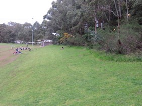
Bank above Norman Griffiths Oval
The cost of installing the turf is currently $1.4m, $500,000 of which has come from the state government with the remainder from Council ($511,000) and various sporting organisations. The extra cost of the recommended stormwater detention system is estimated at $1.25m to be funded from money previously allocated for the indoor sports centre on the old nursery site near the St Ives Wildflower Garden that has been abandoned.
STEP’s main concerns about the project that may be addressed in the detailed design are:
- Disturbance to the moisture levels of the bank above the oval where some 30 native plants including 7 orchids have been found, with some uncommon species.
- The grassed area above the oval should be retained as this is frequently used as a source of food by birds.
- The concept plan shows that parts of the surrounding Sydney Turpentine Ironbark Forest vegetation will be removed to provide pedestrian pathways. These should be changed.
- The flood reports show that there will still be overflows from detention system in a severe storm and additional measures may be needed to prevent erosion and ensure ecosystem health along Quarry Creek.
- There could be pollutants in the runoff from the synthetic surface depending on the materials chosen.
Council, bushcare groups and NPWS have invested considerable effort into the health and regeneration of the Quarry Creek area over the last 20 years. The creek water quality has been significantly improved and there has been incredible regeneration of the surrounding bushlands. We don’t want to see this work being jeopardised.
Council has commissioned a separate flood risk report that covers areas below the oval. Bicentennial Park covers a large area that is the catchment for Quarry Creek that flows down under Yanko Road and into Lane Cove National Park. In a one in 50 year storm event Yanko Road could be flooded. Mitigation measures will be expensive but are a separate consideration.
Barra Brui Sportsground
Barra Brui is surrounded by endangered ecological communities, Sydney Turpentine Ironbark Forest and Duffy’s Forest on three sides and, on the eastern side, Garigal National Park is below the site with the land falling away steeply. A creek flows on the northern side of the ground and down into the valley.
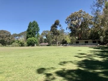
Barra Brui Oval with magnificent Angophora in flower
This ground has been considered for conversion to synthetic hockey field since 2018. In this case the field will be a wet field. The ground is sprayed with water to control the ball speed and reduce the surface temperature. Therefore tanks are needed to store the water as well as gutters to control the flow of water.
The ground is currently used for cricket and soccer as well as being the local community play area and off-leash dog park. It is not clear whether cricket and soccer matches would continue to be possible. The clubhouse and parking would also be improved. The aim is to have 100 car parking spaces.
The cost is substantial, a total estimate of $4.1m: $2.25m from the Greater Sydney Sports Facility Fund, $500,000 further government funding, $250,000 from the Northern Sydney and Beaches Hockey Association and $1.1m from Council.
At the meeting on 30 June Council decided to engage in preliminary design/scope studies to inform detailed costings and the feasibility of project design options.
In this case the concerns that require more information are:
- Floodlighting is to be improved so the spill of light into the surrounding bushland may be reduced but the field may be used more often.
- How the forest will be affected including 11 important trees that the arborist report states ‘with a high potential to contribute to amenity so any adverse impacts on them should be minimised’.
- The impact of the bushfire Asset Protection Zone on the surrounding endangered ecological communities.
- Water management details are not available including controls of pollutants and stormwater and impacts on the riparian zone next to the field.
- Will the field be a bushfire hazard? There will be plenty of water supply but will there be controls to turn on the water in the case of a fire?
- Clearing required to create the necessary car parking space.
How Western USA Forests Respond to Fire
Now our bushfire season has officially started it’s interesting to look at the devastating fires in the western US: still burning, their season apparently with some weeks to go! I got interested through visits to relatives in California and British Columbia, including in the latter case in 2014 when BC had many interior blazes and Vancouver was smoke-hazy, however this article is tempered by my frustrating lack of first-hand knowledge and draws heavily on on-line info.
Although North America's fire-prone latitudes are roughly a mirror image of our own, their fire weather patterns differ in some respects, in California’s case being driven by the late summer–autumn ‘Santa Ana’ winds, essentially high pressure driven easterlies – very strong and very dry, accelerating down from the interior mountain ranges. You may have seen the satellite images of smoke plumes hundreds of kilometres long streaming westwards over the Pacific. Like here, their blazes may be started by lightning, clashing power lines and careless or criminal acts though I haven’t chased up statistics. Quite terrifying dry lightning storms have been a feature of some of the recent outbreaks.
Fires, plant communities and vegetation
What are the vegetation characteristics of the often mountainous western terranes and how do they resemble or differ from ours in surviving, adapting and recovering from fire? Well there’s an abundance of information available on-line with a lot of names and terms new to me, and it’s crazy to go for too much detail, but let’s look at examples of the main plants, communities and their fire issues.
Chapparal is the summer-dry shrubland and heathland interspersed with grassland in southern California and Mexico that most resembles Mediterranean-type plant communities in Australia. Like shrublands of south-west WA and the fynbos of South Africa it is regarded as a biodiversity hotspot. It is fire prone and its low structure provides little resistance to winds like Santa Ana, therefore fire can engulf it extremely swiftly. But not surprisingly, its tough shrubs like Manzanita sprout and regenerate from woody rootstocks – some pictures on the web of green sprouts rising from nests or corrals of burnt sticks are remarkably familiar. Also many seeds of its common species are fire dependant. And like Australia, seeds of plants like Californian fire poppy germinate to create prolific post-fire wildflower displays.
Coniferous forests with many different tree species have gone up in smoke and I was interested to read what their powers of resistance and recovery might be. Do they resprout or merely re-seed?
Ponderosa pine, Pinus ponderosa is the most widely distributed pine species in North America and a dominant and key one in western forests. It has a distinctive, thick, reddish brown, platy ‘jigsaw puzzle’ bark and been has recorded up to more than 80 m tall. The bark is reasonably fire resistant but its issues with fire have many other interesting aspects. Park-like old growth forests of tall, widely-spaced trees familiar to early settlers and Native Americans, and governed by natural fire regimes and native burning, have been gradually replaced by massive regrowth of multiple, closely-spaced young trees, creating tinder box conditions in hot, dry, windy weather. Abundant saplings can cause a ladder fuel effect with ground fires flaming up and consuming canopies, and thereafter whole forests. The ponderosa fire issue is complex but well researched and if interested I encourage you to read this article.
We are familiar with seed cones that release seeds by fire, but several other species of conifer have this characteristic, where cones are tightly bound and seeds protected by resin only to burst open and release their seeds. Lodgepole pine is one such species and is notably quick to germinate after fire (see Fig 1).
You’ll be aware of Californian redwoods Sequoia sempervirens especially if you’ve visited memorable Muir Wood near San Francisco or any of the reserves of these giant trees growing within a 750 km long near-coastal zone. Yes, they can and do burn but are quite fire resistant having tough, thick bark and very high crown bases, and they also resprout epicormically quite readily. Often their forests have open floors and this is encouraged in a general movement towards hazard reduction burning of understory where possible. (The Redwood Trees will be Just Fine)
Fig 1. Lodgepole pine post-fire regrowth in Montana, courtesy of Yale School of the Environment website
Some more notes and thoughts
Bark beetle infestations
If you look at some of the pictures of infested dying coniferous forests you’ll be stunned and saddened – whole forests wiped out by one or more of the 600 or so species of bark beetle that burrow into the cambium and interrupt the water and nutrient flow. Such dead and dying forests are obviously particularly fire prone.
Snags
This is a common North American term for standing dead trees, from a variety of causes like fire, lightning, beetle attack, disease or old age. But there is a positive note as they are regarded as key wildlife habitats providing homes, nesting sites and food for wildlife. There are whole forests of snags from recent fires, but there are stories and instances of birds such as woodpeckers going in and feasting on dead and dying grubs and beetles, and the dead and broken trees provide many hollows and nesting sites.
Resprouting
Trees can recover by sprouting from lignotubers. But we are familiar with the abundant fuzzy post-fire epicormic regrowth on eucalypts and many other Australian species, and apart from redwoods I didn’t come up with clear examples from the mountain forests of the US west. But let’s not forget that not all eucalypts do this as a matter of course.
Fig 2 was taken in Thredbo Valley in 2010 and shows a dead forest of alpine ash, Eucalyptus delegatensis, floored by a dark green mini-forest of saplings from the seed bed. Many western US forests pictured on the web show a strongly similar recovery pattern (see Fig 1). However, others may be laid open to invasive species or gradual conversion to shrubland or grassland.
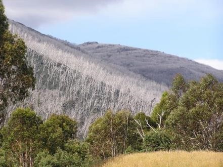
Fig 2. Alpine Ash forest post-fire at Thredbo
Future issues
Donald Trump famously said that poor forest management not climate change had caused the current Californian and Oregon fires. The statement was made in the wrong context from a highly biased viewpoint but surprisingly there’s an element of truth lurking in it. It’s generally regarded that the loss over one and a half centuries of widely spaced, park-like old growth forest and its replacement with dense regrowth has intensified the fire risk, and that human influence is a prime cause. There seems to be a general move favouring closer fire management and hazard reduction burning of ground vegetation and understory that mirrors our own challenging situation, but I’m drifting out of my depth here and I’ll finish on that note. Finally, this link is a good concise read.
Further reading: Struzik, E., 2017, Firestorm. How Wildfire Will Shape Our Future. Island Press
John Martyn has been pondering for some time how forests in the western US resist, react and recover from fire. Do epicormic growth and root sprouting play a role or is it mainly seed based? He decided to do some research and here are his preliminary findings.
Cut to University Funding for Environmental Science – What Consequences for our Future?

It seems good that the cost to students of environmental degrees has been cut but the direct government funding has been cut too. Student costs to take effect from 2021 have been cut from $9,698 to $7,700 per year but the total university income per student will be $24,200 compared to $34,144, a cut of 29%.
Environmental work involves the use of technology (drones, satellites, DNA analysis) as well as field work, all very expensive to provide. No doubt the universities will have to cut the quality of the experience they can provide to students and/or the number of places available. It might be cheaper for students to study, but how ‘job-ready’ will they be? Will the mantra of the government’s university fee changes be achieved that workers will be encouraged into STEM fields?
Australia’s response to climate change already being experienced and planning for the future requires the use of environmental expertise. Even the COVID-19 pandemic has been linked to an increase in human–wildlife interaction following land clearing. New diseases are emerging all the time that have a debilitating effect of people’s health, eg Lyme disease and Ross River virus.
Once again, this government has demonstrated their short-sighted approach to managing our most important asset, a healthy environment.
Why we Should not Fear the Aging Population
Sustainable Population Australia (SPA) is an independent not-for-profit organisation. They work on many fronts to encourage informed public debate about how Australia and the world can achieve an ecologically sustainable population.
SPA has recently published a discussion paper titled Silver tsunami or silver lining? Why we should not fear an ageing population by Dr Jane O’Sullivan who is Honorary Senior Research Fellow at the University of Queensland School of Science.
The paper dispels the myths about the need to have high population growth in order to maintain Australia’s economic wellbeing. Fears are often expressed by politicians and economists that an ageing population will make health and aged-care costs unaffordable and we will not have enough workers and tax-payers. The main points from the paper are summarised below. Please read the paper to see the comprehensive discussion of these issues.
Ageing is inevitable but will reach a stable point in the future
Like all developed countries we have been going through a demographic transition since early in the 20th century. In those days high birth rates were countered by high mortality including at infant ages. Since the increase in life expectancy arising from the development of antibiotics, vaccines and medical technologies, births have been exceeding deaths even though family sizes are now smaller. Now the average age has risen and will continue to rise in line with the increased longevity. This demographic ageing represents the final stage of the inevitable demographic transition that will lead to a stabilisation in the total population numbers and age distribution unless a high level of immigration is added.
The discussion paper includes projections comparing the proportions of the population in the working age bracket as usually chosen by statisticians (age 15 to 64) and those aged 65 and over, now and into the future and then adds the effect of immigration to project the age composition at the stabilisation point. They show that the proportion of people aged 65 and over is likely to be in the range of 30 to 35% but will never outnumber the working age population. Currently Australia’s population aged 65 and over is 16% compared 65% in the age 15 to 64 bracket.
Boosting population growth does not solve ageing, but is ageing a problem anyway?
Immigration, by bringing in more ‘working age’ people, will delay the stabilisation process. The paper goes on to look at the effects of a range of growth levels (natural increase plus net immigration) that are summarised in the table below (copied from the discussion paper). Growth is defined as a percentage of the then current population. For example, recent growth of 1.6% equates to the need to provide housing and services for an extra 400,000 pa. When population grows to 40 million, which could happen by 2050 if growth returns to recent levels, there would be an extra 640,000 people to accommodate.
Fig 3C shows the costs of provision of population based necessities such as health, aged care, education and infrastructure, as a proportion of GDP. This data is the essential part of the paper’s arguments that growth comes with a significant cost.
The cost of population growth exceeds the cost of ageing
As Fig 3C shows, immigration is expensive. The cost of extra infrastructure to support population growth outweighs the small extent to which that population growth could lessen relative pension, health-care and aged-care costs. A figure of $100,000 is quoted as the infrastructure costs of each new resident. Most of this infrastructure cost falls to state and local governments, and private individuals, rather than the federal government. The national interest should not be narrowly defined as achieving a balanced federal budget while the states are having to increase their revenue raising to provide new infrastructure.
The paper concludes that high levels of immigration can slow, but not prevent, population ageing. But the cost of extra infrastructure and education to sustain population growth is greater than the avoided costs of pensions, health care and aged care.
Will we run out of workers and taxpayers to support the non-workers?
One of the main arguments for increased population is the dependency drag on the economy. This ‘dependency ratio’ assumes that those over-65 depend economically on people aged 15-64, and that there will not be enough people of ‘working age’ to perform all the required work.
The paper presents the argument that there is no evidence that boosting the working-age population has increased employment per capita. Instead, Australia’s labour market has been oversupplied, with high immigration contributing to youth underemployment, wage stagnation and rising inequality through increased housing costs.
Many European countries with slow population growth have higher productivity growth and youth unemployment than Australia.
With the same demand for workers but fewer working-age people competing for jobs, there is less unemployment and underemployment. Improved wages and conditions attract more people into the workforce. This is what economic theory expects the labour market to do. But the economic models which predict that ageing will constrain the workforce have ignored these feedbacks.
The paper found no credible evidence that ageing will constrain Australia’s workforce, productivity or GDP. Tax contributions per adult would increase due to higher wages and workforce participation. In contrast to the common claims of a fiscal burden, they anticipate a fiscal dividend.
Health and aged care costs
While aged care and health care will likely increase as a share of national spending, the rise will be much smaller than the rise in number of retirees because older cohorts are getting healthier and better services are extending their independence. The major increases in health costs have been due to new, improved and more services per person. Longevity has deferred, rather than extended, the period over which the elderly need more health care and aged care.
There is not enough room here to summarise the detailed discussion in the paper on issues such as taxation, retirement incomes and intergenerational equity and the myths trotted out by the growth lobby. This lobby, including the likes of demographer Liz Allen from ANU and the Scanlon Foundation are comprehensively debunked by this paper.
Conclusion – silver tsunami or silver lining?
Those with vested interests in population growth have overstated ageing concerns, to make high immigration seem essential. The resulting negative social and environmental impacts continue to accumulate for no net economic gain.
The paper concludes that an older, numerically stable or decreasing population offers many benefits for quality of life, environmental sustainability and economic stability. Depopulation dividends could make us richer, smarter, safer, fairer, greener, healthier and happier.
Fig 3. Elevated population growth rates don’t lessen fiscal costs
In Fig 3, the authors compare five projections that achieve approximately steady population growth rate and age composition. (While these projections are produced by varying immigration, raising birth rates would yield fairly similar results.)
Fig 3B shows that if our population grew at 2% per year (projection E), we could keep the proportions of children, 15-64 year-olds and over-65s roughly the same as we currently have (until we are too overpopulated to keep growing).
But, as Fig 3C shows, the cost of infrastructure and education to support this growth outweighs any benefit from lowering costs related to elderly citizens. On the other hand, if we had no population growth, or even a gentle decline, then there would be a higher proportion of older citizens, but the savings on infrastructure and education would pay for the increase in pensions, health care and old-age care.
New Research Shows Lyrebirds Move More Litter and Soil than any other Digging Animal

New research shows lyrebirds move more litter and soil than any other digging animal
When you think of lyrebirds, what comes to mind may be the sound of camera clicks, chainsaws and the songs of other birds. While the mimicry of lyrebirds is remarkable, it is not the only striking feature of this species.
In research just published, we document the extraordinary changes that lyrebirds make to the ground layer in forests in their role as an ecosystem engineer.
Ecosystem engineers change the environment in ways that impact on other species. Without lyrebirds, eastern Australia’s forests would be vastly different places.

What is an ecosystem engineer?
Ecosystem engineers exist in many environments. By disturbing the soil, they create new habitats or alter existing habitats, in ways that affect other organisms, such as plants and fungi.
A well-known example is the beaver, in North America, which uses logs and mud to dam a stream and create a deep pond. In doing so, it changes the aquatic habitat for many species, including frogs, herons, fish and aquatic plants. Other examples include bandicoots and bettongs.
The Superb Lyrebird acts as an ecosystem engineer by its displacement of leaf litter and soil when foraging for food. Lyrebirds use their powerful claws to rake the forest floor, exposing bare earth and mixing and burying litter, while seeking invertebrate prey such as worms, centipedes and spiders.
To study the role of the lyrebird as an engineer, we carried out a two-year experiment in Victoria’s Central Highlands, with three experimental treatments.
First, a fenced treatment, where lyrebirds were excluded from fenced square plots measuring 3m wide.
Second, an identical fenced plot but in which we simulated lyrebird foraging with a three-pronged hand rake (about the width of a lyrebird’s foot). This mimicked soil disturbance by lyrebirds but without the birds eating the invertebrates that lived there.
The third treatment was an unfenced, open plot (of the same size) in which wild lyrebirds were free to forage as they pleased.
Over a two-year period, we tracked changes in the litter and soil, and measured the amount of soil displaced inside and outside of these plots.

Lyrebirds dig up a lot of dirt
On average, foraging by wild lyrebirds resulted in a staggering 155 tonnes per hectare of litter and soil displaced each year throughout these forests.
To the best of our knowledge, this is more than any other digging vertebrate, worldwide.
To put this in context, most digging vertebrates around the world, such as pocket gophers, moles, bandicoots and bettongs, displace between 10–20 tonnes of material per hectare, per year.
To picture what 155 tonnes of soil looks like, imagine the load carried by five medium-sized 30 tonne dump trucks – and this is just for one hectare!
But how much does an individual lyrebird displace? At one study location we estimated the density of the lyrebird population to be approximately one lyrebird for every 2.3 hectares of forest, thanks to the work of citizen scientists led by the Sherbrooke Lyrebird Study Group.
Based on this estimate, and to use our dump truck analogy, a single lyrebird will displace approximately 11 dump trucks of litter and soil in a single year.
Changes to the ground layer
After two years of lyrebird exclusion, leaf litter in the fenced plots was approximately three times deeper than in the unfenced plots. Soil compaction was also greater in the fenced plots.
Where lyrebirds foraged, the soil easily crumbled and the litter layer never fully recovered to a lyrebird-free state before foraging re-occurred.
This dynamic process of disturbance by lyrebirds has been going on for millennia, profoundly shaping these forests. For organisms such as centipedes, spiders and worms living in the litter and soil, the forest floor under the influence of lyrebirds may provide new opportunities that would not exist in their absence.
An ecosystem ravaged by fire
The Australian megafires of 2019/20 resulted in approximately 40% of the Superb Lyrebird’s entire distribution being incinerated, according to a preliminary analysis by BirdLife Australia.
So great was the extent of these fires that the conservation status of the lyrebird has been thrown into question. That the conservation status has fallen – from “common” to potentially being “threatened” – from a single event is deeply concerning.
Loss of lyrebird populations on this scale will have potentially far-reaching effects on forest ecology.
In the face of climate change and a heightened risk of severe wildfire, understanding the role that species such as the Superb Lyrebird play in ecosystems is more important than ever.
Without lyrebirds, eastern Australia’s forests would be vastly different places, with impacts extending well beyond the absence of their glorious song to other animals who rely on these “ecosystem engineers”.![]()
Alex Maisey, PhD Candidate, La Trobe University and Andrew Bennett, Professor of Ecology, La Trobe University
This article is republished from The Conversation under a Creative Commons license. Read the original article.
Book Review – Landscapes of our Hearts
I came across this book through a very positive review in the Weekend Australian. Its author is ecologist Matthew Colloff, Honorary Senior Lecturer at the Fenner School, ANU. Matthew grew up in rural Kent developing a strong allegiance to the natural world, something I immediately related to as it was close to my own experiences growing up in Middle England. He carried this affinity through his 23 years with CSIRO where he spend much time on the complex and highly politicised natural and man-made environments of the Murray Darling Basin. But the book extends far beyond that both geographically, ecologically and conceptually.
How do we as individuals relate to landscapes and nature and how did our early encounters and memories stay with us and colour our views of the natural world? Are there particular holidays, outings, travels and experiences, fishing in a quiet river, listening to the cicadas and sea sounds on a hot afternoon camped in a forest by the beach? Or how do we relate to the interwoven intricacies of bush, parks, suburbs and city? But what of First Nation people whose connection with the landscape stretches back for more than 50,000 years; their sacred and canoe bark trees that have survived in our parks: do we cut them down when they grow old and pose safety risks? And how do the farmers who now occupy their cleared former country cope with and live with the vagaries of drought, floods, bushfires, rising salinity and a warming world.
This book is wide ranging and thoughtful and full of stories and anecdotes, both historical and from his own experiences: like getting bogged alone, far from a main road in mallee country or releasing a captive turtle back into the wild that had been rescued from drought-shrunken pools. The writing style is fluid and readable and hard to put down, but most of all the book is thought provoking and makes you examine your own attitudes, and ponder the future for our country, our biodiversity and the survival of the landscapes that we love.
Matthew Colloff, 330 pages: Thames and Hudson: trade paperback RRP $35
Reviewed by John Martyn
More...
Hornsby Council’s Plan for Rehabilitation of The Quarry – New Documents Released

On 6 May the Sydney North Planning Panel conducted a hearing into Hornsby Council’s DA for the works of Hornsby Quarry. Some individuals and community groups made submissions explaining their serious concerns about some aspects of the proposed works.
The panel found that more information is needed and deferred the application so that the following detail can be completed and made public for further consultation:
- biodiversity offsets package, vegetation management plan (VMP) and habitat creation and enhancement plans
- rehabilitation works around the Powerful Owl breeding pair’s roosting tree
- information about extent of the volcanic diatreme rock face exposure when the filling and creation of the lake and wetland in front of the face have been completed
This information has now been published and further submissions could be made up to 21 August. Another panel hearing will be held in due course.
1. Biodiversity offsets package
The development involves the clearing of some areas and the replanting or restoration of other parts. The development assessment concluded that there will be a residual impact on biodiversity values that need to be offset.
Three options were considered. One option was to use offsets from another site. This is what we were most concerned about. The good news is that priority has been given to offsets that can occur around the quarry and surrounding bushland. This land will be managed as part of the VMP. In-perpetuity protection of the offset areas will be provided by a Voluntary Conservation Agreement which will comprise the offset area and additional lands managed under the VMP.
The Voluntary Conservation Agreement will be co-signed by Hornsby Council and the NSW Biodiversity Conservation Trust.
There is one concern that funding has not been specifically allocated for the VMP so its sufficiency is not certain.
STEP would like to have seen a VMP that is more progressive in recognising the resilience benefits of selecting plants from nearby areas outside Hornsby Shire with similar soils or more likely to cope with changing climate or could have been present before the quarry area was developed but have since disappeared.
2. Powerful Owl protection
A staging plan has been completed highlighting earthworks that will not be undertaken within the recommended Powerful Owl exclusion zones if a breeding pair are occupying a nest on site. Post works habitat creation and appropriate vegetation management practises are also stipulated in the VMP.
The Powerful Owl Coalition is concerned that the language in the documents is not strong enough. Words like ‘should’ are used when the particular actions are a ‘must’.
3. Recognition of the scientific value of the ‘Jurassic’ diatreme rock face
Ian Percival from the Geological Society of Australia toured the site with council officers. In a follow-up letter he explained that the society’s concerns have been addressed. The proposed level of the quarry floor in the redevelopment will be entirely comparable with the exposure more than four decades ago. The letter states:
It is apparent that council now recognises the geoheritage significance of its own ‘Jurassic Park’ (a reference to the known age of the diatreme) which is right in its backyard. As the centrepiece of the redevelopment of the old Hornsby Quarry it will no doubt be a remarkable tourist drawcard if properly protected, allowing public (and restricted research/educational) access with suitable interpretation.
Hornsby Twin Towers Development to Proceed Overlooking Hornsby Park

The Powerful Owl Coalition, of which STEP is a member, presented a submission to a Sydney North Planning Panel on 10 June on the proposed development of two high rise apartment buildings on Peats Ferry Road (the old Pacific Highway). The site overlooks Hornsby Park and is close to the Quarry site and Berowra Valley National Park.
As the buildings will be at the top of the ridge their effective height relative to the valley will be similar to the high rises of Chatswood or Parramatta.
The submission highlighted the risks to birdlife from the development, in particular:
- the risk of birds flying into reflective glass
- disturbance to nocturnal birds – a Powerful Owl breeding site is only 900 m away
- light pollution into Hornsby Park and Berowra Valley National Park – biological systems are arguably organised foremost by the daily and seasonal rhythm cycle of light and dark
- interruption to the movement of birds between catchments both north/south and east/west
Sadly, all these issues were ignored by the panel. This is likely to be the first of many more similar developments along the old Pacific Highway that will exacerbate the issues explained above.
Some Encouraging Hornsby Council Decisions

On 14 August some good Hornsby Council decisions were made.
Byles Creek Valley
Local residents of the Byles Creek Valley and nearby have been fighting developments along the edges of the valley for many years. They have been calling for parts of the valley, especially near the creek to be protected through changes in zoning from RE1 zoning to E3 to limit the potential for further clearing of trees. They are also asking for an existing informal walking track to upgraded in recognition of its social value from long-term use of the valley for recreation.
The motion passed by council implies that the upgrade will be given priority and that funds could be provided from a reserve that has been set aside from the sale of a church in Cheltenham.
The motion also stated that a councillor workshop be held to review the planning controls to protect environmental qualities of residential properties adjoining open space lands within the Byles Creek catchment.
So there is some hope for improved recognition of this beautiful valley and pristine waterway on the edge of Lane Cove National Park.
Native vegetation mapping
The vegetation mapping that is used to define where clearing must have council approval was reviewed as part of updating the Local Environment Plan. Council approved option 2 that will allow for the protection of all of the significant vegetation as mapped within the shire. This is wonderful news for our tree canopy and our precious forests.
Mirvac’s Forest Protection won't be Fast Tracked

An article in the last issue of STEP Matters explained the bad news that the rezoning of the IBM site was on the list of projects being ‘fast tracked’ by the NSW government. The approval applies to the rezoning required from that of a business park to enable Mirvac to proceed with the construction of 600 apartments.
We did explain that there are some modifications that appeared to address some of the concerns held by local community groups. However, it has since been discovered that there are conditions that may put these improvements in doubt.
The NSW government and Mirvac promised the community that the critically endangered forest on the Mirvac site would be incorporated into the Cumberland State Forest. Residents have found out that Mirvac intends to dedicate the forest to the Minister for Planning only just prior to the issue of the occupation certificate for the final stage of the proposed development. It will be at least five years before this stage will be reached. It seems some hard-nosed bargaining took place.
According to the documents there will be no funding provided by Mirvac for the upkeep of the forest. With no commitment how can it be looked after while it is right next to a construction site?
Mirvac has set up a promotional website that states that:
Mirvac understands the important role the remnant Blue Gum High Forest and Sydney Turpentine Ironbark Forest has in providing valuable habitat for local native flora and fauna and we are committed to its protection. Approximately 9 hectares will be committed to the State Government to become an extension to the Cumberland State Forest.
The original plans that were knocked back by Hills Council included a voluntary planning agreement. Mirvac was going to fund the construction of some public recreation space, but that has disappeared from the planning documents. It is estimated that a whopping $46 million worth of local infrastructure has been given up by the NSW government in their haste to push through this development that has been condemned by the local community. Council will have to find the funds to provide the infrastructure needs for an estimated additional 1,200 residents.
The local community groups, Forest in Danger and West Pennant Hills Valley Progress Association will be keeping a close eye on the next stage of approvals that will need to be assessed by council.