
Newsletter blog
Children categories
Mixed Response to EPBC Act Interim Report
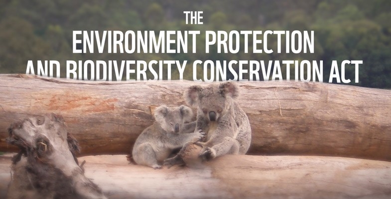
The EPBC Act that has been in force since 1999 is required to be reviewed every 10 years. The second review chaired by Prof Gordon Samuel, is currently underway. The interim report that considered close to 30,000 submissions was released in July. The Review is continuing to consult with stakeholders and the final review is due at the end of October.
At the outset, the report recognises the serious environmental crisis we are facing and the deterioration of our natural capital. It recognises that the current Act is failing to address the causes of this decline. The report calls for national leadership and stronger laws that effectively address our greatest environmental challenges.
While the report was being prepared, the auditor general released a report finding 80% of approvals under the EPBC Act and regulations were non-compliant or contained errors.
Federal Labor analysed those findings and concluded that since the coalition came to power, there had been a 510% blowout in the number of environmental approvals delayed beyond time frames indicated in the laws.
The delays came as the government cut funding to the environment department, which Labor said was now 40% lower than it was before the coalition came to power.
Main findings of interim report
The report calls for:
- More streamlined regulation and a reduction in duplication by creating bilateral agreements between the Commonwealth and states via national environmental standards whereby most of the assessment and approvals will be carried out by the states.
- The development of national environmental standards that will be essential in enabling this proposed devolution of the Commonwealth's functions. These standards must be legally enforceable that 'set clear rules for decision-making' by the states. They should be outcomes focused and measurable, but with some for flexibility.
Government response
The main response by the government to the review is at odds with the fundamental issues highlighted in the interim report.
In the government’s view the main metric of the success of the review is how quickly approvals can be signed off. The Environment Minister Sussan Ley agreed in principle with most of the recommendations but then has proposed introducing legislation to implement some of them in August before the final report is completed – due in October. This could seriously compromise the effective implementation of the reforms
The report suggests that the development of a robust suite of environmental standards will drive the improved outcomes. On the other hand, the government is intending to pass legislation as soon as possible in parliament to facilitate new bilateral assessment and approval agreements. In the absence of confirmed standards, a set of ‘interim standards’ will be used to fast track the devolving of powers to states and territories. By definition the interim standards will have to be vague such as preventing unacceptable impacts on matters of national environmental significance. How can ‘unacceptable’ be defined without a thorough framework of standards?
There is the risk that, once the interim process is in place, the implementation of the more rigorous process will be resisted. How can the accreditation be secure when currently there are states like NSW with laws that cannot even protect koalas and has land clearing laws that facilitate habitat loss? However, once the final standards are in place, if these are mandatory and measurable, they could play a key role in lifting state standards and ensuring environmental outcomes are actually achieved.
Minister does not support independent regulator
Despite the report pointing out the fundamental flaw of the current EPBC Act being that the Environment Department has utterly failed in its implementation, the minister has stated that the government will not implement the recommendation for an independent regulator. She has stated that proponents should still expect a significant increase in compliance and enforcement activity by her department under the EPBC Act.
Other recommendations
Introduce limited merits review – the report clearly rejected the notion of ‘green lawfare’ acting as an obstacle to development while the government is determined to maintain its position that reform is needed.
Consider biodiversity offsets as a last resort – offsetting should be considered only when proponents have exhausted all reasonable options to avoid or mitigate impacts, and that offsets should deliver genuine restoration.
Modify water trigger – Prof Samuel proposes modifying the 'water trigger', which requires the referral and approval of coal seam gas and large coal mining projects that are likely to have significant impacts on water resources.
Promote use of Indigenous knowledge – the interim report concludes that the EPBC Act is not fulfilling its objectives as they relate to the role of Indigenous Australians in protecting and conserving biodiversity and heritage and promoting the respectful use of their knowledge.
Greener Places Design Guide - Many Objectives but is there the Will and Money for Action?
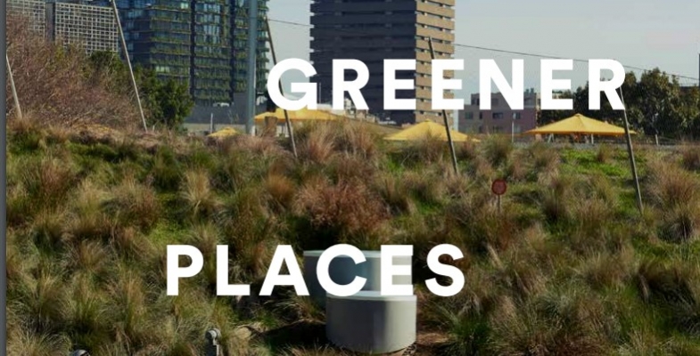
The NSW Government Architect has released a draft Greener Places Design Guide that is open for comment until 28 August. It is aimed at providing guidance for the state and local government, developers and the land managers.
The disclaimer is significant. It says:
Implementing the Greener Places Design Guide framework will require new governance arrangements, collaborations, and the identification of roles and responsibilities.
This guide attempts to set out such a framework but it should be noted that all roles and responsibilities, suggestions for ‘interagency’ bodies, and the commitment of resources by State or local government are yet to be agreed and are included for discussion only.
The guide covers three areas:
- open space for recreation
- urban tree canopy
- bushland and waterways
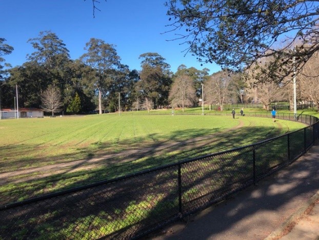
Open space for recreation
Most of the guide is devoted to guidelines for the provision of open space for recreation and sporting fields. It provides details on desirable land areas, accessibility and types of spaces relative to local population size and type of housing. Issues like anticipating additional green space needs when infill development is planned are covered in detail. It emphasises the importance of green space in enhancing the quality of local neighbourhoods.
Of particular interest to STEP are statements like:
Parks should consider adjacent land uses and be adequately buffered from incompatible uses. Solutions may include vegetation corridors, planted mounds, and fencing.
We would add appropriate flood lighting and use of synthetic turf in suburban playing fields.
One concern is the emphasis that is placed on the use of natural areas for bike and walking tracks when planning greenfield development sites.
They offer opportunities for active transport connections and integrated open space planning that support water-sensitive urban design and local habitat conservation, as well as promoting walkable environments for the health and wellbeing of its inhabitants.
Urban tree canopy
A common method for determining the amount of urban tree canopy is to measure the area of canopy as a percentage of total land area. The measures of tree canopy cover rely on aerial surveys. Ground surveys are needed to confirm the adequacy of vegetation cover.
The guide lists the many health, economic (property values) and environmental benefits of urban tree canopy. However, there is no definition of a tree. In local streets many species that are capable of growing to a size large enough to provide shade have been pruned savagely to provide space for powerlines.
The guide outlines indicative targets to improve tree canopy cover in Greater Sydney and regional urban areas including areas of major infrastructure such as transport. This has been the subject of detailed scientific research. Many cities have already adopted new canopy targets. For example, Melbourne aims to increase from 22% (2017) to 40% by 2040 and London from 20% (2008) to 30% by 2050. The indicative targets in the guide are to increase the canopy over Greater Sydney by 2056 to the following levels.
- CBD >15%
- medium to high density residential >25%
- low density residential >40%
The implementation of these targets will require major changes to state and local government planning policies and public recruitment to help look after the trees. We need to overcome the trend to remove all the trees and substantial shrubs when a house is demolished and replaced by a larger dwelling. Usually the well-established garden is replaced with neat hedges, lawn and paving. The bird habitat and connectivity is vanishing.
Bushland and waterways
The section on bushland and waterways defines strategies for improving the quality and quantity of natural habitat in urban areas. There are lists of desirable planning actions that will conserve, restore and create ecosystems as urban areas are planned, constructed and maintained. It is stated that the approach adopted recognises the important role of integrating nature into urban areas and the lives of people, not just protecting selected sites and landscapes. Examples are:
- establish threshold levels for ecological communities beyond which no further development can be considered
- review planning policies that conflict with the provision of urban habitat and corridors, and devise triggers to switch off incompatible policies, or incorporate provisions to avoid incompatible outcomes in core, transition, and corridor areas in consultation with local government
- incorporate consideration of threatened species, endangered ecological communities, locally rare species, core bushland, and strategic linkages to maximise biodiversity conservation
The key recommendation for councils to prepare a strategic urban biodiversity framework is very good but the practicality of applying priority to urban bushland improvement at the same time as meeting the demands for development to meet population growth expectations is challenging.
We are concerned about the emphasis placed in the design guide on the use of bushland for creating linkages. This reflects the unresolved conflict between the demand to use bushland for recreation and the needs of conservation.
Nevertheless the draft design guide sets out a thorough set of principles and actions to ensure that our bushland and native habitats are preserved and improved. Unfortunately, it is not clear that government policies and funding will allow the objectives to be met.
1080: A Weighty Ethical Issue
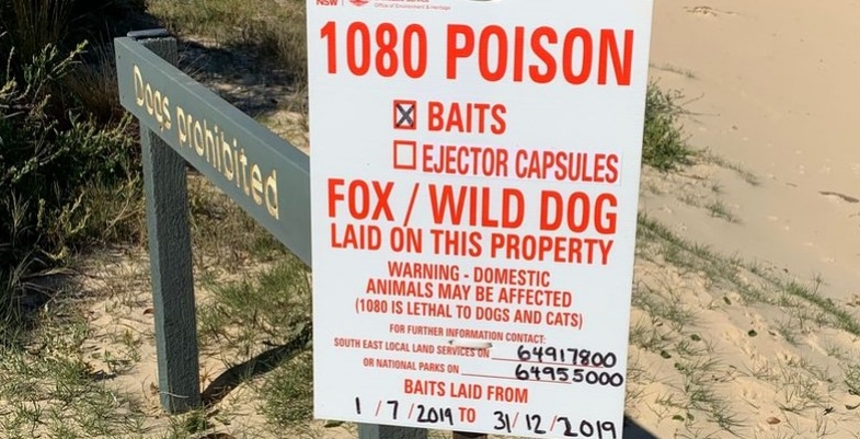
 We are all aware of the impact that the use of 1080 poison has had on the local population of feral cats and foxes. We now have a lot more wildlife in the suburbs that may be a delight or may be a nuisance, for example brush turkeys. It is being used extensively in bushfire affected areas to help wildlife recovery. It has the advantage that baits can be dropped into remote areas. It is generally believed that native animals are immune to this poison as it is present in a range of Australian plants.The has released a report, 1080: A Weighty Ethical Issue that looks at the ethical considerations of using 1080 to control feral animals in Australia and finds that the conservation benefits to native species necessitates its use until an alternative is available
Here is the ISC’s summary from the report.
1080 – sodium monofluoroacetate – is very important for conservation in Australia, used extensively to protect rare native species from foxes, cats, pigs and rabbits. But many people oppose its use because it is regarded as inhumane.
In this report the Invasive Species Council considers the conservation and welfare consequences of 1080 baiting. We do this as an environmental organisation whose mission is to strengthen protection for Australian species from harmful introduced species, but also as people who care about the welfare of animals, whether introduced or native.
Diagnosing pain and distress in animals is difficult, and there is much uncertainty about the welfare impacts of 1080 poisoning, because the extent to which animals are conscious during some of the worst symptoms is unknown. However, it seems highly likely that 1080-poisoned animals suffer pain and distress before they become unconscious, although the extent and duration are highly variable and poorly understood. A 2010 assessment by an independent expert panel in New Zealand concluded that 1080 had severe to extreme impacts on the welfare of the species assessed (including cats, pigs and rabbits) lasting from hours to days.
1080 has been essential for enabling the survival or recovery of many threatened species and their reintroduction to sites where introduced predators have been suppressed or eradicated.
The use of 1080 also has welfare benefits for native animals who are freed from the pressure of heavy predation or competition by introduced animals. A ban on 1080 without an effective replacement would overall result in greater suffering (as well as declines in native species).
As a high priority, we recommend research into effective replacements for 1080 that are more humane. Four new more-humane baits have been approved in Australia since 2016, but they cannot totally replace 1080 due to their nontarget impacts and limited delivery options.
The ISC believes that an ethical approach to the welfare problems of 1080 requires the following:
- Develop and deploy more-humane and effective ways of controlling harmful introduced animals
- Design long-term control programs that minimise the overall extent of killing of introduced animals – for example, by eradicating or substantially suppressing their populations, and by intervening ecologically to help native animals withstand invasive pressures
- Improve monitoring to ascertain whether 1080 baiting (and other methods) achieve conservation goals and are cost effective (it is unethical to kill animals if no conservation benefit is achieved and wrong to waste scarce conservation funds)
- Strive to better understand (where feasible) the welfare consequences of 1080
A Viral Witch Hunt

It has been a bad decade for bats. Prior to the emergence of COVID-19, they were already in severe decline worldwide. Now, they are blamed as the culprids behind one of the costliest pandemics in modern history, even though the source and method of transmission haven’t been identified. Although scientists have an obligation to promptly disclose new threats, premature speculation about bats has been exaggerated in attention-grabbing media headlines. The result has been needless confusion, leading to the demonization, eviction, and slaughtering of bats even where they are most needed.
As of mid-March, ‘patient zero’ for COVID-19 still had not been found, and who or what infected that person remains a mystery. There is even uncertainty about whether the viral jump from an unknown intermediate host to humans occurred in the location initially identified, an animal and seafood market in Wuhan, China. Despite these uncertainties, the media, with no small assistance from scientists, has sensationalized the risks, often without providing perspective, settling on bats as the likely culprit and thus making them targets in a viral witch hunt.
Around the world, bats are feeling the effects of this misinformation. My Malaysian colleague, Sheema Abdul Aziz, has spent years documenting the key role of flying fox bats as essential pollinators of Southeast Asia’s multibillion-dollar-a-year durian crop. Growers were planning to join her in a public education campaign explaining the value of bats, but now they fear a public backlash and are reluctant to support her efforts. A local resort has expressed fear of loss of sales due to a nearby flying fox colony. Fearing her research will trigger a new disease outbreak, private citizens have even asked the government to stop her from handling bats and to support eradication, something already reported in neighboring Indonesia. My colleagues in China are also deeply concerned about the demonization of bats and calls for their eradication.
Even in my home city of Austin, Texas, where we have safely enjoyed sharing a downtown bridge with 1.5 million bats for decades, growing numbers of people are asking about disease risks. Despite warnings from poorly informed health officials that our bats were rabid and dangerous, they’ve yet to transmit a single case of disease. They simply attract millions of tourist dollars each summer and control tons of crop pests each night. Texas bats are worth more than a billion dollars annually. Now bat-lovers are experiencing a backlash against putting up bat houses because neighbors say they fear that attracting bats will bring disease.
But simply telling people that bats are valuable and shouldn’t be killed can’t counter panic. I have personally investigated instances where fearful humans had burned, poisoned, or sealed caves, killing millions of bats at a time. Based on my experience, I have concluded that there is no greater threat than the intolerance and eradication that results from misguided fear.
Exaggerated warnings of bat disease risks aren’t just misguided. They threaten the health of entire ecosystems and economies. Researchers in Indonesia conservatively estimate that bats save cacao growers more than $700 million annually in avoided insect damage. In Mexico, tequila and mescal production worth billions annually relies on bats that pollinate agaves. From Southeast Asia to the Mediterranean, bats provide key pest control for rice growers. In South Africa, macadamia growers benefit from bat control of stink bugs.
Despite a long tradition of being misunderstood and feared, perhaps because of their nocturnal habits and erratic flight, bats have an outstanding record of living safely with humans. Millions living in backyard bat houses, city parks, and bridges have proven to be safe neighbors. I have never been attacked and am still healthy after more than 60 years studying and handling hundreds of species worldwide, sometimes surrounded by millions in caves. Because, like veterinarians, I am occasionally bitten by unfamiliar animals I handle, I’m vaccinated against rabies.
For anyone who simply avoids handling bats, the odds of contracting any disease from one are incalculably small. All diseases attributed to bats are easily avoided, even when bats live in one’s yard.
However, these facts typically go unreported, while risks are often magnified. The March 11 issue of Scientific American provides an excellent example. Its COVID-19 article subhead reads:
Wuhan-based virologist Shi Zhengli has identified dozens of deadly SARS-like viruses in bat caves, and she warns there are more out there.
The use of ‘deadly’ is unjustified speculation.
The article additionally claims that the Wuhan outbreak is the sixth outbreak caused by bats in the past 26 years. In fact, the first four listed (SARS, MERS, Hendra, Ebola) appear to have been transmitted to people by animals other than bats—yet bats still receive primary blame. The fifth, the Nipah virus, which likely is spread to people from flying fox bats, is easily prevented by simply covering collection containers or pasteurizing contaminated palm juice.
Two possible scenarios have been hypothesized for the COVID-19 outbreak. The first is that a new coronavirus entered an intermediate host animal, such as a pangolin, where it evolved over an undetermined period to gradually become a threat to people. Alternatively, the new coronavirus could have been harmless when it first entered humans, but over time evolved to become virulent. Such scenarios would be difficult to predict, and a publication currently under review even points to mice and domestic pigs as possible sources.
So why has the media almost universally blamed bats? In part because scientists have disproportionately focused on sampling them.
Since 2005, when coronaviruses in horseshoe bats were first hypothesized to be the ancestors of the coronavirus that caused SARS, bats have received far more scrutiny than any other group of animals. For example, in the study on which the scariest headlines were based, researchers sampled nearly twice as many bats as rodents, shrews, and nonhuman primates combined and didn’t even include carnivores or ungulates.
Easily blamed, due to their lack of popularity, bats are also the easiest mammals to quickly sample in large numbers. This led to rapid publication of the results, and sensational speculations were deemed more acceptable when focused on already-feared animals.
Not surprisingly, more viruses have been found in bats than in less-surveyed species, so biased speculation has become a self-fulfilling prophecy. We don’t yet know if bats have more viruses than other animals because we haven’t similarly sampled others. And even if bats do have more, the number of viruses isn’t necessarily indicative of transmission risk. Many viruses are innocuous or possibly even beneficial.
Some virologists have capitalized on the fear of pandemics to promote funding for viral surveys in nature as a possible means of preventing or mitigating these scary events. They convinced the US National Institute of Allergy and Infectious Diseases to budget $4.8 billion in 2019 for surveys searching for potentially high-risk viruses. Referring to the COVID-19 pandemic, long-time surveying proponents now argue that the best way forward is to prevent future outbreaks by beginning with surveys to find and catalog wildlife viruses globally, focusing on what they consider to be high-risk animals, including bats.
However, many leading experts strongly disagree. They argue that such surveys would be extremely costly and have little practical value. Viral-caused outbreaks are exceedingly rare, and their emergence is unpredictable. The evolutionary virologist Edward Holmes and associates note that even if all current viruses could be catalogued, new variants of RNA viruses are constantly evolving. They bluntly warn of arrogance and loss of credibility resulting from promises that viral surveys could prevent or even mitigate pandemics.
To understand why surveying will fail as a strategy, consider the examples of MERS, West Nile, and Zika viruses. MERS jumped to humans from a seemingly unlikely source, camels, in Saudi Arabia, previously believed to be an extremely improbable location for such an incident. Robert Tesh, an expert on emerging viruses, has pointed out that neither West Nile nor Zika viruses are new. They simply spilled over when transported to new areas in incidents that couldn’t have been predicted.
A growing number of leading epidemiologists agree that it isn’t possible to predict the animal origin of the next viral outbreak. Unfortunately, their warnings are seldom covered by public media. When they are, they tend to be de-emphasized.
Finding the true source and means of infection for patient zero in the current outbreak seems far more important than condemning bats or spending billions on searches for potential pathogens. Such public health funds would be much better directed toward improved early detection in humans.
But we humans must also address our own culpability. Caging and slaughtering a wide variety of animals in markets virtually guarantees the spread of viral infections. Blaming already unpopular bats only increases already severe threats to their survival, despite scientific certainty about the enormous benefits they provide to both the environment and societies. Care about bats or not, we should see COVID-19 as a grim reminder that human well-being requires responsible stewardship of nature, not just dominance.
This article was written by Dr Merlin Tuttle, a leading bat researcher who founded and directed Bat Conservation International for 30 years. He now directs Merlin Tuttle’s Bat Conservation and is a research fellow in the Department of Integrative Biology at the University of Texas at Austin.
Australia has Failed Miserably on Energy Efficiency – and Government Figures Hide the Truth

Amid the urgent need to slow climate change by cutting greenhouse gas emissions, energy efficiency makes sense. But as Australia’s chief scientist Alan Finkel last week warned, we’re not 'anywhere close to having that nailed'.
Energy efficiency means using less energy to achieve the same outcomes. It’s the cheapest way to cut greenhouse gas emissions and achieve our climate goals. Improving energy efficiency is also vital to achieving so-called 'energy productivity' – getting more economic output, using the same or less energy.
But Australia’s national energy productivity plan, agreed by the nation’s energy ministers in 2015, has gone nowhere.
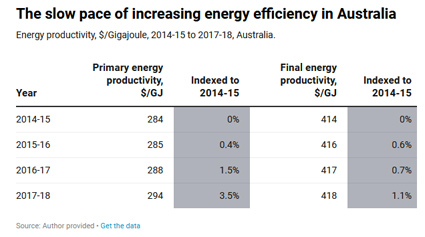
It set a goal of a 40% improvement in energy productivity by 2030. But my analysis, based on the most recent official data, shows that in the three years to 2017-18, energy productivity increased by a mere 1.1%.
Clearly, there is much work to do. So let’s take a look at the problem and the potential solutions.

Energy efficiency: a low-hanging fruit
Better energy efficiency lowers electricity bills, makes businesses more competitive and helps manage energy demand. Of course, it also means less greenhouse gas emissions, because fewer fossil fuels are burnt for energy.
Business, unions and green groups recognise the benefits. Last month they joined forces to call for a sustainable COVID-19 economic recovery, with energy efficiency at the core, saying:
In Australia, a major drive to improve the energy efficiency of buildings and industry could deliver over 120,000 job-years of employment […] Useful upgrades could be made across Australia’s private and public housing; commercial, community and government buildings; and industrial facilities.
The group said improvements could include:
- more efficient and controllable appliances and equipment, especially for heating and cooling
- improved shading and thermal envelopes (improving the way a building’s walls, ceiling and floors prevent heat transfer)
- smart meters to measure energy use
- distributed energy generation and storage, such as wind and solar backed by batteries
- fuel switching (replacing inefficient fuels with cleaner and economical alternatives)
- equipment, training and advice for better energy management.
The International Energy Agency (IEA) has suggested other measures for industry and manufacturing, such as:
- installing more efficient electric motors
- switching from gas to electric heat pumps
- more waste and material recycling.
And in transport, the IEA suggests incentives to get older, less efficient cars off the roads and encourage the uptake of electric vehicles.
Governments’ sleight of hand
In 2018 the IEA observed:
the power sector will be at the heart of Australia’s energy system transformation […] International best practice suggests that both energy efficiency and renewable energy are key drivers of the energy transition.
Since then, renewable energy’s share of the electricity mix has increased. But energy productivity has stalled.
To understand how, we must define a few key terms.
Primary energy refers to energy extracted from the environment, such as coal, crude oil, and electrical energy collected by a wind turbine or solar panel.
Final energy is the energy supplied to a consumer, such as electricity delivered to homes or fuel pumped at a petrol station.
A lot of energy is lost in the process of turning extracted primary fuels into ready-to-use fuels for consumers. For example at coal-fired power stations, on average, one-third of the energy supplied by burning coal is converted to electricity. The remainder is lost as waste heat.
Until 2015, Australia and most other countries used final energy as a measure of how rapidly energy efficiency was improving. But the national productivity plan instead set goals around primary energy productivity – aiming to increase it by 40% between 2015 and 2030.
This has made it possible for governments to hide how badly Australia is travelling on improving energy efficiency. I analysed national accounts figures and energy statistics, to produce the below table. It reveals the governments’ sleight of hand.
Over the three years from 2014-15 to 2017-18, final energy productivity increased by only 1.1%, whereas primary energy productivity increased by 3.5%.
The reduced primary energy consumption is mostly due to a large increase in wind and solar generation. The efficiency of energy used by final consumers has scarcely changed.
A sustainable future
The lack of progress on energy productivity is not surprising, given governments have shown very little interest in the issue.
As Finkel noted in his address, Australia’s energy productivity plan is absent from the list of national climate and energy policies. The plan’s 2019 annual report has not been released. And those released since 2015 have not monitored progress in energy productivity.
What’s more, the plan makes no mention of previous similar agreements, in 2004 and 2009, to accelerate energy efficiency with regulation and financial incentives. Since 2013, almost all Commonwealth programs supporting those agreements have been de-funded or abolished, and many state programs have also been cut back.
The IEA’s sustainable recovery plan, released last week, outlined what a sustainable global economic recovery might look like. In particular, it said better energy efficiency and switching to more efficient electric technologies will deliver triple benefits: increased employment, a more productive economy and lower greenhouse gas emissions.
In this carbon-constrained world, relatively easy and cheap opportunities such as energy efficiency must be seized. And as Australia spends to get its post-pandemic economy back on track, now is the time to act.![]()
Hugh Saddler, Honorary Associate Professor, Centre for Climate Economics and Policy, Australian National University
This article is republished from The Conversation under a Creative Commons license. Read the original article.
Recognition of the Work of Bill Jones and Noela Kirkwood
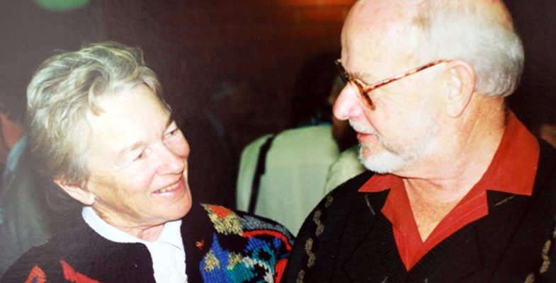
On Thursday morning 18 June the Friends of Lane Cove National Park held a special celebration at Carter Creek to celebrate the retirement of Bill Jones and Noela Kirkwoods, as coordinators of the Quarry Creek bushcare site. Bill and Noela have been with Friends from the beginning – in fact from before the beginning. They attended the inaugural bushcare breakfast meetings in 1991, which later led to establishment of Friends of Lane Cove National Park after the 1994 fires.
They both have given so much more to the environment than bushcare. Both helped to educate a generation of new volunteers; Noela through her association with TAFE and Bill with the walks and talks program organised by the Australian Plant Society at Ku-ring-gai Wildflower Garden. They were involved in preserving Wallumatta Nature Reserve, one of the largest remaining areas of Sydney Turpentine Iron Bark Forest as part of Lane Cove National Park. They have been enthusiastic regenerators on Ku-ring-gai Council sites and keenly pursued grants from council to support their work.
Of course, Bill and Noela have been actively involved with STEP since we merged with KUBES (Ku-ring-gai Bushland and Environment Society) in 1998 have a passionate interest in Ku-ring-gai Council’s bushland management. Bill was a committee member from 1998–2001 and has led some of our walks.
Photo is of Noela and Bill at STEP’s 20th anniversary in 1998
Great Southern Bioblitz: A Massive Citizen Science Project
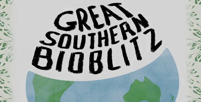
In April this year an international citizen science bioblitz event was held. Volunteers from all over the world recorded flora and fauna sightings from their neighbourhood in the City Nature Challenge. This event was organised from the USA so the timing was set for the spring in the northern hemisphere.
But the peak time for nature in the southern hemisphere is spring. So the Australian organisers of the City Nature Challenge are coordinating a Great Southern BioBlitz, or GSB for short, from 25 to 28 September. Countries in the Southern Hemisphere have now joined in. There will be an international period of intense biological surveying in an attempt to record all the living species within several designated areas across the Southern Hemisphere in spring.
The GSB will run through the online citizen science platform iNaturalist. All you need to do is download the iNaturalist AU app and start observing. Recordings are made by uploading photos or sound recordings. It is also possible to record observations via your computer.
Projects for many areas are being created using the platform. The purpose of area projects is to gather separate data of the numbers of observations and species for different locations. A project has already been set up for the Greater Sydney region. You don’t need to record your sightings under this region. This will happen automatically when you record observations with their geographical location.
Survey of People’s Connection with Nature

A group of researchers from Macquarie University are currently conducting a national online survey that aims to examine people’s connection with nature by engaging with outdoor environments (such as gardens, local parks, natural reserves etc) and how this is related to the importance they place on such activities. They also want to examine whether their attitude has changed since the bushfires and COVID-19 and whether people’s connections with nature are related to their physical and mental health.
You are invited to complete the survey. It takes between 20 to 30 min to complete online and is anonymous. There is an additional (opt in) follow-up interview component of this study.
Some Good News from the State Government
Suspension of old growth forest logging but other logging continues
The government has suspended plans for the Natural Resources Commission to re-map old-growth coastal state forests. The mapping by remote sensing technology was to have been used to identify forest that might still be available for logging. The remote sensing technology cannot be applied accurately after the burning of so many hectares of forest canopy last summer. The funds for the project have been redirected to a Forest Monitoring and Improvement Program.
The Nature Conservation Council has campaigned for the end of logging in old-growth forests altogether and has welcomed the suspension. However, logging has been resumed in some state forests in the north that include koala habitat. Forests on private land are still not adequately protected.
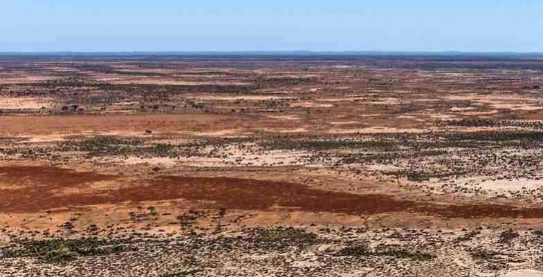
New national park in western NSW
A new conservation area will be created in far north western NSW following the purchase of 153,415 ha of private land about 60 km from Tibooburra.
The land contains important ecosystems, particularly wetlands fed by the Bulloo River. It is not part of the Murray Darling Basin or the Lake Eyre Basin. The wetlands support at least 27 threatened species. The area is rich in Indigenous and European history.
Mirvac Development on IBM Site to be Fast-tracked
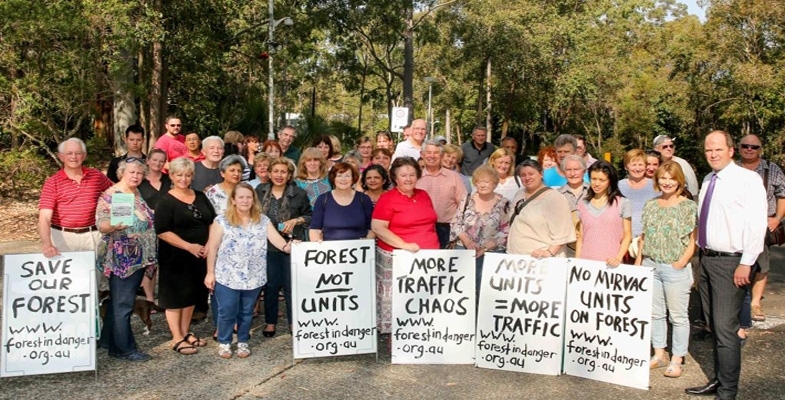
As feared by the residents of West Pennant Hills and environment groups the NSW government has ignored the more than 4,000 resident and local council objections to Mirvac’s plans for the development of 600 dwellings on the former IBM corporate headquarters next door to the Cumberland State Forest. The plans are on the list of projects to be ‘fast-tracked’ in the interests of creating jobs to speed up recovery after the COVID-19 slowdown. A short-term gain of employment will result in the long-term destruction of beautiful, tall mature forest and the creation of more traffic jams and infrastructure shortfalls. The site could have been retained for commercial or education uses and provided many more jobs for the local area.
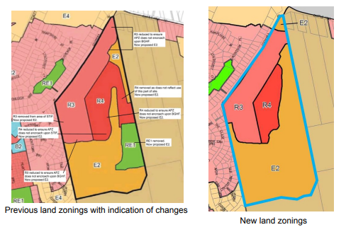
The approval applies to the rezoning required from that of a business park in order for the development to proceed. Some modifications have been made to the plans that were described in STEP Matters, Issue 201.
There has been some recognition of community concerns and comments by the Environment, Energy and Science Group of the Department of Planning (EES, formerly OEH). Some modifications of the proposal are outlined below. Many questions and concerns still remain in addition to the overall concern about over-development of the Cherrybrook area and the destruction of a large number of mature trees that surround the existing IBM buildings.
- The area of the residential footprint will be reduced and the associated bushfire Asset Protection Zones (APZs) so they do not encroach on the BGHF and STIF critically endangered ecological communities. The proposed APZs would have resulted in the modification of multiple patches of BGHF and STIF totalling approximately 1 hectare. The number of dwellings remains at up to 600 so, no doubt, there will more high rise and less medium density apartments. The tiny 86 m2 terraces remain.
- A 100 m buffer distance from residential buildings is required near nest trees in accordance with guidelines for conserving Powerful Owl habitat.
- EES has commented on the need for prohibition of free-ranging cats in the development and that dogs would need to be under control at all times but especially near bushland areas. This would require fencing critically endangered ecological communities. How can these requirements be enforced? We have generally observed that dog owners let their dogs off the leash as soon as they think no one is looking or they feign ignorance of the requirement. Will fencing inhibit the normal movement of native species for foraging and nesting? This suggestion requires a lot more investigation!
- The area zoned as E2, environmental conservation, will increase to 15 ha because of the change in the residential footprint and removal of the recreation zone. It is proposed that 9 ha of the E2 zone be managed by Forestry NSW as part of Cumberland State Forest. Will the funding be increased for management of this area?
- The public recreation area, that was to be zoned as RE1 with a synthetic turf soccer field and lighting, has been removed in recognition of the impact the lighting and noise would have had on the Powerful Owls nesting and foraging needs. It will then be part of the E2 zone and this area, currently mostly mown grass, will be rehabilitated and revegetated with local native species. This area may include a kiosk or café with a maximum area of 50 m2.
- The other E2 zone in the north that currently includes a car park could include a private recreation facility under community title subdivision, possibly indoors, subject to council consent. The public recreation facilities that were to be funded by Mirvac have gone.
- EES recommended the existing pathways/walking trails be closed and revegetated and the number of pathways/walking trails within the ‘bushland edge’ and close to the Powerful Owl nesting sites are minimised. Further, EES recommended the new pathways/walking trails be located outside the bushland reserve and constructed of appropriate materials to minimise impacts on biodiversity. It is noted the walking trails are in the forested areas proposed to be dedicated to Forestry NSW and will be subject to a future plan of management.
- Introduce a local design excellence provision for the residential areas. So what was the quality of the design going to be before?
What happens next?
The change in zoning has been forced through via this fast tracking process but the detailed layout and design of the residential buildings as well as other details of the land management still has to be approved by Hills Council. There will still be opportunities to make submissions on the next stage of the planning process. No doubt there will be a great deal of community interest.
Hornsby Council Plan for Rehabilitation of the Quarry – More Homework Required
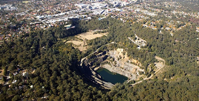
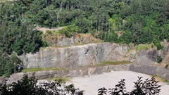 The process of partially filling in the void that was Hornsby Quarry using spoil from the excavation of the North Connex road tunnel has been completed. Hornsby Council is now planning the next stage to create a recreation area that comprises Old Man’s Valley below the swimming pool, the Quarry and its surrounding area.
Some of the steep sides of the Quarry, particularly the northern side, are unstable and could collapse in a major rainfall event so rehabilitation works are required. Reshaping of the North Connex fill is proposed, as well as other spoil mounds within the site to allow future development of the quarry into a parkland for community use. These works have to go through a Development Application (DA) process including consideration of public submissions.
Hornsby Council has undertaken public consultation using public displays of the plans and put documents on exhibition. There are futuristic illustrations of the potential use of the site but this level of detail will be in the next stage of consultation.
On 6 May the Sydney North Planning Panel conducted a hearing into Hornsby Council’s DA for the works of Hornsby Quarry. Some individuals and community groups made submissions explaining their serious concerns about some aspects of the proposed works.
STEP, Protect your Suburban Environment (PYSE) and the Powerful Owl Coalition’s submissions drew attention to shortcomings revealed in some key documents.
- The agreement document for a biodiversity offsets package was not available. It was totally unclear how biodiversity offsets under the Biodiversity Conservation Trust were applicable to the project.
- A preliminary Vegetation Management Plan was provided but lacked the detail required for works on such a large and diverse site. Its link with the offsets package was also missing.
- How the Blue Gum High Forest Save Our Species Priority Management Sites in the south western side of the site will be affected by the works.
Representatives from three geological societies made several submissions about the lack of recognition of the scientific significance of the volcanic diatreme rockface that is exposed by the quarry excavation. The outcomes of the final filling and landscape works on the floor of the quarry were not explained so it is not clear how much of the rock face would remain visible.
Panel decision
The people who had made submissions were delighted with the result. The Panel noted that several key issues of significant public interest were unresolved, and the development’s conditions did not provide necessary certainty of the outcomes for the Panel or for the public.
The Panel deferred the application so that the following processes can be completed:
- Provide detail of the Biodiversity Offsets Package, Vegetation Management Plan and Habitat Creation and Enhancement Plans and submit these documents for public exhibition.
- Submit a plan for public consultation defining and managing a buffer zone during the rehabilitation works around the Powerful Owl breeding pair’s roosting tree.
- The information about extent of the volcanic diatreme rock face exposure when the filling and creation of the lake and wetland in front of the face have been completed.
Another process of consultation will occur when the required documents are completed.
A subsequent visit by Geological Society of Australia members with council officers provided an indication that there is likely to be more of the diatreme rock face exposed, not less. So good news.
More on Climate Change Policy

The Coalition government just does not get it! Scott Morrison has stated in relation to the COVID-19 response that:
What we do in the next five years will determine the next thirty.
With the need to boost the economy and respond to the climate change risks demonstrated by ‘black summer’, one would think that climate change policies that will set a pathway to zero emissions by 2050 would be front of mind. We need long-term job creating strategies that demonstrate a clear trajectory towards a goal matching our Paris agreement commitments.
There are three reports and consultations over the past three months all of which have been dominated by fossil fuel industry interests:
- Andy King, former Origin Energy CEO, was appointed last October to produce a review into new low cost sources of emissions reduction. Industry was consulted but not the general public or not-for-profit groups. Most of the recommendations in the report released in May have been accepted.
- A consultation paper on a technology roadmap was released with over 140 technologies listed that could potentially be supported by government. Submissions closed on 21 June.
- The National COVID-19 Coordination Commission (NCCC) led by gas company executive Nev Power, has been tasked with coming up with plans to revitalise the economy after the coronavirus shutdown.
All these actions are geared to allowing the market to control the implementation of the changes with some government support. Therefore, there is no overriding mechanism to ensure that Australia can be on a track that will lead to the goal of zero emissions by 2050. This goal can only be achieved if the fossil fuelled electricity generation is closed down progressively and replaced by renewable energy and storage mechanisms. Major changes are needed to other major sectors such as transport. The demand side of the equation that would reduce energy use needs to be addressed in a structured way.
It is clear that moving away from fossil fuels is not going to be actively managed. It will be up to consumers and business to take the initiative. The level of frustration of all sectors of the community was demonstrated in May when a cross section of peak organisations representing business, unions and charities sent a letter to the cabinet, energy ministers and the NCCC calling for rebuilding of a sustainable economy including measures to cut emissions and accelerate a transition to clean energy across all regions and economic sectors, and recommend a focus on fixing inefficient homes and commercial buildings.
Instead government rhetoric is emphasising:
- carbon capture and storage
- hydrogen produced from fossil fuels
- gas as an interim energy source for electricity and manufacturing
Carbon capture and storage (CCS)
The King report recommended that a new abatement category be created under the Emissions Reduction Fund (ERF) for carbon capture and storage. The ERF has thus far been focussing on carbon farming and projects that increase energy efficiency. Australian governments have already spent over a billion dollars into carbon capture projects and technologies but there has been virtually nothing to show for it. Even if it works – which it very rarely does – CCS is extremely expensive and cannot deliver zero emissions. It cannot compete with the reducing cost of wind and solar. CCS paired with fossil fuels (so called ‘clean coal’) is simply an attempt to prolong the life of ageing, polluting fossil fuels in our energy system.
Gas
A draft report from the NCCC recommended that billions of public dollars be spent on increasing gas use by building new gas pipelines and underwriting of supply projects. They called for scrapping of state bans on coal seam gas as well as ‘green and red tape’ on gas development, including a relaxation of Australian standards for equipment used in gas infrastructure and a loosening of environmental regulations and approval processes under the EPBC Act.
The use of gas may be less carbon intensive for electricity generation but the production of gas is another matter. Fugitive emissions from the extraction, processing and export of gas (the liquification process) have been the main driver behind Australia’s emissions staying so high. A large part of the gas industry is geared to exports where prices are very volatile. The Climate Council has reported in detail on the reasons to steer clear of gas expansion.
The fracking process to produce coal seam gas is a major concern as it uses vast amounts of water, mostly drawn from the Great Artesian Basin, and converts it into similar amounts of salty water that may leach into groundwater, farmland and ecosystems. The Santos Pilliga Forest project is a prime example.
The use of gas for electricity generation instead of coal does not reduce emissions significantly compared with renewable sources, even with battery backup. Investing further in gas risks locking in huge investment losses, stranded assets and environmental harm.
Hydrogen
When the term ‘hydrogen’ is used in the energy sector, it refers to a simple molecule of two hydrogen atoms: H2. Creating hydrogen uses a lot of energy, and splitting it apart releases that energy again. This means that generating hydrogen, then using it, works a little like charging and discharging a battery.
While hydrogen is unlikely to outperform a conventional battery in the near future, there is huge potential for hydrogen to replace fossil fuels in areas that are difficult or impossible to address in other ways, like steel-making and long-range transport. Hydrogen can be used in many other sectors as well, from fertiliser production to simple energy storage.
Hydrogen can be created via a number of different methods. In the near future the most feasible means is using gas. Just one type of hydrogen – so-called ‘green hydrogen’ – which is hydrogen generated through renewable energy, is capable of playing a role in our zero emissions future.
Hydrogen shows great promise for low carbon industrial development and Australia’s energy exports but it will take time for the technology to be developed.
3 Times Michael Moore's 'Planet of the Humans' Gets the Facts Wrong and 3 Times it Gets them Right
Documentary maker Michael Moore’s latest offering, Planet of the Humans, rightly argues that infinite growth on a finite planet is 'suicide'. But the film’s bogus claims threaten to overshadow that message.
Planet of the Humans is directed and narrated by longtime Moore collaborator Jeff Gibbs. It makes particularly contentious claims about solar, wind and biomass (organic material which can be burnt for energy). Some claims are valid. Some are out of date, and some are just wrong.
The film triggered a storm after its free release on YouTube late last month. At the time of writing, it had been watched 6.5 million times. Climate sceptics here and abroad reacted with glee. Environmentalists say the film has caused untold damage when climate action has never been more urgent.
For 50 years, I have studied and written about energy supply and use, and its environmental consequences. So let’s take a look at how Planet of the Humans is flawed, and where it gets things right.
Where the film goes wrong
Critics have compiled a long list of questionable claims made in the film. I will examine three relating to renewable energy.
1. Solar panels take more energy to produce than they generate
It’s true that some energy is required to build solar panels. The same can be said of coal-fired power stations, oil refineries and gas pipelines.
But the claim that solar panels generate less energy in their lifetime than that taken to manufacture them has long been disproved. It would not be true even if, as the film says, solar panels converted just 8% of the energy they receive into electricity.
But that 8% figure is at least 20 years old. The solar panels now installed on more than two million Australian roofs typically operate at at 15-20% efficiency.
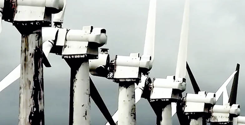
2. Renewables can’t replace fossil fuels
The film claims green energy is not replacing fossil fuels, and that coal plants cannot be replaced by renewables.
To disprove this claim we need look no further than Australia, where wind turbines and solar panels have significantly reduced our dependence on coal.
In South Australia, for example, the expansion of solar and wind has led to the closure of all coal-fired power stations.
The state now gets most of its power from solar and wind, exporting its surplus to Victoria when its old coal-fired power stations prove unreliable on hot summer days.
What’s more, a report released this week by the Australian Energy Market Operator (AEMO) said with the right regulations, renewables could at times supply 75% of electricity in the national electricity market by 2025.
3. Solar and wind need fossil fuel back-up
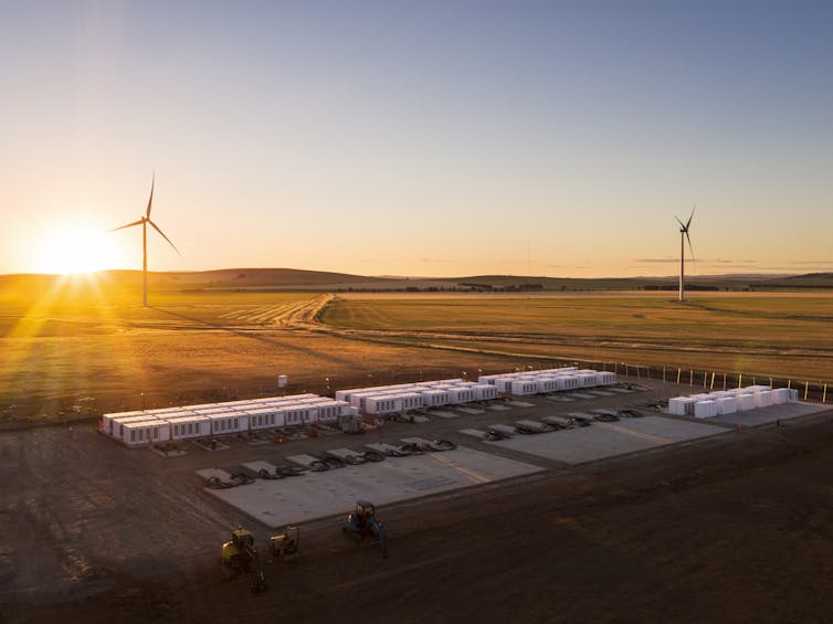
Some renewables systems use gas turbines to fill the gap when the wind isn’t blowing and the sun isn’t shining. However renewable energy storage is a cleaner option and is fast becoming cheaper and more widely used.
AEMO forecasts battery storage installations will rise from a low base today to reach 5.6 gigawatts by 2036–37. The costs of storage are also projected to fall faster than previously expected.
South Australia’s famous grid-scale Tesla battery is being expanded. And the New South Wales government’s pumped hydro plan shows how by 2040, the state could get 89% of its power from solar and wind, backed by pumped hydro storage.
Read more: How an Aussie invention could soon cut 5% of the world's greenhouse gas emissions
In Australia on Easter Saturday this year, renewables supplied 50% of the national electricity market, which serves the vast majority of the population.
Countries such as New Zealand and Iceland essentially get all their power from renewables, backed up by storage (predominantly hydro).
And putting aside the federal government’s problematic Snowy 2.0 project, Australia could get all its energy from renewables with small-scale storage.
What does the film get right?
Planet of the Humans makes several entirely valid points. Here are a few:
1. We need to deal with population growth
The film observes that population growth is the elephant in the room when it comes to climate change. It says politicians are reluctant to talk about limits to population growth 'because that would be bad for business'.
As one observer in the film says, the people in charge aren’t nervous enough. I agree.
An increasing population means increasing demand for energy and other resources, accelerating climate change.
2. Biomass energy does more harm than good
While the film unfairly criticises the environmental benefits of solar energy, it’s true that some so-called clean technologies are not green at all.
As the film asserts, destroying forests for biomass energy does more harm than good – due to loss of habitat, damage to water systems, and the time taken for some forests to recover from the removal of wood.
Most advocates of cleaner energy systems recognise the limitations of biomass as an energy source.
3. Infinite growth on a finite planet is suicide
The film calculates the sum total of human demands on natural systems as about 1,000 times what it was 200 years ago. It says there are ten times as many people now, each using 100 times the resources, on average.
Experts have repeatedly warned that human demand for resources is damaging the natural systems that all life depends on.
For large parts of the world, the consequences could be catastrophic.
Get the message
Several other aspects of the film have been savaged by critics – not least its claims about emissions produced by electric cars, which had previously been debunked.
Personal attacks on two prominent US clean energy advocates, Bill McKibben and Al Gore, also detract from the film’s impact.
It’s clear renewable energy has an important role to play in reducing greenhouse gas emissions and slowing climate change. But it won’t solve the fundamental problem: that humans must live within Earth’s natural limits.
Those cheering the film’s criticism of renewables would do well to consider its overriding message.
Read more: Australia could fall apart under climate change. But there's a way to avoid it
Correction: A previous version of this article said the claim that solar panels produce less energy than they generate in their lifetime has long been disproved. This has been amended.![]()
Ian Lowe, Emeritus Professor, School of Science, Griffith University
This article is republished from The Conversation under a Creative Commons license. Read the original article.
The Rakali: Don't Blink or You'll Miss It
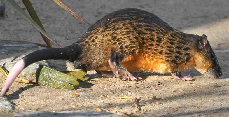
Many of you will know the Empire Marina at Bobbin Head, and if you have young kids or grandkids, buying a little bag of chook pellets for them to feed the schools of hungry yellowfin bream that swarm near the cafe. Well, a couple of weeks ago I was wandering back to the car around 1:50 pm following a bushwalk and coffee, scanning the water for life, when a strange ‘fish’ caught my eye. It was swimming rapidly underwater, sweeping and turning in S shapes, and immediately I saw it wasn't a fish at all but a furry animal with a tail, and about the same size as a ringtail possum. It was all too quick for a photograph and it disappeared into an underwater hole in the rocky bank (it was high tide).

Rakali in Frankfurt Zoo photographed by Klaus Rudloff
Well, it was a rakali, or golden-bellied water rat: (binomial Hydromys (water mouse) chrysogaster (golden belly)) and it's an Australian native rodent. Indigenous people on the Murray called them ‘rakali’, and that name is probably preferable to water rat because they are rather different to the European water rat or water vole which I remember well from childhood. They also differ from the North American muskrat, though comparable in size, being up to 60 to 70 cm long including the tail, which is furry and with a white tip like a ringtail. They weigh up to 0.8 to1 kg, about the same as a ringtail. The feet are partially webbed which is why they can be seen to ‘swim like a fish’. In fact in habit and diet they are more like a small otter, feeding on crustaceans, shellfish and small fish. They also share some habits and habitat with platypuses, and the best information link for them is the Australian Platypus Conservancy.
So, where do they occur? All round Australia actually, and PNG too. Where locally? Well a good source of information has been naturalist Jayden Walsh who has seen them at several localities, notably Warriewood Wetlands, Irrawong Reserve, Gledhill Falls on McCarrs Creek and South Curl Curl rockpool (yes, they're OK in salt water).
Do they occur in the Lane Cove catchment? Probably: I'm not aware of recent sightings but Jennifer Schwarz in her mammals chapter in the Field Guide mentions sightings, and they are so widespread but also so secretive they are almost certainly present.
Was that distant splash in the creek actually a water dragon? Or maybe ... !
Please contact STEP if you've seen one!
We thank John Martyn for this interesting sighting.
What Australian Birds Can Teach Us About Choosing a Partner and Making it Last
Love, sex and mate choice are topics that never go out of fashion among humans or, surprisingly, among some Australian birds. For these species, choosing the right partner is a driver of evolution and affects the survival and success of a bird and its offspring.
There is no better place than Australia to observe and study strategies for bird mate choice. Modern parrots and songbirds are Gondwanan creations – they first evolved in Australia and only much later populated the rest of the world.
Here, we’ll examine the sophisticated way some native birds choose a good mate, and make the relationship last.

Single mothers and seasonal flings
For years, research has concentrated on studying birds in which sexual selection may be as simple as males courting females. Males might display extra bright feathers or patterns, perform a special song or dance or, like the bowerbird, build a sophisticated display mound.
In these species, females choose the best mate on the market. But the males do not stick around after mating to raise their brood.
Read more: How the Australian galah got its name in a muddle
These reproductive strategies apply only to about tiny proportion of birds worldwide.
Then there are “lovers for a season”, which account for another small percentage of songbirds. Males and females may raise a brood together for one season, then go their separate ways.
These are not real partnerships at all – they’re simply markets for reproduction.
Birds that stick together
But what about the other birds – those that raise offspring in pairs, just as humans often do? Those that form partnerships for more than a season, and in some cases, a lifetime?
More than 90% of birds worldwide fall into this “joint parenting” category – and in Australia, many of them stay together for a long time. Indeed, Australia is a hotspot for these cooperative and long-term affairs.
This staggering figure has no equal in the animal kingdom. Even among mammals, couples are rare; only 5% of all mammals, including humans, pair up and raise kids together.
So how do long-bonding Australian birds choose partners, and what’s their secret to relationship success?

Lifelong attachment
The concept of assortative mating is often used to explain how humans form lasting relationships. As the theory goes, we choose mates with similar traits, lifestyle and background to our own.
In native birds that form long-lasting bonds, including butcherbirds, drongos and cockatoos, differences between the sexes are small or non-existent – that is, they are “monomorphic”. Males and females may look alike in size and plumage, or may both sing, build nests and provide equally for offspring.
So, how do they choose each other, if not by colour, song, dance or plumage difference? There’s some research to suggest their choices are based on personality.
Many bird owners and aviculturists would attest that birds have individual personalities. They may, for example, be gentle, tolerant, submissive, aggressive, confident, curious, fearful or sociable.
Read more: Magpies can form friendships with people – here's how
Research has not conclusively established which bird personalities are mutually attractive. But so far it seems similarities or familiarity, rather than opposites, attract.
Cockatiel breeders now even use personality assessments similar to those used for show dogs.
There is practical and scientific proof to support this approach. In breeding contexts, seemingly incompatible birds may be forced together. In such cases, they are unlikely to reproduce and may not even interact with each other. For example, research on Gouldian finches has shown that in mismatched pairs, stress hormone levels were elevated over several weeks, which delayed egg laying.
Conversely, well-matched zebra finch pairs have been shown to have greater reproductive success. Well designed experiments have also shown these birds to change human-assigned partners once free to do so, suggesting firm partner preferences.
More than just sex
Now to some extraordinary, little-known facets of behaviour in some native birds.
Bird bonds are not always or initially about reproduction. Most cockatoos take five to seven years to mature sexually. Magpies, apostlebirds and white winged choughs can’t seriously think about reproducing until they are five or six years old.
In the interim, they form friendships. Some become childhood sweethearts long before they get “married” and reproduce.
Socially monogamous birds, such as most Australian cockatoos and parrots, pay meticulous attention to each other. They reaffirm bonds by preening, roosting and flying together in search of food and water.
Even not-so-cuddly native songbirds such as magpies or corvids have long term partnerships and fly, feed and roost closely together.

All in the mind
Bird species that pair up for life, and devote the most time to raising offspring, are generally also the most intelligent (when measured by brain mass relative to body weight).
Such species tend to live for a long time as well – sometimes four times longer than birds of similar weight range in the northern hemisphere.
So why is this? The brain chews up lots of energy and needs the best nutrients. It also needs time to reach full growth. Parental care for a long period, as many Australian birds provide, is the best way to maximise brain development. It requires a strong bond between the parents, and a commitment to raising offspring over the long haul.
Read more: Bird-brained and brilliant: Australia's avians are smarter than you think
Interestingly, bird and human brains have some similar architecture, and the same range of important neurotransmitters and hormones. Some of these may allow long-term attachments.
Powerful hormones that regulate stress and induce positive emotions are well developed in both humans and birds. These include oxytocin (which plays a part in social recognition and sexual behaviour) and serotonin (which helps regulate and modulate mood, sleep, anxiety, sexuality, and appetite).
The dopamine system also strongly influences the way pair bonds are formed and maintained in primates – including humans – and in birds.
Birds even produce the hormone prolactin, once associated only with mammals. This plays a role in keeping parents sitting on their clutch of eggs, including male birds that share in the brooding.
The power of love
Given the above, one is led to the surprising conclusion that cooperation, and long-term bonds in couples, is as good for birds as it is for humans. The strategy has arguably led both species to becoming the most successful and widely distributed on Earth.
With so many of Australia’s native birds declining in numbers, learning as much as possible about their behaviour, including how they form lasting relationships, is an urgent task.
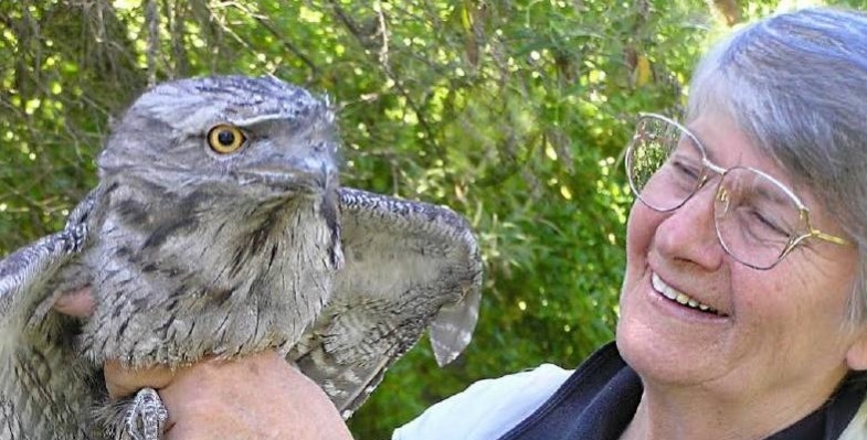
Much of the information referred to in this article is drawn from Gisela Kaplan’s book Bird Bonds. See also Bird Minds and Tawny Frogmouth![]()
Gisela Kaplan, Emeritus Professor in Animal Behaviour, University of New England
This article is republished from The Conversation under a Creative Commons license. Read the original article.
Felixer: The Feral Cat Problem Fixer
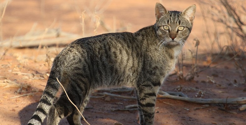
Reintroducing protected species into the wild has been near impossible due to predation by cats and foxes unless the site is protected by exclusion fencing. Now a promising solution has been trialled.
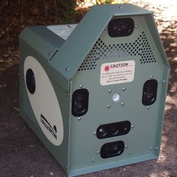 A device, called the Felixer, has been successfully trialled by researchers at UNSW. The device is getting rave reviews because it poses no threat to Australian native animals.
The device uses lasers to detect the shape of an animal as it walks by. If it detects a cat it sprays poison gel onto its fur. The cat then licks the gel off their coat and dies.
The device takes a photo with each spray, so there is good information on which animals it is firing on. So far the researchers have found that it's highly target-specific.
The researchers at UNSW set up 20 Felixers for a six-week trial on a 2,600-hectare, fenced-off property, Arid Recovery near Roxby Downs in South Australia. At the end of the six weeks researchers found that two-thirds of the 50 feral cats on the property had been killed by the device and no other wildlife had been harmed.
One of the study's lead researchers, Dr Katherine Moseby, said the results were very promising for eradicating feral cats in Australia:
In the trial we had 100% firing on cats. In some other trials, native animals triggered the device but it has a much higher target specificity than traps left on the ground.
Dr Moseby says the device is currently only available for research purposes, but they have high hopes it will become commercially available in the future. The idea is that in the future people will be able to purchase the device for use on their properties, particularly in remote areas.
Teaching resilience
Arid Recovery is home to some of the most endangered animals in Australia and remains one of the only places on the mainland that can support populations of the greater stick-nest rat.
Arid Recovery manager, Katherine Tuft, said the Felixer study was not the sort of experiment that the reserve was used to as it usually focussed on keeping native animals away from cats. She said:
This particular paddock where we did the research in is part of our 'beyond the fence' research projects …
We're trying to train native animals to cope with a certain number of feral cats because we'd like to have bilbies and bettongs surviving outside fences one day.
Parliamentary enquiry
While we are on the subject of feral cats, the Environment Minster, Susan Ley, has announced an enquiry into the problem of feral and domestic cats by the House of Representatives Standing Committee on the Environment and Energy. Submissions close on 30 July.
The terms of reference are wide ranging covering the extent of the problem, effectiveness of current abatement plans and control methods and awareness and education of the public. It includes the critical issue of the interaction between domestic cat ownership and the feral cat problem.
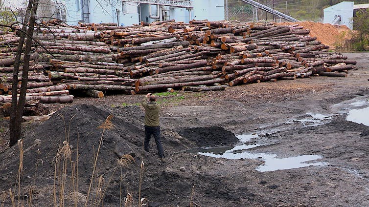
Forest Derived Bioenergy – Not a Carbon Neutral Option
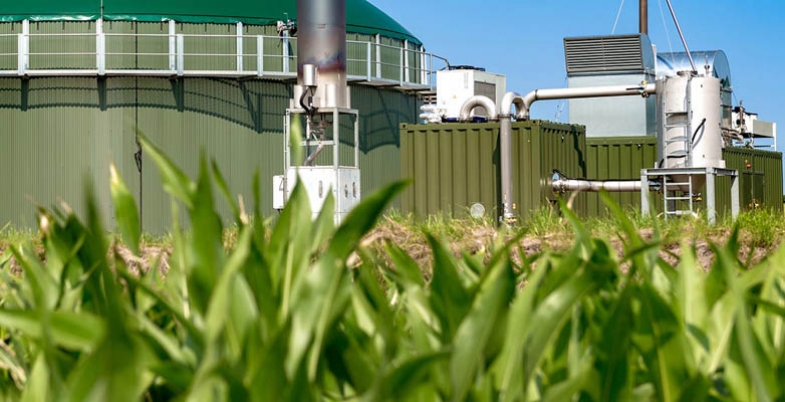
ARENA is the Australian Renewable Energy Agency that is tasked with improving the competitiveness of renewable energy technologies and increase investment in their supply. It is currently undertaking an enquiry to identify the role that the bioenergy sector can play in Australia’s energy transition. Bioenergy is a form of renewable energy that uses organic and renewable materials, typically waste streams from the agricultural, forestry and industrial sectors to produce heat, electricity, biogas and liquid fuel.
The Nature Conservation Council has written a submission to the enquiry into forest-derived bioenergy (FDB) that has been endorsed by 89 environment groups, including STEP. This article summarises the arguments against this source of energy.
In brief, as explained in the NCC’s submission, there are some fundamental problems with FDB:
- the level of carbon emissions is greater than coal-fired generation at the point of combustion
- it is not carbon neutral within time frames identified by the IPCC to reduce atmospheric carbon, if ever
- it is harmful to people and biodiversity
Carbon emissions
Burning biomass emits CO2 to the atmosphere, just as burning fossil fuels does. In fact, generating a unit of energy from wood emits between 3 and 50% more CO2 than generating it from coal (see figure below).
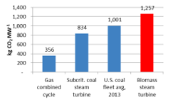
Data is derived from various sources for units burning biomass for fuel (assembled by Mary S Booth, Partnership for Policy Integrity)
The claim of carbon neutrality is based on simplistic assumptions and flawed carbon accounting
Emissions generated by combustion of biomass for energy generation are not reported nor accounted in the energy sector of the consuming country. The assumption behind this zero accounting in the energy sector is that all emissions are instead to be accounted for when the biomass is logged. Under the international carbon accounting rules all accounting for emissions and removals from actions associated with forests and forest materials is consolidated within land use, land use change and forestry (LULUCF) accounts. The rationale is that this avoids double counting of emissions but the signals sent by a zero emissions record in the energy sector have been misconstrued to wrongly claim carbon neutrality for burning forest biomass.
Carbon from the loss of trees is not recaptured within critical timeframes
Claims that forest regrowth nullifies the impact of forest biomass combustion on climate change are incorrect. When trees are removed from forests, especially with industrial forestry that uproots trees, we remove their function as a living carbon sink, and we damage the ability of forest soils to store carbon. Trees utilised for FDB may regrow but reaching their equivalent carbon storage capacity could take decades or even centuries. Replanting trees does pull carbon from the air, but not as much as letting existing forests keep on growing.
We have less than a decade to vastly reduce emissions. Carbon from the combustion of FDB cannot be recaptured within this timeframe.
FDB is not cheap or efficient
FDB requires intensive production, distribution and consumption of huge forest resources in order to have economies of scale. FDB energy is expensive in comparison to genuine renewable energy sources.
FDB has negative health impacts
Like coal-fired power, burning biomass also has significant public health impacts. Data from the Drax power station in the UK shows that biomass burning has increased particulate pollution by 400% since switching four of six boilers to FDB, while power output has remained constant.
Risks to Australian native forests increase with adding FDB in the product mix
Australia is already exporting native forest biomass for FDB. The logging industry, supported by governments, is planning to increase domestic uptake and exports. Proponents argue that FDB will not be a driver of increased native forest logging in Australia because it is derived from residue and waste materials. However the definition of ‘residue’ in Commonwealth and some state legislation can include whole logs. NSW has specifically defined immature native forest trees as ‘residue’.
Any incentive for logging native forests in Australia is a risk to native habitat and biodiversity. Industrial logging of forests is identified as a factor contributing to fire severity.
Our native forest carbon stores need to be increased, not burnt!
Membership Fees

Considering that we have had to cancel or postpone our walks and talks we decided it is appropriate to take some temporary measures to compensate members.
One year membership fee waive
We’ve credited everyone with one year’s free membership. New members who join before 30 June 2020 will be extended to 30 June 2022.
Lapsed members
We've reinstated recent lapsed members.
Purchase of book or map by non-members
For the rest of 2020 we'll offer the option of one year free family membership to anyone who buys a map or book. This means they'll be entitled to pay the member’s price for the publication.
Donations
We've added a donations button to our website if you ever want to make a tax-deductible donation. Donations help fund our environmental education grants.
AABR’S Post-fire Wildlife Habitat Recovery Response
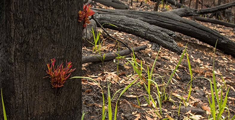
The Australian Association of Bush regenerators (AABR) is cautioning against rushing in to replant burnt areas. They are advocating a focus of allowing sites to regenerate and for sites where there is a need (and an opportunity) to remove weeds that could worsen if not treated and which would prevent recovery of native habitats.
They are establishing a database of volunteers, skilled and unskilled, AABR members and supporters who might be able to contribute some time to the volunteer effort over the next 6 to 12 months. They are particularly seeking people who provide their expertise to inform under-supported land managers and private landholders in high priority fire-affected areas about post-fire weeding so that they can better secure recovery of faunal habitats.
State Government News
The NSW government is not holding sittings in Macquarie Street but decisions are still being made, with most of them being a continuation of the same disregard for the environment. Here are some examples.
Planning System Acceleration Program
To aid recovery from the economic downturn arising from the COVID-19 pandemic the government has announced a Planning System Acceleration Program which will bring forward planning reforms:
to cut red tape and fast-track assessment processes to boost the construction pipeline and fast-track new projects
Only limited details of the program have been provided and it is proposed that it will include measures:
- to fast-track the assessment of state significant developments, development applications and rezonings, with more decisions to be made by the minister if necessary
- to support councils and planning panels to fast-track locally and regionally significant development applications
- to expand the type of works that can be carried out as a complying development
- to introduce a ‘one stop shop’ for industry to progress projects that may be ‘stuck in the system’
- to appoint additional acting commissioners to help clear the current backlog of merits appeals in the New South Wales Land and Environment Court
The developer lobby group, Urban Taskforce, was asked by Treasury to provide a list of ‘shovel ready’ projects that could be accelerated. STEP has been following two of these candidates closely. They have both been knocked back for good reason.
- The Mirvac plan to build 600 units on the old IBM site in West Pennant Hills that would destroy Blue Gum High Forest and threatened species habitat. The zoning changes required before the detailed DA could be assessed were rejected by the Hills Council for many technical reasons and huge community protest.
- The seniors housing development on Bayview Golf Course proposal that would clear an important wildlife corridor was rejected by the Land and Environment Court. The developer has resubmitted the DA.
Logging in koala and threatened species habitat
It is appalling that the NSW Forestry Corporation is logging in unburnt forests on north coast in some of the depleted habitat for threatened species. This includes areas that conservationists hope will become part of the Great Koala National Park.
Approval to extend longwall mining under Sydney’s water catchment
In March approval was granted for further longwall mining by Peabody Energy at the Metropolitan Mine under the Woronora Dam to provide coal for the Port Kembla steel works. It is claimed by the Planning Department that the mining process has been reviewed by independent experts who:
consider that the proposed mining would not compromise the reservoir – but have recommended a range of precautionary adaptive measures to ensure the mining is carefully monitored.
How can it be possible to manage the damage after subsidence has started causing loss of water from the reservoir into the mine?
In December the government also gave its tick for another longwall expansion at South32's Dendrobium Mine, also within Sydney's catchment. With this one the Avon and Cordeaux Dams are affected.
It has been revealed by the Sydney Morning Herald that WaterNSW is strongly opposed to the project. There is insufficient design to prevent drainage cracks and predicted water loss of as much as 5.2 million litres a day might be an underestimate.
Sydney is the only city in the world to allow mining under its water catchment. A petition with over 10,000 signatures opposing these decisions cannot be debated in parliament in the current circumstances.
NSW climate change policy
There is some good news at the state government level. They and most of the other states are leaving behind the recalcitrant federal government and have announced some real climate change policy.
The Net Zero Plan: 2020–30 is to reduce emissions by 35% below 2005 levels by 2030. This is more ambitious than the federal commitment to reduce emissions by 26-28%. The plan is part of the pathway aiming for zero emissions by 2050.
The plan recognises the situation that jobs will be created and business will save money by using low emission technologies. The government will spend almost $2 billion in a series of programs.
The programs include support for electric vehicle charging infrastructure, electricity demand reduction via building codes, creation of renewable energy zones that will create jobs in regional areas and a fund to support manufacturers to install low emissions equipment and farmers to lower emissions and take advantage of carbon offset programs.
Raising the Warragamba Dam Wall
The government seems determined to proceed with the plan to raise the Warragamba Dam wall by 14 metres. The project is currently undergoing research for a final EIS. It has been reported that the species mapping that was carried out before the fires was rushed with timeframes that would make it impossible to properly identify species numbers.
The area in the Blue Mountains World Heritage Area that would be affected by flooding after the dam wall is raised has been badly affected by the bushfires. No appraisal is being done of the impact of the fires.
Ku-ring-gai Council's Recreation in Natural Areas Strategy

 This strategy has taken many months to finalise after extensive consultation was undertaken with interested groups, often with competing interests.
STEP’s main interest is the Warrimoo downhill mountain bike track in St Ives. We have written about this many times (STEP Matters 181 and 188). It was built illegally back in the early 2000s.
Council closed the track in 2016 because it went through a coastal upland swamp, a vegetation community that was declared to be an endangered ecological community in 2012. The track also went through areas that are habitat for endangered wildlife such as the Eastern Pigmy-possum and Rosenberg’s Goanna. Nevertheless, the mountain bikers ignored or removed the barriers and carried on regardless.
Council resolved the situation by deciding to create an official track covering some of the existing track but changing the route so that it was well away from the upland swamp. This is a single downhill track (pretty scary) and a separate track for the return uphill. There is still stage 2 to do to investigate completing the loop for the return uphill and provide access for walkers. This project will be subject to approval from Crown Lands and an environmental impact assessment.
A volunteer Trailcare group, the Moo Volunteers has been appointed to assist with the construction planning and maintenance.
A visit to the site in March 2020 revealed that it was already in use but some signage is still needed.
The strategy also plans the following actions where improvement is badly needed:
- Establish and manage an environmental advisory group, with representatives from Council, the community and environment groups, to provide advice on environmental issues and opportunities in relation to recreation in natural areas and to assist Council in promoting responsible and sustainable recreation in the region.
- In collaboration with recreation user groups, develop codes of conduct for endorsed recreation activities in Ku-ring-gai’s natural areas, as well as dog walking and horse riding, to facilitate responsible and safe user behaviour and practices and to reduce conflict between recreation user groups and individuals. Codes of conduct will guide users to partake in recreation in natural areas in a socially and environmentally sustainable way.
- Reduce the incidence and impacts of unauthorised bicycle track construction through proactive management and stakeholder engagement – this activity is rife – we need to keep an eye out for these illegal tracks and shortcuts. In some cases, Council will pursue prosecution for unauthorised clearing or environmental harm.
- Improve directional signage and interpretative information about recreation areas on location and on Council’s website.
Planning for Bushfires – the Urban Perspective

Sydney escaped the extreme bushfire experiences of last summer but the heatwaves, strong winds and extremely dry bush conditions could easily have caused a major fire. After all the experiences of 1987, 1994 and 2001–02 demonstrate what can happen.
Bushfire preparation has been extensively upgraded by the Rural Fire Service and local councils. The following information has been provided by Ku-ring-gai Council’s Bushfire Technical Officer, Heath Fitzsimmons. He has now moved to the Central Coast so his position is vacant.
The authorities cannot possibly provide all the protection that property owners need from bushfire. People living near bushland have a responsibility to maintain their own properties to minimise the fuel load and vulnerability of their houses. Maintaining means regular clearing the roof and gutters, ensuring there are no wood piles or flammable gardens etc. Maintenance could also mean upgrading doors, windows etc to safer options).
Even so it is important not to overestimate the level of protection that a fire break or hazard reduction burn can provide. Experience with recent fires such as in Paradise California has shown that homes far from the fire front are at great risk from ember attack.
There is also the issue of whether property owners next to bushland are able to do any clearing of an Asset Protection Zone in bushland next to their boundary if the vegetation and debris has built up to be a fire hazard and Council or National Parks have not been able to do any clearing in recent times.
STEP developed the STEP Method of Selective Hand Clearing to be used for this purpose some 40 years ago but the legality of its application on Council or National Park land is not clear. If Council and National Parks are able to adopt a policy whereby qualified homeowners are able to be permitted to hazard reduce in land adjacent to their properties then STEP would of course support that. A natural extension of that would be permitting approved commercial bush regeneration firms to carry out such hazard reduction work at the homeowner's cost should they so propose.
When Ku-ring-gai Council has appointed a new bushfire officer STEP will hope to discuss this issue further and organise a talk prior to the next bushfire season, COVID-19 restrictions permitting.
Information from Ku-ring-gai Council
Planning and coordination of bush fire hazard reduction works
Bush fire hazard reduction works in the Ku-ring-gai Area are planned by the Hornsby Ku-ring-gai Bush Fire Risk Management Committee (BFMC), comprised of representatives from Ku-ring-gai and Hornsby Councils, NSW Rural Fire Service, NSW Fire and Rescue, NSW National Parks and Wildlife Service and other land managers, emergency services and utility managers.
Every 5 years the BFMC develops a Hornsby Ku-ring-gai Bush Fire Risk Management Plan (BFRMP), Risk Assessment Table and Asset and Treatment Table. These documents identify the ‘assets’ within the district, categorise those assets based on the level of bush fire risk faced and set out a broad 5-year plan for prioritised bush fire risk management works including hazard reduction burning, fire break and fire trail maintenance, and community engagement. From this broad plan the BFMC develops an annual works program.
A list of the hazard reduction burns on the current works program for the Ku-ring-gai area and maps of the proposed burn areas can be found toward the bottom of the bush fireplans and policies page of Council’s website. As these burns are scheduled (up to a week in advance) they will appear on the hazard reduction section of the NSW RFS website, and will also be published on Council’s Twitter and Facebook pages. Past fire history including both hazard reduction burns and bush fires can be viewed on Council’s web map.
Bush fire protection measures and effective risk management treatments
When considering the bush fire risk faced by a home it is most important to consider two major methods of bush fire attack; radiant heat and ember attack. Direct ignition from radiant heat/flame contact accounts for less than 15% of the houses lost to bush fire, while the overwhelming majority (approximately 85%) of losses are due primarily to ember attack. The two also have a cumulative effect, with houses exposed simultaneously to both radiant heat and ember attack at greatest risk.
The threat posed by radiant heat is very effectively reduced by establishing an Asset Protection Zone (APZ), i.e. increasing the separation distance between buildings and bush fire prone vegetation. The separation distance required ranges from 10 to 100 m depending on slope, vegetation type, and the nature of the asset. Council maintains more than 22km of fire breaks on public land in locations where APZs cannot be accommodated within private property boundaries. Where APZs can be accommodated within private property boundaries it is the responsibility of private property owners to manage these areas.
It is important to note that even the largest APZ provides a negligible reduction in the risk posed by ember attack and the only effective way to increase a home’s resilience to ember attack is through upgrading and effectively maintaining the building and immediate surrounding area. It is also critical that people living in bush fire prone areas recognise that there can be no guarantee that even buildings constructed to the absolute highest standards will be defendable or able to provide a safe refuge during a bush fire, and often the only safe option is to leave early, before a fire even starts. No buildings are designed to withstand a bush fire during Catastrophic Fire Danger Rating conditions, and many older buildings and subdivisions were not designed to withstand bush fire at even the lower Fire Danger Ratings.
Hazard reduction burning is an important aspect of an effective bush fire risk management plan, but does not provide long term protection from the threat of bush fire on its own. Rather, it is intended to complement other bush fire protection measures such as ember protection and APZs. More specifically, the purpose of hazard reduction burning is to:
- Provide fuel reduced areas which enable the protection of assets by firefighters when APZs are not in place,
- Complement APZs where these do not provide adequate protection,
- Provide strategically located fuel reduced areas to reduce the potential for large wildfires to develop,
- Provide areas where fire can more easily be suppressed, or
- Provide strategically located fuel reduced areas to reduce vulnerability of assets which are susceptible to fire.
A range of environmental considerations must be taken into account when planning hazard reduction activities, and for information on this see Guidelines for Ecologically Sustainable Fire Management and Bush Fire Environmental Assessment Code. A key concept of these guidelines is that of an appropriate fire interval – the minimum and maximum length of time between fires necessary to maintain ecosystem functions. Recommended fire intervals vary depending on vegetation type, with the minimum intervals applicable to Ku-ring-gai ranging from 5 years for dry ridgetop vegetation to 25 years for wet eucalypt forests.
The final critical component of an effective bush fire risk management plan is community engagement. Ku-ring-gai Council, in consultation with emergency management agencies and government, has developed the award-winning Climate Wise Communities initiative to actively engage with individuals and communities and assist in increasing the resilience of their homes and neighbourhoods to extreme weather events including bush fire. Through this program we partner with other councils, emergency services, non-government organisations and community groups to provide workshops, tools and access to experts for ‘at risk’ community members.
You may also find some useful information at the following links:
- Climate Wise Communities Ready Check – An online tool developed by Council to help you understand your risk from bush fire and other extreme weather events, and the first step in creating a survival plan.
- Bush Fire Survival Plan – A guide from the RFS to help you and your family create an all-important survival plan.
- NSW RFS Standards for Asset Protection Zones – Includes recommendations on landscaping and vegetation management.
- Building Best Practice Guide: Upgrade of Existing Buildings – Upgrades you can make to your home’s building elements to improve bush fire resilience.
- Water Smart and Energy Smart rebates – some applicable to bush fire protection, including up to $1000 for water tanks and up to $500 for external window shutters.
- 10/50 Vegetation Clearing Code – Some information on the sort of vegetation clearing you may be allowed to carry out on your property without Council consent.
One final link I want to include is the Overall fuel hazard assessment guide 4th ed. This is the industry standard method of assessing bushfire fuel hazard and is used to inform bushfire behaviour models and help plan hazard reduction activities.
Fudging About Emissions Figures Denies the Government the Credibility it Must Claim on the Global Stage
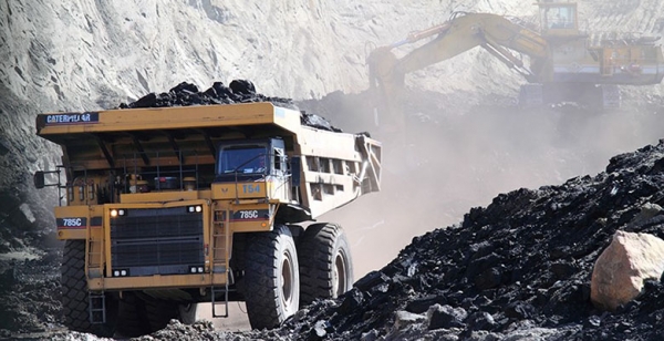
Optimistic, prosperous – a country of rare beauty, blessed with abundant natural resources. Australia has all the ‘golden eggs’ ’needed to position itself as a global leader, to help its Asia-Pacific region leapfrog to a new energy future and to guarantee its prosperity in the process.
Watching this summer’s unprecedented firestorms, I was heartbroken by the sheer scale of the human and ecological tragedy. ‘This must be the tipping point on climate politics in Australia,’ I said to myself. ‘Surely now the politicians will join hands and forge a bipartisan plan for a better future.’
Instead, the climate wars have returned, driven by a handful of deniers given air by powerful media sympathisers and a Prime Minister unwilling to fully embrace the science and stare them down.
For Australia, the choice between danger and opportunity is clear, and that choice must be made now. Since the 2008 Stern Review, the world has known that the cost of not acting is much greater than the cost of our current path. And since the 2008 Garnaut Review, Australians have known that without stronger action, droughts and bushfires would become more frequent and intense, and ‘observable by 2020’. It is time to move on from denial, delusion and delay towards preparedness, productivity and prosperity.
The following three steps will put Australia on track to the future we must create. First, be honest about where Australia is at. Your country is much more than 1.3% of the global climate problem. Carbon emissions from Australia’s use and export of fossil fuels account for about 5% of the global fossil fuel footprint. With exports included, Australians have the biggest per capita carbon footprint in the world.
Australia is not ‘meeting and beating’ its emissions targets. Emissions have increased in every calendar year since 2014. The government’s own projections say Australia will reduce emissions by only 16% by 2030, not the 26 to 28% it promised in Paris, nor the 50% required by science to limit warming to 1.5 degrees.
Kyoto ‘carryover’ can’t be used to make up the gap. The Paris Agreement doesn’t allow it. To suggest otherwise is at best an attempt to paper over Australia’s lagging efforts and at worst a legally baseless ploy that encourages cheating and holds back the next phase of carbon markets.
A highly vulnerable Australia cannot address climate change on its own, but its heel-dragging leaves it without the international credibility to drive a stronger global response.
The Australian government must look seriously at how to truly meet and beat its 2030 target, and it must ask other major emitters to join it in an alliance for higher ambition at the COP26 climate summit in Glasgow this November.
Second, Australia needs a bipartisan, long-term vision for decarbonisation. Rattled by the bushfires and growing evidence of climate-related risks and stresses, Australia’s biggest corporations – including Rio Tinto, Qantas, Telstra and BHP – have announced support for a national net zero target for 2050. For them, legislating this target is important to finally end the climate wars and provide certainty to underpin investment in the transition.
All states and territories have 2050 net zero targets, as do 73 other nations, including Britain and Canada. British Prime Minister Boris Johnson would welcome Australia joining these ranks ahead of the COP26 and giving consideration to the British model of using an independent expert body to advise government on five-yearly carbon budgets en route to net zero by 2050.
Independent MP Zali Steggall’s private members’ bill does exactly that.
Third, Australia must embrace net zero by 2050 as a central pillar of its economic plan for the future. The plan must prioritise the policies, industries and technologies that are scientifically aligned with the 1.5 degree temperature limit, and retire those that are not. Despite a booming renewables industry, coal still accounts for around 60% of Australia’s energy mix. But the technology is tired and unreliable in the summer, highly polluting, and no longer price-competitive with solar and wind. There is no place for governments signed up to the Paris Agreement to provide subsidies for dying coal. We must instead invest in the future.
After two years in operation, South Australia’s 100 megawatt ‘big battery’ at Hornsdale has successfully stabilised the state’s grid, saved consumers $50 million and produced handsome financial returns for its investors. In NSW, the Snowy 2.0 hydro project will deliver at least two gigawatts of dispatchable power to the main Australian grid, creating up to 5000 jobs along the way.
These ground-breaking projects are examples of how Australia can lead and prosper. With political honesty and vision, ambitious targets and a stubborn commitment to innovation, Australia stands ready to assume its rightful place as a clean energy superpower.
This article was published in the Sydney Morning Herald on 9 March 2020 and is republished with permission of the author Christiana Figueres. Christiana is a former UN Executive Secretary for Climate Change and the co-author of The Future We Choose
Development of a Plastic Waste Strategy

China decided two years ago to ban the importof plastics for recycling and several SE Asian countries have limited imports. This has forced governments to think of new ways of dealing with the growing pile of plastic waste. The mindset of out-of-sight-out-of-mind has to change.
Current waste generation statistics
According to the National Waste Report 2018 by Blue Environment Pty Ltd, prepared for the Department of Environment and Energy in 2016–17, Australia generated an estimated 54 million tonnes (Mt) of waste including:
- 17.1 Mt of masonry materials
- 14.2 Mt of organics
- 6.3 Mt of hazardous waste (mainly contaminated soil)
- 5.6 Mt of paper and cardboard
- 5.5 Mt of metals
This comprised 13.8 Mt (560 kg per capita) of municipal solid waste from households and local government activities, 20.4 Mt from the commercial and industrial sector and 20.4 Mt from the construction and demolition.
Although waste per person is going down, Australia’s population is growing so more volume is being generated.
Recycling rates are highest for metal: 90% is successfully reused (mostly overseas). Masonry materials have a recycling rate of 72%, followed by paper and cardboard (60%), glass (57%), organics (52%) and hazardous waste (27%).
The report makes a telling point about the lack of recycling of mobile phones and computers:
Some toxic metals, such as cadmium and cobalt, and rare and precious metals, such as gold and palladium, are still being landfilled in composite material products such as electronic waste. The tonnages are low but the potential environmental impacts and value of the lost resources are high.
Only 12% of plastic is recycled. Nationally we use 3.3 bn plastic bags, 2.6 bn coffee cups, 2.4 bn plastic straws and 1.3 bn plastic bottles each year. In total each person generates about 103 kg of plastic each year.
In August a meeting of environment ministers agreed to a ban on the export of waste glass, plastic, paper and tyres that will be phased in from mid-2020 after they agreed to a timetable for changes in the way Australia deals with recyclable material. The export of waste glass will be banned by July 2020, followed by mixed plastics by July 2021, whole tyres by December 2021 and all remaining waste products, including paper and cardboard, by no later than mid-2022. It has finally been recognised that we should be responsible for our waste generation and it is a resource that is valuable.
The plastic waste problem
The most difficult issue is plastics. A National Plastics Summit was held on 2 March with 200 participants from government, industry and the community.
The meeting agreed to 2025 National Packaging Targets:
- 100% reusable, recyclable or compostable packaging
- 70% of plastic packaging being recycled or composted
- 30% of average recycled content included in packaging
- phasing out of problematic and unnecessary single-use plastics packaging
Several manufacturers made pledges to introduce new measures to reduce or reuse plastic. Most significant was the pledge by the Pact Group, the largest manufacturer of rigid plastic packaging in Australasia, to invest $500 million in research and facilities to include 30% recycled content in their products by 2025 and keep 2 billion plastic containers out of landfill. McDonalds pledged to phase our plastic cutlery and straws by the end of 2020.
New technologies for reusing plastics
New technologies are being developed all the time so hopefully we won’t resort to the huge waste to energy incineration plant in Eastern Creek in western Sydney that has yet to be approved. The application for approval was refused in 2018 based on advice from the EPA, NSW Health and the independent experts that the air quality impacts and risk to human health of the proposal are unknown.
One example of new technologies that has huge potential was profiled on ABC’s 7.30 Report.
The patented Catalytic Hydrothermal Reactor (Cat-HTR) technology is a circular solution to problem plastic. The Cat-HTR is able to chemically recycle mixed plastics without separating different plastic types, including end-of-life plastic that would otherwise be sent to landfill, incineration or end up in our oceans. The oil created from the process can be refined into fuels and chemicals, including the chemicals to make new plastics.
There is a pilot plant operating in Somersby on the Central Coast but operation on a commercial scale is some way off. The first such plant is being built in the UK.
Local council plans
Hornsby Council updated their waste strategy early this year.
Ku-ring-gai Council decided at the March meeting to adopt a new waste strategy. Some of the major changes to the current services relate to the bulky clean-up and green waste services. A pleasing development is a plan to introduce waste recovery at the kerbside for e-waste, mattresses and metals. Currently there are organisations that will collect and recycle the components of the mattresses but they are not free. Surely the two councils could coordinate collection of large items like mattresses so we no longer see them sitting forlornly by the roadside in the rain.
We look forward to receiving details of timing of implementation.
Click here for recycling locations for specific items such as printer cartridges and mobile phones.
Post-fire Re-growth
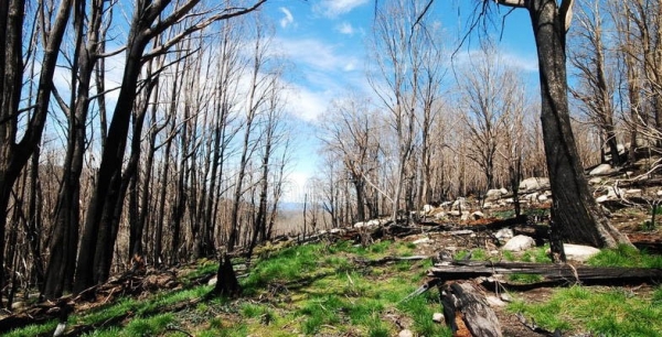
This article is based on recent visits by John Martyn to two different burnt areas, the Blue Mountains and the Mitchell Crescent side of Twin Creeks Reserve and is a summary only of a complex situation: of course we must await and monitor the long-term consequences.
The southern edge of the Gospers Mountain megablaze complex impinged on Blackheath, but a spring hazard reduction burn of the bushland south-west of Mitchell Oval, Turramurra, gave those of us living downwind of it a feeling of security whilst watching the January carnage elsewhere on ABC TV. Regrowth by coppicing, sprouting from tuberous rootstock and germination is obviously time related, and is relatively advanced at Mitchell Crescent, but is widespread too in the Blue Mountains after relatively few weeks. The article is illustrated with a small selection from numerous pictures.
Blue Mountains
We stayed in Blackheath over the weekend of 8 February (talk about a ‘wet weekend’ probably the wettest in recent history). Torrential rain and gale force winds made observations difficult, but from glimpses through the fog it was apparent that fire intensity in the Grose Valley was strongly variable and slope related. The canopy in the valley bottom was widely unburnt even though the ground flora and understory were brown and charred. Some eucalypt canopies were even in flower though it was hard to tell what species through the mist.
The wooded rocky slopes, cliffs and ridge crests were completely charred, however. Trees on ridge crests are generally shorter, and coupled with high fire intensity burning uphill, most canopies didn't survive. Many such trees however were bursting with epicormic shoots, and the charcoal-strewn ground was peppered with green shoots of rushes and sedges, even some grasses. Most if not all of the numerous tree ferns at Govetts Leap were bursting with lush new green crosiers (pictured) and some ground ferns like gristle fern were also flush with new leaves from their underground rhizomes.
Mitchell Oval ridge
This local hazard reduction burn left large areas of canopy untouched so total loss of foliage was restricted to shrubs and small trees, plus ferns and ground flora. In the broad sense, eucalypts were relatively unaffected, and short species that did get burnt, like dwarf apple Angophora hispida, are mostly bursting with new growth.
Many Proteaceae species have coppiced or re-shooted. We saw banksias B. oblongifolia and B. spinulosa coppicing readily while one large B. serrata was flush with epicormic shoots. Other proteoid re-sprouters were mountain devil Lambertia formosa and crinkle bush Lomatia silaiifolia.
The fire was limited by the northern valley track downhill from the bottom of Mitchell Crescent, but singed the edge of the valley rainforest and riparian understory. Young specimens of coachwood Ceratopetalum apetalum, white cherry Schizomeria ovata and scentless rosewood Synoum glandulosum show flourishing coppicing. The two other main rainforest species of the valley, Lillypilly Acmena smithii and sassafras Doryphora sassafras were out of reach of the fire, as were most grey myrtles Backhousia myrtifolia. Essentially riparian species like black wattle Callicoma serratifolia have coppiced strongly where burned.
Some surprises maybe, maybe not: the pea flower Platylobium formosum was seen re-shooting, as was one black sheoak Allocasuarina littoralis too.
Ferns like rainbow fern Calochlaena dubia and gristle fern Blechnum cartilagineum have widely recovered, and there are many pinnate seedlings of unknown wattle species plus twiners like Hardenbergia violaceae. The latter will create carpets of purple in a couple of years’ time, perhaps with a sprinkling of ground orchids in season.
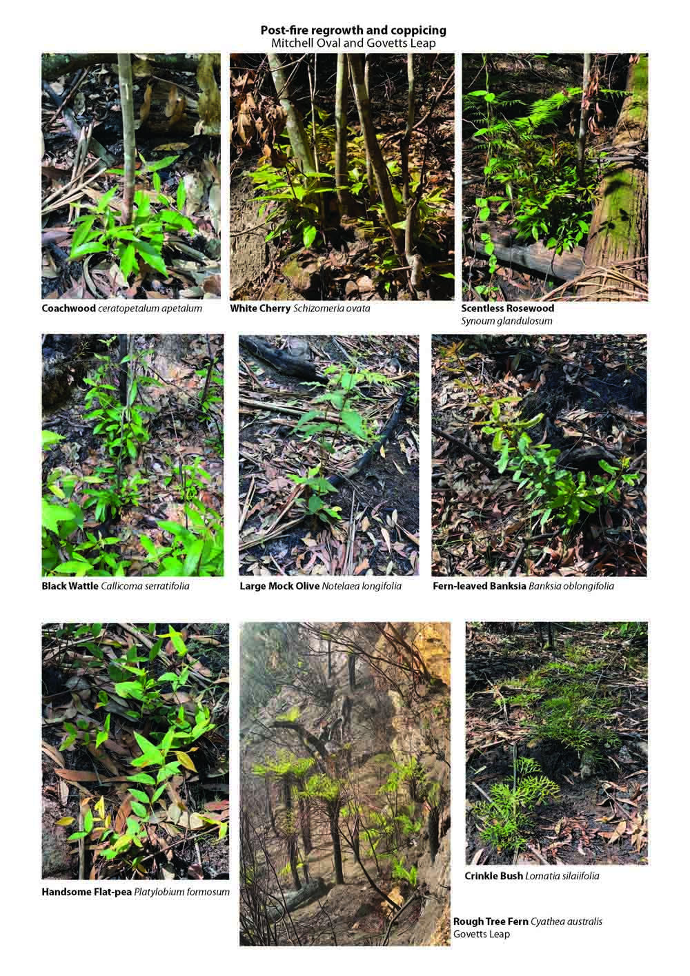
Pulling Out Weeds is the Best thing you Can do to Help Nature Recover

Many Australians feel compelled to help our damaged wildlife after this season’s terrible bushfires. Suggested actions have included donating money, leaving water out for thirsty animals, and learning how to help the injured. But there is an equally, if not more, important way to assist: weeding.
An army of volunteers is needed to help land owners with judicious weed removal. This will help burnt habitats recover more quickly, providing expanded, healthy habitat for native fauna.
Other emergency responses, such as culling feral animals and dropping emergency food from aeroplanes, are obviously jobs for specialists. But volunteer weeding does not require any prior expertise – just a willingness to get your hands dirty and take your lead from those in the know.
The recent bushfires burned many areas in national parks and reserves which were infested with weeds. Some weeds are killed in a blaze, but fire also stimulates their seed banks to germinate.
Weed seedlings will spring up en masse and establish dense stands that out-compete native plants by blocking access to sunlight. Native seedlings will die without setting seed, wasting this chance for them to recover and to provide habitat for a diverse range of native species.
Read more: Many of our plants and animals have adapted to fires, but now the fires are changing
This mass weed germination is also an opportunity to improve the outlook for biodiversity. With a coordinated volunteer effort, these weeds can be taken out before they seed – leaving only a residual seed bank with no adult weeds to create more seed and creating space for native plants to flourish.
With follow-up weeding, we can leave our national parks and reserves – and even bushland on farms - in a better state than they were before the fires.
Weeding works
In January 1994, fire burned most of Lane Cove National Park in Sydney. Within a few months of the fire, volunteer bush regeneration groups were set up to help tackle regenerating weeds.
Their efforts eradicated weeds from areas where the problem previously seemed intractable and prevented further weed expansion. Key to success in this case was the provision of funding for coordination, an engaged community which produced passionate volunteers and enough resources to train them.
Read more: Conservation scientists are grieving after the bushfires -- but we must not give up
Following recent fires in the Victorian high country, volunteers will be critical to controlling weeds, particularly broom (Scotch broom and related species), which occurs throughout fire-affected areas .
Fire typically kills these woody shrubs but also stimulates seed germination. Without intervention, broom will form dense stands which out-compete native plant species .
However, swift action now can prevent this. Mass germination reduces the broom’s seedbank to as low as 8% of pre-fire levels, and around half of the remaining seeds die each year. Further, broom usually takes three years to flower and replenish its seedbank. So with no new seeds being produced and the seedbank low and shrinking, this three-year window offers an important opportunity to restore previously infested areas.
Parks Victoria took up this opportunity after the 2003 fires in the Alpine National Park. They rallied agencies, natural resource management groups and local landholders to sweep up broom . Herbicide trials at that time revealed that to get the best outcome for their money, it was critical to spray broom seedlings early, within the first year and a half.
Broom management also needs to use a range of approaches, including using volunteers to spread a biological control agent.
Plenty of work to do
Parks Victoria continue to engage community groups in park management and will coordinate fire response actions when parks are safe to enter. Similar programs can be found in New South Wales, Western Australia, South Australia, Queensland, Tasmania, the Northern Territory, and the ACT.
A wide range of weeds expand after fire and warrant a rapid response. They include lantana, bitou bush, and blackberry.
Read more: Yes, native plants can flourish after bushfire. But there’s only so much hardship they can take
Managing weeds after fire is currently a high priority at many sites. At the edges of the World Heritage Gondwana rainforests of southwest Queensland and northern and central NSW, there is a window to more effectively control lantana. In many forested areas in NSW, Victoria and South Australia, fire has created an opportunity to address important weed problems.
State government agencies have the mapping capacity to locate these places. Hopefully they can make these resources easy for the public to access soon, so community groups can self-organise and connect with park managers.
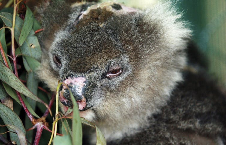
All this needs money
Emergency funding is now essential to enable community-based weed control programs at the scale needed to have a substantial impact. Specifically, funding is needed for group coordinators, trainers and equipment.
While emergency work is needed to control regenerating weeds in the next 6-18 months, ongoing work is needed after that to consolidate success and prevent reinfestations from the small, but still present, seed bank.
Ongoing government funding is needed to enable this work, and prepare for a similar response to the next mega-fires.
Want to act immediately?
You can volunteer to do your bit for fire recovery right now. In addition to state-agency volunteer websites, there are many existing park care, bush care and “friends of” groups coordinated by local governments. They’re waiting for you to join so they can start planning the restoration task in fire-affected areas.
Contact them directly or register your interest with the Australian Association of Bush Regenerators who can link you with the appropriate organisations.
Read more: You can leave water out for wildlife without attracting mosquitoes, if you take a few precautions
If we do nothing now, the quality of our national parks will decline as weeds take over and native species are lost. But if you channel your fire-response energy and commitment to help manage weeds, our national parks could come out in front from this climate-change induced calamity.
By all means, rescue an injured koala. But by pulling out weeds, you could also help rescue a whole ecosystem.
Dr Tein McDonald, president of the Australian Association of Bush Regenerators, contributed to this article.![]()
Don Driscoll, Professor in Terrestrial Ecology, Deakin University
This article is republished from The Conversation under a Creative Commons license. Read the original article.
Snowy Hydro Must Not be Rubber Stamped

NPA NSW has released a new research paper that has found that the claimed benefits of the Snowy 2.0 project are overstated or false.
Several environmental groups have signed an open letter to the Ministers of Planning and Environment appealing to them to reject the environmental impact statement for the main works that will be the first stage of the Snowy Hydro pumped storage project. Several contracts for the project have already been awarded before the EIS has been assessed.
A group of 30 experts also sent a letter to the prime minister and premier calling for a comprehensive review of the project and alternatives.
Politicians are acting as if the project is a fait accompli. The media is not giving any attention to the issues that have been raised. We need to send emails to the ministers so the issue cannot be forgotten.
John Martyn Research Grant Award for 2020

We are pleased to announce that the John Martyn Research Grant for 2020 has been awarded to Ruby Paroissien.
Ruby is currently undertaking her honours at UNSW, studying the effects of fire seasonality on seed ecology, a particularly important topic given the current climate. Her current focus is on Doryanthes excelsa (Gymea lily), a post-fire flowerer endemic to NSW and at risk to changes in fire regimes.
She holds both a Bachelor of Fine Arts and a Bachelor of Science giving her a unique perspective to understanding dynamics in nature. Prior to this year Ruby has spent her time volunteering alongside Mark Ooi among other scientists, to work on a variety of research projects. Last year she completed a summer research scholarship, which lead her to develop a paper on the rare flannel flower Actinotus forsythii.
The grant winner for 2019, Gabby Hoban has had to defer her project but we expect to hear all about her project later this year.
Postscript
Ruby's research was published in Environmental and Experimental Botany, vol 192, Dec 2021, 104634. You can also download a PDF of the paper, Effects of fire season on the reproductive success of the post-fire flowerer Doryanthes excelsa.
Good News Regarding the Mirvac Decision
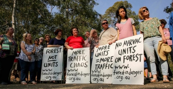
We have written several times about Mirvac’s proposal to develop the land at 55 Coonara Ave, West Pennant Hills that contains the old IBM corporate headquarters plus a large area of forest. IBM sold the site to Mirvac in 2010 but stayed on as a tenant until September this year. Mirvac’s proposal was for the development of a 600 dwelling complex that would result in the loss of many mature trees including Blue Gum High Forest and Sydney Turpentine Ironbark Forest. The future responsibility for management of a large forested area below the new housing areas was left unknown.
In order for the development to proceed the Hills Council needed to vote in favour of the rezoning of the land from its current classification as a business park to various residential zonings plus an E2 zoning for the forest. The vote was due to be held at the council meeting on 26 November. Naturally the council was recommending approval.
The local community has been objecting to the development for over two years. Many meetings have been held and large numbers have sent submissions and signed petitions. When the item was placed on the meeting agenda the community united again to remind the councillors of their opposition with over 4,000 submissions.
The Forest in Danger group was overjoyed to learn that council voted against the proposal. It was a tied vote of six all with Mayor Michelle Byrne using her casting vote to refuse the proposal.
Councillors who spoke against the proposal expressed the arguments that:
- the proposal is inconsistent with the district plans
- whole of area planning should take place not spot rezoning
- business zones should not be rezoned for housing – Hills has met their housing targets but are short of business zones
- lack of infrastructure
- the significant impact it would have on this sensitive environmental site
- the large amount of community concern about this development
A couple of councillors put in a last-ditch attempt to submit a rescission motion but this was soon seen to be very bad form so the council decision stands. Who knows what Mirvac will do next?
Synthetic Turf at Mimosa Park

The local residents living near Mimosa Oval, Turramurra that is part of Rofe Park have been campaigning strongly against Ku-ring-gai Council’s proposal to install synthetic grass on the oval. The vote was taken on 10 December and the residents were much relieved when council resolved to not proceed with installation on the grounds that:
- the oval is impacted by the Vegetation Category 1 bushfire zone and the proposal presents an unacceptable fire risk
- the oval is surrounded by Rofe Park and Sheldon Forest comprising Ku-ring-gai’s only Biodiversity Stewardship Site
- the proposal cannot accommodate informal recreational use currently enjoyed by the community
Promising Proposal for a Small Bird Habitat Corridor along Manly Creek

Mermaid Pool, a rock pool below Manly Dam was named in the 1930s for the naked girls who used to swim in it. The beauty was lost when suburbia arrived and the pool became a dumping ground for rubbish. The bush was not held in very high regard in those days! But some locals saw the potential beauty of the area and its importance as a wildlife and vegetation link between Manly Dam and Millers Reserve. They got together to save the bushland and waterway.
In the first exercise on Clean Up Australia Day in 2002 over 4 tonnes of waste was removed from the creek including old ovens, car parts, trolleys and building materials. Ever since, the Save Manly Dam Catchment Committee has been working converting the area into high quality bushland. More about the story of Mermaid Pool can be found here.
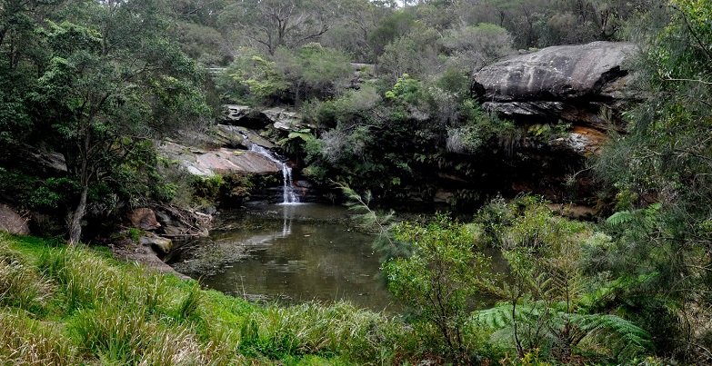
The Committee has developed a proposal to create a small bird habitat corridor on some Crown land parcels that are currently zoned for potential residential development. The land is close to Mermaid Pool and along Manly Creek but is bounded by low density residential development to the north and south.
Rare bushland has already been lost nearby through the development of Manly Vale Public School. The Species Impact Survey conducted for this school development identified the presence of many species of small birds. Upstream at Manly Dam Reserve (Manly Warringah War Memorial Park) over 80 bird species have been recorded. The proposed corridor is particularly suitable for small birds due to large areas of dense undisturbed vegetation, connectivity with surrounding reserves and refuge from predation and harassment by aggressive species like noisy miners and other impacts associated with the urban environment.
The Northern Beaches Council and local MPs have supported changing the zoning of these parcels to Public Recreation. In August 2019 the Department of Planning made a Gateway Determination in favour of the proposal. The rezoning process has progressed to the stage where council has called for public submissions on the proposal. The final hurdles are likely to have been overcome. Ultimately it is hoped it will be given the status of a Wildlife Protection Area.
Impact of Bushfires on Biodiversity
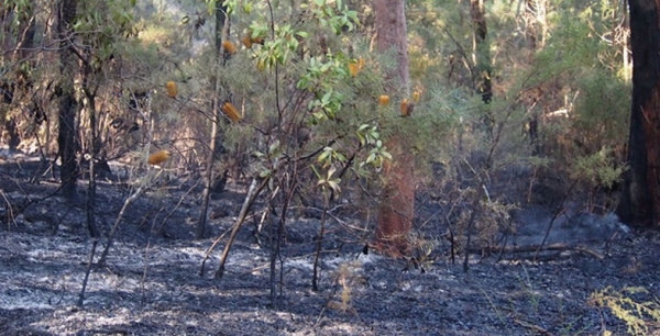
Australia and the world have been horrified by the devastating bushfires that have been burning along the east coast and tablelands and South Australia since September and reached their climax in December and January. These events have given the world a stark example of the extreme events that will be experienced as a result of climate change. The severe drought conditions combined with weather systems that delivered hot westerly winds followed by strong southerly changes created severe and unpredictable fires. On top of the impact on fire fighters and communities, the long-term impact on biodiversity will become apparent over many years. The Department of Planning, Industry and Environment (the department) has done a preliminary assessment of the areas affected by fires using satellite imaging.
As the department states, the period immediately after a fire is critical for the survival of injured animals and for threatened species. The priority is to support those involved in the recovery of injured wildlife and detailed data on the damage to habitat is essential for planning the next steps to minimise the long-term loss of ecosystems.
As of 10 January 2020, the data available reveals that:
- 5.128 million hectares (6.4%) of NSW has been affected by the wildfires. The severity of fire within this total area varies.
- More than 35% of the national park estate (or 2.539 million hectares) has been impacted. In key bioregions, the figure is well over 40%.
- More than 80% of the Greater Blue Mountains World Heritage Area and 54% of the Gondwana Rainforests World Heritage Area have been affected by fire.
- The most affected ecosystems are rainforests (35% of their state-wide extent), wet sclerophyll forests (41%) and heathlands (53%).
- More than 60 threatened fauna species have been affected by the fires, including 32 species for which 30% or more of all recorded locations occur in the burn areas.
As at 10 January 2020, the bushfires had impacted on the habitat of at least 60 threatened species listed under the NSW Biodiversity Conservation Act 2016.
The intensity of the fires has varied widely. In this initial assessment, the department developed a new methodology using Google Earth imagery which enabled the rapid estimate of where fire skipped over an area within the fire ground, leaving it little affected, where it burned the understorey and some of the canopy, where it burned the canopy only, and where it appears to have burned all vegetation.
Once it is safe to do so and ensuring that the environment is not damaged inadvertently, the department is carefully preparing a more refined version of this data for each fire ground, which utilises reference data gained from aerial imagery and ground-based post-fire surveys to provide a more detailed understanding of this variation.
Impact on Threatened Fauna
The department has compared the records of 300 threatened fauna species with bushland affected by the ongoing fires.
As of 10 January 2020, fires have burnt in:
- 70% of the bushland where six threatened animal species were previously sighted include the Long-footed potoroo, Philoria pughi (a frog), Hastings River mouse and Brush-tailed rock-wallaby
- 30% of the bushland where 32 threatened animal species were previously sighted
- 5% of the bush areas where 114 threatened animal species were previously sighted
As of 6 January 2020, more than 24% of all koala habitat in eastern NSW was within fire-affected areas. The total area of highly suitable koala habitat affected by fire in eastern NSW was more than 19%.
The data is being renewed as staff get the opportunity to check the situation on the ground.
Threats to Recovery
In the flurry of announcements of funding for bushfire recovery it is hard to get a perspective on funding that has been provided to prevent loss of animals that have survived. $50 million sounds good but this is against a background where funding for environmental management has been cut by Coalition governments. Will extra staff be employed to carry out the work required?
Recovery will involve the following stages:
- rescue of injured animals
- providing survivors with food and water
- prevention of damage to unburnt bushland from the extra browsing pressure, particularly from feral animals
- removal of feral predators such as cats and foxes
Will the NSW Government Amend its Policies?
There are two areas where the NSW Government has perverse policies.
Feral Horses in Kosciuszko National Park
In November the results of an aerial survey of feral horse numbers was released. The numbers have increased by more than 170% in the past five years. In the most populated area, North Kosciuszko National Park, the 2019 numbers are almost five times the 2014 numbers (see Table 1).
These numbers of horses are having a huge impact on alpine species and ecosystems. Horses create tracks through alpine swamps causing the water to drain away. They damage vegetation along streams that are essential for the survival of threatened species such as the Corroboree frog and Stocky Galaxia fish. These streams are the headwaters of the Murray and Murrumbidgee Rivers. Horses also pose a risk on roads.
The North Kosciuszko area, that has the highest number of horses, is also an area badly affected by the fires. So, the horses will move into the undamaged parts of the north placing great pressure on alpine vegetation already stressed by drought.
The NSW Government has virtually completely cut the program to remove the horses from the park. Only 99 were removed in 2019 and none in 2017 and 2018. Thanks to the influence of the leader of the National Party, John Barilaro, the horses are treated as having heritage value despite the huge damage they are doing to the sensitive alpine vegetation and animal species. The successful program of aerial culling has been terminated.
Hope for change now rests with the new feral horse management plan being developed by the recently established Kosciuszko National Park Wild Horse Community Advisory Panel and the Wild Horse Scientific Advisory Panel.
The Scientific Committee said the draft plan for action will be open for comment in February 2020 to meet NSW environment minister Matt Kean’s deadline for a final plan by 1 May 2020. This rapid timeframe is essential as substantial control measures should be implemented straight away before winter conditions arrive.
Clearing of Koala Habitat
The decline in koala numbers in NSW has been highlighted over many years by environment groups. The major causes have been land clearing for agriculture, forest logging and urban development. A significant part of koala habitat in NSW is in state forests or private land. The forests will recover after the fires but in the meantime the precarious situation for koalas will worsen.
Before this summer’s bushfires, koala populations in NSW and Queensland had already dropped by 42% between 1990 and 2010, according to the federal Threatened Species Scientific Committee.
The mid-north coast is home to a significant number of Australia’s koalas, with an estimated population between 15,000 to 28,000. It is estimated that 30% of their habitat was destroyed in the November/December fires in that area.
NSW Forestry Corporation is still logging unburnt koala habitat in state forests. It is believed that the NSW Government is planning on privatising the Forestry Corporation. The initial focus will be on selling softwood plantations but, as the organisation shrinks, the rest of the organisation will be regarded as uneconomic and the native forests will be next. It is reasonable to expect that private owners are likely to expect a higher profit and hence more rapid harvesting. The principle of sustainable harvesting has been compromised before.
The major clearing is occurring in the inland woodlands where the push is for agricultural development. Grazing land can allow for trees to be retained to shelter stock and provide bird habitat. The push has been to total clearing to make it easier for machinery to plough, plant and harvest vast swathes of land. The value of this cleared cropping land increases dramatically. What will its long-term value be when the nutrients and carbon in the soil have been blown away in dust storms?
As for clearing for urban or tourist development, the State Environmental Planning Policy (Koala Habitat Protection) 2019 has been changed recently. It clarifies the definition of core koala habitat and increases the number of tree species that can be used to identify koala habitat from 10 to 123. 99% of identified koala habitat on private land in NSW was at risk of being cleared before these changes and that remains the case.
On a more hopeful note the NSW Government has allocated $20 million for the purchase of private land that is core koala habitat to be converted into the reserve system. The NSW Koala Strategy is part of a long-term vision to first stabilise, then increase, koala population numbers across the state. Through many of its actions, it will also contribute to protecting other threatened species.
The NSW Government has committed $44.7 million to support the implementation of the NSW Koala Strategy.
With the sudden loss of so much koala habitat the logging contracts must be reassessed. There is talk that the numbers of koalas killed has tipped the population into the threatened category. It is hoped that the population assessment is made before the loggers can move back in to unburnt habitat.
Will the NSW Government Amend its Policies on Feral Horses?
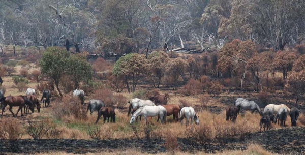
In November the results of an aerial survey of feral horse numbers was released. The numbers have increased by more than 170% in the past five years. In the most populated area, North Kosciuszko National Park, the 2019 numbers are almost five times the 2014 numbers (see Table 1).
These numbers of horses are having a huge impact on alpine species and ecosystems. Horses create tracks through alpine swamps causing the water to drain away. They damage vegetation along streams that are essential for the survival of threatened species such as the Corroboree frog and Stocky Galaxia fish. These streams are the headwaters of the Murray and Murrumbidgee Rivers. Horses also pose a risk on roads. The North Kosciuszko area, that has the highest number of horses, is also an area badly affected by the fires. So, the horses will move into the undamaged parts of the north placing great pressure on alpine vegetation already stressed by drought.
The NSW Government has virtually completely cut the program to remove the horses from the park. Only 99 were removed in 2019 and none in 2017 and 2018. Thanks to the influence of the leader of the National Party, John Barilaro, the horses are treated as having heritage value despite the huge damage they are doing to the sensitive alpine vegetation and animal species. The successful program of aerial culling has been terminated.
Hope for change now rests with the new feral horse management plan being developed by the recently established Kosciuszko National Park Wild Horse Community Advisory Panel and the Wild Horse Scientific Advisory Panel.
The Scientific Committee said the draft plan for action will be open for comment in February 2020 to meet NSW environment minister Matt Kean’s deadline for a final plan by 1 May 2020. This rapid timeframe is essential as substantial control measures should be implemented straight away before winter conditions arrive.
Clearing of Koala Habitat: Another NSW Government Decision Required

The decline in koala numbers in NSW has been highlighted over many years by environment groups. The major causes have been land clearing for agriculture, forest logging and urban development. A significant part of koala habitat in NSW is in state forests or private land. The forests will recover after the fires but in the meantime the precarious situation for koalas will worsen.
Before this summer’s bushfires, koala populations in NSW and Queensland had already dropped by 42% between 1990 and 2010, according to the federal Threatened Species Scientific Committee.
The mid-north coast is home to a significant number of Australia’s koalas, with an estimated population between 15,000 to 28,000. It is estimated that 30% of their habitat was destroyed in the November/December fires in that area.
NSW Forestry Corporation is still logging unburnt koala habitat in state forests. It is believed that the NSW Government is planning on privatising the Forestry Corporation. The initial focus will be on selling softwood plantations but, as the organisation shrinks, the rest of the organisation will be regarded as uneconomic and the native forests will be next. It is reasonable to expect that private owners are likely to expect a higher profit and hence more rapid harvesting. The principle of sustainable harvesting has been compromised before.
The major clearing is occurring in the inland woodlands where the push is for agricultural development. Grazing land can allow for trees to be retained to shelter stock and provide bird habitat. The push has been to total clearing to make it easier for machinery to plough, plant and harvest vast swathes of land. The value of this cleared cropping land increases dramatically. What will its long-term value be when the nutrients and carbon in the soil have been blown away in dust storms?
As for clearing for urban or tourist development, the State Environmental Planning Policy (Koala Habitat Protection) 2019 has been changed recently. It clarifies the definition of core koala habitat and increases the number of tree species that can be used to identify koala habitat from 10 to 123. 99% of identified koala habitat on private land in NSW was at risk of being cleared before these changes and that remains the case.
On a more hopeful note the NSW Government has allocated $20 million for the purchase of private land that is core koala habitat to be converted into the reserve system. The NSW Koala Strategy is part of a long-term vision to first stabilise, then increase, koala population numbers across the state. Through many of its actions, it will also contribute to protecting other threatened species.
The NSW Government has committed $44.7 million to support the implementation of the NSW Koala Strategy.
With the sudden loss of so much koala habitat the logging contracts must be reassessed. There is talk that the numbers of koalas killed has tipped the population into the threatened category. It is hoped that the population assessment is made before the loggers can move back in to unburnt habitat.
Following the Fires – Time to Reboot Biodiversity Management

Currently there are several reviews taking place into biodiversity management at the federal level:
- Senate inquiry into faunal extinction
- review of the Biodiversity Conservation Strategy
- review of the Environment Protection and Biodiversity Conservation Act (EPBC Act)
The outcomes of these reviews will be important in setting policies for the long-term survival of Australia’s unique biodiversity.
In the shorter term there is vital work to be done in ensuring that the wildlife that has survived the drought and fires has sufficient food and water and is not overwhelmed by feral animals such as cats and foxes. The major work will be in bushland to ensure it not invaded by weeds or pillaged by feral horses and deer.
Funding for biodiversity management at the federal and state level has been cut severely since the coalition came into power in 2013. Surely, after the massive bushfires governments need to reassess their priorities for biodiversity management. The media focus has been on the rescue of cute and cuddly animals. Even their long-term survival depends on restoration of habitat.
STEP Matters has included articles about Australia’s biodiversity strategy before. In Issue 194 we lamented the inadequacy of the 2010–2030 strategy. In summary it was at the level of simplistic statements with no quantification of targets. Instead it linked to various strategies that are to be adopted by the states and territories.
It is pleasing to report that progress has been made. On 8 November 2019, Australian, state and territory environment ministers endorsed a new approach to biodiversity conservation through Australia’s Strategy for Nature 2019–2030. The strategy is supported by a dedicated website, Australia’s Nature Hub. Both the strategy and the hub are owned by all the governments involved.
The strategy is coordinated with the Aichi Biodiversity Targets under the UN Convention on Biological Diversity. These targets are meant to be in place by 2020. We are a bit late but at least we have started.
The strategy provides an adaptive approach allowing each jurisdiction the flexibility to establish targets appropriate to the variety of environments across Australia and to change these as we continue to build knowledge during the life of the strategy.
It does acknowledge the scale of our biodiversity crisis and the role of science in finding solutions. For the first time there is explicit recognition of the need for management to allow for climate change.
An example of the goals is ‘reduce threats to nature and build resilience’. There are six progress measures under this goal, but most are not anything that can be measured, for example ‘retention, protection and/or restoration of landscape-scale, native vegetation corridors’.
A baseline is needed in order to assess progress in achieving this sort of goal. Following the fires, we may need two baselines for many species and vegetation communities – pre-fires and post-fires.
In a positive move the strategy sets an accountability framework, with ongoing working groups and four-yearly reporting, and should drive collaboration between federal agencies, the states and territories on nature conservation – all welcome moves. Fingers crossed that there is the will to progress the strategy beyond statements of the problems and the desire to fix them.
The amount of funding provided for the implementation of the strategy by all the jurisdictions involved is unknown. In the short term, funding will be focussed on fire recovery. Federal funding for the environment department has been cut.
The legislation to support the strategy at the federal level is the EPBC Act. It is currently under review – see below. The shortcomings of the NSW biodiversity legislation will be a stumbling block.
The Nature Hub is a link to projects and strategies that have been adopted so far. There is not much information there yet so the implementation mechanisms for most objectives are unclear.
For example, the national Threatened Species Strategy that commenced in 2016 has goals to tackle the feral cat problem, create safe havens for species at risk from feral cats, improve habitat and apply emergency interventions to avert extinctions. Targets to measure success are:
- 2 million feral cats culled by 2020
- 20 threatened mammals and 20 threatened birds improving by 2020
- protecting Australia’s plants
- improving recovery guidance
Senate Inquiry into Faunal Extinctions
This enquiry commenced in June 2018 and provided an interim report in April 2019 just prior to the federal election at which point the enquiry automatically folded.
The main points in the interim report were:
- Our lack of knowledge about fauna species – estimates suggest that, at present, there are 250 000 faunal species in Australia, with around 120 000 of these yet to be scientifically documented.
- We have a damning track record with a continuing decline in mammal species and a very significant slump in bird populations.
- Evidence given to the enquiry raised serious questions about the ability of the EPBC Act to achieve its objectives with extinctions continuing since the act was introduced in 1999.
- The EPBC Act has no compulsory mechanism to address the cumulative impacts of species decline including the loss, degradation and fragmentation of habitat, the threats posed by invasive species and the effects of climate change.
- The framework of the EPBC Act is not adequate to address the drivers of species decline plus there have been significant failures in its implementation, including use and resourcing of compliance and protection mechanisms, and that these would need to be addressed in a new or revised act.
- New environmental laws should be developed and there should be an independent institution with sufficient powers and funding to administer and oversee environmental approvals and compliance.
After the election the Senate granted the committee a further extension of time to produce a final report to 7 September 2020. We hope the Senate inquiry has some influence on the formal government processes and the funding available.
Review of EPBC Act
The federal government is undertaking a review of the chief biodiversity conservation law, the EPBC Act. It is led by Prof Graeme Samuel. A discussion paper can be found here.
The closing date for submissions has been extended to 17 April 2020.
The EPBC Act is more than 1000 pages of complex legislation, to which has been added over 400 pages of regulations. Clearly it is not fit for purpose of improving biodiversity into the future when we consider the outcomes of the past 20 years.
The Environment Defenders Office is calling for:
- A new Australian environment act that elevates environmental protection and biodiversity conservation as the primary aim of the act instead of the narrowly defined matters of national environmental significance.
- Duties on decision makers to exercise their powers to achieve the act’s aims.
- Two new statutory environmental authorities – a National Sustainability Commission and a National Environment Protection Authority.
- New triggers for federal protection action including activities that will impact on national reserve system (terrestrial and marine protected areas), ecosystems of national importance, vulnerable ecological communities, significant land-clearing activities, significant greenhouse gas emissions, significant water resources (beyond coal and gas project impacts).
- A dual focus on protection and recovery of threatened species and ecological communities.
- A national ecosystems assessment and environmental data and monitoring program that links federal, state and territory data.
- Greater emphasis on indigenous leadership, land management and biodiversity stewardship, including formal recognition of indigenous protected areas.
- A suite of international conservation protections to ensure Australian governments, companies, citizens and supply chains protect and support global biodiversity.
One of the stumbling blocks is the mindset held by governments and business that decisions should be made quickly to reduce ‘green tape’. The value of the environment has to be elevated above the value of development at any cost.
Lord Howe Island Rodent Eradication Declared a Success

After a prolonged process of research, impact assessment, economic analysis and discussion with residents the Lord Howe Island Board got the go ahead for the rodent eradication program – see STEP Matters Issue 191.
It was estimated there were 150,000 rats and 210,000 mice on Lord Howe — some 1,000 rodents for each of the island's 350 residents. Lord Howe Island is home to many threatened, endemic and migratory species. Rodents have previously caused the extinction of five bird and 13 invertebrate species on the island and currently threaten another 70 species.
One area of concern about the widespread use of baits was the risks to the island’s unique wildlife, particularly two endemic species of bird, the Lord Howe Island woodhen and the currawong, that might be particularly at risk of eating the bait. The former is an endangered bird, which was nursed back from the brink of extinction on the island in the 1980s — only a few hundred exist. The two species were taken into captivity while the rodent eradication program took place — placed in cages and looked after by staff from Sydney's Taronga Zoo.
Baits being used in the past to control the rodent population have proven to be ineffective largely because the program was too limited and most of the island is inaccessible. The program had to be much more comprehensive. In June the project commenced when cereal pellets laced with poison were placed inside 22,000 lockable traps distributed around the island. Inaccessible areas were targeted by aerial drops of the same bait.
There was a rapid reduction in the number of rodents at first, and then a few little blips of activity. The last set of baits was distributed in November. The island will be monitored for two years, and if no rats or mice are spotted, the area will be declared rodent free. So far it appears the project has been a resounding success.
 Return of the Phasmid
If the rodents are eliminated it should be possible to reintroduce the world’s rarest insect, the Lord Howe Island phasmid or stick insect. This giant is about the length of an adult’s palm when fully grown. It lives in communities, from a few dozens to several hundreds, in hollow trees.
In the early nineteenth century the insect was common but the rats found them very palatable so they disappeared in about 20 years. They were believed to be extinct until, in 2001, a group of scientists managed to climb onto the precipitous Ball’s Pyramid, a rock island 20 kilometres away. Several specimens were collected but only two survived. The female nearly died but intensive care enabled her to survive and lay several eggs. She has provided the insurance population but with a lack of genetic diversity.
Another expedition was undertaken in 2019 using professional climbers. The exploration had to be carried out at night as the phasmid is nocturnal. After a week only 17 insects were found. The low numbers may be because these insects only eat one plant, Melaleuca howeana. The museum had a permit to take no more than 10% of them so one precious specimen was taken back to Melbourne Zoo. She is now busily laying eggs.
In about two years’ time it is hoped they will be released onto Lord Howe Island.
Australia's Climate Change Policies
At the start of the bushfires right up to December the government refused to talk about the influence of climate change on the drought and bushfires – ‘now is not the time’, etc.
Seriously!
Australia’s current climate change polices are woefully inadequate. So much so that they were ranked 57th out of 57 countries in a report by The 2020 Climate Change Performance Index prepared by a group of international thinktanks that looked at national climate action across the categories of emissions, renewable energy, energy use and policy.
On the assessment of national and international climate policy, Australia is singled out as the worst-performing, with the report saying the re-elected Morrison government:
has continued to worsen performance at both national and international levels.
As the fires worsened the government’s stonewalling became stronger still trotting out the tired old excuses; we are only 1.7% of world-wide emissions. we will make our 2030 target ‘at a canter’, we are doing better than other countries on a per capita basis, etc.
In response to the criticism the statement from PM Morrison that policies are ‘evolving’ does not engender confidence that any meaningful changes will be made.
I don’t want to bore the reader with a lot of technical detail but I will try to provide a brief fact check on progress in meeting emissions reduction commitments and the effectiveness of current policies in one place.
Emission Reduction Targets Explained
The reports from the Australian Department of Environment and Energy provide detailed explanations of the sources of emissions and projections through to 2030. The past data is constantly updated which can be confusing. I am using the latest report called Australia’s Emissions Projections 2019 published in December 2019.
Carry Over Credits
The original Kyoto Protocol commitments were based on data of greenhouse gas emissions during 1990. Australia managed to negotiate a favourable position whereby the base year data included emissions from land use, land use change and forestry. It just so happened that there was a high rate of land clearing in Queensland in that year so we had an unusually high baseline.
Australia’s first commitment for the 2008–12 period was an allowance for average emissions to increase by an average of 8% compared to 1990 levels, unlike most countries that committed to reduce emissions by at least 5%.
As it happened, we managed to over-achieve the target emissions and ended up with a carryover credit of 128 Mt CO2-e.
The next commitment was made to reduce emissions compared to 2000 levels by 5% to 2020. The way this is described implies that the level at 2020 should be 5% below the 2000 level. In fact, the requirement is that the total emissions over the 8-year period 2013 to 2020 should be 5% less than 8 times the level in 2000. The data cannot be quite finalised yet but it looks as though this commitment will be over achieved by around 280 Mt CO2-e. The total carryover is then of the order of 400 Mt.
The next target to focus on is the commitment made under the Paris Agreement to reduce emissions by 26 to 28% below 2005 levels by 2030. Again, this means that the total emissions over the 10-year period 2021–30 will be 26 to 28% below ten times the level in 2005.
The government’s own advisory body, the Climate Change Authority advised in 2015 that the science-based target should be between 40 and 60% below 2000 levels based on a goal of keeping global temperature below 2°C above pre-industrial levels.
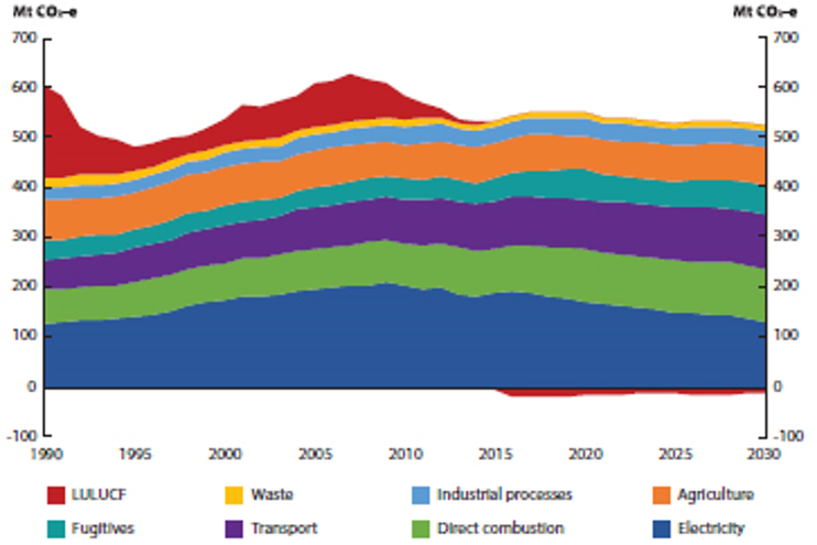 How are Emissions Tracking?
The latest government report states that the 2005 emissions level was 602 Mt CO2-e. So, the total emissions allowance for 2021–30 is 4,778 to 4710 Mt (602/1.26x10 to 602/1.28x10) (see figure which shows Australia’s emissions 1990–2030).
Emissions in 2020 are estimated to be 534 Mt and in 2030 511 Mt. The current projections are that emissions over the 10 years will be 5,169 Mt, at least 390 Mt over the commitment. We can only achieve the commitment if use is made of the carryover credits of 400 Mt.
Taking advantage of these credits is very poor form. No other country is doing this. Most of the rest of the world is genuinely taking action to reduce their emissions. What matters is emissions now and the path to zero emissions by 2050, not the easy ride we were given last century.
2050, not the easy ride we were given last century.
Climate Policies
The policies to reduce emissions are:
- Renewable Energy Target (RET)
- direct action under the Emissions Reduction Fund (ERF)
- safeguard mechanism
- National Energy Productivity Plan (NEPP)
It doesn’t appear that these policies, particularly the ERF, are sufficient to achieve our 2030 target, particular given that many do not currently appear to have sufficient funding.
Renewable Energy Target
The original RET was established with the goal of increasing generation from renewable electricity sources compared with the level in 1997 to 20% by 2020. In practice the goal was expressed as 41,000 GWh of electricity generated per year.
The Abbott Liberal Government claimed the cost was too high and instituted a review by the Climate Change Authority. As a result, the target was reduced to 33,000 GWh by 2020 equivalent to about 23.5% of the current total of electricity demand.
Despite the dramatic rhetoric from the politicians supporting coal-fired power, the cost of providing incentives for renewable electricity generation has increased bills by only about 5%.
 This target has been achieved already in 2019. No announcement has been made of any future policy creating great uncertainty in the industry. There has been a drop in new investment of nearly 21% in 2018–19 (see figure) at a time when the technology is developing rapidly.
Several states have announced renewable energy targets so it looks as though it is up to the states to encourage new renewable energy projects. The take-up of rooftop solar is also still strong. Data from CSIRO and AEMO confirms that, while existing fossil fuel power plants are competitive due to their sunk capital costs, solar and wind generation technologies are currently the lowest-cost ways to generate electricity for Australia, compared to any other new-build technology.
Continued renewables growth also requires long-term planning of transmission infrastructure and storage technologies to ensure the distributed energy can be delivered where it is needed, and that reliability is maintained.
Emissions Reduction Fund (ERF)
The ERF is a voluntary scheme designed to provide financial incentives for businesses, landholders and communities to reduce emissions. As of 16 November 2017, the ERF had contracted 189 million tonnes of emissions reductions at a cost of $2.23 billion. Around $300 million remained for government purchasing of emissions reductions. Further funding of $200 million pa has been agreed over the next 10 years.
A range of projects to reduce emissions have been funded under the ERF so far. These include, for example, projects to replace Melbourne street lights with more energy efficient light bulbs, native forest and vegetation regrowth projects and the use of gas from waste to create energy. Many have been criticised as an inefficient way of reducing our emissions, amid suggestions that the government is paying polluters for emissions reductions that would have happened anyway even without the scheme – see STEP Matters Issue 188.
Safeguard Mechanism
The ERF includes a safeguard mechanism, which aims to ensure that emissions reductions achieved by the ERF are not nullified by rises in emissions elsewhere. The safeguard mechanism came into effect on 1 July 2016, and encourages large businesses not to increase their emissions above historical levels. The mechanism applies to emitters with annual emissions of over 100,000 tonnes CO2-e. The mechanism has been criticised as weak as there is too much flexibility to allow companies to shift or adjust their obligations.
Energy Productivity
There is also a National Energy Productivity Plan (NEPP) that aims to encourage more productive consumer choices and promote more productive energy services.
Measures listed in the NEPP include improved vehicle efficiency and improved residential building energy ratings and disclosure. The NEPP could result in reduced greenhouse gas emissions in numerous sectors including transport, agriculture, industry and electricity.
The NEPP is expected to contribute over one quarter of the emissions reductions required to meet our 2030 target. However, as of July 2016, there does not appear to be any additional funding specifically allocated to implement this plan. The plan appears to have a very low profile.
Book Review – Native Fauna of the Greater Blue Mountains World Heritage Area
While we may stand on a clifftop lookout and gaze in awe at its world-class sandstone scenery, it wasn't the scenery or the geology but the flora and fauna that pushed the Greater Blue Mountains over the line in its world heritage listing. In an era in which we are easily distracted by technology and worrying world events not to mention frantically busy lives, this book is a balm to the spirit and a timely reminder that we have on our doorstep a region that is unique and biologically rich, and must be preserved at all cost. The work was compiled by veteran Blue Mountains ecologists whose names many of you will recognise from their comprehensive botanical surveys of the Hornsby Shire and other wild areas of greater Sydney.
Native Fauna of the Greater Blue Mountains World Heritage Area is far from the first publication on the topic in the region of course, but it compiles for the first time in one volume all the mammals, reptiles, amphibians and birds that have been recorded in that vast and physically challenging area. It does this with many compact but excellent photos, and also with summary descriptions of sightings, key habit and habitat information and conservation status. Plus there is a full index and comprehensive reference list.
The impact of the book is further lifted however by more than 25 beautiful watercolours by Kate Smith. These not only are accurate representations of their subjects but have a pleasing softness that contrasts with the many sharply-defined photographs taken by Peter Smith. This is a must buy for anyone with an interest in Blue Mountains natural history and should sell at least many hundreds of copies. It's available in Blue Mountains bookshops and information centres (there are many) so buy a copy next time you're up there.
Judy, Peter and Kate Smith
P&J Smith Ecological Consultants
published 2019, 172 pp, full colour, $35
Review by John Martyn
Infrastructure Cannot Catch Up with Current Population Growth

The state and federal governments are unwilling to discuss the issue of Australia’s population growth. The general view is that the greater the growth the more we will all benefit. Of course their only interest is the simple notion of economic growth, not social wellbeing or environmental quality. Actually economic growth has not been great either. The fact that economic growth per capita has not kept up with inflation has been conveniently ignored.
Australia’s population grew by an average of 400,000 over each of the last five years to reach 25.4 million at 30 June 2019. 60% of this growth is from net overseas migration. This is adding another Canberra every year. The prospect that our population could reach 60 million by the end of the century doesn’t seem to worry the politicians. They appear to believe that this is a fact of life.
Sustainable Population Australia commissioned a report on the infrastructure needs of Australia following the increase in our growth rate this century. The report by Leith van Onselen from business analysis firm Macrobusiness found that unless Australia's population growth is substantially reduced, it is an illusion to believe that infrastructure will ever catch up.
Amenity for people in our major cities is being eroded through increasing congestion and road tolls, declining housing affordability and loss of green space. The whole country is having to bear the growing infrastructure costs.
The report estimates that each additional person requires at least $100,000 worth of additional public infrastructure to maintain the current standard of living. Governments have been trying to catch up with a backlog of infrastructure that developed during the early part of this century. Some progress is being made but we will be forever trying to catch up to cater for the new residents.
The Bureau of Infrastructure, Transport and Regional Economics estimated that congestion costed the Australian economy $16.5 billion in 2015. Moreover, without major policy changes, congestion costs are projected to reach $27 to $37 billion by 2030. Similarly, Infrastructure Australia, in its 2019 infrastructure audit, estimated that the annualised cost of traffic congestion and public transport crowding in Australia would rise from $19 billion in 2016 to $39.6 billion in 2031. These congestion pressures will be particularly acute in Sydney and Melbourne.
The cold hard truth is that the quantity of infrastructure investment required for a big Australia is mind-boggling.
The volume of population growth into Sydney and Melbourne needs to be put into perspective:
- It took Sydney roughly 210 years to reach a population of 3.9 million in 2001. Yet the official medium projection by the ABS has Sydney reaching roughly 2.5 times that number of people in only 65 years.
- It took Melbourne nearly 170 years to reach a population of 3.3 million in 2001. The official medium ABS projection, however, has Melbourne’s population tripling that number in only 65 years.
In the face of these unprecedented numbers, the key difference between then and now needs to be underlined: unlike the post-war period, it is no longer easy to further expand the capacities of our largest cities. What was an abundant supply of cheap frontier land in the 1950s and 1960s is now well and truly built-out. Both cities are now sprawling metropolises with greenfield land in short supply. Ever-longer commutes erode productivity, and ever-greater distances between rich and poor neighbourhoods entrench disadvantage. New infrastructure investment necessarily requires costly solutions like land acquisitions and tunnelling in order to retrofit projects into existing suburbs.
Some recent examples are stark. The WestConnex project in Sydney will reportedly cost $17 billion for 33 km ($515 million per kilometre) while Melbourne’s West Gate Tunnel is expected to cost $6.7 billion for five kilometres of highway ($1.34 billion per kilometre). In contrast, the 155 km Woolgoolga to Ballina highway upgrade, a surface road, costs $4.9 billion, or just $32 million per kilometre (approximately 16 times less than WestConnex, and 42 times less than the West Gate Tunnel, on a per kilometre basis). And yet, with all of this current and proposed investment, of increasing orders of magnitude, congestion is still expected to increase.
The Productivity Commission has reported several times on the costs and benefits of immigration and has found little if any net benefit for the existing population. It has also added an important caveat, namely that it has not taken the infrastructure or environmental costs into its analyses because of the complexity of doing so
There are two myths that the government keeps on spruiking as the solution. Again these were the findings of a COAG report.
Invest in Infrastructure and Plan Better
The SPA report demonstrates that this is impossible with the current growth rate.
Settle New Migrants in Regional Areas
There is no way of keeping migrants in regional areas when there is not enough employment. Cutting Sydney’s population by 40,000 would not be noticed but the addition of that many people to a centre like Orange would double its current numbers. Most regional centres do not have enough water supply to cater for a large increase in population. Much of regional Australia is located far away from the ocean, meaning that desalination of seawater is not an option, and large-scale desalination of groundwater for inland towns is unlikely to be feasible or ecologically sustainable.
Vale Doug Stuart
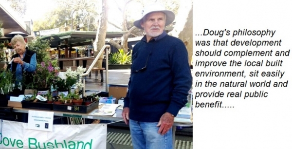
Members of the Lane Cove Bushland and Conservation Society and the Lane Cove community have been saddened by the death in September of Doug Stuart. Doug was a tireless advocate for the natural and built environment of Lane Cove and further afield. His first venture into bushland protection was prompted by news in 1970 that the local golf course wanted to double its size by annexing bushland, some of it at the bottom of his garden. Community anger at the potential harm to local flora and fauna prompted a public meeting and the foundation of the Lane Cove Bushland and Conservation Society in March 1971. Stuart was a founding executive member and, with his wife Norma, has been a driving force behind the society serving as president (10 years) and secretary (12 years).
In the summer of 1971 to 72, Stuart organised a large team of volunteers to survey the state of all Lane Cove’s bushland to identify sites suitable for regeneration. He drew maps of each site and collated ownership details. He gave the document to council who responded to the call to maintain and protect it. In 1998, he helped found RASAD, a community group advocating for appropriate development in the Lane Cove village. Doug’s profession as an architect enabled close analysis of development proposals.
His philosophy was that development should complement and improve the local built environment, sit easily in the natural world and provide real public benefit. RASAD spoke out against a series of inappropriate proposals, demanded change in others and refused to accept developers’ proposals that would have turned Lane Cove’s art deco village into concrete and steel.
Turramurra Turf Battle

Ku-ring-gai Council is soon to decide whether to install synthetic turf at Mimosa Oval in Turramurra.
Click here for our submission to council and here for our report on Mimosa Oval's geological and physical setting and flora.
STEP is opposed to the use of synthetic turf for a number of environmental reasons. These are accentuated by the location of Mimosa Park being surrounded by bushland, most of which is a biobanking site. These reasons include:
- During heavy rain additional water run-off is generated because the synthetic surface does not absorb water.
- Chemicals may leach from the synthetic turf and the breakdown of the plastics and rubber may pollute surrounding areas.
- Natural grass acts as a carbon sink but requires mowing and fertilizer use. On the other hand, synthetic turf is made from petrochemical materials, so the manufacturing process involves energy use.
- Synthetic turf requires ongoing cleaning and has a limited life so will need to be disposed of and replaced after 8 to 10 years depending on the level of use.
- Synthetic turf has a significantly higher surface temperature than natural grass making it impossible to use the field in hot weather, even only as high as 30°C.
- The synthetic turf surface will lead to compaction of the soil underneath and the loss of the microorganisms and insects that normally live in grassed areas.
- Natural grass fields provide a food source for birds such as magpies, lapwings and cockatoos. The reduction in foraging areas for these birds will have impacts further up the food chain. Top predators, such as the Powerful Owl, will lose a foraging opportunity.
Apart from the environmental issues the installation of synthetic turf at Mimosa is being opposed strongly by the local community that will lose use of the oval as a general recreation area. Its current use for cricket will not be possible. Kissing Point Cricket Club will have to find another venue for its matches. If natural grass is maintained soccer can still be played in the winter as well as cricket.
Mimosa Oval is part of Rofe Park that was gifted by the Rofe family:
Upon trust for the public as a public park and reserve for the preservation of natural fauna and flora.
The proposed use solely as a soccer field will mean it will no longer be a public park.
Council originally considered installing synthetic turf at Norman Griffiths Oval. From the soccer club’s point of view this has the major advantage that the field would be right next to their clubhouse. It appears that Norman Griffiths will still be used for soccer matches as there is a shortage of suitable fields.
Norman Griffiths Oval was rejected on the grounds of difficulty and expense of the works needed to control heavy rain run-off. The Mimosa plan will save about $1 million. Council now proposes to use the money saved to upgrade Norman Griffiths as well as installing the synthetic turf at Mimosa. It is not clear if the upgrade plan includes the installation of better fencing around the Norman Griffiths Oval to prevent people shimmying down the slopes around the oval. This work is essential in any case because these areas contain a special range of plants including orchids.
To cater for the cricketers who used to play at Mimosa Oval, council is proposing to install a concrete cricket pitch at Norman Griffiths. It is not clear what effect this will have on its use as a soccer field.
Bayview Golf Course Development – They’re Trying Again!

In the last issue of STEP Matters we reported good news that, in April 2019, the Land and Environment Court had upheld a decision by Northern Beaches Council and the North Planning Panel to refuse a seniors housing development on Bayview Golf Course. Unfortunately the Golf Club in association with developer Waterbrook has now re-submitted plans to the Department of Planning, Industry and Environment for a similar development consisting of seven large buildings, with three storey apartments over 5 acres of historical open space land.
The Golf Club wants to clear the last remaining area of remnant forest left on the golf course. This will further impact significantly the already fragile ecosystem within this important wildlife corridor that is home to nine threatened fauna species. It is habitat to a family of Powerful Owls and their creek line roosting area is very close to the development site. They also want to raise the level of the flood affected portion of their land, which is a designated wetland area for many bird species.
The community is concerned that if this application is approved it will create a significant precedent for Bayview and the whole of the Northern Beaches area. If seniors three storey apartments can be built in the middle of a high priority wildlife corridor, and that is not considered 'environmentally sensitive', nor worthy of protection, then we can expect similar large-scale seniors living complexes to be built on any wildlife habitat or ecologically sensitive land across the Northern Beaches.
Click here to sign a petition organised by the Bayview residents community group and here for more information.
Berowra Valley National Park – Some Good News
There is a parcel of land at the end of Chestnut Road, Mt Colah that has been privately owned for years. It is just below a playing field that was built on a former landfill site. Pollutants have been leaching out of the tip into the creek below. Nevertheless, the land has some high quality bushland and borders on Berowra Valley National Park.
The landowner submitted a subdivision plan for the land that would have created 49 housing lots on the 4.4 ha sloping site. The process has been ongoing since 2017 as Hornsby Council has requested further documentation and an EPA investigation was required of gas from the former landfill site.
Hornsby Council recommended refusal mainly on the grounds that most trees would be cleared, and major landform modifications would be required. Over 100 objections have been submitted by local residents on the grounds of site contamination, overdevelopment, traffic, parking and safety impacts, tree loss, flora and fauna impacts, acoustic impacts and unacceptable impacts on the catchment of the Berowra Valley National Park.
In October the DA went before the Local Planning Panel. It is a great relief that the Panel unanimously decided on rejection because the proposal did not comply with many principles of the urban bushland policies and the Hornsby Development Control Plan.
What happens next is not clear. Could some or all of the land be added to Berowra Valley National Park?
Water Desalination
As this is being written in late-August, Sydney is enjoying another near cloudless day. There’s been no rain for weeks and none is forecast. Rainfall at the observatory has been 3.2 mm for the month so far.
This is not unusual for August. August 2018s total was 7.8 mm; 2017s 24.2 mm. But it can be very variable; 2014s was 215 mm. Sydney’s record daily rainfall was on 6 August 1986 – 328 mm with a total of 448 mm with the inclusion of the day before and the day after.
It has been dry and the dams are about 50% full and falling rapidly. As a result the desal plant at Kurnell is in operation to provide about 15% of Sydney’s water. Consequently our water bills are being increased from $2.11 to $2.24 per kL on 1 October.
Desal means desalination; i.e. the process of converting sea (saline) water to drinking water by the removal of salt. This is done by a process of filtration (reverse osmosis) but requires the water to be subject to massive pressure. It is very expensive in terms of energy consumption.
Brisbane (Gold Coast), Sydney, Melbourne and Adelaide all got their desal plants as a result of the millennial drought in the early years of this century. They are only operated fully in drought periods – but see our update on Adelaide.
The Melbourne operation is quite marginal as the plant is located near Wonthaggi south-east of Melbourne not far from Phillip Island. It was impossible to locate it on Port Phillip Bay as water circulation in the bay is too low. So an 85 km pipeline had to be built as well and this of course gives rise to extra energy for pumping.
What about Perth you ask? This is the standout situation as this city depends on desal for about 40% of its supply year on year. Only about 10% comes from the dams in the Darling Ranges near Perth as most of this water is piped to the Eastern Goldfields (Kalgoorlie). One suspects that much of it is used by the gold mines.
The remainder is supplied by groundwater and recycling. The groundwater in future might become saline in which case it will be subject to desal too. This is also an issue in outback NSW.
The environmental impact of desal in Perth is somewhat mitigated by the use of natural gas to generate electricity.
Do Perth residents pay more than Sydney residents given that their water costs more to provide? The answer appears to be yes but it is not as simple as it might be. Perth has a sliding scale of charges. Like Sydney there is quarterly billing but the Perth charge depends on one’s annual consumption and can cost up to $4.442 per kL.
Sydney Water claims that its desal power is provided in an environmentally friendly way in that they have a contract with the 67 turbine Capital Hill Wind Farm, near Canberra.
This is a furphy. When the desal plant isn’t operating the wind farm feeds the NSW power grid. So when it is operating this feed is reduced and we have more reliance on gas and coal so increasing greenhouse gas emissions over what they otherwise would be.
A contrary view might be reasonable if we knew the pricing/contractual arrangements between Sydney Water and Infigen Energy, the owner of the Capital Hill Wind Farm. It may be that the farm would not have been developed without the desal requirement or not developed to the same extent.
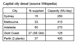
CityLab article
Here are some excerpts from an article entitled A Water-stressed World Turns to Desalination.
The first large-scale desal plants were built in the 1960s, and there are now some 20,000 facilities globally that turn sea water into fresh. The kingdom of Saudi Arabia, with very little fresh water and cheap energy costs for the fossil fuels it uses in its desal plants, produces the most fresh water of any nation, a fifth of the world’s total.
Israel, too, is all in on desalination. It has five large plants in operation and plans for five more. Chronic water shortages there are now a thing of the past, as more than half of the country’s domestic needs are met with water from the Mediterranean.
Ecological impacts: It takes two gallons of sea water to make a gallon of fresh water, which means the gallon left behind is briny. It is disposed of by returning it to the ocean and - if not done properly by diffusing it over large areas – can deplete the ocean of oxygen and have negative impacts on sea life.
Another problem comes from the sucking in of sea water for processing. When a fish or other large organism gets stuck on the intake screen, it dies or is injured; in addition, fish larvae, eggs, and plankton get sucked into the system and are killed.
Contributed by Jim Wells
Update on Adelaide – November 2019
In another example of policy on the run like Snowy 2.0, PM Scott Morrison announced a drought relief package in early November. This includes a deal to crank up Adelaide’s desal plant in order to provide water for farmers to grow fodder for livestock.
Lin Crase, Professor of Economics and Head of School, University of South Australia in an article in The Conversation points out that this is not such a brilliant idea.
The plan involves the federal government paying the South Australian government up to $100 million to produce more water for Adelaide using the little-used desalination plant. Adelaide has continued to mostly draw water from local reservoirs and the River Murray, which on average has supplied about half the city’s water (sometimes much more).
But with federal funding, the desal plant will be turned on full bore. This will free up 100 GL of water from the Murray River allocated to Adelaide for use by farmers upstream in the Murray Darling’s southern basin.
The federal government expects the water to be used to grow an extra 120,000 tonne of fodder for livestock. The water will be sold to farmers at a discount rate of $100 per ML. That’s 10 cents per 1,000 litre.
The production cost of desalinated water is about 95 cents per 1,000 litres, according to a cost-benefit study published by the SA Department of Environment and Water in 2016. That means the total cost for the 100 GL will be about $95 million. So the federal government is effectively paying $95 million to sell water for $10 million: a loss to taxpayers of $85 million.
The discounted water provided to individual farmers will be capped at no more than 25 ML. The farmers must agree to not sell the water to others and to use it to grow fodder for livestock.
The amount of hay that can be grown with 1 ML of irrigation water depends on many things, but 120,000 tonne with 100 GL is possible in the right conditions. In the Murray-Darling southern basin lucerne hay currently sells for $450 to $600 a tonne. That would make the market value of 120,000 tonne of lucerne $54 to $72 million.
It means, on a best-case scenario, the federal government will be spending $85 million to subsidise the production of hay worth $72 million to its producers. One question is how will the government distinguish between the fodder grown with the megalitres provided at low cost and any other fodder harvested on the same farm that has been grown from rainfall or other irrigation water? How much will it cost to monitor and enforce such arrangements?
It seems a long way from the type of national drought policy Australia needs. It’s hard to see how a policy of this kind does anything other than waste a large amount of public money and disrupt important market mechanisms in agriculture in the process.
Contributed by Jill Green
We must Hit the Pause Button on Snowy 2.0

The article explains that the Snowy 2.0 project will be a financial disaster and that the project will also cause huge environmental damage. The National Parks Association has published a damning report on the project.
The federal government’s much-vaunted Snowy Hydro expansion is supposed to smooth out the bumps in electricity supply as Australia transitions to renewables. But not only is the project a bad deal for taxpayers, our analysis suggests it will deliver a fraction of the energy benefits promised.
Fossil-fuel power generators store coal or gas at the point of production. This means electricity can mostly be created on demand when homes and businesses need it. Renewable energy cannot do this. If wind or sun is not abundant, solar panels and wind turbines may not produce enough electricity to meet demand. At other times they might produce more than required.
The Snowy 2.0 project is supposed to provide a solution to this problem - storing renewable energy for when it is needed.
The project’s cost and time estimates have blown out massively. It would now be surprising if Snowy 2.0, including the transmission upgrades it relies on, comes in at less than A$10 billion or is finished before 2027.
But there is another serious problem. Our analysis has revealed that of the extra pumped hydro capacity promised by the project, less than half can be delivered. There is now overwhelming evidence the project should be put on hold.
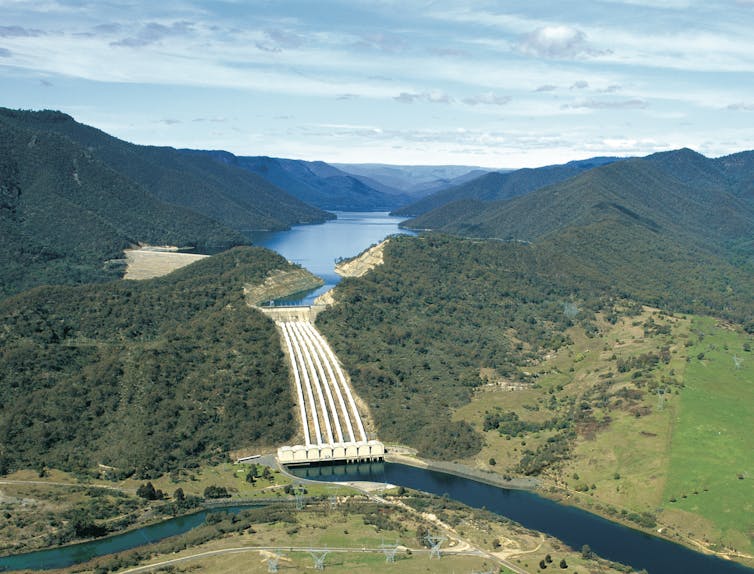
The problems we know about: cost and time blowouts
The list of possible alternatives to Snowy 2.0 is long. Aside from other pumped hydro projects, it includes chemical batteries, encouraging demand to follow supply, gas or diesel generators, and re-orienting renewable generators to capture the wind or sun when it is less plentiful.
But despite this plethora of options, the federal government announced the Snowy 2.0 project without a market assessment, cost-benefit analysis or indeed even a feasibility study.
Read more: The government's electricity shortlist rightly features pumped hydro (and wrongly includes coal)
When former Prime Minister Malcolm Turnbull announced the expansion project in March 2017 he said it would cost A$2 billion and be commissioned by 2021. This was revised upwards several times and in April this year, a A$5.1 billion contract for partial construction was awarded. This excludes the costs of transmission and other considerable expenses.
The main contractor says the project will take eight years to build - bringing us to 2027 before the full scheme is completed. We will happily wager that more delays and cost increases will be announced.
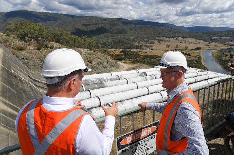
Snowy Hydro has not costed the transmission upgrades upon which the project depends. TransGrid, owner of the grid in New South Wales, has identified options including extensions to Sydney with indicative costs up to A$1.9 billion. Massive extensions south to Melbourne will also be required.
Snowy Hydro contends it should not pay for the new transmission lines because the benefits would flow to the entire grid, not just its venture. In other words Snowy Hydro argues, conveniently, that we should count the benefits but ignore the costs when thinking about their project.
The numbers simply do not add up
The Snowy 2.0 project grandly claims it could generate at its full 2,000 megawatt capacity for 175 hours - or about a week. This capacity can also be expressed as 350 gigawatt hours (GWh).
Energy Minister Angus Taylor has talked up the project’s superiority to smaller-capacity alternatives such as batteries.
But the maximum additional pumped hydro capacity Snowy 2.0 can create, in theory, is less than half this. The reasons are technical, but worth taking the time to understand.
The figure below outlines the main physical features that define Snowy 2.0. It includes four dams: Tantangara, Talbingo, Jounama and Blowering. For simplicity, we have numbered these from 1-4 in the following explanation.
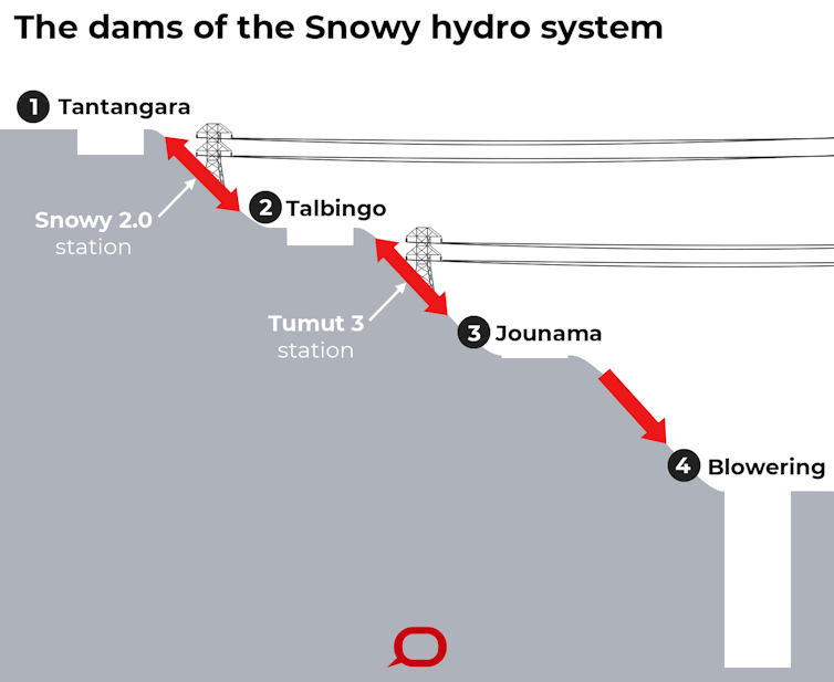
When Snowy 2.0 generates electricity, water will be released from Dam 1 at the top of the system. It will flow through a long tunnel to the smaller Dam 2. The flow of water drives turbines which generate energy. When the turbines are reversed, the water is pumped back to the top to continue the cycle.
For Snowy 2.0 to produce the 350 GWh of electricity claimed, the top dam must be full and all that water released through the system. But replenishing the top dam after this event would take many months of pumping water from elsewhere in the system, and use up 40% more electricity than was originally generated. So the 350 GWh would never be achieved because it is extremely inefficient and inflexible.
In reality, the pumped hydro capacity of Snowy 2.0 is defined by the amount of water that the smaller Dam 2 can hold. If the scheme was a closed system, with no other water flowing in or out, it could produce around 230 gigawatt hours (GWh) of electricity.
But the system does not exist in isolation. Part of the existing Snowy Hydro scheme, known as Tumut 3, also uses Dam 2. It creates pumped hydro electricity by cycling water between that dam and the even smaller Dam 3 below it.
For Snowy 2.0 to operate at full cyclical capacity, Dam 2 must be empty to receive the water. That would entail emptying Dam 2 into the smaller Dam 3 and from there to Dam 4 at the bottom of the system. This water could not be used again to generate electricity. This “lost” water would have generated 60 GWh worth of electricity in the Tumut 3 scheme.
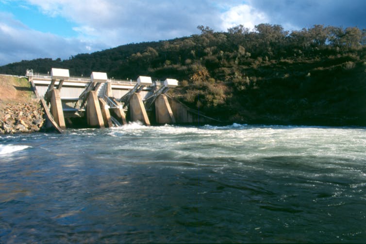
This means that as a cyclical pumped hydro system, Snowy 2.0 does not add 230 GWh of capacity. When you subtract the 60 GWh from the 230 GWh, Snowy 2.0 adds just 170 GWh of recyclable pumped hydro. This is less than half the claimed storage capacity.
And this is the maximum cyclical capacity in theory only. Snowy 2.0 would never produce continuously for the time needed to generate and then pump 230 GWh because it would never be economically viable to run it this way.
In practice if Snowy 2.0’s lower dam is operated in future as it is now – almost always close to full – the cycling capacity of Snowy 2.0 may be as low as 40 GWh – around one tenth of the promised number.
What does all this mean?
These facts put Snowy 2.0 in a completely different light. There are many competing alternatives that can provide storage far more flexibly for a fraction of Snowy 2.0’s price tag. These alternatives would also have far fewer environmental impacts or development risks, in most cases none of the transmission costs and could be built much more quickly.
It is always difficult to press the pause button on a major project once it has begun. But the evidence for doing this is overwhelming. In pursuit of the public interest, the federal government should put the project on hold and ask a reputable investment bank to publicly advise, perhaps through the Productivity Commission, what Snowy 2.0 would be worth if built.
A credible independent valuation would establish with some confidence how deeply Snowy Hydro will have its hands in the public’s pockets. A panel of independent experts should then be asked to publicly advise whether taxpayer money is needed to meet the demands of a renewables-dominated power system, and if so, the best way it should be spent.![]()
Bruce Mountain, Director, Victoria Energy Policy Centre, Victoria University
This article is republished from The Conversation under a Creative Commons license. Read the original article.
Destination Pagoda could be a Win for the Environment and the Lithgow Community
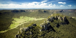
Lithgow coal miners want job security. Environmentalists want protection for the Gardens of Stone region’s upland swamps, endangered wildlife and the spectacular but fragile pagoda rock formations. Lithgow needs a boost to its economy. Centennial Coal has to pay millions as an ‘environmental offset’ for damage done to nationally significant and endangered upland swamps. They have identified the preferred swamp management program as reservation of the Gardens of Stone region. This is a no-brainer for a win-win situation.
The Colong Foundation, Blue Mountains Conservation Society and Lithgow Environment Group have launched a plan, called Destination Pagoda that will capitalise on this situation. The plan is to reserve the Gardens of Stone as a State Conservation Area to protect its pagodas and swamps. At the same time this designation will permit appropriate underground coal mining. New facilities will be created in the Lithgow area to develop tourism that will expand opportunities for visitors to experience the rock formations and aboriginal heritage of the area.
The plan will require a modest investment that will establish professional conservation management, improve access roads, develop visitor facilities, restore degraded areas, encourage visitors, support local enterprises and protect important values. The cost can be funded from Centennial Coal’s swamp offset funds of up to $14 million currently; mining company management of some roads and pest species, transfer of state forest expenditures to NPWS and Commonwealth and NSW government funds.
Getting the plan up has required much discussion. The process for getting a dialogue happening was facilitated by visits to Lithgow by unionists from the Combined Retired Union Members Association. Now the need is to get government support.
Events such as a bush dance in Lithgow on Saturday 23 November 2019 are being held to build the momentum of support for the plan.
The story about the campaign and the efforts to save the area are presented in Tom Zubrycki's documentary film called Gardens of Stone – A Living Landscape. The film will be screened on Tuesday 26 November at 6 pm at the Sydney Trades Hall Auditorium, Unions NSW, 4–10 Goulburn Street, Sydney – Gardens of Stone Alliance. For bookings contact Janine Kitson (0428 860 623, This email address is being protected from spambots. You need JavaScript enabled to view it.).
Letters to the local MP for Bathurst, Paul O’Toole will help.
For more details go to www.gardensofstone.org.au.
State Government News

National park land
At the Nature Conservation Council annual conference Environment and Energy Minister Matt Kean was positive in his support for some of the environment objectives of the member groups. We just hope that he can have enough authority in cabinet. He wants to increase the land in national parks by 200,000 ha and has funding to do this. Already 64,000 ha has been added with most of it in north-west NSW near Broken Hill. He recently announced that Radiata Plateau will be purchased for addition to the Blue Mountains National Park. This is a major win for the Blue Mountains Conservation Society that has been lobbying for this addition for years. There has been virtually no declaration of new national park land since 2011 under the previous Liberal environment ministers.
He suggested we approach our local MPs or councils to nominate suitable pieces of land in our local areas to be added to the portfolio of protected lands. He indicated that unprotected land in Byles Creek Valley should be on the list.
Bush fires and climate change action
At the NCC conference Matt Kean stated that he wanted NSW to lead the nation in achieving the goal of zero greenhouse emissions by 2050 and he would be setting interim targets. There was no detail on the policies that would aim to achieve these targets but the time available for his speech was short. The adoption of this policy could be problematic with the current refusal by the Deputy Premier, John Barilaro to talk about climate change while the bushfires are burning. Surely this is the appropriate time.
Coal mine refusals
In a landmark decision in September the Independent Planning Commission (IPC) knocked back an application by Kepco Ltd for a new coal mine in the Bylong Valley. The IPC is the statutory agency responsible for making arm's-length decisions on state-significant development.
The IPC based its refusal on environmental impacts other than climate change, including impacts of the project on strategic agricultural land, groundwater and Aboriginal cultural heritage. However, the IPC found the project's contribution to global greenhouse gas emissions was a factor that needed to be considered in its assessment, and placed weight on Kepco’s failure to propose any offset measures.
The IPC drew its decision on the principles established by the NSW Land and Environment Court in February regarding the assessment of cumulative greenhouse gas impacts in its decision concerning the Rocky Hill project near Gloucester. This project was for a new coking coal mine. The decision must be viewed in context, with the court stating it would have refused this particular mine anyway for other reasons, such as inconsistency with other land uses, amenity impacts (noise, dust), visual intrusion and social impacts of the mine. However the decision did state that the court had regard to, not only the direct emissions of the mining activities, but also the 'scope 3' indirect emissions, being the greenhouse gas emissions associated with third-party burning of the coal (which make up the vast majority of emissions associated with the coal).
Both these decisions have given great heart to people concerned about climate change and wanting to see Australia reducing its reliance on the coal mining industry.
Now we are shocked to learn that the NSW government is undertaking a snap review of the IPC saying that the reason for the review was another decision that didn’t follow due process. Terms of reference for the review, which will be overseen by NSW Productivity Commissioner Peter Achterstraat, include ‘whether it is in the public interest to maintain an Independent Planning Commission’, and whether changes should be made to the thresholds for referring matters to the IPC. The Minerals Council has launched a campaign against the IPC.
If the IPC is scrapped these decisions would be made by the planning minister and transparency would be lost. Submissions are now closed and the Productivity Commission’s report is due by mid-December.
Anti-protest laws
The right to protest is being attacked at the state and federal level.
The NSW government has passed its Right to Farm Bill and it will come into force early 2020, it will almost quadruple the penalty for ‘aggravated unlawful entry on inclosed lands’ from $5,500 to $22,000 and add a three-year prison term for people who merely ‘hinder’ a business while trespassing. The government claims this law is needed to protect farmers from ‘dangerous’ protesters but this protection already exists. The way the bill is drafted it would have ramifications for all protests on ‘inclosed lands’ such as protests against coal seam gas projects and forest destruction.
Now Scott Morrison wants to get in on the act with a ridiculous suggestion that environment activists should be outlawed from lobbying against businesses that are providing services to the mining industry such as banks and insurers. He said the government is ‘working to identify mechanisms that can successfully outlaw these indulgent and selfish practices’.
The idea has been roundly condemned by human rights lawyers and business among others as unlawful as well impossible to implement. It is a threat to freedom of speech.
Young Scientist Awards

In this time when science is our main hope for combating climate change, it was so uplifting to attend the presentation of the Young Scientist Awards by the Science Teachers' Association of NSW in early November.
From the little kindergarten girl, who had done a maths project on blueberries, to high school student Angelina Arora and her work in cancer cells, the standard and range was inspiring, and it was such a delight to see each student's pride at being acknowledged.
Nine of the year 9 to 12 winners will be travelling to Anaheim, California, to represent Australia at the International Science and Engineering Fair. Two years ago, one of the NSW prize-winners carried off the top international award.
STEP is the only community environmental group that presents an award at this ceremony and this year it went to Suzanne Jones of Redeemer Baptist School for The Call of the Wild. She surveyed the abundancy and diversity of cicadas at Lake Parramatta Reserve from October 2018 to April 2019 and found 17 different species, including the ‘undescribed’ Ticking Ambertail Yoyetta!
Observation, questioning and experimenting are all part of building an interest in our natural world and these bright youngsters may make a huge difference to our understanding and our future. It was wonderful to see these talents recognised.
Article by Isolde Martyn
Royal Botanic Garden Needs your Help
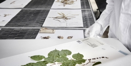
From January 2019 the National Herbarium of NSW has been closed while its collection of plant specimens is relocated from the Royal Botanic Garden Sydney to a new purpose-built facility at Australian Botanic Garden Mount Annan. While construction for the world-class innovation hub is underway, the 1.43 million herbarium plant specimens will also be transformed into high-resolution digital images. In 2021, digital images will be available for everyone around the world to access. It will help researchers make new discoveries to advance science and conservation and it assists in protecting this valuable collection.
The Royal Botanic Garden needs help to prepare the specimens for the digitising process! Volunteers will have the opportunity to see the incredible collection up close and meet expert plant scientists. There are two sessions per weekday and each session runs for 3 hours. Contact This email address is being protected from spambots. You need JavaScript enabled to view it. for more information or to volunteer.
Annual Report for the Year to 2019

The NSW and federal elections in 2019 had the unfortunate result of leaving us with business as usual. No policy decisions have been made to address climate change and the abuse of the environment continues unabated. As the drought becomes more serious the consequences of decisions to exploit forests and the Murray Darling Basin water supply are becoming increasingly apparent. For STEP it has also been business as usual. This annual report gives a brief summary of our activities over the past year. More details are in the issues of our newsletter, STEP Matters and on our website.
Committee
The STEP committee has always worked cohesively with everyone willing to contribute to the smooth running of the organisation. They frequently come up with new ideas that expand or enhance our activities. I thank them all for the great contribution that they make to STEP. We welcome some new members to the committee, Peter Clarke, Beverley Gwatkin and Jan Newby. They all bring particular skills and good knowledge of our local bushland.
Publications
John Martyn’s new book, Rocks and Trees continues to sell well especially in the Blue Mountains. However there is a decline in interest in our older books. For this reason we have decided to offer bulk package where all our books can be purchased in a bundle at a substantial discount. The demand for maps is steady as the interest in bushwalking seems to be increasing. A paper map has the advantage of providing the big picture.
Accounts
Our operations incurred a very small deficit over the year but we remain in a sound financial position. The main activity has been sales of Rocks and Trees where John has been very active in visiting book shops showing the book. Membership has remained steady. We appreciate the pro bono work done by Allan Donald, Chartered Accountant, who completed the audit of STEP’s financial statements.
Environment Protection Fund
We have maintained the Environment Protection Fund which provides Deductible Gift Recipient (DGR) status for donations that support STEP’s environmental objectives. We received a total of $783 in donations in the past financial year. The donation process on our website has been simplified and there has been a good response! We had a strong response of applications for the John Martyn Research Grant which supports student research in an area relating to the conservation of bushland. This year the grant was awarded to an honours student at the University of NSW researching changes in soil characteristics in association with woodland regeneration.
Electronic media
The new email and newsletter system is being well received. It is a time-consuming process to put together its presentation with illustrations and the links to previous and related stories to each article. Peter Clarke is now helping Helen Wortham with this task but other volunteers are welcome. Trish Lynch and John Burke continue to alert readers to current issues and events through Facebook and Twitter. Readers are attracted to the terrific range of photos that show off our beautiful bushland.
Education
We support the Young Scientist Awards run by the NSW Science Teachers’ Association with a prize in the environmental sustainability category. The winner of the STEP prize this year undertook a phenological study of the population of cicadas at Lake Parramatta. We also supported the Children’s Threatened Species Art Competition. The primary school children produced some fabulous paintings that can be seen on the competition’s Facebook page.
Talks
Our talks have had a local focus this year covering Ku-ring-gai Council’s program supporting bushfire awareness, the Lane Cove environment, native bees and our 2018 grant recipient’s project. At our AGM we like to have a speaker who is an expert on a subject with a broader focus. In 2018 we were lucky to hear the latest on climate change science from Professor Lesley Hughes. She has a great ability to give a clear perspective on this complex issue.
Walks
Peter Clarke has led a series of local walks of up to about 5 km aimed at introducing walkers to our local bush. His entertaining walks have been well received. John Martyn led walks with the usual special features. The spring wildflower show along the Centre Trail was as spectacular. Tall trees were the feature of the walks in the Watagans and Winmalee.
Newsletter
Our newsletter, STEP Matters, is emailed to members as a pdf. The email also contains a list of links to the stories in the latest issue so readers can select the items they want to read. The pdf is a permanent record of the newsletters as all issues are available on our website. We reached the milestone of the 200th issue in April. We commemorated this issue by publishing some stories about the heritage, both natural and cultural, of the bushland areas of northern Sydney written by local experts. We hope that the newsletter can keep members up to date on local environmental events and issues. The newsletter email has a wide circulation including local councillors and politicians. We welcome alerts from our members of local events and developments and, of course, article contributions and feedback on articles is always welcome.
Collaboration with other local groups
We are increasingly working with other local environment groups to research and make submissions on local developments that will have a detrimental effect on the environment. This applies to major issues like the Mirvac development next to the Cumberland State Forest, the threats to Sydney’s national parks from development within and bordering on the parks and the perennial issue of degradation and clearing of urban bushland. The cumulative impact of these developments is rarely assessed by government. We may be sharing information but collaboration does not extend as far as sending submissions. We know that governments and assessment authorities count a submission from one person almost equally with one from a group representing a large number of people. However they do pay attention to submissions that have individual content and detailed arguments. STEP is a member of the Powerful Owl Coalition that is now supported by about seven local environment groups in northern Sydney as well as the Powerful Owl Project run by Birdlife Australia. We have been sending copies of the detailed position paper to local governments and organisations whose work influences the owl’s habitat. We would like to cover more than just northern Sydney as we know they are out there in other bushland areas of Sydney.
Advocacy
Once again there has been plenty of local issues to attract our attention. The Mirvac development proposals have had to be modified but it is still not clear how the large area of bushland, including Blue Gum High Forest, will be managed. Byles Creek Valley continues to be unprotected from subdivision and massive clearing. The push for use of synthetic turf on playing fields has become a controversial issue. At the state level the government there is hope that the new Environment and Energy Minister, Member for Hornsby, Matt Kean will be able to declare new national park land acquisitions.
What Happened at the AGM?

You may be wondering what happened on 12 November, the evening of STEP’s AGM.
Owing to temperatures in the 30s, low humidity and high winds the government declared a catastrophic fire risk, a first time for Sydney. Late in the afternoon a fire broke out near Canoon Road.
After much discussion and viewing of live coverage on TV we decided to proceed with the AGM. However our speaker Culum Brown was told by police to stay at home. In the end the fire was out but only seven people turned up. It was a quorum so the meeting was completed.
Click here for the president’s report and list of office bearers.
Let’s Declare a Climate Emergency in Hornsby

Hornsby Shire Climate Action has set up an online petition calling on Hornsby Council to declare a climate emergency. Declaring a climate emergency is a vital step in building support for the very large changes required to restore a safe climate.
Once declared, the council must enforce policies that will reduce emissions as much as possible. They must also educate the public about the state of emergency. Click here to sign the petition.
Good News for Streamwatch

From July the management of the Streamwatch program was taken over by the Greater Sydney Landcare Network. This is a great relief. As previously reported there was a risk that this valuable program would be discontinued because NSW government annual funding of a measly $100,000 was uncertain. Streamwatch, with almost 300 volunteers, plus 30 years of data has to have a paid coordinator.
Data will be migrated to the SEED platform – an open government repository of environmental information hosted by the environmental cluster within the Department of Planning, Industry and Environment. The Landcare Network is delaying taking on new volunteers until the new testing system is finalised.
This is a great citizen science project that has given school, children community groups and individuals a meaningful way of getting out into the environment.
Now the Cumberland State Forest is Under Threat

NSW Forestry Corp has lodged a proposal to sell off parts of the Cumberland State Forest for housing subdivision. More critically endangered forest would be cleared. Not just Mirvac but now NSW Forestry Corp want to decimate some of these forests in West Pennant Hills.
Documents have been lodged with the Hills Council applying for the rezoning of two areas that would then be the subdivided for low density housing. They claim the land is surplus to their needs but what about the needs of the people of Sydney to keep existing green space?
An on-site meeting was held with Greens MP David Shoebridge on 11 August.
For updates on the campaign go to www.facebook.com/pg/ForestinDanger.
Mirvac Development a Threat to Critically Endangered Ecological Communities
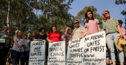
The Office of Environment and Heritage has alerted the Hills Council to the fact that the presence of Blue Gum High Forest and Sydney Turpentine Ironbark Forest, both critically endangered ecological communities are listed as potential ecological communities that meet the principles and criteria for serious and irreversible impact as defined under the Biodiversity Conservation Act. Under this act development consent cannot be granted to proposals that impact on serious and irreversible impact entities.
The Office of Environment and Heritage and an independent ecologist have identified large areas of Blue Gum High Forest within the proposed development footprint and the bushfire asset protection zones.
The Forest in Danger group does not believe that the planning proposal 1/2018/PLP can be approved in its current format. The draft development control plan, the planning proposal and the voluntary planning agreement would have to be re-exhibited.
For more details see previous issue of STEP Matters or the Forest in Danger Facebook page.
Update on the Bayview Golf Course Development

Good news! The Land and Environment Court has upheld the decision by the Northern Beaches Council and Sydney North Planning Panel to refuse the seniors housing development application on part of the Bayview Golf Course land. The site compatibility certificate had been granted by the Department of Planning to allow a development, but the council still had to approve the details of the development approval. Council knocked back the application on the grounds that its size was excessive and its impact on local biodiversity.
The developer wanted to amend the site compatibility certificate so that the council would not have grounds for refusal. The site compatibility certificate has now expired. The developer will have to start from scratch if they want to try again.
Byles Creek Valley should be Protected
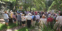
Hornsby Council is undertaking a four-month review at a cost of $70,000 into potential rezoning and acquisition of land in Byles Creek Valley that is currently unprotected. Council has come to this conclusion in all reviews and reports in the past.
In 2014 Hornsby Council made a very comprehensive submission to the NSW government pushing for acquisition of Byles Creek Valley land in 2014. In this document council’s expert environmental team stated that:
The Byles Creek catchment has been identified as environmentally significant due to the unique environmental values of the area … The preservation of these lands provides connectivity between the significant vegetation corridor along Byles Creek and Lane Cove National Park. The connectivity of this corridor ensures the ability for species to disperse between reserves and the national park and for the transferral of genetic material. The conservation value of this corridor is further emphasised by its inclusion as a core area in the NSW Biodiversity Investment Opportunities Map as part of the NSW government’s Green Corridors Program.
The valley is noted for the high quality of the water in the Creek that flows into the Lane Cove River. It is used as a reference standard for water quality in the shire.
As a member of the Powerful Owl Coalition, STEP strongly supports the protection of the valley as it links with breeding habitat for the Powerful Owl.
Our thanks to the Byles Creek Valley Union for this information.
Ku-ring-gai Chase National Park Plan of Management
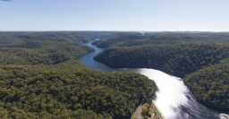
Ku-ring-gai Chase National Park is one of the most popular national parks in NSW, with over 3 million visits each year. The existing plan of management for the park was written in 2002. Since that time there has been a steady increase in visitors coming to the park, new recreational uses have become popular, information about the values of the park has improved and new approaches to managing fire and pests and weeds have been developed. The NSW National Parks and Wildlife Service (NPWS) is preparing a new plan of management for the park and island nature reserves.
As part of preparing the new plan of management NPWS has released five discussion papers exploring some of the key management themes that will be included in the new plan:
- aboriginal cultural values
- natural, visitor experience and shared heritage values
- recreational activities
- visitor destinations
- leases licences and consent
NPWS is keen to hear what the community has to say about future management of the park.
Comments close on 15 September 2019. Click here to contribute your ideas and comment.
There will be other opportunities to provide input to the plan of management when the draft plan is exhibited for public comment.
Friends of Lane Cove National Park Celebrate 25 Years
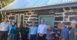
On 25 May the Friends of Lane Cove National Park put on a special celebration. They were founded in 1994 after major bushfires burnt out large areas of the park and exposed the bushland to weed invasion. They have been working for 25 years to restore the bushland of Lane Cove National Park together with the NPWS staff.
The occasion was also the official opening of Jenkins Kitchen after its restoration using a NSW government Heritage Near Me grant and resources from the Friends, their time and money, to restore the interior and set up displays of historical and wildlife items. The building built in 1855 is believed to be the oldest in Ku-ring-gai.
NSW Government News

Since the re-election of the Berejiklian government there has been a mixed bag of news in relation to the environment. Here are some brief points.
New Environment Minister
We welcome the appointment of Hornsby MP Matt Kean as Minister for Energy and Environment. He has made promising statements emphasising the importance of national parks and the need for new action on climate change and threatened species. However his power over the short-sighted members of cabinet is uncertain.
Changes to the Office of Environment and Heritage
The Office of Environment and Heritage is no longer a separate entity - it now comes under the Department of Planning, Industry and Environment. The level of influence that staff from the former Office of Environment and Heritage will have in the future is uncertain.
More National Park Funding Cuts
The abolition of the Office of Environment and Heritage makes it difficult to assess the level of funding for national parks under the budget relative to previous years. The ABC has reported that, in the latest budget, $80 million is being cut from NPWS.
In a statement to the ABC, the government said those cuts would come through more efficient work practices in the department. How can the department be made more efficient after the $121 million cut in the 2016–17 budget that lead to about 100 ranger positions being lost? We believe there is more restructuring of front-line staff to come.
Local Green Spaces Funding
The budget included $9 million to improve open space in Frenchs Forest with new green connections, walking tracks and bike paths linking the local community to nearby bushland corridors. This is a development to watch out for. Will there be more mountain bike tracks?
Land Clearing
The Audit Office released its assessment of the administration of the land clearing laws in June. The media release included this statement:
The processes supporting the regulatory framework are weak and there is no evidence-based assurance that clearing of native vegetation is carried out in accordance with approvals.
Maps of vegetation that landowners need to operate under the new legislation are still not available.
It was announced recently that the government will not be pursuing prosecutions of landowners who have cleared land illegally under the Native Vegetation Act that applied prior to the Biodiversity Conservation Act in 2018. This new act provides for a lot more self-assessment so the past clearing may have been legal under the new law.
Data show massive increases in land clearing over recent years. The data are often disputed on the basis that some clearing is of woody weeds or regrowth. Is that a reasonable excuse? There is no big picture data to help determine whether the regrowth should be encouraged, not cleared.
There are also severe concerns with the renewed Regional Forestry Agreements and the attitude to logging in native forests, particularly koala habitat. Detail about these issues is covered by the Nature Conservation Council.
No matter what data are revealed the area of native vegetation needs to be increased significantly, not decreased, to halt the trend of land degradation and species extinction.
Feral Horses in Kosciuszko National Park
A statewide campaign to protect Kosciuszko National Park from destructive feral horses has forced the government to debate its controversial Wild Horse Heritage Act. This will occur on 22 August.
Meanwhile the number of horses is increasing and the damage to the fragile mountain ecology worsens as the government has suspended the removal program.
Raising Warragamba Dam Wall
The proposal to raise the Warragamba Dam wall by 14 m may have hit a couple of stumbling blocks:
- a UNESCO world heritage committee says that the proposal could threaten the listing of the Blue Mountains as a World Heritage area
- modelling of the reduction in flood risk shows the higher wall will have very little benefit
The government is currently preparing an environmental impact statement. Some of the work so far was leaked. It revealed that about 1,300 ha of the world heritage area would be permanently damaged including significant aboriginal cultural sites. The UNESCO committee has asked the government to consult with them before making the final decision. Federal government approval is also required because of the world heritage listing.
It has been stated that the objective of the proposal is to reduce the impact of flooding of the Hawkesbury-Nepean floodplain by holding back water after heavy rainfall for longer. However some of the charts from modelling the effects of the wall raising prepared for the EIS were leaked to the Sydney Morning Herald.
As Figure 1 shows there is very little change in the water outflows during a likely flood event.
In the case of a major flood such as the 1867 flood that is the highest recorded, the picture is similar. This level is believed to be equivalent to a one-in-500 year event (see Figure 2).
The reason for the small reduction in flooding is that there are major rivers that flow into the Hawkesbury-Nepean system below Warragamba Dam such as the Nepean, Grose and Colo. This compounded by the flow downstream being held back at a number of pinch points where the river valley narrows.
Figure 1
Figure 2
More...
The River Red Gum is an Icon of the Driest Continent

River red gums, Eucalyptus camaldulensis, are among the most iconic of Australia’s eucalypts. They are the most widely distributed of all the eucalypts. They grow along rivers, creeks, waterways and flood plains where many Australians like to picnic, so most of us get to know and love them.
Formerly known as Eucalyptus rostrata, the species was one of the first eucalypts encountered in parts of Australia by European settlers. Curiously, the name camaldulensis comes from the Italian monastery of Camaldoli near Naples, where a specimen grown from seed in a private garden was given the name Eucalyptus camaldulensis in 1832. No one knows how the seed got to be there!
River red gums can be very large spreading trees with huge trunks more than 5 m around. In parts of Australia, such as along the Murray River, they can be very erect trees reaching more than 45 m tall.
Most specimens have smooth bark with a mottling of multiple colours ranging from creams to orange and red, but there may be a skirt of fibrous grey bark for the first few metres of the base. They are called river red gums because they grow along rivers and their wood when freshly exposed is a bright red; almost blood-coloured.
River red gums have been used by Indigenous people for canoes, bowls, shields, and other utensils. The wood is red is because it contains very high levels of chemicals such as polyphenols, which are a natural antibiotic when combined with air.
These chemicals not only protect the living tree from disease and some pest attacks, but make the timber very durable. These chemicals meant river red gums were used for medicinal purposes by Indigenous people. The wood has been widely used for railway sleepers, fence posts, and piers and wharfs where durability and water resistance are desirable. They have been widely planted overseas and in some countries pose a serious weed problem.
The trees can have very long lives, and may reach 1,000 years of age. They grow very rapidly when conditions are favourable and so become large trees quite quickly. But as they get older it is very difficult to age them without damaging the tree and putting it at risk of disease and decay. So their ages are estimated, as no one wants to be responsible for killing a grand old tree just to confirm its age!
Older specimens almost always develop large hollows, which can take centuries to form. The hollows provide refuges for birds, mammals and reptiles. The nesting sites are often raucously defended by brightly coloured parrots. The trees and the nectar from their small white flowers are also very important for honey production – a large tree in full flower over the warmer months can attract so many bees that the whole tree can be heard humming from many metres away; it’s a wonder the tree doesn’t take off.
At certain times of the year, often during summer, river reds can be very heavily grazed by insects to the point where their leaves are skeletonised. The trees look as though they are about to die, but they are very resilient and a few months later most are back to a full and healthy canopy. Another insect, the psyllid, also feeds on and skeletonises the leaves. It has a sweet, waxy covering called a lerp that protects the vulnerable insect nymphs beneath. Some Indigenous groups scrape off the lerps, roll them into a ball, and eat them like a lolly.
Surviving Floods and Driving Rain
Any tree that can live for a millennium must be adaptable, so like some other eucalypt species, river red gums can shed up to two-thirds of their foliage when soils dry out during a drought, which reduces water demand and prevents the trees from wilting. This shedding often causes people to complain about the trees when they grow in towns and cities, but when the rains come a few months later they rapidly produce new leaves and are soon once again in full canopy.
River red gums can tolerate immersion in flood waters for up to nine months. They do this by having extensive roots, some of which contain a spongy, air-filled tissue called aerenchyma that allows for the accumulation and transport of much-needed oxygen in waterlogged soils. This adaptation to stressed soils also means river red gums can do quite well in disturbed urban soils when the urban sprawl impinges on their natural domain.
River red gums readily seed after flooding events and great numbers of young trees may germinate. However, relatively few survive to maturity due to competition from other red gums, other trees, and weeds. They may also struggle to survive in some places due to a lack of water.
Because river reds occur in some of the driest and harshest parts of the Australian mainland, you might think they are very efficient users of water. However, nothing could be further from the truth. The trees can have very deep, spreading and searching root systems, which tap into subterranean water, even if the water is many metres from the trunk. They are luxury water users with very little capacity for water use control. If water becomes really limiting, they simply wilt.
Territorial Trees
E. camaldulensis produces a water-soluble chemical that is washed from its leaves by rain. These chemicals inhibit the growth of other plants, including river red gum seedlings, under the canopy. This phenomenon is called allelopathy, and along with a dense canopy inhibits plant growth under the trees. These chemicals are washed from the soil by flood water, which makes way for the germination of seedlings after floods. This is a wonderful mechanism that ensures seedlings do not germinate when conditions are dry and where they would compete with the parent tree for limited water, but germination is facilitated when there is plenty of water and soils are wet.
Some people think river red gums are dangerous because they shed large limbs without warning on calm, still, summer days. There is no doubt this does happen, but there is no clear evidence they shed limbs more often than other species.
The problem is complex, because they tend to grow everywhere people want to go. They provide shade along waterways on a hot, dry continent. In going to places where the trees grow, people tend to compact the soil with their vehicles and footpaths, which can be causes of limb shedding. The compaction of the soil affects soil moisture and aeration, which can lead to limb shedding.
In other contexts such as farms where limbs are shed, many old river red gums are growing in highly disturbed or changed ecosystems. Furthermore, many of these remnant specimens are often stressed and getting older and so more prone to shedding.
River red gums trace the watercourses of mainland Australia, and are easily seen from aeroplanes as you cross the continent. They connect the continental fringes with its arid heart. Their lives can span many human generations and it is nice to think that the majestic old trees that pull at our heartstrings have done the same to previous generations and, if we and they are lucky, will continue to do so for generations of Australians yet to come.
This article appeared in The Conversation on 12 July. It is written by Gregory Moore, Doctor of Botany at Melbourne University.
Here’s some more information about the importance of river red gum in maintaining healthy landscapes and controlling salinity:
Stands of river red gum are associated with the surface flooding regime of watercourses and related ground water flow. The species is a profligate and opportunistic water user, and this is a contributing factor to the maintenance of water tables at depth. Even without large amounts of empirical data it is clear that loss of large tracts of the species in the Murray River corridor would have a major impact on the hydrology of the system, as well as on vegetation communities and associated biodiversity.
Which Urban Trees can Survive a Changing Climate?

There is lots of research demonstrating the benefits of trees in urban areas. Not only do they camouflage the grey asphalt and concrete of roads and footpaths, they can reduce temperatures and the need for air conditioning in buildings. They also improve the microclimate by retaining moisture in the air and soil and they encourage residents to get out into the community and enjoy beautiful shaded areas.
Tree planting is an effective and efficient way to adapt to climate change. However as climate change leads to higher temperatures and more variable and lower rainfall we need to consider how the popular trees used in urban areas will respond to the changes.
Different species have different levels of tolerance of heat, lack of water and other threats posed by climate change.
Research teams from Macquarie University (including former STEP president Prof Michelle Leishman) and Western Sydney University, have embarked on a project called Which Plant Where. The project is supported by Hort Innovation Australia, the Department of Planning, Industry and Environment and the Australian government. Their mission is to find the best plant species for urban landscapes that will be resilient to climate change.
The project works with the nursery industry to gather evidence on species’ resilience to extreme heat and drought by testing plants to their limits in research glasshouses. This work will inform plant growers and nurseries on how to adapt their business, by identifying the new challenges posed by climate change, as well as selecting diverse ranges of climate-ready species. They advise landscape architects, designers and urban planners about not only the best planting choices, but also how to increase the biodiversity of our cities.
We need to know how our current tree canopy will be affected as well as plan new plantings.
The research team recently published a study (Burley et al) that investigated likely climate change impacts on 176 of the most common tree species planted across Australian cities. The analysis showed more than 70% of these species will experience harsher climatic conditions across Australian cities by 2070.
Some of the most commonly planted trees are unlikely to survive. Conversely, in some cooler climate areas, such as Orange, the number of suitable species may increase. These impacts will progressively worsen as climate change intensifies. A proactive approach is needed to identify new climate-ready species and plantings. Tree species growing in warmer cities are more likely to be affected than those in cooler cities. Some species, such as the golden wattle (Acacia longifolia) or the prickly paperbark (Melaleuca styphelioides) might not make it in northern cities unless we invest precious resources – such as water – to maintain these civic assets. Other species, such as the native frangipani (Hymenosporum flavum) or the tuckeroo (Cupaniopsis anacardioides) will likely become more suitable for planting in southern cities.
Australian cities are blessed with a higher diversity of tree species compared to other cities globally. However, the 30 most commonly planted species make up more than half of Australia’s urban forests. This poses a great risk for our cities. If we were to lose one or two of these common species, the impact on our urban tree cover would be immense. Trees are a long-term investment that will be affected by the very factors that they are meant to mitigate. Consequently, our best insurance is to increase the diversity of our trees.
The study highlights the need for more research:
- which species experience a reduction in growth or, even mortality, during extreme weather events and the duration of any growth reduction
- variation of impacts in different climate zones, for example subtropical areas are likely to experience greater declines in growth than temperate areas
- whether it is feasible with some species to mitigate impacts by providing more irrigation, selective pruning or planting in a more sheltered position
- investigate new choices of species suitable for the urban environment from the huge range of Australian native species
The NSW government announced a plan in February to plant five million trees in Greater Sydney by 2030. They are counting trees planted in streets, parks, backyards, neighbourhoods and schools with an objective of increasing the tree canopy from 16.8% to 40%. Councils can apply for grants for tree planting projects. Individuals can register the trees they plant.
Reference
Hugh Burley, Linda J. Beaumont, Alessandro Ossola, John B. Baumgartner, Rachael Gallagher, Shawn Laffan, Manuel Esperon-Rodriguez, Anthony Manea, Michelle R. Leishman (2019) Substantial declines in urban tree habitat predicted under climate change, Science of the Total Environment 685, 451–462
Australia’s Possible Future in 40 Years Time

CSIRO Futures released a report in June on Australia’s future in the next 40 years, called Australian National Outlook 2019 (ANO 2019).
The report is the outcome of a collaborative project that took two years involving more than 50 leaders from over 20 organisations across industry, non-profit and university sectors, including the National Australia Bank, Shell, Australian Red Cross, Monash University, the Grattan Institute and the Wentworth Group of Concerned Scientists. ANO 2019 uses CSIRO’s integrated modelling framework to project economic, environmental and social outcomes to 2060 under two scenarios in the context of responses to six identified future challenges. The challenges are:
- risks and opportunities from the rise of Asia
- technology development and implementation skills
- climate change and environmental degradation – our response and that of the rest of the world
- population aging
- trust in government and business
- social cohesion
The report concludes that if we resist the changes needed to meet the challenges, essentially business as usual, the outcome is described as the Slow Decline. The alternative scenario of bold action is called Outlook Vision.
In brief some of the environmental outcomes of the two scenarios are summarised in Table 1.
Here is some context to the projections in the assumptions that have been made.
Population Growth
The report had to model a lot of information but the major factor has been taken as a given. They have assumed that population growth will continue on the current high path. Population will be 41 million by 2060 with Sydney and Melbourne growing to 8 or 9 million people and Brisbane and Perth growing to 4 or 5 million. That is an extra 16 million people in 40 years. Our population in 1980 was about 14.5 million. So by comparison the increase in the past 40 years was about 11 million. CSIRO expects this growth to be accommodated within our finite land and ecosystems.
It is very sad that no mainstream organisation is willing to publicly countenance a reduction in population growth and demonstrate the implications this will have for our future.
Water Supply
Very little detail is provided about the costs of maintaining an adequate urban water supply for the burgeoning population. It seems the assumption is made that sufficient desalination can be installed. The cost of this is incorporated in the infrastructure costs of catering for the growth in population.
Climate Change Scenarios
This is what they say about the implications of climate change under the two scenarios (from https://agupubs.onlinelibrary.wiley.com/doi/full/10.1029/2018EF000922).
The most reliable estimates aligned to the scenarios indicate that 4°C global warming without adaptation could lead to a global per annum GDP loss of 7.2% and an Australian per annum GDP loss of 1.6% by 2100. If mitigation can limit the global warming to 2°C by 2100, the global per annum GDP loss would be reduced to 0.5–1.6% by 2050–60 and to 1.8% by 2100, and the Australian per annum GDP loss would be reduced to 0.6% by 2100. The GDP loss would be further reduced by adaptation.
There is a lot of detail in the modelling of the implications of climate change in the two scenarios. The quotation above gives a scale to the importance of reducing greenhouse gas emissions.
Table 1
Land Use and Biodiversity
Taking into account climate change and the need to maintain agricultural exports and feed our own population very radical change is envisaged under the Outlook Vision scenario. There is a strong message about the necessity to end the trend of rural land degradation and to restore ecosystems. Productivity improvements through plant genomics and digital agricultural mapping technology will not be enough. The statements about ecosystem health are significant in the context of the current federal and state governments’ attitudes towards exploiting the environment. Here are a few quotes from the report:
… the high agricultural productivity rates necessary for the Outlook Vision outcomes will not be possible without sustaining broader ecosystem health, particularly in the face of effects associated with a changing climate.
… agriculture not only affects the environment but is also highly dependent on the quality of natural assets and the ecosystem services they provide for its productivity and profitability.
Soil Health
The report highlights the negative trajectory of soil health that has resulted from intensive agriculture on fragile soils. Several aspects of current soil health will limit productivity, particularly long-term erosion, acidification, low carbon levels, soil compaction and soil nutrient decline. The risk of erosion increases with an increasing frequency of droughts and lower groundcover. Ecosystem and land management practices must turn around the deterioration of soil health.
Agriculture is also dependant on access to a reliable supply of clean water, pollination services and shade and shelter provided through native vegetation. Land degradation needs to be halted and, where possible, remediated to ensure the long-term viability of agriculture.
New forms of investment that provide financial support for carbon farming are recommended as a means of providing a return to landowners for the benefits of improving ecosystem services.
Emissions Reduction through Carbon Sequestration
Under Outlook Vision carbon sequestration will play an essential part. By 2060, up to 30 million hectares – or roughly half of Australia’s marginal land within more intensively farmed areas – could be profitably transitioned to carbon plantings, which would increase returns to landholders and offset emissions from other sectors. The success of this scenario depends on increases in productivity so that less land is needed to produce the required food. Table 2 shows the potential sources of change from the current annual emissions of greenhouse gases of 532 million tonnes under the Outlook Vision scenario.
Table 2
In theory there could be an excess of carbon sequestration that could be sold on the international carbon market. However it would be more prudent to keep this stored carbon as a buffer against bushfire and other risks.
Out of the 30 million hectares 11–20 Mha is defined as environmental plantings rather than direct carbon forestry (i.e. native–endemic mixed environmental plantings that provide the most suitable habitat for biodiversity). This will build resilience against future climate change. This translates to between 12 and 24% of intensive agricultural land (or between 32 and 42% of the total land area used for carbon forestry). The overall transition of land use is shown in Figure 1.
The wide range of returns to landowners of $42 to 84 billion in Table 1 is indicative of the complex interplay between the impacts of climate on modelled agricultural production and tree growth, among other factors. The modelling results show that additional income from other land use change can more than offset any reductions in agricultural production due, in part, to the fact that agricultural production will be concentrated on more productive land, with less productive land transitioned to other uses. However the returns to landowners are affected by carbon prices that will be dependent of the level of global cooperation in reducing emissions.
Carbon and environmental plantings on this scale are a significant land use shift, and so require careful planning, consultation and engagement with the community, particularly regional communities. Such considerations will include protecting prime agricultural land for food and fibre production and avoiding adverse effects on water supplies.
Conclusion
CSIRO has produced several of these big picture reports before:
- Future Dilemmas: Options to 2050 for Australia's Population, Technology, Resources and Environment in 2002
- Balancing Act: A Triple Bottom Line Analysis of the Australian Economy in 2005
Where are they now?
The Morrison government has been re-elected despite having a very limited set of policies for change. We need a government with a long-term vision and a willingness to explain convincingly the reasons for change. We should be able to reach a consensus despite there being some losers as well as winners.
Buy a Bundle of Books and Save

This is a great opportunity to do some Christmas shopping. We have decided to reduce the price of our books if they are purchased in a bundle.
Postage costs about $11 but it is free to pick up from South Turramurra.
Contact This email address is being protected from spambots. You need JavaScript enabled to view it. for more information.
Book bundle 1 = $25 ($17.50 for members)
- Field Guide to the Bushland of the Lane Cove Valley +
- Sydney's Natural World +
- Understanding the Weather
This is a saving of $45 (or $31.50 for members)!
Book bundle 2 = $80 ($56 for members)
- Book bundle 1 +
- Rocks and Trees
This is a saving of $50 (or $35 for members)!