Displaying items by tag: mountain bikes
Build-and-ride scheme at Grayling Reserve – a difficult balance
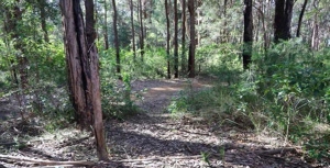
Grayling Reserve is a small area on the corner of Grayling Street and Binalong Street in West Pymble. It covers an area of about 1,300 m2. There is a creek on one side plus a narrow strip of bushland. Two sides are bounded by houses and the fourth side is a narrow entrance from Grayling Street. The remainder is a grassed area with a few saplings. Visibility of the grassed area is screened by the bushland.
In the bushland there are several large Blackbutt trees with hollows that are likely to be over 100 years old. These trees are increasingly rare in Ku-ring-gai and need special protection. There is one Blackbutt that would have a girth of about 5 m at the Grayling Street entrance. There is also a Lomatia myricoides (River Lomatia) and some Allocasuarina torulosa which are quite unusual in West Pymble.
The major part of the reserve is classified as critically endangered Sydney Turpentine Ironbark Forest on council mapping. The reserve is also an essential wildlife corridor.
The trees in the reserve used to be roosting sites for Powerful Owls, Boobook Owls and Tawny Frogmouths. Gliders have also been seen in the past and there are markings on the trees from their activity. The neighbours have advised that they have not seen this wildlife since the bike park disturbance occurred.
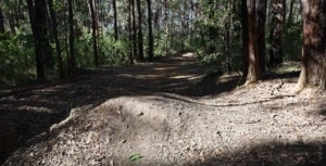
During COVID, in 2021, the locals started building bike jumps and paths in the cleared area of the park. This area is only small, about 900 m2. Even though this construction was unauthorised, council recognised the demand for this sort of informal facility. The building is an integral part of the fun as well as the bike riding.
After some consultation with the neighbours and an environmental assessment, in May 2023, council decided to trial making the bike park official and provided some dirt and tools to assist with building jumps.
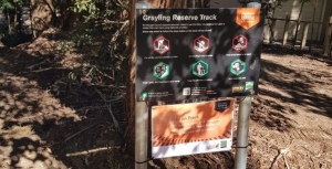
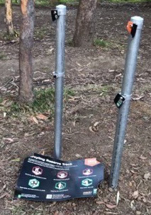
Signs were erected advising the conditions of the trial, for example:
Do not dig, use the materials provided
Tread lightly, don’t harm bushland or plants
Keep the site clear of rubbish
 However, by July there were reports from neighbours of anti-social behaviour with older children harassing the younger ones, night time disturbance and dangerous riding in nearby streets. Trees were being damaged, some small Callicomas chopped down and dirt piled up against the Blackbutt at the entrance. Water was being taken from neighbouring properties. Creek crossings were being created interrupting the flow of the creek.
In response council placed temporary signs with stronger warnings in several locations around the site, for example:
Do not harm trees or plants or this track will be closed
Damage continued and the signs were pulled down so council closed the site and undertook a survey of the local community.
This site is not suitable for a bike park
STEP’s submission argued that this area should be a reserve, that is a quiet space for passive enjoyment for visitors and habitat for wildlife; not a highly disturbed play area. The area is not visible from the street and is too small to be a useful bike park.
In September council responded to the consultation feedback by deciding to close the build-and-ride park trial, saying the reasons were the various environmental and social issues. The announcement noted that signposted conditions of use had been repeatedly broken by users. Details are here: .
The West Pymble Facebook page erupted with comments expressing outrage at the removal of a valued facility. It seems the value had been abused. However there is a strong interest in the concept of a build-and-ride site.
Often it is the build aspect that is the most popular – sand pits for bigger kids? Council is looking for suggestions from the public of sites suitable for trials of the build-and-ride concept.
Westleigh Park development
In Issues 217 and 219 of STEP Matters there was some information about the proposals for development by Hornsby Council of the land known as Westleigh Park.
The Save Westleigh Park group has been engaging with the local community explaining the draft plans that have been put out for consultation. Very few locals are aware of this significant development. It is very disappointing that council has not even put up signs in the local shopping centre to alert the locals. This development will have major impacts as there is currently only one road providing access to this major sporting complex with three fields. Does council expect people to be constantly on social media looking for local news?
The draft Master Plan and Plan of Management were approved for exhibition by councillors at the 8 March meeting. Four weeks was provided for submissions with closing date of 9 April for the draft Master Plan and 23 April for the Plan of Management.
Mountain bike trails to remain in the endangered forests
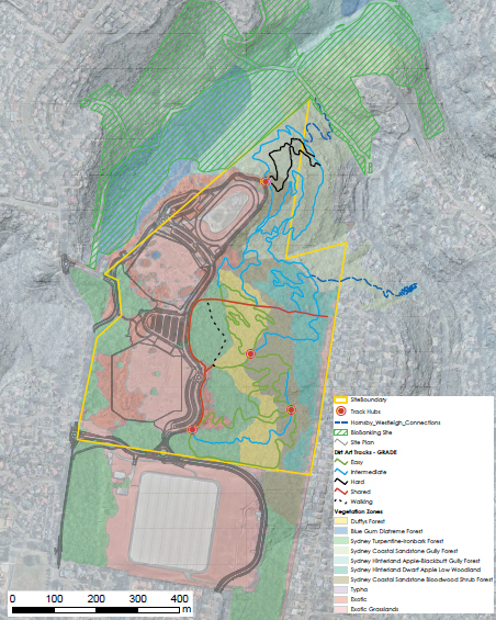
The biggest bone of contention has always been the illegal mountain bike trails in the large bushland area that totals 26 ha. This bushland includes areas of critically endangered Sydney Turpentine Ironbark Forest (STIF) and endangered Duffys Forest, totalling 9 ha plus several threatened species in other areas. The trails were built by the mountain bikers while the land was owned by Sydney Water and have been expanded since. They have named the complex network zigzagging through the bushland as H2O MTB Trails.
In 2021 council exhibited a preliminary master plan that proposed that most of the trails in the endangered forest be removed or relocated to the edges. Trails in the other bushland would remain and be upgraded to conform to industry standards. This caused an outraged reaction from the mountain bike community.
Council held a series of workshops to try to establish a consensus between the opposing groups of mountain bikers and local community and conservation groups. This was never going to happen. We waited with bated breath to see the final proposals that Council would come up with.
No doubt there was much lobbying going on behind the scenes. The conservationists group, now called Save Westleigh Park, were horrified to see that council was proposing to retain some of the trails and even build some new ones in the endangered forest areas. A specialist trail building company had been brought in to advise on a network that would be a ‘good experience’ and cover a range of abilities from beginner to advanced.
The total length of trails would be reduced from 9.5 to 7.3 km. The trails in STIF would be reduced from 2.45 to 0.96 km and in Duffys Forest from 1.9 to 1.5 km. However some of these trails would be new so more damage to the bushland, including the endangered forests, would be incurred.
The continuation of trails in the endangered ecological communities goes against all the principles of conservation. Council claims they are observing the Biodiversity Conservation Act hierarchy of avoid, minimise and mitigate, but they will have to resort to the last stage and try to find offsets for the loss of integrity of the forests. The STIF is critically endangered which means the forest is on the brink of extinction. There are only small areas left so suitable offsets are not available and the net effect will be a loss of healthy STIF.
Not only will the trails remain in the forest but the general public will be excluded from their use. The only consolation is a walking track that is only 150 m long plus a shared path around the boundary between the bushland and the sporting fields.
The Master Plan also does not specify when and how council will close down the trails that are to be removed and undertake the rehabilitation to undo the damage already done.
Risks to endangered ecological communities
STEP’s submission on the Master Plan focussed on the risks posed by the building and use of bikes through endangered ecological communities that threaten their survival. These include:
- disruption of pollination
- soil compaction that damages fungal diversity and spore dispersal
- edge effects that change growing conditions such as light, humidity and wind
- introduction of pathogens
By allowing these trails to continue council is evading its responsibilities under the Biodiversity Conservation Act to protect these forests.
Other issues
There are other concerns about the Master Plan many of them related to the plans to squeeze three sporting fields into the cleared areas.
The draft Plan suggests that the middle sporting field that is designed for soccer could be synthetic grass. This is highly inappropriate for an area so close to the bushland.
It is also proposed to build a link trail through the Dog Pound Creek biobanking site to the Hornsby Quarry site. This area is another critically endangered ecological community and a biobanking site. It must be protected from pathogens that could be introduced by the movement of bicycles. There is already evidence of Phytophera infestation. It is intended to close this link from use by walkers so they will lose the experience of a spectacular area of Blue Gum Diatreme Forest.
The whole development is large enough to cater for regional needs, not just local needs. Hornsby Council has received a large grant ($40 million) but this is not sufficient to cover the huge cost of the project. Rate payers will be covering much of the cost.
One major cost is the need to remove the contaminants such as asbestos and heavy metals that have arisen from the use of the site as a tip and fire-fighting training ground. These are to be localised and buried under concrete. Will this be effective? The fields will then need to be levelled which involves building up the south-west corner by 8.5 m.
Funding is not available for the whole project so it will be done in stages. The removal of the mountain bike trails in the endangered ecological communities and rehabilitation of the weed infested bushland should be a priority.
Urgent action required on illegal Westleigh mountain bike trails
Near the end of Quarter Sessions Road in Westleigh there is a large area of land (34 ha) that was owned by Sydney Water until it was bought by Hornsby Council in 2016. This site has had various uses over the years; a training site for the RFS and a dumping ground for asbestos. There is a large area of bushland near the Sydney Water reservoir. Most of the land not been managed for many years.
As there was no management of the bushland, local mountain bike riders have built a huge network of trails and claimed the area as their own, calling it the H2O facility. Many of these trails go through a large area of high quality critically endangered Sydney Turpentine Ironbark Forest (STIF) and endangered Duffys Forest. The future survival of these forest areas is at risk from the bikes riding over tree roots, soil compaction and weed invasion. The activity also disturbs the wildlife especially as night riding is occurring. The other areas of bush are also valuable and contain threatened plants and orchids.
Hornsby Council drew up a master plan for the site. Submissions were made in June 2021. The plan proposed that most of the network of bike trails in the endangered forest areas be closed and rehabilitated. The trails would be relocated to the edges and away from high value biodiversity. The trails in the other bush areas would remain and be upgraded.
So what has happened since? There have been various forms of consultation with local residents, bikers and conservation groups. Basically the mountain bikers are very unhappy about losing the trails in the forest and have been actively lobbying the council. STEP and all the local conservation groups want the trails removed from the endangered forests.
In fact, council’s development of the Westleigh Park site has to heed the conservation advice for STIF issued by the Australian Government in response to its listing as critically endangered under the EPBC Act. This states that the priority recovery and threat abatement actions required for this ecological community are:
- to prevent further clearing or fragmentation of the ecological community
- to manage weeds within existing remnants
- to identify and fence important remnants to minimise impacts from grazing and recreational activities
- to rehabilitate degraded but recoverable remnants so that they meet the condition criteria for the ecological community
A series of workshops was held in June with representatives of the mountain bikers, environment groups and local residents. The plan was to resolve the impasse and come to a consensus on where the trails should go. Council could then proceed with the next stage of the development process in getting detailed environmental information and approvals. This was a very time consuming process (13 hours in total) that basically came to no decision. Naturally the conservation groups and the local residents wanted the illegal trails removed. The bikers argued that the trails were of great benefit for teaching young riders new skills and a love of the bush in the lovely shady trails. The forest in the STIF area in particular is mostly level and ideal for learner riders.
So the ball is back in the court of Hornsby Council where it should be. No news has been heard from council. H2O is still in operation so the damage continues and no action is being taken to close the endangered forest areas and start their rehabilitation. This laissez faire attitude is reprehensible.
Mountain Bikers Continue to Abuse the Environment
Ku-ring-gai Council’s decision to close the Warrimoo Downhill Mountain Bike Trail was taken in July 2016 (see STEP Matters 188). We all thought that this decision would be respected by the downhill bike riders given the strong reasons for its closure. We were wrong! This is not the only area that is being abused by these arrogant individuals. We recently discovered another track in Garigal National Park and have heard of many others. The details below explain why these cowboys must be stopped.
 Warrimoo Area
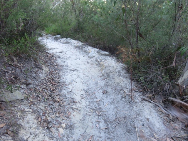
The track below Warrimoo Oval must have taken a lot of effort by several people to construct. It contains multiple jumps, ramps and curves as shown above and right. It could only be used by expert thrill-seeking riders. The independent report commissioned by council stated that the average decline is over 23% whereas the standard used for downhill trails is that they should be no more than 10%. Hence it is risky.
The major reason for closure is the ecological damage caused by the track construction and its continued use. The area contains an endangered ecological community called Coastal Upland Swamp and is also habitat for several threatened native birds, plants and animals. A STEP committee member who is a volunteer in a council-run Eastern Pygmy Possum monitoring project has observed threatened Eastern Pygmy Possums and Rosenberg’s Goanna. Under NSW and federal environmental laws, council is required to protect and conserve this ecological community and the native animals and birds that live within it.
The construction involved bush rock removal, clearing of native vegetation, removal of dead trees and wood, infection of native plants by Phytophthora cinnamomi and changes to landscape hydrology, which is adversely affecting the Coastal Upland Swamp and individual threatened species.
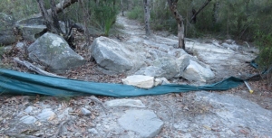
During a visit to the area just after the recent school holidays it was discovered that barriers and signs on the track installed by council had been shoved aside. The tyre marks along the track indicated that riders were still using the track. In 2016, council installed signs warning about video surveillance and explaining the reason for closure. These are being ignored.
This track and other downhill tracks are shown on some mountain biking websites encouraging this illegal use.
Following discussions with the local mountain bike community, council is working on options to reopen part of the trail that is south of the Coastal Upland Swamp. This involves completing an ecological feasibility study and consulting with an experienced mountain bike trail builder to see if suitable track modifications can be made with satisfactory ecological and safety outcomes. Given the steepness of the site and disturbance of the bushland reopening of the track is not guaranteed. The study will be completed by mid-2018.
Garigal National Park
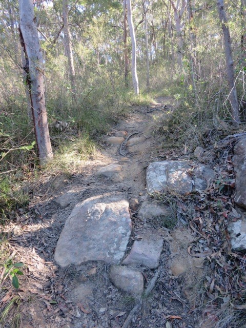 We have also discovered a new mountain bike track that has been carved through high quality bushland below Cambourne Avenue in St Ives down to Middle Harbour Creek. It takes a straight line down the hill while the legal management trail zigzags across the slope.
This is another area where threatened species have been found, namely the New Holland Mouse and also the Eastern Pygmy Possum.
Again a lot of work has gone into constructing ramps and jumps – see photo.
We encountered two riders who didn’t care that they were breaking the law and possibly causing untold damage to threatened fauna as well as their habitat, the bushland with large numbers of species providing food for these animals.
The law is that mountain bikes are allowed in national parks and council land on fire trails, roads and management trails and signage is provided to confirm that cycling is permitted.
These riders think their needs are too important for them to have to wait for the proper process of downhill track construction. This involves surveying plant and animal species that will be affected by bike riding. A route needs to be chosen that will cause minimal damage to the bushland and then a track is built that will be safe, resilient to weather and usage pressures. This process takes time and is expensive.
STEP is not happy about the two tracks that were built in the Frenchs Forest part of Garigal National Park, the Gahnia and Serrata tracks, because they traverse high quality bushland and their usage is likely to lead to introduction of pathogens and weeds and changes in hydrology. However the quality of construction means that their usage over the past two years has not caused any obvious damage so far. We understand that these two tracks cost over
$1 million to build.
Certainly there is a growing demand for mountain biking facilities and we should be encouraging participation in active outdoor sport like this but there are many trails available that can be used legally.
There is also a strong demand for the adrenalin rush of steep downhill rides but this must not be at the expense of damaging quality bushland that is already under attack from urban development and climate change (drought, bushfire). It is not as if the riders could possibly appreciate the bushland as they speed down a hill paying close attention to the next obstacle on the track.
NPWS needs the resources to prevent the construction of these illegal tracks.
What can we do?
The best we can do is alert the authorities, national parks rangers and council staff about any track we see when out walking in the bush. Also alert your local MP about your concerns and the need for more policing of illegal activities.
Warrimoo Mountain Bike Track – Some Good News
Previously we've reported on Ku-ring-gai Council’s closure of the mountain bike downhill track that had been constructed illegally near Warrimoo Oval in St Ives. After strong protests from the mountain biking community, including attempts to remove the fencing used to close the track, council undertook to commission independent ecological and safety investigations into the track. In July 2016 council announced that the research supported its decision to close the track so this will happen permanently.
This track has been evolving over several years and was tolerated by council under the Unstructured Recreation Strategy even though it was constructed without approval. However the listing of Coastal Upland Swamps as an Endangered Ecological Community (EEC) in 2012 under the NSW Threatened Species Conservation Act 1995 changed all that. A determination to list Coastal Upland Swamp as an EEC under the federal Environment Protection and Biodiversity Conservation Act 1999 was made in 2014, further strengthening the need for protection and the legislative requirement of council as the land manager to ensure its protection.
Key Findings from the Independent Report
The independent assessment determined:
that the creation and use of the mountain bike track has had a detrimental impact on the local occurrence of the Coastal Upland Swamp EEC and threatened species and their habitats.
The threatened species include Melaleuca deanei, Tetratheca glandulosa, Eastern Pygmy-possum, Rosenberg’s Goanna and Red-crowned Toadlet within Ku-ring-gai.
It also deemed the mountain bike activity ‘not sustainable’ due to the loss of vegetation and habitat, soil loss and irreversible localised changes to hydrology.
If use of the track were to continue, further degradation of the EEC and threatened species habitats could be expected:
A significant amount of work would be required to bring the track up to IMBA standards and these works are not recommended as they would cause further damage to the environment.
Council is currently looking into possible alternative sites that may accommodate downhill mountain biking in an ecologically sustainable way. The area at Lovers Jump Creek Reserve (Golden Jubilee) is the best and most suitable site. If council were to pursue track development a more detailed impact assessment would be required.
Closure of Unauthorised Mountain Bike Track in St Ives
Ku-ring-gai Council has received considerable flak over a decision to close an unauthorised mountain bike track down a steep hill below the tennis courts near Warrimoo Oval, St Ives.

