
STEP Matters 188
- Default
- Title
- Date
- Random
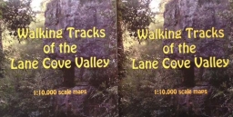
- Yes, the brand new Lane Cove Valley map is now available. It has been produced by John Martyn with his…Read More
- Most people who live in the upper North Shore and who are interested in bushland, or gardening, or geology, or…Read More
- South Dural Residents and Ratepayers Group, a developer initiated lobby group, has made numerous applications since 1990 to Hornsby Council…Read More
- In November the Turnbull Government ratified Australia’s commitment to comply with the Paris Agreement on Climate Change. Australia has set…Read More
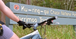
- Previously we've reported on Ku-ring-gai Council’s closure of the mountain bike downhill track that had been constructed illegally near Warrimoo…Read More
- There has been a flurry of legislative action and announcements during the final months of the year following varying periods…Read More
- Knowledge of some of the common endings of scientific names can help to make names less forbidding. It is well…Read More
- In last year’s Annual Report I noted the transformation happening in Sydney and the unknown impacts on our bushland, the…Read More
- Have you ever enjoyed the cool refuge that an underground cave offers from a hot summer’s day? Or perhaps you…Read More
- On Saturday 25 February 2017 the NSW Rogaining Association is holding LaneCoveRivergaine3, backing up the very successful LaneCoveRivergaines 1 and…Read More
- In 2015 the winner of STEP’s prize for a project relating to an environmental issue was awarded to Jade Moxey…Read More


Delving Deep into Caves can Teach us about Climate Past and Present
Have you ever enjoyed the cool refuge that an underground cave offers from a hot summer’s day? Or perhaps you have experienced the soothing warmth when entering a cave during winter?
When descending into a cave, you may not only enjoy the calm climate, you may also admire the beauty of cave deposits such as stalagmites, stalactites and flowstones, known by cave researchers as speleothems.
Perhaps you already know that they grow very slowly from minerals in the water that drips off or over them. This water originates from rain at the surface that has travelled through soil and limestone above, and seeped into the ground and ended up in the cave.
As speleothems grow, they lock into their minerals the chemical signatures of the environmental and climatic conditions of the time the rainwater fell at the surface. So, as a stalagmite grows, the surface climate signature is continuously trapped in the newly created layers.
Some very old stalagmites hold climatic signatures of the very distant past, in some cases up to millions of years. They contain an archive of the past climate as long as their age, often predating global weather station records.
Above and Below
But if a cave remains cool during summer and warm during winter, how is its climate related to that of the surface? And how does this affect the chemical signature recorded by speleothems?
To understand the relationship between surface and cave climate, our research group, Connected Waters Initiative Research Centre at UNSW Australia, conducted multiple field experiments at the Wellington Caves Reserve in New South Wales.
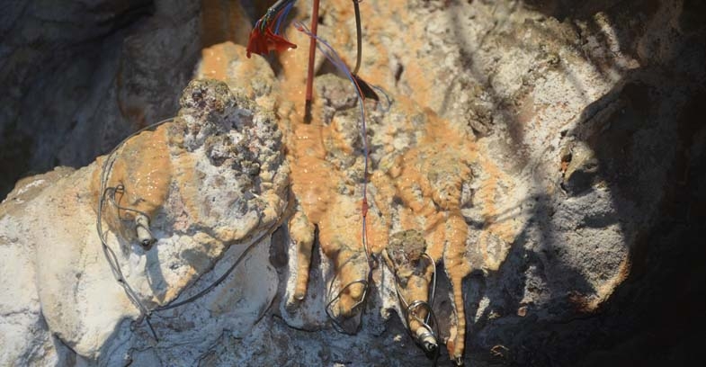
During the experiments, the surface and the cave climates were measured in detail. For example, highly accurate temperature sensors were used to measure the water temperature at the surface, and at the point where water droplets hit the cave floor forming stalagmites.
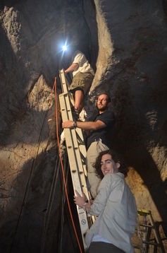
Installation of high-resolution temperature sensors inside the cave. Martin S Andersen
The research team initiated controlled dripping in the cave by irrigating the surface above the cave with water that was cooled to freezing point to simulate rainfall.
The cold water allowed us to determine whether the drip water in the cave is affected by the conditions at the surface or those along its pathways through the ground.
We also added a natural chemical to the irrigation water, which allowed us to distinguish whether the water in the cave originated from the irrigation or whether it was water already present in the subsurface.
Our results revealed a complex but systematic relationship between the surface and the cave climate. For example, surface temperature changes are significantly reduced and delayed with depth.
Our research illustrates how to decipher the surface temperature from that in the cave. Understanding this is necessary to correctly decoding past surface temperature records from their signatures preserved in stalagmites.
Keeping it Cool
We also discovered that air moving in and out of the cave can cool cave deposits by evaporating water flowing on the cave deposits. This cooling can significantly influence the chemical signature trapped in the cave deposit and create 'false' signals that are not representative of the surface climate.
In other words, it will make the surface climate 'look' cooler than it actually was, if not accounted for. While this is more likely to occur in caves that are located in dry environments, it may also have to be considered for stalagmites in caves that were exposed to drier climates in the distant past.
Our new knowledge can also help scientists select the best location and type of stalagmite for the reconstruction of past climatic or environmental conditions.
This new discovery is significant because it can improve the accuracy of past climate signals from cave deposits. It may also help us understand previously unexplained artefacts in existing past climate records. By improving our understanding of the past climate we can better understand future climate variations.
(![]() Photo at the top of page is of temperature loggers installed on stalactites to measure the drip water temperature. Martin S Andersen)
Photo at the top of page is of temperature loggers installed on stalactites to measure the drip water temperature. Martin S Andersen)
Gabriel C Rau, Associate Lecturer in Groundwater Hydrology, UNSW Australia; Andy Baker, Director of the Connected Waters Initiative Research Centre, UNSW Australia; Mark O Cuthbert, Research Fellow in Hydrogeology, University of Birmingham, and Martin Sogaard Andersen, Senior lecturer, UNSW Australia
This article was originally published on The Conversation. Read the original article.
Annual Report for Year to Oct 2016

In last year’s Annual Report I noted the transformation happening in Sydney and the unknown impacts on our bushland, the preservation of which is the primary focus of STEP’s activities. We are none the wiser with major pieces of legislation still in the formative stages. So the focus in 2016 has been on broader rather than local issues.
Committee
We are lucky to have a committee with a wide range of skills including ecology, landscape and bushland restoration, the intricacies of planning regulation and web communications. These people have been hardworking committee members for many years. We would welcome new ideas and experience. We recently emailed a survey aimed at discovering if there are any members, or people members may know, who could contribute in some way to STEP’s activities.
I would particularly like to thank Helen Wortham for the fantastic work she has done in getting the new website up and running and setting up the system for emailing the newsletter. Many hours have gone into getting the email addresses updated and developing a presentation that is very clear and attractive.
I would also like to thank Frank Budai for all his work over the past 3 years as treasurer, keeping track of our finances and organising the audit of our financial statements. Frank has resigned so we are looking for a new treasurer.
Publications
We have reduced the prices of our books and sales have been similar to recent years. Map sales are still solid. Our maps are more detailed than generally available on-line and there is no better way to plan a walk than poring over a full-size paper map.
The new Lane Cove Valley map is about to be printed using the more durable ‘stone’ paper that is waterproof. We are thankful for having a large team of volunteers who have been ground checking the new map that has been masterminded by John Martyn. Copies will be available before the end of the year.
Accounts
Our finances show a deficit of $3,550 for the year to 30 June mainly from a write down in the value of our stock of publications. Until now the major expenditure item has been the cost of production of the newsletter. This cost will be lower in future because of the use of email for distribution.
We have maintained the Environment Protection Fund which provides Deductible Gift Recipient (DGR) status for donations that support STEP’s environmental objectives. We received a total of $350 in donations in the past financial year. The government has been reviewing the criteria for providing DGR status. The current recommendation from a parliamentary report released just before the election is that this status should apply only if at least 25% of an organisation’s expenditure relates to on ground environmental work, however that can be defined. There is a risk that many environmental organisations will lose their DGR status.
Electronic Media
Our website has been upgraded and rebranded so that there is full functionality on tablets and smart phones and well as old-fashioned computers. New features include a secure shopping cart where you will be able to order and pay for publications and membership on-line. There is a simple system for registering for our walks. If you haven’t had a look, please do.
Trish Lynch creates an innovative Facebook page with an attractive selection of photographs and alerts of current local events and issues.
John Burke looks after our Twitter feed with incisive comments on current environmental affairs.
Education
We support the Young Scientist Awards run by the Science Teachers’ Association NSW with a prize in the environmental sustainability category. The winner of our award in 2015, Jade Moxey went on to win the overall Young Scientist of the Year and international awards as well. She has extended her project this year and is again our winner. There was another worthy project so we have also awarded a runner up prize this year. It is great to see the interest the students have shown in environmental research.
The Environment Protection Fund can be applied to educational and research projects. Ideas and proposals are welcome.
Talks
We organised public talks over the past year on Sydney’s birdlife, the unique geology revealed by the Hornsby Quarry, Wahroonga Waterways Landcare, exploration of the seafloor and land snails.
We did not manage to organise a STEP lecture last year as the potential speaker was not available.
Walks
STEP organises a walk every month or two (eight since our last AGM) in both our local area and further afield. Two of the walks focusing on birds were very popular. We also introduced members to some very different plant communities in western and south-western Sydney. The walks aim to be educational and to encourage new walkers so most walks are not physically challenging. We thank Andrew Little and John Martyn for organising and leading walks. If you have a request for a walk please let us know.
Newsletter
Our newsletter, STEP Matters, is our main means of communicating events, our activities and issues with our members. We also include other articles with an environmental angle that will be of interest to members. The newsletter is also sent to local councillors and politicians. We welcome alerts from our members of local events and developments and, of course, feedback on articles is always welcome.
We are now emailing the new editions to the majority of members and a few members still prefer a hard copy in the post. All past editions are available on our website going back to scans of the typewritten versions from 1978.
Environmental Issues
Despite the huge opposition on scientific and sustainability grounds to proposals to change the biodiversity conservation and land clearing legislation the Baird Government has given no hint that it is listening. There are also proposals to change Crown Land management that could have the potential to encourage commercialisation and alienation of green spaces. We are soon to be invited to comment on a broad picture framework for the development of Sydney over the next 20 years as set out in District Plans drafted by the Greater Sydney Commission. STEP’s major concern is whether there will be adequate provision for the maintenance of healthy bushland and tree canopy within our suburbs in the face of rapid unsustainable population growth. We urge everyone to get involved by sending comments to the Greater Sydney Commission.
Then there is the prospect of council amalgamation hanging over our heads. It is likely there will be a period when we will have no local representation with decision making taken over by an administrator appointed by the government. Once amalgamation is bedded down there is uncertainty about the application of planning instruments where, for example building standards or tree preservation orders could be set at a common standards that will lead to denser development in low and medium density residential areas and loss of the current treed character and amenity of many Sydney and other coastal areas.
One local issue is the outcome for the Hornsby Quarry after it has been filled with spoil from the NorthConnex tunnels. We have been unable to get any assurances that the rock face of the volcanic diatreme will remain visible.
New Lane Cove Valley Map
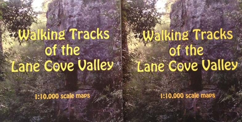
Yes, the brand new Lane Cove Valley map is now available. It has been produced by John Martyn with his keen eye for detail and clarity. We are grateful to have had the assistance of a team of walkers who checked the details of the tracks and names of streets etc.
The map covers a larger area than the old map going further north and west to cover the major connection points from the North Shore railway line and Pennant Hills.
The price is $15. For STEP members the price with the usual 30% discount is $10.50. Order your copy now!
Please note that you do not need to have a PayPal account in order to use PayPal to make a payment.
Warrimoo Mountain Bike Track – Some Good News

Previously we've reported on Ku-ring-gai Council’s closure of the mountain bike downhill track that had been constructed illegally near Warrimoo Oval in St Ives. After strong protests from the mountain biking community, including attempts to remove the fencing used to close the track, council undertook to commission independent ecological and safety investigations into the track. In July 2016 council announced that the research supported its decision to close the track so this will happen permanently.
This track has been evolving over several years and was tolerated by council under the Unstructured Recreation Strategy even though it was constructed without approval. However the listing of Coastal Upland Swamps as an Endangered Ecological Community (EEC) in 2012 under the NSW Threatened Species Conservation Act 1995 changed all that. A determination to list Coastal Upland Swamp as an EEC under the federal Environment Protection and Biodiversity Conservation Act 1999 was made in 2014, further strengthening the need for protection and the legislative requirement of council as the land manager to ensure its protection.
Key Findings from the Independent Report
The independent assessment determined:
that the creation and use of the mountain bike track has had a detrimental impact on the local occurrence of the Coastal Upland Swamp EEC and threatened species and their habitats.
The threatened species include Melaleuca deanei, Tetratheca glandulosa, Eastern Pygmy-possum, Rosenberg’s Goanna and Red-crowned Toadlet within Ku-ring-gai.
It also deemed the mountain bike activity ‘not sustainable’ due to the loss of vegetation and habitat, soil loss and irreversible localised changes to hydrology.
If use of the track were to continue, further degradation of the EEC and threatened species habitats could be expected:
A significant amount of work would be required to bring the track up to IMBA standards and these works are not recommended as they would cause further damage to the environment.
Council is currently looking into possible alternative sites that may accommodate downhill mountain biking in an ecologically sustainable way. The area at Lovers Jump Creek Reserve (Golden Jubilee) is the best and most suitable site. If council were to pursue track development a more detailed impact assessment would be required.
Having Trouble with Plant Names?

Knowledge of some of the common endings of scientific names can help to make names less forbidding. It is well worthwhile learning some of them.
A plant named after a person may end in ‘i’, ‘ii’, ‘iae’ or ‘ana’:
- -iae indicates that the plant was named in honour of a female, e.g. Acacia kettlewelliae from the subalpine areas of Victoria was named in honour of Mrs A Kettlewell, who was one of the founders of the Wattle-day League in 1909
- -i or -ii indicates that the plant was named after a male, e.g. Acacia beckleri was named in honour of the German born Dr Hermann Beckler, and Acacia williamsonii after Herbert Williamson, a teacher and botanist – usually (but not always) an i or ii ending means that the person named was the first to find the plant
- -ana indicates that the plant was named in honour of someone other than the finder. Acacia baileyana was named after FM Bailey, a prominent Queensland botanist. Sometimes the -ana ending is used after a place name, e.g. Eucalyptus papuana, the Ghost Gum of Central Australia
- -ensis indicates a native of the area named, e.g. Eucalyptus delegatensis is from the town of Delegate in south-eastern NSW. Note that austalis means southern and australiensis means inhabiting the south
- -oides means ‘resembling’, e.g. Acacia asparagoides is asparagus-like
- -cola means ‘native of’, e.g. Acacia saxicola is an inhabitant of rocky places
- -ella means ‘diminutive’, e.g. Dianella is the diminutive form of Diana
- -escens means ‘becoming’, e.g. Acacia glaucescens means becoming glaucous (powdery white)
- -osus or -osa indicates ‘abounding in’, e.g. the Common Fringe-lily Thysanotus tuberosus is abounding in tubers, and Acacia dentulosa is abounding in teeth
- -folia or -phylla refers to the leaves, e.g. Acacia brevifolia has short leaves, Acacia juncifolia has juncus (rush like) leaves, Acacia aciphylla has sharp, needle-like leaves, while Acacia aphylla is leafless. Acacia genistfolia has leaves resembling those of Genista (the brooms)
- -issima means ‘very’, e.g. Acacia aculeatissima is very prickly, and Acacia elegantissima is very elegant
- -ata indicates ‘a little’, e.g. Acacia crenulata has leaves a little bit crenulated (toothed) and Prostanthera denticulate has little teeth on its leaves
- -dentata means ‘toothed’, e.g. Acacia bidentata means two toothed
So next time you see Eucalyptus balladoniensis you will know that there is a town or district called Balladonia, and because there is a eucalypt called Eucalyptus burracoppinensis, there must be a place called Burracoppin.
And Eucalyptus brockwayi was named after Mt Brockway. One of the plants in the local bushland is the Bedstraw, Gallum gaudichaudii, so there must have been a Mt Gaudichaudi. And Acacia victoriae was named after a female, actually a queen. If it was named after Victoria, it would have been called Acacia victoriensis.
But some names are a simple giveaway, such as Persoonia hirsuta, the hairy geebung.
This article has been reproduced with permission from an item in Blandfordia, the magazine of the Australian Plant Society NSW Ltd, North Shore Group
Lane Cove Valley Metrogaine
On Saturday 25 February 2017 the NSW Rogaining Association is holding LaneCoveRivergaine3, backing up the very successful LaneCoveRivergaines 1 and 2 in 2015 and 2016.
Rogaining involves teams of 2 to 5 people navigating to checkpoints marked on a map.
This is a great community event. Over 400 entrants of all ages (6 to 80+) and abilities are expected – from elite athletes to walkers and families. You get to choose your own route and level of difficulty and how long you take, within the 6 hour time limit.
You don't need special gear. Comfortable jogging or walking shoes and appropriate clothing are fine. Food and water should be carried, though bubblers and shops are located throughout the area and are marked on the map. A compass isn’t essential, but would be useful.
Start (11 am) and finish will be at Blackman Park, Lloyd Rees Drive, Lane Cove.
Instruction will be available for all first timers. Just form a team and register on-line (in January).
Enquiries: 0419 663 539 or This email address is being protected from spambots. You need JavaScript enabled to view it..
As for the two previous events, John Martyn has modified the STEP map of Walking Tracks of the Lane Cove Valley for the event. The location is the lower Lane Cove River Valley from Epping Road Bridge to Fig Tree Bridge, and surrounding suburbs. And John has helped to identify the most spectacular tracks and vistas for the event.
NSW Government Ploughs on with Controversial Legislation
There has been a flurry of legislative action and announcements during the final months of the year following varying periods of consultation. The concerns about the legislation have been covered in recent issues of STEP Matters and more details are provided by the peak bodies leading the campaigns, the Nature Conservation Council and Total Environment Centre. Here is a brief update concentrating on the implications for urban areas.
Crown Land Management
The new Crown Law Act was pushed through state parliament on 9 November. The government claims that the new legislation will reduce complexity and deliver better management. It is expected that commencement will be in early 2018 after the required policies and systems have been prepared.
Submissions to the inquiry pointed out that, in fact, the problems with the current legislation are with administration, not the act itself. There are many examples of the misuse of crown land, for example the Talus Reserve in Willoughby that Willoughby Council allowed to be taken over by commercial interests that have generated a private profit.
Under the new legislation crown land may be transferred to local government or vested in other NSW government agencies. It is unclear whether they will be given the financial resources to carry out these new responsibilities. It seems there would be no barriers to councils classifying the land as operational land that could be sold or leased for development without any community consultation. Time will tell!
Climate Change Policy
One item of good news is that the NSW government announced a policy to reduce greenhouse gas emissions to zero by 2050. The announcement documents contain lots of statements of intention but most of them are dependent on federal government policy and action.
The sincerity of the government’s policies are now called into question. A Climate Change Fund was established by the NSW government in July 2007 to help households, businesses, community organisations, schools and government to save water, energy and greenhouse gas emissions. We now learn that the $240 million for private land conservation under the new Biodiversity Act will come from this same fund ‘to help landholders and land managers reduce the impacts of climate change on natural systems’.
Biodiversity and Land Clearing Laws
On 17 November the biodiversity laws were passed with the help of the Shooters and Fishers and Fred Nile’s Christian Democrats in the Upper House. Over 7,000 submissions were received with the majority expressing alarm about the prospects for increased land clearing and relaxed biodiversity offset provisions. Some minor changes have been made to the draft bills:
- Some vitally important areas will be excluded from the land clearing codes which means that it will be harder for farmers to clear them. These areas include coastal and Ramsar wetlands, littoral rainforest, core koala habitat, critically endangered ecological communities, old growth forests and high conservation value grasslands.
- The act ensures that the Office of Environment and Heritage will remain responsible for compliance and enforcement of the legislation, rather than the Department of Primary Industries as the government originally suggested.
- The Minister for the Environment and Minister for Primary Industries have the power to stop the use of land clearing codes under certain circumstances which is significant due to the expansion of codes under the new legislation.
- The use of biodiversity offsetting is greatly expanded under the new legislation which is a significant concern, however the final legislation has improved the offsetting provisions by requiring the minister to ensure that offsets result in ‘no net loss’ of biodiversity. This creates the opportunity to pressure the minister to adopt a more strict interpretation of offsetting that will have tangible result for bushland across the state.
Further consultation will occur on regulations that are yet to be released on aspects such as ‘red lights’ for development that impact on critically endangered species, testing of the Biodiversity Assessment Method that will determine how the impacts of development on biodiversity are managed and the long awaited State Environmental Planning Policy that will decide the fate of urban vegetation and biodiversity.
The government is still trumpeting the benefits that will come from private conservation actions but it is unclear how this can compensate for lost vegetation and habitat in other areas and that there will be sufficient long-term funding. In fact it has recently been discovered that the Climate Change Fund has been raided to provide funding for private land conservation.
Draft land clearing codes and regulations will be released early in 2017 for consultation.
Greater Sydney Commission District Plans
The much anticipated District Plans were released on 21 November. Submissions may be made up to the end of March and the intention is to finalise the plans by the end of 2017.
The District Plans cover the next 20 years. The overriding document is the Plan for Growing Sydney that covers development up to 2056. Over this time Sydney’s population is projected to grow from the current 4.6 million to 8 million.
On first perusal the District Plan for northern Sydney appears to recognise the value of our bushland and coastal environments. The detail is not available on how Local Environment Plans can be used in future to ensure the preservation of wildlife corridors and local bushland as well as national parks.
At forums organised by the Better Planning Network, commissioners have emphasised social and economic aspects of the plans. The environment seems to be a poor relation instead of being a vital consideration that will impact on socio-economic outcomes. For example, who wants to live in a concrete jungle of high rise apartments with no shade or natural landscape nearby?
The consultation period provides an opportunity for the public to reinforce the importance of maintaining healthy quality green spaces, bushland and national parks that are identified in the District Plans. Please write a submission.
Review of Direct Action’s Ability to Meet our Greenhouse Commitments

In November the Turnbull Government ratified Australia’s commitment to comply with the Paris Agreement on Climate Change. Australia has set a target to reduce emissions by 26 to 28% below 2005 levels by 2030, which builds on the 2020 target of reducing emissions by 5% below 2000 levels. The 2030 target is equivalent to about 13% below 2000 emission levels so the 2030 target is not as good as it sounds.
Currently the government’s main plan to reduce greenhouse gas emissions to meet our obligations under the Paris Treaty is called the Direct Action Plan. Introduced in 2014, the scheme operates by reverse auction, funding projects voluntarily proposed by the private sector. Projects are selected on the amount of greenhouse gas emissions expected to be abated at the cheapest price. So far $1.7 billion has been allocated out of a budget under the Emissions Reduction Fund (ERF) of $2.55 billion over 4 years.
Direct action also involves an emissions ‘safeguard mechanism’ to discourage large emitters from increasing their emissions above historical benchmarks. It commenced on 1 July 2016. It is not clear yet whether the rules will be effective in controlling increases in emissions.
This article draws on two recent analyses of the effectiveness of the Direct Action Plan:
- Paul J Burke, Undermined by Adverse Selection: Australia’s Direct Action Abatement Subsidies, Australian National University, April 2016
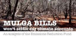
- Margaret Blakers and Margaret Considine, Mulga Bills won’t Settle our Climate Accounts: An Analysis of the Emissions Reduction Fund, The Green Institute, November 2016
Risk of Adverse Selection
Paul Burke questions the effectiveness of the direct action projects because of fundamental flaws in the scheme design:
- There is no way of preventing the direct action scheme subsidising projects that would have gone ahead anyway. For example funding has been provided for replacing machinery that is inefficient and upgrading lighting in supermarkets. These projects would provide a financial benefit to the proponent in any case so a subsidy has no justification.
- The international rules of carbon accounting require additionality. This means that credit for emissions reductions must not include changes that would have occurred anyway, say, because of legislation.
- The information about emissions expected to be abated will depend on a definition of baseline emissions, that is, what emissions would have been if the project had not been implemented. It is the proponent’s responsibility to identify their baseline in accordance with approved methods, and there is some flexibility. The government’s inability to know true project baselines creates a major challenge. Projects with overgenerous baselines will be able to submit relatively low auction bids because the abatement they offer will be easy to achieve, and thus cheap. These bids are well placed to secure funding. If the baseline is higher than business as usual, in the end the project will deliver less abatement than notionally indicated.
Effectiveness and Value for Money of Abatement to be Delivered
Margaret Blakers and Margaret Considine have undertaken the first ever analysis of the ERF auctions. They found that direct action not only fails its own test of delivering ‘real and additional’ emissions reductions, but also that it cannot serve as the foundation for more serious action without very substantial changes to its architecture. Their key findings are:
- Large sums of money (around $1.2 billion) have been poured into protecting land sector carbon. At the same time there is no federal policy safeguarding existing landscape carbon stocks. They are turning a blind eye to state governments rolling back land clearing controls. The entirety of the abatement purchased by the ERF so far (143 Mt CO2-e) at a cost of $1.73 billion accounts for less than 20% of projected emissions from land clearing up until 2030.
- Over half of all abatement comes from just two mulga-dominated bioregions in south-west Queensland and western NSW. The value of ERF contracts in and around these regions is about $1 billion. With carbon payments estimated to average $195 per hectare, this represents many times the per hectare value of land in the region. Paul Burke makes a similar point. This situation only applies to land with existing land clearing permits predating 1 July 2010. The payments rest on the assumption that clearing would have happened without the subsidy. No doubt some vegetation has indeed been preserved, albeit at a high price. Some of the spending has questionable additionality, however, given that the incentive to clear was anyway rather low (clearing is expensive and the productivity of the land is low).
- Much of the scheme’s expenditure has either been wasted or is at risk due to doubtful additionality (as per Paul Burke’s examples) and lack of permanence. 25% of ERF abatement has a ‘permanence’ period of only 25 years, after which time landholders regain ‘full land-use flexibility’. As well, the concentration of abatement in the semi-arid mulga regions carries its own risks such as from drought and climate change itself.
Fundamentally the ERF abatement profile is at odds with Australia’s emissions profile. Over 80% of our emissions are from industry, but 80% of direct action abatement is from the land sector. Only 4% is from the energy and industrial processes sectors, which produce most of Australia’s emissions.
Inadequacies in Methods for Vegetation Abatement
All the methods apply to ‘forest’ which is defined under the international rules. No methods are available at present for non-forest native vegetation or existing native forests on public land. Native forests on private land protected by legislation or covenant do not qualify because they are required by law to be protected.
Most landscape carbon resides in natural ecosystems. If well-managed, these will be resilient and are likely to persist and accumulate large carbon stocks in soils and plants over decades and centuries. Natural ecosystem management requires coherent, continental-scale policies and funding for the long term coordinated by the states and Commonwealth, not the ad hoc project funding that direct action provides.
The ERF is failing the climate, failing the land sector and failing the budget. To be credible, Australia’s climate policies must address the land sector in its own right and must stem the loss of carbon from the landscape caused by clearing, logging and other forms of degradation.
Ultimately the only effective long-term strategy to reduce Australia’s greenhouse gas emissions is to place a direct price on emissions.
Young Scientist Awards 2016

In 2015 the winner of STEP’s prize for a project relating to an environmental issue was awarded to Jade Moxey from Sapphire Coast Anglican College This year she has done it again with a project that extended her previous research that scotched theories that cattle grazing can stop the spread of weeds. She showed that fireweed is similarly not controlled through sheep grazing. Then she showed great initiative in organising testing of whether the toxic alkaloids in fireweed have the potential of health impacts for sheep and humans.
We also decided to give a highly commended prize to Darryl Domer and Carlos Meier, home schooled, for an evaluation of cell grazing compared with conventional open paddocks. They found that cell grazing provided significant economic and ecological benefits including increases in water use efficiency, pasture productivity and plant biodiversity. The results showed that that cell grazing could provide a potential solution to global food security when applied to a larger scale.
Marian Haire awarded STEP’s prizes.
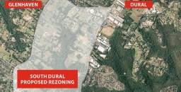
South Dural Rezoning Proposal is Alarming
South Dural Residents and Ratepayers Group, a developer initiated lobby group, has made numerous applications since 1990 to Hornsby Council for the rezoning of 240 ha of rural lands in south Dural for urban purposes. The latest attempt is currently under consideration. Click here for details of the history of the lobbying
In the latest attempt, consultants’ reports have been commissioned as part of the first step of the application, that is, to change the zoning from rural to various levels of residential density and recreational zoning. Submissions closed on 2 December.
The spine of the proposed development is an area of bushland along Georges Creek and another unnamed tributary of Berowra Creek. Indeed the developer is touting the natural views and the tall forest as a feature that will allow six storey apartments to fit into an ‘eco-friendly’ community. All in all the proposal is for 2,900 dwellings that could house 9,000 people.
The bushland is of high conservation value with areas of Blue Gum High Forest (10.5 ha), Sydney Turpentine Ironbark Forest (22 ha), Blackbutt Gully Forest (30 ha) and Shale Sandstone Transition Forest (1.4 ha). The first two listed are classified as critically endangered ecological communities under the federal Environment Protection and Biodiversity Conservation Act.
As the opposing residents’ group, the Galston Area Residents Association, points out there are many reasons to oppose the application, for example:
- it is inconsistent with the metropolitan plan to preserve remaining rural land
- current roads cannot cope with current traffic let alone that generated by the extra residents
- public transport is inadequate and the north west rail line is a long way away so buses will have to operate on clogged roads
- there is insufficient provision for schools, shops, recreation areas and other basic infrastructure
STEP opposes the rezoning application for three main reasons:
1. Inadequate vegetation data and mapping
The bushland area comprises about 64 ha, a quarter of the site. As large parts of the land are privately owned it has not been possible to carry out on the ground vegetation mapping. This applies in particular to the area of Blue Gum High Forest of about 10 ha. This is in the context of the total area of Blue Gum High Forest remaining in Sydney of less than 200 ha. Other areas of significant vegetation have not been sampled adequately or consistently.
It is totally unsatisfactory to be asking the public to comment on such inadequate information, especially when dealing with endangered ecological communities.
2. The proposed zoning map does not reflect the described development or the stated purpose to conserve native vegetation
The higher density six storey buildings are planned to be built closest to the bushland but they are zoned R3 (medium density). It should be zoned R4, high density residential.
There are also inconsistencies in the minimum lot sizes of 125 m2 and 225 m2 stated in different parts of the proposal documents. The prospect of lot sizes of 125 m2 is alarming! No room for trees.
Most of the riparian areas are described as having high conservation significance so should be zoned as E2. However the proposed zoning is RE1. It appears the intention is to allow a gravity feed sewer to be installed along the creek lines, hardly compatible with conservation. Construction of a sewer would need road access that would damage the natural creek line and, on past experience, create a wide band of weed invasion.
3. Large areas of the zoning proposal are deferred
The deferred areas are the main bushland strips that interface between the residential areas and the core riparian areas. They cover a significant part of the bushland. The reason given is the uncertainty of the biodiversity legislation that had not been passed when the proposal was submitted.
These deferred areas will be hard to manage because of the proximity to the housing development so government agencies will probably not want them.
An absolute tragedy would occur if they were traded for biobanking sites elsewhere as it would be impossible to find equivalent vegetation communities to be restored to offset the losses. They should become areas that are off-limits to biobanking.
The effect of this proposal on the existing vegetation will be very damaging unless very detailed precinct plans to protect it are drawn up and very active and expensive management takes place in perpetuity.
It is unsatisfactory to expect the public to comment on this proposal with incomplete and inadequate information.
Summary
Ideally STEP would like this parcel of land to remain rural, but in the event of it being rezoned for residential development STEP would like the potential impact on biodiversity reduced. Possible mechanisms for this include:
- The RE1 zoning changed to E2 to allow better management of the biodiversity values
- The deferred areas to be zoned E2
- The areas zoned E2 to be managed by the local council with the provision of funding for long-term management from the developer
- The area currently proposed for R3 (medium density) should be greatly reduced with a zoning of R2 (low density) in areas with scattered trees
- Very limited R4 (high density) set well back from the bushland
- The minimum lot size for dwelling houses and semi-detached houses increased well above 225 m2, preferably up to 500 m2
- Find an alternative to gravity-fed sewers down the creeks
- Development set further back from the areas of biodiversity constraints so that the bushland edges are not as severely impacted
- Provision of buffering by revegetation should be considered along bushland edges
Hawkesbury Sandstone Shale Lenses

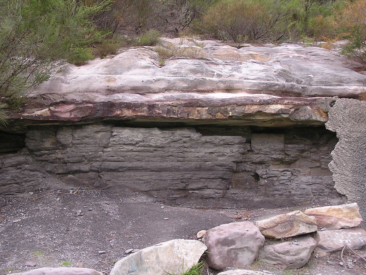
Most people who live in the upper North Shore and who are interested in bushland, or gardening, or geology, or maybe all three, would be conscious of whether they live on ‘shales’ or ‘sandstones’. They might also be aware that the shales generally overlie the sandstones, or so it would seem. But I had a conversation once with a lady who lives at Duffys Forest who believed that she and her neighbours lived on ‘Wianamatta Shales’. Well it was a reasonable assumption – but incorrect!
The shales that were once extensively quarried at Duffys belong to a thick lens some 140 to 170 m above the base of the Hawkesbury Sandstone, and at these levels and geologic times, the meandering, braided river channels that deposited the sands were starting to pond, and flood plain lagoons became more extensive and persisted for longer, accumulating clays that were preserved beneath further layers of river sand; or torn up and redeposited as sand with shards of shale. Eventually the sand was washed down only in intermittent flood bursts; its sand bars invading the muddy lagoons and the sands interlayering with the clays and silts, creating the transitional Mittagong Formation. The clays then took over as the river basin became a swampy, Triassic coastal lowland, and the Wianamatta Group was formed, but more about Mittagong and Wianamatta in later articles.
Shale Lenses: Form and Size
Hawkesbury Sandstone shale lenses lie sometimes only a few tens of metres or less below the stratigraphic top of the sandstone and they have been mapped and interpreted in different ways over the years. Without drill data it can often be difficult for a field geologist to know if scrappy, lateritised shale floaters and outcrops on a ridgetop are lying within or on top of the sandstone. As such, they were mapped sometimes as outliers of Wianamatta Group or Mittagong Formation, but latterly they have tended to be pushed down into the sandstones. A good example of such ambiguity would be the lateritised shale ridge capping at St Ives Showground, whose topographic setting could fit it into either category. Not only do such shale lenses tend to increase in frequency upwards in the sandstone sequence, but they are more common northwards and towards the coast.
Most lenses are just oversized slivers less than a metre thick and tens to hundreds of metres in lateral extent, and they tend most commonly to consist of laminite: a thinly bedded (mm to cm) alternation of shale, siltstone and sandstone. If you're out and about there are several places you can see them such as the south wall of the Argyle Cut in the Rocks. And on the M2 at Barclay Road overbridge, North Rocks, the NorthConnex guys are excavating a sandstone face with a laminite lens, though this may well soon be concreted over. There's a great example on the cliff top north of Wattamolla, and then there's Beacon Hill, just off Warringah Road, where shale once quarried for ceramics is still visible at the base of the hillside flanking the sports oval. This lens is more substantial and actually yielded numerous fish fossils of freshwater affinity.
Laminite – millimetre-thick alternating layers of sandstone and shale, Wattamolla cliff top
The Beacon Hill shale lens is thick, but not as thick as the Duffys Forest lens which was 35 m thick before quarrying. Thick also was a lens at Lucas Heights which is of the order of 10 to 20 m. Substantial lenses also occur at Canoelands, Kirrawee, Menai and Darkes Forest, and most of these larger ones tend to carry shale and mudstone in addition to laminite. There is a very readable account published on-line by ANSTO of the Little Forest lens at Lucas Heights, in which the author found little difference between its shale and typical Ashfield Shale of the overlying Wianamatta Group.
In terms of area, the larger lenses may originally have covered several square km, though because they were formed in lagoons and oxbows there is a tendency for them to appear long and narrow. The Darkes Forest lens for example extends along its ridgetop for nearly 4 km and the Duffys Forest lens measures 3 km in outcrop from north to south.
Shale/mudstone overlain by sandstone in former wall of Beacon Hill Quarry
Shale Lenses and their Vegetation
The shale lenses have a marked effect on soils, and this is reflected of course in the vegetation. Shale soils being more fertile have often been cleared for orchards and smallholdings, as at Darkes Forest and Canoelands, though there are significant surviving natural vegetation remnants, as described below.
Darkes Forest
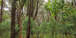
I first stumbled on Darkes Forest by following the signs to the orchards from the Princes Highway, and was surprised to drive past quite tall forests of straight trunked trees; quite a contrast to the sandstone woodlands and shrublands along the highway. The forests are catchment protected so it's unwise to venture too far in, but it's easy to distinguish White Stringybarks, Sydney Peppermints and Sydney Red Gums shading an open floor peppered with tall shrubs of Two-veined Hickory Acacia binervata and a variety of other species including Gymea Lilies. About 200 ha of this forest remains, and has been declared as O'Hares Creek Shale Forest community and listed as endangered. See photo at the top of the page.
Menai
You may drive past the 5 ha Halls Drive Bushland Reserve off New Illawarra Road without noticing it, and be unaware there is any shale in the area, but venture in and you'll see shale fragments in the soil and be confronted with several species of eucalypts of both shale and sandstone affinity. It's probable both White and Common Sandstone Stringybarks are present as are Red Mahoganies, and these are accompanied by Sydney Red Gums and scribbly gums (unsure of species). The last two are perfectly at home on sandstone, but there are also abundant Blackthorns Bursaria spinosa – shrubs more typical of shale terrain. The plant community falls within the broad embrace of the critically endangered Shale Sandstone Transition Forest community.
Kirrawee
The 1:100,000 scale published geology map shows a chain of shale bodies running for 10 km along the ridge line between Sutherland and Cronulla. These are almost entirely built over except for some tiny patches of bushland adjoining Kirrawee railway station. These feature grassy woodland dominated by Grey Ironbarks and are a good example of Sydney Turpentine Ironbark Forest.
Beacon Hill–Frenchs Forest
The only surviving bushland on Beacon Hill itself is totally on sandstone not the shale of the former quarry, but shale lenses mapped around Frenchs Forest nearby carry surviving forest and woodland, though this has been under recent threat from hospital and road construction. A tree that can still be found there is White Mahogany Eucalyptus acmenoides, a shale-loving northern species also common in Edna Hunt Sanctuary near Epping, both areas at the southern limit of its natural range.
Duffys Forest
This semi-rural ridgetop settlement spreads across sandstone and shale, extending over the old shale quarry which has been manicured into a housing estate, country club and golf course. Much of the shale-related bushland was lost in the quarrying but some survives on its north-east and south-west sides. Whether it's truly Duffys Forest plant community may depend on interpretation, as key Duffys species such as Brown Stringybark Eucalyptus capitellata and Caley's Grevillea Grevillea caleyi are either absent or extremely hard to find there.
Trees that can be found include common species like Red Bloodwood, Silvertop Ash, Common Sandstone Stringybark, Sydney Red Gum and Christmas Bush, with a scattering of Blackbutts and Turpentines. The tree flora has affinities with both Duffys Forest and Shale Sandstone Transition Forest communities.
The shale is heavily lateritised, and iron-rich laterite debris have accumulated downslope on sandstone benches and in hollows. Among the species supported in such sites are a wealth of Proteaceae including Waratahs.
Berowra
When you walk from Berowra to Berowra Waters you descend to a firetrail that follows the contour. The hillside here has flattened into a broad bench and there are numerous shale and siltstone fragments in the soil. A shale band has created an aquiclude, wetting the soil to support abundant Umbrella Fern groves, plus thickets of the green-flowered Grevillea mucronulata; not a common plant on the North Shore but very abundant here. The Berowra example is a departure from the ridgetop shale settings and threatened, shale-related plant communities, and if any threatened community is represented there it is Coastal Upland Swamp.
Canoelands
The name of this locality is said to derive from timber getters finding stringybark ‘canoe trees’ with scars from bark removal. The stringybark was said to be Eucalyptus cephalocarpa but there are no known localities of this species north of Merimbula. The few hectares of bushland remnants among the Canoelands orchards carry tall straight stringybarks that are most likely E. globoidea. Such remnants have been mapped as critically endangered Turpentine Ironbark Forest in Hornsby Council's surveys.
This is the second in a series of articles by John Martyn on Sydney’s geology. Click here for his article on the Narrabeen Group.