
Newsletter blog
Children categories
STEP Matters 185
- Default
- Title
- Date
- Random
- During the STEP walk at Agnes Banks Nature Reserve we came across an endangered Persoonia nutans with lots of little…Read More
- Beecroft is bearing the brunt of three significant infrastructure developments (North West Rail Link, Epping to Thornleigh Third Track and…Read More
- Interesting consumer research has found the number of Australians going bushwalking has risen significantly in the past five years. Findings…Read More
- A group of people living in the Shoalhaven region have seen the potential of the bushwalking boom. The Shoalhaven region…Read More
- The battle continues against coal mining under the water catchments in the Illawarra but there are some hopeful signs that…Read More
- At the end of March aerial surveys of more than 500 coral reefs from Cairns to Papua New Guinea revealed…Read More
- Technological developments have had profound impacts on our lives, some good and some not so good, some with immediate benefits…Read More


STEP Matters 184
- Default
- Title
- Date
- Random
- The population of the Sydney metropolitan area is estimated to grow by 1.6 million people by 2031. According to the…Read More
- In STEP Matters, Issue 183, p4 (Concern about Changes to Biodiversity Laws) we explained the reasons for concerns about the…Read More
- In the past, councils expended significant funds in formulating local environment plans with zoning locations appropriate for different areas. The…Read More
- After promising that amalgamation would not be forced onto residents, the NSW Government is pressing ahead by moving the goal…Read More
- The Ku-ring-gai Bushcare Association is an unincorporated organisation that is supported by Ku-ring-gai Council which supports the Bushcare volunteer program…Read More
- The Paris climate change talks in December 2015 produced an agreement hailed as 'historic, durable and ambitious'. Developed and developing…Read More
- In November last year STEP held a talk by Dr Ian Percival on the unique volcanic diatreme that has been…Read More
- STEP committee member, Andrew Little, happened across an Echidna searching for ants in a driveway in Roseville Chase. It was…Read More
- Mark Diesendorf, UNSW Australia Can Australians be sustainable and enjoy endless economic growth? It’s not likely.Read More
- The Boomerang Alliance, a coalition of groups led by the Total Environment Centre, has been campaigning for more than ten…Read More
- Out thanks to the Ku-ring-gai Bat Conservation Society for permission to publish this article that was originally published in Friends…Read More
- Two members of the STEP committee visited the Snowy Mountains in recent months. John Martyn saw plenty of flowers in…Read More


STEP Matters 183
- Default
- Title
- Date
- Random
- About a year ago the discovery of a new species of Hibbertia in was announced. The species, with the scientific…Read More
- Sadly another STEP stalwart has died. Glenn Johnson was a member of the committee for nine years from 1984 to…Read More
- The Science Teachers’ Association of NSW conducts a program to assist students and their teachers to carry out scientific investigations.…Read More
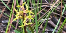
- Wander through the bushland of Wahroonga Estate and you will see the delicate heads of native orchids peeping out from…Read More
- Ross Rapmund gave a fascinating talk on the changing birds in northern Sydney. He started with a slide which compared…Read More
- The NSW Government is currently considering legislation to implement the recommendations of the Independent Biodiversity Legislation Review Panel contained in…Read More
- This article by Connie Harris was originally published in the October edition of Native Plants for NSW. It concerns the…Read More
- Silly me; I thought world population now around 7 billion was going to stabilise at around 9 billion by 2050.…Read More
- Media Release 17 September 2015, The Hon Kelvin Thomson, Federal Member for Wills.Read More
STEP Matters 182
- Default
- Title
- Date
- Random
- Last year the NSW Government’s planning legislation was rejected because communities were going to be left out of significant parts…Read More
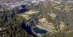
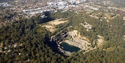
- The Environmental Impact Statement on Hornsby Quarry was released in August with a closing date for submissions of 4 September…Read More
- The report on the review of the 10/50 Vegetation Clearing Code of Practice was released in August. The NSW Government…Read More
- The issue of waste and litter from single use plastic bags handed out by supermarkets and other stores has been…Read More
- The impact on marine life from plastic may be most obvious in coastal regions, but in August CSIRO released the…Read More
- Allan Dale Professor in Tropical Regional Development, The Cairns Institute James Cook Universiity. Originally published on The Conversation. Read the…Read More
- The Australian Government is reviewing the tax deductibility status of donations to environment organisations and is in the process of…Read More
- Ever heard of Shazam? It’s an app that tells you the name of that song you just can’t remember. Well…Read More
- This article has been written by Frances O’Brien, Group Administrator at Wahroonga Waterways Landcare. The site is part of SAN…Read More
STEP Matters 181
- Default
- Title
- Date
- Random
- A new high quality walking map of the Berowra Valley has been published by Friends of Berowra Valley.Read More
- The Sydney Institute of Marine Science, located in a historic sandstone quarry on the Chowder Bay foreshore, has opened a…Read More
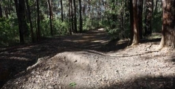
- Ku-ring-gai Council has received considerable flak over a decision to close an unauthorised mountain bike track down a steep hill…Read More
- Issue 178 (p2) of STEP Matters outlined the content of a preliminary draft plan of management for the Canoon Road…Read More
- In early 2015, Ku-ring-gai Council invited submissions on a draft plan of management for St Ives Showground and Precinct Lands.…Read More
- Freedom of Information (FOI) requests made by the Stop the Chop alliance have revealed that the NSW Government ignored expert…Read More
- This information came from an article written by Margery Street for Blandfordia, the newsletter of the North Shore Group of…Read More
- The efficacy of offsets depends on a strict set of rules and long-term consistency of application. The first article ponders…Read More
- Under the United Nation's climate change agreement Australia’s current greenhouse gas emissions reduction task is to reduce its emissions by…Read More
- This article was originally published on The Conversation. Read the original article.Read More
STEP Matters 180
- Default
- Title
- Date
- Random
- Participants in Clean Up Australia Day once again noticed the massive extent of littering and rubbish dumping from vehicles. The…Read More
- The NSW Government election demonstrated the high level of concern about coal mining and coal seam gas. Several seats affected…Read More
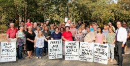
- The residents of Malton Road and the Beecroft Cheltenham Civic Trust have been working for many months to try and…Read More
- Several past and present members of the STEP committee were delighted to be invited to a function at Ingleside on…Read More
- This article was written by former president of STEP, Barry Tomkinson, who has had a close involvement with the Berowra…Read More
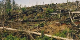
- Previous issues of STEP Matters (Issue 173, p7–8 and Issue 175, p2) have highlighted the damage that is occurring in…Read More
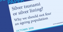
- The release of the 2015 Intergenerational Report (IGR) by the Treasurer Joe Hockey brings nothing new to raise hopes that…Read More
- STEP member Ralph Pridmore describes his personal experiences with his local feathered friends.Read More
- This article was originally published on The Conversation. Read the original article.Read More
STEP Matters 179
- Default
- Title
- Date
- Random
- The NSW state election is not far away and we have only just found out who the Liberal Party candidate…Read More
- Just before Christmas, NSW Premier, Mike Baird, and the Environment Minister, Rob Stokes, announced that the Government favoured the introduction…Read More
- Local environment groups have been calling for a moratorium on bushfire clearing under the 10/50 Vegetation Clearing Code while the…Read More
- The reasons for concern about the loss of old trees under the 10/50 Code are demonstrated by research.Read More
- Residents of Sydney's suburbs cannot help but notice the abundance of the native honeyeater, the noisy miner (Manorina melanocephala) in…Read More
- Jim Wells, former STEP treasurer, has contributed this detailed information comparing the finances of Hornsby and Ku-ring-gai councils. We leave…Read More
- Much of Ku-ring-gai’s money has come from apartment building construction. Contributions appear to be about $30,000 per unit with most…Read More
STEP Matters 186
- Default
- Title
- Date
- Random
- The NSW Government has been reforming the legislation governing the operation of local government under the catchy title of Fit…Read More
- On 4 May 2016, the Senate Standing Committee on the Environment tabled a report on its inquiry into the Register…Read More
- Everyone likes a race; whether it’s the Melbourne Cup, some sporting event or an election. Winning is fabulous, losing can…Read More
- The NSW government has been undertaking a major review of the biodiversity legislation in response to farmers’ complaints about the…Read More
- Former NSW Crown Solicitor, Hugh Roberts, was treasurer of STEP from 1996 to 2001. In this period STEP began its…Read More
- The previous issue of STEP Matters 185 described the risks to Sydney’s water catchment in the Illawarra region from longwall…Read More
- Good news, a container deposit scheme is going to happen. The NSW Premier announced on 8 May that a scheme…Read More
- Australians buy more than 100 million litres of paint each year but around 5% of it ends up as waste,…Read More


STEP Matters 187
- Default
- Title
- Date
- Random
- Sheldon Forest in Turramurra contains the second largest area remaining of the critically endangered Blue Gum High Forest covering an…Read More
- The tremendous efforts of the local community have produced some beneficial outcomes. Issue 185 of STEP Matters provided an update…Read More
- STEP welcomes new members of the committee and other members who would like to contribute to our work in some…Read More
- Two weeks before the Federal election with Warragamba Dam threatening to spill due to severe storms, the Baird government committed…Read More
- The Greater Sydney Commission has been created by NSW legislation with a brief to make Sydney more liveable, more productive…Read More
- There is surprisingly little information that describes, interprets and records heathlands and its ecology in Australia. However, Nick de Jong’s…Read More
- STEP was actively involved in the fight against the O’Farrell government’s legislation introduced in 2012 allowing amateur hunting in national…Read More
- In the 19th century deer were imported and released into areas like Royal National Park because they were regarded as…Read More
- Well the July election is done and dusted and the Liberal–National Coalition just scraped in. Despite Malcolm Turnbull’s previous statements…Read More
- John Martyn discovered this beautiful pink fungus in Sheldon Forest. Fungi expert Ray Kearney identified it as Cantharellus lilacinus. A…Read More
- Back in the 1970s, a speck of harbourside bushland in Hunters Hill achieved unexpected fame as the site of the…Read More
- To many people who are fascinated by Sydney's native flora but have no formal training in geology, the rocks around…Read More
- NSW residents are currently waiting for the state government to respond to the deluge of submissions opposing the new draft…Read More


STEP Matters 188
- Default
- Title
- Date
- Random
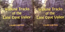
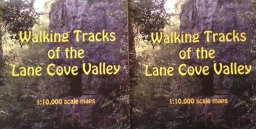
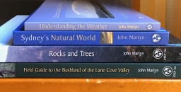
- Yes, the brand new Lane Cove Valley map is now available. It has been produced by John Martyn with his…Read More
- Most people who live in the upper North Shore and who are interested in bushland, or gardening, or geology, or…Read More
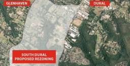
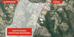
- South Dural Residents and Ratepayers Group, a developer initiated lobby group, has made numerous applications since 1990 to Hornsby Council…Read More
- In November the Turnbull Government ratified Australia’s commitment to comply with the Paris Agreement on Climate Change. Australia has set…Read More
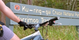
- Previously we've reported on Ku-ring-gai Council’s closure of the mountain bike downhill track that had been constructed illegally near Warrimoo…Read More
- There has been a flurry of legislative action and announcements during the final months of the year following varying periods…Read More
- Knowledge of some of the common endings of scientific names can help to make names less forbidding. It is well…Read More
- In last year’s Annual Report I noted the transformation happening in Sydney and the unknown impacts on our bushland, the…Read More
- Have you ever enjoyed the cool refuge that an underground cave offers from a hot summer’s day? Or perhaps you…Read More
- On Saturday 25 February 2017 the NSW Rogaining Association is holding LaneCoveRivergaine3, backing up the very successful LaneCoveRivergaines 1 and…Read More
- In 2015 the winner of STEP’s prize for a project relating to an environmental issue was awarded to Jade Moxey…Read More


STEP Matters 189
- Default
- Title
- Date
- Random
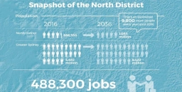
- It's important that as many people as possible comment on the Greater Sydney Strategy and the North District Plan by…Read More
- Have your say on the North District Plan and the Greater Sydney Strategy by 31 March 2017. District Plans cover…Read More
- Ku-ring-gai Council has been developing plans to improve the Turramurra local centre over many years. As a resident of Turramurra…Read More
- STEP is delighted that our secretary has received Ku-ring-gai Council’s Australia Day Award for Outstanding Service to the Ku-ring-gai Community…Read More
- The geology of the Sydney Basin changes dramatically at the top of the Hawkesbury Sandstone, which is followed upwards ultimately…Read More
- Hornsby Council has moved to the next stage of planning for the redevelopment of Old Mans Valley and the Quarry.…Read More
- It’s a rare week when natural resource management policy penetrates the national news cycle not once, but twice. Nonetheless, last…Read More
- We've previously summarised our concerns about the application to rezone rural land to residential land. It is a relief that…Read More
- The Institute for Economics and Peace has supplemented their Global Peace Index with a Positive Peace Report 2016. But be…Read More


STEP Matters 190
- Default
- Title
- Date
- Random
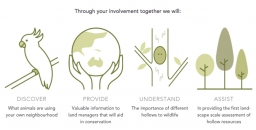
- Hollows as Homes The Australian Museum has joined the Royal Botanic Garden Sydney and Sydney University in launching a new…Read More
- Firstly, some history; in 2003 UTS decided to vacate the site and sought a rezoning for residential development with 560…Read More
- Thirlmere Lakes lie in an area that was subject tectonically to weak uplift and gentle monoclinal warping at the ill-defined…Read More
- Every day there’s an outdoor event to celebrate or commemorate something or other, and balloons will be released. It looks…Read More
- Following the serious power blackouts that occurred in South Australia and near misses in other states, gas-fired power stations have…Read More
- The Australian Association of Bush Regenerators was established in 1986 out of concern for the continuing survival and integrity of…Read More
- Ku-ring-gai Council has commissioned a report on developing the tourism potential of the municipality. Ku-ring-gai Destination Management Plan 2017 to…Read More
- The name Wianamatta is familiar through the loose usage of the term ‘Wianamatta Shale’ to embrace the Triassic rocks that…Read More
- Sydney's Blue Gum High Forests built colonial Sydney. By the 1850s most had gone. However a few patches survived. The…Read More


STEP Matters 191
- Default
- Title
- Date
- Random
- In May the NSW government released regulations and codes that provide some of the detail on how the biodiversity legislation…Read More
- Over the past 200 years NSW has lost almost half of its bushland through land clearing and only 9% of…Read More
- Ku-ring-gai Council is anticipating that there will be a strong demand for biodiversity offsets once biodiversity legislation comes into operation…Read More
- STEP is supporting a great initiative by organised by Forestmedia, a small not-for-profit organisation that is aiming to increase community…Read More
- The Australian and Queensland governments are still pushing for the Adani mine to go ahead and are bending over backwards…Read More
- Lord Howe Island is a magnificent island about 600 km off the coast of NSW. Its unique landform as an…Read More
- There has been much media interest in the report that Sydney's population has reached 5 million. What has also been…Read More
- Our economy and society ultimately depend on natural resources: land, water, material (such as metals) and energy. But some scientists…Read More


STEP Matters 192
- Default
- Title
- Date
- Random
- Male superb fairy-wrens change colour every year, from dull brown to bright blue. But being blue may be risky if…Read More
- The Chief Scientist, Dr Alan Finkel, was asked by the Council of Australian Governments (COAG) to undertake an independent review…Read More
- One of the major concerns about the NSW government’s biodiversity laws is the fundamental flaws in the Biodiversity Offsets Scheme,…Read More
- STEP’s public fund, the Environment Protection Fund, is registered as a Deductible Gift Recipient (DGR) via the Register of Environmental…Read More
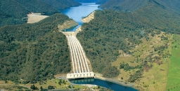
- The NSW government thinks that raising the spillway wall of Warragamba Dam by 14 m will significantly reduce the risk…Read More
- In the early days of settlement in NSW development decision-making took little heed of its impact on the environment, the…Read More
- Over the past century, average land surface temperatures have risen by almost 1°C across the Australian continent. Models suggest this…Read More
- Please consider sending a submission opposing Mirvac's rezoning and development proposal for land adjoining Cumberland State Forest in West Pennant…Read More
- A special resolution will be moved at our AGM to modify our constitution. In accordance with the constitution, official notice…Read More


STEP Matters 193
- Default
- Title
- Date
- Random
- Can one form a friendship with a magpie – even when adult males are protecting their nests during the swooping season?…Read More
- Back in the 1980s IBM built an office complex at 55 Coonara Road, West Pennant Hills. The building design won…Read More
- Another round of ‘restructuring’ has hit our national parks staff. More managers and rangers with superb skills and experience have…Read More
- Hornsby Council weakened its Tree Preservation Order (TPO) in 2011 so that only tree species indigenous to the area (about…Read More
- Robin Buchanan reminds us that maps on smart phones have limitations. ‘Just another lost bushwalker’ said the weary voice of…Read More
- STEP applied for an Environmental Small Grant from Ku-ring-gai Council last year for further repairs to the STEP Track near…Read More
- The NSW Government forecasts of population growth for metropolitan Sydney over the next 20 years are frightening, at 37% or…Read More
- STEP continues to sponsor an award for a project about an environmental issue under the Science Teachers’ Association Young Scientist…Read More
- This year, for the first time, STEP supported a great initiative organised by Forestmedia, an organisation that is aiming to…Read More
- We recently wrote about the exhaustive research, economic analysis and consultation that has been undertaken into a plan to eradicate…Read More


STEP Matters 194
- Default
- Title
- Date
- Random
- Our plans to celebrate STEP’s 40th anniversary will be announced later this year. Graeme Aplin has kindly offered to write…Read More
- The Plan of Management of the Canoon Netball Complex was amended in 2015. It involved improvements to landscaping and changing…Read More
- At the last Clean Up Day the largest number of items collected by far was beverage containers (about 30% of…Read More
- The last two issues of STEP Matters (Our National Parks Need Protection and Fifty Years of the NPWS but is…Read More
- It is with great sadness that Willoughby Environmental Protection Association (WEPA) reports the peaceful passing of long-term member, Harold Spies,…Read More
- It seems a long time ago when the NSW public were fighting an attempt in 2013 by the Shooters and…Read More
- Northern Beaches Council is currently considering a development application that has been submitted to build 95 seniors housing units, three…Read More
- STEP Matters issue 193 provided detail on the application by Mirvac to build 600 apartments in the former IBM business…Read More
- The Australian government has a framework of strategies and programs for the management of biodiversity. According to the Department of…Read More
- In the previous issue of STEP Matters we reported on the major loss of trees in Hornsby Shire in recent…Read More
- In the last newsletter we highlighted the loss of tree canopy in Hornsby Shire and illustrated the abrupt decrease in…Read More
- Did you know that your morning cup of coffee contributes to six million tonnes of spent coffee grounds going to…Read More
- Here are five common Australian energy myths and facts for the next barbeque when these questions about renewable energy are…Read More
- Good insulation in a tree hollow or a well ventilated drey provides better protection than a nest box on a…Read More


STEP Matters 195
- Default
- Title
- Date
- Random
- There has been much local angst about the idea that lights be installed on some of the Canoon Road netball…Read More
- The Nature Conservation Council with the help of the Environmental Defenders Office won the case challenging the process of implementation…Read More
- All members of the local botanical, bushcare and conservation communities have been deeply saddened by the sudden death of Noel…Read More
- Regional Forest Agreements (RFAs) are the mechanism by which the states are permitted to log native forest under accreditation from…Read More
- The Australian government proposal, first floated in 2016, to remove tax deductibility status from donations to environment groups unless they…Read More
- Australia’s rate of species decline continues to be among the world’s highest. Government decisions to promote population growth and resource…Read More
- It has been a long drawn out process to develop a National Representative System of Marine Protected Areas (NRSMPA). In…Read More
- We gardeners are often urged to ‘buy native’, especially nectar-producing flowering shrubs like grevilleas and banksias – they attract birds of…Read More
- The preparation of STEP’s history by Graeme Aplin and the committee is progressing well and will be completed by our…Read More
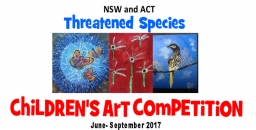
- STEP was a sponsor of this competition last year. Over 1,600 children entered and created some brilliant art works. The…Read More
- FrogID is a project to help identify and survey frogs in your area. This is done via an app on…Read More


STEP Matters 196
- Default
- Title
- Date
- Random
- We are delighted to announce that Katie Rolls (Hawkesbury Institute for the Environment, Western Sydney University) is the winner of…Read More
- The Powerful Owl is a keystone species of bushland in eastern Australia. The survival of the current population of this…Read More
- Ku-ring-gai Council is currently undertaking a review of policy for managing recreation in bushland areas. This will cover the way…Read More
- Just months after the hard fight to get tree protections strengthened in Hornsby, council is trying to water down those…Read More
- Ku-ring-gai Council’s decision to close the Warrimoo Downhill Mountain Bike Trail was taken in July 2016 (see STEP Matters 188).…Read More
- Back in 2016 the NSW government conducted a consultation process on a Wild Horse Management Plan for Kosciuszko National Park…Read More
- The South Dural proposal for rezoning and development of rural land has fallen through thanks in no small part to…Read More
- The NSW government has finalised the Low Rise Medium Density Housing Code and Design Guide that were the subject of…Read More
- Great cities need trees to be great places, but urban changes put pressure on the existing trees as cities develop.…Read More
- With the recent introduction of the Biosecurity Act, there is now more emphasis to think about our action in terms…Read More
- The iNaturalist website has been set up as a means for citizens and scientists worldwide to record their observations of…Read More
- The perfect way to learn about the geology that underpins the landscape and diverse flora of the Sydney region A…Read More


STEP Matters 197
- Default
- Title
- Date
- Random
- STEP member, Beverley Gwatkin, came up with the great idea of conducting walks for people unfamiliar with the amazing features…Read More
- This walk on 22 June was fascinating. We heard all about the diverse diet and life of the local Kai’ymay…Read More
- Our 40th birthday party on 22 July was a great occasion to remember the bold actions of the STEP people…Read More
- Over 700 native plant species and 300 vertebrate species have been recorded in Ku-ring-gai. On 19 June Chelsea Hankin (council’s…Read More
- Call for Review of 10/50 Legislation At their meeting on 11 July, council resolved: to write to the state government…Read More
- 2018 Budget The NSW government is flush with money thanks to the property boom. But, according to the Opposition, the…Read More
- The ABC reported that the May budget has reduced the budget allocation of funding to the biodiversity and conservation division…Read More
- What if Australia were to stop farming? At approximately 3% of gross domestic product, the removal of agriculture from the…Read More
- There are many books on the environment, as you will see if you scan the shelves of bookshops like Kinokuniya,…Read More
- The amount of development along Epping Road is astronomical. Sure, this development is near the Chatswood to Epping train line…Read More
- We recently received a message from a fellow bird enthusiast about his blog called the Ultimate Beginners Guide to Bird…Read More


STEP Matters 198
- Default
- Title
- Date
- Random
- We have conducted two introduction to bushland walks this year, one in Sheldon Forest/Rofe Park and the other along the…Read More
- STEP is one of a group of environmental organisations that has got together to write a position paper on the…Read More
- The speaker at STEP’s AGM on 30 October was Lesley Hughes, Distinguished Professor of Biology from Macquarie University, who has…Read More
- We recently reported on the application for development on Bayview Golf Course for seniors housing units in an area that…Read More
- In recent months there have been several more bad policy decisions by the NSW government that go against scientific common…Read More
- Issues 193 and 194 of STEP Matters give a rundown of the convoluted application process by the Hills Council through…Read More
- The NSW government wants to bulldoze a large tract of community land around Flat Rock Drive to construct the Northern…Read More
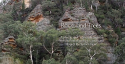
- Such a simple title for such a comprehensive book – the subtitle ‘A photographic journey through the rich and varied geology,…Read More
- This is not a recent issue. The process of approval of this mine application by Korea Electric Power Company (KEPCO)…Read More
- The names of many of our native trees were taken from perceived resemblances of their timbers to those of traditional…Read More
- STEP has been giving a Young Scientist prize at the annual awards every year since 2001. During this period the…Read More
- This year 2749 children participated in the Children’s Threatened Species Art Competition. There were 2397 entries and over 100 schools…Read More
- In 2018 STEP celebrated our 40th year of activity with a party at Lane Cove National Park and the publication…Read More


STEP Matters 199
- Default
- Title
- Date
- Random
- It is estimated that there are fewer than 21,000 koalas left in NSW. The population may have reduced by more…Read More
- Australia’s total population grew by 390,000 over the year to 30 June 2018. In August 2018 Australia’s population hit the…Read More
- The Beecroft Cheltenham Civic Trust has been working for the local community for many years, keeping them informed about local…Read More
- Clean Up Australia was founded 30 years ago by Ian Kiernan. It is sad to hear of his death in…Read More
- In Issue 198 of STEP Matters we described the latest application by the Hills Council through the Gateway Process to…Read More
- Lane Cove National Park will be expanded, albeit marginally, with the addition of 0.6 ha near the river at North…Read More
- We have all been shocked by the mass killing of fish in the Menindee Lakes and other areas in January,…Read More
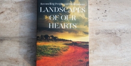
- Frances O’Brien worked as the Environmental Officer at Wahroonga Waterways Landcare for four years and has written a book about…Read More
- It may not look like a pristine expanse of Amazon rainforest or an African savannah, but the patch of bush…Read More
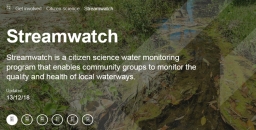
- We have been alerted to a perplexing situation by a Streamwatch volunteer. Streamwatch was established in 1990 by Sydney Water…Read More
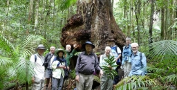
- The participants of John Martyn’s walk in the Watagans on 5 December 2018 were treated to some great views of…Read More


STEP Matters 200
- Default
- Title
- Date
- Random
- The rainforest corridors along the gullies of northern Sydney have been called by many names as ecologists try to describe…Read More
- The Aboriginal heritage of northern Sydney reminds us that these precious environments around us have been valued and nurtured for…Read More
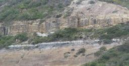
- Our local and regional environment owes so much to its geological heritage. We live in the Sydney Basin, an epicontinental…Read More
- In February 1805 botanist George Caley (sent out by Sir Joseph Banks) made an exploratory trip from Pennant Hills across…Read More
- Ku-ring-gai has a rich environmental history. Some even consider it to be the birthplace of the Australian conservation movement because…Read More
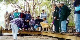
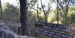
- Walking along hand built stone paths into the bushland property Ahimsa is a step back in time and an inspiration…Read More
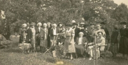
- 1956 was my second year out from Sydney Teachers’ College where I trained as a physical education teacher. As a…Read More
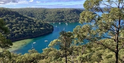
- Ku-ring-gai Chase National Park is part of a geographic, geologic and eucalyptus sandstone bushland arc that encircles Sydney. This 12,963 hectare…Read More
- The early European history of the area that became Lane Cove National Park could be said to stem from an…Read More
- Sydneysiders are lucky to have several national parks within easy reach of suburbia. Their existence is thanks to a situation…Read More
- On the high ridges north of Sydney Harbour grew a tall, open forest of blue gums, blackbutts and casuarinas with…Read More
- Berowra Valley bushland stretches from south of The Lakes of Cherrybrook to the Hawkesbury River. The valley has a long…Read More


STEP Matters 201
- Default
- Title
- Date
- Random
- Western Sydney University and the University of New England have set up a Citizen Science Project called the Dead Tree…Read More
- STEP has supported the Threatened Species Children’s Art Competition since 2017. The competition has been a great success and has…Read More
- The NSW Threatened Species Scientific Committee, established under the Biodiversity Conservation Act 2016, has made a Final Determination to list…Read More
- We are very pleased to announce that the John Martyn Research Grant for 2019 has been awarded to Gabriella Hoban.…Read More
- The final deadline was set at 31 May for submissions on the Hills Council’s applications to the NSW government to…Read More
- The transport sector is Australia’s second fastest growing source of carbon dioxide emissions and yet we still don’t have any…Read More
- The costly problem of ash dieback has been highlighted in New Scientist. This fungal disease caused by Hymenoscyphus fraxineus was…Read More
- When the USA became serious about WWII they brought about an amazing mobilisation of their entrepreneurial industrial potential. That is…Read More
- Visiting Tasmania at leatherwood flowering time in February was a nice experience apart from the weather. It has a perfumed…Read More
- In May 2019 the Intergovernmental Science-Policy Platform on Biodiversity and Ecosystem Services (IPBES) published its global assessment of the state…Read More
- Our walk in Fox Valley on 14 April revealed some surprises. A Powerful Owl was spotted and there were several…Read More
- We welcome Peter Clarke as a new member of the committee. He is well known for his work with Ku-ring-gai…Read More


STEP Matters 202
- Default
- Title
- Date
- Random
- Hornsby Shire Climate Action has set up an online petition calling on Hornsby Council to declare a climate emergency. Declaring…Read More
- From July the management of the Streamwatch program was taken over by the Greater Sydney Landcare Network. This is a…Read More
- NSW Forestry Corp has lodged a proposal to sell off parts of the Cumberland State Forest for housing subdivision. More…Read More
- The Office of Environment and Heritage has alerted the Hills Council to the fact that the presence of Blue Gum…Read More
- Good news! The Land and Environment Court has upheld the decision by the Northern Beaches Council and Sydney North Planning…Read More
- Hornsby Council is undertaking a four-month review at a cost of $70,000 into potential rezoning and acquisition of land in…Read More
- Ku-ring-gai Chase National Park is one of the most popular national parks in NSW, with over 3 million visits each year.…Read More
- On 25 May the Friends of Lane Cove National Park put on a special celebration. They were founded in 1994…Read More
- Since the re-election of the Berejiklian government there has been a mixed bag of news in relation to the environment.…Read More
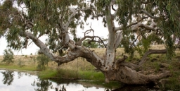
- River red gums, Eucalyptus camaldulensis, are among the most iconic of Australia’s eucalypts. They are the most widely distributed of…Read More
- There is lots of research demonstrating the benefits of trees in urban areas. Not only do they camouflage the grey…Read More
- CSIRO Futures released a report in June on Australia’s future in the next 40 years, called Australian National Outlook 2019…Read More
- This is a great opportunity to do some Christmas shopping. We have decided to reduce the price of our books…Read More
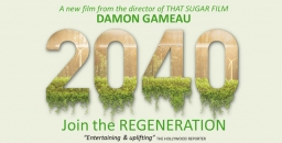
- STEP is supporting the screening of the film 2040 at Roseville Cinema. Booking is essential. We need a minimum of…Read More


STEP Matters 203
- Default
- Title
- Date
- Random
- Members of the Lane Cove Bushland and Conservation Society and the Lane Cove community have been saddened by the death…Read More
- Ku-ring-gai Council is soon to decide whether to install synthetic turf at Mimosa Oval in Turramurra. Click here for our…Read More
- In the last issue of STEP Matters we reported good news that, in April 2019, the Land and Environment Court…Read More
- There is a parcel of land at the end of Chestnut Road, Mt Colah that has been privately owned for…Read More
- As this is being written in late-August, Sydney is enjoying another near cloudless day. There’s been no rain for weeks…Read More
- The article explains that the Snowy 2.0 project will be a financial disaster and that the project will also cause…Read More
- Lithgow coal miners want job security. Environmentalists want protection for the Gardens of Stone region’s upland swamps, endangered wildlife and…Read More
- National park land At the Nature Conservation Council annual conference Environment and Energy Minister Matt Kean was positive in his…Read More
- In this time when science is our main hope for combating climate change, it was so uplifting to attend the…Read More
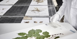
- From January 2019 the National Herbarium of NSW has been closed while its collection of plant specimens is relocated from…Read More
- The NSW and federal elections in 2019 had the unfortunate result of leaving us with business as usual. No policy…Read More
- You may be wondering what happened on 12 November, the evening of STEP’s AGM. Owing to temperatures in the 30s,…Read More


STEP Matters 204
- Default
- Title
- Date
- Random
- We have written several times about Mirvac’s proposal to develop the land at 55 Coonara Ave, West Pennant Hills that…Read More
- The local residents living near Mimosa Oval, Turramurra that is part of Rofe Park have been campaigning strongly against Ku-ring-gai…Read More
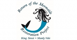
- Mermaid Pool, a rock pool below Manly Dam was named in the 1930s for the naked girls who used to…Read More
- Australia and the world have been horrified by the devastating bushfires that have been burning along the east coast and…Read More
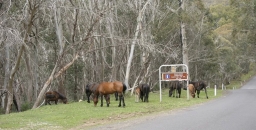
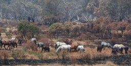
- In November the results of an aerial survey of feral horse numbers was released. The numbers have increased by more…Read More
- The decline in koala numbers in NSW has been highlighted over many years by environment groups. The major causes have…Read More
- Currently there are several reviews taking place into biodiversity management at the federal level: Senate inquiry into faunal extinction review…Read More
- After a prolonged process of research, impact assessment, economic analysis and discussion with residents the Lord Howe Island Board got…Read More
- At the start of the bushfires right up to December the government refused to talk about the influence of climate…Read More
- While we may stand on a clifftop lookout and gaze in awe at its world-class sandstone scenery, it wasn't the…Read More
- The state and federal governments are unwilling to discuss the issue of Australia’s population growth. The general view is that…Read More


STEP Matters 205
- Default
- Title
- Date
- Random
- Considering that we have had to cancel or postpone our walks and talks we decided it is appropriate to take…Read More
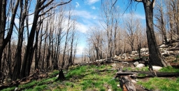
- The Australian Association of Bush regenerators (AABR) is cautioning against rushing in to replant burnt areas. They are advocating a…Read More
- The NSW government is not holding sittings in Macquarie Street but decisions are still being made, with most of them…Read More
- This strategy has taken many months to finalise after extensive consultation was undertaken with interested groups, often with competing interests.…Read More
- Sydney escaped the extreme bushfire experiences of last summer but the heatwaves, strong winds and extremely dry bush conditions could…Read More
- Optimistic, prosperous – a country of rare beauty, blessed with abundant natural resources. Australia has all the ‘golden eggs’ ’needed to…Read More
- China decided two years ago to ban the importof plastics for recycling and several SE Asian countries have limited imports.…Read More
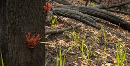
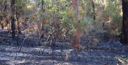
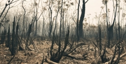
- This article is based on recent visits by John Martyn to two different burnt areas, the Blue Mountains and the…Read More
- Many Australians feel compelled to help our damaged wildlife after this season’s terrible bushfires. Suggested actions have included donating money,…Read More
- NPA NSW has released a new research paper that has found that the claimed benefits of the Snowy 2.0 project…Read More
- We are pleased to announce that the John Martyn Research Grant for 2020 has been awarded to Ruby Paroissien. Ruby…Read More


STEP Matters 206
- Default
- Title
- Date
- Random
- Suspension of old growth forest logging but other logging continues The government has suspended plans for the Natural Resources Commission…Read More
- As feared by the residents of West Pennant Hills and environment groups the NSW government has ignored the more than…Read More
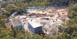
- The process of partially filling in the void that was Hornsby Quarry using spoil from the excavation of the North…Read More
- The Coalition government just does not get it! Scott Morrison has stated in relation to the COVID-19 response that: What…Read More
- Documentary maker Michael Moore’s latest offering, Planet of the Humans, rightly argues that infinite growth on a finite planet is…Read More
- Many of you will know the Empire Marina at Bobbin Head, and if you have young kids or grandkids, buying…Read More
- Love, sex and mate choice are topics that never go out of fashion among humans or, surprisingly, among some Australian…Read More
- Reintroducing protected species into the wild has been near impossible due to predation by cats and foxes unless the site…Read More
- ARENA is the Australian Renewable Energy Agency that is tasked with improving the competitiveness of renewable energy technologies and increase…Read More


STEP Matters 207
- Default
- Title
- Date
- Random
- On 6 May the Sydney North Planning Panel conducted a hearing into Hornsby Council’s DA for the works of Hornsby…Read More
- The Powerful Owl Coalition, of which STEP is a member, presented a submission to a Sydney North Planning Panel on…Read More
- On 14 August some good Hornsby Council decisions were made. Byles Creek Valley Local residents of the Byles Creek Valley…Read More
- An article in the last issue of STEP Matters explained the bad news that the rezoning of the IBM site…Read More
- The EPBC Act that has been in force since 1999 is required to be reviewed every 10 years. The second…Read More
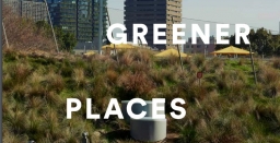
- The NSW Government Architect has released a draft Greener Places Design Guide that is open for comment until 28 August.…Read More
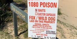
- We are all aware of the impact that the use of 1080 poison has had on the local population of…Read More
- It has been a bad decade for bats. Prior to the emergence of COVID-19, they were already in severe decline…Read More
- Amid the urgent need to slow climate change by cutting greenhouse gas emissions, energy efficiency makes sense. But as Australia’s…Read More
- On Thursday morning 18 June the Friends of Lane Cove National Park held a special celebration at Carter Creek to…Read More
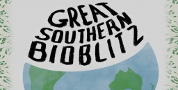
- In April this year an international citizen science bioblitz event was held. Volunteers from all over the world recorded flora…Read More
- A group of researchers from Macquarie University are currently conducting a national online survey that aims to examine people’s connection…Read More


STEP Matters 208
- Default
- Title
- Date
- Random
- Welcome to the annual report on the 42nd year of operation of STEP Inc. Believe it or not, 2020 has…Read More
- The Nature Conservation Council held their annual conference on 31 October via Zoom. There were speeches by Matt Kean, the…Read More
- Ku-ring-gai Council is currently developing plans for conversion of two existing sporting fields to synthetic turf. Both could have impacts…Read More
- Now our bushfire season has officially started it’s interesting to look at the devastating fires in the western US: still…Read More
- It seems good that the cost to students of environmental degrees has been cut but the direct government funding has…Read More
- Sustainable Population Australia (SPA) is an independent not-for-profit organisation. They work on many fronts to encourage informed public debate about…Read More
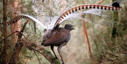
- New research shows lyrebirds move more litter and soil than any other digging animal When you think of lyrebirds, what…Read More
- I came across this book through a very positive review in the Weekend Australian. Its author is ecologist Matthew Colloff,…Read More


STEP Matters 209
- Default
- Title
- Date
- Random
- In many areas of Ku-ring-gai people living near bushland have been busy constructing bike tracks for their family and neighbours…Read More
- In the November 2020 newsletter we explained concerns about the proposed change to land clearing regulations that would allow landowners…Read More
- In November 2020 we were alerted by residents of North Turramurra that the Glengarry Girl Guides site was up for…Read More
- The Mirvac development of the old IBM site next to Cumberland State Forest in West Pennant Hills was fast-tracked by…Read More
- The North Connex Tunnel that is a direct link between the Sydney Newcastle Expressway (now called the M1) and the…Read More
- The final report on the review of the federal Environment Protection and Biodiversity Conservation (EPBC) Act headed by Prof Graeme…Read More
- There has been much relief that the Independent Planning Commission (IPC) has ruled against the expansion of the Dendrobium Mine…Read More
- The NSW government is ploughing ahead with plans to build the Northern Beaches tunnel link at great expense estimated at…Read More
- We previously wrote about the damage the Snowy Hydro 2.0 project will cause to the sensitive environment of the Snowy…Read More
- The Linnean Society of NSW was established in 1874 and is one of Australia’ oldest scientific societies. Their objective is…Read More
- The Clarke Medal is awarded each year for distinguished research in the natural sciences conducted in Australia and its territories.…Read More


STEP Matters 210
- Default
- Title
- Date
- Random
- The Friends of Berowra Valley are sad to report the death of founding chair, Robert ‘Bob’ Salt OAM on Easter…Read More
- We are pleased to announce that the recipient of the John Martyn Research Grant for 2021 is Erin Rogers. She…Read More
- The long-awaited plans for the redevelopment of Hornsby Park and Westleigh Park are now open for submissions until 2 June.…Read More
- In the November 2020 issue of STEP Matters we outlined the current issues with proposals to install synthetic turf on…Read More
- We have just found out about a proposal for an 18-storey office tower to be built on the Eden Gardens…Read More
- Picture this: you’re in your backyard gardening when you get that strange, ominous feeling of being watched. You find a…Read More
- The devastating fires over the Black Summer in the Blue Mountains have produced one remarkable display, the pink flannel flower…Read More
- Arguably there are fewer animals in the world that are feared more than sharks. But the reality is that they…Read More
- Glyphosate, most commonly marketed as Roundup, is extensively used as a herbicide in agricultural areas and bushcarers know how effective…Read More
- It is 20 years since the Grey-headed Flying-fox was listed as a threatened species under NSW and Commonwealth legislation. This…Read More


STEP Matters 211
- Default
- Title
- Date
- Random
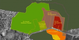
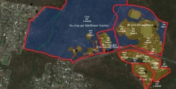
- The land that comprises the St Ives Showground, Wildflower Garden and Community Nursery are important areas for conservation as well…Read More
- We haven’t heard much lately about Mirvac’s planned development on the IBM site in West Pennant Hills next to the…Read More
- In our previous newsletter there was a last-minute story about a proposal to build an 18-storey tower at Eden Gardens…Read More
- Early this month the Department of Planning, Industry and the Environment announced that Macquarie Park has been chosen as one…Read More
- In STEP Matters 210 we described the strong community opposition to plans by several councils for the installation of synthetic…Read More
- The Byles Creek Valley Union has been fighting for several years for the valley to be protected from further development.…Read More
- In Issue 191 we wrote about our concerns about the effectiveness of the Biodiversity Offsets Scheme (BOS) to be established…Read More
- The key recommendation of Prof Samuel’s review of the EPBC Act was that the national environmental standards need to be…Read More
- Since 2017 STEP has supported the Threatened Species Children’s Art Competition. The competition was instigated by Forestmedia Network, a non-profit…Read More
- This information has been provided by the Willoughby Environment Protection Association, a member of the Powerful Owl Coalition. WEPA was…Read More
- In the Issue 209 we reported on the community concern about Ku-ring-gai Council’s determination to remove an illegal mountain bike…Read More
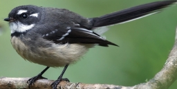
- Birdlife Australia’s regular newsletters have a regular series of snippets about well-known birds. Here are some about the Grey Fantail,…Read More
- Staghorn ferns belong to a group of tree-dwelling plants known as epiphytes. Tree canopies are a challenging environment for plants…Read More


STEP Matters 212
- Default
- Title
- Date
- Random
- Earlier this week, NSW Environment Minister Matt Kean claimed he was ‘fortressing’ threatened species from extinction within our national parks…Read More
- The NSW Bushfire Inquiry recognised the need to identify the most important natural and cultural assets in the national park…Read More
- It is interesting to note that there are some local asset of intergenerational significance (AIS) sites protecting an unusual plant,…Read More
- The Morrison government has proposed scrapping recovery plans for almost 200 endangered species and habitats. Recovery plans are documents that…Read More
- In the previous issue of STEP Matters we provided information on what wasn’t happening with the Mirvac development on the…Read More
- The St Ives Showground and Precinct Lands are a complex mix of developed areas with a long history within a…Read More
- My concern is that weeds occur along all land that has been disturbed in otherwise pristine bushland areas. These are…Read More
- Under the Paris climate change agreement the majority of countries have made pledges to get their greenhouse gas emissions down…Read More
- We have all been out and about this spring and have made some new discoveries of orchids, some quite rare…Read More
- Although most of our walks and talks have had to be cancelled there has been lots of activity behind the…Read More
- To help STEP members learn more about the environmental credentials of candidates in Hornsby and Ku-ring-gai we sent them a…Read More


STEP Matters 213
- Default
- Title
- Date
- Random
- Welcome to the annual report on the 43rd year of operation of STEP Inc. Because of the COVID-19 pandemic, 2021…Read More
- Much has been written in the press about the stalemate that developed within Ku-ring-gai Council following the ‘election’ of a…Read More
- In the last parliamentary sitting week of the year the Coalition attempted to legislate some major changes to the National…Read More
- Our highly intelligent and loud sulphur-crested cockatoos have developed a new skill, opening wheelie bins in order to raid their…Read More
- The Friends of Lane Cove National Park were planning to hold a celebration this year commemorating 30 years of volunteering…Read More
- It is good to see the Young Scientist Awards being run again this year. The winner of the STEP award…Read More
- NPWS has released a set of documents for consultation on an updated cycling strategy in national parks and reserves. The…Read More
- After 90 hard years of campaigning the NSW government has finally decided to declare some protection for the Gardens of…Read More
- A couple of months ago, I sat in on an Australian Conservation Foundation (ACF) event via Zoom for its donors…Read More
- Between July 2003 and January 2017 Greg was Commissioner, Fire and Rescue, NSW. Being a former employee is an advantage…Read More


STEP Matters 214
- Default
- Title
- Date
- Random
- 'What’s in a name?', asked Juliet of Romeo. 'That which we call a rose by any other name would smell…Read More
- There have been several items of news that are making the Warragamba Dam project look increasingly less likely to proceed.…Read More
- As one drives north along the M1 towards Gosford and cross the Hawkesbury River Bridge one has magnificent views of…Read More
- The Wahroonga Estate was acquired by the Seventh-day Adventist Church in 1898 when the land was just an orchard. The…Read More
- It is ten years since the Powerful Owl Project was initiated under the auspices of Birdlife Australia. This highly successful…Read More
- We have a rival? Well actually no! The Southern Tablelands Ecosystems Park has very similar interests to ours. The Park…Read More
- There are many books dedicated to nature and the environment, most of them good, some very good, but this one…Read More
- I can't quote a price for this book because it was a gift or rather a swap. I met the…Read More
- As one who enjoys long bushwalks and studying nature, having walked as a ‘swaggie’ from Yuleba to Surat along the…Read More


STEP Matters 215
- Default
- Title
- Date
- Random
- The NSW and Australian governments still want a rapid increase in population This will place great pressure on new outer…Read More
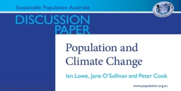
- This important discussion paper on population and climate change by Ian Lowe, Jane O’Sullivan and Peter Cook was published in…Read More
- The EPA released the three-yearly State of the Environment Report (SoE) in February. There are some pluses but mostly it…Read More
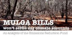
- The Emissions Reduction Fund (ERF) is a voluntary scheme, administered by the Australian government’s Clean Energy Regulator. It aims to…Read More
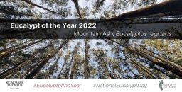
- Eucalypt Australia holds a competition every year asking people to vote for their favourite out of a short list of…Read More
- There are nearly 20,000 introduced plant species in Australia – roughly the same number as our native species – and while some…Read More
- When we attached tiny, backpack-like tracking devices to five Australian magpies for a pilot study, we didn’t expect to discover…Read More
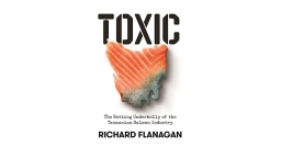
- Richard Flanagan provides a depressing description of the Tasmanian salmon farming industry in 189 pages. This review looks at environmental…Read More


STEP Matters 216
- Default
- Title
- Date
- Random
- At last we have some good news to report. The country is breathing a sigh of relief following the defeat…Read More
- Australia is losing more biodiversity than any other developed nation. Already this year the charismatic and once abundant gang gang…Read More
- On 10 May 2022 Chantelle Doyle gave our members a presentation on her extensive PhD work on conserving Hibbertia spanantha.…Read More
- Trees play an important role in defining the character of Ku-ring-gai. Council has been going through a process to develop…Read More
- Tradescantia fluminensis, commonly known as wandering trad is one of the worst weeds in Sydney’s bushland and home gardens. This…Read More
- In November 2021 the NSW government announced the creation of the Gardens of Stone State Conservation Area. This means this…Read More
- In Issue 211 of STEP Matters we wrote about the review being undertaken by Hornsby Council of the planning controls…Read More
- Dr Holly Parsons and the Powerful Owl team from Birdlife Australia, with financial assistance from a Ku-ring-gai environmental levy grant,…Read More
- In June 2021 NSW introduced a Plastics Action Plan. The most visible action is the plan to reduce harmful plastic…Read More
- In great news for the circular economy, the Thornleigh Community Recycling Centre is now able to accept hard plastics! This…Read More
- As reported in Regenavitus (newsletter of the Friends of Lane Cove NP), the botanical name of the pesky weed known…Read More


STEP Matters 217
- Default
- Title
- Date
- Random
- In our submissions STEP has often highlighted the issue of the disruption to animal behaviour from artificial light spill. Examples…Read More
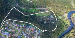
- Near the end of Quarter Sessions Road in Westleigh there is a large area of land (34 ha) that was…Read More
- We are all aware of trees being chopped down and poisoned in order to facilitate development (subdivision) or views. The…Read More
- Fungi are poorly known. Of the estimated 3 to 8 million species in existence, only about 120,000 species ever have…Read More
- The first State of the Environment (SoE) report for Australia was produced in 1996 by a team led by Prof…Read More
- In August the NSW Environment Minister, James Griffin, announced a project, dubbed the Seabirds to Seascapes project that aims to…Read More
- While Ku-ring-gai Council was in caretaker mode in December 2021, Mayor Cedric Spencer signed the documents giving the go-ahead for…Read More
- WildThings NSW is a local not-for-profit organisation with a goal to promote, protect and enhance urban wildlife and their habitats…Read More


STEP Matters 222
- Default
- Title
- Date
- Random
- Australia’s national parks, botanic gardens, wild places and green spaces are swarming with an invasive pest that is largely flying…Read More
- A group of residents in West Pymble took Ku-ring-gai Council to the Land and Environment Court for a judicial review…Read More
- The synthetic hockey surface was installed about 30 years ago and is now worn out. The Northern Sydney and Beaches…Read More
- There has been much angst expressed at Ku-ring-gai Council forums and meetings about the grandstand project. Sure there is a…Read More
- Typical low maintenance plantings on public land have low diversity, visual appeal and function. Monocultures of strappy plants such as…Read More
- At the August council meeting it was decided to trial the introduction of a new recycling service of items that…Read More
- Prepare to appreciate the world under your feet (well, your feet grounded on the earth, maybe not on a concrete…Read More
- Finally there is the prospect of real action on feral horses in Kosciuszko National Park – please make a submission by…Read More
- This book was of great interest having lived in Perth for 9 years and worked and travelled at length in…Read More


STEP Matters 223
- Default
- Title
- Date
- Random
- Welcome to the annual report on the 45th year of operation of STEP Inc. There is a brighter outlook for…Read More
- Those of you who attended Ian Dunlop's STEP AGM talk on 4 November may have ended up distressed by the…Read More
- At our AGM on 4 November, Ian provided a clear message about the future of the Earth and humankind. He…Read More
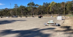
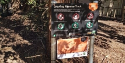
- Grayling Reserve is a small area on the corner of Grayling Street and Binalong Street in West Pymble. It covers…Read More
- Our Black Summer fires were closely followed by record rainfall and flooding. We were actually up in the Blue Mountains…Read More
- ‘What an amazing opportunity …’ was a student response overheard during a lunch conversation at the recent biodiversity survey held at…Read More
- Would you like to take part in our citizen science project? STEP is becoming increasingly concerned about the potential impact…Read More
- Two threatened species, the Eastern Pygmy Possum and the Red-crowned Toadlet, are both listed as Vulnerable under the NSW Biodiversity…Read More
- In the previous edition of STEP Matters there was an article about the NSW government’s proposal and consultation on reinstating…Read More
- STEP has given a prize for environmental projects in the Science Teachers Association of NSW Young Scientists Awards for 22…Read More
- The Upper House of the NSW parliament has been conducting an inquiry into how the planning system can be improved…Read More


STEP Matters 227
- Default
- Title
- Date
- Random
- We recently published an article in STEP Matters about the sorry tale of construction of the new synthetic playing field…Read More
- Back in December 2022 the Sydney North Planning Panel rejected a DA by the owner of Eden Gardens (the Ainsworth…Read More
- STEP representatives and many others with an interest in the well-being of the Lane Cove Valley attended a workshop on…Read More
- One initiative that relates to the Durumbura project was the cultural burn near Browns Waterhole that took place in April…Read More
- The EPA has released a discussion paper on a plan to reduce the use of plastic and the quantity of…Read More
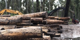
- We recently wrote about the urgency of a decision to cease logging in NSW native forests. Logging cannot continue in…Read More
- I personally got interested in the Francis Barralier story by an indirect route. I found that much of the gravels,…Read More
- Pictured is a first time flowering for our 6-year-old Lord Howe wedding lily, bought originally at Wirreanda Nursery. Huge mystery…Read More
- The quite horrendous series of windy August and September days across SE Australia was felt in Sydney under bright blue…Read More
- Friends of Berowra Valley have produced an introductory booklet on the wildflowers commonly met on local ridge tops. It is…Read More
- The STEP Track bushcare site at the end of Kingsford Avenue in South Turramurra meet from 9 to 11 am…Read More
STEP Matters 224
- Default
- Title
- Date
- Random
- In December, just as we were looking forward to a peaceful holiday break, the NSW government released plans for new…Read More
- Myrtle rust is an invasive species of fungus that threatens plants in the Myrtaceae family. Researchers want to know more…Read More
- According to 2020 data Ku-ring-gai currently has an urban forest canopy cover of 45%. The Urban Forest Strategy is to…Read More
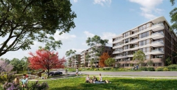
- A planning proposal for the redevelopment of the Lourdes Retirement Village at the end of Stanhope Road in Killara was…Read More
- Domestic cats and dogs pose a serious threat to wildlife because of their natural hunting instincts. With a large number…Read More
- The Ku-ring-gai Bushcare Association (KBA) came up with the idea to run a competition to encourage cat owners to keep…Read More
- This book is delightfully easy to read but not so easy to review in a limited space as it moves…Read More
- Hornsby Council is making good progress on the development of the Hornsby Park and Quarry site with works almost completed…Read More


STEP Matters 225
- Default
- Title
- Date
- Random
- When we make roads, houses or farmland, we often find large old trees in the way. Our response is often…Read More
- One of the Albanese Government’s promises was to take action to halt the alarming decline in our biodiversity and rewrite…Read More
- The NSW government’s Transport Oriented Development (TOD) plans came into effect on 1 April. We provided an outline in the…Read More
- Construction of the synthetic turf field at Norman Griffiths Oval in Bicentennial Park, West Pymble commenced in August 2023. You…Read More
- In Issue 221 we reported on the Chief Scientist’s report into Synthetic Turf Study in Public Open Spaces. One of…Read More
- We have observed several trees in Turramurra and Warrawee that seem to have died of natural causes. Here is one…Read More
- On 26 March Ku-ring-gai held a forum on the management of trees. It was very well attended with over 150…Read More
- Our talk on 27 April was presented by Shannon Kaiser, PhD researcher into the impact of aerially deployed fire retardants…Read More
- We are pleased to announce that the recipient of this years’ award is Solomon Maerowitz-McMahan for his project entitled Exploring…Read More


STEP Matters 226
- Default
- Title
- Date
- Random
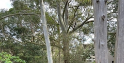
- As humanity continues to burn fossil fuels, the delicate balance of life on Earth is changing. That’s true of trees,…Read More
- Rofe Park Turramurra was not on Wikipedia before now – there is an entry for Rofe Park in Hornsby that has…Read More
- The concept of a Tiny Forest was developed in the early 1970s by the Japanese forest ecologist, Akira Miyawaki, as…Read More
- What is being overlooked in current international climate policy under the Paris Agreement is the crucial role of biodiversity in…Read More
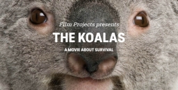
- Please go and see the documentary The Koalas to get a graphic view of the ridiculous situation in NSW where…Read More
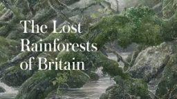
- Rainforests in Britain? Surely not! What have you been smoking? Well, please buy and read this book and blow your…Read More
- National Tree Day is on Sunday 28 July. It was co-founded by Planet Ark in 1996 and it has since…Read More
- The Great Southern BioBlitz (GSB) is an exciting international initiative that embarks on an intensive biological survey during the vibrant…Read More
- We don’t tend to associate bats with winemaking except to consider that flying foxes or fruit bats might happily eat…Read More
- We made only one submission in the last two months. This was in relation to a public hearing on a…Read More
- The prolonged process of applications to redevelop the Lourdes Retirement Village in Stanhope Road, Lindfield (explained in (explained here) culminated…Read More


STEP Matters 220
- Default
- Title
- Date
- Random
- At the time of finalising an article for our last issue of STEP Matters we were still waiting for the…Read More
- In Issues 217 and 219 of STEP Matters there was some information about the proposals for development by Hornsby Council…Read More
- The draft Berowra Valley National Park and Berowra Valley Regional Park Plan of Management was exhibited for public comment way…Read More
- The Centre for Population, part of federal Treasury, was established in 2019 to improve data collection on how Australia’s population…Read More
- We have been part of Ku-ring-gai Council’s microbat surveys for some time as part of the Pool to Pond program.…Read More
- The Albanese government has passed revisions to the Safeguard Mechanism legislation with the help of the Greens in the Senate.…Read More
- STEP members were sad to hear about the death of Harry Locke in February. Harry and his wife Neroli were…Read More
- One of Australia’s leading climate scientists, Prof Will Steffen, died in January. Steffen has been hailed as a brilliant climate…Read More
- Ever heard of Stockwellia? No? Well actually me neither, till reading this book! Stockwellia quadrifida is a rainforest giant found…Read More


STEP Matters 219
- Default
- Title
- Date
- Random
- The Mirvac development of the former IBM business park at West Pennant Hills is proceeding. In September 2021 the application…Read More
- I have to admit I didn’t know anything about the location of Westleigh until the Westleigh Park Master Plan development…Read More
- Early in 2021 the owner of the Eden Gardens nursery complex on Lane Cove Road in Macquarie Park submitted a…Read More
- In November 2022 the Friends of Lane Cove National Park alerted us to the news that Naamaroo was on the…Read More
- Manly Warringah War Memorial Park Is an area of 375 ha that covers the Manly Dam, its catchment area and…Read More
- In October, at NSW’s Local Government Annual Conference, a motion calling for better protection of wildlife on development sites was…Read More
- In STEP Matters Issue 213 we commented in detail on the new draft NPWS cycling strategy. This is a highly…Read More
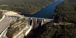
- Nothing has been happening with the Warragamba Dam wall raising proposal for some time. The idea was first raised by…Read More
- Victoria has legislated to enable backyard fruit growers who use the wrong netting and those who sell or advertise it,…Read More
- We are still waiting for the review of environment factors for Ku-ring-gai Council’s project to install synthetic turf at Norman…Read More
- As reported in STEP Matters Issue 216 Hornsby Council voted in favour of changing the zoning and other conditions in…Read More
- The Friends of Ku-ring-gai Environment (FOKE) has initiated a fascinating project aiming to gain aspiring georegion status for the Ku-ring-gai…Read More
- The northeastern Sydney Basin is bounded by Sydney Harbour to the south, the Hunter River to the north, the coastline…Read More
- KCNP’s current plan of management is over 20 years old and its review is moving at a glacial pace. In…Read More
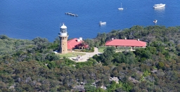
- The future of Barrenjoey lighthouse has long been a bone of contention. The submission summary reported that adaptive re-use of…Read More
- In 2018 the Powerful Owl Coalition highlighted the importance of reducing artificial lights near bushland in the publication Protecting Powerful…Read More


STEP Matters 218
- Default
- Title
- Date
- Random
- The owner of Lourdes Retirement Village at the end of Stanhope Road in Killara have been trying for several years…Read More
- The Environmental Defenders Office (EDO) has been struggling to cover demand for its services since 2013 when the Federal Government…Read More
- NSW has two million hectares of public native forests along the coast. They are home to diverse wildlife and myriad…Read More
- There is a plethora of international agreements that relate to the protection of the Earth’s biodiversity. The overarching convention is…Read More
- Australian cities are good at growing – for decades their states have relied on it. The need to house more people…Read More
- It's difficult to write a simple review of this book because it works at several different levels. But first of…Read More
- Welcome to the annual report on the 44th year of operation of STEP Inc. Our lives have, in theory, returned…Read More
- STEP has given a prize for environmental projects in the Science Teachers Association of NSW Young Scientists Awards now for…Read More
- Ku-ring-gai Council has a new way for you to check whether a permit has been granted for trees being removed…Read More


STEP Matters 221
- Default
- Title
- Date
- Random
- The Chief Scientist’s report, Synthetic Turf Study in Public Open Spaces has finally been released but fails to give definitive…Read More
- We congratulate former STEP treasurer and councillor on Ku-ring-gai Council, Anita Andrew, on receiving the W.R. Browne Award for 2023.…Read More
- High net immigration is putting huge pressure on governments to get more housing built. But do we need to do…Read More
- There has been a lot of publicity about the proposed development of an area of land known as Lizard Rock.…Read More
- The local orchid Genoplesium baueri (endangered), also known as Bauer’s Midge Orchid, was added to the IUCN Red List of…Read More
- Ku-ring-gai Council has recently completed a recreation needs study. The June meeting agreed to put the study out for public…Read More
- Ku-ring-gai Council is developing a masterplan for the St Ives Showground and Precinct that will guide future improvements and define…Read More
- We are pleased to announce that the recipient of this years’ award is Margarita Gil-Fernández for her project entitled Mycorrhizal…Read More
- We have decided to expand our commitment to environmental education, and this year we have awarded our first ad hoc…Read More
- Have you ever wondered about all the little creatures that may visit your garden at night? A wildlife camera has…Read More
- STEP families may be interested in Country Town, a children’s picture book that will be coming out soon. Isolde Martyn…Read More


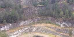
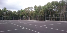
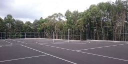
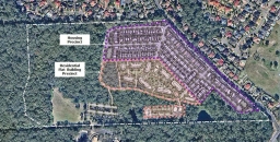
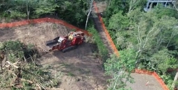
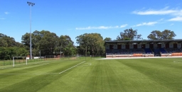
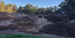
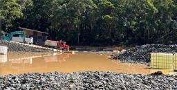
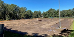
Norman Griffiths Oval synthetic turf debacle continues
We recently published an article in STEP Matters about the sorry tale of construction of the new synthetic playing field at Norman Griffiths Oval in West Pymble. Four months later and nearly a year after the oval was due to be completed by November 2023, the work on the stormwater detention system is still continuing. According to council’s website the completion date is now due to be November 2024.
The original cost estimate was $3.3 million. It is now $5.5 million.
Initial pollution incidents
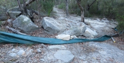
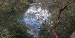
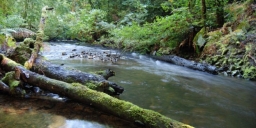
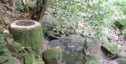
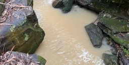
In April 2024 there was a disruption to the works after heavy rain caused a lake to develop on the site. Bushcarers who have been working along Quarry Creek that leads from the field discovered large quantities of sediment-laden water going down the creek. This has happened numerous times. The process of draining the lake must not impact this creek that leads to Lane Cove National Park.
After this flooding was reported to the Environment Protection Authority (EPA) the EPA made several inspections. They noted three pollution incidents:
- 6 to 8 April – the north-east wall of the sediment basin had collapsed and damaged a pipe which resulted in an uncontrolled discharge of sediment laden water into Quarry Creek
- 13 to 15 April – discharge of sediment-laden water from a stormwater outlet on the oval site into Quarry Creek
- around 19 April – as a result of sediment-laden water being leaked, spilled, otherwise escaped or deposited from the oval into water of Quarry Creek, signs of impact were observed in waters of Quarry Creek including the presence of algae and suspended solids for over 200 metres
Council subsequently advised the EPA that the damaged pipe was plugged and a faulty joint in a stormwater pipe had been identified and repaired where sediment laden water had been seeping into Quarry Creek.
Nevertheless, the evidence of pollution led the EPA to issue a clean-up notice on 26 April to repair pollution as defined under the Protection of the Environment Operations Act 1997.
The clean-up notice required council:
- to repair the collapsed sediment dam wall, repair the damaged section of pipe leading from the dam to the stormwater system and reinstate the holding capacity of the sediment dam;
- to assess the condition and operational status of all stormwater pipes running underneath or above at the premises to prevent any further sediment-laden water from entering the stormwater system from the premises;
- to arrange for the sediment-laden water at the premises to be lawfully disposed of and/or discharged in an appropriate fashion that does not result in further environmental harm;
- to remove the build-up of any sediment originating from the premises in Quarry Creek as well as algae and suspended solids in waters of Quarry Creek for at least but not limited to 200 m from the stormwater outlet.
Council was also required to engage an independent and suitably qualified person to review all sediment and erosion controls and identify any existing controls which are in a poor condition or ineffective. This entailed a detailed ‘Sediment and Erosion Control Plan’ for the site. Also, Council was required to engage a consultant to conduct a comprehensive inspection and assessment of the drainage systems beneath the Oval.
The project has been delayed because of the need to construct an extra retaining wall at the north-eastern corner, pump out the accumulated muddy water into trucks and repair the damaged pipes.
But the pollution has continued
Despite all these actions, in June and August there have been more incidents of sediment flowing down Quarry Creek. Some of these incidents have coincided with a rainfall event, but not all.
There is still a significant build-up of sediment along the creek even as far as Lane Cove National Park below Yanko Road. A relatively clean creek with clear water flowing over bedrock now has many pockets of sand and gravel sediment. The clean-up action has not been completed.
Council has acknowledged that the overflows at Norman Griffiths have been ongoing, and it has been working closely with contractors to address them. They advised that a significant issue, which was not immediately apparent, involved turbid water releases linked to the underground infrastructure. Action has now been taken to make the site more resilient, and the contractors are fully aware of their water management responsibilities. Council staff have said they will continue to monitor the creek, and operations staff will maintain the temporary sediment control measures until the oval works are complete.
The EPA is still considering all these incidents and may take further action.
Insights from the court case
In Issue 222 of STEP Matters we describe the case taken to the Land and Environment Court by NGANG (Natural Grass at Norman Griffiths, a group of local residents) for a judicial review of the decision to proceed with the project. The evidence presented during the case revealed shortcomings in the review of environmental factors (REF); that is the report that details the project and explains how the risks during construction and operation of the field will be managed. In this case the REF used assessments undertaken by council and the contractor.
The contractor chose to embark upon construction relying on two REF appendices that were for the installation of ‘a synthetic surface’. They were in no way based on the final design of the field as they were completed almost a decade ago – a geotechnical report (Appendix 6) and supplementary contamination investigation report (Appendix 5). Both reports highlighted the need for further investigation of the unconsolidated fill and asbestos risk. In fact, asbestos has been found during construction and buried onsite so that additional costs have been incurred.
The on-site water detention system is a major part of the project. The previous field area has acted as a stormwater detention system and there were pipes under the field taking water from the upper part of Quarry Creek across to the outlet near the swimming pool. The synthetic turf is not absorbent so the surface rainwater and water running onto the field from the surrounding slopes has to be controlled as well as Quarry Creek water from across Lofberg Road. A new system has had to be designed to allow the water to flow slowly through detention tanks and gravel beds under the surface. The large cost of this system was the reason the original plan to put synthetic turf on the oval was rejected back in 2017.
Given the shortcomings of the REF, the issues with the project were foreseeable and should have been carefully investigated before construction began. Further, the REF’s so-called ‘construction environmental management plan’ that is meant to protect the environment from harm, has already failed on more than one occasion and led to impacts on Quarry Creek, an EPA notice, and further delays.
Following the case, council has had to redesign the field and put in further mitigation measures against microplastic movement.
A clearly inadequate REF has already had major implications for ratepayers - not just adding approximately $1 million to the project that ratepayers have borne - but directly causing substantial delays to the project.
The contract stipulates an ‘external, independent review of the proposed design’ should be undertaken. Has this occurred?
Updated flood study still required
The community’s concern is that ratepayers will continue to pay the price for the REF’s inadequacies. This includes serious issues, some of which were highlighted during the court case:
- a lack of flood study modelled on the current design;
- the lack of examination of the impacts of a probable maximum flood as a result of this development as required under 171A of the Planning Act and its possible catastrophic environmental consequences.
There is also an unacceptable fire report which claims synthetic (plastic) fields are flame resistant.
A flood study on the current design is important for two reasons.
- Firstly, because previous comprehensive flood studies of a proposed synthetic field showed damage to Quarry Creek and led to the project being initially rejected in 2017.
- Secondly, control measures are in place for expected rain events, but uncontrolled flooding could lead to tonnes of plastic blades fragments and cork sludge escaping from the field and polluting Quarry Creek. The synthetic turf has plastic blades that are highly buoyant and can break off as the field is played on. Cork will be used as infill to hold up the plastic grass blades to simulate natural grass. While cork is preferable to rubber tyre crumb infill (which is now banned in many countries because of toxic chemical runoff) the stability of cork infill is not proven in heavy rainfall events as has been demonstrated by the cork sludge runoff from ELS Hall field in North Ryde.
It could be that the area is never under threat from a bushfire or fire on the field, but the REF’s bushfire report is not only factually inaccurate but also completely at odds with the Chief Scientist who recommended these fields should not be placed in fire prone (or flood prone) areas. This recommendation occurred before council's decision to go ahead was made.
Questions and actions for the new council
As noted above, we would like the new council to ask questions about why ratepayers are paying for variations for the contractor hitting unconsolidated fill and asbestos given the contractor chose to rely on these completely inadequate studies to tender for the project.
We would like the new council to follow up on ecologist Roger Lembit's report that noted threats to the Sydney Turpentine Ironbark Forest and the orchids (some classified as endangered) around the oval due to changes to hydrology caused by the construction.
Also unknown is the whereabouts of the vulnerable microbats which were mapped at the oval, as well as the Powerful Owl which roosted in the forest above it. There was also no examination on the impact of the multiple high fences around the field given the area is a wildlife corridor.
We remain unconvinced that plastic blades and cork infill will be kept out of Quarry Creek in extreme rainfall conditions, and we will be watching this very closely. The Chief Scientist recommended that pollutant testing be carried out near synthetic fields. Council has now set up a microplastic monitoring process after intensive lobbying from the bushcare group.
The clean-up of the sediment build up needs to be completed. Council also needs to undertake the flood study of Quarry Creek to ensure is not further damaged by erosion and scouring from excess water coming off the synthetic field. Previous council flood studies clearly highlighted the risk of damage to Quarry Creek, where there is a beautifully regenerated bushcare site. We will be asking council to make any flood studies public and outline how Quarry Creek will be monitored and protected. It is not clear whether the Lane Cove Northern catchments flood study that commenced in 2022 has been completed.
It is a great shame that the local community had to raise money to get the council to assess the field adequately – it is the local community that have somewhat abated a complete flood/pollution disaster at that field. Expert witness reports by Dr Daniel Martens (flood expert) and Roger Lembit (ecologist) warning of issues were sent to council staff and councillors and the court case was only initiated when they were completely ignored. Even after the NPWS called for more time to further assess the REF, the majority of councillors rejected a motion by Councillor Kay that a consultation on the REF should be examined further. Some councillors even tried to pass a motion that NGANG should be made to pay council’s costs for the case. Sadly the experts’ concerns have proven to be justified.
Proper consultation is essential for these expensive projects
This project is a prime example of the need for councillors to take notice of expert advice and carry out transparent consultation. This can provide great insights into the impacts, good and bad of a project.
Currently the legislation does not require a council to carry out detailed consultation or an environmental impact assessment (more rigorous than a REF) on a project like Norman Griffiths Oval as it is deemed to be general maintenance. There were numerous submissions to the draft Guidelines on the Use of Synthetic Turf calling for this to be remedied.
Image: Muddy water in Quarry Creek near Yanko Road (30 June 2024)
Eden Gardens 18 storey tower development is refused
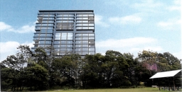
Back in December 2022 the Sydney North Planning Panel rejected a DA by the owner of Eden Gardens (the Ainsworth family, registered as Thunderbirds Are Go Pty Ltd) on Lane Cove Road, Macquarie Park to build an 18 storey office tower and other facilities. This plan was originally rejected by Ryde Council in March 2021. The applicant made no attempt to address the many issues given for the council’s rejection such as traffic, visual impact and impact on Lane Cove National Park (LCNP) next door. Therefore, the panel’s rejection decision was expected.
The next step was inevitably a Land and Environment Court hearing. This occurred in February 2024. It has taken until September, more than six months later, for the court commissioner to make a final ruling. To everyone’s relief, the application was refused.
The judgement centred on the legal considerations of:
- a merit contention of whether the visual impact was acceptable
- a jurisdictional prerequisite that the traffic impact would satisfy the terms of the Transport and Infrastructure SEPP
Submissions on environmental impacts
Several representatives with an interest in LCNP made presentations to the court hearing such as the NPWS, Friends of Lane Cove National Park, 416 Group, STEP and aboriginal cultural and heritage representatives.
Ryde Council’s submission also made several objections to the impacts on LCNP:
The development creates an unacceptable interface with LCNP, impacting on fauna habitat values, vegetation integrity, aquatic ecological values with the jarring building height resulting in significant visual impacts upon sensitive surrounding areas. These impacts are inconsistent with the zone objectives of C1 National Parks and Nature Reserves within the Ryde LEP 2014.
The judgement made little reference to the environment. Negotiations prior to the hearing did lead to the addition of a condition of consent in relation to light spill. The only other environmental consideration was the impact of shading on an area of endangered Duffys Forest near the development that was discounted because it applied only during a short period of winter. Other issues raised such as risks to birds from reflection of sunlight off the tower, light disturbance to nocturnal animals or bushfire evacuation were not covered in the judgement.
There is going to be increasing pressure for development abutting bushland that will increase bushfire risks and impacts on wildlife. It is concerning that the legal process does not seem to give these issues enough consideration. Legal judgements usually quote extensively from other precedents that relate to past cases. Environmental issues are evolving all the time, especially the impacts of climate change. How can we progress the interest of the natural environment in this backward-looking situation?
The main issue – traffic
The development application (LDA2021/0095) was for alterations and additions to the existing garden centre and construction of an 18 storey office building including car parks with a total of 539 car spaces and additional dining space. All these aspects of the development will obviously generate more car movements. The garden centre is to remain in place.
A lot of the court hearing processes related to options for road access modifications and a proposed pedestrian bridge over Lane Cove Road. Nevertheless, the commissioner commented that the application process was fragmented in relation to this most important issue. She commented:
I observe, merely by way of comment, that none of the parties seem to have properly grappled with the status of the relevant roads adjoining the site until very late in the proceedings including up to and during the hearing.
Basically, the applicant contended that there would be no adverse impact on classified roads, namely Lane Cove Road and the M2 access ramps. When Ryde Council and Transport for NSW raised this issue they made an attempt to respond by proposing to build a pedestrian bridge over Lane Cove Road from near Fontenoy Road to Eden Gardens. The commissioner dismissed this as a ‘red herring’. It was a half-baked idea. Several trees would have to be removed that currently shield the unit blocks on the western side. It would not help commuters walking from the Metro Station as they would still have to cross the M2 link roads somehow. A few residents near Fontenoy Road might have benefitted, that is all.
The applicant suggested some options for easing congestion at the access to the site and intersection with Fontenoy Road. The commissioner considered that the modelling demonstrated that, even with the implementation of mitigation measures such as extra turning lanes, the volume of traffic generated by the development would have clear adverse effects on the safety, efficiency and ongoing operation of the M2 and Lane Cove Road.
Visual impact
The applicant’s experts argued that the tower was desirable because:
A tower form with its small footprint enables activation of the ground plan and uses that continue the functions that the community currently enjoy on the site.
They are also taking advantage of the situation that there is no height limit for the site specified in the Ryde LEP. There is however a maximum floor space ratio 1:1. The proposed development would have a floor space ratio of 0.996:1!
Four aspects of the obvious visibility of the 18 storey tower (80 m high) were considered:
- Consistency with the urban landscape as defined by the objectives of the Ryde LEP. The court decided that was compatible with the appearance of the area even though the tower would be 60% higher than the nearest tall buildings on the southern side of the M2.
- Its proximity to LCNP. The site is next to the Tunks Hill Picnic Area so one would expect an 80 metre high tower would have a big impact. Some experts argued that the picnic area is not totally immersed in the national park. Unfortunately, the LCNP website states that one of the features of the area is its ‘great views of Chatswood’. The fact that these are very distant views with dense forest in the foreground did not have any relevance to the court.
- Its proximity to other parts of LCNP is dismissed on the grounds that it would not be visible from other picnic areas or recognised walking tracks further into the park, where it would be screened by topography. This ignores the topography aspects for all the residents on the northern side of LCNP.
- Visibility to road users. Current views for drivers along Lane Cove Road, de Burghs Bridge and the M2 can enjoy a vista of bushland when travelling near the Eden Gardens site. Town planning experts provided differing views, one that the tower will have an adverse impact, another said the view would only be fleeting for cars on the M2 and there are already numerous views of high development nearby. The commissioner considers the impact to be acceptable. So much for the idea that cumulative impact of adding another high rise interruption to bushland views along the M2 is an intrusion for many people.
On these grounds the arguments about visual impact were deemed to not merit the refusal of the DA.
Lane Cove River restoration – the Durumbura Dhurabang stakeholder project
STEP representatives and many others with an interest in the well-being of the Lane Cove Valley attended a workshop on 16 August organised by Macquarie University. It was led by Dr Jo Rey from the Department of Indigenous Studies.
The restoration project is a recent Dhurag initiative aiming to return traditional custodial ontologies, knowledges, languages, practices to the Lane Cove River catchment in respectful alliance with existing stakeholders.
The goal is to bring best practices together for the well-being of Ngurra/country knowing that if we have healthy country we can have healthy people for a sustainable future.
The participants were representatives from local councils, academics, Macquarie Business Park companies, environment groups, indigenous communities, government organisations such as Sydney Water and NPWS.
The workshop was an initial idea sharing exercise to identify knowledge gaps, issues, barriers to improvement and initial priorities for action.
Urban planning impacts on the catchment
The workshop identified one of the major issues for the catchment is the lack of coordinated monitoring of water quality and modelling of stormwater management requirements. This is vital with the increasing incidence of extreme rainfall events and the rapid increase in residential development and associated infrastructure.
A matter of concern is that there are currently no flood-related development control provisions applying under the Ku-ring-gai local environmental plan. A number of catchment flood studies are being undertaken subject to funding from the NSW government but these are progressing very slowly.
Our planning system needs a major upgrade to improve stormwater controls and reduce pollution from run-off and erosion. All governments and organisations like Sydney Water have to be involved.
Dharug women's-led cultural burn at Browns Waterhole
One initiative that relates to the Durumbura project was the cultural burn near Browns Waterhole that took place in April 2024. Dharug women and allies worked together to undertake the first (since earliest colonisation days) Dharug women’s-led cultural burn. The information in this story comes from Regenavitis, the newsletter of the Friends of Lane Cove National Park.
The cultural burn originated from an invitation and funding from the Department of Planning and Environment’s Cultural Fire Management Team to the Dharug Yanama Budyari Gumada Collective. Macquarie University was also involved with the management of the burn. It is the first time Dharug women have been invited by a government department to restore Dharug cultural knowledges, language, and practices through fire, as a Caring for Country initiative so close to the inner city.
It was actively supported by a variety of Dharug community members as well as the NPWS, Friends of Lane Cove National Park, the three relevant local councils (Hornsby, Ku-ring-gai and Ryde) and the Rural Fire Service. It took about four years to plan the project including preparing a review of environmental factors and developing the burn plan.
The journey involved Dharug women holding a women’s camp in May, 2023, thanks to Ryde Council permitting Dharug women to camp at Waterloo Park – another first! Over the three days of the camp, Dharug women renewed cultural connection to Ngurra/country, engaged in ceremonial practices, storytelling, yarning, weaving, made place-based art, did some tools-based training with NPWS, and engaged in digital data collection thanks to Macquarie University scientists. In the process, they were able to establish the presence of swamp wallabies, bandicoots, goannas, turtles, gudgeons, diamond pythons, echidnas, a large variety of culturally important plants, and, of course, ever-present multitudes of sulphur-crested cockatoos, bell minors, kookaburras, various finches, parakeets, and other important bird species. Soil testing, before and after the burn has also been undertaken to determine changes in soil quality.
Originally it was supposed to be completed by 2023, but due to COVID and poor weather conditions, the burn was delayed until 2024. As such the undergrowth grew in height from around 1 m in 2021 to nearly 2 m in 2024. Nevertheless, the delay allowed for greater time to plan and budget. In March, 2024, Dharug women and allies came together to prepare the site for the burn and it was completed in April. It will be interesting to observe the impact of the burn on the forest ecology in coming years.
Group’s summary of the experience was:
While Dharug women have undertaken the cultural burn according to our cultural priorities of nurturing Ngurra (her soils, plants, animals and other presences), we recognise that based on the contemporary context, working collaboratively together with our allies enables us to continue our cultural ways of knowing, being and doing, as well as bringing others along the journey to establish sustainable futures in the city. Undertaking our cool-fire burn approaches mitigates the threat of mega-fires in the Durrumburra Dhurabang (Lane Cove River) valley, and simultaneously restores and strengthens an appreciation of the values that caring for Ngurra/country enacts.
Plastics reduction – have your say on proposed actions

The EPA has released a discussion paper on a plan to reduce the use of plastic and the quantity of waste generated. Comments may be made via a survey or you can email a submission to This email address is being protected from spambots. You need JavaScript enabled to view it. (closing date 6 November).
Due in part to past litter reduction initiatives such as the Return and Earn recycling scheme and the phase-out of lightweight plastic bags, there has already been a 49% reduction in litter density since 2018–19.
What about a major source of plastic – synthetic turf?
As an aside, there is a major source of plastic that is only going to get worse that is from synthetic turf playing fields and its general use for surfaces in parks and school grounds. This issue doesn’t come under the plan but could be referred to in submissions.
There is no effective method for recycling this product. Microplastics that end up in the environment from the break-up of the plastic grass blades and loose infill are a major concern that is being monitored by the AUSMAP project. There will be more about research on this in a future issue of STEP Matters.
Strong action is needed
There are still frightening statistics about the impact of litter and the volume of plastic ending up as waste in landfill. For example, in 2022–23, NSW alone generated 891,000 t of plastic waste. Only 14% of this was recycled.
About 79% of litter washed into our waterways is plastic. Plastic litter can have disastrous consequences and significant cost on the environment and communities.
For every piece of litter on land in NSW, nine times more can be found in our waterways.
As littered plastic items are exposed to water, sunlight and rain, they can break down over time into microplastics and leach potentially harmful chemicals into the environment. It can also entangle or be swallowed by marine animals.
Taking into account the direct costs of cleaning up litter, as well as the indirect costs associated with loss of amenity and environmental values, litter costs NSW more than $500 million.
Is the reduction plan good enough?
The Boomerang Alliance’s view on the proposals is that the plan includes some sound policy actions and a timeline for implementation, but many of these proposed measures may not deliver the needed reductions in plastic litter and waste. Here is a summary of their main points
Reusable cups at food venues (applied from 2027)
Currently, food venues may voluntarily accept reusable cups, but this needs to go further. All outlets should be required to offer reusable cups and containers or accept BYO, reducing reliance on disposables. In Europe, dine-in customers are never served with disposable food ware.
Recyclable single-use cups and containers (2027)
While recyclable or compostable containers are already common, the issue lies with inadequate collection systems. Simply labelling items for recycling won’t address the core issues.
Return and earn for single-use cups and containers (2030)
This proposal is both tokenistic and impractical. What we need is a robust reusable cup return system. Other countries have already implemented these models, which reduce plastic waste and greenhouse gas emissions. These systems could be adopted now.
Tethered caps on bottles (2030)
One never knows whether loose caps from milk and soft drink bottles can be recycled. Attached caps solve this question. This strong policy is already in place in Europe. So, why wait until 2030? Propose that it be introduced by 2026.
National approach to cigarette butt litter (2027)
Ideally eliminate cigarette filters altogether, as recommended by the World Health Organisation. A reusable holder could replace the need for single-use filters.
Elimination of harmful chemicals in packaging (2027)
While this is a positive step, if chemicals are harmful, they should not be used in the first place. Mandatory labelling of ‘green-listed’ chemicals is also essential.
Phase-out of microplastics (2025)
Support this, but there should be stronger measures, such as mandating filters on washing machines to capture microfibres, rather than relying on a proposed rating system by 2027.
Standards for reusable shopping bags (2025)
Require plastic shopping bags to be stored out of sight at the point of purchase and only provided on request, unless they are clearly designed for reuse or are part of an extended producer responsibility. Reusable bags must be durable, contain recycled content, and be recyclable at the end of their lifecycle.
Phase-out of various plastic items (2027)
Agree with the phase-out of plastic carrier bags, food tags, and other non-compostable items.
Ban on lighter-than-air balloons (2025)
This ban could be implemented immediately. There is no need to wait until 2025.
Phase out of expanded and foamed plastic trays and packaging (2025)
Support this phase-out and believe it should be done as soon as possible.
A final word on the Australian recycling label
This system needs to ensure that labelled items are genuinely recycled, reused, or composted. Without this, it’s simply greenwashing.
Take action for forests

We recently wrote about the urgency of a decision to cease logging in NSW native forests. Logging cannot continue in public native forests without pushing the koala, greater glider, coastal emu and many more forest-dependent wildlife species much further towards extinction. Illegal logging practices, endangered species habitat destruction and totally inadequate pre-logging wildlife surveys have become the norm for Forestry Corporation. Under current rules, the volume of logs taken is considered more important than endangered wildlife.
There is now a great opportunity to act to cease native forest logging in NSW. The NSW government is developing a Forest Industry Assessment Plan that will shape the future of forestry in NSW. Ending native forest logging is one of the options being considered. There is a call for submissions to the Independent Forestry Panel that will assess the sustainability of current and future forestry operations.
This is a historic opportunity to finally win this long fought for campaign. Take action by making a submission by 13 October to the Independent Forestry Panel. Click here for the Nature Conservation Council’s submission guide and further information.
The Frenchman: Francis Barrallier, Life and journeys 1773–1853

I personally got interested in the Francis Barralier story by an indirect route. I found that much of the gravels, like those at Penrith Lakes, that have flooded down across the inner Sydney Basin had been washed from a vast Devonian age volcanic formation called the Barrallier Ignimbrite of the Wollondilly Valley in a district known as Barrallier. So we visited the area via the Wombeyan Caves road and also read a version of his diary of attempts, in 1802, to penetrate and cross the Blue Mountains. All useful background, and an introduction to the challenging terrain, but this new book is currently the best source for information and the whole historic setting.
Barrallier and his party set up a depot at Nattai and made three journeys that could be termed ‘excursions’ or ‘incursions’ depending on one’s point of view. The motives were complex, stimulated by Governor Phillip King’s curiosity, and framed by the knowledge of the times, the confronting physical presence of the Blue Mountains and what lay beyond. But the concept of meeting the ‘King of the Mountains’ was also in the thoughts of the time.
The first journey in November 1802 was investigative and followed the Nattai River down to its confluence with the Wollondilly, which they crossed and made an attempt to climb Tonalli Peak, a fearsome, projecting sandstone cliff flanked by blocks and debris. They failed but shot a rock wallaby for food. They were impressed by its sense of balance and ‘mountain goat’ terrain ability – and this was possibly the first European sighting of this animal.
Barrallier's second journey, November to December 1802, was the big one. His party began by following the earlier route to the lower slopes of Tonalli, then proceeded westwards following the Tonalli River and valley past the locality now known as Yerranderie (which became a silver mining settlement). They climbed through the narrow Byrnes Gap and descended to the Kowmung River, crossing it and following tributaries Christys Creek then Wheengee Whungee Creek. This became an increasingly a tough route, rocky, and with waterfalls and ravines, and I should highlight here that they were not in typical Blue Mountains horizontal sandstone country but folded Devonian Lambie Group basement terrain of folded conglomerate, sandstone and shale – quite a different challenge. And this brought the journey to a halt at Johnston Falls. At 30 metres, this waterfall below Kanangra Walls is substantial and there’s an impressive picture in the book that indicates why it stopped them. And the option of climbing out to the Boyd Plateau was not on the table in dry, December heat. They finally gave up and turned back.
Some people have misunderstood the failure to have been due to breach of Aboriginal tribal territory but this wasn’t the case. Their relationship with the locals was mixed and eventful but had positive elements, including employing essential guides like Gogy and Boodbury. Negative aspects include cases of ‘domestic abuse’ particularly by Gogy of his female partner, and the burning of the Nattai depot huts. Botanist George Caley features in the book too through an incident in which accusations of shooting at Aborigines were aired, though not supported by the accused. Barrallier’s recorded botanic observations aren’t of great consequence.
Note: Andy Macqueen has also written a fascinating book about the history of the Grose Wilderness and the saving of the Blue Gum Forest called Back from the Brink.
Andy Macqueen (self-published) 2024,
paperback, 247 pp, RRP $40
Available from This email address is being protected from spambots. You need JavaScript enabled to view it. or Blue Mountains bookshops.Review by John Martyn
Lord Howe wedding lily – one of botany’s greatest mysteries

 Pictured is a first time flowering for our 6-year-old Lord Howe wedding lily, bought originally at Wirreanda Nursery.
Huge mystery surrounds this species, Dietes robinsoniana, which is incredibly disjunct and all of its near relatives are South and East African – you may have D. grandiflora and/or D. bicolor in your garden and the former is widely used in landscaping (and is also a tough and troublesome weed). But how did a species of the genus jump two oceans with no obvious links and no near relatives?
Lord Howe is the remnant of a 7 million year old Hawaiian-type shield volcano of basaltic composition and it sits on the western edge of Zealandia, a largely-submerged continent and our nearest continental neighbour. That date captures the plant's older time bracket and Lord Howe was never part of much older Gondwanaland wherein the plant might have got there by land.
Nobody seems to have published a solution. The Wikipedia entry is the best and it cites a Dietes paper by Peter Goldblatt of Missouri Botanic Gardens who tries to put D. robinsoniana into context, suggesting a connection via India when the continents were merged but was clearly unaware of the nature and age of Lord Howe. But interestingly he also concluded that D. robinsoniana is the most primitive of the genus and possibly ancestral to the rest – how about that for a brain stretch?
John Martyn
Wild and woolly westerlies

The quite horrendous series of windy August and September days across SE Australia was felt in Sydney under bright blue skies. Further south and in Tasmania however the wind gusted up to category 3 cyclone strength with torrential rain and widespread flooding. We are getting weird and wonderful and often not so wonderful weather outbreaks, usually fires and floods, which are often attributed to or amplified by climate change, but what exactly led to this one?
On 3 September, Caitlin Fitzsimmons, the Sydney Morning Herald’s environment and climate reporter, explained that it’s largely the fault of the jet streams. Two jet streams affect Australia, the subtropical and polar. They both blow fiercely from the west at altitudes of ±10,000 metres but are normally separate at this time of year. However, they have merged across the south of the continent and have amplified each other. The subtropical tends to stay aloft, however the polar often drives weather at lower levels and is linked to the Roaring Forties wind belt of the Southern Ocean within which this dangerous weather resides.
What has climate change done to cause this? Climate change in the Northern Hemisphere has already been blamed for amplified bends and deviations in jet stream paths leading to bottled-up heat domes and devastating fires, or southward surges of the Arctic vortex feeding intense chill across continental Eurasia and North America. Our recent experience is more complex! Warming is apparently nudging the subtropical stream southwards away from the equator while warming and ice melt in Antarctica may be easing the polar one northwards.
John Martyn
New booklet: Wildflowers on the Ridgetops
Friends of Berowra Valley have produced an introductory booklet on the wildflowers commonly met on local ridge tops. It is light weight and hence suitable for carrying in a backpack. Flowers have clear photos and are arranged by colour. An amazing Christmas present. Order online – the cost is $10 plus postage.
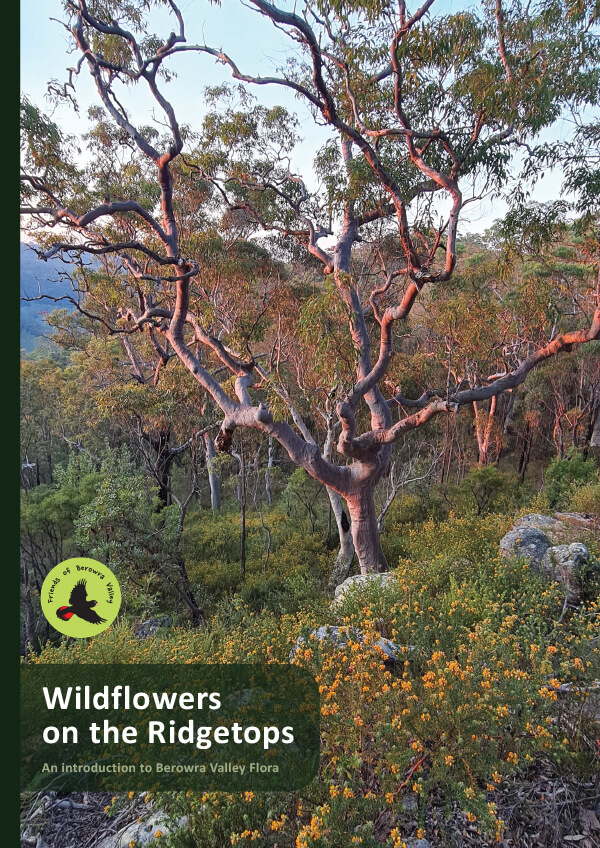
STEP Track bushcare needs volunteers
The STEP Track bushcare site at the end of Kingsford Avenue in South Turramurra meet from 9 to 11 am on the first Saturday of every month, and they’d love more volunteers.
For more information contact Margaret (0420 511 940) or register with Ku-ring-gai Council online.
A bit of history ... the STEP Track
In 2018 STEP celebrated it's 40th anniversary. To commemorate the event, Graeme Aplin wrote a history STEP Forth Boldly: STEP Inc from birth to 40. Here's what's said about the history of the STEP Track.
STEP took part in Heritage Week each year, normally by providing a bushwalk. In 1989 this was along the STEP Track, highlighting possible impacts of road proposals: close to 300 walkers attended and the walk was led by Yvonne Langshaw and Alan Catford (Newsletter 38, May 1989).
In an effort to develop a system of high quality walking tracks in the municipality, Ku-ring-gai Council successfully applied for a grant to upgrade what had been known for many years as the STEP Track.
The STEP Track originated when some of the early STEP activists such as Alan and Janet Catford, John and Margaret Booth and Helen Petersen decided that a walking track should be made in South Turramurra which showed more of the diversity of the bushland. On 3 April 1993 over 100 people gathered at the end of Kingsford Avenue to attend the official opening (Newsletter 61, April 1993).
Picture above is the STEP Heritage Week walk and B3 protest (16 April 1989)
More...
A fierce battle is being fought in the soil beneath our feet – and the implications for global warming are huge

As humanity continues to burn fossil fuels, the delicate balance of life on Earth is changing. That’s true of trees, many of which are growing faster as a result of increased carbon dioxide (CO₂) concentrations in our atmosphere.
But not all trees are responding in this way. In particular, eucalypts – Australia’s iconic forest trees – haven’t benefited from the increase in CO₂ as they were expected to.
Why not? Our new research, published today in Nature, shows it comes down to a below-ground battle for phosphorus, a mineral nutrient in soils that is essential for tree growth. The results suggest in some parts of the world, increased CO₂ means tiny bugs in the soil 'hold onto' their phosphorus, making less available for trees.
This is alarming news, because according to current projections, global forest growth is meant to limit damage from global warming.
What our study involved
Our study used data from a Western Sydney University experiment known as Eucalyptus Free Air CO₂ Enrichment, or EucFACE. The experiment is located in a century-old Cumberland plain woodland in Sydney’s Hawkesbury district.
CO₂ is released into the woodland through a computer‐controlled system. Scientists then monitor the effects on trees, soils and the broader ecosystem. Over six years, CO₂ was raised to the levels expected around the year 2050 (according to the current business-as-usual emissions trajectory).
Our previous studies found the woodland trees did not show any extra growth at high CO₂ levels. We suspected the low availability of soil phosphorus was the cause, and set out to test this.
Phosphorus is crucial to the process of photosynthesis that makes trees grow. Phosphorus in soil is provided by bugs known as microbes. These micro-organisms break down dead and decaying matter, and in the process change phosphorus into a form that plants can take up with their roots.
Most Australian soils are naturally low in phosphorus, because they are derived from ancient, nutrient-depleted rocks. The same is true for most soils in tropical and subtropical regions. That makes the phosphorus service provided by microbes even more important.
We sampled phosphorus in all parts of the ecosystem, tracing its journey from the soil to the trees. We found under high-CO₂ conditions the microbes keep more of the phosphorus they produce, to aid their own metabolism. This left less available for trees to take up.
This occurred despite the trees trying to 'bargain' for phosphorus by releasing extra carbon into the soil to feed the microbes.
What’s more, trees are big 'recyclers' of phosphorus – they remove half of the phosphorus from any leaf before it falls. But this was still not enough to support extra tree growth.
EucFACE is designed to predict the effects of rapidly rising atmospheric carbon dioxide on Australia’s unique native forests.
Why this matters
Our study is the first to show how the phosphorus cycle is affected by high CO₂ – and in particular, the role of soil microbes.
The results are important to predicting soil phosphorus availability, and plant productivity, in woodlands and forests as CO₂ levels increase in the atmosphere.
Current climate projections assume increasing CO₂ will lead to more forest growth globally. Forests are a vital carbon 'sink' – that is, they draw down carbon from the atmosphere. So the increased forest growth was projected to go some way to limiting the effects of climate change.
If our results are taken into account, future warming would be higher than current projections. However, it’s important to verify our results in other locations, with other tree species. New experiments are being formed by overseas teams, including in the Amazon rainforest, to test the findings.
Importantly, our results don’t mean that forests are not a crucial sink for carbon. Forests hold a vast quantity of carbon. Avoiding deforestation and planting new forests are both valuable means of maintaining and adding to carbon stores.
Our research demonstrates the importance of considering soils when growing trees. We also hope our research stimulates further efforts to find phosphorus in ecosystems, especially in tropical rainforests where phosphorus is often greatly limited.
Kristine Crous, Senior Lecturer, Hawkesbury Institute for the Environment, Western Sydney University; Belinda Medlyn, Distinguished Professor, Ecosystem Function and Integration, Western Sydney University, and David S Ellsworth, Professor of Plant Eco-physiology, Western Sydney University
This article is republished from The Conversation under a Creative Commons license. Read the original article.
Rofe Park Turramurra is now on Wikipedia

Rofe Park Turramurra was not on Wikipedia before now – there is an entry for Rofe Park in Hornsby that has been there a while. I first submitted the article to Wikipedia in February 2024, after much change and back and forth with editors, the article was accepted and created on the 21 June.
My reason for getting Rofe Park Turramurra on Wikipedia was that it reaches much further and is more permanent than the website and domain created in 2022.
The disadvantage of a website is that it needs to be managed and a payment made for the domain yearly and obviously I won't be around forever! In the future the Wikipedia site can be edited by others.
During the last year, Councillor Jeff Pettett tried again to get Rofe Park heritage listed. This failed for the second time, the council heritage committee were not interested. I think we can give the idea a miss. The heritage listing is symbolic only and would have had no influence on development near the park. If the councillors were determined to vote for synthetic turf on Mimosa Park they would have done so regardless of a heritage listing. See for example, Gardiner Park, Banksia in the Bayside area.
I hope that eventually we can get a decent sign at the Mimosa Road entrance for Rofe Park. If anyone would like to make a bit of noise about this please feel free!
My next task is to work out how to add pictures to the Wikipedia article. Nothing is straightforward and everything must be a watertight public copyright to be on Wikipedia. My estimation of the information on Wikipedia has improved enormously now I know how difficult it can be to get published.
Here is an extract from the Wikipedia article describing how Rofe Park became council land:
Thomas and Minnie Rofe were living in Wahroonga, Sydney in 1927 when they gave the 50 acres of land to the Council of the Shire of Ku-ring-gai.
In the Sydney Morning Herald article dated 6 April 1927, Councillor Thistlethwayte, president of Ku-ring-gai Shire said:
This generous act on Mr Rofe’s part, is being consummated to-night in the transfer of the property to the council, and the execution of a deed of trust by the council, so that the area will for all time be an open space in which the preservation of the natural fauna and flora will be a dominant feature. The land is well wooded and includes a natural cave unsurpassed in the metropolitan area.
This article has been written by Trish Lynch, STEP’s Facebook manager, who lives near Rofe Park and has studied its history.
Tiny forest planted in West Pymble – how well will it grow?

The concept of a Tiny Forest was developed in the early 1970s by the Japanese forest ecologist, Akira Miyawaki, as a means of restoring degraded urban and industrial environments. The area to be restored can be as small as 3 m2 but is usually about the size of a tennis court.
The method involves the following steps:
- determine the plant species native to a given area;
- improve the soil by mixing in organic material;
- plant seedlings of native trees and understorey plants in a dense, mixed manner (about three seedlings per square meter) meant to simulate a natural forest;
- remove weeds from the site for up to three years after planting, if necessary.
After that, the grove is left to its own devices. Due to the dense planting, the seedlings grow quickly as they compete for sunlight. It is claimed that growth is about 10 times faster than in a natural forest.
Ku-ring-gai Council worked with Earthwatch Australia in partnership with BUPA to establish a tiny forest at West Pymble Village Green. About 70 locals joined in the planting day on 17 June 2024. A site was chosen that was large enough for the forest to cover a small part of the open space and not impact on existing users.
Council’s nursery provided approximately 980 native plants to grow the tiny forest and the Indigo Native Nursery provided a further 490 native species. Nursery volunteers have propagated and cared for these seedlings, which all belong to the Sydney Turpentine Ironbark Forest ecological community. Seed and cuttings were collected from local populations to ensure the tiny forest is suited to Ku-ring-gai’s conditions and ensure the continuation of wild plants.
The results of the tiny forest will be monitored with the help of citizen scientists and local schools. The research data gathered by the Earthwatch Tiny Forest program will go towards a global research project that looks at tiny forests from around the world. School children and communities monitor biodiversity, growth rates, carbon storage, thermal comfort, water infiltration, soil condition, social benefits and learn about the importance of local biodiversity to our lives.
Will this forest thrive in Sydney’s conditions?
STEP member and experienced bushcarer Janet Fairlie-Cuninghame has expressed doubts about the Miyawaki concepts achieving the claimed benefits in the Sydney environment. She points out that we have a very diverse plant community and local ecology; with very different climate, geology, soil types and plant ecology. Janet cites examples of projects run by the NPWS rangers that are well versed in working with the community on planting days. They use local provenance for planting material and a diverse species selection which grows quickly and establishes a natural balance of diverse structure and layers. Ground covers, shrubs and understorey are all important components to make a sustainable balance.
There is extensive discussion that provides a broader perspective about the use of the Miyawaki method. It has been successfully used to restore industrial sites in Japan and to create greener urban environments but has not been so successful in other countries such as India.
Time will tell how successful the project will be in Sydney.
Adrienne McLean has provided us with a personal perspective of the event
On a beautiful Sunday morning, the community of West Pymble and Ku-ring-gai gathered for a remarkable event: planting a tiny forest. Hosted by Ku-ring-gai Council, in collaboration with horticulturists, community scientists, and Earth Watch, this event was a testament to the power of community action.
The tiny forest project is a scientifically managed initiative with three distinct sections: two planted by event attendees and one by local schools. Each section uses different fertilizers and levels, providing a controlled environment for scientific observation. Children, parents, and locals enthusiastically participated, planting native species that we can all watch grow and flourish over time.
I’m especially excited to watch the eight plants I planted thrive. It’s going to be a joy to pass by this tiny forest and see how our collective efforts have taken root and grown.
Ending native forest logging would help Australia’s climate goals much more than planting trees
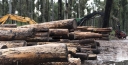
What is being overlooked in current international climate policy under the Paris Agreement is the crucial role of biodiversity in maintaining healthy ecosystems and their integrity, which keeps carbon stored in forests, not the atmosphere. Healthy ecosystems are more stable and resilient, with a lower risk of trees dying and lower rates of carbon emissions.
The way we currently count carbon stores risk creating incentives to plant new trees rather than protect existing forests. Yet old-growth forests store vastly more carbon than young saplings, which will take decades or even centuries to reach the same size.
Can ending native forest logging help the climate?
We’ll need to go further and ban logging in all native forests in Australia to help meet our net-zero emissions target, while meeting timber demand from better-managed and increased plantations.
Stopping native forest logging avoids the emissions released when forests are cut and burned. It would also allow continued forest growth and regrowth of previously logged areas, which draws down carbon from the atmosphere and increases the amount held in the forest ecosystem.
The natural biodiversity of our native forests makes them more resilient to external disturbances such as climate change. These forests have larger and more stable carbon stocks than logged areas, newly planted forests and plantations.
If we compare forests protected for conservation with those harvested for commodity production in the Victorian Central Highlands, research shows conservation delivers the greatest climate benefits through continued forest growth and accumulating carbon stocks.
There are growing calls to create the Great Forests National Park to the north and east of Melbourne, which would protect a further 355,000 hectares and more than double protected forests in the Central Highlands.
Net zero: deep, rapid, sustained cuts needed
The world’s nations are aiming to reach net zero by mid-century. Meeting this target will require deep and rapid cuts in carbon dioxide emissions as well as pulling carbon out of the atmosphere into land sinks, especially forests.
The land sector is unique in that it can be both a source (logging, agriculture) and a sink (forest regrowth, for instance) for carbon. The natural way forests take up carbon can be increased through natural regrowth or plantations.
Unfortunately, the current approach, based on IPCC guidelines, to counting this type of natural carbon storage can lead to perverse outcomes.
The carbon sink from forest regrowth only counts towards the “removals” part of net zero when it results from changes we make, such as ending native forest logging. It doesn’t count if it’s regrowth after a natural event such as a bushfire. It’s important to count only human-induced changes in our climate targets.
Tree planting, on the other hand, can be counted towards net-zero targets, despite the fact that newly planted trees will take centuries to sequester as much carbon as found in an old-growth forest.
This type of accounting – known as flow-based accounting – can mean a premium is placed on planting and maintaining young forests with high carbon uptake rates, overlooking the substantial benefits of protecting larger trees in native forests.
That is, this approach favours carbon sequestration (the process of taking carbon out of the atmosphere and storing it in wood) over carbon storage (the total carbon stocks already contained in a forest).
A comprehensive approach to forest carbon accounting would recognise both flows of carbon (as sequestration) and carbon stocks (as storage) contribute to the benefits that native forests offer for reducing emissions.
Carbon accounting needs more clarity
This becomes a problem when forests and fossil fuels are included in a net accounting framework, such as the one used in Australia’s national greenhouse gas inventory.
In net accounts, emissions (from fossil fuel and land sectors) within a year are added to removals, which includes the sequestration of carbon into forests and other ecosystems.
Because this type of accounting only counts the flows of carbon – not existing stocks – it omits the climate benefits of protecting existing forests, whose stored carbon dwarfs the amount Australia emits from fossil fuels each year.
But if we separated out targets for the fossil fuel and land sectors, we could properly treat forest carbon stocks as an asset, giving us incentives to protect them.
Another problem with net accounting is it treats all carbon as equivalent, meaning a tonne of carbon sequestered in trees compensates for a tonne of carbon from burned fossil fuels. This has no scientific basis. Carbon dioxide emissions are effectively permanent, as the buried carbon we dig up and burn stays in the atmosphere for millennia, while carbon in trees is temporary in comparison.
As trees grow, their carbon storage compensates for earlier logging and clearing emissions, which is an important climate benefit. But we’re not comparing apples and apples – forest carbon doesn’t compensate for fossil fuel emissions.
Logging bans are important – but no substitute for ending oil and gas
While ending the clearing and logging of native vegetation is vital for both climate and biodiversity, it’s no substitute for preventing emissions from fossil fuels.
To make this clearer, we must urgently set separate targets for emissions cuts for fossil fuels and increased carbon removal in the land sector. This will ensure phasing out fossil fuel use is not delayed by planting trees, and that the carbon stocks of biodiverse and carbon-dense native forests are protected.
Kate Dooley, Research Fellow, School of Geography, Earth and Atmospheric Sciences, The University of Melbourne
This article is republished from The Conversation under a Creative Commons license. Read the original article.