
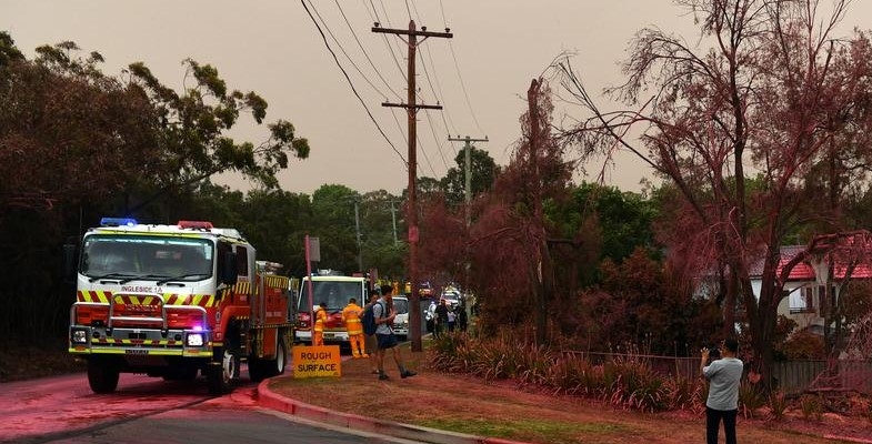
Sydney escaped the extreme bushfire experiences of last summer but the heatwaves, strong winds and extremely dry bush conditions could easily have caused a major fire. After all the experiences of 1987, 1994 and 2001–02 demonstrate what can happen.
Bushfire preparation has been extensively upgraded by the Rural Fire Service and local councils. The following information has been provided by Ku-ring-gai Council’s Bushfire Technical Officer, Heath Fitzsimmons. He has now moved to the Central Coast so his position is vacant.
The authorities cannot possibly provide all the protection that property owners need from bushfire. People living near bushland have a responsibility to maintain their own properties to minimise the fuel load and vulnerability of their houses. Maintaining means regular clearing the roof and gutters, ensuring there are no wood piles or flammable gardens etc. Maintenance could also mean upgrading doors, windows etc to safer options).
Even so it is important not to overestimate the level of protection that a fire break or hazard reduction burn can provide. Experience with recent fires such as in Paradise California has shown that homes far from the fire front are at great risk from ember attack.
There is also the issue of whether property owners next to bushland are able to do any clearing of an Asset Protection Zone in bushland next to their boundary if the vegetation and debris has built up to be a fire hazard and Council or National Parks have not been able to do any clearing in recent times.
STEP developed the STEP Method of Selective Hand Clearing to be used for this purpose some 40 years ago but the legality of its application on Council or National Park land is not clear. If Council and National Parks are able to adopt a policy whereby qualified homeowners are able to be permitted to hazard reduce in land adjacent to their properties then STEP would of course support that. A natural extension of that would be permitting approved commercial bush regeneration firms to carry out such hazard reduction work at the homeowner's cost should they so propose.
When Ku-ring-gai Council has appointed a new bushfire officer STEP will hope to discuss this issue further and organise a talk prior to the next bushfire season, COVID-19 restrictions permitting.
Information from Ku-ring-gai Council
Planning and coordination of bush fire hazard reduction works
Bush fire hazard reduction works in the Ku-ring-gai Area are planned by the Hornsby Ku-ring-gai Bush Fire Risk Management Committee (BFMC), comprised of representatives from Ku-ring-gai and Hornsby Councils, NSW Rural Fire Service, NSW Fire and Rescue, NSW National Parks and Wildlife Service and other land managers, emergency services and utility managers.
Every 5 years the BFMC develops a Hornsby Ku-ring-gai Bush Fire Risk Management Plan (BFRMP), Risk Assessment Table and Asset and Treatment Table. These documents identify the ‘assets’ within the district, categorise those assets based on the level of bush fire risk faced and set out a broad 5-year plan for prioritised bush fire risk management works including hazard reduction burning, fire break and fire trail maintenance, and community engagement. From this broad plan the BFMC develops an annual works program.
A list of the hazard reduction burns on the current works program for the Ku-ring-gai area and maps of the proposed burn areas can be found toward the bottom of the bush fireplans and policies page of Council’s website. As these burns are scheduled (up to a week in advance) they will appear on the hazard reduction section of the NSW RFS website, and will also be published on Council’s Twitter and Facebook pages. Past fire history including both hazard reduction burns and bush fires can be viewed on Council’s web map.
Bush fire protection measures and effective risk management treatments
When considering the bush fire risk faced by a home it is most important to consider two major methods of bush fire attack; radiant heat and ember attack. Direct ignition from radiant heat/flame contact accounts for less than 15% of the houses lost to bush fire, while the overwhelming majority (approximately 85%) of losses are due primarily to ember attack. The two also have a cumulative effect, with houses exposed simultaneously to both radiant heat and ember attack at greatest risk.
The threat posed by radiant heat is very effectively reduced by establishing an Asset Protection Zone (APZ), i.e. increasing the separation distance between buildings and bush fire prone vegetation. The separation distance required ranges from 10 to 100 m depending on slope, vegetation type, and the nature of the asset. Council maintains more than 22km of fire breaks on public land in locations where APZs cannot be accommodated within private property boundaries. Where APZs can be accommodated within private property boundaries it is the responsibility of private property owners to manage these areas.
It is important to note that even the largest APZ provides a negligible reduction in the risk posed by ember attack and the only effective way to increase a home’s resilience to ember attack is through upgrading and effectively maintaining the building and immediate surrounding area. It is also critical that people living in bush fire prone areas recognise that there can be no guarantee that even buildings constructed to the absolute highest standards will be defendable or able to provide a safe refuge during a bush fire, and often the only safe option is to leave early, before a fire even starts. No buildings are designed to withstand a bush fire during Catastrophic Fire Danger Rating conditions, and many older buildings and subdivisions were not designed to withstand bush fire at even the lower Fire Danger Ratings.
Hazard reduction burning is an important aspect of an effective bush fire risk management plan, but does not provide long term protection from the threat of bush fire on its own. Rather, it is intended to complement other bush fire protection measures such as ember protection and APZs. More specifically, the purpose of hazard reduction burning is to:
- Provide fuel reduced areas which enable the protection of assets by firefighters when APZs are not in place,
- Complement APZs where these do not provide adequate protection,
- Provide strategically located fuel reduced areas to reduce the potential for large wildfires to develop,
- Provide areas where fire can more easily be suppressed, or
- Provide strategically located fuel reduced areas to reduce vulnerability of assets which are susceptible to fire.
A range of environmental considerations must be taken into account when planning hazard reduction activities, and for information on this see Guidelines for Ecologically Sustainable Fire Management and Bush Fire Environmental Assessment Code. A key concept of these guidelines is that of an appropriate fire interval – the minimum and maximum length of time between fires necessary to maintain ecosystem functions. Recommended fire intervals vary depending on vegetation type, with the minimum intervals applicable to Ku-ring-gai ranging from 5 years for dry ridgetop vegetation to 25 years for wet eucalypt forests.
The final critical component of an effective bush fire risk management plan is community engagement. Ku-ring-gai Council, in consultation with emergency management agencies and government, has developed the award-winning Climate Wise Communities initiative to actively engage with individuals and communities and assist in increasing the resilience of their homes and neighbourhoods to extreme weather events including bush fire. Through this program we partner with other councils, emergency services, non-government organisations and community groups to provide workshops, tools and access to experts for ‘at risk’ community members.
You may also find some useful information at the following links:
- Climate Wise Communities Ready Check – An online tool developed by Council to help you understand your risk from bush fire and other extreme weather events, and the first step in creating a survival plan.
- Bush Fire Survival Plan – A guide from the RFS to help you and your family create an all-important survival plan.
- NSW RFS Standards for Asset Protection Zones – Includes recommendations on landscaping and vegetation management.
- Building Best Practice Guide: Upgrade of Existing Buildings – Upgrades you can make to your home’s building elements to improve bush fire resilience.
- Water Smart and Energy Smart rebates – some applicable to bush fire protection, including up to $1000 for water tanks and up to $500 for external window shutters.
- 10/50 Vegetation Clearing Code – Some information on the sort of vegetation clearing you may be allowed to carry out on your property without Council consent.
One final link I want to include is the Overall fuel hazard assessment guide 4th ed. This is the industry standard method of assessing bushfire fuel hazard and is used to inform bushfire behaviour models and help plan hazard reduction activities.