
STEP Matters 193
- Default
- Title
- Date
- Random
- Can one form a friendship with a magpie – even when adult males are protecting their nests during the swooping season?…Read More
- Back in the 1980s IBM built an office complex at 55 Coonara Road, West Pennant Hills. The building design won…Read More
- Another round of ‘restructuring’ has hit our national parks staff. More managers and rangers with superb skills and experience have…Read More
- Hornsby Council weakened its Tree Preservation Order (TPO) in 2011 so that only tree species indigenous to the area (about…Read More
- Robin Buchanan reminds us that maps on smart phones have limitations. ‘Just another lost bushwalker’ said the weary voice of…Read More
- STEP applied for an Environmental Small Grant from Ku-ring-gai Council last year for further repairs to the STEP Track near…Read More
- The NSW Government forecasts of population growth for metropolitan Sydney over the next 20 years are frightening, at 37% or…Read More
- STEP continues to sponsor an award for a project about an environmental issue under the Science Teachers’ Association Young Scientist…Read More
- This year, for the first time, STEP supported a great initiative organised by Forestmedia, an organisation that is aiming to…Read More
- We recently wrote about the exhaustive research, economic analysis and consultation that has been undertaken into a plan to eradicate…Read More
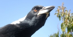


Magpies can Form Friendships with People – Here's How
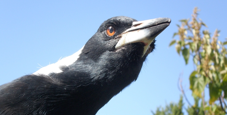
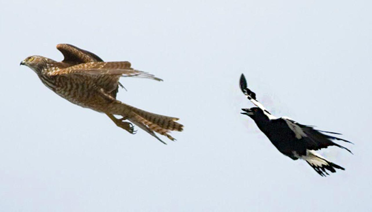
Can one form a friendship with a magpie – even when adult males are protecting their nests during the swooping season? The short answer is: 'Yes, one can' - although science has just begun to provide feasible explanations for friendship in animals, let alone for cross-species friendships between humans and wild birds.
Ravens and magpies are known to form powerful allegiances among themselves. In fact, Australia is thought to be a hotspot for cooperative behaviour in birds worldwide. They like to stick together with family and mates, in the good Australian way.
Of course, many bird species may readily come to a feeding table and become tame enough to take food from our hand, but this isn’t really 'friendship'. However, there is evidence that, remarkably, free-living magpies can forge lasting relationships with people, even without depending on us for food or shelter.
When magpies are permanently ensconced on human property, they are also far less likely to swoop the people who live there. Over 80% of all successfully breeding magpies live near human houses, which means the vast majority of people, in fact, never get swooped. And since magpies can live between 25 and 30 years and are territorial, they can develop lifelong friendships with humans. This bond can extend to trusting certain people around their offspring.
A key reason why friendships with magpies are possible is that we now know that magpies are able to recognise and remember individual human faces for many years. They can learn which nearby humans do not constitute a risk. They will remember someone who was good to them; equally, they remember negative encounters.
Why become friends?
Magpies that actively form friendships with people make this investment (from their point of view) for good reason. Properties suitable for magpies are hard to come by and the competition is fierce. Most magpies will not secure a territory – let alone breed – until they are at least five years old. In fact, only about 14% of adult magpies ever succeed in breeding. And based on extensive magpie population research conducted by R. Carrick in the 1970s, even if they breed successfully every single year, they may successfully raise only seven to eleven chicks to adulthood and breeding in a lifetime. There is a lot at stake with every magpie clutch.
Read more: Bird-brained and brilliant: Australia’s avians are smarter than you think
The difference between simply not swooping someone and a real friendship manifests in several ways. When magpies have formed an attachment they will often show their trust, for example, by formally introducing their offspring. They may allow their chicks to play near people, not fly away when a resident human is approaching, and actually approach or roost near a human.
In rare cases, they may even join in human activity. For example, magpies have helped me garden by walking in parallel to my weeding activity and displacing soil as I did. One magpie always perched on my kitchen window sill, looking in and watching my every move.
On one extraordinary occasion, an adult female magpie gingerly entered my house on foot, and hopped over to my desk where I was sitting. She watched me type on the keyboard and even looked at the screen. I had to get up to take a phone call and when I returned, the magpie had taken up a position at my keyboard, pecked the keys gently and then looked at the 'results' on screen.
The bird was curious about everything I did. She also wanted to play with me and found my shoelaces particularly attractive, pulling them and then running away a little only to return for another go.
Importantly, it was the bird (not hand-raised but a free-living adult female) that had begun to take the initiative and had chosen to socially interact and such behaviour, as research has shown particularly in primates, is affiliative and part of the basis of social bonds and friendships.
Risky business
If magpies can be so good with humans how can one explain their swooping at people (even if it is only for a few weeks in the year)? It’s worth bearing in mind that swooping magpies (invariably males on guard duty) do not act in aggression or anger but as nest defenders. The strategy they choose is based on risk assessment.
A risk is posed by someone who is unknown and was not present at the time of nest building, which unfortunately is often the case in public places and parks. That person is then classified as a territorial intruder and thus a potential risk to its brood. At this point the male guarding the brooding female is obliged to perform a warning swoop, literally asking a person to step away from the nest area.
If warnings are ignored, the adult male may try to conduct a near contact swoop aimed at the head (the magpie can break its own neck if it makes contact, so it is a strategy of last resort only). Magpie swooping is generally a defensive action taken when someone unknown approaches who the magpie believes intends harm. It is not an arbitrary attack.
When I was swooped for the first time in a public place I slowly walked over to the other side of the road. Importantly, I allowed the male to study my face and appearance from a safe distance so he could remember me in future, a useful strategy since we now know that magpies remember human faces. Taking a piece of mince or taking a wide berth around the magpies nest may eventually convince the nervous magpie that he does not need to deter this individual anymore because she or he poses little or no risk, and who knows, may even become a friend in future.
A sure way of escalating conflict is to fence them with an umbrella or any other device, or to run away at high speed. This human approach may well confirm for the magpie that the person concerned is dangerous and needs to be fought with every available strategy.
![]() In dealing with magpies, as in global politics, de-escalating a perceived conflict is usually the best strategy.
In dealing with magpies, as in global politics, de-escalating a perceived conflict is usually the best strategy.
Gisela Kaplan, Professor of Animal Behaviour, University of New England
This article was originally published on The Conversation. Read the original article.
Planning Debacle of IBM Site in West Pennant Hills
 Back in the 1980s IBM built an office complex at 55 Coonara Road, West Pennant Hills. The building design won several architecture awards. The office environment is idyllic. The buildings are surrounded by an extensive tree canopy including Blue Gum High Forest that is now 25 to 30 years old. IBM worked with the National Trust to establish a bush regeneration plan and 40,000 native plants were planted.
IBM sold the land to property developer Mirvac in August 2010. The buildings were renovated in 2011 and IBM is still a tenant but Mirvac has set out to develop the site to take advantage of the site’s location near the Cherrybrook Metro development precinct.
The total site covers about 28 hectares. It is next to Cumberland State Forest. The IBM buildings are on the northern western part of the site. The southern part contains bushland that is at least 70 years old, some having not ever been cleared but may have been logged in the early days as happened in most of Sydney’s original forests. A large part of this area contains critically endangered Blue Gum High Forest or endangered Sydney Turpentine Ironbark Forest. The forest is Powerful Owl habitat plus there is known habitat for the threatened Dural land snail and two vulnerable microbat species. There hasn’t been a full ecological assessment of the whole site.
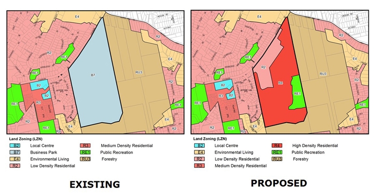
Mirvac originally proposed to build 1269 dwellings in the area of the old IBM buildings but negotiations with the Hills Shire Council cut this back to 600 dwellings. The whole site including the southern forest is currently zoned as B7, business park. The proposal was considered by council in July. They decided to submit the plan to the Department of Planning for a Gateway Determination of an amendment to the zoning of the site.
Council proposed that the redevelopment area be zoned as R2 medium density, an existing cleared area be RE1 but the remainder, the high quality bushland area, be zoned as R4 high density residential. Importantly, there was going to be no environmental protection for this area containing a significant area of critically endangered forest.
Once it became known all the local community groups formed a coalition called Forest in Danger to oppose the prospect of this magnificent bushland being covered in high rise apartments. In fact the immediate medium density development will also destroy high quality vegetation. There are several other reasons for rejecting the plans that are listed below.
The basic problem is that the reports from Mirvac and council focused on the development site. There was very little information on the rest of the site and therefore no consideration of fundamental issues with the potential loss of biodiversity.
Not only that, the Department of Planning provided a rezoning review briefing report on the site. It noted that A Plan for Growing Sydney does not identify this land for residential purposes and there is no alternative strategy endorsed by council regarding the site’s future use. So, on top of the issues with loss of the forest there is no justification for the rezoning consistent with a strategic plan for additional housing, employment, retail or other business development and transport infrastructure. Traffic on nearby Castle Hill Road is already severely congested. The claims of proximity to Cherrybrook Metro Station are questionable as the walk is more than the desirable criterion of 800 m from the northern part of the site but more like 2 km from the southern part up a steep hill.
The R4 zoning is proposed for the southern area even though no proper assessment has been made of bushfire management, stormwater and flood prone land on top of the loss of biodiversity. Once the zoning is changed the whole forest would be in danger of destruction.
Gateway Determination
Lots of letters of objection have been sent to the Department of Planning and the Hills Council. The Gateway Determination was made on 31 October. The Department of Planning advised council to give proper consideration to appropriate zoning including environmental zones.
One concern with the determination is the suggestion that there could be an area allocated as a forestry zone. The strange aspect of the determination is that the department is allowing council to conduct consultation with the community on an amended plan before the department has reviewed it. Surely the department should consider the new allocation of zoning in light of the overall strategy for north west development so the community has certainty.
Another community forum was held on 18 November in Cherrybrook. Over 250 people attended and heard a detailed description of the flawed process undertaken so far and of what would be lost if the current zoning were to go ahead. The rezoning plan is opposed by several new councillors on council including the mayor and nearby Hornsby Council.
Summary of Arguments against the Proposal
STEP is strongly opposed to any loss of Blue Gum High Forest (critically endangered) and Sydney Turpentine Ironbark Forest (endangered) no matter how small, as these tiny incremental losses will inevitably lead to their extinction in the long term. This applies to the potential loss in the medium density development area as well as the large areas of these forests in the southern forested areas where the R4 zoning is proposed.
Current Proposal for Medium Density Housing (First Part of the Development)
Asset Protection Zones
The proposed asset protection zone around the development area impacts 0.18 ha of Blue Gum High Forest up to 71 years old, and 0.5 ha of Blue Gum High Forest and Sydney Turpentine Ironbark Forest natural remnant bushland. The NSW Rural Fire Service discourages development in bush fire affected areas that would incur significant environmental costs. There are significant environmental constraints here which are not overcome in this proposal.
Impact of Internal Roads
Currently planned internal roads impact Blue Gum High Forest with a loss of 300 m2 proposed.
Powerful Owl
The impact on Powerful Owl residents would be substantial. These owls need not just peaceful nesting trees and roosting habitat but large areas of trees in which to hunt. Substantial numbers of trees 25 to 30 years old would be cleared for this development and hence reduce hunting opportunities and the probability of owl survival.
Fragmentation of the Forests
The Cumberland State Forest and 55 Coonara Avenue currently form an area of over 60 ha of bushland from the ridge, down to gully habitat. The development and asset protection zone reduce the area of trees and forests and the asset protection zone increases the separation of this site from the Cumberland State Forest. This fragmentation reduces the value of this comparatively large area of remaining Sydney Turpentine Ironbark Forest.
Recommendations
We recommend that the application is rejected in its entirety due to its impact on the environment, particularly Blue Gum High Forest, Sydney Turpentine Ironbark Forest and Powerful Owls. Any possible future development must not have any impact on these endangered communities species and Powerful Owls.
The bulk of this land should at the very least be rezoned to E2 for environmental conservation. Ideally the site should be added to the adjacent Cumberland State Forest and conserved in perpetuity.
More Information
For the latest information on the campaign against the development and more detail on issues with the proposal go to www.forestindanger.org.au.
Email or write to:
- Minister for Planning, Anthony Roberts This email address is being protected from spambots. You need JavaScript enabled to view it.
- Member for Bauklham Hills, David Elliot This email address is being protected from spambots. You need JavaScript enabled to view it.
- Director Sydney West Planning This email address is being protected from spambots. You need JavaScript enabled to view it.
- Hill Shire Council Mayor Michelle Byrne This email address is being protected from spambots. You need JavaScript enabled to view it.
Our National Parks Need Protection
Another round of ‘restructuring’ has hit our national parks staff. More managers and rangers with superb skills and experience have to reapply for the jobs they have been performing under extreme pressure from previous cutbacks. It is clear that the Department of Planning and Environment does not value ecological skills any more. Nobody knows what the selection criteria will be for the new positions – tourism experience perhaps?
A group of former NPWS employees has formed a group called Park Watch to monitor the impacts the cuts are having. There is a forum on 30 November at NSW Parliament House to discuss the future of national parks.
Carolyn Pettigrew, one of the members of Park Watch presented a talk on ABC Radio National’s program Ockham’s Razor. Here is a transcript reprinted with permission from Carolyn.
Introduction from Robyn Williams
Conservation. It's a word that sounds a bit like conservative, doesn't it? But the conventional wisdom these days is that environmental matters are green - green in philosophy and probably green in politics. But this didn't used to be the case. When I went to my first meeting of the Australian Conservation Foundation in the early 70s, the president was not Peter Garrett, who would have been about 20 at the time, but Prince Philip. And back then the president of the United States, Richard Nixon, he of tainted memory, was behind some of the most far-reaching environmental initiatives which in 2017 are steadily being dismantled by Donald Trump. So what about our own national parks, where did they come from, and why should we care.
Carolyn Pettigrew
2017 is the 50th anniversary of NSW National Parks and Wildlife Service. Born out of the Land Department's Parks and Reserves division and the NSW Fauna Protection Panel, it was largely the brain child of a Liberal politician, the Hon Tom Lewis.
The service's 50th birthday is a cause for celebration - as some of its achievements are really outstanding. The declaration of the Border Ranges and Blue Mountains National Parks as world heritage regions must be among the highlights, signifying the importance of these areas not only to Australia but the world.
National parks and reserves represent the highest level of protection available to our unique fauna and flora, and are vital to their survival. They are becoming even more important as threatening processes outside the reserve system put pressure on our remaining natural ecosystems. Unfortunately, the ability of our national parks and reserves to protect this natural heritage is being eroded - both within and outside the parks.
The National State of the Environment Report 2016 states that the threatening pressures on biodiversity include land clearing, invasive species, the fragmentation of habitat, changed fire regimes, and climate change.
Most of these exert a high or very high pressure on biodiversity, and are worsening. The cumulative and interacting effects of these pressures amplify the threat to biodiversity in Australia.
Excessive land clearing poses a particular threat.
It certainly surprised me to learn that Australia has a land clearing rate similar to Brazil and Indonesia. Queensland alone has cleared more than one million hectares of woodland in the past 10 years, and New South Wales looks set to follow suit.
In 2013 the NSW Government developed a program called Save our Species (SOS). This program provided the framework for identifying threatened species and what was needed to ensure the survival of threatened species for the next 100 years. It made sense of all the efforts being made by various environmental groups, communities, academic institutions, and the government to halt the loss of species. SOS identifies where the gaps are and ranks the importance of the work needed. Importantly, there is some funding available for groups to carry out the work required.
Backing the SOS plan was legislation designed to protect biodiversity and to halt the loss of habitat on land outside the reserve system. This system of protecting against land clearing wasn’t perfect - but it was crucial to making the SOS plan work.
Unfortunately, it was met with hostile opposition by powerful agri-business and political voices, so instead of modifying the rules the NSW government threw out the legislation.
What we're left with is legislation which is little more than a self-assessment process. If you read what a landholder can clear on their land it is virtually everything.
The loss of habitat that allowed some species to hang on and connect with nearby habitat will be devastating. The remnant koala population in northern NSW is a case in point - trees on private land and roadsides are being cleared at an alarming rate. These koalas seem destined to disappear.
Local citizen scientists, conservation groups like Birdlife Australia and the Australian Wildlife Conservancy and concerned landholders are all doing a magnificent job despite the odds but what are our governments doing?
Which brings me back to national parks and reserves. In NSW about 9% of the total land area is reserves of one kind or another. Not all threatened species depend on national parks and reserves but a hell of a lot most certainly do.
There are huge gaps in what we know about threatened species, their location, habitat requirements and distribution.
Very broadly, threatened species management in national parks and reserves fall into two categories – site-managed species like the Mallee Fowl and landscape managed species such as the threatened Powerful Owl. If I take the latter example, Powerful Owls are top predators. They feed mostly on arboreal mammals – possums of various kinds. That means they need tall forests with lots of hollow trees which also meet the requirements of other threatened species such as the yellow-bellied glider. So the land is managed at the landscape and ecological community level to cover as many species as possible.
Threatened plants and animals are identified in plans of management for a reserve. But there are a multitude of management objectives for each reserve. Making sense of the different priorities, the capital works and the human resource deployment needs professional park managers like graduate rangers and specialists.
You might think we have an army of these people but we don’t. Despite the fact that these are the folk who provide the intellectual grunt in reserve management their numbers are dwindling due to cut after cut. Every time you hear those words efficiency drive or restructure - think job losses. NSW has lost 30% of rangers over the past 10 years and more than 200 field officers, administration, specialist project and support staff.
Rangers and field officers are the men and women who do the hard lifting in our parks and reserves. They carry out fire-fighting, whale rescuing, walking track maintenance, weed control programs - to name just a few of their tasks. Loss of the expert knowledge of graduate rangers and specialists is tragic. These are the people who plan and implement the strategies that conserve representative ecosystems and the habitat of rapidly diminishing native Australian species.
There is even a move in NSW to classify all national parks staff as clerks, lower entry level qualifications and put in place hard progression barriers. Rangers and specialist jobs will no longer specify a degree as an essential job requirement. Of course, graduates could still apply for these jobs, but the career opportunities offered to them will be severely limited due to the hard promotional barriers.
But what has all this got to do with science? Two major impact pressures on threatened species in national parks and reserves are fire management and pest control.
Taking fire management as the example, the media and the public tend to regard the rural fire services as the ‘heroes’ which they definitely are. The problem is fire research and fire mitigation management is at least as important as fire-fighting, but it isn’t as sexy as lots of big red trucks. What is important to remember is that national parks and reserves have been created to conserve representative ecosystems, and fire regimes are biodiversity ‘drivers’ within most of our natural ecosystems. The importance of fire can be best illustrated by the fact that the absence of certain fire frequencies and intensities may be just as detrimental to biodiversity as a regime of fires that are too frequent or too intense.
Fire management, including fire mitigation must be based on good science, not political imperatives. Fire management must also encompass a complete appreciation of the other threatening processes and activities that mitigate against species survival such as habitat loss, soil erosion, water quality and carbon sequestration. That is why national park services throughout the country need a qualified, well-resourced and equipped ranger force to undertake assessment, management and implementation of fire management, soil conservation, weed management, visitor facilities, and development. It requires a holistic view, not simply a view of hazard reduction and asset protection.
We can't expect our parks and reserves to remain in a heathy state if jobs and knowledgeable people keep disappearing.
I believe the rot starts at the top. Increasingly we have ministers for the environment who wouldn’t know a wombat from a woylie. Maybe that’s not important but the same ministers don’t seem to have any regard for the moral responsibility they have as guardians of the natural national estate.
In the recent NSW by-election for the seat of Murray, the Nationals candidate was elected. His primary policy was to log Murray Valley National Park, and if that failed, instigate a land-tenure swap. There simply aren't many areas of river red gum forest left, so a tenure swap is a ridiculous suggestion. If that's not bad enough, the NSW timber industry and their lobbyists are running a campaign, Beyond Tenure, which is a thinly disguised attempt to allow logging in our national parks.
I believe that all of us, citizen scientists, conservation bodies, academics, concerned land holders - need to keep reminding politicians that we value our national parks and reserves. Our national parks and reserves are the genetic gene banks of our precious Australian flora and fauna and we shouldn’t lose them by political ignorance and neglect.
Extraordinary Loss of Trees in Hornsby

Hornsby Council weakened its Tree Preservation Order (TPO) in 2011 so that only tree species indigenous to the area (about 100 species) are protected apart from heritage conservation areas where all trees (as defined in the TPO) are protected. In June 2014 we wrote about a survey of tree cover that revealed that about 2% of the area was lost during 2011-13, about 27% more than the previous 2 years (see STEP Matters, Issue 176, p3). This data was recorded before the 10/50 bushfire clearing regulations came into force plus the tremendous number of new apartment approvals and infrastructure development.
Now the new mayor, Philip Ruddock has expressed shock at the latest data showing that 15,000 trees were cleared in the last year which equates to 60 hectares of canopy. The council has commissioned a report outlining options to strengthen tree protection measures to re-establish Hornsby’s tree canopy.
It is hard to get clear data of the tree cover in Hornsby because about two-thirds of the Shire’s tree cover is in national parks and reserves. Some reports do not make it clear whether they were looking a percentage loss of tree canopy in the total area or just urban areas.
In 2014, 202020 Vision (a collaboration of horticultural companies formed with the objective of making our urban areas 20% greener by 2020) published the Where Are All The Trees? report based on research undertaken by the Institute of Sustainable Futures at UTS Sydney. This was the first time that urban canopy had been benchmarked nationally.
This year, RMIT and Clean Air and Urban Landscapes Hub researchers published a follow-up report called, Where Should All the Trees Go? that compares canopy levels, overlays urban heat and socio-economic data, and provides an overall vulnerability indicator.
This report showed that Hornsby had lost 5% of urban tree canopy over the 5 years to 2016. And the latest report is that over 2016-17 the loss was 3%. At the current rate there will be very little urban tree cover left in 30 years’ time.
Loss in Pittwater (13%) and Warringah (7%) over the 5 years was even worse.
Dr Peter Davies pointed out in his talk at our AGM that there are many factors that will make it harder to increase urban tree cover in the future, the main one being the reduction in housing block sizes. The new block sizes of as little as 250 m2 leave no room for a backyard let alone trees. So the main responsibility for tree canopy will fall on local authorities.
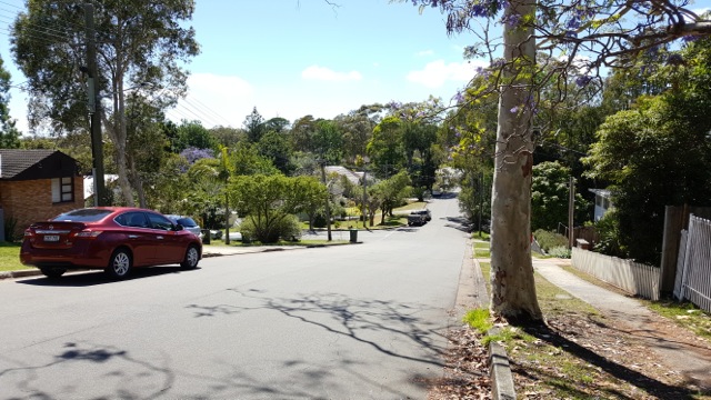
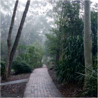
Looking down Harwood Avenue, Mt Ku-ring-gai. Before the change to the TPO in 2011 and the introduction of 10/50 in 2015 it was impossible to see the boundary of Ku-ring-gai Chase National Park. Now the suburban area is stark against the wall of trees in the national park.
Paper Maps are Good Friends
Robin Buchanan reminds us that maps on smart phones have limitations.
‘Just another lost bushwalker’ said the weary voice of the policeman at Hornsby Police Station when I rang to ask why there was a helicopter searching the bush below our house. For those who know the areas of Lane Cove, Berowra and Ku-ring-gai National Parks well it is hard to imagine becoming lost but it happens very regularly and even more so in larger national parks.
Too many people rely on smart phones. These are really useful but they have three disadvantages. They run out of batteries quickly if they are used for navigation for too long, they don’t show landform and they can’t give both a detailed view of where you are at the same time as giving a broad view of the area. Hand held GPS (global positioning system) units are better as they are more rugged; the batteries are only used for the GPS and are easily replaced. They also have designated maps installed but they still suffer the same problem as phones when you zoom in and out.
Paper maps never run out of batteries and you can simultaneously see where you are and where you are going – even if it is several kilometres away. These days I tend to take a phone, GPS and paper map with me at all times as experience has taught me that they all may come in useful. The following examples illustrate how useful maps can be.
We were on a track a friend had walked many years ago but as the sun slid down in the west the track became more and more overgrown and our speed became slower and slower. The GPS told us exactly where we were but the paper map was spread out so we could accurately gauge the distance if we went back, continued on or crossed the valley to a well-established tack. It quickly became clear that forward and backwards would see us out after dark but we should make it if we crossed the valley.
On another occasion a friend decided to walk ahead but missed the turnoff to the cars. No friend when we got there! The map was spread out and his most likely positions determined. The hunt was begun. He was quickly located at one of the points and all ended happily.
I have even given away a map when it was obvious that walkers had no idea of the size of the area in which they were walking: some simple calculations were done; if it has taken x amount of time to walk as far as you have, then to reach Berowra Creek and back is going to take four times as long. That will be after dark. Why not go to a nice lookout instead? Here, have a map.
Groups can gather around a map, make collective decisions, name far mountain ranges and reminisce about walks they have done before or plan the next walk. Good group dynamics.
1:25 000 Maps
The maps that give the largest view of an area are the 1:25 000 series (every distance on the ground is divided by 25 000). These are published by the NSW Government.
Bobbin Head Information Centre in Ku-ring-gai Chase usually have stock of the maps covering local national parks.
Don’t be put off by the name of the maps; they are titled by a main feature on the map. The Hornsby map is not a map of Hornsby, Hornsby is located in the centre of the map and lots of bushland is shown on the map as well. The local national parks are covered by several maps:
- Ku-ring-gai Chase: Hornsby, Cowan, Mona Vale and Broken Bay
- Berowra Valley: Hornsby and Cowan
- Lane Cove: Hornsby and Parramatta River
- Garigal: Hornsby,Parramatta River and Mona Vale
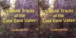
STEP and Friends of Berowra Valley
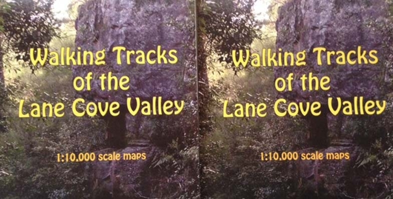
STEP’s three maps cover the Lane Cove Valley and Middle Harbour (North and South) and are printed at 1:10 000 (ground distances divided by only 10 000). They give a more detailed view of the area but are still broad enough to give you a good view of your surroundings.
The Walking Guide to Berowra Valley National Park published by the Friends of Berowra Valley is printed at a scale of approximately 1:18 000.
WildWalks
WildWalks produces detailed maps and descriptions of particular walks. You can download pdfs but printing them is safest. They are best used in conjunction with maps of the area such as the ones described above.
Great North Walk
The Great North Walk, through Lane Cove Valley and Berowra Valley is covered by The Great North Walk Companion.
Having Trouble Reading Maps?
If you have trouble reading paper maps and would like an introductory course, please let us know! Don’t be ‘just another lost bushwalker’.
New Steps on STEP Track
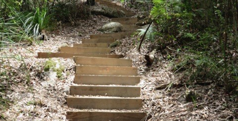
STEP applied for an Environmental Small Grant from Ku-ring-gai Council last year for further repairs to the STEP Track near the Lane Cove River. Previous repairs were carried out near Kingsford Avenue. The repairs have now been completed so the walk up or down the steep section is now much safer.
Annual Report for the Year to October 2017

The NSW Government forecasts of population growth for metropolitan Sydney over the next 20 years are frightening, at 37% or 1.7 million. Planning systems have been put in place and legislation has been enacted to facilitate development that claim to maintain a ‘liveable’ city but we have serious doubts this can be achieved given the attitude of the current government to the environment. Legislation like the biodiversity offsetting provisions that came into force in August are aimed a facilitating development, not protecting bushland.
STEP and all the community groups that are concerned about the impending loss of native vegetation and suburban trees will need to fight to try to keep Sydney’s unique bushland and wildlife.
This annual report gives a brief summary of our activities over the past year. More details are in the issues of our newsletter, STEP Matters and on our website.
Committee
Several of STEP’s committee members have knowledge of our environment that makes an essential contribution to our work in making submissions and liaising with local councils. They have been doing this voluntary work for many years. There comes a time when dedicated people need to give up these responsibilities.
Andrew Little has decided not to stand for the committee next year. During his period on the committee since 2005 he has provided detailed analysis of local soils, vegetation and bushland restoration issues that has formed the basis of our submissions. He also has detailed knowledge of planning laws and has led and organised our walks program. He will be hard to replace.
Our committee members are being stretched by the volume of developments and changes in legislation. We need more resources to continue our work. If you would like to volunteer or know a potential candidate please let us know. Help with a one-off issue or particular aspects of our work is very welcome.
Publications
The updated version of the Lane Cove Valley map was published late in 2016 and has been well received. The waterproof paper is proving to be much more resilient.
There continues to be steady demand for our maps that are appreciated by those who want to plan a walk by looking at the ‘big picture’ and identify options for different routes.
Sales of books has slowed over recent years in line with the general reduction in interest in larger format books. The Field Guide to the Lane Cove Valley remains the most comprehensive source of information about this beautiful part of Sydney. The Weather Book is useful for all people preparing to venture into the outdoors and simply a great source of information.
Accounts
Our operations broke even over the year so that membership fees and interest income cover our core activities. The use of email to distribute our newsletters has reduced costs significantly.
Total assets reduced due to accounting adjustments writing off the cost of our web system update and donations were made to some other environmental organisations with similar objectives to ours.
We appreciate the pro bono work done by Allan Donald, chartered accountant, who completed the audit of STEP’s financial statements.
Environment Protection Fund
We have maintained the Environment Protection Fund which provides deductible gift recipient status for donations that support STEP’s environmental objectives. We received a total of $349 in donations in the past financial year. The government is still threatening to impose more strict conditions on environment NGOs if they are to maintain entitlement to tax deductibility status of donations.
We have not made any payments out of the Environment Protection Fund for the past two years but we are currently developing a scheme for funding a student research project
Electronic Media
Our website has been working smoothly. Helen Wortham does a sterling job in keeping the website up-to-date and setting up the newsletter on the main page in an attractive and easy to use format so that individual stories can be selected or the whole newsletter can be downloaded.
Trish Lynch and John Burke continue to alert readers to current issues and events through Facebook and Twitter. Trish and John have established links with many like-minded people and organisations. Social media does receive a lot of bad publicity but careful use does facilitate valuable information sharing.
Education
We support the Young Scientist Awards run by the Science Teachers’ Association of NSW with a prize in the environmental sustainability category. The winner of the STEP prize this year investigated the design of nest boxes for sugar gliders.
We also supported the Children’s Threatened Species Art Competition. The primary school children produced some fabulous paintings.
Talks
We organised public talks over the past year on paleoclimatology, environment management in Hornsby, UNESCO World Heritage, the Hawkesbury River and the geology of Sydney Harbour.
Walks
Our walks program was disrupted by wet weather with two walks having to be postponed. Walks were held in the local area and on the Central Coast.
The walks aim to be educational and to encourage new walkers so most walks are not physically challenging. We thank Andrew Little and John Martyn for organising and leading walks this past year. If you have a request for a walk please let us know.
Newsletter
Our newsletter, STEP Matters, is our main means of communicating events, our activities and current issues. We also include other articles with an environmental angle that will be of interest to members. The newsletter is also sent to local councillors and politicians. We welcome alerts from our members of local events and developments and, of course, feedback on articles is always welcome.
Administration Matters
Attendees at the AGM will be asked to approve a major rewrite of our constitution so that it is consistent with the model rules developed by the Department of Fair Trading. We have taken the opportunity to amend our objectives. We continue to focus on conservation of bushland but the defined area of interest is expanded to cover northern Sydney rather than our local area. This reflects the fact that threats are sourced more from broader state issues rather than local government.
We thank Jan Newby for her help in creating the new draft.
Anniversaries
STEP was established in 1978 so 2018 is our 40th anniversary year. We are planning a celebration and publication of a historical report that is being prepared by Graeme Aplin.
It is 10 years since the Blue Gum High Forest Group, a local coalition of groups and individuals, including STEP, was successful in increasing the protection of a significant area of Blue Gum High Forest in St Ives. A number of walks and talks have been organised by FOKE during the year to celebrate this achievement.
Young Scientist Award 2017

STEP continues to sponsor an award for a project about an environmental issue under the Science Teachers’ Association Young Scientist Awards.
It was a difficult decision this year with some innovative and well thought out projects. The winner was Evette Khaziran, year 10, from Redeemer Baptist School, North Parramatta. Her project on the use of nest boxes by sugar gliders was the nearest to STEP's urban bushland focus and philosophy. Not only that, the work was well thought out and innovative with patient field observation and an outcome that could be applied to bushland areas all round metropolitan Sydney and beyond.
Threatened Species Children’s Art Competition

 This year, for the first time, STEP supported a great initiative organised by Forestmedia, an organisation that is aiming to increase community awareness of the plight of our threatened species and help to develop the next generation of environmental leaders.
Long-time STEP member and artist, Yvonne Langshaw, helped judge the winners which were announced on 7 September, Threatened Species Day, at NSW Parliament House.
The competition was very well organised and a great success. The fabulous entries were displayed in Surry Hills, the Botanic Gardens and Canberra.
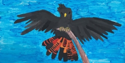
Jake Ferguson won best written work for the summary below:
When I think of a Corrobboree I don't think of a frog. I think of dancing around on the land. But I guess that’s what a frog does. So I chose this frog because it’s native to our land and it has bright yellow Australian colours of our land. Australia's Southern Tablelands and waterways are very important to the life of this frog. Let’s look after them so the frog can keep dancing.

Lord Howe Island Rodent Eradication to go Ahead
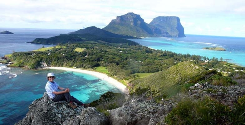
We recently wrote about the exhaustive research, economic analysis and consultation that has been undertaken into a plan to eradicate rats and mice from Lord Howe Island. At last it has been decided to go ahead.
The project will distribute rodenticide (brodifacoum) in cereal-based pellets via helicopter in the uninhabited parts of the island and via hand broadcast and bait stations in the settlement area in winter 2018 (June or July).
Eradicating invasive species from Australian islands has long been recognised as providing immense long-term benefits. It will be a complex operation that requires extensive cooperation but if successful will allow the island’s unique wildlife to flourish and make Lord Howe Island an even more exceptional place to visit.