
Newsletter blog
Children categories
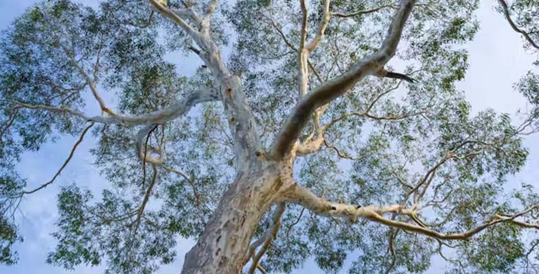
Stopping the destruction of NSW’s native forests is urgent
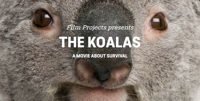
Please go and see the documentary The Koalas to get a graphic view of the ridiculous situation in NSW where koala habitat destruction is being sanctioned by the government and our planning laws. It is not only koala habitat under threat, native forests all over the state that are essential for our welfare are still being destroyed. There are screenings of the film in many locations.
For many years conservation groups have been attempting to make the government accept the reality that the native forestry industry cannot continue to destroy our biodiversity, wildlife habitats and carbon sinks. Victoria and WA have finally ceased logging in native forests and have initiated transition plans for the forestry industry. However, all along the coast of NSW, state forestry operations are continuing and they are flouting the regulations under the Regional Forestry Agreements that are intended to provide protection of the biodiversity of these forests.
Glider populations ignored
It is not only koalas under threat. The Forestry Corporation of NSW is flouting regulations by failing to do proper surveys of wildlife to ensure they avoid cutting down habitat trees. Earlier this year South East Forest Rescue published evidence that Forestry has failed to comply with the most basic of regulations – to survey for the nocturnal greater gliders at the time when they are emerging from their dens.
The Environment Protection Authority, the body meant to be enforcing these regulations, has refused to prosecute or extend stop work orders in response to this clear violation of the law. Instead, they have weakened the regulations even further. The new requirements have significantly reduced when and where Forestry must survey glider dens during the periods they are active.
Logging of koalas’ forests accelerated
Our koalas are now declared an endangered species with a prediction that they will be extinct in the wild by 2050 if current habitat destruction continues.
The Minns government made an election promise to create the Great Koala National Park in the north-east, an area that would contain one-fifth of the state’s koala population. But the government is stonewalling on putting this into action. It has established a long-winded process to determine the boundaries of the park leaving most of the area subject to ongoing intense logging by Forestry in the meantime.
Based on Forestry’s own maps as at 25 June 2024, of the 20 active logging operations on the north coast from the Hunter to the Queensland border, more than half were in the Great Koala National Park footprint. That’s despite the proposed park area containing just one-fifth of state forests in the region. Dalian Pugh from North East Forest Alliance (NEFA) said:
The Minns Government is allowing the state owned logging company to target the proposed park to take as many trees as they can, degrading the proposed park before it’s even established.
Forestry’s planning portal shows the forest compartments on the chopping block before the Great Koala National Park boundaries are finalised.
The NCC has developed an interactive map showing past and planned logging. Their analysis shows that up to 19,000 hectares of forest in the proposed Great Koala National Park is at risk of destruction by Forestry before April next year.
This situation is outrageous. Taxpayers are paying for this environmental destruction. The public native forest hardwood division of Forestry is also costing millions to keep it afloat. It made just $400,000 profit in 2019–20, and in 2020–21 it ran at a loss of $20 million. Forestry is predicted to lose $15 million a year between 2022 and 2024.
Until now legal action has been unsuccessful
Legal action by citizen groups against Forestry operations has been limited by the existence of the Regional Forestry Agreements as they bypass normal federal environmental scrutiny. This situation may have changed when in November 2023, the Land and Environment Court rejected that position when a case brought by NEFA, with the help of the EDO, was successful.
NEFA lodged an application for an urgent injunction to stop Forestry logging vital koala habitat in two state forests in north-east NSW. While NEFA was not ultimately successful, the court confirmed for the first time that the Forestry Act does not prevent persons with a special interest from taking legal action over forestry operations, including disputing logging approvals.
This decision has emboldened the South East Forest Rescue to sue Forestry over their inadequate protection of glider populations referred to above.
Sydney’s koalas are also threatened
Lendlease is currently developing 3,300 homes on the Gilead Estate, south-west of Sydney near Campbelltown. Their website claims that:
Our proposal prioritises areas for environmental conservation upfront providing a unique opportunity to improve biodiversity and conservation outcomes throughout the life of the project and into the future.
The Planning Panel that assessed the development imposed a condition for a wildlife corridor along Menangle Creek that the Chief Scientist advised should be at least 425 m wide in order to facilitate movement between the Georges River and bushland along the Nepean River and underpasses under busy Appin Road. Most of the clearing has occurred without the underpasses being built and the corridor is less than the required width.
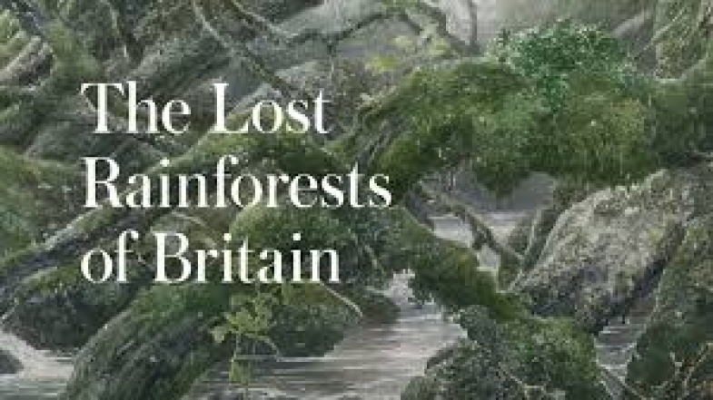
Book review: The Lost Rainforests of Britain
Rainforests in Britain? Surely not! What have you been smoking? Well, please buy and read this book and blow your mind in other ways – on some astonishing facts collated by a sharp and inquisitive mind. This book will appeal especially to anybody with British or European links or interests, including ex-Poms like my wife and I who grew up in the manufactured English landscape and hardly thought otherwise that this wasn't how it had always been.
The word ‘rainforest’ usually evokes images of the Amazon Basin, or North Queensland's tropical rainforests, though it hopefully may also conjure images of our local coachwood canyons and valleys, or of the Antarctic Beech forests of Barrington Tops or Western Tasmania. The latter are temperate rainforests of course but they're just as much true rainforests. So surely forests growing in similar climates, in rain soaked Western Britain, are likely also to be rainforests. Britain hosts different native trees to down here of course, but ‘English oaks’ and other tree species like hazel, ash and rowan grow happily festooned in lichens, mosses and ferns in rain-drenched glens and hollows in South West and North West England, Wales and Scotland.
Such forests once covered vastly bigger areas, and this is where the author has put his body and mind into tracking and collating a huge amount of current and historical data to create a full picture of survival and losses, even exploring ancient Celtic myths and legends. This has involved interacting with professional and amateur botanists and ecologists, environmentalists, local historians, landowners, governing and management authorities and the media.
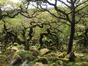
In May 2016 we made a point of visiting one of the best known rainforests or Atlantic oakwood remnants featured in his book – Wistmans Wood near Two Bridges on Dartmoor. Dartmoor has many connotations, from wild moorland and its famous prison to Arthur Conan-Doyle’s Hound of the Baskervilles. However it seems it wasn’t always like today – its open granite terrain of 400 to 600 m elevation was once extensively forested. Wistmans is a gentle 2 km walk from Two Bridges Hotel (nice place to stay) and is classic rainforest, absolutely, but just a surviving remnant of only 3.2 hectares. Look at the top picture: it might appear straight out of Tolkien but they’re actually pedunculate oaks, Quercus robur, the same English oak of Sherwood Forest and tall ships fame, but gnarled and supressed by the bleak Dartmoor climate – though richly festooned by rainforest mosses and lichens.
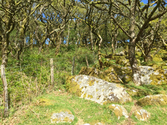
The heart of Wistmans is fenced in, so look closely at the bottom picture – at the vegetation contrast on either side of the boundary fence. This striking difference is largely down to sheep grazing! The trees outside the fence can’t propagate because sheep eat the seedlings and saplings – then the parent trees eventually die and the rainforest retreats! Shrubsole highlights this, and that of deer grazing (deer, native and introduced, are out of control) as one of the most damaging causes of rainforest decline in Britain.
Clearing of forest by man going back past the Bronze Age is even bigger of course, but there are many modern man-made scourges. Rhododendrons, highlighted by the author, are widely planted, some say beautiful in flower, but highly invasive to rainforest – seeding, layering and suckering to create dense, dark, impenetrable thickets suppressing all other vegetation. Scottish landowners (many are actually wealthy English ‘pseudo-lairds’) have planted them widely as shelter for their precious grouse (which they then shoot and call it sport).
So why review this book? Britain has a very different landscape and flora to down this way. But domestic grazing by stock is hugely damaging to natural vegetation here too. So are invasive plants – not rhododendrons but multiple other nasty species. So what’s the big deal with rainforests? Well it isn’t just cutting and burning the Amazon – rainforest loss is a huge issue everywhere, all the more so given climate change. This Sunday Times best seller may well be one of the most important works on British ecology ever written, and it reflects and stimulates thinking on rainforest status everywhere. And it has strong messages for anywhere that European (or Asian) style ‘fell, clear and farm’ land management has been adopted or imposed.
Guy Shrubsole, William Collins, 2023
Paperback, 326 ppReview by John Martyn
The Lost Rainforests of Britain won The Wainwright Prize for Writing on Conservation in 2023 and was shortlisted for the Richard Jeffries Award in 2022. It was also the Sunday Times Science Book of the Year for 2022.
National Tree Day

National Tree Day is on Sunday 28 July. It was co-founded by Planet Ark in 1996 and it has since had more than 5 million people participate and plant over 27 million native trees and shrubs. National Tree Day is Australia’s biggest community tree-planting and nature care event.
Tunks Hill, Lane Cove National Park, 10 am to 2 pm
Tunks Hill is just off Riverside Drive (accessed via Delhi Road or Ryde Road). It is a flat easily accessible site with picnic tables and toilets.
The planting will help contribute to screening between the park and the development on the Eden Gardens site. There is still no news on the outcome of the Land and Environment Court case about the proposal to build an 18 storey commercial tower on the site.
The organiser, Friends of Lane Cove National Park, will provide a delicious sausage sizzle and refreshments.
If you are able to help with catering or planting contact This email address is being protected from spambots. You need JavaScript enabled to view it. or register here.
St Ives Showground, 10 am to 1 pm
Ku-ring-gai Council will oversee the planting of trees, shrubs, groundcovers, grasses and vines to expand the endangered Duffys Forest ecological community. Many areas of Duffys Forest at the showground are badly degraded due to overuse.
Tools will be provided but please bring gloves and wear closed shoes. Free BBQ afterwards!
No booking required but you can register here.
Great Southern BioBlitz

 The Great Southern BioBlitz (GSB) is an exciting international initiative that embarks on an intensive biological survey during the vibrant spring season of the southern hemisphere. The GSB was established in 2020 during the global pandemic by a group of bioblitz enthusiasts in Australia. The goal of the GSB is to document the flora, fauna, fish and fungi of the southern hemisphere while providing a platform for groups, associations, local governments and individuals to encourage engagement in citizen science. This collaborative effort is facilitated through the online platform iNaturalist.
In the past three years, GSB has proved to be a resounding success in engaging individuals with nature and expanding their knowledge of local flora and fauna.
iNaturalist
iNaturalist is one of the world’s most popular biodiversity observation platforms. It is an online, biodiversity-focused, citizen science platform and app. Its main goal is to create a nature-based social network where like-minded users can share photos of interesting organisms they've observed. iNaturalist has evolved over time to become a valuable biodiversity database tool and is used by more than 2.5 million people globally, including amateur naturalists, museum curators, and world experts in their field.
Every observation you upload becomes a valuable data point representing an encounter with a species at a point in space and time. Anyone, anywhere in the world, with a smartphone can download the app and start posting images and descriptions of their observations. Artificial intelligence narrows down the ID first, and you can share your findings with others to confirm it. A large community of identifiers helps to confirm the species observed, after which it becomes labelled as ‘research grade’. Research grade observations are then piped into databases like the Atlas of Living Australia and the Global Biodiversity Facility where they can be used by scientists, schools and more for research.
Want to learn more about iNaturalist?
- Join the Introduction to iNaturalist workshop
- Detailed guide to iNaturalist for Australia
- Getting started guides on iNaturalist
Participate in the Great Southern Bioblitz 2024
- Join the iNaturalist community – download the iNaturalist app or upload your photos onto iNaturalist Australia. After you have signed up by entering a username and password your observations will be automatically recorded under the project for the locality where the recording occurred.
- Make nature observations from 20 to 23 September. You can upload your observations until 7 October 2024.
- Register as a Great Southern BioBlitz participant to receive project updates and a certificate at the end of the bioblitz.
- Join your local council Great Southern BioBlitz project page, see what has been observed and help identify species:
Microbats and vineyards
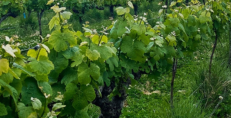
We don’t tend to associate bats with winemaking except to consider that flying foxes or fruit bats might happily eat grapes. But microbats wouldn't – they're insectivores – so I was fascinated by an article in AgJournal, a supplement published in The Weekend Australian and taken from The Weekly Times. This featured a vineyard in the Strathbogie Ranges in Victoria which is one of several involved in a research project with University of New England (UNE).
The vineyard, a significant producer of 2,500 t of grapes per year, is Fowles Wines and the business mantra of proprietor Matt Fowles is ‘to farm in nature's image’. The partnership with UNE was triggered by his observations that the vines and fruit in locations with microbat populations were thriving and healthier than those elsewhere on the property.
The UNE research is led by Dr Xenon Czenze and Dr Heidi Kolkert whose research had already established that bats play a vital role in pest control in New England vineyards. Fowles Wine has more than a dozen acoustic detectors arranged around the vineyard, a significant bat-monitoring system, and also has a partnership with Euroa Arboretum, with insectariums established to catch and monitor insect comings and goings. Not all insects are bad, and information on the good ones is also essential! All this is capped by attention to and encouragement of the native flora, from bordering bushlands and forests to grasses growing beneath the vines to cool the soil and roots.
The Secret Garden
We made only one submission in the last two months. This was in relation to a public hearing on a Ku-ring-gai Council Planning Proposal to change the classification of land at 1192 Pacific Highway, Pymble from community to operational.
This land is commonly known as the Secret Garden. It is a small block (974 m2) that contains several mature trees such as Blue Gums and Blackbutts. It is classified as Blue Gum High Forest, a critically endangered ecological community. About half the land is subject to easements for Sydney Water infrastructure. To get access one has to go down several steps that were installed for Sydney Water’s use. According to council the land is not suitable to be used as public open space.
The land itself is weed infested but could quite easily be regenerated with a native shrub layer. Apart from the steps the land is inaccessible with the railway line below and private land either side. On the northern side the apartment block residents benefit from the views over the forest in contrast to the heavy traffic of the Pacific Highway. On the southern side there is an old house that is ripe for redevelopment in line with the high density zoning.
Council argues that retaining the site as community land will be a continuing expense with little benefit to the community. If the land were to be classified as operational, council could sell the block. Its value would be realised if it could be amalgamated with the block next door and allow a larger apartment development of the old house using a floor space ratio combining both blocks. For this reason council has been keenly supporting the reclassification.
Land reclassification process
The land reclassification involves several stages. We won‘t go into the detail. The proposal has reached the stage of being considered by an independent commissioner. The commissioner has to consult affected agencies (eg Sydney Water and Transport NSW), invite public submissions and hold a public hearing. The commissioner then writes a report that is reviewed by council that then decides whether the proposal should go to the Department of Planning that will make the necessary amendment to the local environment plan.
Seventeen public submissions were received opposing the reclassification and one in favour.
Outcome of the consultation process
The commissioner’s report recommended that the proposal should not proceed for several reasons including:
- it would risk compromising Sydney Water’s access to these critical assets for maintenance;
- a development application or subdivision/ amalgamation could negatively impact the values of the site state heritage registered water reservoirs in nearby Telegraph Road (see https://en.wikipedia.org/wiki/
_1_and_No._2); - the majority of the site is mapped on the biodiversity values map, which identifies land with high biodiversity value that is particularly sensitive to impacts from development and clearing;
- the site assists with urban cooling in the vicinity due to shade from the mature trees which contributes to Ku-ring-gai’s urban tree canopy in the Urban Forest Strategy.
Commissioner’s recommendation
The commissioner recommended that the land remains in council’s ownership and as community land, and that it is ‘improved’ as a rest area and wild garden. This would ensure:
- the land is available to the whole community for informal recreation
- retention of the Sydney Water easements
- no structures are placed on the land
- the elements of the land that the local residents and community value, ie the leafy green outlook and wildlife habitat, would be retained
- minimal maintenance required by council because interested local residents could assist with maintenance
What happens next?
It is still up to council to decide whether the planning proposal for the reclassification should be submitted to the Department of Planning, but they have to consider the submissions and the commissioner’s report that concluded that it should be withdrawn.
Good news – Lourdes development rejected
The prolonged process of applications to redevelop the Lourdes Retirement Village in Stanhope Road, Lindfield (explained in (explained here) culminated in a Planning Panel hearing in December 2023. The panel rejected the proposal so the next stage was for the Minister for Planning to consider the panel’s recommendation.
It has now been announced that the minister has accepted the panel’s advice that the proposal was not appropriate because issues such as bushfire risk and ecological impacts had not been adequately addressed.
Nevertheless, the owner, Levande, still has the right to develop the land. The most telling evidence against the proposal came from Ku-ring-gai Council. The Department of Planning has acknowledged this by stating that any new proposal should only be developed in close collaboration with council to address the unacceptable risks.
Large old trees are vital for Australian birds. Their long branches and hollows can’t be replaced by saplings
When we make roads, houses or farmland, we often find large old trees in the way. Our response is often to lop off offending branches or even cut the tree down.
This is a bad idea. The more we learn about large old trees, the more we realise their fundamental importance to birds, mammals, insects, plants and other inhabitants. More than 300 species of Australian birds and mammals need large old trees to live.
Why focus on mature trees? It’s because they have many features that younger trees simply don’t have: cracks, hollows, dead branches, peeling bark and large quantities of nectar and seeds. The limbs and leaves that fall on the ground make excellent homes for many small creatures.
Our new research sheds light on the importance of such grand old trees for birds. We used lidar (scanning using lasers) to map small, medium and large tree crowns in unprecedented detail. On average, we found large old trees had 383 metres of the horizontal or dead branches preferred by birds, while medium trees had very little and young trees none. Some old trees had almost 2 kilometres of branches.
Why are branches so important?
If we think of long, overhanging branches, chances are we may think “threat”. Some large trees can drop limbs without warning, although some arborists have pointed out the threat is overstated. To reduce the risk, councils and land managers may remove the limbs of large old trees.
But if you cut down a 300-year-old river red gum, you can’t simply replace it with a sapling of the same species. It will take centuries for the sapling to take up the same ecological role as its predecessor.
In our research, we mapped more than 100,000 branches from many millions of laser samples and recorded how birds use branches through years of field observations.
When we spot a bird using a branch, we can safely infer the bird has chosen it for a reason, whether resting, socialising, feeding, hunting or nesting.
What our data shows is that not all branches are equal. Birds find it easier to perch on horizontal or slightly inclined branches. Branches with few or no leaves offer clear vantage points for birds to land, hunt or see predators. You may have noticed crows and currawongs choosing dead branches for these reasons.
As trees mature, their branches begin to grow horizontally. Some branches may die due to lightning strikes, fire, wind damage, or attacks by insects or fungi, while the rest of the tree continues living. These long-term patterns of growth, decay and random events are necessary to produce the horizontal and dead branches prized by birds. For a large eucalypt, that process can take up to 200 years.
Mapping the canopy with lasers
Until recently, it’s been hard to map the tree canopy. Traditional methods rely on researchers visually assessing this vital habitat. But we know eye observations don’t do well at capturing parts of trees such as branches.
That’s where lidar comes in. Lidar sends out laser pulses, which bounce back when they hit objects. By recording the time taken for the light to return, we can build very detailed three-dimensional models. It’s a little like echolocation, but using light rather than sound.
This laser-scanning technology has been used in the jungles of Central America to find the ruins of lost Mayan cities. But it can do much more.
In forests, lidar is now increasingly used to estimate how dense the tree cover is, and how variable. This useful data feeds into how we assess a forest’s ability to store carbon, how much timber is present, and the current fire risk. We can even use it to spot animal pathways.
To get the canopy detail we wanted, we used lidar on the ground rather than from the air, and processed the data with algorithms that can recognise and describe about 90% of branches in even the largest trees.
We mapped trees in an area near Canberra. We chose this area because it represents the plight of temperate eucalypt woodlands, which have shrunk by up to 99% since European colonisation.
What should we do?
The very things that make branches good real estate for birds can make them seem dangerous or aesthetically displeasing to us. We tend to cut dead or long, horizontal branches and leave the living or more upright ones. But for birds, this is a disaster as many cannot live without such branches.
Young trees are no substitutes for their older counterparts. Planting saplings or installing nest boxes cannot replicate the ecological value of large, mature trees.
We can live alongside large old trees. To reduce the chance of injury or worse from falling limbs, we could use exclusion zones, add artificial supports for branches, and install devices to catch or redirect falling limbs. We can also look at emergency solutions such as prosthetic hollows on younger trees or even artificial replicas of old trees.
We should preserve these trees wherever we can and aim to keep them intact with their complex crowns and dead branches. We should also make sure there is a pipeline of young and medium trees to make sure there will be old trees in the future. ![]()
Alex Holland, Researcher at Deep Design Lab and PhD Candidate at Melbourne School of Design, The University of Melbourne; Jason Thompson, Associate Professor, Faculty of Medicine and Melbourne School of Design, The University of Melbourne; Philip Gibbons, Professor, Australian National University, and Stanislav Roudavski, Founder of Deep Design Lab and Senior Lecturer in Digital Architectural Design, The University of Melbourne
This article is republished from The Conversation under a Creative Commons license. Read the original article.
New nature laws announced but the most important parts are missing
One of the Albanese Government’s promises was to take action to halt the alarming decline in our biodiversity and rewrite the ineffective laws that were highlighted in the Samuel Review into the Environment and Biodiversity Conservation Act. In December 2022 the government announced what was dubbed the Nature Positive Plan with a comprehensive list of actions that are intended to be implemented.
The key part of the plan is to implement national environmental standards that will set the outcomes that the laws are seeking to achieve.
The timing of the introduction of the plan was to carry out consultation in stages and release an exposure draft of the legislation by the end of 2023. We are nowhere near that objective; in April the Minster for the Environment, Tanya Plibersek, announced that legislation will soon be presented to parliament to set up two new agencies:
- Environmental Protection Agency, to act as a national watchdog for nature
- Environmental Information Australia so everyone has access to authoritative data on our environment
But these are the easy parts. The major parts of the plan have been deferred with no time frame.
What use is a watchdog with no standards to enforce? The government appears to have given in to the mining lobby. There are also reports of warnings from the Western Australian Labor government of a backlash in the electorally critical state. This is so frustrating when the need for comprehensive action is so urgent.
The major environment groups that were involved in the consultation process are worried that the process will be drawn out for a long time. The government has made a promise so we must be optimistic that the steps outlined in the Nature Positive Plan will be implemented. But how much more destruction will occur in the meantime?
Currently several coal mine expansions are up for approval that will cause loss of important habitat. An example is the Moolarben mine near Mudgee owned by Yancoal. The expansion application before the NSW government would make the mine one of the largest in Australia. Even according to the mine manager it would destroy 113 ha of critical koala habitat. The company says they will create offsets on their own land. Development assessments should be made in the context of the total cumulative impacts on habitat.
Multiple threats to koala habitat
Koala habitat is under multiple threats from forest logging, mining and urban expansion. The promised Great Koala National Park is one area where logging is continuing. Plus, there is a sustained attempt by the logging industry to ‘redefine’ the borders of the park. Little is known about koala habitat being cleared on freehold land – there is no accurate data or independent assessment required.
Actions that are being taken
Nature repair market
Legislation to roll out a ‘nature repair market’ was passed in March 2024. This legislation aims to facilitate voluntary or philanthropic investment in conservation projects by giving them a definable value with government-backed quality assurance of processes to manage the market for these biodiversity credits.
To make these credits worthy of investment and tradeable, they need a governance framework, measurement systems, certification, registration, contracting, trading, monitoring, reporting, accounting, auditing, and a bureaucracy for administering, consulting and advising on all of it. All this is still in the process of being established. The CSIRO has been engaged to lead a research collaboration to design and pilot an ecological knowledge system for the market.
This all sounds like an offset system that has a bad reputation from the experience of the biodiversity offsets that enable destruction of habitat under the NSW Biodiversity Conservation Act. The Greens made sure the legislation prevented the credits from being used as offsets.
Environment Protection Agency
This authority will be responsible for:
- issuing permits and licenses
- project assessments, decisions and approval conditions
- compliance and enforcement
It would be able to issue stop-work notices, fines and be able to audit businesses to check their compliance with developments approvals. It will also oversee enforcement of other environmental laws such as animal trafficking, recycling and sea dumping.
Environment Information Australia
This agency will:
- provide government and public with authoritative data and information about the environment
- develop an online database to help give business quicker access to data
- publish State of the Environment reporting every two years
- report on progress towards environmental outcomes
Confusing messages on NSW government TOD proposals
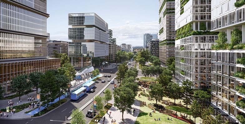
The NSW government’s Transport Oriented Development (TOD) plans came into effect on 1 April. We provided an outline in the previous issue of STEP Matters. Ku-ring-gai Council has been trying to negotiate a softening of the impositions imposed by the plans with little success. Basically, the TOD means that 6 to 7 storey flat buildings can be built in all residential zones within 400 m of the Gordon, Killara, Lindfield and Roseville stations or 8 or 9 storeys if an affordable housing component is included.
Council has been trying to negotiate with the Minister for Planning, Paul Scully, and the Department of Planning to reduce the impacts, particularly on heritage conservation areas and tree canopy. The specifications for the building size (floor space ratio of 3 to 1) and minimum land area mean that here is no room for any trees in addition to the building footprint.
Council has argued that they need 12 to 18 months to plan a housing strategy properly and in accordance with guidelines from the department – a 6 month extension has been offered. Ideally planning should also encompass the other part of the announced changes to provide for low to mid-rise housing within 800 m of all railway stations and St Ives centre. An idea of the target for new housing numbers would also be a help.
Council also tried to take one of the TOD stations, such as Killara, off the list and shift the numbers to the other TOD stations. The 400 m radius around Killara is the area with the greatest proportion of heritage houses and it doesn’t have any shops.
Paul Scully would not consider any of these arguments. So there is now a stalemate.
The current situation is that the TOD State Environmental Planning Policy (SEPP) is being imposed on Gordon, Killara, Lindfield and Roseville from 1 April. Council has still not received a copy of the document (the SEPP) that acts as the regulation of the planning rules that are supposed to guide the implementation of the policy.
Meanwhile the developers are ready to pounce from the middle of May.
The low to mid-rise housing changes are due to come into effect later this year. Targets are yet to be revealed although the 42-page Explanation of Intended Effect provides sufficient detail to conservatively anticipate the doubling of Ku-ring-gai’s population as a combination of both the TOD and low to mid-rise housing SEPPs.
The standoff continues on the major issues with the TOD plans:
1. Heritage conservation areas
There are still conflicting statements being made about the application of the new housing to heritage conservation areas. The government has stated in the media that current council heritage provisions under the LEP and DCP can continue to apply. Demolition would not be permitted of heritage buildings or those that contribute to the heritage value of the conservation area. They optimistically state that there will be opportunities to build new housing consistent with the heritage values of the TOD area. How can that be possible in an area like Killara with 80% of the TOD area being heritage conservation areas?
Many high rise buildings will be required to achieve the target of at least 4,500 to 5,000 new homes over the next 15 years in each TOD area. The minister states that council will still be the consent authority and will be able to conduct merit assessments of development applications. But these assessments will have to comply with the new standards that conflict with the Ku-ring-gai DCP specifications. It doesn’t make sense!
2. Traffic
The mayor’s concerns about local traffic are dismissed. The minister seems to think that the railway line is all that is needed. What about all the people that need to travel to the north along Mona Vale Road or Warringah Road and to the south via Lane Cove Road or Mowbray Road? They have to use the already highly congested Pacific Highway to get to these roads that are located some distance away from the TOD stations.
3. Local services
As the mayor points out in his letter, the people living in all these new dwellings require amenities such as parks, libraries and community spaces. It is unlikely that developers will include space for health and education needs. So, the council has to cover the cost but the government has not offered any funding. The council had almost finalised plans for the Lindfield Village Hub when the government withdrew its agreed contribution.
There are various development contribution schemes but no certainty about how the money raised will be distributed.
Land values have already increased markedly since the new housing plans were announced making it more difficult for council to buy land to be used for new amenities.
4. Tree canopy
State and all local governments are proceeding with tree planting activities in the hope of achieving the target of 40% urban canopy by next decade. Ku-ring-gai is trying to better this target. However the TOD mid-rise housing specifications leave no room for trees. The low to mid-rise housing specifications require only 15 to 20% deep soil space so the 40% target would not be achievable.
There will be no room for trees unless there is room on the nature strip but with all the disturbance from construction of these buildings and their underground car parks trees of any size large enough to provide shade are unlikely to survive.
The Urban Forest Strategy points out that 70% of urban trees are on private land. Council has limited capacity to increase tree cover to meet the target and the housing proposals make this even harder or impossible.
Upper House enquiry
The Legislative Council initiated an enquiry into the TOD proposals that is due to report by 27 September. This has called for submissions on the investigations and consultations prior to the TOD announcement into the appropriateness of the chosen locations and the impacts on heritage, capacity of infrastructure and on local amenity and environment.
There are already over 180 submissions on their website pointing out problems with the proposals. The committee has a big job on their hands to distil these submissions. How much notice will the government take?
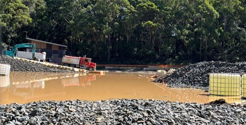
Norman Griffiths Oval synthetic turf installation has become a debacle
Construction of the synthetic turf field at Norman Griffiths Oval in Bicentennial Park, West Pymble commenced in August 2023. You will recall the controversy about the use of this site for synthetic turf with its proximity to Sydney Turpentine Ironbark Forest and Quarry Creek, the waterway that runs under the field and flows through to Lane Cove National Park. The bushland along the creek has been transformed by bush carers working over many years.
One major issue with the choice of this location for synthetic turf is that the field acts as a stormwater detention basin. Water from rainfall events runs from the surrounding slopes into the field and into pipes and a detention system then would gradually drain ultimately into Quarry Creek at various locations. There was also a pipe running under the field taking water from the nursery on the other side of Lofberg Road into the detention system.
The installation of synthetic turf creates an area where rainwater can seep through but heavy rain will flow rapidly across the field and into Quarry Creek. Flood models were commissioned that determined that a new drainage system was required. This comprises a large area of porous aggregate which allows for vertical, filtered drainage and stormwater detention. Once the water has filtered through this detention basin it will go into a bio-retention basin where it then flows gradually into the current stormwater pipe system under the aquatic centre carpark.
There have been repeated incidents of muddy water running down Quarry Creek usually after rain since construction started. It seems the runoff from the field is not being controlled. A broken pipe is blamed so the detention system is not working. The EPA is investigating.
Now the stage of construction has been reached where there are large piles of aggregate and dirt across the site. Then there was very heavy rain on 5 and 6 April with over 200 mL. The construction site became a lake as it seems there was too much water for the drainage system (see image at the top of the page).
There have been repeated episodes of muddy water in Quarry Creek but the latest incident is the worst. A solution has to be found to pump out the water from the muddy lake. It can’t go down Quarry Creek. There is already a build-up of silt on the bed of the creek. We are trying to find out who is responsible for cleaning this up.
Meanwhile construction activity has ceased.
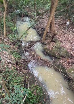
Muddy water flow into Quarry Creek, 150 m from oval, 6 Nov 2023
Synthetic turf guidelines released at last, but a big disappointment

In Issue 221 we reported on the Chief Scientist’s report into Synthetic Turf Study in Public Open Spaces. One of the recommendations was a call for an accessible and reliable source of verified information that distilled the vast amount of data that is available. It also called for further research on the impact on human health from heat generated by the plastic surface and chemicals in the turf/infill and environmental impacts such as microplastic loss into waterways and the loss of habitat for local wildlife.
The government’s response was a promise to produce guidelines to assist decisions about the installation and use of synthetic turf. Nine months later they have been released but they are a huge disappointment. Submissions were invited up to 29 April so we hope for a significant rewrite.
The announcement on the Department of Planning website states that:
The guidelines will help decision-makers, planners and sports field managers who may be considering synthetic turf as an alternative to natural grass.
There are lots of lists of what to consider but little actual guidance and references to sources of information plus many important matters are missing.
Lack of information about natural turf alternative
The first issue is the lack of information about natural grass practices to enable comparison with synthetic turf. There should be information on where to find data on modern science-based techniques for soil and drainage preparation and grass choice. The guidelines say these techniques are not well known but this statement is false. There are references in the guidelines to management guidelines that was produced as long ago as 2007 but nothing about construction.
There should be a moratorium on new installations
The Chief Scientist’s report highlighted the multiple areas where further research is needed into the environmental and health impacts of synthetic turf particularly under the Australian climatic conditions. This includes the breakdown and escape into waterways of plastic blades and infill that include PFAS and microplastics. Many countries overseas that have been using synthetic turf for many years are starting to phase out its use particularly with rubber tyre crumb as infill.
Organisations like the Total Environment Centre (TEC) are calling for a moratorium on synthetic turf installations for five years until more data is available. The TEC has been working with Macquarie University on the AUSMAP: Australian Microplastic Assessment Project that is monitoring microplastic pollution in waterways.
Information missing from the guidelines
- There are many aspects of the current use of synthetic turf where the data is clear that practices should be changed. This includes the use of rubber tyre crumb as infill and the need for collection systems for microplastic runoff.
- The government has not taken action to develop standards for materials used in synthetic turf and infill, particularly imported products. There are standards in place for most other materials for public use but this essential consideration has been neglected in respect of synthetic turf.
- There are Australian standards in place for installations that impact surrounding wildlife such as the lighting systems but the draft guidelines do not mention them. The Australian government's Department of the Environment has lots of information.
- There is no clear statement of locations that are unsuitable for synthetic turf such as areas with bushfire and flooding risk and environmentally sensitive areas with nearby endangered vegetation and wildlife.
- There is little coverage of the approval process required under the planning legislation. Given all the environmental and social impacts of synthetic turf the standard for project approval should be an Environmental Impact Statement.
- There is insufficient emphasis on the need for consultation with local communities that will be affected by the installation of synthetic turf that is usually fenced off and restricts future use to specific sports so that casual recreational use is no longer possible.
- There in no mention of planning regulations requiring consultation with NPWS for developments near a national park.
- Impact on local environment from a large area of plastic that excludes wildlife (birds and insects) and amplifies the heat island effect is not covered.
Finally, the structure of the guidelines is not useful. For example, there are long explanations of how to plan the demand for sporting fields and development of council strategies that are irrelevant to the actual analysis of whether to use synthetic turf. It would more useful to have checklists of actions and considerations with references to sources of information.
Have you observed large trees dying seemingly of natural causes?
We have observed several trees in Turramurra and Warrawee that seem to have died of natural causes. Here is one example in Cherry Street.
We would like to collect a database. Please send photos and information about the type of tree (if possible) and location to This email address is being protected from spambots. You need JavaScript enabled to view it..
Ku-ring-gai Council tree forum

On 26 March Ku-ring-gai held a forum on the management of trees. It was very well attended with over 150 people at the council chambers or on-line.
The objectives were to inform the public about tree management in Ku-ring-gai, to hear concerns about loss of local trees and ask for suggestion of solutions.
Click here for slides from the presentations and a recording of proceedings and here for more information.
Tree removal hotline
A hotline (9424 0400) has been set up to report illegal tree removal, pruning or damage.
First check council’s map viewer to see if the listing for the address has approval for tree removal. If approval is NOT shown:
- report the illegal removal online (select report unauthorised tree works option (photos cannot be submitted online so email your report and photos); or
- call 9424 0400 (it’s a 24 hours a day, 7 days a week service); or
- email This email address is being protected from spambots. You need JavaScript enabled to view it.
Fire retardant being dumped with little information on the ecological consequences
Our talk on 27 April was presented by Shannon Kaiser, PhD researcher into the impact of aerially deployed fire retardants on bushland ecology. This is another example of action being taken with an aim to reduce a risk without full understanding the potential environmental consequences. The 10/50 legislation is one example where trees have been removed that will have no benefit of reducing fire risk but for other reasons such as increasing views and property values.
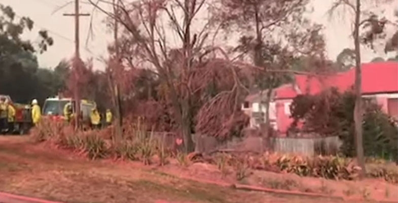
Fire retardants have been deployed from aeroplanes in California for many years in fighting forest fires and are used by the Rural Fire Service but not usually in urban areas. There was much publicity when NSW authorities decided to use it in the Turramurra fire in November 2019. Shannon decided to investigate the impact on the local ecology.
Shannon’s work was mostly done in the lab. The components of the retardant are mostly ammonium phosphates with some ingredients that are trade secrets. He found that the concentrations used in the environment were at a level much higher than safe levels. This had the potential to impact basic measures of water quality such as increasing acidity, turbidity and salinity and reducing dissolved oxygen.
He tested a range of concentrations on tadpoles. He found the higher concentrations would have affected the survival of tadpoles by slowing and reducing their movements. The vulnerable Green and Golden Bell Frog (Litoria aurea) was more susceptible than the more common Striped March Frog (Limnodynastes peronii).
The next step is to discover the level of retardant that ends up in our waterways. The trees in our bushland are very different to the pine forests in California so the chemical can fall through the open canopy of Australia’s forests to the shrub and ground level.
Our fauna are also different, there being no marsupials in the United States. Shannon will be ready to discover this contaminant information when the next bushfire occurs.
Research Grant for the Conservation of Bushland 2024

We are pleased to announce that the recipient of this years’ award is Solomon Maerowitz-McMahan for his project entitled Exploring Mycorrhizal Resilience: Insights from Post-Hazard Reduction Burns in Ku-ring-gai Chase Forests.
Solomon is a PhD candidate at the Hawkesbury Institute for the Environment, Western Sydney University, specialising in fungal ecology. His work aims to quantify soil functions across diverse ecosystems and advocating for the preservation of natural resources on a global scale. Through investigating fire-induced adaptations of mycorrhizal fungi, he endeavours to inform land management practices that nurture ecological resilience.
The intersection between fire and fungal ecology is largely unexplored, with little functional understanding of the mechanisms through which fire impacts fungi. While previous research has shed light on the unique attributes aiding plant and animal survival in fire-affected ecosystems, studying fungi in the soil poses distinct challenges, often requiring indirect methods. Mycorrhizal fungi, forming symbiotic relationships with plants, play pivotal roles in these landscapes, influencing decomposition, nutrient cycling, and plant productivity. This project aims to highlight the role that mycorrhizal fungi play in fire-affected ecosystems and the methods that can be used to study these fungi. Drawing insights from forested sites across the Sydney basin, including Ku-ring-gai, and spanning Australia, we aim to untangle the direct and indirect effects of fire on mycorrhizal fungi and enhance our understanding of their impact on ecosystem recovery post-fire.
Government plans to increase housing density are roundly condemned

In December, just as we were looking forward to a peaceful holiday break, the NSW government released plans for new policies aimed at increasing housing density to cater for the massive increase in demand brought about by recent and projected high levels of immigration. We all understand the need to boost housing supply in the right areas to avoid adding to the existing suburban sprawl but the way the government is going about it is totally unacceptable.
The explanatory document, the Explanation of Intended Effects: Changes to Create Low- and Mid-rise Housing (the EIE), makes some grandiose statements. It claims that:
The changes will give NSW households more choice and promote vibrant, sustainable and liveable communities …. Our longer term aim is to enable better planning that is led locally.
This all plain spin.
The reality is that a new planning system is being imposed without opportunities for local input. Council local environment plans (LEPs) and controls will be overridden by ‘non-refusal standards’ determined on a one-size-fits-all basis.
The headline description of the new housing typology is that they will be well-located and well-designed. However, the standards in most of the redevelopments will create housing that leaves only room for a small or medium size tree in a small garden. Existing mature tree canopy will be severely reduced so all the government rhetoric about creating ‘liveable’ communities in the face of climate change will become meaningless. These mature trees and their environmental benefits cannot be replaced.
The EIE applies to the Six Cities Region that covers the Illawarra, Blue Mountains, Sydney and Newcastle and lower Hunter with the exception of dual occupancy provisions that apply to the whole state.
Transport Oriented Development (TOD)
Another announcement was made in December that has potentially drastic implications for the established suburbs of Gordon, Killara, Lindfield and Roseville. No consultation with the public is to occur and Ku-ring-gai Council has had limited opportunity to have their say to the Department of Planning. This development standard is to be implemented from 1 April. More detail is further on in this article.
When will this all happen?
First of all the government has to finalise the new State Environment Planning Policy (SEPP) that governs the implementation of the policy. The intended effective date is mid-2024. So time is tight.
The government did invite feedback from the public, councils and stakeholder bodies. This is currently being considered and a response will be published. Whether they will modify the policy to recognise the outpouring of criticism remains to be seen.
The intention is to ‘fast-track’ the new housing plans so it is likely that the problematic complying development process with private certifiers will be used. In 2022 only 48,000 new homes were completed in NSW. The goal of this new policy is to build 75,000 new homes over each of the next 5 years in accordance with the new housing accord agreed between the states and federal governments.
How will it happen?
That is the big question that will determine whether the intended large increase in the number of dwellings does actually occur. It appears that developers will be knocking on doors with generous offers to buy people’s houses. Alternatively landowners will put their place on the market. The take-up response is unknown so the outcome is unpredictable.
The normal process is for councils to be given new housing targets over a wide time frame and they then carry out strategic analysis and community consultation to identify where the increases should occur by rezoning areas for higher density housing development. Controls are defined taking into account local conditions such as existing infrastructure, topography, local character and heritage, biodiversity protection and bushfire risk. They aim to avoid issues like overshadowing and increased stormwater flood risk. This provides certainty for all parties that enabled long-term planning.
Non-refusal standards
This time the state government proposes new ‘non-refusal’ standards – if types of development are compliant with such a standard, they cannot be refused. As these are to be implemented under a SEPP, they can overrule LEPs or Development Control Plans. These standards are outlined in the EIE.
In recent budget estimates hearings the Minister for Planning claimed that councils will retain their powers to control development. Yes okay, but only if the council controls are similar to or more permissive than the non-refusal standards in terms of the housing outcomes. This is obviously unlikely.
The implementation of the EIE is undermining the government’s own existing statutory strategic planning framework that coordinates new housing plans. The government is working on new regional and district plans to be released in 2024 that should inform local council plans. In June 2023 the government abolished the Greater Cities Commission that had the role of determining these plans. This function has been brought back to the Department of Planning. So currently we do not have a holistic plan allocating when and where the increased housing numbers should go together with the associated infrastructure needs.
Higher density standards
There are three types of higher density housing that are to be implemented:
- dual occupancy in R2 (low density) residential areas
- low-rise housing in R2 zones within 800 m of railway stations and local centres
- mid-rise housing in R3 (medium density) zones within 400 m of railway stations and local centres
1. Dual occupancy in all low density (R2) zones in the whole of NSW
This change may have the most significant impact in the character of our cities and towns. Currently many councils do not allow dual occupancy in R2 zones. This includes Hornsby and Ku-ring-gai. If this option is taken up by many landowners then the tree canopy cover of all our suburban areas will reduce significantly.
Under the non-refusal standards, any block that is at least 450 m2 could be converted to dual occupancy. Another house can be added to the existing one on the block or an existing house can be knocked down and replaced with two houses. Larger blocks that are common in northern Sydney of over 900 m2could be sub-divided into two blocks and then two dual occupancies could be built – four houses in all. Currently the local trend is to knock down established houses and replace them with a much bigger single house. Will this trend continue as well?
In either case established tall trees and gardens are being cleared and replaced with smaller trees and hedges that will be of limited value for cooling the environment and providing habitat for wildlife. The EIE prescribes a minimum number of trees be planted depending on the size of the block but they only need to be a small tree (5 to 8 m – bottlebrush size) for a medium size block and medium tree (8 to 12 m – jacaranda size) for a larger block of over 600 m2.
2. Low-rise housing close to local centres
Low-rise housing as defined in the EIE is to be permitted in R2 zones within 800 m of railway stations and local centres (zoned E1). The definition of local centre is up for discussion. It is intended to apply to places with a good range of services such as a full-sized supermarket and restaurants. In our area it would apply to St Ives. It is also intended to apply to centres with good access to public transport. St Ives has poor public transport and frequent traffic congestion.
Low-rise housing will include:
- manor houses – two-storey flat building – can be four or more flats depending on land area
- terraces – row of dwellings
- townhouses or villas – multi dwelling housing
Manor houses
Terrace
The specifications for maximum floor space ratio and minimum site area will mean that the space remaining for gardens and trees will be very limited. The minimum tree canopy target for larger blocks is 30% assuming the trees will reach maturity compared with the current guideline of 40%.
The greater density will increase the need for car access. This means more driveways with less space for street trees.
It appears that sub-division will be encouraged so that the normal sized lot in the northern Sydney area could be sub-divided and replaced with two or three low-rise developments.
3. Mid-rise housing
Mid-rise housing is to be permitted in E1 (local centres) and R3 (medium density) zones within 800 m of railway stations and local centres. This is defined at residential flat buildings or shop-top housing. The maximum height allows for building up to six to seven storeys (maximum height 21 m) within 400 m of the station or town centre and up to four to five storeys (maximum height 16 m) in the 400 to 800 m radius.
Developers can add extra floor space if affordable housing is included. If 10 to 15% of the gross floor area is allocated to affordable housing then the height can be increased by 20 to 30% respectively. This means a six to seven storey building can be increased to eight to nine storeys.
Mid-rise housing
Transport oriented development
Four station areas, Gordon, Killara, Lindfield and Roseville have been identified as places appropriate for Transport Oriented Development (TOD); 31 areas in total have been identified for the TOD in the Six Cities Region. This Imposes mid-rise housing (six to seven storeys) within 400 m of these stations to be applied to all residential areas. Some of these areas already have higher rise development but the majority of areas are low density. Not only that, but 40% of these areas have a concentration of heritage housing.
The minister claims that the non-refusal standards can be avoided if Ku-ring-gai Council does their own strategic assessment and works out planning controls that will enable the new housing numbers to be accommodated before the TOD requirements are implemented. But they come into effect on 1 April and the government advice on the expectation of new dwellings has not been provided.
The government proposals have been roundly condemned
There is a long list of problems with the government’s denser housing proposals. Ku-ring-gai Council’s website contains their lengthy detailed submissions. On 3 February an extraordinary meeting passed a resolution that:
- Condemns the State Government for its irresponsible approach to planning for the future of the built and natural environment in
- Rejects the proposed changes to planning controls and demands that they be withdrawn with genuine consultation to be undertaken with councils and their communities, as intended by the National Housing Accord 2022.
Brief summary of issues
The proposals basically do not conform with the Environment Planning and Assessment Act and the principles of ecologically sustainable development.
Ku-ring-gai Council’s analysis of the higher-density development configurations for mid-rise housing shows do not even conform with the government’s own SEPP 65 Design Quality of Residential Apartment Development.
Government claims that there will continue to be opportunity for genuine merit assessment of developments, taking into account local character, biodiversity and heritage matters are meaningless. As currently announced the two SEPPs will apply a top-down one-size-fits-all approach.
The landscaping and building parameters prescribed in the non-refusal standards are not suitable for established suburbs. The planning system must continue to allow the consideration of issues such as consistency with existing built form, tree canopy targets, topography, bushfire risk with the need for asset protection zones and stormwater management.
As announced, development types will be determined by the developer resulting in a mishmash of housing styles throughout Sydney particularly in the areas near stations and local centres.
The mid-rise development of up to seven storeys near railway stations along the Pacific Highway from Roseville through to Wahroonga is very concerning. This will create a wide strip of development about 1 km wide that will be a barrier for wildlife movement between north to south bushland. The land falls away sharply on the southern side of the highway where the impact of the ridge barrier will be emphasised. These areas retain the seedbank and soils that are essential for the survival of the last remaining areas of remnant critically endangered forests.
Councils must be able to limit the amount of clearing on properties when additional dwellings are added so that mature trees are retained. The blanket dual occupancy approval provisions must not proceed.
The two proposals for ‘transport-oriented development’ and ‘low and mid-rise housing’ together endanger more than 4,000 heritage properties (items and sites within heritage conservation areas).
Help tackle the spread of myrtle rust

Myrtle rust is an invasive species of fungus that threatens plants in the Myrtaceae family. Researchers want to know more about the extent of the problem, and they are asking for public help.
Alyssa Martino, a PhD student at the University of Sydney who is studying myrtle rust infection and leads the iNaturalist Gum Tree Guardians project says reports of myrtle rust will give the team a broader understanding of the extent of the disease.
If you see some myrtle rust please upload photos using the iNaturalist app and provide other information such as the species of the host plant, age of the plant and how much it and other nearby plants are affected.
Calls for stronger tree protection measures
According to 2020 data Ku-ring-gai currently has an urban forest canopy cover of 45%. The Urban Forest Strategy is to increase this to 49% by 2036. However the level of canopy cover is going the wrong way and there is increasing community concern about tree destruction, both legal and illegal.
In recent months there have been some extreme examples of tree destruction in Middle Cove (over 250 trees) and Longueville (about 300 trees and shrubs). There are many examples of trees being removed in order to ‘improve’ views or increase property value as the size of a home rebuild is increased.
There is some dispute about the level of canopy loss. Council’s measures are that 1.4% of canopy has been lost over the two years to 2022. An article in the Sydney Morning Herald quoted data from a study compiled by consultancy group ArborCarbon for the state government and analysed by the Western Sydney Leadership Dialogue. This claimed that the Ku-ring-gai had lost 8.2% between 2019 and 2022. The discrepancy is so large that the baseline or methodology needs to be examined.
The article stated that, altogether, Greater Sydney’s tree canopy barely changed; trees covered 21% per cent of the city in 2019 and, in 2022, cover was 21.7%. That’s a long way off from the government’s target of 40% coverage by 2036. That target will totally unachievable if the housing proposals go ahead as announced (see previous article). A large proportion of the increase needs to occur on private land. Only so many trees can be planted along streets and in parks.
Responses by local councils
Several local councils presented motions to the local government conference in November 2023 calling for increases in penalties for tree vandalism and illegal removal. The motion passed called on Local Government NSW to:
- Urgently undertake a review of the legislative regime for tree protection and seek increased penalties and deterrents, including significantly increased fines and community service for the destruction and vandalism of trees in NSW. The review is to include the destruction and vandalism of vegetation in environmentally sensitive areas such as riparian zones, areas of high biodiversity value and foreshore protection areas. The review should identify opportunities to better coordinate tree protection across NSW, along with improved education and awareness around the importance of tree protection to build stronger community support.
- Advocate for effective reform to improve collaboration and coordination in education and enforcement to combat tree vandalism in NSW.
Upper house petition – please sign
The Legislative Assembly of the NSW parliament has put up a petition calling on the government to significantly increase penalties for urban forest tree vandalism. It also calls for the recognition of trees as 'natural assets' in the Integrated Planning and Reporting framework of the Local Government Act.
Click here to sign the petition.
The preamble to the petition explains that councils lack resources for thorough criminal investigations, hindering effective prosecution. Despite the illegality of tree vandalism under the Environmental Planning and Assessment Act, only 19 cases were prosecuted from 2018 to 2022.
The petition also asks the Legislative Assembly to call on the government to amend the NSW Local Government Act to include trees in councils' asset registers as 'natural assets', allocate a budget for a collaboration of councils to undertake pilot projects to integrate natural capital/asset reporting in balance sheets and develop natural asset data capture and management standards. Recognising trees as 'natural assets' helps us appreciate their true value including their role in combating climate change and preserving biodiversity.
What’s Ku-ring-gai doing?
1. Strengthened tree regulations
Council is now enforcing strengthened tree regulations.
Residents who breach the conditions of their DA or Complying Development Certificate through illegal tree removal, will be required to replace them with a like tree in addition to fines. Residents undertaking works on their land should expect to be monitored and conditions enforced in accordance with their development approval.
2. Illegal Tree Removal Community Forum
Tuesday 26 March, 6 to 8pm
Ku-ring-gai Council Chambers,
818 Pacific Highway, Gordon
This text comes from council’s website.
Council invites all community members and groups to a public forum addressing the critical issue of illegal tree removal in our neighbourhoods. This growing problem threatens our tree canopy - an invaluable community asset we must protect.
We will discuss the challenges faced in curbing the threat, as well as potential solutions. Most importantly, we seek to hear from you - the community - regarding your insights into the problems and opportunities before us. What actions can we take together to protect our trees and urban forest?
The session will concentrate on three crucial aspects:
- the primary obstacles in sustaining and enhancing our tree canopy
- compliance and regulation – measures that can be taken to prevent or remedy tree removal
- education – discouraging people from wanting to remove trees
By registering now, you can share your views in advance of the forum. This will aid in guiding the forum discussion by addressing questions on the above topics in the registration form.
This is a call to all who care about saving our trees to get involved. Join the forum and make your voice heard in developing community-driven strategies to turn the tide on illegal tree loss in Ku-ring-gai.
3. TreeCare
A group of concerned citizens has been working with some of the councillors and staff on ways to ensure that our iconic trees are cared for. The plan is to set up a TreeCare group that will install protection measures such as and information signs around significant trees on public land. The angophora at the edge of the car park at the St Ives Showground has been suggested as the first site.
4. Tree Watch
A new community action group has been formed called the Voices of Ku-ring-gai with goals of lifting the standard of integrity, environmental protection, transparency, accountability, and community-mindedness of Ku-ring-gai Council.
One of their first initiatives is to set up a scheme called Tree Watch. Community members who opt into Tree Watch can download a poster for their community notice board or place a plaque on their fence or gate. This alerts the neighbourhood to the fact that the person who lives there places a high value on the precious and sensitive ecosystem in the neighbourhood.
The group will share information about tree losses and how to report to council if someone spots tree loppers in action and council’s website shows that the tree removal has not been approved. However, their main objective is to educate the community about the benefits provided by maintaining our tree canopy.
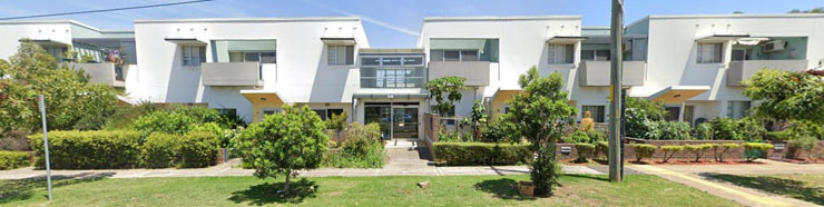
Lourdes development application is refused

A planning proposal for the redevelopment of the Lourdes Retirement Village at the end of Stanhope Road in Killara was first submitted in February 2018. The proposal was to rezone the site from R2 low density to R3 medium density residential. The proponent also sought to amend the usual R3 maximum building heights to heights ranging from 9.5 to 22 m; and amend the maximum FSR from 0.3:1 to 0.75:1 under Ku-ring-gai LEP 2015.
The key objective of the planning proposal was to facilitate the redevelopment of the site to increase the number of dwellings for seniors housing and make improvements to the current facilities that are very rundown.
Ku-ring-gai Council refused the application mainly on the grounds of bushfire risk and its inappropriate location for the planned expansion of seniors housing including a building six to seven stories. Therefore the application had to go through the Sydney North Planning Panel (SNPP).
The proposal was reviewed by the SNPP and progressed into the gateway determination process in November 2018. The Department of Planning then engaged in discussions with the proponent, Levande, aimed at addressing some of the concerns about the project. In May 2022 the department made a gateway determination that the planning proposal could proceed to the development application stage subject to a long list of required amendments and consultation with authorities and public exhibition. These were to be submitted to the department for review and endorsement prior to public exhibition in September 2022. Finally, prior to the final panel hearing, further amendments were made including a change to zoning of the site to include a strip of C2 land (environment conservation) and updates on reports.
Throughout this prolonged process Ku-ring-gai Council has pointed out shortcomings in the plans particularly in relation to bushfire risk. They disagreed with the consultant’s statements that the site has low fire risk and that satisfactory protection measures can be engineered during the detailed DA stage.
These statements were effectively endorsed by the RFS without any independent review. The RFS did not explain the basis for their support and did not object to the plans stating that issues could be sorted out in the DA stage.
The protection measures involved the construction of townhouses that would act as a special fire protection facility. In other words, a buffer protecting the high rise part of the site that would be an aged-care facility. However, the purchasers of these townhouses could have the same dependency and accessibility issues as the residents of the aged-care component of the site.
The final SNPP hearing occurred in December. Many residents of Lourdes and members of community groups including FOKE and STEP presented to the hearing. Ku-ring-gai Council made a detailed presentation criticising the bushfire reports and many other aspects of the project plans and consultants’ reports.
We were all relieved when the panel decided to reject the proposal unanimously and requested that the previous decision to agree to the gateway determination to amend the LEP no longer proceed.
The SNPP reason for their decision was primarily that the solution for bushfire risk was not appropriate. They did acknowledge that the site provided desirable facilities and needed to be upgraded and made some suggestions of alterations that could improve the planning outcome.
This is not the absolute end to the proposal. The minister makes the final decision about what happens next.
Domestic cats and dogs pose a serious threat to wildlife

Domestic cats and dogs pose a serious threat to wildlife because of their natural hunting instincts. With a large number of unowned (stray and feral) and free-roaming cats and dogs, it’s important to manage domestic pets to minimise the damage that can be done to other, more vulnerable species.
It’s difficult to estimate the impact domestic cats have on wildlife, however studies suggest a suburban domestic cat can kill and bring home anywhere from 5 to 30 native and non-native animals each year.
Pet owners should:
- keep cats inside, even if it’s just at night when native animals are most active
- keep dogs inside at night, or confined to a secure space on the property
- provide a safe environment for wildlife in their garden and encourage a wildlife-friendly backyard
- identify pets with a collar, tag or microchip
- add collar bells for cats
- de-sex their pets
If a pet brings in an animal, if possible take it straight to a vet. The saliva of dogs and especially cats, contains bacteria that is toxic to wildlife. It is known amongst WIRES carers and rescuers that animals bitten by a cat or a dog have a small window (usually a few hours) where antibiotics must be administered, or the animal is unlikely to make it.
Lizards such as Blue-tongues often reside in backyards and can have around 15 gardens within their territory. It is likely the lizard has lived in the area for some time and is adept at avoiding hazards such as cats and dogs. However the rescue office receives a large number of calls for Blue-tongued Lizards who have sustained injuries such as puncture wounds or broken backs from domestic animal attacks.
This article has been contributed by Andrew Little. It is a transcript of presenter notes by Jess Styan, WIRES Rescue and Care of Wildlife on the North Shore, as part of WildThings NSW Forum on Sunday 15 October 2023.
Initiative to keep cats safe at home
The Ku-ring-gai Bushcare Association (KBA) came up with the idea to run a competition to encourage cat owners to keep their cats inside and protect wildlife. Residents were provided with information about the risks to wildlife and cats if they are allowed to roam outside. They were invited to submit photos of their cat safely inside and have a chance to win a $500 voucher to install cat enclosures for their pets. Over 130 entries were submitted so it was a difficult task to select the winners.
The competition was funded through an Environmental Levy Grant and was a partnership between Ku-ring-gai Council, Catnets and KBA.
The KBA was established in 1994 to represent bushcare, streetcare and parkcare volunteers at Ku-ring-gai Council. The KBA committee meets monthly with council to provide input into native vegetation management issues and assist with organisation of activities such as convenor forums.
Book review: What the trees see: A wander through millennia of natural history in Australia
This book is delightfully easy to read but not so easy to review in a limited space as it moves widely from topic to topic despite being embraced by a common theme, being Australia’s incredibly diverse tree flora and the human interaction and exploitation both pre- and post-European occupation.
An early chapter captured and intrigued me right away because we lived in Perth for nine years, and he writes through the eyes of a First Nations woman as she traversed Perth's original landscape with its native trees, now changed largely beyond recognition. But the portion of that chapter that deals with Rottnest Island was an eye opener for us who visited the island regularly and actually had our honeymoon there. The brutal incarceration of Aboriginal prisoners and the gradual destruction and thinning of the native flora meant that what we saw on visiting bore little resemblance to its original state.
One chapter features the Leichhardt Tree Nauclea orientalis, a member of Rubiaceae or the coffee family. The so-named tree in Mackay is probably 200 years old and has survived incredible danger and destructive forces like tropical cyclones, has lost all its neighbouring companion flora, but has survived the destructive fate of so many native trees. So-named because it was encountered and recorded by explorer Ludwig Leichhardt, the author highlights its cosmopolitan distribution in the south-west Pacific and its recognition by Melanesian islanders of the Kanaka slave trade as a reminder of home. But of course it was also part of the largely lost native flora of the Yuwibara First Nations inhabitants of the Mackay region and part of its rich history.
The previous paragraph was a brief 10 pages, illuminating and dense with information, but numerous other chapters follow comparable themes with diverse species and settings. For example, having worked inland and encountered isolated palm groves – oases in the middle of nowhere – I was fascinated to learn of the possibility that these had been brought south by First Nations travellers from closely related tropical palm groves, and had only modestly diversified and evolved to fit their new homes.
He touches a number of times on the huge diversity of eucalypt species, highlighting Dean Nicolle’s Currency Creek ‘tree museum’ in South Australia. He intertwines this with Murray Bail’s Eucalyptus novel, a story in the vein of that country and western song Wolverton Mountain. Coming from Britain which has only 15 or 20 truly native tree species, you can spend a lifetime learning only a small fraction of what Australia has to offer even if you never get beyond the eucalypts.
What author Dave Witty’s professional qualifications are or what he does for a living when he’s not writing books or articles never came clear (he has been awarded a Nature Conservancy nature conservation prize and has published articles in Meanjin and Griffith Review among other journals). But it’s made clear he grew up in Britain and migrated here, and had a long standing relationship that failed after 12 years. The latter arose as an uncomfortable backdrop on several occasions in the book though it did tend to soften and humanise it, and it was good to learn he subsequently met and married a new partner and they have a young daughter.
Dave Witty, Monash University Publishing (2023) 284 pp (reviewed by John Martyn)
Can you suggest a name for the new park at the Hornsby Quarry?
Hornsby Council is making good progress on the development of the Hornsby Park and Quarry site with works almost completed on the landform of the roads, pathways and stabilisation of the surrounding walls and slopes. A lot of new planting will be required. They hope to complete the park by the end of 2024.
Council is currently going through a process of deciding a name for the new park. This involves consultation with focus groups, indigenous groups and the broader community. It will be a long process even before a proposal goes to the Geographical Names Board.
Council is looking for a name that reflects the history and also gives a sense of the future direction of the place. There are many historical elements at the site, such as the quarry (geological), Higgins Family cemetery (heritage) and the Crusher Plant (industrial) as well as the aboriginal custodianship and rare Blue Gum Diatreme Forest. Send suggestions to This email address is being protected from spambots. You need JavaScript enabled to view it..
Annual report 2023

Welcome to the annual report on the 45th year of operation of STEP Inc. There is a brighter outlook for the environment in 2023 following the election of the Minns Labor government. But we have to be vigilant in advocating for stronger action.
The report on the NSW Review of the Biodiversity Conservation Act was scathing about the loss of biodiversity over the past
5 years that was supposed to be conserved under this Act. Strong action is required in implementing the recommendations. The same applies at the federal level as we await release of the revision of the EPBC Act.
A change of attitude towards coal and gas mining, native forestry and land clearing is vital for progress on climate change and loss of biodiversity.
Activities
Talks
Our post AGM talk in 2022 was given by Professor Michelle Leishman on creating resilient urban green spaces in the face of climate change.
So far in 2023 we have held talks on the aboriginal heritage of the Ku-ring-gai GeoRegion, Powerful Owls and the future approaches to bushland management in Hornsby Shire. We will be hearing about Ku-ring-gai bushland management in a talk by Jacob Sife on 25 November.
Walks
We scheduled 7 walks that featured national parks and the variety of vegetation that is a feature of northern Sydney bushland. John Martyn also introduced us to new reserves in outer Sydney; well worth a visit. With the period of hot weather lengthening we are reluctant to schedule walks during the November to February period. We thank our volunteer leaders, David Roberts, John Martyn, Helen Logie and Mark Schuster who shared their local knowledge and Beverley Gwatkin who has organised these walks.
Publications
We are still offering a year’s free membership to anyone who buys a book or map. Sales of our maps is still strong and there is a steady demand for our books.
We printed an updated version of the Middle Harbour North map. There is still a demand for paper maps that give a big picture for planning of potential walk itineraries.
Committee
The STEP committee has, as always, been a great group of people to work with. We owe a huge thank you for all their efforts.
We thank Jim Wells for keeping track of our finances and compiling monthly finance reports. Trish Lynch continues to keep Facebook up to date and find news of local activities and wildlife discoveries. We have closed down our Twitter account because the decline in its popularity. John Burke did a great job of highlighting environmental issues while Twitter was a strong source of commentary.
There have been several issues to review this year, often this is in association with other groups such as the Natural Turf Alliance. The committee members work well together in organising activities, responding to questions from the public and, writing submissions.
Newsletter
We are continuing to publish five issues of the newsletter each year. We have ceased providing hard copies of STEP Matters with members receiving a pdf version via email. Links to individual topics are also included in the email and are on our website so anyone can pick out particular articles of interest. These articles also have links to previous articles on related topics and all our past newsletters are on our website.
While the newsletter concentrates on local issues and events we also cover broader national environmental issues that affect us all. We aim to be educational but not too technical. I hope they are of interest, but feedback is welcome. Also, contributions from members about local events and developments can be published in the newsletter or on Facebook. If you have read a book that you think will be of particular interest to our members, please send us a review.
Accounts
The net cash balance at the end of the financial year reduced compared to last year because we awarded three research grants (see more detail below).
The Environment Protection Fund (EPF) balance is on-hold in case a major issue arises. We need to maintain this separate fund that is part of our deductible donation status. The fund’s purpose is to support our environmental objectives. We received a total of $365 in donations in the past financial year.
Our general fund can be used to support educational projects as well as the EPF. We are keen to support more environmental projects so please contact us if you have any ideas.
Again we thank Allan Donald, chartered accountant for his completion of the audit on a pro bono basis.
Education and research grants
The John Martyn Research Grant supports student research in an area relating to the conservation of bushland. The grant for 2023 was awarded to Margarita Gil-Fernandez to support her research on anthropogenic disturbance and its impact on mycorrhizal fungal diversity.
STEP will also award an ad hoc research grant for worthwhile projects. Vanessa McPherson and Michael Gillings gave a talk to members last year about their research into coral fungi that has ramifications for improving strategies for bushland restoration. We awarded a grant to Vanessa that will help progress her research.
For many years STEP has been donating a prize in the Young Scientist Awards run by the NSW Science Teachers Association. The selection of a winning project out of a wide range of ecological issues is an interesting exercise. We are still judging this year’s entries with help from Syd Smith and Gaye Braiding.
Advocacy
Synthetic turf and the Westleigh Park development with its extensive ‘unsanctioned’ mountain bike trails in endangered turpentine forest were again our main areas of attention. It is concerning that the current government sports grant system is facilitating the installation of synthetic turf instead of improving natural grass with the result that the field is effectively no longer a space for community use and other sports. The Chief Scientist’s report on synthetic turf highlighted the environmental harm and potential risks health from the use of this product. STEP, as part of the Natural Turf Alliance, is calling for a moratorium on its installation and awarding of grants until guidelines are issued by the NSW government and further research can be carried out.
There were many issues with the approval process carried out by Ku-ring-gai Council in relation to the synthetic turf at Norman Griffiths Oval but its installation is proceeding.
We made submissions on the major Hornsby Council development plans at the quarry and Westleigh that currently do not provide protection for this high quality bushland.
Submissions were made on some Ku-ring-gai Council plans of management and the Urban Forest Strategy.
The Mirvac development at West Pennant Hills continues to need scrutiny and submissions. There are still concerns about excessive development plans at North Turramurra Recreation Area, Lourdes and Eden Gardens that have not been resolved.
Conclusion
A community group like STEP works best with many lines of communication. We enjoy a good relationship with other community groups and local council staff. Information sharing is an important part of our work. To that end we appreciate feedback from our members and reports on local issues that we may not be aware of. It is becoming harder to keep track of local developments as the local newspapers have shrunk considerably.
Jill Green, President
29 October 2023
Book review: Humanity’s Moment: A Climate Scientist’s Case for Hope
Those of you who attended Ian Dunlop's STEP AGM talk on 4 November may have ended up distressed by the implications for the future from human-induced climate change, and frustrated by the slow progress of political action. As such you may not want to read any more bad news having also had more than enough from the current global scene. But I’m still strongly recommending this book, for quite a variety of reasons.
We’ve all heard of the IPCC, and maybe also read or heard the climate-sceptic’s nonsense: that it’s just a bunch of academics in ivory towers massaging dodgy data on screens to predict disasters that will probably never happen. Well Joëlle Gergis is a fully fledged climate scientist, an academic currently linked to ANU, who's a true insider on IPCC reporting, and her story is telling, compelling and very personal. In various contexts she highlights the intense scrutiny and work, often at night and into the early hours and mostly unpaid, by the thousands of scientists from all over our besieged planet. If there is any better evaluation of this ground-breaking global organisation I’ve yet to come across it.
But there’s much more to this book because it’s a personal journey by somebody who’s professional, dedicated and almost obsessive in her devotion to her science and its message. The implications of hers and the IPCC’s work have left her depressed and almost suicidal at times but she soldiers on under a worsening climate and its disasters. In this respect, the content of the book may seem repetitive at times but I never wanted to put it down. I can think of many public figures for whom it should be compulsory reading. But it does end on a hopeful note, that the means of fixing things are widely available, and work is in progress on many fronts.
Joëlle Gergis, Black Inc (2022) 325 pp (reviewed by John Martyn)
Talk by Ian Dunlop – what kind of world do we want?

At our AGM on 4 November, Ian provided a clear message about the future of the Earth and humankind. He summed up with a quotation from a statement made in 2021 by Sir David King, former UK Chief Scientist:
What we do over the next three to five years will determine the future of humanity.
The talk was about global warming. It was also about the urgent need to change the paradigm of growth and capitalism that underpins our economic systems.
Firstly, here is some background to his arguments.
Club of Rome – limits to growth
Fifty years ago, the Club of Rome created a computer model that projected trends in the variables that define human society: population, food production, industrial output, pollution and use of non-renewable resources.
At the time all these variables were increasing and were assumed to continue to grow exponentially while the ability of technology to increase the efficiency of use of finite natural resources grew only linearly.
The model predicted that the continuation of these trends would lead to a limit in the second half of this century. The most probable result will be a sudden and uncontrolled decline in population and ecosystems with flow on effects on industrial capacity and the supply of our basic needs.
Many studies have shown that the trends predicted are proving to be realistic. The limit of available non-renewable resources is being reached which will affect our capacity to continue our current lifestyle. Our civilisation only works if it grows, but that growth is now destroying the resources that maintain the civilisation.
The most obvious limit – our climate
The recent extreme weather experience in many locations around the world and the reports from the scientific experts highlight that we are getting close to a situation where temperature increases will exceed the ideal set in the Paris Agreement of 1.5°C and the fall-back position of 2°C is becoming harder to achieve.
We are already reaching tipping points, namely changes in the Earth’s systems that will be impossible to reverse, such as melting of the Arctic and Antarctic ice sheets and boreal permafrost. Once these changes are set in train the trend of temperature increases and sea level rise will be even harder to reverse.
The climate system has a strong level of inertia so any response to a reduction in greenhouse gas emissions will take several years to have any effect on temperature levels.
If emission levels are not reduced urgently to zero, not just net zero, we are on a path to temperature increases of 3°C or even 5°C that will make human life on our planet unliveable for most people. Zero emissions is required to reduce the concentration of CO2 in the atmosphere that is the driving force behind climate change.
How can we turn around these frightening prospects?
There is a lot of optimism expressed about the ability of technology to slow down emissions. But implementation of these technologies is too slow. Forget about the conflict that we are experiencing. These security threats and the need to build up military capacity are less urgent. What we need is radical change in the economic system. Is this possible?
Ian Dunlop is a member of the think tank called Earth4All that focuses on systemic change for global well-being. They are presenting two scenarios:
- Too little too late – what if we continue on our current destructive path?
- Giant leap – what if we achieve the fastest transformation in history?
Earth4All has gathered leading thinkers to advice on the economic ideas that show the most promise to unite societies and bring long-term prosperity to the majority. The current trend of an increasing gap between rich and poor has to change. Instability will be the outcome if the poor have to bear the brunt of impacts from climate change.
There are five core changes that are needed:
- poverty – more government planning and less market influence in economic development
- inequality – transfers from the few rich to the many poor
- empowerment – education, health, contraception, and opportunity to all women
- food – regenerative agriculture, higher efficiency, fairer distribution
- energy – shift from fossil fuels to renewables, higher efficiency, carbon capture and storage
Forces working against change
The free market will not solve the problems. However, what the world needs is not profitable from the investor perspective using conventional criteria.
Existing jobs are threatened – we need to move from jobs creating emissions and using natural resources to jobs restoring nature and re-using materials
Government measures will not be popular. These will entail such measures as higher taxes and more regulation.
Ian Dunlop suggests that the disparity in wealth means that the richest 10% could pay to make these changes happen.
Change remains possible and solutions exist if we choose to take them. Cooperation, not conflict, is the essential ingredient.
Communities must speak out loudly, bluntly and frequently about the urgency for change.
Ian Dunlop has been a writer and activist on climate change for about 50 years and he is chair of the Australian Security Leaders Climate Group.
Build-and-ride scheme at Grayling Reserve – a difficult balance
Grayling Reserve is a small area on the corner of Grayling Street and Binalong Street in West Pymble. It covers an area of about 1,300 m2. There is a creek on one side plus a narrow strip of bushland. Two sides are bounded by houses and the fourth side is a narrow entrance from Grayling Street. The remainder is a grassed area with a few saplings. Visibility of the grassed area is screened by the bushland.
In the bushland there are several large Blackbutt trees with hollows that are likely to be over 100 years old. These trees are increasingly rare in Ku-ring-gai and need special protection. There is one Blackbutt that would have a girth of about 5 m at the Grayling Street entrance. There is also a Lomatia myricoides (River Lomatia) and some Allocasuarina torulosa which are quite unusual in West Pymble.
The major part of the reserve is classified as critically endangered Sydney Turpentine Ironbark Forest on council mapping. The reserve is also an essential wildlife corridor.
The trees in the reserve used to be roosting sites for Powerful Owls, Boobook Owls and Tawny Frogmouths. Gliders have also been seen in the past and there are markings on the trees from their activity. The neighbours have advised that they have not seen this wildlife since the bike park disturbance occurred.
During COVID, in 2021, the locals started building bike jumps and paths in the cleared area of the park. This area is only small, about 900 m2. Even though this construction was unauthorised, council recognised the demand for this sort of informal facility. The building is an integral part of the fun as well as the bike riding.
After some consultation with the neighbours and an environmental assessment, in May 2023, council decided to trial making the bike park official and provided some dirt and tools to assist with building jumps.
Signs were erected advising the conditions of the trial, for example:
Do not dig, use the materials provided
Tread lightly, don’t harm bushland or plants
Keep the site clear of rubbish
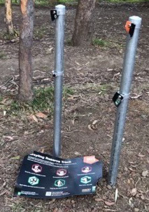 However, by July there were reports from neighbours of anti-social behaviour with older children harassing the younger ones, night time disturbance and dangerous riding in nearby streets. Trees were being damaged, some small Callicomas chopped down and dirt piled up against the Blackbutt at the entrance. Water was being taken from neighbouring properties. Creek crossings were being created interrupting the flow of the creek.
In response council placed temporary signs with stronger warnings in several locations around the site, for example:
Do not harm trees or plants or this track will be closed
Damage continued and the signs were pulled down so council closed the site and undertook a survey of the local community.
This site is not suitable for a bike park
STEP’s submission argued that this area should be a reserve, that is a quiet space for passive enjoyment for visitors and habitat for wildlife; not a highly disturbed play area. The area is not visible from the street and is too small to be a useful bike park.
In September council responded to the consultation feedback by deciding to close the build-and-ride park trial, saying the reasons were the various environmental and social issues. The announcement noted that signposted conditions of use had been repeatedly broken by users. Details are here: .
The West Pymble Facebook page erupted with comments expressing outrage at the removal of a valued facility. It seems the value had been abused. However there is a strong interest in the concept of a build-and-ride site.
Often it is the build aspect that is the most popular – sand pits for bigger kids? Council is looking for suggestions from the public of sites suitable for trials of the build-and-ride concept.
Fires and floods
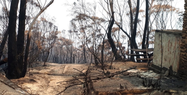
Our Black Summer fires were closely followed by record rainfall and flooding. We were actually up in the Blue Mountains for a week in February 2020 when it virtually poured every day, accumulating more than 500 mm. Soil on steep slopes was either winnowed or swept away along with a mind boggling volume of charred debris. But outcomes from such a scenario can be even worse in a safety sense, as described in an article from The Atlantic Weekly (first published on 1 November in High Country News). I’ve reproduced a couple of paragraphs below.
Two Septembers ago, the residents of Grotto, Washington, woke to the Bolt Creek Fire ripping through the mountains above their homes … No one was hurt, and no houses burned. But now, wildfire survivors in Washington now face a new threat: debris flows. Wildfires can lessen the soil’s ability to absorb water, so when thunderstorms, rapid snowmelt, atmospheric rivers, or rain falling on snow occur in a burned area, that can create a roaring earthen river. Debris flows can move quickly — 30 mph or more — sliding from the uplands to the valley floor in a matter of minutes.
Debris flows are more dangerous than mudslides and slower-moving landslides: They can sweep away boulders, trees, and cars, and threaten everything in their path, including roads and homes and the people who live in them. Last year, in Washington’s Okanogan County, two residents were rescued from their home after earth flowed through a burn scar. Another flow destroyed a cabin and sent a foot of water and mud into at least 30 structures. And in 2018, 23 people were killed when heavy rains triggered a debris flow in the burn scar of Southern California’s Thomas Fire.
John Martyn came across this article in Apple News that’s very relevant for fires in our mountainous districts.
Biodiversity camp – Muogamarra Nature Reserve
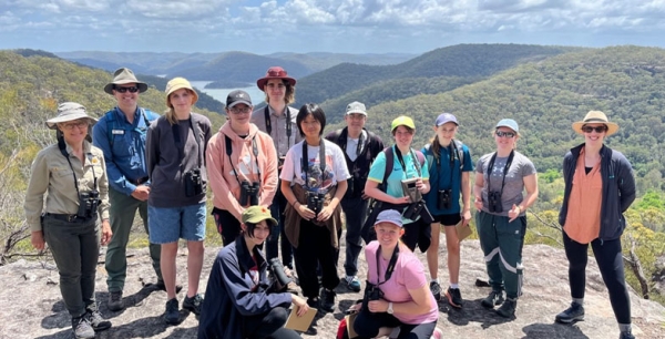
‘What an amazing opportunity …’ was a student response overheard during a lunch conversation at the recent biodiversity survey held at Muogamarra Nature Reserve on 1 November 2023. Now in its second year, the biodiversity camp coordinated by Gibberagong Environmental Education Centre (GEEC) and the NSW National Parks and Wildlife Service provides an opportunity for students to learn about their local environment, fauna, wildlife survey techniques and careers in the environmental field.
GEEC staff, teachers and students were overjoyed by the support offered by our local community-based environmental organisation, STEP. STEP so willingly offered a grant to help financially support this important project. With living costs at a high, the grant provided by STEP helped us subsidise the cost of the experience to students, purchase ten pairs of binoculars and help pay for secondary teachers to attend.
Year 10 students from Ku-ring-gai HS and Turramurra HS were invited to apply for this opportunity. Upon meeting these students in the morning, one could immediately pick up on the passion and interest of these young people.
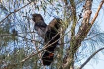 It was most disappointing for all involved to learn of a total fire ban on the Tuesday. This meant that all tracks were closed and our extensively planned overnight biodiversity camp could not run in the original format. Unfortunately, we could not do the overnight component. Due to the challenges in coordinating such events, were very lucky to proceed with a full day event on the Wednesday.
There was a silver lining in running a modified program. As we travelled into Muogamarra early in the morning we spotted two families of Glossy Black-Cockatoos. This was an amazing experience and opportunity for our students to observe this beautiful species feeding early in the morning on specific feed trees. It also provided our resident Glossy Black-Cockatoo expert and NPWS Chase Alive Volunteer, Barbara Hamilton with the opportunity to collect valuable observational data on these birds.
During the morning, the students were very fortunate to listen to two expert presentations. The first presentation was delivered by Kathy Potter from the Frog and Tadpole Study Group (FATS). Kathy so generously shared her expertise on local frog species, identification, habitats and how we can encourage frogs into our urban landscape.
This was then followed by an excellent presentation by Barbara Hamilton, Chase Alive Volunteer and local bird expert. Barbara spoke taught the students about local bird identification, evolutionary history of birds, bird distribution and how to attract a variety of birds to our home environments.
Armed with our fantastic binoculars, funded fully by STEP, we were set to conduct our survey walks. We listened and looked for all animals, especially birds. The students also collected the wildlife cameras that were set-up in the weeks prior to the survey.
 Unfortunately, we did observe a European Red Fox on the wildlife camera. This will be provided to the NSW National Parks and Wildlife Service for future management of the site.
Despite the limitations on the surveys, we did manage to identify over twenty species of animals during the survey. This information will be provided back to NPWS. Ideally, we would like to have completed more surveys during the evening and very early morning.
The major benefit of this fieldwork is the seed that has been sown in our next generation. The students were overwhelming enthusiastic about learning about our local environments, especially our fauna. They felt more connected to their local environment and have left with not only more knowledge about fauna, habitats, and survey techniques. Most importantly, the students left with an even deeper passion and love for our natural environment. So much so, they are going to do follow-up fauna surveys at their own schools as well as present their learnings to their broader school community.
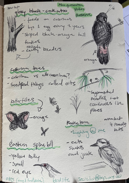
Gibberagong EEC would like to express our deepest gratitude to all involved – teachers and students, STEP, NPWS, Kathy and David Potter (FATS), Barbara Hamilton (Chase Alive) and Gibberagong staff.
Brad Crossman, Teacher, Gibberagong Environmental Education Centre
Spanish moss
Would you like to take part in our citizen science project?
STEP is becoming increasingly concerned about the potential impact of the introduced Spanish moss on our bushland and so we are trying to establish where it is and on what trees it is growing.
How you can help
Please send details of any Spanish moss you see growing on trees to Robin Buchanan (This email address is being protected from spambots. You need JavaScript enabled to view it.). Ideally:
- send a geotagged photo (you may have to enable location) OR details of the location (e.g. street, park, suburb); and
- if known, the name of the host tree (common name is fine)
Fire management guidelines: Eastern Pygmy Possum and Red-crowned Toadlet

Two threatened species, the Eastern Pygmy Possum and the Red-crowned Toadlet, are both listed as Vulnerable under the NSW Biodiversity Conservation Act 2016 and could be termed a ‘flagship’ species for biodiversity in Ku-ring-gai.
In the next few years some hazard reduction burns are planned in bushland which contains existing populations of both these species. As a result Mark Schuster (Ku-ring-gai Council’s Bushfire Technical Officer) has written two very detailed fire management guidelines to help maintain both habitat and viable populations when planning and implementing burns.
The Eastern Pygmy Possum is a small nocturnal marsupial, and in Ku-ring-gai its preferred habitat is either woodland or heath as it is highly dependent on flowering banksia species – particularly Banksia ericifolia.
The Red-crowned Toadlet is a small, distinctive frog found around temporary creeks and soaks in sandstone habitats in woodland, heathland and dry sclerophyll forest.
Click below to download the fire management guidelines for:
Good news on effective control of feral horse numbers
In the previous edition of STEP Matters there was an article about the NSW government’s proposal and consultation on reinstating aerial culling of feral horses in Kosciuszko National Park. In October there was the pleasing announcement that the ridiculous decades-old ban on aerial shooting of feral horses is to be repealed. The latest government survey of horse numbers has actually shown a small decrease of about 7%. There is a long way to go to get down to the target of about 3,000 from the current estimate of about 17,000 horses.
This decision throws a lifeline to more than 30 endangered species that call the Australian Alps home, including the southern corroboree frog and mountain pygmy possum. Our park rangers can now finally get on with the task of removing thousands of feral horses from our fragile alpine environments – before the mountains and rivers are trampled beyond repair.
Young Scientist Awards 2023

STEP has given a prize for environmental projects in the Science Teachers Association of NSW Young Scientists Awards for 22 years.
This year more than 800 students submitted projects, and STEP’s winner is Isabel Fisher from Roseville College. Her project investigated the effects that the presence of a mycorrhizal (fungal) network has on seed germination and growth for Acacia linifolia and Acacia ulcifolia.
The project showed that the fungal network had a positive impact. This finding could have a direct relevance to local bush regeneration methods.
Recent submissions: planning and Westleigh Park

The Upper House of the NSW parliament has been conducting an inquiry into how the planning system can be improved so that people, threatened species and the built environment are protected from the impact of climate change. Sue Higginson from The Greens is chairing the inquiry. The terms of reference were broad and provided an opportunity for individuals, local councils and community groups to comment using local examples of the long list of inadequacies of the system and the resulting environmental destruction. They make interesting reading!
The development application for Westleigh Park was open for submissions until 20 November. STEP’s criticisms of this large project have not been addressed so our submission drew largely from previous ones. Most of the more detailed ecological reports have many inadequacies so we consider that the development application should not be submitted to the Planning Panel until the missing details are covered. The basic problems that we have written about many times remain, namely the mountain bike trails, the use of synthetic turf and the serious and irreversible impacts on Sydney Turpentine Ironbark Forest.
The feral flying under the radar: why we need to rethink European honeybees

Australia’s national parks, botanic gardens, wild places and green spaces are swarming with an invasive pest that is largely flying under the radar. This is yet another form of livestock, escaped from captivity and left to roam free.
Contrary to popular opinion, in Australia, feral colonies of the invasive European honeybee (Apis mellifera) are not 'wild', threatened with extinction or 'good' for the Australian environment. The truth is feral honeybees compete with native animals for food and habitat, disrupt native pollination systems and pose a serious biosecurity threat to our honey and pollination industries.
As ecologists working across Australia, we are acutely aware of the damage being done by invasive species. There is rarely a simple, single solution. But we need to move feral bees out of the 'too hard' basket.
The arrival and spread of the parasitic VarroaVarroa mite in New South Wales threatens to decimate honeybee colonies. So now is the time to rethink our relationship with the beloved European honeybee and target the ferals.
What makes a hive feral?
European honeybees turn feral when a managed hive produces a 'swarm'. This is a mass of bees that leaves the hive seeking a new nest. The swarm ultimately settles, either in a natural hollow or artificial structure such as a nesting box.
With up to 150 hives per square kilometre, Australia has among the highest feral honey bee densities in the world. In NSW, feral honeybees are listed as a 'key threatening process', but they lack such recognition elsewhere.
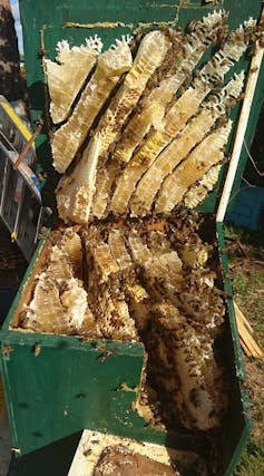
Feral honeybees have successfully invaded most land-based ecosystems across Australia, including woodlands, rainforests, mangrove-salt marsh, alpine and arid ecosystems.
They can efficiently harvest large volumes of nectar and pollen from native plants that would otherwise provide food for native animals, including birds, mammals and flower-visiting insects such as native bees. Their foraging activities alter seed production and reduce the genetic diversity of native plants while also pollinating weeds.
Unfortunately, feral honeybees are now the most common visitors to many native flowering plants.
Are feral bees useful in agriculture?
Feral honeybees can pollinate crops. But they compete with managed hives for nectar and pollen. They can also be an reservoir of honeybee pests and diseases such as the Varroa mite, which ultimately threaten crop production. That’s because many farms rely on honeybees from commercial hives to pollinate their crops.
So reducing feral honeybee density would benefit both honey production and the crop pollination industry, which is worth A$14 billion annually.
Improved management of feral honeybees would not only help to limit the biosecurity threat, but increase the availability of pollen and nectar for managed hives. It would also increase demand for managed honeybee pollination services for pollinator dependent crops.
What are our current options?
Tackling this issue will not be straightforward, due to the sheer extent of feral colony infestation and limited tools at the disposal of land managers.
If the current parasitic Varroa mite infestation in NSW spins out of control, it may reduce the number of feral hives, with benefits for the environment. Fewer feral hives would be good for the honey industry too.
Targeted strategies to remove feral colonies on a small scale do exist and are being applied in the Varroa mite emergency response. This includes the deployment of poison (fipronil) bait stations in areas exposed to the mite.
While this method seems to be effective, the extreme toxicity of fipronil to honeybees limits its use to areas that do not contain managed hives. In addition, the possible effects on non-target, native animals that feed on the bait, or poisoned hive remains, is still unstudied and requires careful investigation.
Where feral hives can be accessed, they can be physically removed. But in many ecosystems feral colonies are high up in trees, in difficult to access terrain. That, and their overwhelming numbers, makes removal impractical.
Another problem with hive removal is rapid recolonisation by uncontrolled swarming from managed hives and feral hives at the edges of the extermination area.
Taken together, there are currently no realistic options for the targeted large-scale removal of feral colonies across Australia’s vast natural ecosystems.

Where to now?
For too long, feral honeybees have had free reign over Australia’s natural environment. Given the substantial and known threats they pose to natural systems and industry, the time has come to develop effective and practical control measures.
Not only do we need to improve current strategies, we desperately need to develop new ones.
One promising example is the use of traps to catch bee swarms, and such work is underway in Victoria’s Macedon Ranges. However, this might be prohibitively expensive at larger scales.
Existing strategies for other animals may be a good starting place. For example, the practice of using pheromones to capture cane toad tadpoles might be applied to drones (male bees) and swarms. Once strategies are developed we can model a combination of approaches to uncover the best one for each case.
Developing sustainable control measures should be a priority right now and should result in a win-win for industry, biosecurity and native ecosystems.
If there is something to learn from the latest Varroa incursion, it is that we cannot ignore the risks feral honeybees pose any longer. We don’t know how to control them in Australia yet, but it is for lack of trying.
We would like to acknowledge the substantial contribution made by environmental scientist and beekeeper Cormac Farrell to the development of this article.![]()
Amy-Marie Gilpin, Research Fellow, Ecology, Western Sydney University; James B. Dorey, Adjunct Lecturer, Flinders University; Katja Hogendoorn, Research fellow, University of Adelaide, and Kit Prendergast, Native bee ecologist, Curtin University
This article is republished from The Conversation under a Creative Commons license. Read the original article.
Norman Griffiths court case: a loss for the community and the environment
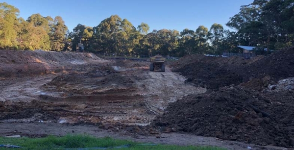
A group of residents in West Pymble took Ku-ring-gai Council to the Land and Environment Court for a judicial review of the decision to proceed with the construction of a stormwater mitigation system and synthetic turf soccer field at Norman Griffiths Oval. A group called Natural Grass at Norman Griffiths (NGANG Ltd) was registered in order to conduct the case and receive community donations.
This follows council’s decision to proceed with the project in early March 2023 after the release of the Review of Environmental Factors (REF), version 8, two weeks earlier. The haste in starting work was a cause of much frustration in the community and a fiery public forum meeting. After all we had had to wait over 14 months to see the details of the design and the REF. The time available to review the REF was inadequate; much shorter than promised. The councillors dismissed the relevance of the environmental issues raised by the community on the grounds that the REF provided assurance that the issues were not significant.
An injunction was accepted by the court to stop construction past the stormwater mitigation system stage until the case was decided. The case was expedited so there would not be a long delay before contractors started laying the turf.
Over $120,000 was raised towards the costs of the case and expert witnesses. This is a demonstration of the high level of public interest and concern about the use of synthetic turf.
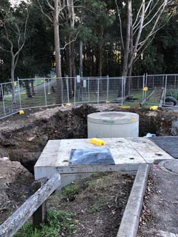
The gross pollution trap and diversion to underground detention ... but what about the water flow from the hill above the field?
Last minute amendment to the REF
NGANG was right! The time allowed to review the REF was too short. The REF was missing some of the analysis required about environmental impacts following an amendment to the Environmental Planning and Assessment Act 1979 (EP&A Act). Council decided it was okay to make a last minute amendments so version 9 was published on
4 July. Sadly, the L&E Court did not see that this expediency was an issue that could prevent the project proceeding but it is another demonstration of council’s poor governance.
Court case begins on 2 August
The main arguments submitted by NGANG were that:
Not all required environmental issues were considered to the fullest possible extent
The case was a judicial review where the relevant task is the consideration of the decision made by council. The judgement explained that a challenge may be made on the basis that the decision-maker should, acting reasonably, have made some additional inquiries. Expert evidence as to what the outcome of those inquiries would have been is, in some cases, admissible. Expert evidence was provided by Dr Scott Wilson, a microplastics expert and Dr Martens, a stormwater expert. Council also engaged three experts on flooding, pollution and ecology.
NGANG argued that council had not examined and taken into account to the fullest extent reasonably possible all matters likely to affect the environment following the installation of the synthetic turf. This is a duty imposed under section 5.5 of the EP&A Act.
NGANG’s case was that there should have been inquiries covering:
- a pollutant load study to assess microplastic pollution;
- a flood study to understand the flood impacts on the area and whether the stormwater detention proposed would function in the manner intended; and
- an investigation and understanding of where the overland stormwater flow path would be located in circumstances of an extreme rainfall (1 in 100 year event); and the investigation of the impact of the overland flow path upon the Sydney Turpentine Ironbark Forest below the field.
There was disagreement between NGANG’s expert and council as to the adequacy pf the onsite stormwater detention system (OSD). As an observer of the case, it appeared that much of the discussion of the OSD was at cross-purposes in referring to the existing system versus the new system. A new system had to be installed because the hard surface of the synthetic turf could not retain the stormwater. The old grass surface acted as the OSD.
The court ruled that the judicial review could not consider the merits of council’s decision and could only review whether it was acting reasonably. The judge rejected the evidence of Dr Martens and Dr Wilson that was sought to be tendered to establish the duty to make further inquiries in the circumstances of this case.
Stormwater system
Dr Martens advised on the requirement to undertake a study to understand the flood impacts on the area and whether the stormwater detention proposed would function in the manner intended. The report in the REF by Optimal Stormwater Ltd determined that the proposed system was capable of operating in the manner and to the specifications for which it was designed. The judge ruled that, in the circumstances, there was nothing on its face that would cause a decision-maker to consider that the opinions expressed were not reliable or not properly formed. The suggestion that the council was not entitled to take ‘at face value’ the information in the Optimal Report has no foundation. The question remains as to whether the specifications are adequate.
Microplastics
The ruling in relation to this issue indicates that the wrong question was being asked. On the evidence contained in the REF there is a goal of minimising microplastic loss from the synthetic field and identifies the measures to be adopted to achieve such goal. It is acknowledged that 100% capture is not possible, especially in extreme rainfall events but no further inquiries were recommended.
There is an obligation to commission an environmental impact statement
The other main ground argued by NGANG was the failure to comply with section 5.7(1) of the EP&A Act. This provision contains within it two obligations, first to determine whether the activity has a significant effect on the environment and secondly, if so, to not carry out the activity or grant an approval until it has obtained and considered an environmental impact statement (EIS):
In submissions NGANG formulated this ground on three bases:
- If the court found on the evidence that there was a prospect that the flood mitigation scheme being an integral part of the activity did not work as asserted by the manufacturer, either in not acting as an OSD system or not sufficiently capturing the overland flows, the court would find, on the evidence, that the proposal was likely to significantly affect the environment.
- If the court found on the evidence that the OSD system would not work as designed the infill and microplastics will not be sufficiently captured or retained on-site and will be washed down into the receiving environment, including Quarry Creek.
- A separate impact which has not been assessed from the overland flow path, which is the water diverting to the south over the field and then discharging into Quarry Creek, and the potential impacts on the adjoining STIF and Quarry Creek from that overland flow.
The judgement stated that consideration of significant impact on the environment is so broad and far reaching that it was unlikely to be determined as an objective fact by the court in judicial review proceedings. Therefore the question of whether an activity is likely to significantly affect the environment is not an objective jurisdictional fact but is a matter for the determining authority (the council) to determine acting reasonably. It seems that the precautionary principle doesn’t have any weight in this case whereby uncertainty does not justify inaction.
In this case the Judge found that council had acted reasonably. Statements by Dr Martens that the impacts may occur were insufficient to permit a finding of a likely significant effect on the environment. Modelling of changes in the hydraulic performance had not been done to enable the Court to make its own assessment.
Full steam ahead but what will happen when the plastic grass needs to be replaced?
So sadly, the construction of the synthetic turf field is now proceeding at maximum pace with completion possible by the end of this year.
The synthetic surface will not last forever, the lifetime with normal levels of use is 8 to 10 years. The question is, will council be able to replace the surface with synthetic turf? Now that a stormwater mitigation system is in place the flood risk from the field that acted as a stormwater detention basin has been substantially ameliorated. So it would be an excellent base for a natural grass field.
Currently there is no effective system for recycling the materials in synthetic turf so the large volume of material ends up in landfill. The evidence of environmental harm from the use of synthetic turf overseas is growing as is community opposition to its use because of the heat and injury risks. Several states in the USA have banned future installations of artificial turf because it contains dangerous chemicals such as PFAS compounds.
The Chief Scientist’s review into the design, use and impacts of synthetic turf in public open spaces highlighted the need for more research into human health and environmental impacts. Microplastics are a becoming more and more pervasive in our waterways. They can also interact with soil fauna, affecting their health and soil functions. Synthetic turf breaks down with people running over it and general deterioration from sunlight exposure. This breakdown increases as the turf blades age. The Norman Griffiths REF acknowledges that it is not possible to capture all the microplastics that will break off the turf. They will be washed off the field by rain but also blown away by wind due their small size of less than 5 mm.
We understand that council will be testing Quarry Creek for microplastics but the soil within the STIF forest and bushland below the field should also be tested.
The outcome of the chemical analysis must be taken into account when the replacement of the field surface is considered. Also we hope that the guidelines developed from the Chief Scientist’s review will provide meaningful decision making processes.
Ultimately the question that has to be asked is about the appropriateness of adding a large area of plastic to the environment when there is a viable natural alternative; that is real grass!
There has been such strong community opposition to synthetic turf at Norman Griffiths and in other parts of Sydney it will be difficult for councils to ignore in making future decisions.
Ku-ring-gai High School hockey field
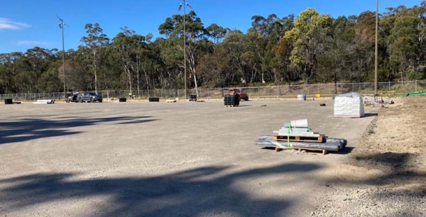
The synthetic hockey surface was installed about 30 years ago and is now worn out. The Northern Sydney and Beaches Hockey Association (NSBHA) has been working on a project to renew the surface and upgrade the players’ amenities. They originally proposed a totally new facility at Barra Brui oval in St Ives on the edge of Garigal National Park. That was eventually knocked back because car parking space was too limited. So the project is proceeding at Ku-ring-gai High.
The project is being funded through a NSW Office of Sport – Sporting infrastructure Grants ($2,720,000), NSBHA funding ($480,000) and a Ku-ring-gai Council contribution for specific carpark works ($1,000,000), giving a total of $4,200,000.
The council meeting in August voted to proceed with the joint project at Ku-ring-gai High. We cannot provide more details as all the reports presented to the meeting were confidential. The meeting minutes note that council is accepting the risks and costs associated with the project and the general manager is to be the delegated authority to execute the draft Heads of Agreement on behalf of council. What are the ‘risks and costs’? The grants are intended to cover the construction and installation costs.
Car parking is an unknown element of the project. A new parking area on the school grounds requires approval under Part IV of the Environmental Planning and Assessment Act 1979, for which council would be responsible. It is hard to see how the car parking can be increased without affecting the broad area of bushland in the school grounds that abuts Ku-ring-gai Chase National Park and contains some rare plants.
The meeting minutes note that the development of the field will occur irrespective of whether development consent is obtained for the car park upgrade. In the staff report for the meeting it is stated that the project is justified because the project will lead to better containment of impacts on-site and hence reduced impact on the local community. We can’t see how impact will be reduced with more traffic on Bobbin Head Road. If the car park upgrade does not occur there will be more demand for parking on Bobbin Head Road.
North Turramurra Recreation Area grandstand
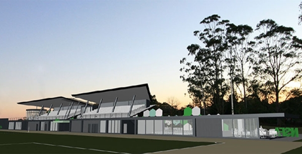
There has been much angst expressed at Ku-ring-gai Council forums and meetings about the grandstand project. Sure there is a need to improve the facilities at the ground but the proposal is over the top. The cost of the proposed 300 seat grandstand plus café, change rooms, offices, treatment rooms, corporate and media facilities has gone beyond the estimate obtained in August 2022 of $5.5 million. A recent quote obtained by Council was $7.76 million. The proponent, the Northern Suburbs Football Association (NSFA) thinks the $7.7 million figure is overly conservative, but $5.5 million is still enormous!
At the council meeting on 28 July a detailed debate occurred over whether council should proceed with a Heads of Agreement and accept the risks, costs and benefits. The motion put before the meeting noted that the project may not be financially feasible but is driven by ‘economic, social and environmental value offered to the community’. This is an odd statement as the community has objected vociferously about the social impacts in particular (increased traffic, noise, bushfire risk).
The NFSA is bearing the construction and operating costs. They were advised that two grants were approved, one a Female Friendly Community Sports Grant for $500,000 and the other from Multi-Sport Community Facility Fund for $3.6 million. So the NSFA is fronting up at least $1.4 million.
There are still several concerns with this ambitious project:
- The cost looks likely to be higher than covered by funding.
- As pointed out by Cedric Spencer in a motion presented to the August council meeting, it is not clear that the grant applications had council’s consent. This is a prerequisite to grant approval.
- Council will seek assurance that a grant that benefits football, is not inconsistent with the key objectives of the Multi-Sport Community Facility Fund.
- The long-term master planning for NTRA when it was developed in 2011 never contemplated a facility of the scale and nature proposed by NSFA. It was a multi-year project funded from development contributions, general revenue and a special rate variation levied on all residents of Ku-ring-gai. The project cost some $30 million. It was not carried out for the benefit of one dominant sporting group which is what it would become with the implementation of the grandstand proposal. The NSFA would be the primary users of this site at the expense of all other users.
- There is conflicting information about the longer term plans for the site in reference to the amount of usage and the traffic that would be generated. It seems a very expensive project if, as declared by the NSFA, the usage of the three fields is not going to increase.
- There are rumours that there are intentions to convert one or more of the other two playing fields to synthetic turf, which would be strongly opposed.
Ku-ring-gai Council is trialling a woody meadow project
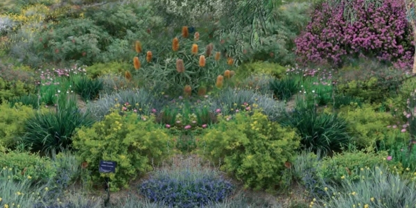
Typical low maintenance plantings on public land have low diversity, visual appeal and function. Monocultures of strappy plants such as Lomandra longifolia and Dianella or single shrub species like saltbush are often the plants of choice that provide little contribution to biodiversity.
Since 2015 Melbourne University, in collaboration with the University of Sheffield, has been trialling a novel low-cost and resilient approach to urban greening, using natural shrubland structures as templates to create beautiful, diverse plantings of Australian shrubs which are maintained through coppicing.
The idea is that coppicing (hard pruning to 10 to 20 cm high) every two to four years will promote flowering and rapid canopy closure to exclude weeds and reduce maintenance. With their high number of flowers, woody meadows encourage insects such as native bees, small birds and other wildlife.
Woody meadows are highly adaptable and can be used in a wide range of urban settings including railway easements and roadside verges, roundabouts, parks and gardens, and as part of water sensitive urban designs like raingardens and retention basins. Their low water use and maintenance requirements, coupled with high visual appeal and adaptability make them an attractive, cost-effective solution for councils and urban land managers challenged by climate change and often limited green space funding.
Councils, government agencies and developers are embracing this idea, with more than 6,000 m2 of woody meadows established around Australia that include approximately 40,000 plants from 150 different species.
With more 25,000 m2 of plantings planned for 2023, you’ll likely be seeing woody meadows popping up in your neighbourhood soon.
In August council’s environmental staff and 14 local volunteers planted 400 tube stock in Transmission Park in St Ives Chase to create the trial woody meadow. The plantings will develop over the next 12 to 18 months and staff will monitor the site to test whether biodiversity is increasing through more sightings of insects, birds and animals.
The evidence from this initial planting will help decide whether to extend woody meadows to other public land in Ku-ring-gai.
A new recycling service has come to Ku-ring-gai

At the August council meeting it was decided to trial the introduction of a new recycling service of items that are currently not included in council’s recycling contract. After a two year trial period its cost effectiveness will be assessed. Items covered by the service include:
- soft plastics
- clothing and linen
- small household appliances such as electrical tools, hairdryers, irons, toasters, laptops and game consoles
- coffee capsules, batteries, medicine containers, printer cartridges and sealed paint tins
Residents are able to book a collection from their home direct to the recycling depot. Residents can use their own bags to separate recyclable items from their general waste. Bags can also be provided by RecycleSmart. Make your booking via the RecyleSmart app.
Collection of larger items can be booked as an add-on to an existing pickup.
Book review: Underground Lovers: Encounters with Fungi

Prepare to appreciate the world under your feet (well, your feet grounded on the earth, maybe not on a concrete slab).
There is a network of mycelia that belong to their own kingdom: Fungus. Lacking chlorophyll, they grow from the tips of microscopic hyphae and digest nutrients externally (underground) before absorbing them into the mycelium.
One hypha is a microscopic filament but together they form a fungus mycelium (the network). Hyphae can not only branch but also fuse, or ‘anastomose’ and exchange genetic material. The cell walls are made of chitin, a hardness also found in arthropod exoskeletons. The mycelial scaffold essentially mirrors exponentially the life forms above ground. Mycelial networks bind soil particles while also aerating the soil, creating spaces in the soil. This architecture allows water to penetrate soil’s deepest horizons.
The fungi also form alliances with plants, or even digest other organisms. Fungi and algae, forming lichens, create soil on rock – as on exposed rock left by the retreating Vatnajökull ice cap in Iceland.
Many plants depend on mycorrhizal fungi – the fungi forming beneficial relations with roots: hyphae extend the roots’ absorbable surface; the tree provides sugars from photosynthesis while the mycorrhizal fungi make nitrogen and phosphorus available to the tree.
The author gives us good reason not to clear-fell, nor burn our forests in super-hot conflagrations, nor overheat the earth with global warming, nor over-fertilise and apply weedicides to our monocrops; even the high-velocity gale of the leaf-blower dislodges spores, let alone grasshoppers, beetles and frogs. It kills the fungi.
Some ‘old growth’ trees reach hundreds of years of age; but the fungi beneath them are at least as long-lived. Old forests support a greater diversity of fungi than young, or obliterated, forests.
Interesting allusions – Pouliot mentions her US Northwest rented V8 Dodge Charger not being the ideal field vehicle ‘with the clearance of an echidna’.
The ninth chapter Women as Keepers of Fungal Lure fills a gap. I searched for books on fungi and nearly all the citations are of men’s studies.
The tenth chapter Restoring Fungi is apposite given the fungus talks by Emeritus Prof Michael Gillings and Vanessa McPherson of Macquarie University. They observed that sites where works such as a drainage pipe had been laid hosted far fewer fungi than undisturbed (or merely weeded) sites. A property owner demonstrates that we need to create diversity and reduce stresses. On her property she supplied diverse organic matter of different species, size and age, and eliminated tilling, digging, excavating, heavy machinery and even hard hooves of stock.
Mistletoe contributes to restoration, providing nectar for butterflies, gliders and possums; and when it dies its leaves enrich the soil with phosphorus, nitrogen and potassium.
Lichens colonise bare earth and are part of the cryptogamic crusts essential for forming a film that reduces wind and water erosion. This crust of fungi, algae, cyanobacteria and mosses over the soil fixes carbon and nitrogen – and is destroyed by stock. The property owner, Kazuko, observes ‘We should be starting with soil crusts rather than trees when restoring ecosystems’.
Fungi have infiltrated Landcare! Officially restoring waterways, agricultural and natural areas since 1989, the movement now recognises the necessity of healthy fungi.
The author has travelled the globe and gives examples of mycophiles’ world-wide fungus hunting throughout the book. There is a species register with common and scientific names of fungi and lichens, plants and animals; a glossary, selected sources and an index. The editor might have picked up the constant misuse of ‘among’ and ‘between’. Despite the listing of 11 images, there are no photographs. Our desire for pictures and descriptions of so many intriguing species and descriptions probably needs a mini-encyclopaedia!
Alison Pouliot, NewSouth Publishing, 2023; 278pp (reviewed by Margery Street)
Feral horses in Kosciuszko
Finally there is the prospect of real action on feral horses in Kosciuszko National Park – please make a submission by 11 September 2023.
Penny Sharpe, NSW Environment Minister has announced a proposal to amend the Kosciuszko Wild Horse Management Plan to permit aerial culling of feral horses. There is an urgent need for action as the number of horses has been increasing rapidly. The government says the most recent official count estimate was that there are between 14,501 and 23,535 feral horses across the park.
Under the management plan agreed to under the previous government, the number of horses had to be reduced to 3,000 by 2027 in order to limit the damage they are doing to the sensitive alpine ecosystems. About 30 endangered native species and their habitats are at risk of extinction due to introduced animals, including wild horses.
However the current management methods used such as on ground shooting, trapping and rehoming are not effective. The numbers are still increasing. More effective action must be taken before the situation gets even more out of control.
The proposal is open for submissions until 11 September. Submissions need only be short. There are various ways to submit, listed on the government's Have your Say page.
Book review: The Memory of Trees
This book was of great interest having lived in Perth for 9 years and worked and travelled at length in WA for more than 40 years, including in many areas covered in the book, set predominantly in the south-west and south of the state. It's written by freelance ecologist and writer Vicki Cramer, whose research and publications through institutes like Curtin University and the CSIRO span a wide range of WA ecology, from bats and marsupials to Western Australia’s management, exploitation and clearing of eucalypt forests. In 2021 she was awarded a Dahl Fellowship from the charitable organisation Eucalypt Australia. Though set almost entirely in WA, the book mirrors the natural vegetation situation in other states and the threats it faces.
The Memory of Trees is divided into long, quite detailed chapters dealing with topics such as Jarrah forests and their threats, the West Australian Wheatbelt and salinity, the amazing Great Western Woodlands with their vast areas of trees growing in climates so dry that trees really shouldn’t grow at all. And, of extreme importance for us in NSW, the subject of bushfire, of hazard reduction and cultural burns and their history and arguments for and against. Relevant to fire and overshadowing everything covered in the book of course is climate change, the biggest mover of the goalposts that we face.
How many plant species are native to the south-west of WA? Well, the book cites 8379 would you believe (but of course new species are discovered every year so that’s by no means the final figure). Of that number, 1750 are native to Fitzgerald River National Park for example, a big park of nearly 3,000 km2 flanking WA’s south coast, big yes, but that’s very, very rich! (Blue Mountains World Heritage with around 1500 species is three times as big). And then the Stirling Ranges: full of endemic species, some of them isolated to individual peaks. These are examples of the fragile communities surviving as large islands of natural vegetation flanked or surrounded by land cleared for agriculture? What species have been lost through the clearing process? We will never know the full number, plant or animal.
Stirling Ranges and Fitzgerald River are flanked by the WA Wheatbelt. Vast areas of forest and woodland were cleared through waves of settlement, and managed on a broadacre basis with no treed remnants allowed to remain that get in the way of the massive harvesters. Farms have merged over time and families have moved away, much as is happening in Europe. The ancient impoverished wheatbelt soils were boosted, and have to be regularly topped up with superphosphate and trace elements. Natural vegetation over most of the wheatbelt is restricted to corridors and fringes along boundaries and roadways, plus isolated small copses. Mass tree removal, their roots no longer pumping, led to gradual rise in salinity – covered by a chapter in the book that highlights the recovery efforts of landowners and community groups but also political sidestepping, ignorance and neglect. Governments like to bypass salinity, highlighting grain yields, but a brief Google search will tell you that the WA wheatbelt yields a ball park figure of around 2 tonnes of grain per hectare – Ukraine by comparison, in its heyday, achieved roughly double that.
The Jarrah forests, featuring Eucalyptus marginata, were a backbone to WA’s historic economy. The rich, deep red, termite resistant timber is hard to source today except through recycling, but it was used in building and construction, in termite proof railway sleepers and in flooring and furniture, and it was exported globally. But it grows on iron and alumina rich laterite terrain large areas of which have been mined for bauxite. Bauxite, a chemically extreme end member of a soil profile, is typically only a few metres thick and so vast areas have to be stripped and mined to yield a commercial tonnage. Companies however are obligated to stockpile and restore the surface material, and the author describes traverses with colleagues in areas ranging from pristine and even rare old growth forest to sites in various stages of restoration. But one comes away with the impression that nothing can truly replace the lost forests. And then of course there’s climate change pushing winter rainfall southwards, and Phytophthora dieback!
Now for the Great Western Woodlands: these are truly vast but exceptionally vulnerable, made up essentially of eucalypt species some of which recover from fire, like the numerous species of mallee, while others are obligate seeders and are incinerated. If you’ve travelled the wheatbelt and the southern goldfields you’ll be familiar with the copper-red trunks of salmon gums. If you’ve driven east of Norseman you’ll have seen fine examples of Great Western Woodland, and perhaps be stunned to learn that the seemingly healthy trees are growing in less than 300mm mean annual rainfall. The author's field descriptions in areas east of the wheatbelt town of Hyden are both illuminating and saddening: overall the vast woodlands are threatened by climate change, reduced rainfall, human activity and most especially by fire.
Later in the book the author veers towards positive aspects: the Gondwana Link and the Nowanup Cultural Community. Gondwana link, which involves Bush Heritage among other groups, acquires land to revegetate to eventually form a chain of natural vegetation from the coastal forests of the south-west 1000km to the east to join up with the Great Western Woodland. Nowanup on the other hand was established to rally behind and promote Noongar cultural elements of which include cultural burning, which is perhaps the only way to mitigate and soften the devastating effects of climate change and fire on the woodlands and forests within a realistic time frame.
Viki Cramer, Thames and Hudson, 2023, paperback, 292 pp (reviewed by John Martyn)
Chief Scientist’s report finally released – there should be a moratorium on new synthetic fields

The Chief Scientist’s report, Synthetic Turf Study in Public Open Spaces has finally been released but fails to give definitive guidance.
Main conclusion is wrong – we cannot treat synthetic turf as an experiment!
The report developed a set of recommendations that it states will (p vii):
allow NSW to adopt an accelerated ‘learn and adapt’ approach to the use of synthetic turf under NSW conditions … If applied, they will allow NSW to set the scene over the next decade, using new fields as a testbed to contribute to innovation and data-driven decisions.
This statement is totally at odds with the precautionary principle. New synthetic fields should not be approved if the major issues cannot be addressed.
The Natural Turf Alliance is calling for the NSW government to put a stop to all plans for synthetic turf on playing fields until there is sufficient information to enable more evidence-based decision making processes. It is only right to take a precautionary approach to ensure that there are no regrettable long-term impacts on human health and the environment. Also, many of the highlighted issues could have significant financial consequences.
In the meantime, there is an urgent need to upgrade some playing fields, and natural turf can be used. Councils are already managing hundreds of natural grass fields. There are ways of doing a better job of upgrading and maintaining these fields. The report acknowledges this but then says nothing more.
Background
There has been considerable community concern about the installation of synthetic turf on playing fields, particularly in environmentally sensitive locations, and bad experiences with the planning process. Following a public enquiry in early 2021 that amplified these issues, in November 2021, Rob Stokes (then) Minister for Planning and Public Spaces, asked the NSW Chief Scientist and Engineer to provide an independent review into the design, use and impacts of synthetic turf in public open spaces.
It was promised in mid-2022. It took the Greens to issue a standing order in the Legislative Council for it to be finally released on 9 June 2023. The report was dated 13 October 2022. Who was trying to hide the results? Was it the Minister for Planning, Anthony Roberts whose desk it was sitting on? The excuse given was it that was ‘cabinet-in-confidence’ and consultation was taking place with councils and sporting bodies about the guidelines that should be issued for synthetic turf installations. In the meantime lots of decisions are being made without this information.
What the report says about natural turf
The first item of the terms of reference is:
- Identify, describe and provide advice on:
(a) key scientific and technical issues associated with the use of synthetic turf compared with grass surfaces in public spaces
The report states (p v.):
Best practice guidelines for improving the performance of natural turf have been developed in NSW. If applied to installation and ongoing management of natural turf sporting fields, these practices may allow increased performance of natural turf fields to meet demand.
In the more detailed discussion of the recommendations, in reference to an example of the guidelines developed for the Lower Hunter, the report states that analysis in the guidelines reported:
that when lifecycle costs and carrying capacity were considered, natural turf fields built to best practice were more cost effective than alternative options including synthetic turf.
Nowhere in the report is there a comparison of the scientific and technical issues that apply to the use of natural grass and synthetic turf. It is frustrating that there is no discussion about making a choice between the two. They are treated as separate entities.
Natural turf is already proven to be a better option
At the community forum organised by the Natural Turf Alliance on 23 June the speakers demonstrated that natural turf will be successful in terms of available playing hours if the correct soil preparation and drainage system is applied. Councils just have to improve their practices.
Demand for synthetic turf
According to the report, which is at least a year out of date, there are currently about 181 synthetic turf fields in NSW in public and private (eg schools) spaces. This compares with about 30 in 2018. The support for these installations has been driven by the soccer associations that are arguing that available playing hours are too restricted on grass fields to meet demand. This has been the case in the past couple of years that were abnormally wet.
Demand is increasing with population growth and it is argued by the soccer associations that the game is becoming more popular as women are taking up the game.
There are other arguments about several issues such as relative life cycle cost and water use that still being debated.
The concerns about use of synthetic turf
The report describes many issues with the use of synthetic turf and many where more research is required.
Chemical composition
Many synthetic sports fields in NSW feature long synthetic blades supported by infill, the most commonly used infill is styrene butadiene rubber crumb sourced from recycled tyres. The crumb is imported and there is a lack of information about potential contaminants such as heavy metals and polycyclic aromatic hydrocarbons. Currently, there is insufficient information and a lack of standards about the materials and chemical composition of synthetic turf. Other types of infill such as cork, are being used in newer fields but the review does not provide detail about these.
Longevity of synthetic fields
Overall, it is not clear how Australian climatic conditions will affect expectations about the longevity and carrying capacity of synthetic fields compared with overseas experience that is the basis of current decision making about installation and cost-benefit considerations.
Sustainability
Practices and standards for recycling and disposal are changing locally and overseas. Australia banned the export of waste tyres including tyre crumb from January 2022 so this component of synthetic turf has to be recycled locally or sent to landfill. The process of separating turf into components that are reusable is highly complex. Plans for a recycling facility near Albury have not yet been established.
Health
Heat impacts are a priority area for research. The commissioned reports and literature review did not identify major health risks associated with the use of synthetic turf, although it was noted that significant knowledge gaps remain and research should prioritise the potential health impacts of chemicals such as polycyclic aromatic hydrocarbons and some heavy metals. The health impacts of the high heat levels of synthetic turf are not discussed in detail but the closure of fields in hot weather is canvassed especially for younger children.
The report notes that per- and poly-fluoroalkyl compounds have been found in low concentrations in the turf blades and base carpet. They create a risk of cumulative harm to aquatic and soil life, the environment and ultimately human health.
Social and wellbeing effects
Important considerations for planners and councils will vary with each site and include reduction in community access, odours from synthetic materials and increased artificial light.
Environment
Many potential impacts are raised that need to be mitigated. Microplastics and infill have entered waterways. Design guidelines are now in force to control leakage but their success still needs to be monitored. Older fields have been observed to lose a lot of rubber crumb especially as they age. The impact of escaping infill and turf fibre (microplastics) on local soil and ecology needs to be researched.
Fragmentation of animal habitat and disruption of ecological functions will occur through the loss of natural grass, increase in heat and additional light at night. The report states that synthetic turf is unsuitable for locations with flood and bushfire risk or in sensitive ecological locations.
Recommendations
Community groups concerned about the increasing use of synthetic turf have highlighted several issues. Many of these are the subject of recommendations in the report.
1. Planning approval process
In most cases a development approval process is not required from the local council. The assessment required is a Review of Environmental Factors (REF) subject to requirements defined in the Environmental Planning and Assessment Regulations.
The report looked at a sample of REFs and found many gaps in coverage of these requirements, for example:
- climate change impacts on surface heat and stormwater
- impact of impermeable surface on soil health
- waste disposal at the end of life of the turf
- micro and nano-plastic contamination
- impact of increased light and heat on fauna outside the footprint of the field
The approval process does not provide clear requirements for community consultation. The report highlights this gap in the process:
Early community engagement that continues through the planning period enables discussion and representation of all stakeholders.
Consultation was sadly lacking in the case of Norman Griffiths.
2. Mitigating environmental risk
A plan is needed for the development of appropriate standards for best practice installation and use, consistency with net zero targets and end-of-life solutions via industry engagement with government and researchers.
In addition, fields in proximity to sensitive ecosystems should be independently assessed to assist with management of identified environmental issues. Risk assessments should be undertaken so that synthetic fields are not approved in areas of high environmental risk including bushfire prone areas or those with higher likelihood of flooding.
3. Future data and research
The report recognises that the scale of public investment in sporting infrastructure requires a more systematic and data-driven approach to decision-making. There is a vast amount of existing information from different sources about the design, management and performance of sporting fields, but these are not readily available or collated. A more accessible and reliable source of verified information is required.
Data collection should be complemented by the research program to address key knowledge gaps in human health and environmental impacts. A key research priority is understanding the characteristics and composition, including the chemical composition, of materials used in synthetic turf and associated layers.
Anita Andrew – award from Geological Society

We congratulate former STEP treasurer and councillor on Ku-ring-gai Council, Anita Andrew, on receiving the W.R. Browne Award for 2023. This award is presented to a person for distinguished contributions and demonstrated impact to the Earth sciences in Australia.
Anita has been joint editor-in-chief of the Australian Journal of Earth Sciences, the official journal of the Geological Society of Australia, for 13 years, and has been instrumental in maintaining the high standard of this international publication.
The medal honours the life and work of geologist William Rowan Browne, 1884–1975 who was a field geologist with a love of the high country and its glaciated terrain. He was a major supporter of the need to conserve Kosciuszko for all time, against much opposition.
Response to housing shortage – will it trash liveability?

High net immigration is putting huge pressure on governments to get more housing built. But do we need to do this at the expense of planning rules that are intended to create housing areas where people might actually enjoy living?
The new NSW government has announced that it will scrap local council and planning panel processes for developments worth more than $75m if they include at least 15% affordable housing. Developers will be able to go straight to the Department of Planning via state significant development rules so that decisions will made more quickly.
Further, these developments will also gain access to a 30% floor space ratio boost, and a height bonus of 30% above local environment plans.
Councils have been assured by the Minister for Planning (Paul Scully) that they will be consulted about the strategic merit of these proposals and council local environment plans will not be overridden.
The reforms are set to take effect later this year and are a part of the government’s commitment to construct 314,000 homes over five years.
Huge growth in population over 2022
It is not hard to see why we need so much new housing. Australia’s population grew by almost half a million during 2022 to reach 26,268,000 people at 31 December 2022. The annual growth was 496,800 people (1.9%). Annual natural increase was 109,800 and net overseas migration was 387,000.
Status of Lizard Rock development proposals
There has been a lot of publicity about the proposed development of an area of land known as Lizard Rock. The outcome could be significant development for other areas of bushland in the Northern Beaches Council area. First some background.
The Aboriginal Land Rights Act 1983 established Aboriginal land councils to manage land to provide an economic base for Aboriginal communities as compensation for historic dispossession and ongoing disadvantage. The Metropolitan Local Land Council (MLALC) owns several areas of land in the northern beaches area. Any development of this land is subject to an approval process with several stages.
Development delivery plans
In September 2019 the MLALC requested the Aboriginal Land SEPP be amended to include its land holdings in the Northern Beaches Council planning processes. This is facilitated by a Development Delivery Plan (DDP), a strategic plan that sets out the development objectives for priority land owned by local Aboriginal land councils. The DDP will help Aboriginal people develop their land to support their community and protect Aboriginal cultural heritage. It will also provide new homes and jobs for the wider community.
Nine sites (six initial sites and three future sites) were identified in the Aboriginal Land SEPP and a draft DDP. Click here for a map of the sites. These documents were exhibited by the Department of Planning for public comment prior to approval. Many submissions were made on issues including bushland and environmental impact, traffic, infrastructure, open space, bushfire and Aboriginal heritage. However these detailed issues will be considered in respect of each individual planning proposal and subsequent development application.
Lizard Rock planning proposal
Of the six sites, Lizard Rock on Morgan Road, off Forestway in Belrose was earmarked as the most suitable opportunity.
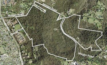
Lizard Rock site
Since October 2022 the proposal for development of this 67.7 ha site has been gone through the stages of the planning approval process, namely a planning proposal and then a gateway determination that have been reviewed by a planning panel and approved subject to various conditions.
The proposals have been opposed by politicians on all sides and the Northern Beaches Council on the grounds of the loss of pristine environment, bushfire risk, the significant congestion created and insufficient regional infrastructure. The mayor, now local MP, claims that the northern beaches already has plans to build sufficient housing in better locations
In June 2023 the planning proposal was supported at gateway determination, subject to several gateway conditions. This is for 450 low-density residential lots with 10% allocated for affordable housing. Approximately 19 ha of the site will be preserved and restored as conservation areas or public open space.
Next steps for Lizard Rock
The amended planning proposal will soon be publicly exhibited for a minimum of 30 working days to allow feedback on the proposal. Then the updated planning proposal will submitted to the department for finalisation assessment and the local environment plan and amendment will be drafted and made.
Next steps for the remaining sites
The remaining five sites require further investigation. Future land uses could include residential, industrial, employment and environmental conservation. These sites could have planning proposals or development applications submitted over the next five years.
Genoplesium baueri now on global list of endangered species

The local orchid Genoplesium baueri (endangered), also known as Bauer’s Midge Orchid, was added to the IUCN Red List of Threatened Species last year at COP 15. It is currently also listed as endangered under the NSW and federal biodiversity conservation legislation.
This classification means that it is at high risk of extinction in the near future. The inclusion in the Red List adds international significance to the classification and opens up international funding opportunities for people working to conserve these orchids.
There are some populations in the St Ives Showground precinct in the vicinity of the Wildflower Garden and nursery. This may restrict development because the plan of management mentions the possibility of road connections and increased parking between the Wildflower Garden and Showground.
Reasons for endangered classification
The NSW Scientific Committee (2012) has identified the following reasons for the endangered classification.
The main reason is the orchid’s highly restricted geographic distribution that is projected to continue to decline. The number of populations of G. baueri is uncertain. Based on records from herbaria and sightings, there are estimated to be between 20 and 30 populations between Port Stephens and Ulladulla and likely to be less than 250 individuals.
Geographic distribution is precarious for the survival of the species based on severe fragmentation of populations; continuing decline inferred and projected due to current threats of disturbance from trail bike riding, rubbish dumping and urban development; and extreme fluctuations in the number of mature individuals.
The species does not produce a new tuber at the end of each growing season but instead persists from the same tuber-like perennial root. Jones (2006) suggests that cultivation is ‘impossible’.
Plants do not regularly appear each year, despite favourable seasonal conditions. When plants do appear, they are only above ground for approximately two months before dying back to a dormant state. Whilst the appearance of plants above ground may fluctuate from year to year, individual plants may remain dormant in the soil. Nevertheless the number of plants of G. baueri is considered to be low.
Reference
Jones DL (2006) A Complete Guide to Native Orchids of Australia including the Island Territories. Reed New Holland: Sydney
Ku-ring-gai recreation needs study

Ku-ring-gai Council has recently completed a recreation needs study. The June meeting agreed to put the study out for public exhibition but it is not there yet.
The outcomes are important for putting the demands for the use of our natural areas into perspective.
Population
Ku-ring-gai’s population is growing and becoming more diverse. Current population is 124,000. Around 17,000 more people will live in the LGA by 2041 (Department of Planning population projections, 2022). In 2021, around 25% of residents live in apartments, 28% speak a language other than English at home, and families with children and young people make up 46% of households.
People want more spaces to participate in informal recreation for fun
Fun and enjoyment (90%), fitness and exercise (88%) and getting fresh air (88%) are the main reasons residents use recreation spaces. Walking (87%) is the most popular recreation activity followed by bushwalking (75%). Other popular activities include picnics (64%), relaxing (58%), walking the dog (48%), fitness activities (44%) and running (44%).
Sports are still in high demand, but non- traditional sports are emerging
Local sporting clubs and peak bodies indicated that participation in organised sport remains popular, reporting a 41% increase in participation in the past five years. There is also increasing demand for spaces for informal social team sports, emerging games such as Padel and pickleball, as well as demands for more spaces for women’s sports.
Sporting fields
A review of the facilities against benchmarks indicates that there are adequate sports fields but their quality should be improved. This is a major barrier for participation with the issues being lighting, amenities, maintenance, safety and unfit facilities for female participation.
There is an oversupply of tennis courts and a need for more basketball courts.
Analysis of council’s formal booking data shows that natural turf sports fields operate below capacity throughout the year, indicating the opportunity to improve their capacity and utilisation. However there are questions about whether the booking data is a true indication of actual usage. It can be observed that tennis courts get a lot of informal usage.
Sports fields and sports spaces can no longer be single purpose or single code to meet needs. The availability of suitable additional land is limited and expensive. This means planning for more diverse and equitable open spaces and recreation facilities that are designed for shared uses by children, older people and dog owners.
Council should undertake a study to determine which sporting codes can share effectively and how to optimise existing sports fields and sports courts to make them more multi-purpose.
In our view synthetic turf is not the answer. Upgrading existing grass fields and improving maintenance will meet the needs of existing organised sports. The study highlights the need for more flexible and multi-purpose use of these fields. This cannot occur with synthetic turf that is focussed on facilities for a single sport.
Open space and parks
There is a need for more open space especially near the railway line. Based on the benchmark of 1 ha per 1,000 people Ku-ring-gai is well below the minimum requirement of 124 ha of parks to support the current population in 2021.
Natural areas
It is acknowledged that natural areas are predominantly conserved or preserved for passive recreation. There are limited opportunities to provide recreational spaces in natural areas. There is still a need to better connect them to the public open space network, as well as expand the recreational trails, where possible. The emphasis should be on ‘where possible’. The walking trails could be improved in many ways such as signposting and better linkages but there is little opportunity for new trails and bike tracks without compromising the quality of bushland.
Draft masterplan for St Ives Showground and precinct
Ku-ring-gai Council is developing a masterplan for the St Ives Showground and Precinct that will guide future improvements and define a longer term vision for the precinct.
This follows the Plan of Management (PoM) that was finalised in October 2021. The PoM sets the overarching principles and direction for the masterplan and must be adhered to as a regulatory document. We have already reported on the fraught consultation process of development of the PoM.
As a first stage council is seeking input from the community about the masterplan with the objective of creating a plan that will:
… ensure it meets the needs of current and future users and the wider community.
Online survey and submission website
Click here to respond to a survey about the current facilities. You can also provide written comments or upload a letter. The closing date is 17 July, 5 pm.
There are several issues that STEP will be commenting on that are not included in the survey. The written submissions will contribute to the contents of the masterplan. It seems that it is difficult to influence council to change a draft plan once it has been published. This will take place in August with the final draft going before council in September 2023.
User groups such as bike riders and soccer players are likely to be commenting so it would good to hear the views of those of you who value the biodiversity of the precinct (as was demonstrated during the STEP walk led by Mark Schuster in February).
What is being surveyed?
The survey asks questions that are narrowly focussed on opinions about the facilities at the showground including suggestions for changes or improvements. There are also questions about the capacity to hold larger events for more than 300 people.
Parking and traffic movements are the most obvious issues. The showground is already highly congested on weekends given the popularity of the playground and regular events such as the markets and horse riding. The PoM states that:
The lack of formal parking and users creating informal parking areas can cause soil erosion and compaction, which impacts negatively on the environment, vegetation, and water quality.
A major part of the parking area near the entrance is actually in amongst vegetation that is classified as Duffys Forest that is endangered and should be protected. It is a dust bowl or muddy mess depending on the weather. It is only going to get worse if more facilities are going to be developed.
The PoM gave a high priority to defining parking controls and preparing a landscape plan to guide the rehabilitation of the Duffys Forest but no plan has been seen yet.
Some sort of public transport system has to be developed as well as a safer way of exiting onto Mona Vale Road especially when major events are held such as the Medieval Faire.
We are also concerned about the health of the trees that are supporting the high ropes course.
The current PoM is not actually a plan for many parts of the Showground precinct. For areas like the nursery and former Greenfields tip it is merely a set of suggestions or ideas. One concern is the plan to upgrade the link between the Wildflower Garden and the Showground. The area contains prime Duffys Forest vegetation as well as the endangered Genoplesium baueri.
John Martyn Research Grant for the Conservation of Bushland 2023

We are pleased to announce that the recipient of this years’ award is Margarita Gil-Fernández for her project entitled Mycorrhizal Fungal Diversity Associated with Small Mammals in Response to Anthropogenic Disturbance.
Margarita has provided the following description of her work.
I received my Master of Research degree from Macquarie University where I am currently completing my PhD degree. I am interested in mammal ecology, from small mammals to big carnivores, including invasive species. I have experience in research planning, experimental design and implementation, as well as data collection, management and data analysis. To date, my research projects have primarily been field-based, including projects for small mammal trapping and monitoring, camera trapping, and forest health research.
Anthropogenic (e.g. agriculture and urbanisation) and natural (e.g. wildfires and insect outbreaks) disturbances are currently increasing. One of the main strategies plants employ to cope with these stress conditions is to form mutualistic associations with mycorrhizal fungi, which enable them to better acquire water and soil nutrient resources. The distribution of mycorrhizal fungi is tightly linked to animals, with rodents and several Australian marsupial species being the key dispersers of these fungi.
Therefore, the composition of small mammal communities could influence the make-up of mycorrhizae communities and in turn the composition and resilience of vegetation communities.
We aim to examine the relationship between anthropogenic disturbance and mycorrhizal fungal diversity associated with small mammal communities around Sydney, to help inform management strategies that will enhance forest resilience to disturbance as well as inform the conservation practices of native small mammal species.
The study will take place in Ku-ring-gai Chase National Park, which is bounded by urban development and hence is exposed to increased anthropogenic disturbances. We will trap small mammals at 10 sites in and around the park and scats of the captured mammals will be collected to assess mycorrhizal fungal diversity. We will then extract the DNA from the scat samples to identify mycorrhizal fungi species being dispersed by these mammals using genetic analyses known as next-generation sequencing barcoding. Our results will provide new insights into the impacts of anthropic environments on small native mammal communities and the mycorrhizal fungi they disperse, with implications for the management of native plant species that depend on these fungi.
Research Grant

We have decided to expand our commitment to environmental education, and this year we have awarded our first ad hoc research grant to Vanessa McPherson from Macquarie University for her project Fungal Biodiversity: Diversity, Distribution and DNA.
Vanessa will examine club and coral fungi in the Lane Cove Valley and surrounding regions, using DNA barcoding to identify and characterise novel and existing species.
New specimens will be prepared for Herbaria and characterised microscopically to unify morphological and DNA data. Existing Herbarium specimens will be processed for DNA analysis. This project will definitively identify diverse species of clubs and corals, assemble a reference collection of specimens and photographs, generating DNA databases and morphological keys for identification of Australian species. New species, phylogenies of fungal taxa and distribution maps will be published in the scientific literature.
Night visitors

Have you ever wondered about all the little creatures that may visit your garden at night? A wildlife camera has been on our wish list for some time but we finally got round to getting one when former STEP president, John Burke, showed us the photo of a wallaby he’d caught on his camera. His garden backs onto a huge bushland area but behind us we have only a very small bush reserve surrounded completely by homes so we knew any of our visitors would be far smaller.
Our first experiment resulted in the usual suspects: a brush tail possum, a ringtail and a rat. There was also a pair of bright eyes across the fence watching from our neighbour’s tree.
The next location we chose for setting up the camera was a series of snuffle holes close to the gate adjoining the bushland and the first images taken that night revealed a very healthy-looking bandicoot. We were so delighted but what chilled us was an image taken not long after of a large cat sniffing the bandicoot’s trail.
It really brings it home how vulnerable our native animals are. There are districts like the Blue Mountains where owners are required to keep their cats in at night. Although it’s not mandatory in metropolitan Sydney, it’s a matter of management — sticking a pot plant in front of the cat flap, saying no to Tiddles. There are mixed reports as to whether collars with bells are a solution because it has been found that some cats are clever enough to move so stealthily that their bells don’t alert their prey. So if you own a cat and live near bushland, please consider keeping it in at night.
Our latest camera experiment has been to set it up to watch the nesting box on our paperbark tree and see if it has any occupants at the moment. The box was designed for a glider but we did suspect that little ringtails had used it and the bark approach to the box showed signs of traffic. So far, we have seen nothing emerging or disappearing into the box (maybe we did not set a long enough timeframe) but our camera has caught a very active ringtail on the tree.
We would encourage STEP members to think about getting a night camera (can be used for general security, too) especially if you have a family. Encouraging kids to understand more about the world of our precious native animals and to appreciate how precarious life can be for these little creatures in our urban environment is one of the ways to safeguard them for the future.
Country Town, a history book for young readers
STEP families may be interested in Country Town, a children’s picture book that will be coming out soon. Isolde Martyn (one of our long time members), Robyn Ridgeway and local illustrator Louise Hogan have created an imaginary inland town that reflects the experiences of many real towns over the last 200 years. From a First Nations People’s camp by a river crossing, young readers can follow the ups and downs in the town’s story right through to the present day. Many themes of Australian history are woven into the artwork and text so it’s a great way to learn about the past and it will be useful in triggering discussions in class and at home.
Why imaginary? Well, say the creators, it would have been very rigid having to tie it down to one location. This way it has a far wider appeal and can hopefully inspire kids, wherever they live, to think about what came before the buildings around them and how the land has been changed.
ISBN 9781922696342 (HB) 9781922696359 (PB)
Publisher: Ford Street Publishing
Email: This email address is being protected from spambots. You need JavaScript enabled to view it.
Norman Griffiths synthetic turf – bad PR by Ku-ring-gai Council again!
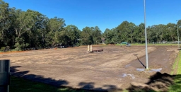
At the time of finalising an article for our last issue of STEP Matters we were still waiting for the review of environment factors (REF) for council’s project to install synthetic turf at Norman Griffiths Oval in West Pymble. This was to be the major document giving details of the stormwater mitigation works and the design specifications of the field together with the management of identified environmental risks. The details of the design had not been made available previously.
By the time this happened on 27 February there was suddenly a great urgency to get started on the project. The public was given only two weeks to review the 72 page document plus 15 appendices and seek answers to questions. The bulldozers were due to start work on 13 March.
The local stakeholder groups wanting details about the project had been told that they would have four to six weeks to review the REF. So there were many representations made demanding that there should be more time. After all, the mayor had signed the documents giving the go ahead in November 2021 while the council was in caretaker mode before the election. Council had taken 15 months to produce the report so why the rush? Was it something to do with a time limit on the payment of grants of about $1 million promised by the NSW government?
Council decided to hold an Extraordinary General Meeting to discuss the project and provided for a further opportunity for submissions at a public forum on 14 March. Council was not swayed by the arguments that more time had been granted even though we had written evidence of this commitment.
The Extraordinary General Meeting was a farce. They simply presented a resolution that the REF be noted and received. The issues raised at the public forum were treated as unimportant.
One issue was the lack of consultation with NPWS that is required as runoff from the field will end up in Lane Cove National Park via Quarry Creek. NPWS was given the same short period to review the REF. The only commitment by council with NPWS is for continuing consultation in relation to any issues that may emerge.
This is just another example of the disregard council staff have for community concerns. Similar attitudes were experienced with the St Ives Showground Plan of Management where consultation occurred after decisions had already been made.
Once the field is in use and the tonnes of cork infill are in place, the amount of infill migration off the field with regular use or heavy rain will be a watched closely. Water quality is being regularly monitored via the Streamwatch program.
The picture at the top of the page shows Norman Griffiths Oval on 15 April 2023.
Westleigh Park development
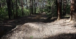
In Issues 217 and 219 of STEP Matters there was some information about the proposals for development by Hornsby Council of the land known as Westleigh Park.
The Save Westleigh Park group has been engaging with the local community explaining the draft plans that have been put out for consultation. Very few locals are aware of this significant development. It is very disappointing that council has not even put up signs in the local shopping centre to alert the locals. This development will have major impacts as there is currently only one road providing access to this major sporting complex with three fields. Does council expect people to be constantly on social media looking for local news?
The draft Master Plan and Plan of Management were approved for exhibition by councillors at the 8 March meeting. Four weeks was provided for submissions with closing date of 9 April for the draft Master Plan and 23 April for the Plan of Management.
Mountain bike trails to remain in the endangered forests
The biggest bone of contention has always been the illegal mountain bike trails in the large bushland area that totals 26 ha. This bushland includes areas of critically endangered Sydney Turpentine Ironbark Forest (STIF) and endangered Duffys Forest, totalling 9 ha plus several threatened species in other areas. The trails were built by the mountain bikers while the land was owned by Sydney Water and have been expanded since. They have named the complex network zigzagging through the bushland as H2O MTB Trails.
In 2021 council exhibited a preliminary master plan that proposed that most of the trails in the endangered forest be removed or relocated to the edges. Trails in the other bushland would remain and be upgraded to conform to industry standards. This caused an outraged reaction from the mountain bike community.
Council held a series of workshops to try to establish a consensus between the opposing groups of mountain bikers and local community and conservation groups. This was never going to happen. We waited with bated breath to see the final proposals that Council would come up with.
No doubt there was much lobbying going on behind the scenes. The conservationists group, now called Save Westleigh Park, were horrified to see that council was proposing to retain some of the trails and even build some new ones in the endangered forest areas. A specialist trail building company had been brought in to advise on a network that would be a ‘good experience’ and cover a range of abilities from beginner to advanced.
The total length of trails would be reduced from 9.5 to 7.3 km. The trails in STIF would be reduced from 2.45 to 0.96 km and in Duffys Forest from 1.9 to 1.5 km. However some of these trails would be new so more damage to the bushland, including the endangered forests, would be incurred.
The continuation of trails in the endangered ecological communities goes against all the principles of conservation. Council claims they are observing the Biodiversity Conservation Act hierarchy of avoid, minimise and mitigate, but they will have to resort to the last stage and try to find offsets for the loss of integrity of the forests. The STIF is critically endangered which means the forest is on the brink of extinction. There are only small areas left so suitable offsets are not available and the net effect will be a loss of healthy STIF.
Not only will the trails remain in the forest but the general public will be excluded from their use. The only consolation is a walking track that is only 150 m long plus a shared path around the boundary between the bushland and the sporting fields.
The Master Plan also does not specify when and how council will close down the trails that are to be removed and undertake the rehabilitation to undo the damage already done.
Risks to endangered ecological communities
STEP’s submission on the Master Plan focussed on the risks posed by the building and use of bikes through endangered ecological communities that threaten their survival. These include:
- disruption of pollination
- soil compaction that damages fungal diversity and spore dispersal
- edge effects that change growing conditions such as light, humidity and wind
- introduction of pathogens
By allowing these trails to continue council is evading its responsibilities under the Biodiversity Conservation Act to protect these forests.
Other issues
There are other concerns about the Master Plan many of them related to the plans to squeeze three sporting fields into the cleared areas.
The draft Plan suggests that the middle sporting field that is designed for soccer could be synthetic grass. This is highly inappropriate for an area so close to the bushland.
It is also proposed to build a link trail through the Dog Pound Creek biobanking site to the Hornsby Quarry site. This area is another critically endangered ecological community and a biobanking site. It must be protected from pathogens that could be introduced by the movement of bicycles. There is already evidence of Phytophera infestation. It is intended to close this link from use by walkers so they will lose the experience of a spectacular area of Blue Gum Diatreme Forest.
The whole development is large enough to cater for regional needs, not just local needs. Hornsby Council has received a large grant ($40 million) but this is not sufficient to cover the huge cost of the project. Rate payers will be covering much of the cost.
One major cost is the need to remove the contaminants such as asbestos and heavy metals that have arisen from the use of the site as a tip and fire-fighting training ground. These are to be localised and buried under concrete. Will this be effective? The fields will then need to be levelled which involves building up the south-west corner by 8.5 m.
Funding is not available for the whole project so it will be done in stages. The removal of the mountain bike trails in the endangered ecological communities and rehabilitation of the weed infested bushland should be a priority.
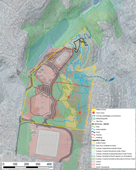
Plan of Management for Berowra Valley National and Regional Parks finally released

The draft Berowra Valley National Park and Berowra Valley Regional Park Plan of Management was exhibited for public comment way back in March 2015 and STEP spent a busy few months liaising, assembling data and writing our submission before close of submissions in July 2015. The final Plan of Management was adopted by the Minister for Environment and Heritage on 2 February 2023, an interval of eight years.
Our comments in 2015 focused on our two main concerns, the proposed sporting fields on the two open grassed areas of approximately 2 hectares in size to the east of Schofield Trail, Stringybark Ridge, Pennant Hills and the potential mountain bike options for the park.
Future of Stringybark Ridge
In the adopted Plan of Management, the provision of sporting facilities at Stringybark Ridge has not progressed, but it has been identified as a potential site for recreational, educational or cultural activities.
Other potential options for the site include camping areas to support use of the Great North Walk and/or an area for community group activities.
The management response is to prepare a precinct plan for Stringybark Ridge to examine opportunities for future use and vegetation restoration. Vehicle and public access arrangements for Stringybark Ridge will be determined as part of the precinct plan.
STEP will be keeping an eye out for the precinct plan as our objection to sporting facilities was not about the sports per se but about the possible ecological impact of development.
Undeveloped ridgetops are particularly rare and valuable in the valleys of the Lane Cove River and Berowra Creek, and we consider that the simple fact that it is a ridge makes Stringybark Ridge of conservation significance.
In 2015 STEP argued that the construction of sporting fields and mountain bike tracks would destroy the value of Stringybark Ridge as habitat and as a corridor. Stringybark Ridge is an integral part of the corridor from the Parramatta River to the Hawkesbury River as it the closest point to Lane Cove National Park. Nomadic and migratory fauna, as well as dispersing young, all need safe corridors for survival of the species.
Environmental impacts
We were concerned about the environmental impacts around the proposed sporting fields, issues that will be similar for any development:
- noise from traffic and sports will disrupt wildlife
- lights that will disrupt wildlife including the threatened Powerful Owl
- traffic causing road kill with significant risk for nocturnal animals, particularly the vulnerable Powerful Owl
- clearing for construction of the sporting fields, roads, parking and facilities will remove native plants and increase the possibility of weeds
- if the sports fields are grassed, impacts such as water runoff carrying nutrients will kill native plants and increase weed invasion into the bushland
- if the sports fields are covered in synthetic grass, then there will be no habitat for ground mammals such as bandicoots, wallabies, native bees and ground feeding birds such as magpies – it will be a desert in the centre of the national park
- fire management will be targeted at protection of life and property rather than protection of the biodiversity values
Social impacts
We were also concerned about the social impacts of the sporting fields:
- noise – this carries for long distances in bushland areas, e.g. the rifle range at Hornsby can be heard from Stringybark Ridge
- lights will be very visible from parts of Westleigh, Thornleigh, Pennant Hills and Cherrybrook – this is against the stated priority of protection of the high scenic quality of the ridgelines found within the planning area, particularly along the Great North Walk and from other vantage points within Berowra Valley National Park
- at present walkers can safely enter the planning area at the park gate – if the sporting fields go ahead, entry will be along a noisy and dangerous road
- a reduction in bushland quality caused by many factors, e.g. weeds and native vegetation being managed for asset protection rather than for biodiversity conservation
Mountain bike options
Mountain bikes were a concern in 2015 but Garigal National Park was chosen as the preferred option for mountain bike facilities. In 2015 the draft Plan of Management stated in Management Response 3.6.8:
Permit cycling on designated management trails and public roads and investigate future opportunities for mountain bike access in the region.
In the 2023 adopted plan, 3.6.8 has been altered to:
Investigate and enable, where appropriate, future opportunities for mountain bike access as part of ongoing discussions with stakeholders and other land managers regarding cross-tenure options across the northern Sydney region. Any new construction will be with a focus on linking cross-tenure mountain biking opportunities.
Cycling is permitted along designated management trails and public roads. Cycling is not permitted on walking tracks. The construction of unauthorised mountain bike tracks remains illegal.
According to management purposes and principles:
The primary purpose of national parks is to conserve nature and cultural heritage. Opportunities are provided for appropriate visitor use in a manner that does not damage conservation values.
Getting the balance between visitor use and conservation correct is always controversial.
Quality of the document
STEP has many criticisms of the quality of the documentation in the plan. The whole geology section needs to be re-written with a correct balance between geology, landscape and soil. The naming and detail of species is inconsistent. Fish and mangroves are completely overlooked despite them being such important ecosystems.
Population – big Australia back on the agenda

The Centre for Population, part of federal Treasury, was established in 2019 to improve data collection on how Australia’s population is changing and the implications of these changes.
The Centre makes an annual statement of population including analysis of changes over the past year. The 2022 statement has recently been released. This report also covers projections of future population levels out to 2033 as well as analysis of the impact of COVID on recent migration and mortality experience. It is good to see regular information in one location instead of previously having to delve into ABS and Department of Immigration website data.
This report brought out the usual hype in the media about the need for new migrants to stave off the ageing population burden and labour skill shortages. There is only limited discussion of the impact the growth will have on significant aspects of social and environmental wellbeing, such as cost of housing and biodiversity.
Projections for next 10 years
The baseline assumption of future net overseas migration (NOM) is 235,000 per annum based on the average over recent years prior to the COVID-19 slowdowns plus some adjustment for policies increasing permanent placements. Despite the COVID experience we are still trying to catch up on the demand for services and infrastructure that was generated by the escalation of growth that was started by the Howard government in 2006 and has been perpetuated by subsequent Labor and Coalition governments ever since. Prior to 2006 NOM was half that level or less.
Our current population is 26.1 million (as at September 2022). The projection in the Population Statement 2022 is that we will reach 30 million by mid-2033. However, the level of migration has been ramped up since the Labor government came to power as a backlog of applications is being processed and international students are flooding back. It is estimated that the NOM for the next two years will be 650,000 so that growth including natural increase (births less deaths) will approach 950,000. No wonder there is a housing crisis! The slowdown during the COVID-19 shutdown is becoming irrelevant.
Intergenerational report — projections to 2060
The 2021 Intergenerational Report provides longer term projections of the outlook for the economy and budget.
This report used the same assumption for NOM of 235,000 pa for the whole 40 years of their projections. The total population in 40 years’ time is projected to be an eye-watering 39 million. That is a 13 million more people, a 50% increase! The growth over the past 40 years was 11 million. We can see the impact of that number. To use the hackneyed catch phrase, it is unsustainable. Liveability of our cities has declined. The State of the Environment Report 2021 showed significant declines in biodiversity. Surveys have highlighted that citizens do not want this high rate of growth to continue.
The governments at state and federal level express plans to stop species extinctions, reduce carbon emissions and improve liveability but they carry on, regardless of popular opinion, doing nothing to stop the forces that go against these policies; vegetation clearing, bigger houses, more roads.
Apparently, there is no contemplation that our growth will ever slow down. The concept of longer term planning whereby the growth can be reduced over time is anathema to the politicians and business even though it would be welcomed by voters. We have to accept the reality of adapting by increasing skill levels, retraining the existing workforce and increasing workforce participation into retirement age. The easy option is still being taken by importing skills from countries that need them more. The hard decisions are being left to future generations.
Alternative viewpoints
Sustainable Population Australia, an environmental advocacy organisation, has recently published some discussion papers with academic analysis calling into question the status quo.
The housing crisis is a population growth crisis
Some of the key points made are:
- The connection between population growth – driven by high immigration – and high housing cost inflation is often ignored or denied in political circles but is accepted as an undeniable fact by almost everyone knowledgeable about the property industry.
- An accumulation of ill-advised policy measures (e.g. negative gearing, reduction in capital gains tax and first home buyer grants) have combined with accelerated population growth to create a perfect housing storm.
- A lower net migration level is needed to slow growth and stabilise population size. Even an optimally regulated market will not prevent housing inflation in the face of endless population growth.
- Lower, well-targeted immigration will not cause intractable skills shortages or unmanageable population ageing, but will reduce housing stress and inequality, and improve environmental amenity.
How many Australians? The need for Earth-centric ethics
This discussion paper has been written by Dr Paul Collins, an historian, broadcaster and the author of 17 books on Catholicism, the papacy, environmental ethics and population issues.
The paper addresses the competing demands of human beings seeking a better life with the rights of our natural systems to prevail against the demands of human activities.
Despite its physical size, Australia is limited in biophysical and geophysical terms. All our State of Environment reports have found the demands of the current population have been degrading natural systems irreversibly. We are not living sustainably with the numbers we have at current standards of living.
Millions want to come and share the riches we enjoy. Do we have a moral duty to let them come and allow them a better life? Or should we protect the ecosystems in our care?
He calls for a totally new moral principle to guide and govern our ethical behaviour as a species. He argues that we must shift our ethics away from anthropocentrism and economism which pays no heed to our dependence on the natural world. Instead, moral decision-making must give priority to the Earth, biodiversity, climate stability and the integrity of natural systems.
Microbats alive and well in South Turramurra
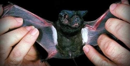
We have been part of Ku-ring-gai Council’s microbat surveys for some time as part of the Pool to Pond program.
Our recent report noted that the water quality in our pond in Kingsford Avenue was excellent and that five species of microbats have been visiting our pond, one of the highest numbers recorded in Ku-ring-gai.
These include the three most common bats:
- Gould’s Wattled Bat (Chalinolobus gouldii) found at 41 sites
- Little Bent-winged Bat (Miniopterus australis) found at 33 sites and vulnerable
- Ride’s Free-tailed Bat (Ozimops ridei) found at 32 sites
as well as the more elusive Little Forest Bat (Vespadelus vulturnus) and the White-striped Freetail Bat (Austronomus australis) pictured above.
Seven species of microbats have been found across Ku-ring-gai. We are sure other STEP members will have contributed to the survey and the biodiversity of our area.
All this is very re-assuring in that Kingsford Avenue was where STEP began in 1978 and is still on the job!
Margaret and John Booth, have provided this good news story.
More...
Safeguard mechanism – how effective will it be?

The Albanese government has passed revisions to the Safeguard Mechanism legislation with the help of the Greens in the Senate. This is a vital part of ensuring that Australia meets its commitment to reduce net greenhouse gas emissions by 43% relative to 2005 levels by 2030 and 100% by 2050. By ‘net emissions’ it is meant actual emissions less offsets.
Two of the main mechanisms for reducing greenhouse gas emissions have been the facilitation of adoption of renewable energy through the renewable energy target schemes and reducing demand through use of more efficient products such as LED lights and home insulation. Many industries have initiated emission reductions by using more efficient production methods.
The legislated government policy tools applied to industry have been the so-called Safeguard Mechanism and Emissions Reduction Fund. We have written before about the questioning of the effectiveness and integrity of the Emissions Reduction Fund in reducing carbon emissions through the creation of carbon offsets.
The Safeguard Mechanism was introduced by the Abbott government in 2016. It applied to larger companies that emitted more than 100,000 tonnes CO2 equivalent per annum; 215 companies came under the scheme that were producing 28% of Australia’s greenhouse gas emissions. The most significant are the big miners, cement and steel manufacturers.
The principle behind this mechanism was that limits would be applied to emissions. If they were exceeded, penalties could be imposed that were meant to be disincentives for exceeding the limits. However, under the Coalition Government, the Safeguard Mechanism has been a farce. National pollution ‘limits’, or company baselines, were set at levels that were way higher than the amount that companies were polluting. If these companies did happen to exceed the very high ‘limits’ that were set, the government of the day would often just let them set new ones anyway, without any penalty.
As a result the total emissions by the affected companies actually increased by 7% from June 2016 to June 2021. In 2020–21, aggregate baselines were set at 180 Mt CO2-e, compared with actual covered emissions of 137 Mt CO2-e.
Under the amended legislation the baseline for each company for 2023–24 year will be set at a level using a production based intensity standard. Beyond 1 July 2023, baselines for new facilities will generally be set in line with ‘international best practice, adapted for an Australian context’. This will also apply to existing facilities if they begin producing new products.
The baseline will be reduced by 5% each year in order to achieve the overall target of a 43% reduction on 2005 emission by 2030. Actually it is not that simple as there is some flexibility by using rolling averages. The total baseline is set in terms of the total emissions over the 10 years to 2030
Companies that reduce emissions below their baseline will receive credits, which they can sell to higher emitting companies. This will provide an incentive to adopt new technologies if they cost less than the price they will receive for the credits. If it is too costly to reduce emissions companies can buy credits within the scheme or offsets from an external source.
Companies cannot simply buy their way out using offsets. Where they rely on offsets to meet more than 30% of their emissions reductions requirements, they will be required to justify their reason for doing so to the Clean Energy Regulator.
Provision for new industries and mines
There is a defined hard cap on the total carbon pollution produced within the scheme, so that new or expanded projects cannot blow out plans to cut national emissions – particularly new coal and gas. If a new facility starts operating the overall baselines of the existing facilities may have to be reduced accordingly in order to maintain the total cap.
New coal and gas developments will have to be net zero for their direct scope one emissions, which means they will have to offset all pollution released in the production process, a step that makes it more expensive to get a project up. All new gas fields for liquefied natural gas export projects will also need to be net zero for CO2 emissions.
The requirement for net zero carbon, combined with the benchmark expectation that no more than 30% of emissions reductions be achieved through offsetting, suggests that carbon capture and storage is likely to be a significant element of the abatement solution for those oil and gas projects that do proceed. But this technology is still unproven.
Are offsets genuine reductions in emissions?
After much publicity questioning the integrity of the offsets scheme known as the Emissions Reduction Fund, the government commissioned an independent review by Ian Chubb, former Chief Scientist. The report released in January concluded the scheme is essentially sound. But key questions raised by a research team at ANU remain unaddressed.
While a carbon credit is meant to represent a reduction of one tonne of CO2, scientists say an offset created through forest regeneration is not equal to a tonne released from fossil fuels. The latter can persist in the atmosphere for hundreds of years. The former is much less likely to survive as long.
Vale Harry Locke

STEP members were sad to hear about the death of Harry Locke in February. Harry and his wife Neroli were key players in the fight to save both the Lane Cove Valley from the proposed freeway and a large area of Blue Gum Forest that is now part of the Dalrymple Hay Nature Reserve in St Ives.
They also transformed weedy bushland in South Wahroonga and were instrumental in trialling a new stormwater detention system on the edge of Lane Cove National Park. Also they were instrumental in rescuing the historic cobbled road at the end of Fox Valley Road from housing development.
For many years STEP’s Christmas barbeques were held just behind their house in Leuna Avenue amongst an array of native plantings.
Vale Will Steffen

One of Australia’s leading climate scientists, Prof Will Steffen, died in January. Steffen has been hailed as a brilliant climate thinker, selfless mentor and gifted communicator. His death is a great loss to climate science and understanding of earth systems.
Some of his friends and colleagues wrote about their relationship with Will in an article in The Conversation, published on 31 January.
Will joined the CSIRO as an editor and information officer but he was soon headhunted to the nascent International Geosphere Biosphere Program, an international consortium of scientists which aimed at understanding the physical, chemical and biological processes that regulate the whole Earth system. He eventually served as the IGBP’s executive director from 1998 to 2004.This was the early 1980s, when the field now known as Earth system science was just taking off.
Will was a visionary in many ways. He understood that the environmental problems we were trying to solve spanned many academic disciplines and were deeply interconnected. Few people had his ability to absorb so many diverse types of science and to work with the diverse research communities whose expertise was urgently needed as part of the solutions.
Will co-developed a number of influential ideas in sustainability science, such as:
- The planetary boundaries framework that shows us that the environment is not boundless and elastic and able to absorb all that we throw at it or take from it. Our planet has limits – and if we push too far, we will break something, leading to dramatic changes to the planet.
- The concept of the Great Acceleration which describes the dramatic increase in human environmental impact since the 1950s, brought about by population growth and fossil-fuel burning.
- The concept of the Anthropocene (that the planet has entered a new geological epoch because of human activity).
Viewing the world in this way helps us understand what we have done to our environment – and how to begin fixing the problems.
In 2011, he was appointed to the Australian government’s Climate Commission, which was dedicated to deepening public understanding of climate change and its impacts. When commission was abolished by Tony Abbott in 2013, Steffen co-founded the Climate Council of Australia to continue the work, funded by public donations. They raised $1 million in a week! Will authored, reviewed and publicly launched numerous reports that clearly explained to the public the risks and dangers of climate change.
Will Steffen epitomised the ethos of a social contract between scientist and society in his pursuit and sharing of knowledge relevant to the grand challenge of climate change. His visionary academic publications represent a track record of which any scientist would be proud, but his even greater legacy is the thousands of people he educated and inspired to work for a better future. From Nature 615, 29 (2023)
Cloud Land: The dramatic story of Australia’s extraordinary rainforest people and country

Ever heard of Stockwellia? No? Well actually me neither, till reading this book! Stockwellia quadrifida is a rainforest giant found in groves high on the slopes of Mt Bartle Frere, North Queensland, but it’s much more than that: it's of family Myrtaceae and actually an ancestral eucalypt, regarded as potentially one of the source genera that evolved into the vast numbers of Eucalyptus, Corymbia and Angophora species that spread across our huge continent from tens of millions of years ago. But even beyond this tree, the ancient lineages preserved in the wet tropics rainforest floras are a wonder and globally unique dating back to the evolution of flowering plants and beyond.
Stockwellia is but one of the many information gems in this book, which starts by tracking the evolution of the wet tropics from their geological past through the waxing and waning of rainforest and dry savannas, and then the First Nations rainforest people in harmony with the landscape. But then came the destructive invasion of European settlers. The latter is carried by a disturbing series of chapters that necessitate a strong drink before reading – these have the potential to make one deeply ashamed of one's country’s past.
Understanding such settlement dates back to the Britain I grew up in, where of course most of the settlers came from. There was a book by W.G. Hoskins titled The Making of the English Landscape that led to a widely acclaimed BBC TV series. My parents watched it and told me they were astonished to learn that the English landscape is largely man made: the farmlands, fields and surviving forest copses were modelled by man, dating from back in the Bronze Age. The loss of trees in Britain has been such that only 12% forest cover survives, the second lowest in Europe after Malta, and much is not native.
The highland and lowland forests of Queensland's wet tropics met a British pastoral landscape fate, only protected where growing on steep, rugged terrain, and not even there if red cedars grew – these were cut and dragged to be floated down rivers like the Barron (where the majority were smashed to pieces on the 230 metre high Barron Falls!).
Unmanaged forestry and land clearing continued right through the 19th and 20th centuries; amplified by certain governments that I don’t need to name. Development ran right up to the Daintree, where of course environmental protest became a global news item – ‘get them out of the way’, ‘they’re not fair dinkum’ and ‘we must build our road’!
So where does the author come in – well Penny van Oosterzee is an adjunct prof at James Cook Uni, has been an environmental consultant and is a multiple award winner with many books published. She and her family bought a large tract of remnant rainforest and pasture called Thiaki, not far south of Malanda. Based on vast amounts of research and local knowledge dating back to First Nations forest practice, they began to restore the areas of cleared pasture. From the photos in the book they’ve been highly successful, but there’s a long road still to travel, and vastly more restoration investment is needed across the region. World Heritage listing was a huge step forward but the challenges in the face of climate change and other obstacles such as government and public ignorance and disinterest are huge.
Penny van Oosterzee, Allen & Unwin, 2023; 312 pp
Reviewed by John Martyn