
STEP Matters 187
- Default
- Title
- Date
- Random
- Sheldon Forest in Turramurra contains the second largest area remaining of the critically endangered Blue Gum High Forest covering an…Read More
- The tremendous efforts of the local community have produced some beneficial outcomes. Issue 185 of STEP Matters provided an update…Read More
- STEP welcomes new members of the committee and other members who would like to contribute to our work in some…Read More
- Two weeks before the Federal election with Warragamba Dam threatening to spill due to severe storms, the Baird government committed…Read More
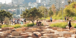
- The Greater Sydney Commission has been created by NSW legislation with a brief to make Sydney more liveable, more productive…Read More
- There is surprisingly little information that describes, interprets and records heathlands and its ecology in Australia. However, Nick de Jong’s…Read More
- STEP was actively involved in the fight against the O’Farrell government’s legislation introduced in 2012 allowing amateur hunting in national…Read More
- In the 19th century deer were imported and released into areas like Royal National Park because they were regarded as…Read More
- Well the July election is done and dusted and the Liberal–National Coalition just scraped in. Despite Malcolm Turnbull’s previous statements…Read More
- John Martyn discovered this beautiful pink fungus in Sheldon Forest. Fungi expert Ray Kearney identified it as Cantharellus lilacinus. A…Read More
- Back in the 1970s, a speck of harbourside bushland in Hunters Hill achieved unexpected fame as the site of the…Read More
- To many people who are fascinated by Sydney's native flora but have no formal training in geology, the rocks around…Read More
- NSW residents are currently waiting for the state government to respond to the deluge of submissions opposing the new draft…Read More


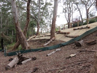
BioBanking Activity in Sheldon Forest
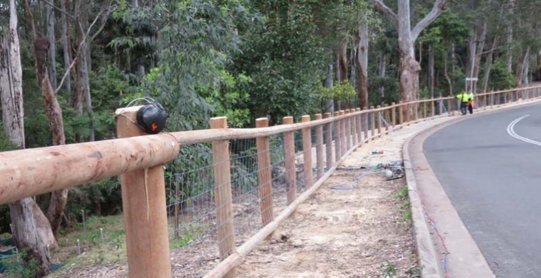
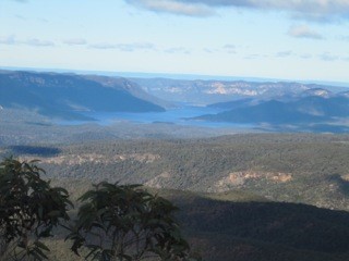
Sheldon Forest in Turramurra contains the second largest area remaining of the critically endangered Blue Gum High Forest covering an area of 5.4 ha. Sheldon Forest is linked to Rofe Park and Comenarra Creek Reserve so that the bushland extends from the railway line at Turramurra to Lane Cove National Park and provides an essential wildlife corridor that can potentially link Lane Cove National Park to Ku-ring-gai Chase National Park. It has been degraded over the years from fill from Warragal Rd and the rail cutting, weed invasion, storm water erosion, and waterlogging, feral animals, rubbish dumping and suburban encroachment.
In 2014 Ku-ring-gai Council signed a BioBanking Agreement with the NSW government under the Linking Landscapes through Local Action grant program. Council agreed to improve the reserves’ biodiversity values by undertaking management actions. These actions will create biodiversity credits and in return council has received grant funding.
Note: In many BioBanking schemes a developer purchases the credits and the money is used to restore a vegetation community elsewhere to make up for the loss caused by the development – see NSW Offsets Policy: A Dubious Way to Prevent Loss of Biodiversity (STEP Matters, Issue 181).
The BioBanking Agreement establishes a fund of $1.6 million that provides an ongoing, annual income to council to manage the bushland. The fund will give council annual management payments of between $100,000 and $130,000 for the first 20 years of the agreement, and thereafter about $40,000 each year in perpetuity. Council will contribute an additional $469,000 over three years to help manage the sites.
Action so Far
Anyone driving down Warragal Road, Turramurra just over the railway line will have noticed a lot of activity. Council has given us information on the works completed or in progress:
- In 2014 a sediment basin was constructed near the railway line and a large amount of ‘foreign’ soil was removed that had been dumped when the railway line was constructed. Creek stabilisation works were completed that were designed to encourage natural revegetation.
- Weed removal and preparation for ecological burns near Albion and Jubilee Avenues.
- Weed removal and stabilisation along Warragal Road.
- The revegetation of approximately 1800 m2 of Blue Gum High Forest using appropriate species and densities.
- Extensive fencing, both temporary and permanent, to assist with stabilisation and regeneration after the weed removal.
There will be much more work to do to ensure the permanent restoration of the native vegetation so that the weeds do not take over again.
 It should be noted that the sloping land adjoining Warragal Road is part of the council road reserve and is fill. As such it should be managed as a buffer to the Blue Gum High Forest in Sheldon Forest. The boundary between the two should be clearly delineated so that any erosion from the slope is managed and does not degrade the forest soil.
The stormwater outlet from Warragal Road discharging directly into Sheldon Forest is also a concern as it will have an impact on the viability of Blue Gum High Forest species in the affected areas. In the long term this stormwater should be redirected to an alternative sub-catchment.
The permanent fencing along Warragal Road is receiving a lot of comment. It is meant to be ‘non-intrusive’. Maybe it will weather to a natural colour?
Outcome of the Federal Election Bad for Climate Change Research and Action

Well the July election is done and dusted and the Liberal–National Coalition just scraped in. Despite Malcolm Turnbull’s previous statements about the need for serious action on climate change it appears that he does not have the political will to overturn past government decisions to downgrade climate change research and development.
CSIRO Cuts
CSIRO is an organisation independent from the government but still very much dependent on government funding. In February the CEO announced that climate science is settled so the focus can change to adaptation and mitigation. This statement was used to justify cutting over 100 climate change research jobs. Funding could be diverted to fields that could be more lucrative.
The size of the cuts was modified following an international outcry but there was still a cut of about 75 positions from the Oceans and Atmosphere division. Research is to be centred in Hobart in a new Climate Science Centre that will coordinate the work of 40 scientists carved out of existing CSIRO teams, and also tap into work by the Bureau of Meteorology and universities.
In August another modification was made when new Science Minister, Greg Hunt, ordered CSIRO to revive some other climate science programs in climate analysis and forecasting in Hobart. But these jobs will be financed out of the existing budget.
Fundamentally we still have less climate science capacity than before the cuts were announced. Some outstanding scientists with a huge accumulation of knowledge such as John Church, global sea level expert, will not return.
Support for Renewable Energy
There are plans to cut most of the funding for Australian Renewable Energy Agency as well as its ability to give grants. As the world responds to the urgent need to build new renewable electricity generation capacity, this plan is puzzling. Again the government’s reason is long-term ‘budget repair’. Australia has a long history of leading research into new solar technology. Hundreds of jobs will be lost from current research organisations and the potential opportunities for future commercialisation.
These policies conflict with the plans to help Australia become an innovation nation. The message from the government is that research is an expensive luxury rather an essential part of our long-term future.
We Need to Fight to Keep our Urban Forests

NSW residents are currently waiting for the state government to respond to the deluge of submissions opposing the new draft biodiversity and land clearing laws. The application of this legislation to Sydney’s bushland is unknown at present.
Urban Forests
Essentially there is a conflict between the need to accommodate the expectation of continuing high population growth and the desire to maintain a desirable city to live in. The high population growth is totally undesirable but we have had plenty to say about that before.
Now turning to the ideal of having liveable cities, one of the major elements is adequate tree cover. This is not impossible to achieve if there is the political will to get the planning right. Given the attitudes of the current NSW government to trees, residents will need to make it loud and clear that they will not accept a continuation of current policies.
In North Sydney Council’s Urban Forest Strategy document 2011, urban forest is defined as:
… the totality of trees and shrubs on all public and private land in and around urban areas and is measured as a canopy cover percentage of the total area. The canopy cover may vary in density depending on the vegetation type (eg almost solid cover under rainforest vegetation to more open cover under woodland or eucalypt forests) however the canopy cover percentage for urban forest measurement purely measures the percentage of land that has tree or shrub vegetation (over 3 m tall) above it, regardless of density.
Benefits of Urban Forests
Reduction in the Urban Heat Island Effect
Heat from the atmosphere is used in vegetation transpiration processes which convert water from leaves to water vapour. This has a cooling effect similar to that when humans perspire. Trees can transpire significant volumes of water and it has been estimated that a mature tree can transpire up to 150 L/day. In a hot dry location this produces a cooling effect similar to that of two air conditioners running for 20 h.
Much of the urban landscape is paved and devoid of vegetation. This means that there is usually little water available for evaporation, so most available natural energy is used to warm surfaces. Construction materials are dense, and many – particularly dark-coloured surfaces like asphalt – are good at absorbing and storing solar radiation.
Trees are a very effective means of blocking the sun’s radiation and, depending on the species and its maturity, up to 95% of the incoming radiation can be blocked. Trees can reduce a building’s temperature by directly blocking radiation through windows and cooling the surrounding air, and can also keep the soil cool thus providing a sink for heat from the building. These effects have been quantified as reducing air temperatures in built up areas by 1 to 5°C.
Reduction in Energy Demand
A typical adaptation response to the lack of external cooling is reliance on air conditioning, which generates waste heat and contributes to greenhouse gas emissions. Studies in the US have indicated that 5 to 10% of electricity demand in cities is from air conditioners used to compensate urban heat island effects. Increases in peak energy demand drive up infrastructure costs and increase the risk of power cuts during heatwaves. Air conditioner use amounts to nearly one-third of the power consumed in Perth on the hottest days in February and March.
Other Benefits
- Reduction in water run-off and erosion during storm events
- Improvement in water quality as the slowing of water run-off allows particulate matter to precipitate out and not pollute waterways
- Wind mitigation
- Improvement in air quality by absorbing gaseous pollutants and trapping particulate matter on their leaves
- Storage of carbon
- Reduction in noise pollution
- Shade for parked cars and outdoor pursuits
- Visual amenity and privacy
- Improved property values
- Attraction of birds and habitat for other wildlife
Recommended Canopy Cover
There have been many international studies of recommended canopy cover targets for urban forest. For example, according to the North Sydney report, for this climatic zone the recommended percentages for specific land-use areas are:
- 15% cover in central business districts
- 25% cover in medium and high density residential areas
- 50% cover in low density residential areas
Many cities now have urban forest targets in place, for example:
- Sydney city aims to increase urban forest cover (including private land) by 50% by 2030 and 75% by 2050
- Melbourne aims to increase canopy cover from 22 to 40% by 2040
- London aims to increase urban tree cover from the current 25% to 32% by 2065
- In 2015 New York City achieved a goal of planting one million trees to increase its urban forest by 20%
- Australian government has pledged to develop decade-by-decade goals out to 2050 for increased overall tree coverage
In 2014 the Institute for Sustainable Futures documented the tree cover in various parts of Sydney: Hornsby (59%), Ku-ring-gai (52%), Blacktown (19%), Parramatta (23%), City of Sydney (15%) and Rockdale (12%).
The figures for Hornsby and Ku-ring-gai are distorted by the inclusion of national parks that can provide some regional benefits such as improved air quality and cooling breezes if the wind is blowing in the right direction. However they do not provide the same benefits associated with trees in the immediate vicinity.
Stumbling Blocks
There are many barriers to achieving and maintaining urban forest. Generally the larger the trees the more effective are the benefits listed above. However there is a cost with managing larger trees. Trees ultimately need to be replaced when they reach their useful life expectancy. In an urban environment one cannot allow trees to reach the age where they become dangerous. There is also the need to achieve access for solar panels.
Developers will argue that the land is worth much more if it is built on. As we have seen all too often in Sydney, house blocks that had room for gardens, now have high and medium density housing with minimal, if any, tree cover remaining. SEPP65, the planning policy for high-rise is supposed to provide for deep soil planting but it does not seem to be enforced.
SEPP65, the planning policy for apartments covering all of NSW, now has a minimum deep soil requirement of only 7% of site area (Apartment Design Guide, p61). This is totally inadequate for a high rainfall area such as the North Shore where the native trees can reach heights of 30 m or more. Ku-ring-gai Council requires a minimum 50% site area for deep soil landscaping on sites over 1800 m2. This should be maintained and not over-ridden by SEPP65 Apartment Design Guide requirements.
Tiny backyards in new fringe areas and boundary-to-boundary development of new houses in existing suburbs often eliminate private land’s potential contribution to the urban forest. This puts incredible pressure on the public realm to provide the urban forest on top of needing to meet demands for infrastructure.
Compact city land-use policies and urban forest policies need to work together to ensure that cities have high-quality built environments and extensive tree cover. These policies must set the overall goals and outline strategies to deliver on them for both public and private land.
Greater Sydney Commission

The Greater Sydney Commission has been created by NSW legislation with a brief to make Sydney more liveable, more productive and more environmentally sustainable.
Currently district plans are being developed that are intended to be a link between local planning (eg council LEPs) and longer term regional planning.
Draft district plans are to be released towards the end of this year at the same time as the government is finalising the biodiversity legislation. The Greater Sydney Commission is currently undertaking extensive consultation in order to identify and prioritise issues.
This is a crucial time for the general public of Sydney to tell our politicians that our bushland and urban trees are vital. The campaign to inform the public about these issues is being led by the Total Environment Centre.
Byles Creek Decision

The tremendous efforts of the local community have produced some beneficial outcomes.
Issue 185 of STEP Matters provided an update on the battle by residents of Beecroft and the Beecroft Cheltenham Civic Trust to save bushland from subdivision and development at 79–87 Malton Road. This bushland is the last remaining corridor along Byles Creek between Lane Cove National Park and Pennant Hills Park.
The matter was brought before a Land and Environment Court conciliation conference. However it was inevitable, the final court determination approved the sub-division.
The asset protection zone around the houses to be built will entail the loss of a lot of vegetation but not as much as originally expected. There are conditions requiring the Vegetation and Fauna Management Plans applicable to the asset protection zone to take measures to preserve threatened species such as Leptospernum deanei and a possible nesting site of the Gang-gang Cockatoo. Part of the site (Lot 6 of approximately 1 hectare) will be passed into council hands to be conserved as open space.
A develpoment application for neighbouring land at 77 Malton Road (approx 7000 m2) has also been approved. Unfortunately, 77 trees will be lost for bushfire protection and construction. The owners are prepared to work with council to come to an agreement over the walking track along Byles Creek that will allow the public access to Byles Creek Valley and Lane Cove National Park.
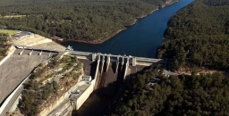
Flooding Wilderness, Wild Rivers and World Heritage
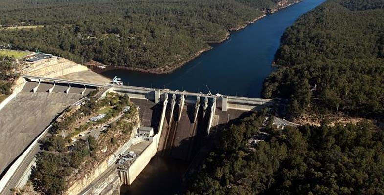
Two weeks before the Federal election with Warragamba Dam threatening to spill due to severe storms, the Baird government committed to raising the dam wall to prevent potential flood impacts on marginally held seats in western Sydney. Perhaps for the same reason, NSW Labor reversed its ‘don’t raise the dam’ position and supported the proposal. However, no new information was released to justify this decision. The economic case and environmental impact statement for such a major project are years away, so it seems to be another case of decision now, judgement later for NSW.
This is not a new proposal. A similar scheme was defeated in 1995 following a strong campaign by the Kowmung Committee led by Andrew Cox, after the Greiner–Fahey government had committed to raising the wall in 1993. The subsequent Carr government then approved construction of a large spillway beside the dam, completed in 2002, to protect it from major floods.
In December 2012 the NSW government accepted a recommendation from Infrastructure NSW in its 20 year State Infrastructure Strategy:
to review all major flood mitigation options available, including raising the Warragamba Dam wall, to significantly reduce the potential economic and social impact of flooding in the Hawkesbury Nepean Valley
This report was overseen by chief executive officer, and former Sydney Water head, Paul Broad, and ex-premier and chairperson of Infrastructure NSW, Nick Greiner. To them the dam was unfinished business.
Raising Warragamba Dam’s wall will inundate over 3,000 hectares of World Heritage listed national park lands, wilderness and wild rivers. Lower reaches of protected wild rivers, including the Kowmung, Coxs and Nattai Rivers, will be flooded. Temporary inundation caused by the proposal will scar wilderness areas, kill riverbank vegetation and deposit sediment. The affected parts of the southern Blue Mountains national parks, arguably the most protected parks in Australia, may have to be revoked, as they will be degraded if this scheme proceeds.
Temporary impoundment of floodwater will result in the ‘bath-ring effect’ – visual scarring of the landscape when natural areas are temporarily inundated. The NSW government would like us to believe that the drowned World Heritage Area will not be degraded, but once native vegetation is inundated and smothered in sediment, it becomes replaced by an eroding mess of bare earth and weeds.
 Views from McMahons Lookout, Splendour Rock, Burragorang Lookout and many others in the Blue Breaks will be ghastly. Lake Burragorang will have a much expanded ‘bath-ring’ and may also gain an enlarged Schedule One area further up the Coxs River, interfering with Katoomba to Kanangra walks, spoiling or placing off limits favoured campsites.
The Camden White Gum forests in the Kedumba Valley, listed as vulnerable under Commonwealth environment laws, will also be lost when flooded.
The Blue Mountains Conservation Society is opposed to the development. Vice-president Tara Cameron said:
We are very concerned that between Badgerys Creek airport and raising the Warragamba Dam wall, the world heritage values of the Blue Mountains will be deemed at risk by UNESCO. Australia has an international obligation to protect these areas not destroy them. This is an environmental disaster
(BM Gazette, 20 June 2016).
Developer Benefits
Former National Parks Association CEO, Andrew Cox, now with 4Nature, believes that the proposal may put more people at risk of flooding, not less. ‘We’re worried that by raising the dam and providing some level of protection it will actually trigger development on the flood plain,’ Mr Cox said.
Western Sydney Leadership Council chairman, Christopher Brown, has already flagged developing flood-prone land as a potential funding source for the dam wall extension.
‘I think there’s the capacity to use a value-capture funding method to reduce the impact on taxpayers,’ he said.
‘Maybe via a levy on land release that was previously considered flood-prone so we might be able to do it at a cheaper rate than what the government’s talking about.’ He suggested the wall extension could potentially be made higher than 14 m if such a levy was charged (Sarah Gerathy, ABC News, 17 June 2016).
Removing planning restrictions to develop flood prone areas will be highly profitable for some, but will endanger lives. In fact much of the North West Growth Centre around Riverstone is significantly affected by flood prone land. Residential areas are nevertheless planned within the maximum possible flood zone despite the acknowledgement that the enlarged dam will have no effect on extreme floods.
Flooding associated with the Upper Nepean which recently inundated Picton, as well as floods coming down the Grose, Colo and Macdonald rivers are not mitigated by the proposed dam wall raising.
Solutions
The best way to reduce the impacts of flooding on people is to relocate low-lying homes and avoid further building in flood prone areas. Floodplains are for floods and the proposed higher dam wall does not alter that fact.
Given Sydney Water’s new capacity to access water from the lower levels of Warragamba Dam, and the water security provided by the desalination plant, a less damaging solution would be to reduce the dam’s full storage level by a third and allow that proportion to be used for flood storage. The dam’s hydroelectric plant could be refurbished and then operate to lower the stored water to desired levels following a flood, while generating electricity for the national grid.
Efficient use of existing dam capacity, along with better flood planning and emergency response will save lives and the World Heritage area from an unnecessary $700 million dollar dam project and its contingent real estate development boom on the floodplain.
This article was written by Keith Muir. It was originally published in the Colong Foundation for Wilderness Bulletin, August 2016 edition. Reprinted with permission.
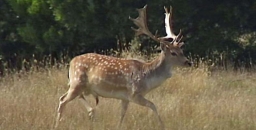
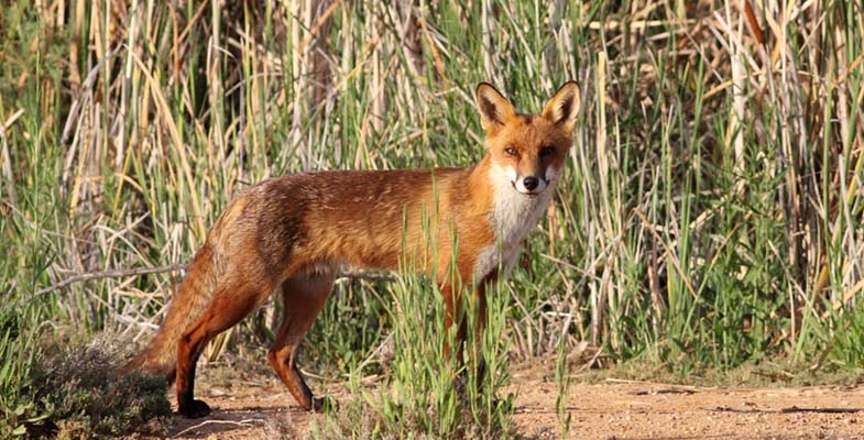
It’s Time to Declare Feral Deer a Pest

In the 19th century deer were imported and released into areas like Royal National Park because they were regarded as useful (for food and sport) and beautiful animals. Now their numbers have exploded.
At the request of the premier, the NSW Natural Resources Commission (NRC) has completed a pest animals management review. They released a draft report early this year and held public hearings around the state and received of over 600 submissions. Its final report and recommendations were submitted to the premier in August. The review found that pest animals cause considerable stress in communities:
It’s hard to measure, but even conservative estimates indicate NSW farmers spend around $22 million to manage pest animals per year, while the total annual economic impact of pest animals in NSW is conservatively estimated to be $170 million. Pest animals also affect 40% of all listed threatened species.
The findings cover pests that have long been causing problems for landholders such as wild dogs, pigs, foxes and rabbits, but they now also recognise that deer are a major cause for concern. For years feral deer have been allowed to run wild in NSW with management aimed at keeping deer numbers high enough to be a game resource. As the report states:
We need to manage the risks and impacts from all invasive species and that means treating feral deer and feral cats as pests just like wild pigs and dogs.
Therefore one recommendation made is that NSW government should:
- exclude all species of deer from the NSW Game and Feral Animal Control Act 2002
- include all species of feral deer in a regulation addressing pest animals under the NSW Biosecurity Act 2015
The Invasive Species Council is concerned that the powerful hunting lobby is determined to maintain the status quo. The Council is calling on people to contact the premier and the Minister for Primary Industries, Niall Blair and support the recommendations of the NRC in order to protect our natural environment from exploding feral deer numbers.
Here is a selection of facts supporting the case for the declaration of feral deer as a pest species. They:
- are out of control throughout NSW
- have been declared by the NRC to be our 'most important emerging pest animal threat'
- are a menace on our roads – in the Illawarra region feral deer have caused nine fatalities in a seven year period and 100 collisions with trains
- can be found in most regions of NSW, threatening the Royal National Park and the Illawarra escarpment rainforests, Kosciuszko National Park, the coastal forests between Newcastle and Coffs Harbour and even woodlands and rangelands in the west
- damage fences, pastures and cropsand can spread weeds and diseases
- impact rainforests and forests
- limit regeneration by reducing seed production and seedling recruitment, heavily browse ferns and other plants and push open the forest understorey
- have already been declared a feral pest in Queensland, SA and WA
Towards a Richer Understanding of Local Geology
To many people who are fascinated by Sydney's native flora but have no formal training in geology, the rocks around and about are generally thought of, in simple terms, to consist either of sandstones, shales or volcanic rocks. To express this in a crude stratigraphic way there are believed to be Wianamatta shales lying above Hawkesbury Sandstone which in turn rests on Narrabeen shales. Plus there are the volcanic diatremes of course.
‘Narrabeen shales’ is a term you often hear and read especially when plant communities like Pittwater Spotted Gum Forest and coastal clay heath are described, even in the formal sense by qualified botanists, and generally refers to the Newport Formation. But this term grossly misrepresents the reality, so firstly let’s look at the Narrabeen Group in more detail.
The Narrabeen Group
This group has the widest distribution of any major suite of rocks in the Sydney Basin making up much of the Greater Blue Mountains and covering a vast swathe of the Central Coast and its hinterland. It reaches a maximum thickness of something like 800 m (by comparison, the Hawkesbury Sandstone reaches roughly 250 m in thickness). It could be argued that ‘Narrabeen’ is a poorly chosen type-locality name because, although the group is a collection of 21 distinct formations scattered across the basin, only two of them are present in full on the Northern Beaches, plus just an isolated seashore outcrop of a third one.
Local Formations of the Narrabeen Group
1. Bulgo Sandstone
The ‘isolated seashore outcrop’ is of the Bulgo Sandstone, the top 10 m of which just, but only just, breaks surface on the outer tip of Long Reef. However, out under the sea, deep drilling for the ocean sewage outfall passed through 200 m of Bulgo Sandstone.
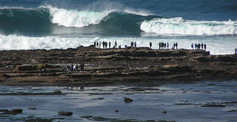
Commonly a grey-green colour when fresh, the Bulgo Sandstone can carry, in addition to quartz, a high proportion of grains of volcanic rock of a type similar to those classic columnar-jointed lavas you see on the coast at Kiama; therefore it bears only passing resemblance to the (very quartz-rich) Hawkesbury Sandstone. You can see the Bulgo Sandstone in full at the southern end of the Royal towards Bulgo village where it forms a stunning cliff line; and its pebbly, more quartz-rich lower layers host the famous Figure 8 Pool.
The Bulgo Sandstone's volcanic sand grains break down under weathering to clays leading to the common misconception that the southern slopes of the Royal are over a shale sequence. These clay-rich soils are much deeper and more fertile than those developed over quartz sandstones, and also have inherited plant nutrients from the sandstone's volcanic component, which helps in their hosting of a diverse littoral rainforest community.
In the photo at the top of the page, facing the full brunt of the waves, the topmost 10 m of the Bulgo Sandstone emerges and protects the soft Bald Hill Claystone of the Long Reef rock platform from being washed away into the Tasman Sea.
 2. Bald Hill Claystone
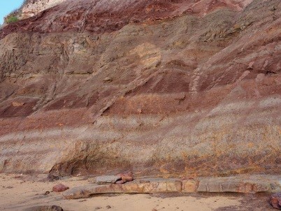
Overlying the Bulgo Sandstone, the Bald Hill Claystone is a strange and remarkable rock by any standards. It's not a shale but the name ‘claystone’ means, like shale and mudstone, it's made largely of clay minerals. It's crumbly but only locally truly shaley.
Also, its kaolinite is stained a deep, dull red-brown (some say chocolate colour) by hematite which, like the kaolinite, was the result of recurrent contemporary weathering of layer upon layer of fine volcanic debris 248 million years ago in early Triassic times. You can see grey-green bands of sandy or gritty debris interlayered with reddish claystones in the cliff faces and platforms at Long Reef.
Bald Hill Claystone at Long Reef is also well known for its Triassic ‘paleosols’ – fossil soil profiles in which you can even recognise ancient root traces.
Red is the prominent colour of the Bald Hill Claystone but you will notice here at Long Reef that the red beds are interlayered with light coloured, greenish-grey bands made of sand grains derived from weathering of volcanic rocks.
In the Northern Beaches, the claystone only supports vegetation on Long Reef Point, though well to the south it's present below the Hawkesbury Sandstone cliffs of the Illawarra Escarpment from the Royal to at least as far as Fitzroy Falls: its formal type locality is actually Bald Hill at Stanwell Tops.
At Long Reef Point it hosts heathland, shrubland and Themeda Grassland, but with a major problem of invasive bitou bush.
3. Newport Formation
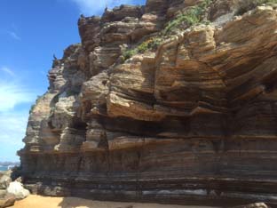
The Newport Formation rests above the Bald Hill Claystone via a transitional few metres of a curious, spotted volcanic ash deposit called the Garie Formation.
You can see a thinned version of the Newport Formation in the cliffs of North Garie Head in the Royal, then northwards it dips below the sea before surfacing low on the North Head cliffs – you can view its 15 m thick laminite and ledge-forming flaggy sandstones from the first lookout walking clockwise round the Fairfax Walk. However, it's much easier to see the formation in the cliffs from Narrabeen northwards where it consists mostly of thinly bedded sandstones and laminites with lenses of conglomerate (see photo).
Northwards along the coastline and across Pittwater into the Hawkesbury estuary there is a thickening and coarsening of the sandstones, and you can easily see this on Barrenjoey and Lion Island where only the topmost quarter of their thick sandstone cliffs belongs to the Hawkesbury Sandstone. You can often strain your eyes deciding where one formation finishes and the other begins, though the Newport sandstones tend to have dirtier, rustier weathering surfaces. The sandstones are impure quartz lithic ones and locally interbedded with laminites which are exposed especially north side of Lion Island where the formation has undergone a name change to Terrigal Formation.
The Newport Formation is host to some important plant communities. Its sandstones and laminites of the coastal cliffs weather to a stony, clay-rich soil which supports coastal clay heath and endangered Themeda Grassland. But traverse the peninsula and this all changes to pockets of littoral rainforest intermixed with endangered Pittwater Spotted Gum Forest. The host soils are weathered, thick quartz lithic sandstones with intermittent laminite layers – but definitely not shales.
Thick sandstones persist westwards and upstream into the Hawkesbury estuary but the tree species change, the principal eucalypt becoming Angophora floribunda comprising the Rough-barked Apple–Forest Oak Forest community defined by Smith & Smith in their plant survey projects for Hornsby and Warringah shire councils.
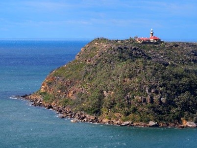
Barrenjoey lighthouse is built on a capping of Hawkesbury Sandstone but the lower two thirds of the headland is coarse-grained, rusty weathering sandstones of the Newport Formation which are the host rocks of the endangered Pittwater Spotted Gum Forest
This is the first in a series of articles by John Martyn describing his exploration of Sydney’s geology.
Heathlands: Walks and Wildflowers of the Ulladulla Headlands
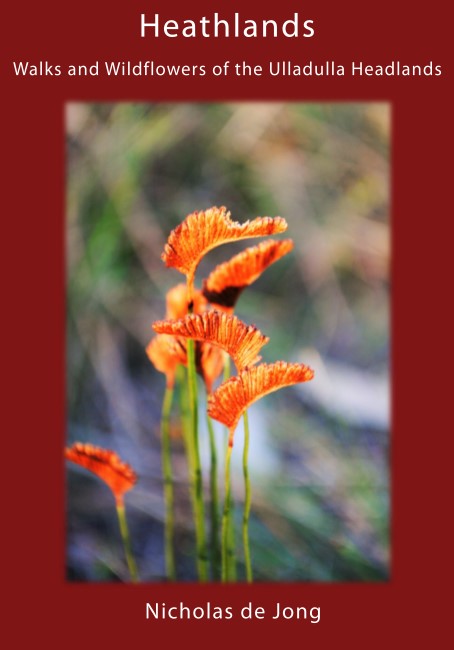 There is surprisingly little information that describes, interprets and records heathlands and its ecology in Australia. However, Nick de Jong’s book, which has more than 700 full-colour photos, goes a long way to addressing this gap in our knowledge.
Nick has recorded, identified, described and photographed more than 320 species of plants from Ulladulla’s coastal headland heathlands. The information he has collated showcases the areas species-rich native flora and it is presented in such a way that it will help you with plant identification.
Whilst the wildflowers form the heart of the book, Nick also describes ten coastal walks and discusses the evolutionary adaptations of the plants to wind, salt, fire and weed invasion. Many of these issues are the subject of current scientific study.
If you’re interested in coastal heathland plants, this book will be an important addition to your library.
- Describes 10 scenic coastal walks
- Identifies and describes 320 native plants and their flowering times
- Contains 700 full-colour photos
- Explains habitats, ecology and cultural history
- Identifies birds and butterflies
Cost: $45 ($35 + $10 postage)
To order, contactThis email address is being protected from spambots. You need JavaScript enabled to view it..
The House that Jack Built
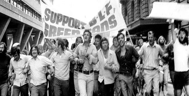
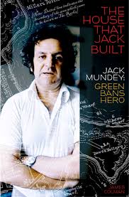 Back in the 1970s, a speck of harbourside bushland in Hunters Hill achieved unexpected fame as the site of the world’s first Green Ban when militant union leader Jack Mundey joined forces with local residents in what became known as the Battle for Kelly’s Bush.
Gordon Library is hosting an evening with James Colman, the author of a new book on the life of Jack Mundey.
Date: Tuesday 27 September
Venue: Gordon Library Meeting Room 1
Time: 6 to 7 pm
Cost: $5, wine and cheese will be served
Book: https://bookings.kmc.nsw.gov.au/coursesAndeventsTel: 9424 0120
After Kelly’s Bush, Mundey and his Builders Labourers’ Federation went on to save The Rocks and dozens of other well-known Sydney sites from the bulldozers. Across Australia, the green ban era saw many battles between residents, developers and officialdom – reaching a peak in the mid-70s. By this time its message had spread far and wide, and Mundey himself had become an international identity in the urban conservation movement.
The House that Jack Built is the first serious book on the man himself. Lane Cove author, architect and planner, Jim Colman, describes for the first time how Mundey moved from his early days as a young builder’s labourer from north Queensland to a leadership role in the Australian heritage movement.
And when the fervour of the green ban era had subsided, Mundey did not hang up his boots. He served a term as an alderman on the Sydney City Council and sat on the council of the Australian Conservation Foundation for a record term. Later he chaired the NSW Historic Houses Trust and in 1998 was named a national living treasure by the NSW National Trust. Amongst his many accolades are two honorary doctorates and an honorary master’s degree in environmental studies.
Colman’s book is a very readable, thoroughly researched and lavishly illustrated coverage of Mundey’s key achievements and activities in the planning and conservation fields during a busy half century. It reveals how this erstwhile communist and trade union leader became a dedicated conservationist who achieved fame – and notoriety – for exploits which were praised by the many, denounced by the few. And despite its evidence that we have made some solid progress in heritage conservation during the Mundey era, it concludes with a warning from the man himself:
The greatest single threat to the environment, locally as well as globally, is the rapacious greed of big multi-national corporations.
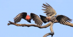
Rare Fungi
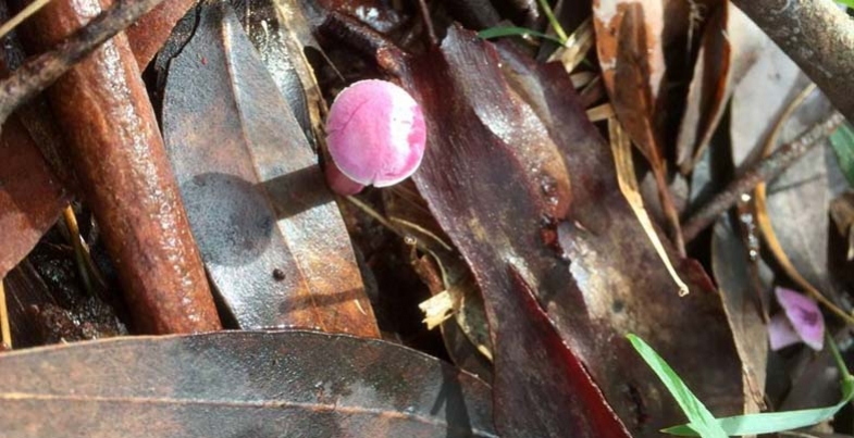
John Martyn discovered this beautiful pink fungus in Sheldon Forest.
Fungi expert Ray Kearney identified it as Cantharellus lilacinus. A wet weather rarity.
Hunting in National Parks
STEP was actively involved in the fight against the O’Farrell government’s legislation introduced in 2012 allowing amateur hunting in national parks, euphemistically called the Supplementary Pest Control Program.
Fortunately a strong public campaign of opposition and a damning report on the activity of the Game Council, the body slated to manage the hunting process, led to a complete rethink of the legislation (see STEP Matters Issue 172, p 5). Instead the government decided to trial over three years, a closely supervised volunteer ground shooting program in 12 national parks and state reserves, mostly in western NSW.
The evaluation of the program will ultimately assist the government in deciding whether, and if so, how, to proceed with supplementary pest control beyond the three year trial period.
In April 2016 the Natural Resources Commission reported in a media release on an interim review of the trial. It stated that the Supplementary Pest Control trial in national parks is building significant positive relationships among volunteers, neighbours, Aboriginal groups, and National Parks and Wildlife Service staff.
The media release stated that:
Both National Parks and Wildlife Service staff and the selected volunteers from the Sporting Shooters Association of Australia, NSW are working together very professionally, safely and with due regard to animal welfare …
An ongoing priority of the pest control trial will be to identify the specific set of circumstances where ground shooting using volunteers can be most useful to National Parks and Wildlife Service primary pest management program …
Overall the Commission found that the trial is being implemented in-line with relevant legislation and ministerial requirements, is meeting human safety and animal welfare requirements and that the efficiency and effectiveness of operations has improved.
In response to the Commission’s recommendations the NSW government has commenced night operations and committed to continuing to improve efficiency and effectiveness of the trial.
Common sense has prevailed. If only political expediency had not taken over when the first decision was made in 2012 to bend to the dangerous proposal by the Shooters and Fishers Party to allow amateur hunters into the majority of national parks.
Call for Nomination of Office Bearers and Committee Members

STEP welcomes new members of the committee and other members who would like to contribute to our work in some way. This work could involve publicity of events, updating our website, writing or researching submissions or whatever you can suggest.
Committee meetings are usually held on the first Wednesday of each month except January.
Our AGM is on 11 October 2016. Nominations for office bearers and committee members should be made in writing and received at least seven days before our AGM.
If you are interested in helping out, please send us an email and we will phone you back. Nomination forms are also available from This email address is being protected from spambots. You need JavaScript enabled to view it..