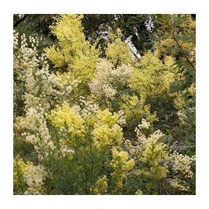
Stringybark Ridge
 Stringybark Ridge, once the site of a long abandoned pony club, is part of the Berowra Valley National Park (BVNP). The main parties involved seemed then to be in agreement that this is how it should remain. All NSW national parks are governed by a legally binding Plan of Management (PoM).
2005
After more than two years of community consultation with a wide range of local sporting and recreational groups, neighbours and other community groups a new Regional Park PoM was supported by both Hornsby Council and NPWS. This PoM stated that the main recreational use of the park was for bush walking, with some provision for limited dog walking on three management trails.
2006
Hornsby Council, after a careful review of potential sports grounds in the Shire, adopted a Sports Facility Strategy Plan, which specifically discounted the possibility of ever again using the old pony club site for active sporting purposes. All of which would seem to indicate that the future of Stringybark Ridge as an easily accessible urban lung for the local community, rather than as a basis for team sporting ovals, was assured.
2012
Despite the agreements reached above, then mayor, Nick Berman, unilaterally wrote to local state MPs asking for their support for the Stringybark Ridge site to be made available to provide additional team sporting facilities for soccer, cricket, AFL, netball and ‘other sports’, including attendant amenity blocks and spectator support arrangements and parking (see STEP Matters 165, p2–4 for full details of the ensuring events).
March 2015
NPWS issued a new draft PoM which, while specifically required under the relevant legislation ‘to protect and conserve’ the area, in point of fact proposed a spectacular reversal of their own previous policy.
Page 18 identified Stringybark Ridge as a potential area for a number of purposes, including ‘activities of a recreational, sporting, educational or cultural nature’ and Hornsby Council proposed building change rooms, amenities buildings, kiosks, parking and to erect tower lighting. The facilities would be used both mid-week and over weekends.
The draft PoM went on to state that NPWS would, in consultation with the community and Hornsby Council, prepare a precinct plan for Stringybark Ridge to articulate the specific activities and facilities for future use, including possible planned future use.
Our comments focused on our two main concerns, the proposed sporting fields on the two open grassed areas of approximately 2 hectares in size to the east of Schofield Trail, Stringybark Ridge, Pennant Hills and the potential mountain bike options for the park.
February 2023
The final PoM was adopted by the Minister for Environment and Heritage on 2 February 2023 ... an interval of eight years! In the PoM:
- the provision of sporting facilities has not progressed, but it has been identified as a potential site for recreational, educational and cultural activities
- other options include camping to support use of the Great North Walk and/or an area for community activities
We have many criticisms about the quality of the plan, for example the:
- geology section needs to be re-written with a correct balance between geology, landscape and soil
- naming and detail of species is inconsistent
- fish and mangroves are completely overlooked despite them being such important ecosystems
Click here for our response to the PoM.
A precinct plan is now being prepared to examine opportunities for future use and vegetation restoration. Vehicle and public access arrangements for Stringybark Ridge will be determined as part of the precinct plan.
STEP will be keeping an eye out for the precinct plan as our objection to sporting facilities was not about the sports per se but about the possible ecological impact of development.
STEP's Position
Undeveloped ridgetops are particularly rare and valuable in the valleys of the Lane Cove River and Berowra Creek, and we consider that the simple fact that it is a ridge makes Stringybark Ridge of conservation significance.
In 2015 STEP argued that the construction of sporting fields and mountain bike tracks would destroy the value of Stringybark Ridge as habitat and as a corridor. Stringybark Ridge is an integral part of the corridor from the Parramatta River to the Hawkesbury River as it the closest point to Lane Cove National Park. Nomadic and migratory fauna, as well as dispersing young, all need safe corridors for survival of the species.
